Tag: Seen & Heard

  • Seen & Heard: A rise in GPS jamming

    Seen & Heard: A rise in GPS jamming

    “Seen & Heard” is a monthly feature of GPS World magazine, traveling the world to capture interesting and unusual news stories involving the GNSS/PNT industry.


    Photo: deepblue4you / iStock / Getty Images Plus / Getty Images
    Photo: deepblue4you / iStock / Getty Images Plus / Getty Images

    Rise in GPS Jammers

    The Finnish government’s Transport and Communications Agency (Traficom) has seen an increase in GNSS jamming devices. In 2024, the agency already has detected 106 GNSS disturbances caused by signal-jamming devices in vehicles. When activated, the devices interfere with GPS signals in a radius that measures from a few dozen to several hundred meters. Authorities have found people have used the jammers in company cars tracked by their employers to disrupt tachographs that track where and when they are driving.


    Photo: kertu_ee / iStock / Getty Images Plus / Getty Images
    Photo: kertu_ee / iStock / Getty Images Plus / Getty Images

    Confirmed Decline in Emperor Penguin Colonies

    A multinational research exercise has confirmed emperor penguins are in decline in Antarctica. However, the cause is still unknown. The assessment of emperor penguin colonies found a 10% decline in the adult population, now estimated at 228,000.  The study used aerial and satellite imagery of all known colonies in Antarctica to collect data for a series of models analyzing emperor penguin population processes across the continent. “Remote sensing has given us the context that, sometimes, these birds hop up on ice shelves or glaciers – we didn’t know they did that prior to seeing them doing that on satellite imagery,” said Michelle LaRue, the wildlife ecologist from the University of Canterbury and Minnesota University, who led the study.


    Image: Phillip Silverman / iStock / Getty Images Plus / Getty Images / Getty Images
    Photo: Phillip Silverman / iStock / Getty Images Plus / Getty Images / Getty Images

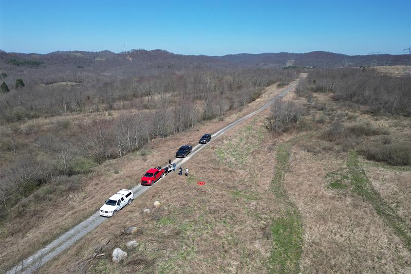
    UK Defense Minister’s Plane Jammed Near Russia

    A plane carrying British Defense Secretary Grant Shapps had its satellite signal jammed as it flew near Russian territory, the government reported on March 14. The government said the Royal Air Force jet carrying Shapps, officials and journalists “temporarily experienced GPS jamming when they flew close to Kaliningrad” on a flight from Poland to the UK. The Times of London, whose reporter was onboard, said that for about 30 minutes, mobile phones could not connect to the internet and the aircraft was forced to use alternative methods to determine its location. Kaliningrad is a Russian enclave bordered by Poland and Lithuania, home to the Russian Navy’s Baltic Fleet.


    Photo: lakshmiprasad S /  iStock / Getty Images Plus / Getty Images
    Photo: lakshmiprasad S / iStock / Getty Images Plus / Getty Images

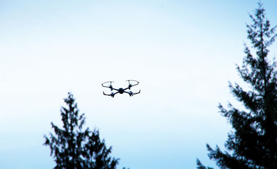
    Medicine from the Sky

    In the remote village of Oren, Kisumu County, Kenya, healthcare providers are now getting supplies and medicine delivered from the sky using UAV technology from Zipline, a U.S.-based logistics company. Healthcare providers can receive deliveries via UAV in less than 10 minutes, residents told Nation. The UAV opens at the bottom and releases a box, attached to a parachute. It then flies back to the Zipline hub in Chemelil, Kenya.

  • Seen & Heard: UAVs to the rescue, fire strikes in Chile

    Seen & Heard: UAVs to the rescue, fire strikes in Chile

    “Seen & Heard” is a monthly feature of GPS World magazine, traveling the world to capture interesting and unusual news stories involving the GNSS/PNT industry.


    Photo: ChristinaFelsing / iStock / Getty Images Plus / Getty Images
    Photo: ChristinaFelsing / iStock / Getty Images Plus / Getty Images

    UAVs to the rescue

    A child reported missing in Robbinsville, N.J., was found in less than 10 minutes using a UAV equipped with a thermal camera, WPVI reported.

    On the night of January 17, Robbinsville Police received a call reporting a missing child last seen running into a heavily wooded area. Officers dispatched the department’s UAV equipped with thermal imaging cameras, which allowed officers to quickly locate the missing boy through thick vegetation after dark. The child was unharmed, according to the report.


    Photo: Maxar Technologies
    Photo: Maxar Technologies

    Fire strikes Chile

    Maxar Technologies has released satellite images showing the widespread damage caused by raging wildfires in Chile’s Valparaíso region. The fires have killed more than 122 people. The images show entire neighborhoods destroyed east of the resort town of Viña del Mar yet do not show active wildfires. The fires reportedly surged in the Valparaíso region, fueled by winds and an intense heatwave that has seen temperatures of around 40° C.


    Photo: seregalsv / iStock / Getty Images Plus / Getty Images
    Photo: seregalsv / iStock / Getty Images Plus / Getty Images

    No drones in the prison yard

    The UK government has introduced regulations establishing a 400 m UAV “no-fly zone” around prison facilities. The announcement addresses the escalating use of UAVs by criminals attempting to transport illicit items — including phones, drugs and weapons — into prisons.

    The initiative is a response to the increase in the number of UAVs detected or sighted within prison grounds, which more than doubled between 2019 and 2021, according to a press statement from the UK government. The implementation of “no-fly zones” aims to enhance law enforcement’s ability to catch organized criminals in the act. Additionally, these measures are designed to prevent illegal aerial filming of prisons.


    Photo: Bim / E+ / Getty Images
    Photo: Bim / E+ / Getty Images

    Back to the fields

    GNSS jamming by the Israeli Defense Forces (IDF) has forced retired farmers in the Israeli settlement Mevo Hama to return to the fields. In an interview with CTech, local farmer Rami Laner shared that the younger equipment operators do not know how to operate the modern tractors for spraying or sowing tasks without the aid of their GNSS-based autonomous systems. With the IDF intentionally jamming and spoofing GNSS signals, civilians in the area are in search of alternative PNT systems to protect communities and maintain workflows.

  • Seen & Heard: Deep sea coral reefs and lava in Iceland

    Seen & Heard: Deep sea coral reefs and lava in Iceland

    “Seen & Heard” is a monthly feature of GPS World magazine, traveling the world to capture interesting and unusual news stories involving the GNSS/PNT industry.


    Photo: NOAA Ocean Exploration
    Photo: NOAA Ocean Exploration

    Exploring the Largest Deep-Sea Coral Reef

    Scientists have mapped the largest deep-sea coral reef, stretching hundreds of miles off the U.S. Atlantic Coast. While researchers have known since the 1960s that some corals were present off the Atlantic Coast, the reef’s size remained a mystery until new underwater mapping technology made it possible to construct 3D images of the ocean floor. The National Oceanic and Atmospheric Administration (NOAA) and a team of scientists recently published maps of the reef in the journal Geomatics. The reef extends for about 310 miles from Florida to South Carolina. The total area is nearly three times the size of Yellowstone National Park.

    Photo: ESA
    Photo: ESA

    Lava in Iceland

    Grindavík, a tiny town in Iceland, stands on the brink of volcanic lava flow in images captured by the European Space Agency (ESA). The lava originates beneath the Svartsengi volcano system — roughly 2.5 miles north of the town — which erupted on December 18 and January 14. ESA’s Sentinel2 satellite revealed the glow of the lava flow’s heat, not far from houses and other infrastructure within Grindavík. The town, with just 3,800 residents, has faced constant evacuations, as well as mini-earthquakes as a result, The Guardian reported.

    Photo: Maris Maskalans / iStock / Getty Images Plus / Getty Images
    Photo: Maris Maskalans / iStock / Getty Images Plus / Getty Images

    Lidar Reveals Lost Cities in the Amazon

    In the Amazon rainforest, archeologists have discovered a vast and highly complex system of ancient cities dating back nearly 3,000 years. Located in Ecuador’s Upano Valley, the structures lie in the eastern foothills of the Andes mountains, according to a study published in the journal Science. After more than 20 years of research, the ancient urban centers were only discovered when the Ecuadorean government employed lidar technology. Researchers from France, Germany, Ecuador and Puerto Rico conducted a lidar survey that covered roughly 300 km2, which revealed a landscape full of organized human activities, including more than 6,000 rectangular earthen platforms, as well as agricultural terraces and drainage systems. According to the study, these structures formed at least 15 distinct settlements, which were connected by a system of wide, straight roads.

    Photo: nickalbi / iStock / Getty Images Plus / Getty Images
    Photo: nickalbi / iStock / Getty Images Plus / Getty Images

    Tracking Cattle from Space

    Australian scientists are attempting to track 1,000 cattle and buffalo using artificial intelligence (AI), and GPS satellites, reported euronews.next. An estimated 22,000 cattle and buffalo roam free in a remote area of Arnhem Land, Australia, though the exact number is unknown. Scientists are now collaborating with stockmen and indigenous rangers in a four-year program that involves monitoring feral animals from space. Titled SpaceCows, the remote herd management system is backed by the Australian government’s Smart Farming Partnership initiative. Local rangers and stockmen are chasing and catching animals to attach solar-powered tags with GPS receivers.

  • Seen & Heard: Launching weather balloons and tracking endangered wildcats

    Seen & Heard: Launching weather balloons and tracking endangered wildcats

    “Seen & Heard” is a monthly feature of GPS World magazine, traveling the world to capture interesting and unusual news stories involving the GNSS/PNT industry.


    Photo: Milos Bjelica/iStock/Getty Images Plus/Getty Images
    Photo: Milos Bjelica/iStock/Getty Images Plus/Getty Images

    Drawing with GPS

    According to Guinness World Records, a 982.53-mile, seven-day ride by David Schweikert was the “largest GPS drawing by bicycle”. His drawing of a cross spanned three U.S. states: Wisconsin, Nebraska and South Dakota. “GPS drawings,” or Strava art, are growing in popularity, with two other notable record attempts being made in the past 12 months. Schweikert completed his ride in May, but for Guinness World Records to consider a record official all documentation and data must be verified. There are also strict rules and regulations relating to mileage that deviates from the course. To stick strictly to the profile of the cross, Schweikert rode 35% of his trip on unpaved roads.


    Photo: MattGush/iStock/Getty Images Plus/Getty Images
    Photo: MattGush/iStock/Getty Images Plus/Getty Images

    Location Data and Accountability

    The Connecticut State Police is under fire for failing to archive vehicle location data. While all police cruisers are equipped with location technology, only live data is available, reported CT Insider. Officials can locate a police cruiser when the vehicle is in use but cannot determine where it has been in the past. Experts and lawmakers told CT Insider that not archiving location data for some period of time is unusual, and they are worried that it could make it harder to hold troopers accountable when their conduct comes into question — including in multiple ongoing investigations examining allegations of ticket falsification within the force.


    Photo: davemhuntphotography/iStock/Getty Images Plus/Getty Images
    Photo: davemhuntphotography/iStock/Getty Images Plus/Getty Images

    Collars and Cats

    The Saving Wildcats conservation project, based at Cairngorms National Park in the Scottish Highlands, is using tracking collars to study endangered wildcats. For the project, 19 wildcats were released into the park while a field research team monitored movement data and was alerted if any of the animals were hurt or killed. This project is a collaboration between the Royal Zoological Society of Scotland (RZSS), NatureScot, Forestry and Land Scotland, and the Cairngorms National Park Authority. The new kittens, born at RZSS’s Highland Wildlife Park, will be released into the wild next summer once they are aged six to eight months.


    Photo: Croydon High School
    Photo: Croydon High School

    High School Launches Weather Balloons

    Croydon High School, in partnership with the University of Bath, has completed the Astrogazers project, which involved launching a weather balloon into space. On September 12, a team of girls from grades 5 through 11 successfully launched two meteorological balloons that ventured to an altitude of 32,380 m. The balloons carried essential equipment, including cameras, data loggers and GNSS receivers — all designed to explore how different materials respond to atmospheric conditions.

  • Seen & heard: Catching crime and tracking songbirds

    Seen & heard: Catching crime and tracking songbirds

    “Seen & Heard” is a monthly feature of GPS World magazine, traveling the world to capture interesting and unusual news stories involving the GNSS/PNT industry.


    Tracking a songbird

    Image: YiBaoTY/iStock/Getty Images Plus/Getty Images
    Image: YiBaoTY/iStock/Getty Images Plus/Getty Images

    Researchers in Alaska tracked the migration patterns of olive-sided flycatcher birds by attaching tracking devices to them to discover why their population is declining. The songbirds travel more than 15,000 miles every year to South America and then back to Alaska. To survive the long trips, they require safe locations to rest during their journeys. The researchers believe the stopover sites may provide an answer to the declining population. During the five-year study, the researchers deployed 95 devices and recovered only 17. The data pointed to 13 stopover sites between Washington and Peru as well as their wintering areas in South America.


    Crime ring members caught

    Image: hdagli/E+/Getty Images
    Image: hdagli/E+/Getty Images

    Members of an organized crime ring in the Florida Keys who are accused of stealing more than $2.5 million in boating navigation devices have been arrested, reported Local 10.com and Fox 4. Eleven men have been accused of targeting multiple marinas throughout Florida and stealing navigation devices from boats, specifically Garmin devices. For example, a Garmin 8612 H16 Model can be sold for more than $5,000. Ten suspects are in custody and are facing more than 122 charges.


    Animals take advantage of COVID-19

    Image: DrDjJanek/iStock/Getty Images Plus/Getty Image
    Image: DrDjJanek/iStock/Getty Images Plus/Getty Image

    A new study published in Science used tracking devices on 43 animal species during the 2020 COVID-19 lockdowns to find that wild animals emerged from their natural habitats and ventured closer to the roads and cities that were empty. The study used several methods to analyze tracking data. Researchers examined how much animals moved on an hourly basis and during a 10-day period. Across species and countries, on average, hour-to-hour movement was 12% lower in the spring of 2020 compared to the same period in 2019. With the end of lockdowns, human activity returned to normal, and animals had to adapt again. The results of the study demonstrate how humans can change their own behavior to lessen their impact on animals.


    Navigation meets creativity

    Image: @vikas_ruparelia on Twitter
    Image: @vikas_ruparelia on Twitter

    A man from Bengaluru, India, Vikas Ruparelia, used the Strava navigation app to trace the country of India to celebrate its Independence Day. Ruparelia started and ended his journey at the Mahatma Gandhi statue near Orion Mall in Rajajinagar, India. He covered more than 73 km on foot in 17 hours. The Strava app enables users to track their running and hiking routes as well as join challenges. The route Ruparelia took was designed by another user of the app.

  • Seen & Heard: Lidar reveals Mayan city, UK begins UAV deliveries

    Seen & Heard: Lidar reveals Mayan city, UK begins UAV deliveries

    “Seen & Heard” is a monthly feature of GPS World magazine, traveling the world to capture interesting and unusual news stories involving the GNSS/PNT industry.


    UK begins UAV deliveries

    Image: Screenshot of video by BBC
    Image: Screenshot of video by BBC

    Royal Mail and UAV company Skyports have launched the Orkney I-Port operation to distribute letters and packages between the Orkney Islands, Scotland, reported the BBC. In partnership with the council’s harbor authority and Scottish airline Loganair, mail will be transported from Royal Mail’s Kirkwall delivery office to the city of Stromness in Orkney. UAVs will then carry items to the islands of Graemsay and Hoy, where postal staff will complete the delivery routes. The UAV service will initially operate for three months and may continue on a permanent basis under existing regulatory frameworks due to Orkney’s unique landscape and the proximity of the islands to one another. The UAV service aims to improve service levels and delivery times to Graemsay and Hoy, as weather and geography typically cause disruption to delivery services. The use of UAVs to deliver mail also may bring significant safety improvements by ensuring that postal workers can deliver between ports without risk.


    GNSS is taking a hike, literally

    Image: Aleksandar Georgiev/iStock/Getty Images Plus/Getty Images
    Image: Aleksandar Georgiev/iStock/Getty Images Plus/Getty Images

    In July, officials in Taichung City, Taiwan, launched a GNSS-based app to aid lost hikers and to mitigate risk associated with outdoor activities in the area’s mountainous region, reported Tapei Times. The app was developed by the Taichung Fire Bureau in response to a surge in outdoor activities after the COVID-19 pandemic restrictions were lifted and, subsequently, an increase in medical emergencies linked to mountain activities. Wi-Fi towers have been built at major trailheads such as Toukeshan, Anmashan, Fushoushan and Snow Mountain to supplement the app as well as to help facilitate UAV deployment to find lost hikers.


    Lidar reveals Mayan city

    Image: tobiasjo/iStock/Getty Images Plus/Getty Images
    Image: tobiasjo/iStock/Getty Images Plus/Getty Images

    In a biological preserve in Mexico’s Campeche state, a team of archaeologists have documented pyramids, palaces, a ball court and other remains of an ancient city they call Ocomtún, reported The New York Times. Archeologists surveyed the site for six weeks in May and June, finding 50-foot-tall structures resembling pyramids, as well as pottery and Mayan engravings they believe date to between 600 AD and 900 AD. The team determined the city was likely abandoned more than 1,000 years ago. Surveying of the area has been revolutionized over the past decade by lidar — allowing researchers to survey densely forested areas that are difficult to explore on foot. Archeologists were able to use airborne lasers to pierce through dense vegetation and reveal the ancient structures and human-modified landscapes beneath.


    Hundreds of UAVs down

    Image: Chesky_W/iStock / Getty Images Plus/Getty Images
    Image: Chesky_W/iStock / Getty Images Plus/Getty Images

    More than 350 UAVs were lost during a practice light display show in Melbourne, Australia, on July 14, ahead of a scheduled performance for the opening of the women’s World Cup. The UAVs appeared to stop mid-show and plummet into the Yarra River. Divers have since fished out hundreds of the UAVs. According to the Resilient Navigation and Timing Foundation, the likely cause of the mass-crash was interference with GPS signals.

  • Seen & Heard: Invasive species vs. UAVs and protecting farms with GIS

    Seen & Heard: Invasive species vs. UAVs and protecting farms with GIS

    “Seen & Heard” is a monthly feature of GPS World magazine, traveling the world to capture interesting and unusual news stories involving the GNSS/PNT industry.


    I Wonder What’s Under There?

    Image: Lokibaho/iStock/Getty Images Plus/Getty Images
    Image: Lokibaho/iStock/Getty Images Plus/Getty Images

    Researchers at the University of Connecticut have conducted one of the largest understory species mapping projects using satellite data and have published the results of the study in the Remote Sensing of Environment journal. In this study, the researchers proposed an automated dense Sentinel-2 time series-based approach for understory plant communities and created maps of four understory classes that include native shrubs of greenbrier and mountain laurel, invasive shrubs of barberry, and the assemblage of mixed invasives at 10 m resolution in Connecticut’s deciduous forests. The researchers developed a strategy that distinguished plant species with an accuracy of 93% and determined that 53% of Connecticut’s understory is now comprised of invasive plant species such as barberry, bittersweet, winged euonymus (burning bush), and multi-flora rose.


    Invasive Species VS. UAVs

    Image: Donn Bartram
    Image: Donn Bartram

    Researchers at West Virginia University are using UAVs to develop tools to detect, map, treat and monitor invasive plant species with a grant from the Richard King Mellon Foundation. Multiflora rose is an invasive shrub that threatens native plants in more than 40 states, including West Virginia and Pennsylvania. This project aims to equip UAVs with sensors to collect environmental data in a designated area of southwestern Pennsylvania over multiple seasons. The research team will use that data, combined with machine learning technology, to develop software that can identify multiflora rose and, eventually, other invasive species.


    Protecting Farms with GIS

    For farmers, every centimeter counts. ComNav’s AG360 Pro autosteering system controls pass-to-pass accuracy within 2.5 cm. (Photo: Daniel Balakov/E+/Getty Images)
    Image: Daniel Balakov/E+/Getty Images

    American Farmland Trust (AFT) is partnering with government agencies and advocacy groups in South Carolina to deploy GIS mapping tools to predict areas at the highest risk of development in the state. Palmetto 2040: Visioning Alternative Futures, Launching Solutions is a geospatial modeling and policy analysis tool designed to identify and model future outcomes. This mapping tool will project what land in South Carolina is at highest risk of development by 2040. The analysis will consider both rapid population growth and climate change impact on settlement patterns and agriculture, according to AFT.


    USV Take Hurricanes

    Image: SailDrone
    Image: SailDrone

    Saildrone is deploying 12 uncrewed surface vehicles (USV) into the tropical Atlantic and Gulf of Mexico this summer, supporting research by the National Oceanic and Atmospheric Administration (NOAA) to advance hurricane forecasting. Ten USVs will be deployed from St. Thomas, U.S. Virgin Islands; St. Petersburg, Florida; and Charleston, South Carolina; to operate in areas with a high probability of intercepting a storm, as indicated by historical data. Two vehicles will remain on land, ready for quick deployment in the event of an approaching hurricane. NOAA will use the data collected by the USVs to improve hurricane forecast models.

  • Seen & Heard: Lighthouses no more, GPS mitigates natural disasters

    Seen & Heard: Lighthouses no more, GPS mitigates natural disasters

    “Seen & Heard” is a monthly feature of GPS World magazine, traveling the world to capture interesting and unusual news stories involving the GNSS/PNT industry.


    Bikes get tricked out

    Image: Snik Bike
    Image: Snik Bike

    Snik Bike is a new app-paired tracking device designed to help users track their bikes if they are lost or stolen, reported North Shore News. Snik Bike Security Co-founder Fraser Vaage developed Snik Bike after having two of his bikes stolen. Snik equips any bike with a rechargeable location device that can be installed in five minutes or less. After pairing the device, the bike is automatically registered with Project 529, which is an online bike registration service. Vaage emphasized that while this device is not a ride-tracking software, such as Strava, it acts as an odometer, tracking overall mileage. The battery is only activated when a bike is stolen, Vaage said, therefore, it’s unlikely Snik will run out of battery. However, if it does, the device diverts to AirTag technology as a backup.


    Lighthouses no more

    Image: Wiltser/E+/Getty Images
    Image: Wiltser/E+/Getty Images

    With the wide adoption of GNSS, lighthouses on U.S. shorelines are no longer needed for navigation. To preserve these properties, the General Services Administration has been transferring ownership of the lighthouses to anyone willing to preserve them, reported The Guardian. This year, six lighthouses are being offered to federal, state or local government agencies, non-profits, educational organizations or anyone willing to make them publicly available for educational, cultural, or recreational purposes.


    Location data ad weather resiliency

    Image: DenisTangneyJr/E+/Getty Images
    Image: DenisTangneyJr/E+/Getty Images

    A Southern Methodist University research team, led by Nicos Markris, measured Dallas’ resilience by recording anonymous cell phone location data among residents in the Dallas metroplex before, during, and after the February 2021 North American winter storm. Measuring a city’s resilience is critical for planning responses to future events and uncovering potential vulnerabilities. By averaging location data, Makris and his team outlined the movement patterns of Dallas residents during a typical week. They compared the normal movement patterns to those during and after the week of the winter storm to determine when Dallas started getting back to normal.


    GPS mitigates natural disasters

    Image: Philip Thurston/E+/Getty Images
    Image: Philip Thurston/E+/Getty Images

    NASA’s Jet Propulsion Lab (JPL) is testing new ways to detect tsunami-like ocean waves before they cause catastrophic damage. The GNSS Upper Atmospheric Real-Time Disaster Information and Alert Network (GUARDIAN) is a new experimental monitoring system that can use data from clusters of GPS and other satellites to detect deadly waves triggered on Earth. Radio signals from GNSS are examined by scientific ground stations around the world. That data is then reviewed by the JPL’s Global Differential GPS network to help mitigate disasters. The GUARDIAN is still evolving and may be used in the future to develop early warning strategies, according to the United Nations’ International Committee on GNSS.

  • Seen & Heard: Driving blind and keeping ballots valid

    Seen & Heard: Driving blind and keeping ballots valid

    “Seen & Heard” is a monthly feature of GPS World magazine, traveling the world to capture interesting and unusual news stories involving the GNSS/PNT industry.


    From paradise to panic… Or not

    Tourists at the Honokohau Small Boat Harbor in Kailua-Kona, Hawaii, drove their car into the harbor after following directions on a mobile map application, and were surprised when the car filled with water, reported Insider and the Washington Post. A witness to the incident took a video showing two women in a Dodge Caravan driving “confidently” into the harbor. The witness also stated that the women were not panicked and were smiling as the car tipped forward into the water. The driver and passenger eventually climbed out of the car and were not injured in the incident. An information specialist for the Hawaii Department of Transportation stated that mobile mapping applications are inaccurate and tourists should always be aware of their surroundings.


    Image: Lorado/E+/Getty Images
    Image: Lorado/E+/Getty Images

    Apple tags to the rescue again

    New York City will give out free Apple AirTags to residents in an effort to stunt an increasing number of car thefts, reported the New York Post. A local nonprofit donated 500 AirTags to the city to be handed out to residents, especially those in New York Police Department’s (NYPD) 43rd Precinct in The Bronx. NYPD encourages drivers to purchase the device if they are not able to receive one from the city. An equitable distribution plan is being designed by the Crime Prevention Unit of NYPD’s Community Affairs Bureau. The city will also be fundraising to purchase more AirTags or similar devices.


    Image: adamkaz/iStock/Getty Images Plus/Getty Images
    Image: adamkaz/iStock/Getty Images Plus/Getty Images

    Keeping ballots valid

    The Ottawa County Clerk’s office in West Olive, Michigan, is using location data to track vital election data around the county in real time, reported KATV News Channel 7. Once the election machine scans the results of a ballot, the data is uploaded to a flash drive and sealed with a tabulator. Then, a bipartisan group of election workers places the flash drive in a sealed container with a GPS receiver and a radio transmitter that communicates the container’s location in real time to the county clerk’s office. Ottawa County Clerk, Justin Roebuck, believes the receivers add an extra layer of security and will instill faith in voters that nobody is tampering with their ballots.


    Credit: vvectors/iStock/Getty Images Plus/Getty Images
    Credit: vvectors/iStock/Getty Images Plus/Getty Images

    Driving blind

    GPS plays a quiet, but integral role in Formula 1 (F1) racing. In a sport where split-second reactions are vital, GPS helps drivers and their teams improve race to race and navigate tracks safely. The importance of live location data was seen in the opening practice session at the 2023 Australian Grand Prix FP1. A red flag was flown due to loss of location data triggered by a glitch in the distribution of live tire information. This caused several near-misses on the track because drivers no longer received traffic advisory calls from their teams, reported Autosport. It took more than nine minutes to restore the real-time location data.

  • Seen & Heard: Earthquakes and high-speed chases

    Seen & Heard: Earthquakes and high-speed chases

    “Seen & Heard” is a monthly feature of GPS World magazine, traveling the world to capture interesting and unusual news stories involving the GNSS/PNT industry.


    Photo:
    Image: Dennis Laughlin/iStock/Getty Images Plus/Getty Images

    GNSS records Alaska earthquake data 

    Researchers in Alaska were able to compare the quality of GNSS and seismic station data when assessing the magnitude 8.2 Chignik earthquake near Dillingham, Alaska. Research recorded by Revathy Parameswaran and colleagues at the University of Alaska, Fairbanks, shows that GNSS and acceleration seismic data can be used interchangeably or in tandem to estimate rapid magnitude or ground motion. The research showed the Chignik earthquake velocity records were almost identical at co-located GNSS and seismic stations for observations at frequencies of less than 0.25 Hz.


    No more high-speed chases

    Photo:
    Image: Screenshot from CBS New York video

    The Old Westbury Police Department of Long Island, New York, has chosen a high-speed pursuit alternative — GPS-equipped darts that relay the current location of suspects, reported CBS New York. It took $36,000 to equip six patrol cars with the air-powered dart launcher, called StarChase, which can be activated from inside the patrol car. When the launcher is activated, it shoots onto the suspect’s vehicle a dart with a GPS receiver inside and an adhesive exterior. It is considered a safe alternative to high-speed chases and safe to use around pedestrians.


    TikTok CEO says app doesn’t track 

    Photo:
    Image: Marco_Piunti/iStock/Getty Images Plus/Getty Images

    Shou Zi Chew, CEO of the popular app TikTok, testified before Congress that TikTok does not collect precise location data from its users. During the hearing, which lasted for more than five hours, Chew assured committee members the app does not collect nor distribute location data. TikTok is under fire as a bipartisan Senate proposal is aimed at banning the social media app, arguing it poses cybersecurity risks. The House Committee interrogated Chew regarding the app’s algorithmic feed, policies for young users and — given TikTok’s Chinese ownership — the amount of access the Chinese government has to user data.


    Just some water, please 

    Photo:
    Image: Bob Douglas/iStock/Getty Images Plus/Getty Images

    Satellite mapping data analyzed at Graz University of Technology’s Institute of Geodesy has revealed long-term drought conditions in Europe, reported GIM International. The data confirmed groundwater levels have been low consistently since 2018. The drought situation was originally published by Eva Boergens in “Geophysical Research Letters” in 2020 when she noted there was a severe water shortage in Central Europe during the summers of 2018 and 2019. There has been no significant rise in groundwater levels since then, and groundwater levels have stayed constantly low. 

  • Seen & Heard: Tracking pythons and wild camels

    Seen & Heard: Tracking pythons and wild camels

    “Seen & Heard” is a monthly feature of GPS World magazine, traveling the world to capture interesting and unusual news stories involving the GNSS/PNT industry.


    Image: Apple
    Image: Apple

    Apple Products Meet Accuracy with GPS

    Apple launched the Ultra Watch, which contains a dual-frequency GPS antenna that can receive L5 signals, as well as the iPhone 14, which features a dual-band GPS receiver combining the L1 and L5 signals. The company is also harnessing signals from more than 70 satellites to boost the accuracy of its services such as SOS alerts and alerting emergency responders, per The National News. The dual-frequency abilities of the new products provide accurate location for calculating distance, pace and routes. The L5 signals also are a critical component of Apple’s health and safety features, providing more accuracy than in previous products.


    Image: dwi septiyana/iStock/Getty Images Plus/Getty Images
    Image: dwi septiyana/iStock/Getty Images Plus/Getty Images

    Collar Accidently Tracks Python

    Wildlife researchers in Key Largo, Florida, accidently discovered a way to locate and eradicate invasive Burmese pythons, per WFLA News Channel 8. The team of researchers were observing racoons and possums that were fitted with tracking collars to note their behavior. After months of observation, a possum collar sent a mortality signal due to lack of movement. To the researchers’ surprise, the collar then started moving again. They later discovered the possum had been eaten by a python. While this was not the intent of the team’s research, they proved this could be an effective way to lower the increasing population of the invasive python species.


    Image: Pavliha/ iStock/Getty Images Plus/Getty Images
    Image: Pavliha/ iStock/Getty Images Plus/Getty Images

    Remote-Sensing Finds Wild Camels

    Scientist Liu Shaochuang and his team have used satellite remote-sensing technology to study and track wild camels. Shaochuang studies the interrelationship between endangered animals and their environments, which may help protect the species against climate change. To track a camel, Shaochuang attaches a GNSS-enabled collar, which transmits the camel’s location every day. The short message function is provided by China’s BeiDou satellite system, which transmits and receives signals in real time. Based on the data, Shaochuang and his team can observe migratory paths, living environments and possible threats.


    Image: Screenshot of CNN video
    Image: Screenshot of CNN video

    Former South Carolina Attorney Convicted with Location Data

    On March 3, Alex Murdaugh was convicted of killing his son Paul Murdaugh and wife Maggie Murdaugh. With limited evidence, the prosecution used a phone video and vehicle navigation data to prove Alex’s guilt. During the trial, Alex claimed he was visiting his mother during the time the murders took place. However, General Motors OnStar data accessed by investigators from his Chevrolet Suburban contradicted the alibi, putting Alex at the scene of the crime during the time of the murders. Plus, in a smartphone video taken by Paul that night, Alex’s voice could be heard, placing him at the scene.

  • Seen & Heard: Can GPS forecast rain?

    Seen & Heard: Can GPS forecast rain?

    “Seen & Heard” is a monthly feature of GPS World, traveling the world to capture interesting and unusual news stories involving the GNSS/PNT industry.


    Image: Licence plate, Reviver
    Image: Reviver

    Digital license plates gone wrong

    A security research team has gained administrative access to Reviver, the only company in California that sells digital license plates, which has allowed them to track the physical location of all of Reviver’s customers. With this vulnerability, anyone could remotely update, track and delete someone’s Reviver plate. The access also enabled the researchers to change a section of the text at the bottom of the plate, designed for personalized messages, to anything they want, according to Vice.com. California launched the option to buy a digital license plate in October 2022, and Reviver has since addressed the license plates’ security vulnerability.


    AirTag. (Image: David Peperkamp/iStock / Getty Images Plus/ Getty Images)
    Image: David Peperkamp/iStock / Getty Images Plus/ Getty Images)

    Bill makes secret tracking illegal

    Indiana state legislators have filed a bill that would make tracking someone with a GPS-based device without their knowledge a crime, reported WTHR of Indianapolis. The bill is in response to the growing number of criminal cases involving Apple AirTags and other GPS-based tracking devices. Tracking someone secretly is not currently a crime in Indiana; however, laws vary from state to state. Under the proposed bill, the penalty would be increased from a Class C misdemeanor to a Class A misdemeanor if the person tracked is under a protective order. The penalty could be enhanced for someone convicted of using a tracking device when committing a felony. Similar incidents are on the rise around the United States involving the use of AirTags and other tracking devices for criminal purposes.


    Image: big-dan/ iStock / Getty Images Plus/ Getty Images
    Image: big-dan/ iStock / Getty Images Plus/ Getty Images

    Cellphones cause demise

    On New Year’s Day, six rockets were launched from a United States-made Himars rocket system at a vocational college in Ukraine, killing at least 89 Russian soldiers. Russia is blaming this on illegal cellphone usage by Russian soldiers, defying a ban. Ukrainian officials say 400 Russian soldiers were killed and another 300 were wounded, contradicting Russia’s report. However, this is the largest number of deaths Russia has acknowledged during the war. Russia says that the obvious cause of the attack was the use of mobile phones, as the enemy was able to locate and determine the troops’ coordinates for the strike. Two of the rockets were shot down before reaching Makiivka in the occupied Donetsk area of Ukraine. 


    Image: Angelo F-/ iStock / Getty Images Plus/Getty Image
    Image: Angelo F-/ iStock / Getty Images Plus/Getty Image

    Can GPS forecast rain?

    Researchers at the Department of Marine Geology and Geophysics at the Cochin University of Science and Technology in Kochi, India, say that heavy rainfall can be detected more than six hours in advance using GPS signals, reported The Hindu. During rainy seasons, as GPS signals pass through the atmosphere, how much they are delayed depends on the amount of water vapor present. By using continuous GPS signals and rainfall data collected in Thiruvananthapuram, the study showed that any heavy rainfall could be detected using this delay.