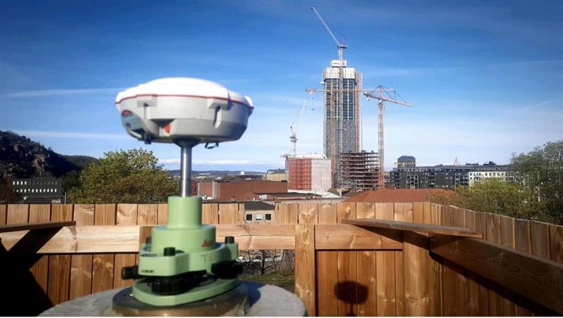
Four T300’s from ComNav Technology have been used as active control GNSS points on the top of Sweden’s tallest building, Karlatornet, during its construction to deliver 3D coordinates to total stations and one was used as a base station. The building is set to be complete this month.
The T300 is a receiver with radio frequency, a baseband chip built in, and a unique quantum-real-time kinematic (RTK) algorithm. It supports full constellation systems including BDS-2, BDS-3, GPS, GLONASS, Galileo, QZSS and NavIC.
The receiver is designed for demanding surveying tasks, features tilt compensation, 4G/Wi-Fi connection, 8-GB internal memory and an easy survey workflow with Android-based Survey Master Software. It is designed to make collecting accurate data easy and fast, whether done by a beginner or experienced professional surveyor, the company said.
A report by CNBC — based on a paper published by Harvard’s’ Belfer Center for Science and International Affairs and written by Sarah Sewall — noted a growing concern that China’s BeiDou is technologically superior to GPS and serves much of the population better.
Experts in the CNBC report explained that BeiDou supports China’s military ambitions, has spurred economic growth in the country, and has increased its diplomatic leverage.
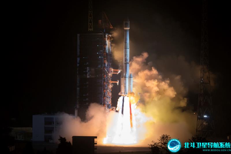
The first BeiDou satellite was launched in 2000 and served only mainland China. The system now consists of 45 operational satellites with 30 of them being the latest generation BDS-3 satellites.
Image: Bedou.gov
In 2020, China launched the last BeiDou satellite, completing the constellation. Since then, the influence of BeiDou has grown, with an estimated 1.1 billion people now using the system.
One feature in the latest BeiDou satellites is two-way messaging that is mainly available in China and requires special chips that are not widely available in the consumer market. It enables users to send short messages in areas without ground network cell coverage and can be used for search and rescue operations.
Surveillance fears
The CNBC report noted the fear that, with its enhancements, the BeiDou system could be used as a surveillance device — as the two-way messaging feature reveals a user’s locations as well as other types of data.
Additionally, with the growing number of apps for cellphones and an increase in autonomous vehicles that use the BeiDou system, more and more user data is being transmitted.
The bottom line
Satellites in the United States’ GPS constellation do not yet have those kinds of features.
There are 31 operational GPS satellites, 6 of which are GPS III satellites.
Image: GPS.gov
GPS satellite modernization
In 2008 Lockheed Martin beat out Boeing — the manufacturer of older GPS satellites — to build the GPS III satellites, the last of which was delivered in February. GPS III satellites deliver enhanced performance through a variety of improvements, including increased signal protection with improved accuracy.
GPS III SV07, SV08, SV09 and SV10 (SV stands for “space vehicle”) are awaiting launch at Lockheed Martin’s GPS III processing facility in Waterton, Colorado.
Lockheed Martin is now working on 22 GPS IIIF satellites — contracted in 2018 — that will feature more advanced capabilities. These satellites are expected to launch in 2026.
The U.S. Space Forceexercised its second contract option valued at approximately $737 million for the procurement of three additional GPS IIIF space vehicles from Lockheed Martin on Oct. 22, 2021. This contract option is for GPS IIIF satellites 15, 16 and 17 (SV15-17).
The entire fleet of GPS satellites is expected to be modernized in 2032 or 2033. However, for now, President Biden’s National Space-Based Positioning Navigation, and Timing (PNT) Advisory Board recognizes the need for a resilient national PNT architecture and acknowledges that BeiDou is technologically superior to GPS.
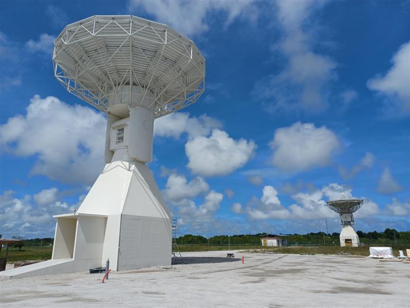
Galileo’s ground segment has gained a new asset, the Telemetry, Tracking and Control (TT&C) facility — a 13.5-m parabola dish mounted on top of a 10-m high building structure of made of steel and concrete. It is based within Europe’s launch site in Kourou, French Guiana, beside TTCF-2.
The TT&C antennas are uncrewed and operate on a fully automated basis from the two Galileo control centers located in Oberpfaffenhofen, Germany, and Fucino, Italy. The TT&C antennas are crucial to regular communication with the Galileo satellites.
This latest antenna will play an important role during the upcoming modernization activities of the earlier TT&C antennas in the station network, which have been in service for several years. TTCF-7 will take over their tasks during the maintenance activities when they need to be taken offline.
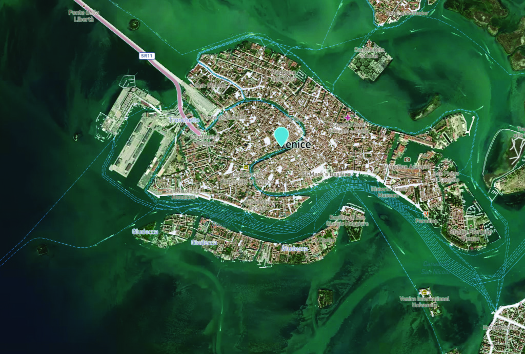
Venice arose after the fall of the Roman Empire. The city holds 450 palaces, more than 400 bridges and is home to the notable St. Mark’s Basilica. It is also known for its many canals, which are full of gondolas the way the streets of other cities are full of taxis or rickshaws. (Image: Freeartist/iStock/Getty Images Plus/Getty Images)
It is hard to believe that Italy’s “floating city” could be underwater soon.
The average rate of relative sea-level rise is 2.5 mm/year, per the European Geosciences Union’s journal Natural Hazards and Earth System Sciences. This photo of Venice from the European Space Agency (ESA) was taken in 2008 by Ikonos-2, a commercial satellite (Image: ESA)
Predictions for the future of the city vary, but most scientists agree that the sea level is rising due to climate change. Natural Hazards and Earth System Sciences, an interdisciplinary journal of the European Geosciences Union, published a report in 2021 suggesting the average sea level could be between 17 cm and 120 cm higher in Venice by 2100.
Venice was built in the middle of a shallow lagoon in the Adriatic Sea. Therefore, it has always been at risk of flooding or “acqua alta,” meaning high water. There is evidence of severe flooding dating back to around the 8th century.
The Venetian lagoon is more than 500 km2 in total, but has an average depth of only 1 m, according to Royal Museums-Greenwich. High tides and severe storms have a devastating impact on the wetland environment on which Venice is built.
Compared to the image of Venice in 2008, this U.S. Geological Survey (USGS) satellite image of Venice from May 2023 shows the rise in sea level within the past 15 years. (Image: USGS)
In November 2019, Venice experienced the second-worst flooding event in almost 100 years. The tide reached 187 cm (6.1 ft) above sea level, covering 80% of the city in water, reported the BBC.
City records show there have been 324 intense high-water events since 1872 and more than half of those have been in the past 30 years. Among the many and vast consequences of human-caused climate change may be the end of one of the world’s most beautiful cities.
1Spatial — a global provider of geospatial software and solutions for improved data governance — has launched the 1Capture, a customizable mobile application for data capture.
1Capture is a mobile GIS editing application that is multi-use and configurable. It provides accurate and reliable GIS data collection and editing in the field for a multitude of asset, job, and survey types.
Customizable rules and actions work to improve data quality at the point of capture. This ensures good quality data is captured at source, minimizing re-surveys. The built-in rules engine automatically validates and corrects the GIS and non-GIS data collected, whether working online or offline.
1Capture connects with a variety of GIS environments including Esri ArcGIS and open-source technologies such as PostGIS and Geoserver.
The Institute of Navigation’s Military Division hosted the 2023 Joint Navigation Conference (JNC 2023) for the Department of Defense andthe Department of Homeland Security, in San Diego, June 12 to 15. JNC, the largest U.S. military positioning, navigation and timing (PNT) conference of the year, was attended by 1,162 people. The theme of this year’s conference was “Enhancing Dominance and Resilience for Warfighting and Homeland Security PNT” and it focused on technical advances in PNT with emphasis on joint development, test and support of affordable PNT systems, logistics and integration. GPS World was one of the event’s media partners. For information on future JNC events, click here.
Image: Institute of NavigationImage: Institute of Navigation
Autonomy & sustainability
Image: HEXAGON
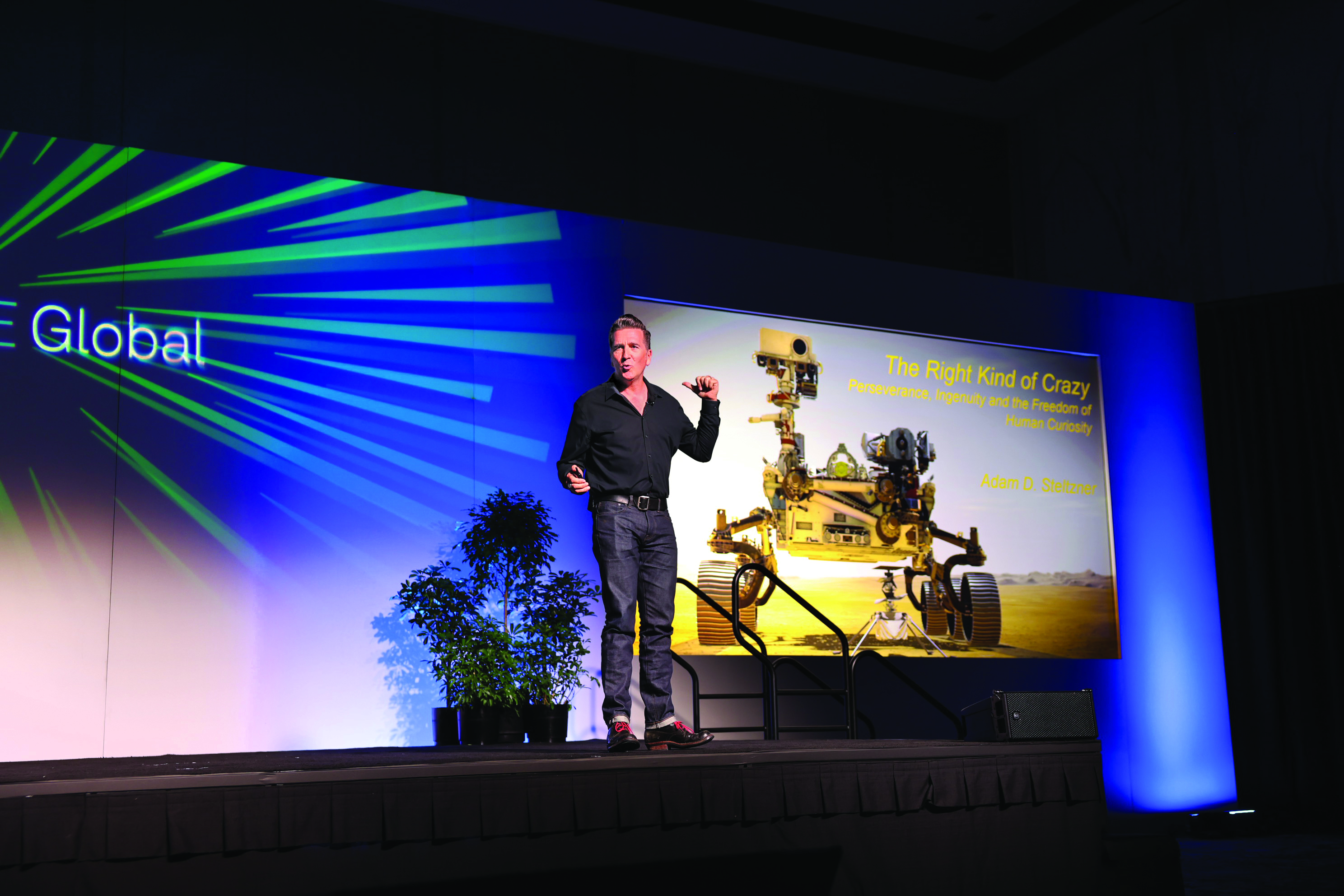
More than 3,600 professionals, business owners, thought leaders and media analysts from 77 countries met in Las Vegas on June 12 to 15 for HxGN LIVE Global, Hexagon’s largest event of the year. In his opening keynote address, the company’s president and CEO, Paolo Guglielmini, announced an exclusive new collaboration between Hexagon and Nvidia to transform industrial digital twin solutions that unite reality capture, manufacturing twins, AI, simulation and visualization to deliver real-time comparison to real-world models using NVIDIA Omniverse, a platform for developing and operating industrial metaverse applications. The conference included panel discussions, general sessions and break-out sessions with presentations by industry experts, as well as hands-on demonstrations in the exhibit hall, called The Zone. Other events included a Women in Tech lunch and ahuge party on Wednesday night.
PlantiQ — an atmospheric observing systems company — will begin daily delivery of its signal to noise ratio GNSS-radio occultation (RO) data to the National Oceanic Atmospheric Administration (NOAA) under the NOAA’s IDIQ-2 operational Delivery Order-2.
The NOAA has allocated $59.6 million over the next five years to use commercial satellite data to achieve high-quality weather forecasting and atmospheric research.
“By incorporating PlanetiQ’s commercial high quality GNSS-RO data, coupled with our deep understanding of RO technology, NOAA will have the information to significantly improve short and medium-range weather forecasts, and provide essential insights to enhance climate change research for the government, military and the private sector,” Ira Scharf, PlanetiQ CEO, said.
PlanetiQ supplies GNSS-RO data to NOAA from its growing constellation of satellites, which has become a critical part of the global observing system.
The U.S. Air Force Research Laboratory has pushed back the launch of the Navigation Technology Satellite-3 (NTS-3) until spring 2024 as the debut of the Vulcan Centaur rocket from the United Launch Alliance (ULA) — that NTS-3 was set to be launched on — has been delayed, reported Defense News.
NTS-3 was scheduled to launch later this year aboard and would remain in a near-geosynchronous orbit for an inaugural year of testing. The experimental satellite aims to shape the future of U.S. positioning, navigation and timing capabilities and to help U.S. forces to operate in GPS-denied environments and areas prone to spoofing.
According to Defense News, ULA delayed the debut of the Vulcan Centaur rocket as it is incorporating a fix to a testing anomaly, which was discovered in March.
NTS-3 minimizes the impacts of GPS jamming through rapidly reprogrammable signal waveforms, frequency agility and increased signal strength. Its embedded software and firmware are reprogrammable on-orbit.
When paired with reprogrammable receivers, the U.S. Air Force and U.S. Space Force can react in real time as threats evolve on the battlefield. In addition, NTS-3 has enhanced processors to support more complex signals.
In January, L3Harris delivered the NTS-3 vehicle to Kirtland Air Force Base, New Mexico, to prepare the satellite for launch. The Air Force Research Laboratory and L3Harris are working together to complete space vehicle testing, as well as to launch vehicle integration and enterprise integration to confirm compatibility between the control segment, ground receivers and the satellite vehicle.
Off the coast of Long Island, New York, UAVs are sweeping the ocean patrolling for any danger that may lurk below the water. This follows a recent increase in shark encounters for beachgoers, reported USA Today.
According to George Gorman, the state’s park director in Long Island, there have been five shark bites reported this year as shark season is just beginning.
On July 6, the sighting of a 10-foot shark prompted officials to keep people out of the water at Robert Moses State Park. This is the same Long Island beach that delayed its opening on July 4, after a UAV spotted a school of 50 sand sharks off the coast.
Even if the injuries have not been serious, Gorman and others are concerned by the spike in shark sightings and encounters.
The UAVs conduct three sweeps a day on popular Long Island beaches — once before opening, sometime midday, and a final round before the end of the day.
Cary Epstein, a lifeguard supervisor who pilots UAVs at Jones Beach, explained how UAVs provide additional viewpoints to lifeguards on the beach.
“When you’re up in an elevated lifeguard station or a lifeguard stand, you can see up and you can see out, but you can’t see straight down,” Epstein said. “When we do have sharks that are eating on these fish, it’s very, very clear to us. You could see it, no questions asked.”
Additional state funding has been provided for more advanced UAVs to spot sharks.
New York Governor, Kathy Hochul, recently announced a new program that will provide $1 million toward purchasing 60 new shark-monitoring UAVs. The new devices will build on the enhanced shark safety measures at Long Island state park beaches — including more trained staff, new jet skis, and more buffer zones between swimming areas and fishing areas.
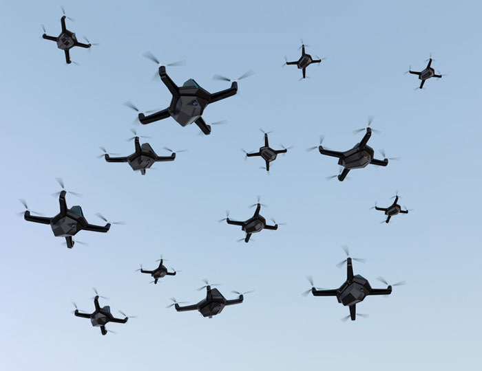
More than 350 UAVs were lost during a practice light display show in Melbourne, Australia, on July 14, ahead of a scheduled performance for the opening of the women’s World Cup.
The UAVs appeared to stop mid-show and plummet into the Yarra River. Divers have since fished out hundreds of the UAVs.
According to the Resilient Navigation and Timing Foundation, the likely cause of the mass-crash was caused by interference with GPS signals. This incident shows that having multiple and robust navigation sources is important for safe UAV operation.
Turf Tank — inventor of an autonomous, GPS-guided line marking robot, built and designed specifically for painting athletic fields — has released the Turf Tank Two.
This robot features dual motor drives for enhanced torque and optimized wheels for traction. On its own and controlled through a tablet, the Turf Tank Two can paint a regulation 11 versus 11 soccer field in less than 24 minutes, a baseball or softball field in less than 11 minutes, a lacrosse field in less than 26 minutes, and a full 100-yard football field in less than 3.5 hours. It can also paint logos and numbers.
The Turf Tank Two is 43 in x 33 in x 22.5 in. It weighs 123 lbs, without paint or the battery installed, and it can hold 5.5 gallons of paint.
Enhanced features of the Turf Tank Two also include a revamped sprayer module and advanced control features — including a redesigned front panel that has convenient pause/resume options with LED indicators displaying the robot’s status and a start/stop sprayer button. An LED indicator also comes on the battery.
Turf Tank Two is both eco- and environmentally friendly, the company says. Its batteries are rechargeable and because of the robot’s precision and accuracy, it uses significantly less paint and eliminates the overspray that is common with either painting by hand or using many of the older paint machines and sprayers in the market.
Guided by GPS, the Turf Tank Two uses a base station to ensure its accuracy. The base station becomes a fixed point from which the robot knows to paint the same exact field every time it is dispatched. The base station communicates with satellites to ensure the accuracy of the field dimensions.
Once the user installs a particular field layout, it becomes a simple drag and drop process through the tablet. From there, it’s as simple as setting one to four points on each field to give the robot a starting point, and then the robot will paint that field autonomously.
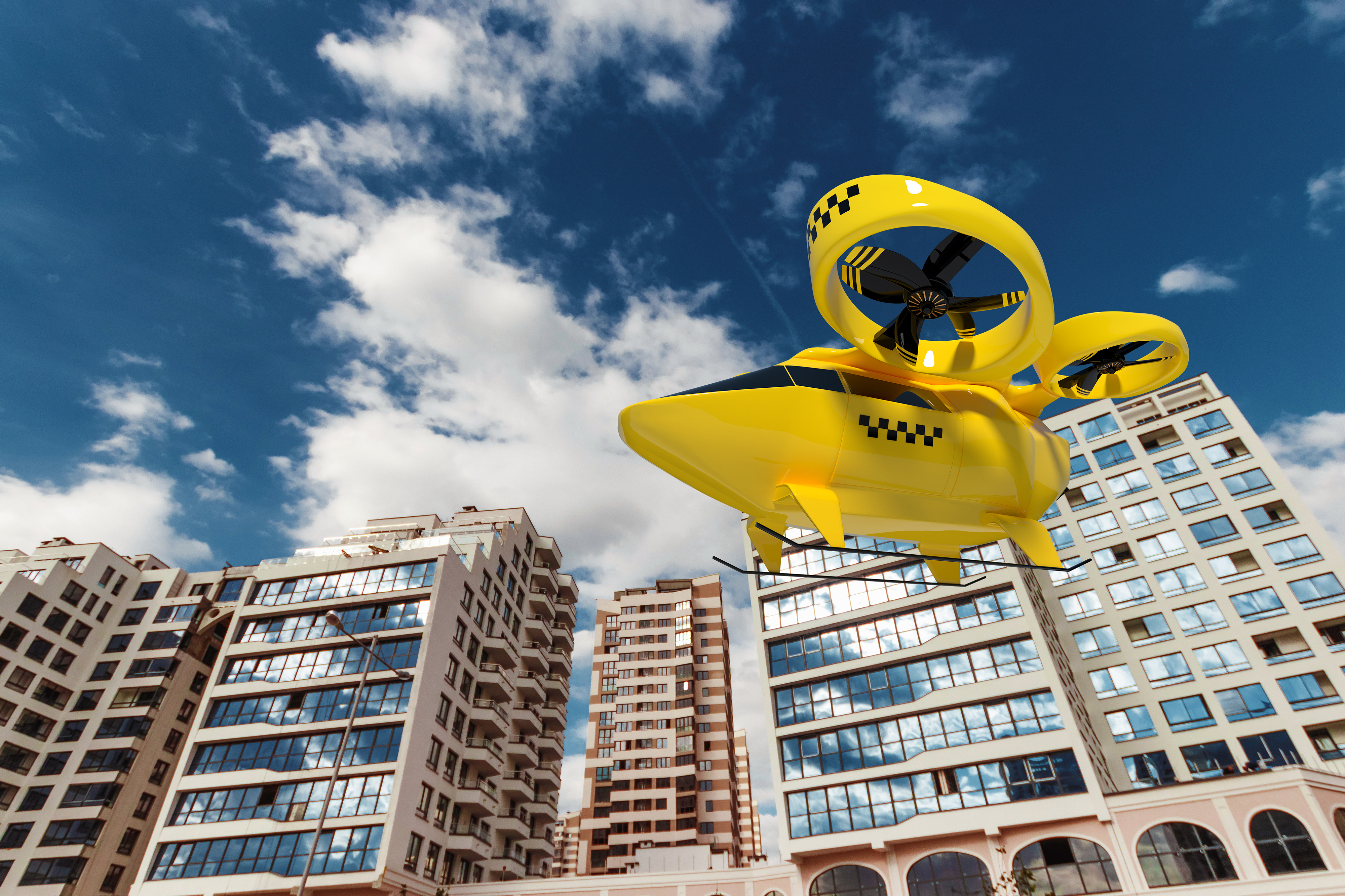
The Federal Aviation Administration (FAA) has released an implementation plan outlining the steps it and others will need to take to enable advanced air mobility (AAM) operations safely. The plan, called Innovate28, includes various components and a timeline for their implementation to hopefully be completed by 2028.
This plan serves as a foundation for making entry into service routine and predictable by maximizing the use of existing procedures and infrastructure. It addresses how the agency and partners will certify aircraft and pilots, manage airspace access, ensure pilot training, develop infrastructure, maintain security and engage communities.
The plan also includes a planning guide that can be applied to any site, laying out key integration objectives and sequences.
Among the entities that play a role in this plan include: the FAA; the advanced air mobility industry; labor partners, NASA; United States Department of Homeland Security; United States Department of Energy; power industry; and state, local and tribal communities.
Pilots will be able to fly the new advanced mobility aircraft to and from multiple locations at the sites, using predetermined flight schedules with pilots aboard.
Advanced air mobility aircraft likely will operate up to 4,000 feet altitude in urban and metropolitan areas, using existing or modified low altitude visual flight rules (VFR) routes where possible within controlled Class B and C airspace around major airports.
Infrastructure
Operators, manufacturers, state and local governments, and other stakeholders will be responsible for planning, developing and enabling heliport/vertiport infrastructure.
Advanced air mobility will initially operate at existing heliports, commercial service airports and general aviation airports. Modifications may be necessary to install charging stations, parking zones and taxiing space.
Power Grid
The electrical power grid may require upgrades to serve advanced air mobility operations.
The FAA has an interagency agreement with the Department of Energy’s National Renewable Energy Lab to determine how aircraft electrification affects a vertiport, heliport or airport’s electrical grid.
Security
The Department of Homeland Security will determine what type of security is necessary.
The Transportation Security Administration and FAA are evaluating the need for expanded cybersecurity requirements due to the use of advanced technology and operational protocols.
Environment
The FAA will consider the environmental impacts of advanced air mobility operations, including factors such as noise, air quality, visual disturbances and disruption to wildlife.
Community Engagement
The FAA will engage with airports, and local, state, and tribal communities to better understand community concerns about advanced air mobility operations, including noise and mitigations.
Many other stakeholders, such as advanced air mobility operators and airport and vertiport operators will have important roles in community engagement.