OCX is more than seven years behind schedule. What are the consequences?
Greg Turetzky
“It’s more consequential than most people realize. The first and most impactful consequence is the limitation of the GPS constellation to
32 satellites. There are more healthy satellites in the sky and, more importantly, Block III satellites sitting in the barn. These additional satellites and their modernized signals would improve navigation globally with improved accuracy and resilience. Additionally, without OCX the L5 signals are labeled ‘unhealthy’ and therefore the constellation is labeled ‘pre-operational.’ Without OCX, L5 cannot reach initial operational capability (IOC), which prevents certain market segments from being able to officially use them. GPS will remain in third place if the delay continues.”
— Greg Turetzky Consultant
Michael Swiek
“OCX seems more than seven years behind when you consider that we have been hearing about it as a concept and then a proposal for years before it became an actual program. In the Hope and Crosby movie, “The Road to Rio,” Jerry Colonna leads a cavalry charge to rescue the heroine across several brief scenes. He never arrives, and the heroine is saved by other means. Colonna then proclaims, ‘Well, we didn’t make it, but we sure added some excitement!’ While waiting for the heroic arrival of OCX, might the evolution of technology, and regular updates to the current system, already provide some of the improvements promised by OCX? The OCS is already upgraded to accommodate Contingency Operations for GPS III satellites, M-Code early use and incorporated cyber security protections. Is it, maybe, time to just move beyond OCX and start anew with today’s context and assessment of future needs?”
Artist impression; size of debris exaggerated as compared to Earth. (Image: ESA)
So much going on up there!
On Jan.11, speaking at a press briefing in Paris, Javier Benedicto, director of navigation for the European Space Agency (ESA), announced the agency had completed the procurement process for the low-Earth Orbit Positioning Navigation and Timing (LEO PNT) program. ESA expects to have the new LEO PNT demonstration satellites, which will broadcast signals over several frequency bands, up and running by 2026. A positive outcome will most likely lead to the procurement and deployment of a full European LEO PNT constellation for global services.
Also in January, news broke that Google and two of the largest mobile network operators in the world, AT&T and Vodafone, had invested more than $200 million in AST SpaceMobile’s cellular broadband network based on LEO satellites and accessible directly by smartphones. AST SpaceMobile already operates the largest-ever commercial communications array in LEO, the BlueWalker 3 satellite, which, due to its size and brightness, is alarming astronomers.
On Feb. 21, The New York Times reported about U.S. warnings to its allies that Russia might deploy a nuclear weapon in orbit this year. According to the paper, U.S. intelligence agencies told their closest European allies that, “if Russia is going to launch a nuclear weapon into orbit, it will probably do so this year — but that it might instead launch a harmless ‘dummy’ warhead into orbit to leave the West guessing about its capabilities.” A space weapon nested inside a satellite could destroy, jam, or otherwise disable dozens or hundreds of commercial and military satellites in LEO, such as the Starlink satellites that are revolutionizing global communications. See Dana Goward’s analysis.
The next day, Tim Crain, chief technology officer of the Houston-based company Intuitive Machines announced, “Houston, Odysseus has found its new home.” For the first time since Apollo 17 in 1972, a U.S.-built spacecraft had landed on the moon. Odysseus, described by the Times as “a bit bigger than a telephone booth,” (which most people under the age of 20 have never seen), was later confirmed to be upright and sending images. It was delivered into lunar orbit by a SpaceX rocket. NASA hopes this mission will help inaugurate a new era of economical spaceflights around the solar system. Intuitive Machines is one of several small companies the agency has hired to transport instruments to reconnoiter the surface of Earth’s only natural satellite in preparation for the return of NASA astronauts.
My highly synthetic description of the Federal Aviation Administration (FAA) aircraft tracking systems in last month’s First Fix was a bit muddled. Fortunately, I can count on our Editorial Advisory Board member Mitch Narins to clarify:
FAA systems determine an aircraft’s position using a combination of independent and dependent surveillance. Independent surveillance does not require the “cooperation” of the aircraft (e.g., primary radar), while dependent surveillance requires the aircraft to either respond to an interrogation signal or periodically transmit its position — e.g., Automatic Dependent Surveillance-broadcast (ADS-B).
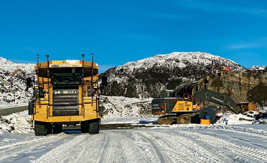
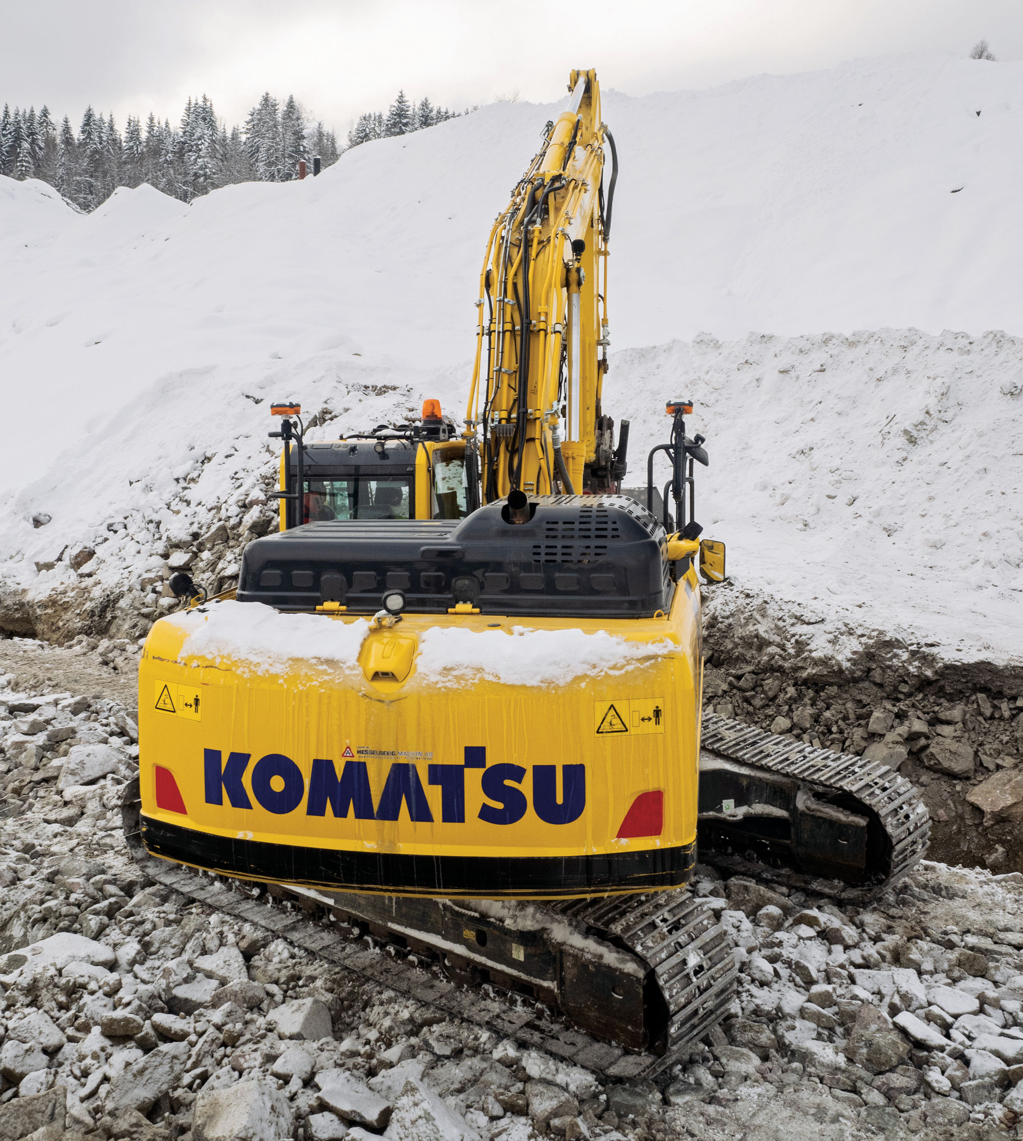
Building a solid foundation for any construction requires that the ground be adequately compacted and leveled. Construction workers and contractors operating earthmoving machines know it is nearly impossible to do that by eyesight alone. For a few decades, leveling was accomplished using rotating lasers mounted on tall tripods, which could typically cover a little more than 1,500 ft on a job site and laser receivers mounted on masts on the earth-moving machines. However, these systems only provide elevation, not position, and must be repositioned frequently.
Photo: Steer
In recent years, laser leveling has been increasingly replaced by machine control systems that enable operators to compare the position of their machine’s blade with a digital grading map, and then guide it very precisely to cut the proper elevation. These machine control systems combine global navigation satellite system (GNSS) receivers, to provide the position of the machine; inertial navigation systems (INS), to bridge short gaps in GNSS availability and to provide the platform’s attitude (pitch, roll, and yaw); and a variety of other sensors, to determine the movement of the machine’s attachments, such as booms, arms and buckets.
In this month’s cover story, we feature perspectives on machine control from:
Microchip, which makes inductive position sensors that monitor the angular and linear movements of the attachments.
Septentrio, which makes the AntaRX series of smart antennas.
Besides grading, other areas for machine control include trenching at a specific depth, spot-bulldozing to better prepare a site for grading, mass excavation and contouring edges. Artificial intelligence (AI) will soon start taking over the operators’ duties, but that’s for a future article.
Controlling an earthmoving machine to perform a task requires knowing exactly where its bucket or blade contacts the dirt. Therefore, in addition to knowing the machine’s position, it is necessary to model, in real-time, the rotation at each pivot point and apply some mathematics and trigonometry.
Microchip makes an integrated circuit, known as an inductive position sensor, that is very well suited for machine control because it is not affected by the harsh conditions on most construction sites — temperature extremes, water, dust and dirt — and the vibrations caused by the machine itself. Additionally, it is not affected by the stray magnetic fields generated by electric motors, which are increasingly common on those machines.
Inductive position sensors are used in many automotive systems. (Photo: Microchip)
“We use our inductive position sensing to measure the angle or the linear movement of some sort of target to get a machine to perform its task,” said Mark Smith, product line manager for many different mixed signal products at Microchip. “For example, to control a blade on an earthmoving machine to do something, you need to have feedback about its current angle.”
Microchip also makes sensors for human interfaces, such as accelerator pedals in cars, which no longer have cables that run up to the motor. “Any sort of movement, such as the angles of rotation of a robotic arm, must be monitored and measured. Inductive position sensing is one of the up-and-coming ways to do it,” said Smith.
To direct a task, a central processing unit must then analyze and integrate the data from the sensors. For that, Microchip makes many types of computing elements — including mini-computers and microcontrollers.
“One of the things that’s coming up with many of these vehicles is ambient magnetic noise in the system,” said Smith, “because you’re next to electric motors these days. You want sensors that are immune to stray magnetic fields. We started with automotive, but we’re also seeing it now in industrial environments, including earthmoving vehicles.” Inductive position sensors, Smith said, are simpler, cheaper, lighter, and better able to withstand extreme temperatures than what they are replacing. “Also, because they are non-contact, the circuit board can be environmentally protected.”
Vibrations also are a concern. “There is an air gap between the target and the sensor itself,” Smith said. “We have an automatic gain control at the sensing side that is constantly adjusting the gain to get the maximum signal strength. This is a fast-moving control algorithm that can adjust the gain to ensure that the vibration does not affect the performance. When everything is operating at its maximum torque, this starts to matter.”
Septentrio’s AntaRx GNSS smart antenna — a box containing a receiver, an antenna and supporting electronics — is designed for machine automation and control in construction, precision agriculture and logistics. The smart antenna is enclosed in a rugged and compact housing for simplified installation. It can handle strong shocks and vibrations, which makes it ideal for harsh industrial environments such as construction and mining.
Septentrio’s AntaRx GNSS smart antenna is designed for machine automation and control. (Photo: Septentrio)
From the early stages of the product’s design and development process, Septentrio collaborated with a leading heavy construction machinery OEM, which provided feedback that helped improve the product’s specifications.
I discussed the use of AntaRx for machine control with Silviu Taujan and Danilo Sabbatini, both product managers for the product — the former with a focus on the machine automation market and the latter with a focus on INS.
What type of customers were you addressing?
Taujan: Mainly OEMs and integrators for machine control systems looking for a GNSS receiver with this kind of form factor to build into their control, automation or guidance systems.
Photo: Septentrio
A smart antenna is easy to install on various machines, correct?
Taujan: Yes. It saves space and the cabling is much simpler. We have a single rugged connector for power and data. Our latest generation of GNSS boards has dual antenna support. You can deploy one smart antenna and feed an auxiliary antenna — the AntaRx-AUX — into it for dual antenna heading capability.
Where does the INS come in?
Sabbatini: The GNSS/INS version is the AntaRx-Si3. It has an industrial-grade IMU that gives very high quality sensor fusion to bridge gaps in GNSS or correction signals. It also provides accurate attitude — pitch, roll and heading. We use this INS mostly for applications that require full 3D attitude, and for integrity and availability. It is built for one minute without GNSS.
Does all the processing happen inside the box?
Sabbatini: The output is a 100 Hz fused position. It will be fused by default to GNSS, plus IMU. The system can also accept the platform’s velocity as an extra input for sensor fusion. The output can include the raw GNSS position, the GNSS-only position and the raw IMU data.
What are some use cases?
Sabbatini: For INS, the most important use case is precision agriculture. For many ag robots, a smart antenna is the form factor of choice and most of them require INS sensor fusion. This INS product is the easiest to integrate because everything is fused inside the enclosure. Also, compared to other form factors, the customers do not need to worry about the lever arm between the antenna and the IMU because it’s inside the box, so it’s already taken into account. So, this form factor eliminates all the installation problems inherent to an INS system. The German company Sodex is creating a real time mapping system to install on top of machine controls. Another application is for users who want to close gaps in signals, especially in smaller machines that are going more often between buildings and close to structures.
Taujan: For the version without INS, we’re looking at the more mainstream machine control customers and applications. Even from the conceptual phase of this, we started by engaging with some customers, including one large OEM in the Asian excavator market. Then, from the aftermarket or integrator side, one machine control integrator integrated it into a system for asphalt pavers. These are not yet commercially available systems, but we’re in the development phase with them.
Gundersen & Løken AS, in Oslo, Norway, founded in 1899, develops equipment for the construction industry. It uses Septentrio’s AntaRx in its Dig Pilot 3D machine guidance system, which it began to develop in 2007. The company is now launching the next-generation DigPilot to assist excavator drivers. Its DigPilot Terra user interface and graphics offer a wide range of functionalities for efficient earthwork. The development of DigPilot Terra is funded partly by Innovation Norway.
DigPilot uses multi-axial CAN bus angle sensors on all moving parts — chassis, boom, arm and bucket — to calculate the position of the bucket tip with centimeter precision. The sensors are gyro-stabilized and hold firmware that predicts angles in the coming milliseconds based on angles from the previous milliseconds. These calculated angles are pushed to the computer in the cabin, which can visualize the bucket position in real-time.
DigPilot is a two-antenna system. Until now, it relied on two Septentrio GNSS antennas installed on the rear of the excavator — one to determine the machine’s position and one to determine its heading. These data are fed to the Septentrio GNSS receiver (rover) inside the machine, which also receives correction data via internet or radio. The data from the GNSS rover is pushed to the computer in the cabin and, when combined with the angular sensor data, provides the exact coordinates of the bucket tip and the delta value of the finished project.
Now, Septentrio’s AntaRx technology makes DigPilot’s installation simpler and more robust because the built-in GNSS rover in one of the rear antennas greatly reduces the amount of cabling and the number of connectors.
I discussed DigPilot with Eric Floberg, the company’s managing director since 2019 when he took over from his father, and Erik Sørngård, the company’s R&D manager, who has been working with Septentrio products for 12 years.
When did you start working with Septentrio on AntaRx for DigPilot? At what stage of deployment is it?
Sørngård: We began to discuss features about four years ago. At that time, we had worked with other Septentrio products for eight years. So, they appreciated our cooperation and wanted to show us where their next stage in development was heading. Last year, they approached us again, to see whether we could start looking further into it.
Floberg: We now have one system here for testing and we have experience from the previous Septentrio products, such as the rover GNSS receivers, which have always given us the best of accuracy. Of course, now, we see the potential to make our system more robust and simpler. As soon as we have sold out the existing Septentrio products, we will incorporate the AntaRx into our next-generation machine control system.
Is DigPilot receiver-agnostic, even though you have a preference for the AntaRx?
Floberg: All the connections, the cabling and the components themselves are exposed to very tough environments and stresses of different kinds, such as extreme temperatures and vibrations. So, reducing the number of components and connections and cabling would definitely give us a higher uptime, which is the most important thing for our end users.
Having the antenna and the receiver in the same box means less cabling and easier installation, correct?
Floberg: Definitely. The anti-theft aspect here is also very important. In certain parts of the world, you will appreciate the opportunity to easily remove it from your excavator or bulldozer when you leave at night.
What are the key challenges?
Floberg: This winter has been the toughest one in Norway in 30 years. We have also had the chance to do some testing in very low temperatures and harsh environments. When we see it work as well as it does, we feel very confident about it.
What accuracy have you been getting?
Sørngård: When it comes to machine control, we look at the end result on the tip of the bucket. We have several sensors, and we have to calibrate the machine accurately. The receiver is not the biggest contribution to the noise in the algorithms. We trust that the Septentrio receiver delivers accurate numbers, and we must push ourselves to make the rest of the system meet the same standards.
Floberg: On 30-ton or 40-ton excavators with booms up to 10 meters long we are able to get sub-centimeter accuracy, but the tip of the bucket in such a machine is 1 in thick. Of course, there are many other factors, such as the wear and tear of the machine.
Is DigPilot typically factory-installed or aftermarket?
Floberg: We’ll do both. We are often called by the distributor — say, Volvo or Hitachi or Kobelco — to install an integrated system.
Should GPS have a satellite-based high-accuracy service, like Galileo’s and BeiDou’s? What would it take to build it?
Bernard Gruber
“No. As Peter Lynch once said, ‘Know what you own, and know why you own it.’ Although this sage advice was for individuals buying equities, I would offer the same for GPS investing in or ‘guaranteeing’ high-accuracy service. Myriad differential GPS solutions currently exist, next generation atomic clocks are in orbit now, internet-based corrections are available. Evolution will improve accuracy, and techniques for higher accuracy will develop when they are needed by the market. I would rather see investment continue in Alt Nav and compatible GPS solutions. As for Galileo and BeiDou authentication plans, I may provide a different answer.” — Bernard Gruber Northrop Grumman
Jules McNeff
“What’s in a name? For most people, GPS already provides a high-accuracy service. Depending on how one uses its signals, you can already track the movement of tectonic plates and changes in Earth reference frames — that’s pretty high accuracy. There are always those who want more, but it’s unreasonable to expect GPS to be the only source, given performance and resilience gains with positioning, navigation, and timing (PNT) augmentations and complements along with GPS basic services. The GPS providers need to focus on Job One, a robust set of GPS services for all its users, and not have that mission complicated further.” — Jules McNeff Overlook Systems Technologies
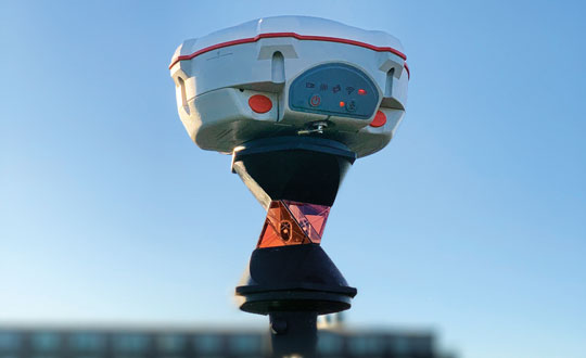
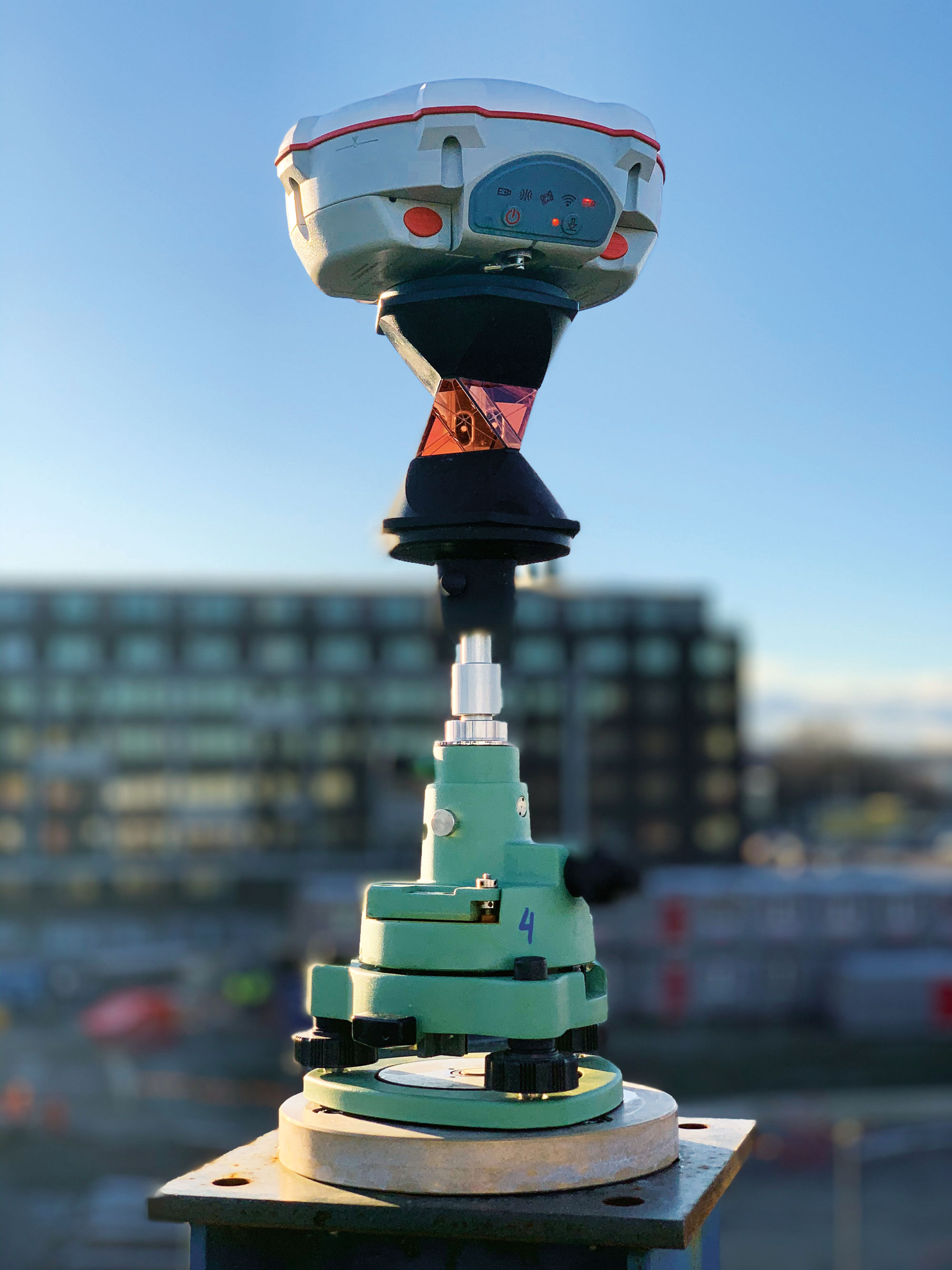
Surveyors for architecture, engineering, and construction projects require GNSS receivers that have high accuracy and are rugged enough to survive the dust, water, and inevitable drops that they will endure at construction sites. They also need to be able to easily share data with architects, engineers, planners, and tradespeople, both at the sites and at the office.
Photo: Juniper Systems
Juniper Systems, which has more than 30 years of experience in mapping and data collection in a wide variety of applications across industries, recently released a real time-kinematics (RTK) activation for its Geode GNSS receiver that allows mapping accuracy down to a centimeter. Pairing a Geode with the company’s Uinta mapping and data collection software and a Mesa rugged tablet makes it easy for users to share their data — such as the locations of fiberoptic telecommunication lines or of utility manhole covers — with other people working on site or at the office. The Geode and the Mesa meet IP68 protection certification for water and dust ingress; they also have MIL-STD-810G certification against drops, vibration, and extreme temperatures.
In this month’s cover image, the Geode is at the top of the survey pole, the Mesa Rugged Tablet is mounted near the user’s hand, and the screen on the Mesa depicts the Uinta mapping software.
On construction sites, surveying is an ongoing process. Surveyors are the first on the site, before any other work begins, and the last ones there, to map the project “as built.” Total stations with GNSS receivers, as well as tablets and other mobile digital devices are their essential tools, increasingly complemented by unmanned aerial vehicles (UAV) and lidar scanners. Accuracy is their key contribution. In this month’s cover story on GNSS for architecture, engineering, and construction (AEC), we highlight three building projects: a skyscraper in Sweden, a highway in China, and a luxury resort in the Caribbean.
Check out these perspectives on architecture, engineering and construction:
When Chris Kahn arrives by helicopter on the island of Barbuda, in the Caribbean, he sees reef-lined beaches, meadows, marshes, and construction underway on a private club consisting of more than 200 luxury family homes, a world-class golf course, and other amenities. Construction on the project, by Discovery Land Management, will last at least another 10 years, said Kahn, who began working on it in late 2019. The island, which can also be reached by ferry or small plane, is 15 miles long and has a local population of about 1,500 people.
The biggest challenge for the project was the total lack of internet connectivity on the island, except for satellite communication at basecamp. A consultant who designed the golf course irrigation layout had attended many meetings for the project in which the participants discussed in vain how to coordinate their work without an internet connection, a problem that a few engineering firms had also been unable to solve. So, he suggested that they turn to Kahn, with whom he had already worked closely. Discovery Land Management hired Kahn, founder and owner of AlphaRTK, to provide a common operating picture for the teams of surveyors, architects, planners, construction workers and landscapers building the resort and the golf course.
Chris Kahn installing a UHF base station (its antenna is visible in the foreground on a telescopic mast) atop a 50-ft water tower. (Photo: Chris Kahn, AlphaRTK)
RTK UHF Base Station
Kahn proposed they build their own RTK UHF base station. “You can get about a seven-mile line of sight out of UHF and with repeater radios we can extend that, which is what we eventually did,” Kahn explained. So, he put the base station where the project had an internet connection and relayed the UHF signal from there. He gave the teams Eos Arrow Gold GNSS receivers, which have a UHF plug on the side, with Satel UHF radios. “It works like a charm,” he said. He also set up for the project an ESRI ArcGIS Online account, which now hosts all its maps and data.
“They’re doing a lot of earthwork that needs survey-grade accuracy but does not legally require a survey,” Kahn pointed out. Starting in about 2010, he explained, RTK accuracy began to explode for geographic information systems (GIS) and unmanned aerial systems (UAS). “It’s accelerating,” he said. This has greatly increased opportunities for high accuracy data collection beyond traditional surveying tasks such as boundary surveying. “My niche, and one of the places where there’s a lot of pain, is this interoperability between projects that have surveyors and landscape architects and all sorts of folks in subject matter expertise that are trying to come together to build something.”
Like the rovers, the base station contains an Eos Arrow Gold, with a 35-watt Satel UHF output. Project staff and contractors can connect to it with any device that can accept that UHF protocol. Their rovers are set up to work with ESRI ArcGIS Field Maps, so that workflow is very smooth, Kahn said. The project started where they began to build the golf course, at a worksite seven miles away from the base station, across open water. Kahn then installed a UHF repeater antenna there and additional ones as construction moved inland.
The island is relatively flat, but the sand dunes are quite large. Therefore, to enable the line of sight that UHF requires, Kahn had to install the antennas for the repeaters as high as possible. For one, he used a whip antenna on top of a 15-foot telescopic mast on top of a 20-ft high deck. A repeater antenna costs about $2,500 and takes a few hours to install. “It is fairly old technology,” he said. “I tend to look for an easy button and string together inexpensive ways to do things fairly rapidly.”
UAS Photogrammetry
The project covers 2,500 acres at two locations. While traditional surveyors are working on the project for building construction, their speed is too slow for the crews doing earthwork, particularly on the golf course. This involves pushing sand around, dredging lagoons, and building the course, which requires taking many elevations very rapidly. To speed things up, Kahn decided to use UAS to fly frequent photogrammetry collections. He began by installing ground control points, surveyed them, and put them around the construction sites. He then trained the laborers on the project to conduct high-accuracy, survey-grade workflows using UAS the flight paths of which he programmed.
All the laborers need to do is launch the UAS and, after each flight, extract the SD memory card and upload the data to a shared directory. “They don’t even have to put the props on anymore because they just fold out,” Kahn said. He processes the data and publishes the aerial photogrammetry into the project maps. The next day, everyone on the project has access to survey-grade accurate aerial imagery and a map.
“How frequently they fly them depends on how much activity is going on at the various sites,” Kahn said. “That turnaround time can be as short as a few hours if they need it, between them flying it, uploading it for me, and having it back in their maps. Everything has sub-inch positional accuracy. When they zoom into some of the foundation pilings on the homes, they’re aligning perfectly.”
Survey-Accurate GIS
Project managers need GIS to see everything — survey, landscape design, architectural design, engineering design — in a common operational picture, which they were not able to do prior to Kahn joining the project. “I was looking at email threads that were 45 messages long, with two dozen people on three different continents, talking about where something’s located and referencing something else, with many civil drawings attached as PDFs — one from the landscape architect, one from survey, one from a civil engineer. They were saying, ‘Well, this doesn’t look like it matches.’ I was brought in to make it all one pane of glass.” That requires overlaying survey-grade accurate architectural and engineering information on the GIS information.
“That’s where you run into this niche area in which I work that often surveyors don’t fully understand,” said Kahn. “In the United States, there are civil engineering surveyors and design-build shops that include geospatial, though it is not commonplace. Outside of the United States, it is rare.”
The rovers for GIS data collection are sub-centimeter accurate, as are the ground control point targets that Kahn installed for the UAS workflows. Workflows were designed for simplicity, allowing laborers to reliably perform UAS and GNSS data collection.
ESRI ArcGIS Field Maps is well suited for this project because it works offline. As they walk around the site and try to understand what they will build, planners, architects and engineers can see the most current maps on their phones, rather than having to consult PDFs or paper.
“I had to do a lot of work with their engineering firm, though, to get their 3D civil drawings to interact with GIS,” Kahn recalled. “Now, all the line work coming from engineering is perfectly aligned, and all field adjustments made by construction are real-time updated in the design drawings. You can see how accurate this GIS is. Everything is perfectly placed, and these are data coming from four different places: GIS, UAS, engineering design, and survey. Everything is aligned within one to two centimeters.”
iPhone screenshot, showing lots, foundations, finished construction, virgin sand, and utility lines. (Photo: Chris Kahn, AlphaRTK)
With golf course building, “design is a suggestion,” Kahn said, and many changes are made in the field. “In fact, the pace of ‘field adjustments’ was a crucial reason I was brought in. Engineers cannot wait a year for an as-built drawing set to be delivered.”
Cut-and-Fill
This workflow streamlines the many cut-and-fill operations involved in the project. “Coco Point is a good example,” Kahn said, “because some of the lots there are completed.” Zooming into one of the completed lots, he can see the nine-foot grade for which one construction company is responsible and the 11-foot grade for which another construction company is responsible. “It’s important for them to know those two grades because of cost; it’s very expensive to bring fill in here. So, as they’re doing these drone flights, they have dashboards that show them how much fill they need to bring in.”
The common operational picture enables project managers to optimize the cut-and-fill transfers. The golf course was particularly challenging because it is in a very swampy area, making it difficult to move the dredging equipment. So, they asked Kahn to design the path for the trucks and determine how much fill they would extract out of these lagoons. “I knew they needed this much to meet design on the green and could get this much out of the lagoon,” he said. “It was very helpful for them procedurally with the planning.”
Challenging Environment
The environment on the island is challenging. “It was wild,” Kahn recalled. “Nothing but wild donkeys and enormous boars, which I really learned to avoid after a while. It is mostly wetlands, so it is hard to get around.” A construction manager told him: “Chris, I’ve led projects on every continent, but this place is the [expletive] moon.”
The challenging environment and the lack of internet connectivity make the system that Kahn set up particularly helpful, because it provides accurate data quickly and with a streamlined workflow. “The big story here is that common operational picture,” Kahn said. “It’s taking the best tools of the GIS/geospatial world — such as RTK and UAS. They must be accurate, work offline, and be very easy and fast. You must maintain that accuracy so that the surveyors who work on this project aren’t going to yell and scream.”
The project also requires building and maintaining utilities — water, gas, sewer, stormwater, electric, and telecom — which are all in underground plastic pipes and are often not placed as designed. “Doing the digital ‘as building’ up front, as it goes in the ground,” Kahn said, “saves time and money down the road.” Additionally, the turnover of people who work on these projects, including managers, is high, so institutional knowledge is constantly lost. “Utilities in the United States have a fairly stable workforce, but in the resort world, everything’s plastic and sand,” said Kahn. “The high turnover and the low institutional knowledge make it even more important to have a true digital twin.”
Due to China’s rapid growth, the G85 highway, which opened in 1995 and connects Chongqing to neighboring provinces, in 2023 required expansion to four lanes. Like with any construction project, the first step was a survey. When the highway was built, surveyors had to rely on total stations and other optical instruments. Today, despite the availability of GNSS receivers, surveying over long distances in rugged terrain is still challenging.
Orthophoto of the service area in the section of the G85 highway that is being enlarged. (Photo: CHCNAV)
Li, a surveyor responsible for surveying a 5 km section that included a service area, bridges, culverts, and embankments, wanted to avoid closing lanes, which would have been expensive and dangerous due to heavy traffic. Additionally, using only GNSS receivers and total stations to complete the project would take a long time and potentially require multiple surveys. Instead, he opted to conduct a lidar survey.
To meet the project’s 2 cm root mean squared error (RMSE) accuracy requirement, Li established ground control points (GCPs) before scanning. To avoid disturbing the traffic and ensure safety, he placed the GCP targets within 50 m of the roadside. Then, a 50-minute flight was enough to scan the 5 km section.
The data was then imported into CHCNAV’s CoPre lidar processing software, which performed point cloud correction and bundle adjustment, increasing the absolute accuracy of the road surface point cloud to the required 2 cm. Next, the software performed point cloud classification, modeling, point cloud coloring, and image georeferencing and generated depth maps.
The resulting color point cloud clearly shows road markings and other features, and makes it possible to accurately measure the locations of drainage ditches, slopes, and culverts. For power lines crossing the highway, the point cloud provides accurate measurements of the minimum distance between the lines and the road for safe equipment operation.
Lidar scanning captures detailed ground surfaces, but road design relies on actual terrain conditions. Using CHCNAV’s CoProcess post-processing software — which has built-in adaptive ground point filtering algorithms — the team removed vegetation, guardrails, and vehicle returns, revealing the bare ground for design. They also accurately extracted road features, including dashed and solid lane lines with width and line type parameters, to enhance the efficiency of subsequent design efforts.
Lidar point clouds provide much richer ground detail than traditional surveys. This allows CoProcess software to automatically generate cross-sections from processed point clouds, while manual editing options are available for special terrain, such as roadside ditches. Sections can be exported to design formats or CAD drawings for immediate use.
For this project, two engineers performed the field scanning, and one engineer handled the point cloud processing, classification, and modeling to provide multi-dimensional data that met the 2 cm accuracy criteria.
When completed, the Karlatornet will be Sweden’s tallest building and redefine the skyline of the city of Gothenburg, rising to 74 stories and 246 meters (the Burj Khalifa in Dubai, currently the tallest human-made structure, is 828 meters high). Ensuring that the building remains stable even when deformed by very strong winds, sun exposure, seismic activity, settling or shrinkage will require very high precision construction methods. To ensure its vertical alignment, the engineers are using the core wall control survey (CWCS) method, which relies on active GNSS control points, and SinoGNSS T300S high accuracy GNSS receivers.
A SinoGNSS multi-constellation T300 GNSS receiver and a 360° prism mounted at the top of a building under construction. (Photo: ComNav Technology)
The CWCS method was first used during the construction of the Burj Khalifa and was subsequently applied in the construction of many other high-rise buildings around the world. Swedish surveying company Teodoliten decided to apply this method for the Karlatornet project. Core walls, which are key structural components of high-rises, require a layered construction approach, with multiple concrete pours for each core wall element. CWCS makes it possible to precisely align these core walls with the vertical axis of the building during construction, using GNSS receivers, total stations, inclinometers, and other tools.
When constructing a tall building, it is essential to continuously measure the positions of various elements at its summit to ensure their vertical alignment. This is typically done by placing at the top of the building four GNSS receivers — referred to in this context as active GNSS control points — each with a 360° prism at the bottom. By sighting the prisms and using the 3D coordinates from the GNSS receivers, a surveyor then sets up a total station. This obviates the need for an extensive array of ground control points, which are often not visible from the top, and for holes in the slabs to accommodate vertical laser plummets. Additionally, observations from a nearby reference station are used to post-process the data from the GNSS receivers in post-processed kinematic (PPK) mode to achieve an accuracy of a few millimeters. The Karlatornet project uses four SinoGNSS multi-constellation T300 GNSS receivers for the active control points.
It is also necessary to correct for the movement of the survey platform as the building’s main axis is flexed by the loads applied to it during construction. This is achieved by placing a series of high-precision dual-axis inclinometers along the core walls and then applying a least squares adjustment that takes into consideration the floor height of the measuring devices.
The SinoGNSS T300 receivers operating in GNSS-RTK mode also will be used to monitor and document post-construction building deformations.
Every day, the Federal Aviation Administration (FAA) monitors and assists more than 45,000 flights — up to 5,000 at any one time — across the more than 29 million square miles that make up the U.S. National Airspace System (NAS). It knows the position of each plane with an accuracy well within its length.
Three key NAS systems are the Automatic Dependent Surveillance-Broadcast (ADS-B), the Airport Surveillance Radar (ASR-11), and the Wide Area Augmentation System (WAAS). They are all part of the Next Generation Air Transportation System (NextGen), a large-scale FAA initiative to modernize the NAS.
ADS-B — which includes ground-based radar and navigational aids and GNSS signals — provides real-time precision, shared situational awareness, and advanced applications for both pilots and air traffic controllers. It enables pilots to see on their cockpit displays what controllers see: other aircraft in the sky.
Relying on satellites instead of ground navigational aids also enables aircraft to fly more directly between airports, reducing flight times, fuel consumption, and air pollution. Furthermore, the improved accuracy, integrity and reliability of satellite signals over radar will enable air traffic controllers to safely reduce the minimum separation distance between aircraft, thereby increasing the number of flights.
ASR-11 is an integrated primary and secondary radar system at terminal air traffic control sites. It interfaces with both legacy and digital automation systems and provides greatly improved local weather forecasts that enhance situational awareness for both air traffic controllers and pilots.
WAAS, a form of a satellite-based augmentation system (SBAS), enables the NAS to provide horizontal and vertical navigation for approach operations for all classes of aircraft in all phases of flight, including vertically-guided landing approaches in instrument meteorological conditions at all qualified locations. It may be further enhanced with ground-based augmentation systems (GBAS) in critical areas.
Through NextGen, the FAA has modernized air traffic infrastructure in communications, navigation, surveillance, automation, and information management with the aim of increasing the safety, efficiency, capacity, predictability, flexibility, and resiliency of U.S. aviation. NextGen includes airport infrastructure improvements, new air traffic technologies and procedures, and safety and security enhancements.
Now, contrast all this with the near inability of the Federal Railroad Administration — tasked with enabling the “safe, reliable, and efficient movement of people and goods” by rail across the United States — to track any of the trains that carry 28 percent of the country’s freight, including many hazardous materials, and to know what they contain. In 2023, there were more than 1,000 train derailments in the United States, most of them in railyards. The derailment in East Palestine, Ohio, a year ago, caused more than $800 million in damages and 80 percent of residents experienced health consequences. Only luck has so far prevented massive loss of life due to a derailment in an urban area. True, the FRA’s operating environment, which includes tunnels and multipath, is very different from the FAA’s, as are its regulatory challenges. Still, tracking where trains are and what they carry would be a great start to addressing the threat of toxic spills.