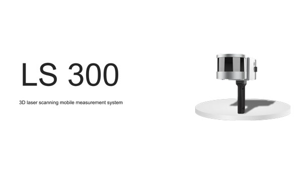
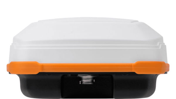
ComNav Technology has released the LS300 3D laser scanning measurement system.
The scanner utilizes simultaneous localization and mapping (SLAM) technology, and advanced real time and mapping techniques. It operates autonomously, independent of GNSS positioning, which makes it ideal for harsh conditions in both indoor and outdoor environments.
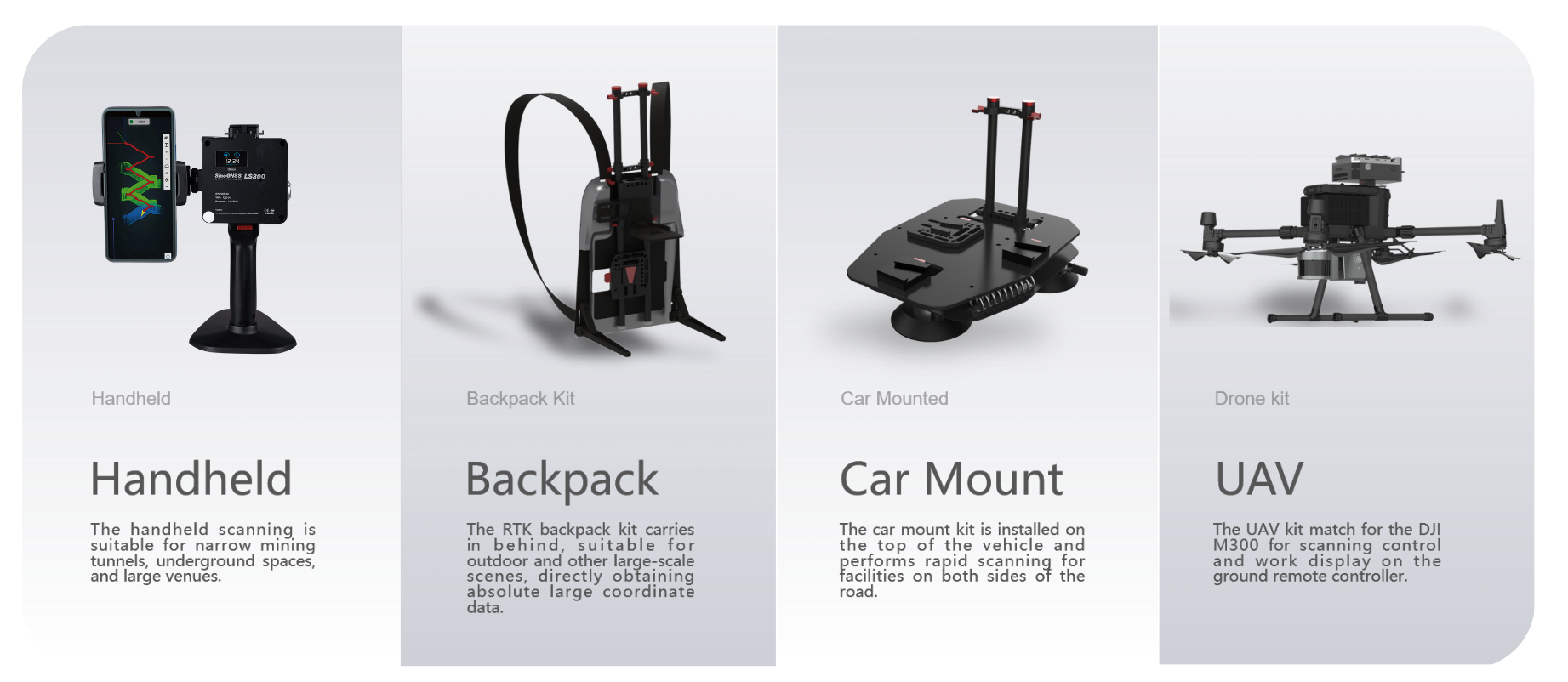
LS300 includes a 120-meter working range and a high sampling rate of 0.32 million points per second. Its point cloud accuracy is designed to perform in low reflectivity extended-range mode. The system is compatible with specialized kits, including the handheld form, back kit, car-mount and UAV kit.
Image: ComNav Technology
The handheld mode is best suited for navigating narrow tunnels and large venues, while the backpack is designed for outdoor environments. The car mount can rapidly scan roadside facilities, and the UAV kit seamlessly pairs with the DJI M300 for aerial control. The LS 300 is suitable for a variety of applications, including smart city, digitization of underground facilities, geology, surveying and mapping, agriculture, mining and forestry.
The scanner uses a unique hybrid HSL technology. This allows for preliminary processing during the scanning process, which aims to accelerates the collection of high-precision data and expedites data processing. It offers real-time viewing of point cloud data through a mobile application and supports multiple interaction modes.
By using data processing software specifically designed and developed for the LS series by ComNav, users can handle large volumes of point cloud data and simplify complex tasks, including point cloud denoising, point cloud splicing, shadow rendering, coordinate transformation, automatic horizontal plane fitting, automatic point cloud data report generation, forward photography, and point cloud encapsulation. This allows users to efficiently process intricate point cloud data, resulting in precise measurement and modeling outcomes.
During data post-processing, users can input absolute coordinates of control points, which allows these control points to make comprehensive adjustments to the data and improve scanning data accuracy.
The LS300 also incorporates a redundant battery design with two hot-swappable batteries, designed for prolonged operation without frequent charging or interruptions. This innovative approach contributes to enhanced safety, reliability, and efficiency, the company says.
Inertial Labs has been awarded an SBIR Phase III contract by the Army Applications Laboratory of Army Futures Command. This award supports Inertial Labs development, design and fabrication of the Cannon Artillery Pointing and Sighting System (CAPSS) for potential use on the U.S. Army’s Paladin and the extended range cannon artillery (ERCA) vehicles.
The CAPSS aims to dramatically reduce weight on the target vehicle platforms by providing a digital replacement for the vehicle’s current panoramic telescope (PANTEL). The PANTEL is used as a sighting system for the gun when the fire control system is inoperable. The CAPSS prototype is being designed to physically replace the PANTEL.
CAPSS is a collection of cameras, inertial measurement units (IMUs), advanced electronics and an intuitive tablet-based user interface. Designed to digitally mirror the PANTEL, the CAPSS system allows soldiers to emulate all PANTEL functions via the tablet, bypassing the need to physically manage the telescope.
More than 400 lbs in equipment weight is eliminated by replacing the current equipment with CAPSS, which improves the vehicle’s operational efficiency. Additionally, the features integrated within CAPSS eliminate the need for warfighters to leave the vehicle cabin for typical aiming and sighting activities connected to the PANTEL setup, such as working with the auto-collimator. All of the functionalities are inherently embedded in the CAPSS, which simplifies operations.
The CAPSS camera technology is also used for semi-automated ranging capabilities. Warfighters can effortlessly zoom in on specific objects, offer estimated data based on the object’s attributes, such as size estimation, and the system will generate the estimated range to that particular object.
Looking ahead, Inertial Labs plans to continue research on optical/inertial-based GPS-denied navigation designed for land vehicles, integrating both camera systems and inertial sensor data.
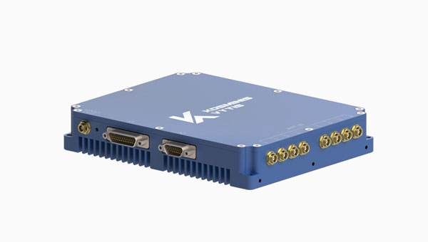
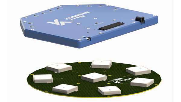
Kosminis Vytis has released two anti-jamming receivers, the KV-AJ3 and KV-AJ3-A, and an 8-channel, controlled reception pattern antenna (CRPA), anti-jamming development kit.
Image: Kosminis Vytis
The KV-AJ3 tri-band anti-jamming receiver combines a digital antenna control unit (DACU) and a GNSS receiver. KV-AJ3 can be used as a jamming protector for legacy receivers or as a stand-alone GNSS receiver solution.
When used with a Kosminis Vytis multi-band 4-channel antenna array, anti-jamming DACU uses the Null-Steering algorithm based on classic auto-compensator architecture and channel equalization, which eliminates the jamming signals from those processed by the receiver.
The tri-band solution decreases interferences from up to three directions in three frequency bands, including S-band, according to the company. This approach is designed to provide significantly higher protection against interference compared to single-frequency devices.
The receiver has a digital port for navigation data output. Jamming-free RF signals can also be delivered to external non-protected GNSS receivers to obtain position, velocity and time.
KV-AJ3 contains a MEMS inertial sensor, which allows for GNSS-aided INS solutions where coordinates and attitude angles are required.
Image: Kosminis Vytis
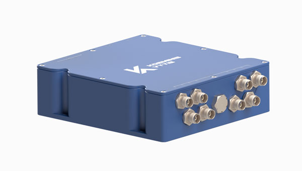
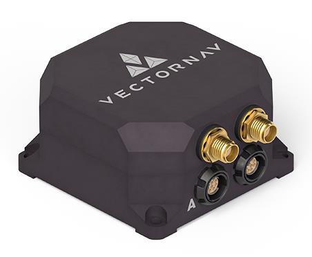
The KV-AJ3-A is designed to provide a stable navigation signal in three frequency bands, including S-band, even in the presence of jamming and other harsh conditions. The technology is MIL-STD compliant and meets the EMI/EMC requirements for avionics.
The direction to interfering signals is determined using a phased array antenna, which can then remove jamming signals from up to three directions. The original signal is either restored and delivered to external GNSS receivers or processed by the internal receiver to obtain position data. The device can be used as a DACU for legacy receivers, or as a stand-alone GNSS receiver solution.
According to Kosminis Vytis, the key components of this anti-jamming device are based on custom ASICs that allow users to achieve high jamming suppression and SWaP. KV-AJ3-A can be used for fixed installations and land, sea and air platforms, including UAVs.
Image: Kosminis Vytis
The 8-channel, CRPA, anti-jamming development kit is a set of instruments designed to help users add anti-jamming and anti-spoofing capabilities to their receivers.
The main development tool is NT1069x8_FMC — an 8-channel receiver board. The 8 coherent channels are based on NT1069, the RF application-specific integrated circuit (ASIC) that supports a high dynamic range of input signals.
Each channel performs amplification, down-conversion of GNSS signal to intermediate frequency (IF) and subsequent filtering and digitization by 14-bit ADC at 100 MSPS.
The board is compatible with GPS, GLONASS, Galileo, BeiDou, NavIC (IRNSS) and QZSS signals in L1, L2, L3, L5 and S bands. Each RF channel has an individual RF input with the option to feed power to an active antenna.
The board also has an embedded GNSS receiver and an up-converter, or modulator, which can provide connection to an external GNSS receiver.
Under a technology license, Kosminis Vytis provides users interested in developing their solutions based on the NT1069 chip with a reference design of anti-jamming receiver, anti-jamming algorithms and software tools for the development and evaluation of anti-jamming receivers.
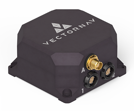
VectorNav Technologies has released two products, the VN-210-S and VN-310-S, which expand its tactical series of GNSS-aided inertial navigation systems (INS).
The VN-210-S GNSS/INS combines a tactical-grade inertial measurement unit (IMU) comprised of a 3-axis gyroscope, accelerometer, and magnetometer with a triple-frequency GNSS receiver. The integrated 448-channel GNSS receiver from Septentrio adds several capabilities, including L5 frequencies, moving baseline real-time kinematic with centimeter-level accuracy, support for Galileo OSNMA and robust interference mitigation.
These capabilities and high-quality hardware offer improved positioning performance in radio frequency-congested and GNSS-denied environments.
Image: VectorNav
The VN-310-S dual GNSS/INS leverages VectorNav’s tactical-grade IMU and integrates two 448-channel GNSS receivers to enable GNSS-compassing for accurate heading estimations in stationary and low-dynamic operations. The VN-310-S also gains support for OSNMA and robust interference mitigation, offering reliable position data across a variety of applications and environments.
The VN-210-S and VN-310-S are packaged in a precision milled, anodized aluminum enclosure designed to MIL standards and are IP68-rated. For ultra-low SWaP applications, VectorNav has introduced L5 capabilities to the VN-210E (embedded) when using an externally integrated L5-band GNSS receiver.
Septentrio has been working on port automation projects with Kalmar, a Finnish company that offers a wide range of cargo handling solutions and services to ports, terminals, distribution centers and heavy industry. I discussed this collaboration with Stef van der Loo, market access manager at Septentrio. Following are excerpts of our conversation. For a much longer version, click here.
What are the challenges operating in a port?
In a container terminal or port, everything is interconnected and, therefore, complex. Lately, GNSS has become more popular, especially when coupled with inertial navigation, because the technology has become more capable of delivering centimeter-level accuracy even in challenging environments where the line-of-sight to GNSS satellites may be partially blocked by containers or structures.
What drives higher accuracy?
this Kalmar container handler has a Septentrio high-accuracy GNSS/INS receiver and an inertial system, which operate in challenging environments of low satellite visibility. (Image: Kalmar)
Every year, every terminal stacks a certain number of containers, but not all the information about them is given to the terminal operating system (TOS) automatically. Sometimes, operators must search for misplaced containers, which may require stopping operations and deploying additional personnel. Additionally, it is not very safe to go into these yards. This is one reason why ports began to deploy positioning systems. However, ten years ago, with meter accuracy, they were failing all the time. Now, improvements in the technology have enabled GNSS to become fit for the challenge. In terminals, you can use GNSS or INS systems for vehicle traffic management, autonomous vehicles and tasks, or to get the position of a container.
For example, when a reach stacker reaches into a stack and locks a container in place, it’s crucial to have a very reliable centimeter-level position. Errors grow as the data is processed from the control systems to the TOS. To know for certain the position of a container when it was placed in a stack errors must not exceed half a meter. Therefore, the reliability and accuracy of the GNSS/INS is crucial for container positioning.
Do you buy the IMUs and do all the integration?
We buy the IMUs mostly from Analog Devices. The integrated inertial navigation solution is our own. We focus on inertial navigation in several markets — including logistics, autonomous mining, and agricultural robotics.
What is the division of labor between you and Kalmar?
Kalmar is both an OEM and an integrator. They are a guru for the automation of logistics terminals. We work with them mainly as an integrator. They will go to a terminal, like other integrators, and install the systems and other equipment. Kalmar built a whole sensor stack with all types of sensors and integrated this in their packages, such as SmartPort. With a train-the-trainer principle, our engineers trained Kalmar employees, so they have first line control of the installations and troubleshooting. Then we are ready to support them where we can. We have a continuous feedback loop with several logistics customers for suggestions and product recommendations for the evolution of our products and services for this segment.
Straddling containers
JAVAD GNSS
Straddle carrier in operation equipped with DELTA-3S. (Image: Canva)
One of the largest container companies in the world needed a solution to manage its straddle carriers, which are specialized container handling vehicles at ports that can pick up large containers and move them to trucks, trains, or other container stacks. This is very challenging for container terminal operators because ports are highly complex operating environments that also provide other maritime services, such as storing and managing cargo, forwarding freight, and clearing customs. To handle containers safely and efficiently, modern terminals have buildings, equipment, and cranes in addition to straddle carriers. All this infrastructure creates a lot of multipath that stresses the capabilities of GNSS receivers.
To develop and install this new system for straddle carrier vehicles, the container company turned to JAVAD GNSS and to ALLSAT GmbH, a German engineering, geodetic and electronic company founded in 1991 that has been JAVAD’s German distribution partner since 1995. To address the challenge, in 2022, ALLSAT GmbH applied a new digital twin concept to supply and support the commissioning of several hundred JAVAD GNSS rover solutions at three international seaports. This required obtaining real-time and highly accurate positional data for moving straddle carriers and uploading it to a terminal information system for control and documentation.
ALLSAT deployed a geodetic conceptual design that integrates JAVAD GNSS Delta-3S receivers and RingAnt G5T and GrAnt-G5T antennas to deliver precise surveying of two GNSS reference stations per port, then commissioned the system on all the straddle carrier vehicles from a single source. It also developed a solution employing two redundantly operating reference stations that broadcast RTK correction data for all GNSS (GPS, Galileo, GLONASS, and BeiDou) on different IP addresses/radio frequencies. All the JAVAD RTK rovers can receive and process data from both correction sources in parallel thanks to their 874 channels and parallel processors. This offers two advantages. First, it provides a comprehensive fallback in the unlikely event that one reference station fails. Second, it greatly improves the reliability, speed and accuracy of the rovers, which operate in an environment rife with signal shadowing and multipath influences.
Working closely with its client and JAVAD GNSS, ALLSAT was able to implement this project, from initial idea to verification and commissioning, in only a few weeks. The combination of redundant, multi-constellation reference stations and JAVAD GNSS multi-base RTK yielded a solution that is highly reliable and available, providing for continuous operation despite the challenging environmental conditions. Additionally, JAVAD GNSS provides firmware updates for the life of the devices, which will enable the customer to rely on this base rover solution for the next 10 years.
Tracking trains
M3 Systems
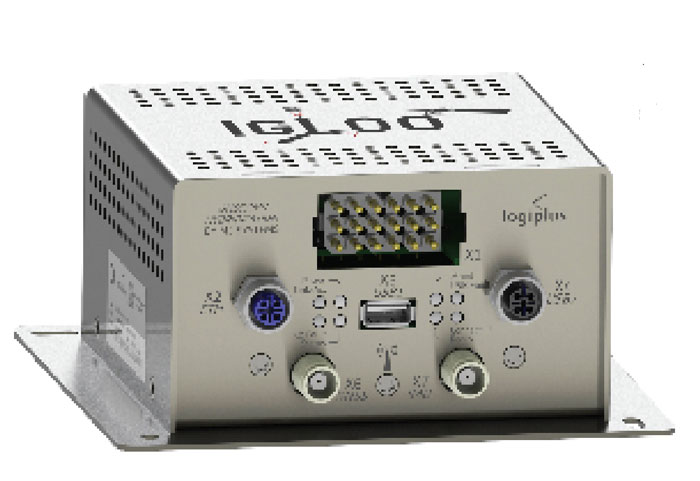
(Image: Logiplus)
M3 Systems, a French-Belgian geolocation company founded in 1999, has long supported the R&D activities of European space and civil aviation agencies. It also markets products that it developed through its R&D activities. In recent years, M3 Systems expanded its activities into the automotive and rail sectors. To develop a new device for trains, it partnered with two Belgian companies: Logiplus, which makes onboard electronic systems for trains, and ALSTOM Belgium, a division of ALSTOM group, which builds trains and equipment for train tracks. “The objective during the product design was the development of a hybrid sensor that uses both a GNSS sensor to provide absolute positioning, and an inertial measurement unit (IMU) to compensate for environmental obstructions such as trees and urban canyons by calculating the train’s position based on its last GNSS-based absolute position,” explained Jérémy Skelton, project lead at M3 Systems.
IMUs have long been coupled with GNSS because each technology compensates for the other one’s limitations: IMUs suffer from drift and GNSS receivers from signal loss in certain environments. In theory, surveying the tracks and using odometry to monitor a train’s linear position on them would suffice to locate it. In practice, however, wheel encoders “are prone to errors because the wheels are subjected to a lot of sliding and skidding,” Skelton said.“So, we need completely independent sensors.”
This requirement led ALSTOM to propose the development of the IGLOO (an acronym for IMU & GNSS vehicle odometry) input device, which integrates all the different sensors. Logiplus designed and manufactured the hardware, while M3 Systems wrote the algorithm.
The project, which was partially funded thanks to a grant from the European Regional Development Fund and supported by the Région Wallonne of Belgium, was divided into three components:
The software to couple the IMU and the GNSS to compute the train’s velocity.
The auto-calibration solution, which eliminates the need for automatic calibration when starting the sensor.
A hardware platform that incorporates a low cost IMU.
The consortium defines three kinds of zones in which a train will operate, depending on the trustworthiness in each zone of the GNSS signals. “For example, an environment with a clear view of the sky and no nearby obstacles is trustworthy,” Skelton said, “while a forest, an urban canyon, or the entry into a tunnel are not. Without GNSS support, eventually the IMU will also become unreliable.”
At very low speeds, errors must be very low, but at higher speeds a greater speed error is allowed. Operators can extract different levels of data from a GNSS receiver. To achieve a tight GNSS-INS coupling, they can use the Doppler delays and hybridize them with the IMU or use the tracking loop and set the range and Doppler. For a loose coupling, they can directly use the GNSS receiver’s positioning, velocity, and timing data. All couplings are performed by using Bayesian filters, for example the Kalman filter. “Loose coupling will give you less accuracy, reliability, and integrity, but it will also be less CPU-intensive,” Skelton said.
For data acquisition on a train, M3 Systems generated a printed circuit board (PCB) with a u-blox GNSS receiver, a Septentrio Asterix GNSS receiver, nine IMUs (which enables them to choose the best one for the use case), a reference trajectory unit that provides ground truth, and a computer that takes the data from the GNSS receivers and the IMUs. “Everything was integrated for measurement purposes on a rack on a train that runs here in Belgium,” Skelton said, “and all the data was retrieved automatically via a 4G internet connection. We have collected a few thousand kilometers traveled, a few hours of tunnels, and both trustworthy and untrustworthy GNSS signals.”
M3 Systems’ partner Logiplus designed the product to support the hybridization software and interface with the European vital computer (EVC), which monitors and continuously calculates the train’s maximum speed and braking curve. “It is critical for the EVC to have perfect knowledge of the train’s speed, which is the main reason we designed this new device,” Skelton said. “What is specific in that hardware is the computing power, the two systems (GNSS and inertial), and the data fusion algorithm, which allows the hardware to evolve. For example, we can switch to a different IMU.”
The IGLOO system complies with the specified safety requirements, contributing to a more reliable knowledge of the train speed, which reduces the risk of accidents and fatalities, improves traffic flow, and improves the efficiency and safety of the train operations, Skelton pointed out.
Surveying a railroad
Eos Positioning Systems
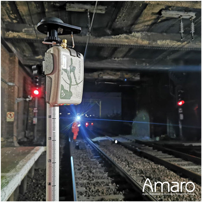
A rail tunnel at Leigh-on-Sea in East of England. Arcadis used Eos Arrow 100 GNSS receivers alongside Esri’s ArcGIS Survey123 to collect rail assets with submeter accuracy in real time. (Image: Amaro)
Network Rail, which owns and manages the railway infrastructure in England, Scotland and Wales, needed an as-is survey of up to 50,000 electrical assets along 400 miles of rails in the eastern region of the country. It turned to Arcadis, a design and consultancy firm that specializes in sustainable design and engineering services. The project required delivering accurate building information modeling (BIM) plans of the rail line to support operations and maintenance of the electrified infrastructure, while ensuring a safe working environment for the surveying teams. Using Arrow 100 GNSS receivers from Canadian manufacturer Eos Positioning Systems and Esri’s ArcGIS Survey123 and ArcGIS Hub software, Arcadis was able to efficiently capture the data with sub-meter accuracy and share it with Network Rail in real-time.
Arcadis decided to conduct a digital field survey to collect the data and to use GIS to manage it, said Gideon Simons, Associate Director of GIS and Geospatial Consultant at Arcadis. “We provided the survey teams iPads, the Esri application, and the GNSS receivers.” For corrections, it used the Ordnance Survey’s OS Net. “We found through a few assessments and testing that the Eos Arrow’s precision was good enough to meet the project’s requirements.”
The region surveyed is mostly rural but the rail line traverses some very urbanized areas. “One of the first challenges was surveying under cover in stations and in quite a few tunnels. So, we developed methodologies using georeferenced plans and imagery and taking temporary datums using GNSS outside the tunnels, to measure distance and offsets to the assets in the tunnels with measuring wheels that allowed for post-survey processing and the location accuracy required,” said Simons.
Photography was also a key to the success of the project. “In just one depot, we surveyed thousands of assets with many inside train sheds,” said Simons. “We use 360-degree cameras and train view cameras, so that we really understand where assets should be placed.”
The next stage for Network Rail is to maintain that equipment — whether it’s replacing it, bringing it up to code, or potentially installing new assets, Simons pointed out. “In the UK, we use a variety of measurements — imperial and metric. So, it’s been very helpful for the client to have just one source of truth reference that supports their work yet that can still link with other systems and ease communication with wider teams.”
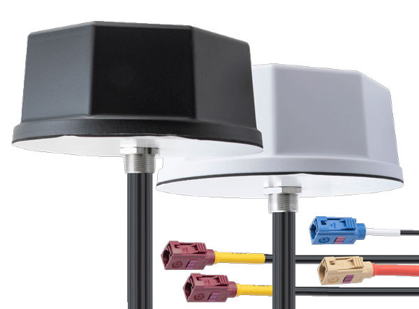
Pasternack has launched its new line of IoT multiband combination antennas. Designed for vehicles, fleets and pivotal base stations, the technology aims to revolutionize how industries perceive and use mobile connectivity.
The antennas integrate 4G, 5G, Wi-Fi and GPS bands to offer emergency teams, on-the-move fleets and first responders an unwavering link, even in harsh environments.
Facilitated with both FAKRA and SMA connectors and extended 17-foot cable leads, users can seamlessly integrate the technology. It also has an IP69K rating, certifying it for both indoor and outdoor deployments.
MIMO capabilities improve data transmission speeds and reliability, ensuring consistent high-bandwidth connections. The antenna’s GPS/GNSS component, enhanced with LNA and amplified by a 26 dB gain, offers users improved navigation and tracking precision.
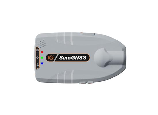
ComNav Technology has released the Z30, a portable high precision GNSS receiver. This device combines a host of advanced features into a compact, versatile design that makes it suitable for a wide range of industries such as personnel positioning, internet of things (IoT), railway patrols, vehicle tracking, and search and rescue missions.
Equipped with the SinoGNSS K8 platform, the Z30 can track full constellations and multiple frequencies, providing centimeter-level accuracy. With 965 channels, it is capable of tracking more than 60 satellites of GPS, BeiDou, GLONASS, Galileo, QZSS, IRNSS and SBAS.
The Z30 features an integrated antenna for stable signal reception. The device is also equipped with two side buttons for power and one-click SOS alerts and three Indicator LEDs for power, satellite, and differential status checks.
It supports NTRIP and TCP protocols, enabling various personnel positioning applications by uploading position data. The Z30 integrates with NaviCloud, offering functions such as real time location display, historical trajectory query, remote control and electric fence. In addition, it can be customized to meet specific customer requirements.
With indoor and outdoor positioning capabilities, the Z30 is a suitable solution for various fields. It supports outdoor real-time kinematic positioning with centimeter-level accuracy and indoor Bluetooth positioning with sub-meter-level accuracy.
Point One Navigation has joined the STMicroelectronics Partner Program. The program aims to deliver reliable navigation and positioning solutions to a diverse spectrum of ST customers in the U.S. and Western Europe.
Because of Point One’s navigation software and real-time kinematic (RTK) network, developers using ST Teseo GNSS solutions now have a more efficient path to create precise navigation solutions in industries such as agriculture, construction, last-mile delivery, and autonomous vehicles.
Point One’s Polaris Cloud is a GNSS correction network that enables GPS based localization, while allowing users to choose the performance and price point that best fits their application. With coverage across the U.S. and most of Western Europe, Polaris Cloud provides a readily available solution for precise localization.
FusionEngine software, developed by Point One, further enhances precision navigation by integrating additional sensors like IMUs and wheel speed sensors. This allows users to achieve a desired level of accuracy, even in situations where satellite signals are absent or in challenging urban environments. The software also offers automatic calibration, fault detection and compatibility with a range of host processors.
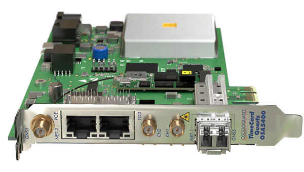
Adtran’s OSA 5400 TimeCard has obtained approval from the Open Compute Project (OCP) Time Appliance Project (TAP) for data center timing and synchronization. The plug-in device integrates Adtran’s Oscilloquartz timing technology into any white box server, aiming to solve key challenges in the transition to virtualized environments.
The OSA 5400 TimeCard facilitates smooth and efficient operations for critical and time-sensitive applications. The card’s compact design, scalability and advanced features make it ideal for data center operators looking to adopt open, disaggregated hardware, the company said.
In combination with Adtran’s Ensemble Sync Director, the timecard offers operational teams a comprehensive, unified view of their entire timing infrastructure. Additionally, the OSA 5400 TimeCard has been developed to fully align with the IEEE P3335 standardization. The inclusion of high-performance quartz and rubidium oscillators ensures accurate timing during extended GNSS disturbances.
The OSA 5400 TimeCard can be integrated into available PCIe slots of standard servers or PCs.
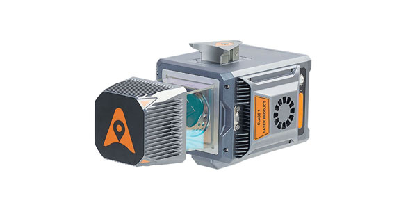
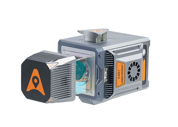
Leica Geosystems, part of Hexagon has developed the Leica BLK2GO PULSE, its first-person laser scanner that combines lidar sensor technology with the original Leica BLK2GO form factor. The technology is set to be released in early 2024.
The scanner offers users a rapid, simple and intuitive first-person scanning method that can be controlled with a smartphone, and delivers full-color 3D point clouds instantly in the field.
The BLK2GO PULSE was built in collaboration with Sony Semiconductor Solutions Corporation to combine Sony’s advanced time-of-flight (ToF) image sensors with Leica Geosystems’ GrandSLAM technology, resulting in a dual ToF hand–held scanner.
The product is designed for indoor applications such as the creation of 3D digital twins and 2D floor plans. It includes first-person scanning capabilities and instant data availability, allowing users to immediately download, view and share colorized 3D point clouds and images from the field. Scans can then be uploaded to Reality Cloud Studio, Hexagon’s cloud application for reality capture data visualization, collaboration and storage.
A roundup of recent products in the GNSS and inertial positioning industry from the October 2023 issue of GPS World magazine.
SURVEYING & MAPPING
GNSS Receiver For GIS and survey professionals
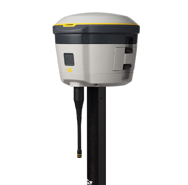
The R2 GNSS system is a compact, durable, and flexible GNSS receiver that collects highly accurate data in a wide range of geospatial applications with submeter to centimeter positioning accuracy. The R2 can track the full range of GNSS satellite constellations and augmentation systems, and also comes with an integrated Trimble Maxwell 6 chip and 220 channels. Users can achieve higher accuracy in real-time with the ability to choose correction sources from traditional real-time kinematic, VRS networks, to Trimble RTX correction services delivered by both satellite and internet/cellular. The R2 can provide improvements to position availability and accuracy when heavy overhead cover, such as tree canopy and buildings, obstruct satellite signals. The receiver is also IP65-rated, making it suitable for rugged environments. Trimble Geospatial, geospatial.trimble.com
Scanning and Mapping Solution Designed for accuracy-focused remote sensing applications
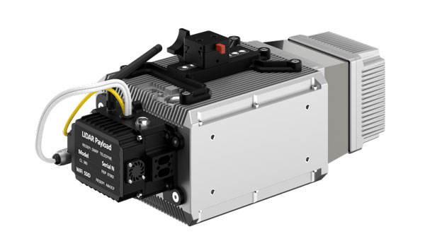
The Resepi Teledyne Optech CL-360-HD has a powerful four-return laser and increased range of up to 750 m, making it ideal for mobile mapping, forestry and crack detection in critical infrastructure areas such as airport runways. Resepi is a sensor-fusion platform designed for accuracy-focused remote sensing applications. Resepi utilizes a high-performance INS and a high-accuracy dual antenna GNSS receiver, integrated with a Linux-based processing core and data-logging software. The platform also provides a Wi-Fi interface, optional imaging module, and external cellular modem for RTCM corrections. Resepi can be operated by a single hardware button or from a wirelessly connected device via a simple web interface. Resepi, equipped with Teledyne’s CL-360HD lidar, offers various laser scan speeds and frequencies, allowing users to tweak the settings to match their individual needs. Inertial Labs, inertiallabs.com
GNSS Receiver Series Available in three different models for various applications
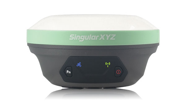
The Xtraordinary X1-series GNSS receivers include X1 and X1 Lite and X1 Pro. The X1-series adopts Linux OS, which improves the stability of the system and the synergistic compatibility of each module. This series of GNSS receivers features improvements to satellite tracking, the inertial measurement unit (IMU), battery life, and more. Optimized with a new generation of IMU module, users can easily initialize the IMU in 5-sec and start tilt measurements up to 60°. The X1-series GNSS receivers supports both 4G/radio correction data transmission and can reach up to 15 km range in enhanced internal UHF mode, 20 km range in external mode, and more than 50 km via internal GSM or PDA CORS mode. SingularXYZ, singularxyz.com
GNSS Smart Antenna For agricultural, marine, GIS, mapping and other applications
The A631 combines the Athena GNSS engine and Atlas L-band correction technologies with a new web user interface (WebUI). Optional features include 16 GB of internal storage, Bluetooth and Wi-Fi. The compact antenna is designed for rugged environments and meets IP67 requirements. With multiple operating modes, A631 can be used as an RTK base station or rover. The device is supported by the Atlas Portal, which empowers users to update firmware and enable functionality, including Atlas subscriptions for accuracies from meter to sub-decimeter levels. A631 also supports BaseLink and SmartLink modes. SmartLink allows users to directly connect AtlasLink as an extension to any existing system that has industry-standard connectivity options. BaseLink automatically sets up AtlasLink as a permanent reference station, delivering corrections to any other GNSS receiver being used for positioning. Hemisphere GNSS, hemispheregnss.com
GNSS Receiver For land surveying, GIS, and construction applications
The Mars Pro combines GNSS, inertial measurement unit (IMU), and laser technologies. When set to laser mode, the Mars Pro can carry out measurements by selecting a signal-friendly spot within a 10-m radius, which aids in measuring hard-to-reach, signal-obstructed, and hazardous areas. With its millimeter-level laser distance meter integrated on its rear, the Mars Pro facilitates the utilization of the laser mode in scenarios involving surveying and stakeout. The integrated IMU sensor offers 60° tilt compensation, which remains functional even when operating in laser mode, allowing for uncompromised efficiency and accuracy. Equipped with the latest K8 platform, it boasts full-constellation support, offering 1,668 tracking channels and more than 60 satellite tracking capabilities across all existing and planned constellations — GPS, GLONASS, Galileo, BDS, QZSS and IRNSS. The Mars Pro offers support for precise point positioning (PPP) service, enabling rapid fixing within seconds. Its dynamic OLED color screen is sunlight readable and offers real-time visualization of essential data — satellite count, fixed state, on-off state, power, and more. It is compatible with mainstream brands and multiple protocols, such as Transparent, TT450S, SATEL, Trimtakl3, CHC and South. ComNav Technology, comnavtech.com
Lidar System For mobile mapping applications
The AlphaUni 20 lidar system (AU20) features advanced multi-target capabilities that support up to 16 target echoes for vegetation penetration. The AU20 captures ground surfaces with extreme precision, producing accurate digital elevation models and digital surface models in challenging environments. The lidar system has an accuracy of 2 cm to 5 cm. It has a lightweight, compact design that weighs 2.82 kg in its airborne configuration and a total of only 10.7 kg with its car mount kit, including a Ladybug5+. Its flexible multi-platform design allows users to install it on manned or unmanned aircraft for aerial scanning, integrate it into a variety of land vehicles, and even use it as a backpack-mounted system for mapping narrow areas. CHC Navigation, chcnav.com
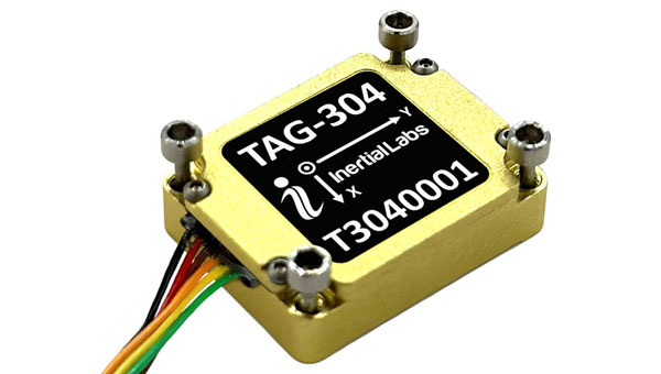
Gyroscope An advanced performance, tactical-grade MEMS gyroscope solution
Developed for use in particularly harsh environments, the TAG-304 gyroscopes can withstand extreme shock and vibrations in accordance with MIL-STD-810 standards. Additionally, TAG-304 gyroscopes are fully digitized (RS-422 interface), include built-in test (BIT) functionalities, and have no moving parts. TAG-304 is an advanced performance, tactical-grade MEMS gyroscope, of which size, power consumption, reliability and performance are ideal for accomplishing complex tasks requiring accurate stabilization of assorted platforms. Very low latency (group delay), small size, 4K Hz data rate, 1K Hz bandwidth, and low noise make TAG-304 gyroscopes a suitable solution for miniature electro-optical systems, gimbals, line-of-sight, and pan and tilt platforms stabilization and pointing applications. Inertial Labs, inertiallabs.com
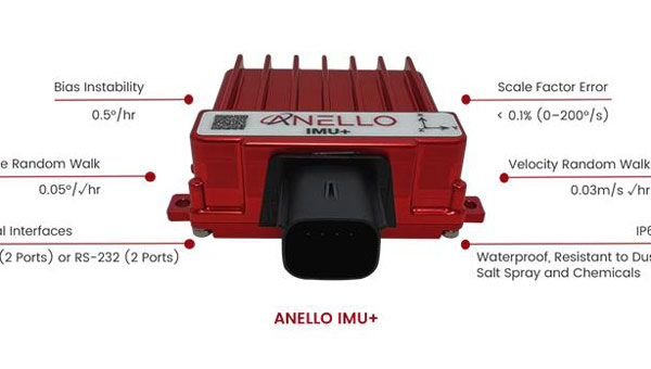
IMU For GNSS-challenged environments
The ANELLO IMU+ provides robust and reliable autonomous navigation and positioning in GNSS-denied or GNSS-compromised environments. Powered by optical gyroscope technology, the ANELLO IMU+ delivers high precision and reliability in demanding conditions, including shock, vibration, electromagnetic interference and temperature. The ANELLO IMU+ is suitable for autonomous applications in the construction, robotics, mining, trucking and defense industries.The device delivers long-term dead reckoning in high-temperature and high-vibration environments.The ANELLO IMU+ features unaided heading drift of < 0.5°/hr, dual high-speed CAN FD interfaces, and dual RS-232 interfaces; has ASIL-D ready, automotive-qualified CPU and OS; and is IP68 waterproof, resistant to dust, salt spray and chemicals. ANELLO Photonics, anellophotonics.com
Flying Laser Scanner Captures colorized 3D point clouds for producing 3D models, drawings, and visualizations
BLK2FLY is a fully integrated lidar UAV laser scanner with advanced obstacle avoidance for reality capture from the air. It can scan inaccessible areas such as rooftops, facades and large building interiors. BLK2FLY autonomously captures interior and exterior dimensions and features of buildings with a few taps on a tablet. Users can select an area within the map on their tablet and the BLK2FLY will create its own flight path to scan it quickly and safely. Users can send the BLK2FLY to scan a new area by tapping anywhere on the 3D view in the app. The BLK2FLY also can be piloted manually with virtual joysticks on a user’s tablet.
BLK2FLY can scan interiors of large arenas, stadiums, facilities, plants, and even obscured or confined outdoor areas with its Indoor Mode, which allows the BLK2FLY to get closer to objects with reduced flight speed and to fly within confined spaces without access to GNSS. With advanced obstacle avoidance and increased visual SLAM capabilities, the BLK2FLY’s Indoor Mode makes scanning inside fast and versatile. Leica Geosystems, leica-geosystems.com
MOBILE
Smart Antenna Suitable for multiple applications
The HCS885XF/HCS885EXF smart helical GNSS antenna is suitable for UAV, land survey devices, automotive positioning, and other precise positioning/heading applications. The HCS885XF/HCS885EXF combines the performance and light weight of the Tallysman dual-band (GPS/QZSS L1/L5, GLONASS G1/G3, Galileo E1/E5a/b, BeiDou B1/B2/B2a) HC885SXF antenna with the low power consumption and GNSS augmentation capabilities of the u-blox NEO-F9P GNSS receiver. HCS885XF/HCS885EXF employs L5 signals (1160-1217 MHz), which transmit stronger signal power and a higher bandwidth chipping rate than L2 signals, thereby offering high performance when challenged with strong multipath signals. It also employs Tallysman’s eXtended Filtering system, which mitigates near-band and out-of-band interference, such as LTE signals and their harmonics and the planned Ligado service in North America, enabling operation in the most challenging deployments. The HCS885XF/HCS885EXF integrated receiver can simultaneously monitor four constellations, support base/rover RTK configurations (<1 cm), and use u-blox PointPerfect PPP-RTK augmented services over a terrestrial control network (3-6 cm). A moving-base precise heading configuration is available with base/rover antenna pairs. Tallysman Wireless, tallysman.com
Antenna Multi-constellation antenna for precision agriculture and semi-autonomous or autonomous applications
The TS122 EUAA provides centimeter-level accuracy in highly variable terrain and challenging GNSS-obstructed environments with ± 10 cm P2P accuracy and STANDALONE technology. The TS122 EUAA smart antenna receives dual-frequency multiple constellation signals from GPS, GLONASS, Galileo and BeiDou, with output position information up to 10 Hz. The antenna is capable of correcting deviations caused by a vehicle’s roll and pitch while working on uneven groups or slopes. Harxon, harxon.com
The antennas come equipped with a high gain of 28 dB or 30 dB, enabling them to capture signals in challenging terrains and conditions. One of their standout features is the use of right-hand circular polarization (RHCP), which reduces signal interference and multipath effects.
With waterproof and dustproof ratings ranging from IPX6 to IP66, these antennas are engineered to excel in the harsh environments and are ideal for vehicle tracking, fleet management, telematics, navigation systems and autonomous vehicles.
The antennas also come with both SMA and FAKRA connector options, ensuring wide-ranging system compatibility. They are tailored for the GPS L1 frequency and are available in both passive and active versions. Mounting them is user-friendly, with options for direct vehicle mount or the added convenience of a magnet mount.