A roundup of recent products in the GNSS and inertial positioning industry from the April 2024 issue of GPS World magazine.
SURVEYING & MAPPING
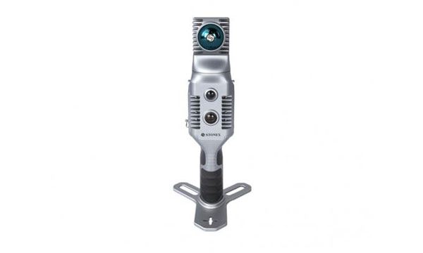
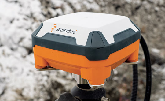
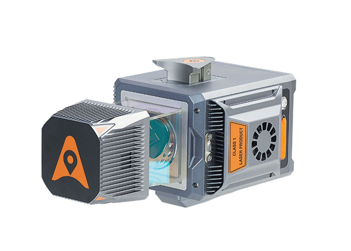
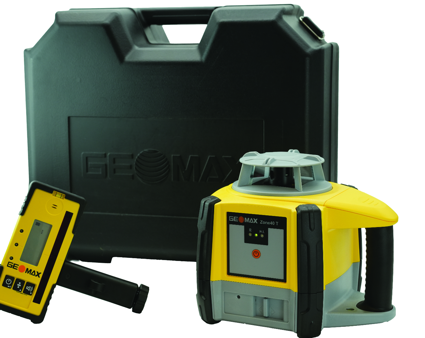
Rotating Laser
Built for challenging worksites
The Zone40 T one-button rotating laser is designed for all types of grading and leveling jobs. It seeks to address the industry’s need for efficient and accurate alignment solutions.
Its one-touch operation is designed to simplify and increase efficient workflows in a variety of jobs such as grading, paving, excavating, surveying, layout and more. It is ideal for contractors, crew chiefs, supervisors and trade professionals.
GeoMax products are tested and proven to endure the toughest conditions. With an IP67 environmental rating, the Zone40 T accurately delivers in dust, water, wind and extreme temperatures.
GeoMax Positioning, geomax-positioning.com
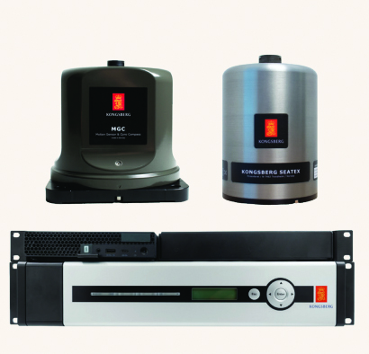
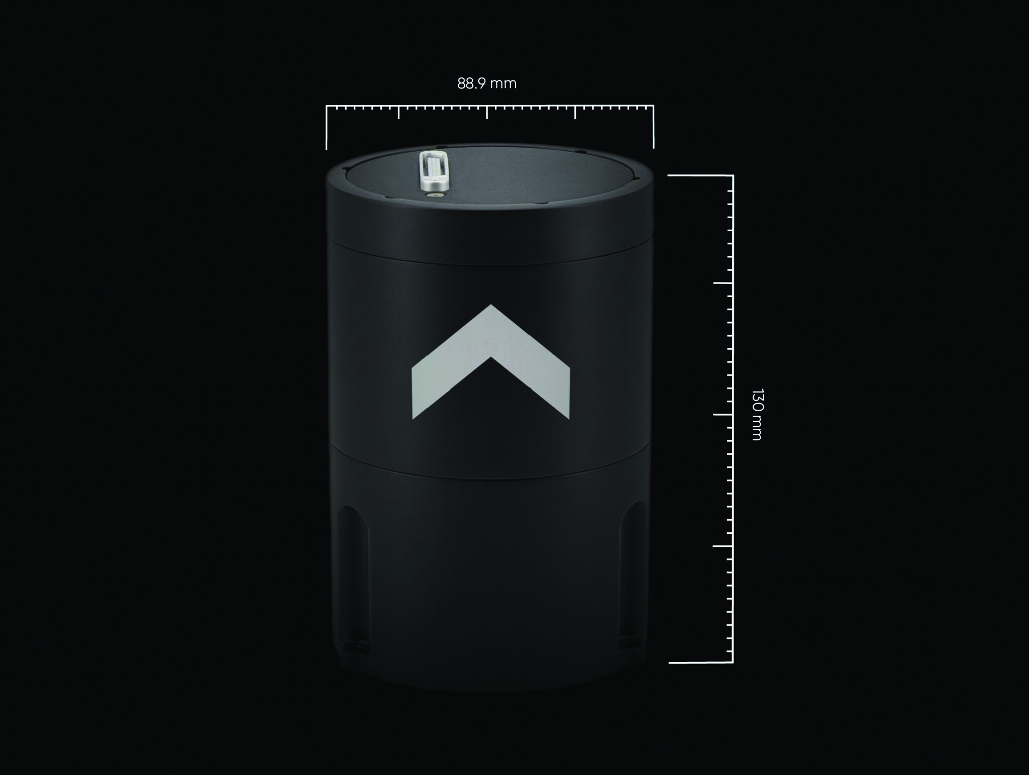
Hydrographic Surveying Solution
With advanced inertial sensors
The Seapath 385 navigation system is designed to enhance precision in hydrographic surveying by using advanced navigation algorithms and integrating a range of satellite signals, including GPS, GLONASS, Galileo, BeiDou and QZSS, alongside geostationary satellite signals. The Seapath 385 system combines raw inertial sensor data from Kongsberg Discovery’s high-performance motion gyro compass (MGC) or motion reference unit (MRU) with GNSS data and corrections from real-time kinematics (RTK), precise-point positioning (PPP) or Differential Global Navigation Satellite System (DGNSS). The integration offers a robust and accurate navigation solution ideal for hydrographic surveying.
The system’s dead reckoning capabilities are attributed to its advanced inertial sensors and updated navigation algorithms. It uses GNSS antennas for both positioning and heading determination designed to add an extra layer of robustness to the system. The Seapath 385 also introduces a new post-processing format that consolidates all necessary data and system configurations into a single file, which allows for centimeter-level position accuracy through either satellite orbit and clock data or data logged from base stations.
Designed for ease of installation and continuous, reliable operation, the Seapath 385 is a modular system with a processing unit that handles all critical computations independently of the user interface on the HMI Unit. This feature offers precise measurements with a data rate of up to 200 Hz at multiple monitoring points, which makes it an ideal solution for accommodating sensors or systems that depend on motion or position data throughout the vessel.
Kongsberg Discovery, Kongsberg.com
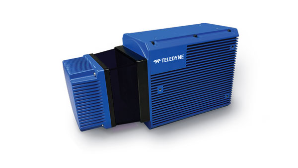
Marine-Grade Sensor
Compatible with USVs
The Optech CL-360 Marine is a 360° long-range laser scanner. It combines a scan speed of 250 lines per second with 2 mm range resolution, a plug-and-play solution and an IP67 marine-grade sensor.The system can be seamlessly integrated with multibeam systems and the CARIS Ping-To-Chart workflow, which allows for full above-and-below-water image capture with survey-grade accuracy in a single workflow.It is ideal for mapping coastal infrastructure and is designed to be used on an uncrewed surface vessel (USV) that provides survey grade range and accuracy.
Teledyne Geospatial, teledyneimaging.com
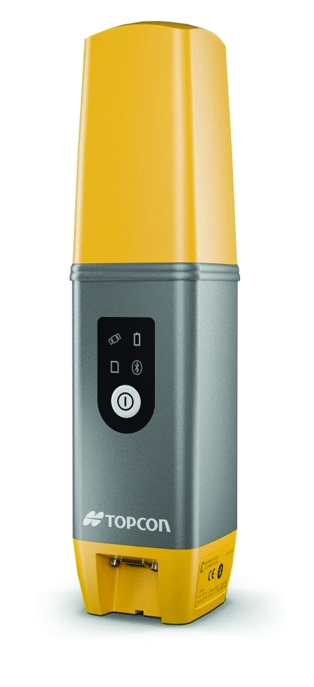
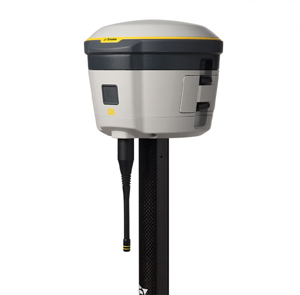
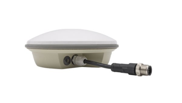
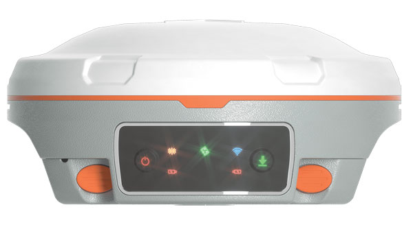
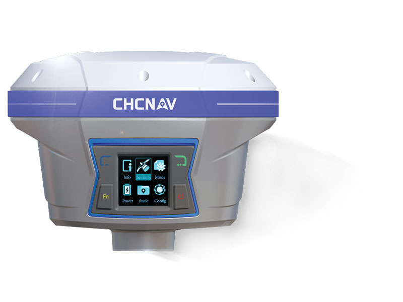
GNSS Receiver
Designed for centimeter-level and RTK accuracy
The HiPer CR is a compact and lightweight GNSS receiver designed for centimeter-level and RTK accuracy for professionals in a wide range of applications in surveying, construction, engineering, forestry and mining. It joins a portfolio of fuller-featured receivers, including the HiPer HR and VR.
The HiPer CR tracks the GPS, GLONASS, Galileo, BeiDou and QZSS constellations. It can be used in a variety of configurations, including as a network RTK rover, in base and rover setups and in integrated hybrid use with a robotic total station.
When used as a network rover with Topnet Live — the company’s global GNSS correction service — the HiPer CR will have access to high-quality data corrections to increase efficiency and productivity. Users also can select to use the receiver as part of a hybrid positioning system, which allows users to use a robotic total station for prism measurements. Users also can switch to GNSS measurement with the HiPer CR for obstructed areas such as warehouses, trailers, or buildings.
Topcon Positioning Systems, topconpositioning.com
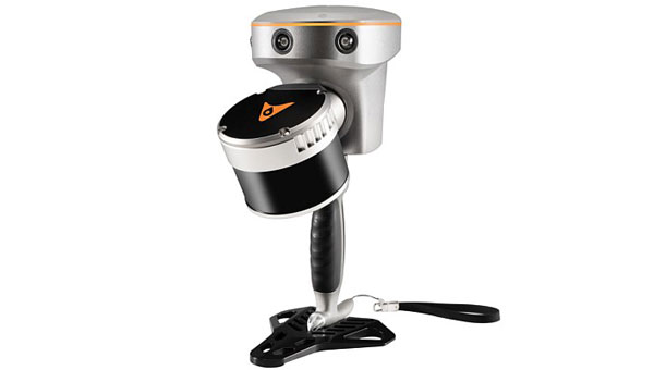
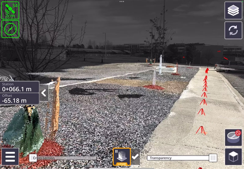
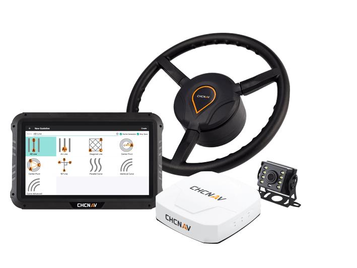
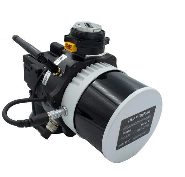
Handheld SLAM laser scanner
For in the field and indoors
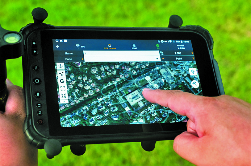
The RS10 is a handheld SLAM lidar laser scanner integrated with a full real-time kinematics (RTK) GNSS receiver.
Designed to improve efficiency across a wide range of mapping and surveying applications, the RS10 seeks to provide professionals with a versatile, all-in-one tool for capturing 3D geospatial data in both outdoor and indoor environments.
The RS10 integrates a GNSS smart antenna for RTK positioning accuracy even in challenging environments. It delivers 5 cm measurement accuracy by fusing high-precision lidar, RTK, laser and visual SLAM using three HD cameras.
The RS10 uses a powerful onboard processor for real-time georeferenced point cloud generation in the field. Users can receive instant feedback, which allows them to adjust while scanning. Large sites up to 13,000 square meters can be mapped in real time.
The integration of high-precision GNSS and SLAM technologies eliminates the need for traditional loop closure, which often complicates the data collection process for handheld scanners. Users can freely scan target areas without having to return to previous locations, which can streamline field data capture and significantly reduce time spent in the field.
CHC Navigation, chcnav.com
Airborne lidar sensor
With scan pattern reconfigurability
The Leica TerrainMapper-3 airborne lidar sensor features a new scan pattern reconfigurability to support a variety of applications and requirements in a single system.
The system offers three scan patterns, which allow users to customize the sensor’s performance to fit specific applications. Its circle scan patterns are designed to improve 3D modeling of urban areas or steep terrains. The ellipse scan patterns use data capture for more traditional mapping applications. Skew ellipse scan patterns are aimed at improving point density for infrastructures and corridor mapping applications.
The sensor has a high scan speed rate and a 60° adjustable field of view to maximize data collection with fewer flight lines. The TerrainMapper-3 is complemented by the Leica MFC150 4-band camera, which operates with the same 60° field of view coverage as the lidar for exact data consistency.
The device’s reduced beam divergence offers more accurate results, while its new multiple pulses in air (MPiA) handling is designed to deliver more consistent data acquisition, even in steep terrain.
The system introduces possibilities for real-time full waveform recording at a maximum pulse rate to open opportunities for advanced and automated point classification.
Leica Geosystems, leica-geosystems.com
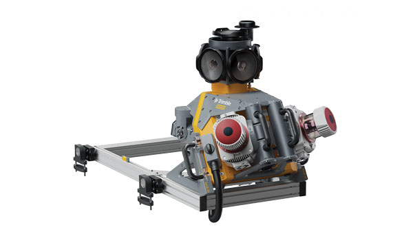
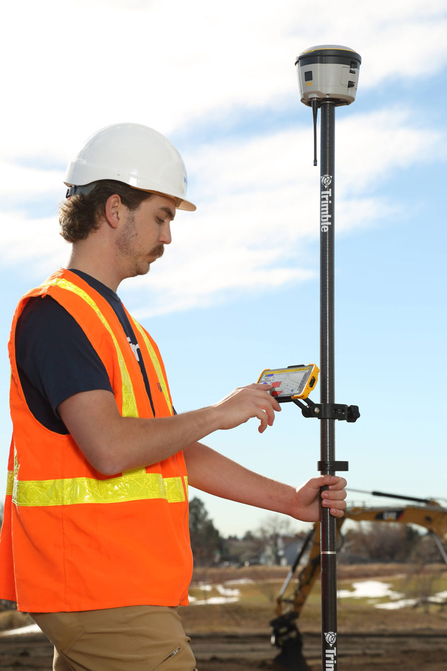
Mobile Mapping Solution
Mounted on vehicles or trains
The Trimble MX90 mobile mapping system integrates advanced Trimble GNSS and inertial technology with Trimble field and office software. It offers users a comprehensive field-to-finish mobile mapping solution designed for robust workflows for data capture, processing and analysis.
The MX90, mounted on vehicles or trains, captures detailed laser scans and imagery —panoramic and multi-angle. This data, collected at highway speeds, undergoes rapid processing to produce deliverables for feature detection and inspections.
The mobile mapping system includes immersive 360° panoramic and targeted cameras to capture high-resolution imagery of various details, such as small or distant road and rail signs, telecommunications towers or cracks and holes in roads.
Additionally, it offers high-density colorized point clouds with rich and accurate color projections. These dense point clouds, along with high-resolution imagery — panoramic and planar — and accurate trajectories, provide the basis for a wide range of deliverables, including street scenes, road and rail asset details, elevation models, volume calculations, 3D city models and as-built surveys.
It features a high-end inertial measurement unit (IMU) combined with IN-Fusion+ data processing technology to achieve high-quality data in challenging GNSS environments. The MX90 also comes with reliable office software solutions to support multiple use cases and applications, such as road inspection workflows and integration into cloud-based applications for efficient data sharing.
Trimble Geospatial, geospatial.trimble.com
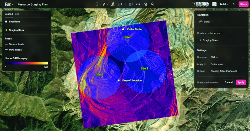
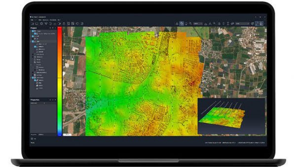
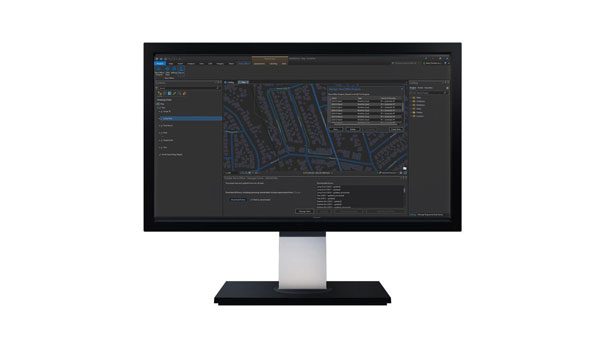
Collaborative Mapping Tool
With spatial analysis features
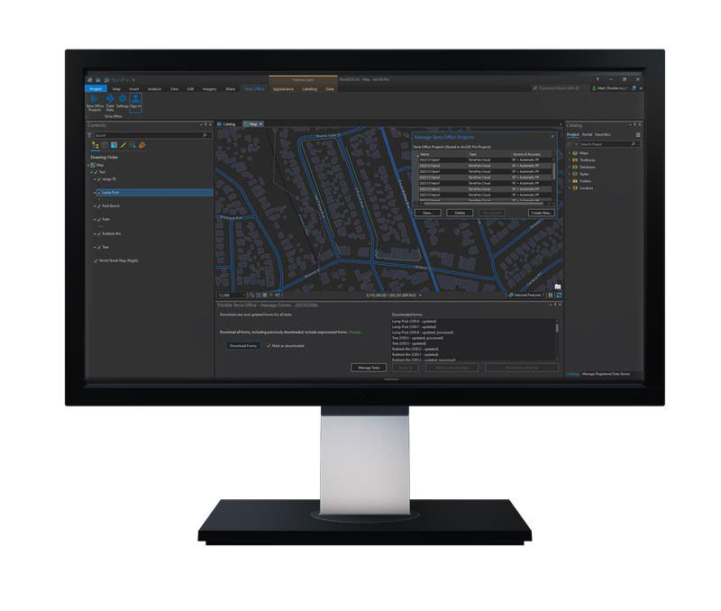
Felt 2.0 is a collaborative mapping tool with powerful data transformation tools. Now with spatial analysis features, users can manipulate and analyze geographic data. It has web-based collaboration features designed to make mapping workflows interactive and accessible across organizations.
The software uses artificial intelligence (AI) to deliver faster workflows for geographic information systems (GIS) professionals. Users can utilize Felt’s Upload Anything capabilities to visualize any file format. The system will read, understand and deliver an internet-fast visualization to the users’ workspace. The software is available for download on tablets and other mobile devices.
Felt, felt.com

Automatic Identification System
Available on Android, IOS, PC and Mac
The Over the Horizon (OHA) automatic identification system (AIS) is the newest update to the savvy navvy app. The update uses a phone’s internet connection to stream other vessels’ locations in real-time directly to the app to improve safety on the water.
Traditional AIS received from the transceiver on the boat has a range of a few miles, whereas OHA is designed to show vessels further afield. While OHA does require an internet connection, users do not need additional hardware to see information on vessel movements.
OHA AIS allows users to see vessels directly on the chart with small and large vessel crafts defined by different colors. Users can also check how crowded an anchorage might be — either from onboard or while planning routes at home.
The savvy navvy application highlights when no position has been received for more than 30 seconds, which marks the positional variance area around each vessel and allows users to be extra vigilant when navigating.
Available on Android, IOS, PC and Mac, the savvy navvy app can be used on multiple devices and is available in both free and “premium” options with enhanced access and functionalities.
savvy navvy, savvy-navvy.com
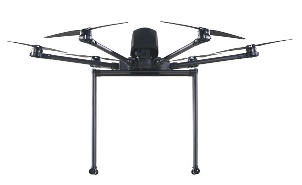
UAV

Real-Time Command and Control System
Supports BVLOS
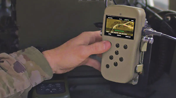
VigilantHalo is a software-based platform designed for real-time command and control of uncrewed airspace. The system supports a wide range of missions from air traffic control (ATC) to beyond visual line-of-sight (BVLOS) operations and counter-uncrewed aerial systems (C-UAS).
VigilantHalo combines radar and multi-sensor surveillance technology into a comprehensive situational awareness solution. It is designed for disaster response and critical infrastructure defense and can be customized for specific mission requirements. The system’s flexibility allows deployment across cloud, mobile or fixed-site installations, which aims to address the evolving threats in national security and the National Airspace System (NAS).
The system features integrated data processing, a fusion tracker and a communications system that enables operators to monitor and manage air traffic under various conditions. It leverages weather analytics from the National Oceanic and Atmospheric Administration (NOAA) and other sources to assess flight paths and identify safety risks. VigilantHalo uses a custom sensor data processor (SDP) that integrates data from different sensors and surveillance feeds into a unified display tailored to specific missions such as ATC, BVLOS, air defense and more.
BlueHalo, bluehalo.com
Dynamic Channel Switching
Improves communication in the field
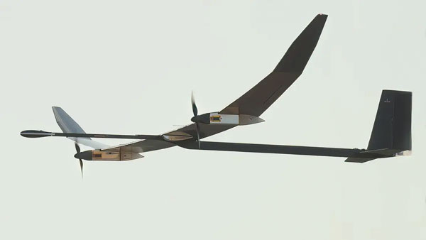
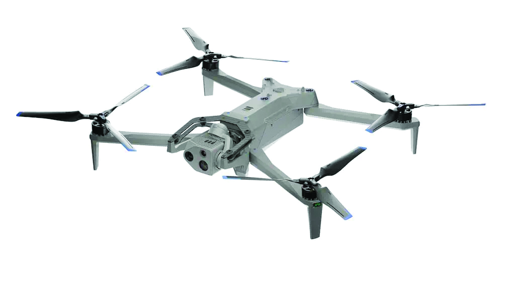
The Skydio X10D UAV features dynamic channel switching to monitor signal interference and move to a clearer channel. This aims to improve wireless transmission signal quality during flights to ensure troops maintain communication with the UAV to accomplish their mission.
Dynamic channel switching allows the X10D to provide adaptable communications between the drone and its accompanying controller in situations where the airspace is congested or under electronic warfare conditions. This feature ensures that reliable command and control is maintained and real-time data feeds are available even in challenging conditions.
The X10D is designed for intelligence, surveillance and reconnaissance (ISR) applications critical to defense and government agencies. It delivers advanced sensor technology, autonomous navigation and a modular, open architecture for military needs.
Skydio’s onboard AI and autonomy for small unmanned aircraft systems (sUAS) offers obstacle avoidance in zero-light environments and autonomous flight. Skydio X10D delivers enhanced compliance with federal standards, including the Robotics and Autonomous Systems – Air (RAS-A) Interoperability Profile (IoP) and an open, modular platform that supports third-party applications. RAS-A compliance and open MAVLINK protocol enable the use of third-party and government-owned flight application software.
Skydio, skydio.com
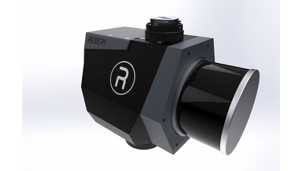
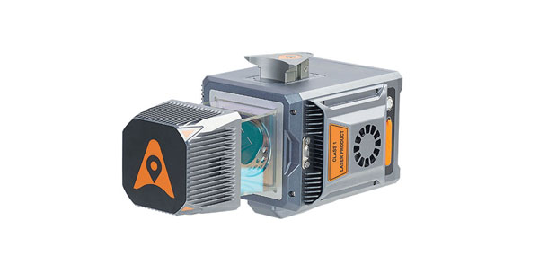
Lidar Sensor
Integrates with UAVs
The JoLiDAR-1000 is a new lidar sensor for UAVs. It aims to improve applications in GIS, surveying, and precision inspections of power lines. The JoLiDAR-1000 incorporates advanced lidar technology to improve measurement accuracy for UAV applications.
The sensor features a 1,000 m medium-range laser scanner, using RTK and inertial measurement unit (IMU) fusion technology and laser scanning for enhanced measurement precision. It achieves a measurement accuracy of 5 mm, a repetition accuracy of 10 mm and a line scanning speed ranging from 10 lines to 300 lines per second. It has a 100° field of view and an angular resolution of 0.001 to precisely detect objects at extended distances.
Designed with compact dimensions and weighing only 1.9 kg, the JoLiDAR-1000 is portable and integrates seamlessly with various UAV platforms. It incorporates a suite of technologies, including a GNSS high-precision positioning system, IMU, high-speed data acquisition systems, time synchronization systems and a 26MP RGB camera to enhance its data collection capabilities.
The JoLiDAR-1000 streamlines operational processes by eliminating the need for base station setup and ground control points. It is equipped with high-precision POS solution computation and point cloud fusion capabilities. The sensor is suitable for a wide range of applications such as terrain mapping, power line inspection, mining surveying, coastline measurement, emergency mapping and natural resource surveying.
JOUAV, jouav.com
AI Autopilot
Designed for USVs
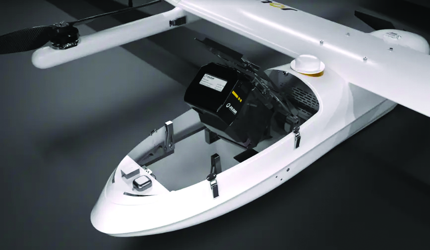
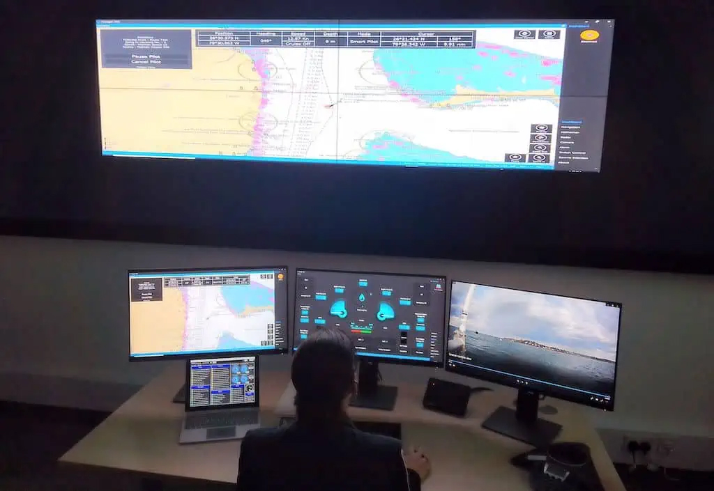
The Voyager AI Autopilot converts newly built or retrofitted unmanned surface vessels (USVs) into fully autonomous craft.
The Robosys Autopilot module seamlessly integrates with Robosys’ Voyager AI Survey as part of the Voyager AI software suite. It enables remote and autonomous heading and speed control as well as various other mission modes for navigation and vessel control, specifically for hydrographic and oceanic surveying operations.
The marine autopilot is designed to meet the demands of 3 m to 12 m electric drive surveys. It is easily scalable to full advanced autonomous navigation, which seamlessly integrates with third-party steering, drive and motor control systems to provide optimal vessel functionality for USVs and other craft.
Robosys Automation, robosysautomation.com
OEM

Satellite Positioning Chips
With AEC-Q100 Grade 2 reliability qualification
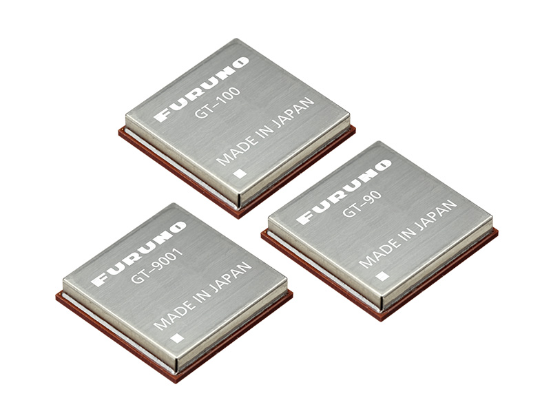
Designed for automotive applications, the AG3335MA satellite positioning chip series has earned AEC-Q100 Grade 2 reliability qualification. The AEC-Q100 is designed to ensure reliability and safety beyond the requirements for consumer electronics.
The AG3335MA series chips have been certified by a third-party quality management system equipped with an automotive specification laboratory. Achieving Grade 2 certification, these chips are tested for operation in extreme temperatures ranging from -40°C to 105°C, which caters to the demanding environments of automotive applications.
The AG3335MA features ultra-low power consumption, high endurance and dual-frequency capability. It supports the five major global satellite systems and NavIC to ensure reliable operation in a broad temperature range and challenging weather conditions. Its GNSS receiver measurement engine has a satellite tracking sensitivity of -167 dBm and a cold boot positioning time of 25 seconds. This allows it to receive and process signals from all visible satellites simultaneously, offering increased accuracy in positioning.
Airoha Technology, airoha.com
SOM-SMARC Modules
Powered by Qualcomm
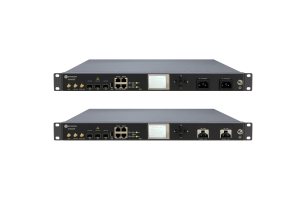
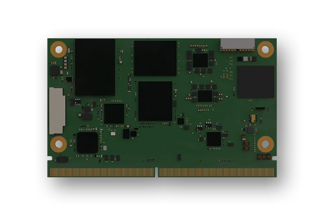
The Smart Mobility Architecture (SMARC) System on Modules (SoMs) are based on Qualcomm QCS6490 and Qualcomm QCS5430 application processors. These new SMARC modules are the first results of SECO’s strategic collaboration with Qualcomm Technologies, announced in September 2023.
The SOM-SMARC-QCS6490 is designed to simplify the use of the Qualcomm QCS6490 processor. The chipset offers support for artificial intelligence (AI) and computing, robust performance at low power and expanded interfaces and peripherals catering to diverse industrial use cases.
The Qualcomm Adreno 643 GPU offers enhanced graphics performance and energy efficiency. It supports FHD+ at 120 fps resolution on primary and secondary displays up to 4k Ultra HD at 60 Hz. The SOM-SMARC-QCS6490 supports Microsoft Windows 11 IoT Enterprise, Yocto Linux and Android, with both commercial (0°C to +60°C) and industrial (-30°C to +85°C) temperature variants available.
The SOM-SMARC-QCS5430, powered by the Qualcomm QCS5430, is a mid-tier solution that slightly moderates CPU and GPU performance. This system-on-chip (SoC) combines enhanced connectivity, performance and edge AI-powered camera capabilities. It also provides scope for field software-based upgrades of the CPU and GPU by using the processor’s capabilities.
SECO, seco.com
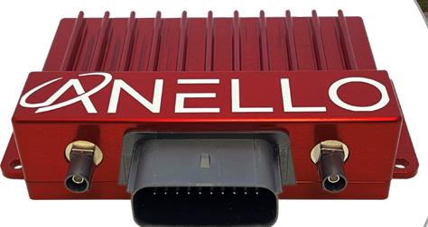
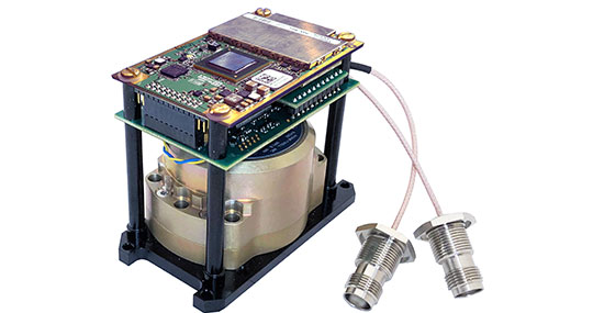
INS
Featuring FOG-based IMU
The Phins 9 Compact is a high-performance inertial navigation system (INS) designed for all unmanned underwater vehicles. It offers a blend of navigation performance, reliability and size, weight and power (SWAP) efficiency.
The Phins 9 Compact is built around a high-performance fiber-optic gyroscope (FOG)-based IMU with advanced accelerometers. With compact dimensions, a DVL-aided position accuracy of 0.1% TD, and a power consumption of less than 7 W, it is ideal for compact subsea vehicles in demanding applications with low power requirements.
The INS aims to redefine the standards of subsea navigation in a wide range of applications, including survey-grade coastal and offshore seabed mapping, inspection repair and maintenance (IRM), defense and more.
Exail, exail.com
MOBILE

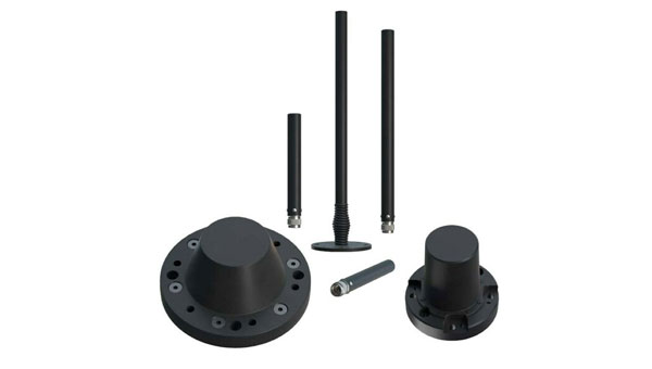
GNSS FR Antennas
Supports a full spectrum of bands
This series of GNSS RF antennas is designed to elevate location-based services with enhanced accuracy and precision. This new lineup aims to outperform conventional GPS technologies by offering faster signal acquisition, improved tracking capabilities and reduced power consumption.
The antennas support a full spectrum of bands, including L1, L2, L5, and L-band data correction services. It can be used in a variety of sectors, such as agriculture, surveying, the Internet of Things (IoT), mapping, defense and aviation.
The technology is designed to meet the rigorous demands for precise location data across various applications. These antennas offer multi-band and multi-constellation support to ensure broad compatibility. With centimeter-level accuracy, these antennas are crucial for aerospace, defense, asset tracking, geolocation, precision agriculture and industrial IoT.
Abracon, abracon.com
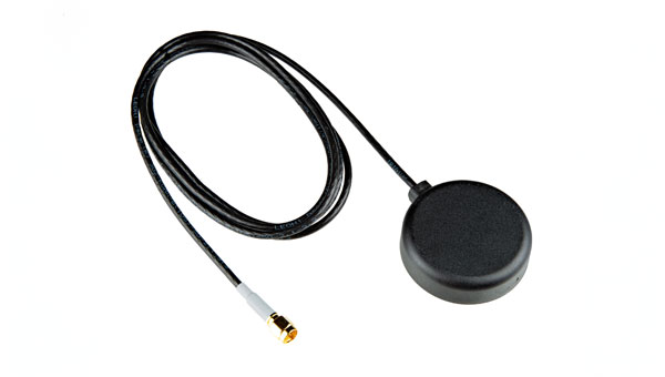
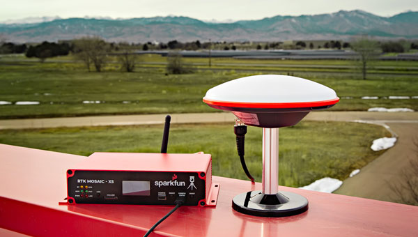
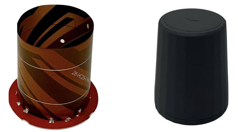
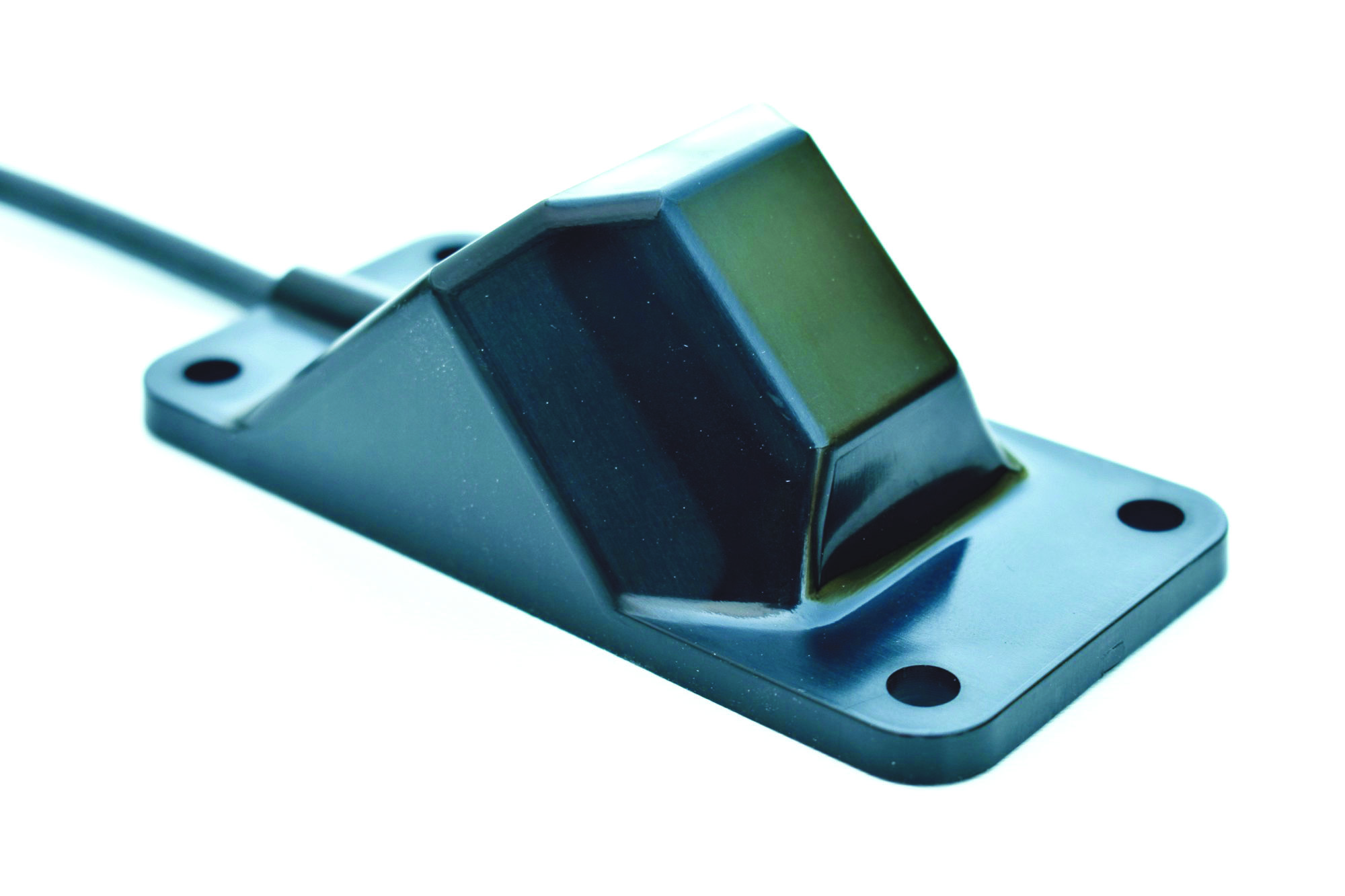
Iridium on the Go
Magnetic mount antenna
The 2J7426MPz by 2J antenna is a high-performance magnetic mount antenna that is designed specifically to communicate efficiently with the Iridium satellite communication system. It is manufactured with high-quality polycarbonate (PC) and acrylic-styrene-acrylate terpolymer (ASA), a thermoplastic combination that offers strong resistance to UV, moisture, and heat and enhances mechanical properties.
The antenna housing is waterproof to IP69 standards and designed to operate in extremely harsh environments, including those with frequent exposure to water, dust and debris. It has a recommended operational and storage temperature of -40°C to +85°C. The magnetic mount allows for easy installation and removal between vehicles or assets, and it is easily converted to an adhesive type for greater flexibility.
It is delivered with a standard SMA-male connector and a standard 300 cm long coaxial LL100 cable. Iridium has certified the 2J7426MPz antenna for commercial use in connection with the Iridium communications system.
SparkFun Electronics, sparkfun.com