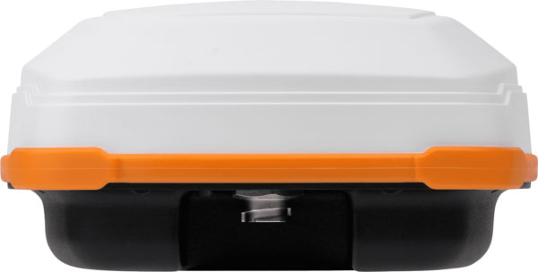
Leica Geosystems, part of Hexagon, has added new capabilities to the Leica BLK2FLY. It now has the ability to scan indoors, providing expanded coverage for complex scanning projects, and the ability to create digital twins for entire structures, both indoors and outdoors.
Hexagon upgraded the autonomous UAV scanning system to allow for safe, effective indoor navigation and capturing. This capability also expands the BLK2FLY’s ability to capture various environments outdoors.
The UAV can scan in areas without GNSS availability, opening reality capture opportunities in new settings, including hazardous indoor areas such as nuclear power plants. Increased performance of the autonomous navigation system heightens the sensor’s spatial awareness, allowing for obstacle avoidance in more confined spaces. This new capability relies upon advancements to Hexagon’s visual SLAM system, providing real-time spherical imaging that improves the BLK2FLY’s operating range to a radius of 1.5 meters.
The BLK2FLY complements Hexagon’s terrestrial and autonomous sensor. Users can also use Reality Cloud Studio, powered by HxDR, Hexagon’s cloud application that enables uploading of data to the cloud from the field using a tablet or smartphone to register, mesh and create 3D models of their data from the field automatically.
The technology’s new indoor scanning capabilities are available at no extra cost via firmware update to all current and future BLK2FLY users.
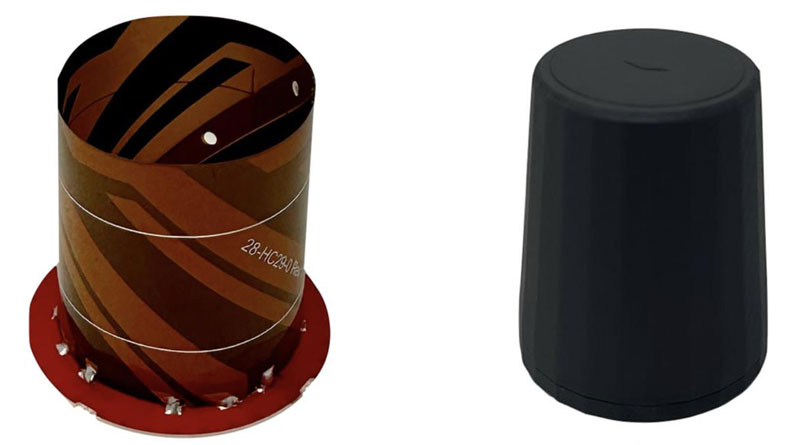
Tallysman Wireless has added the HCS885XF/HCS885EXF embedded smart helical GNSS antenna to its line of Smart GNSS Antennas. This antenna is suitable for UAV, land survey devices, automotive positioning, and other precise positioning/heading applications.
The HCS885XF/HCS885EXF combines the performance and light weight of the Tallysman dual-band (GPS/QZSS L1/L5, GLONASS G1/G3, Galileo E1/E5a/b, BeiDou B1/B2/B2a) HC885SXF antenna with the low power consumption and GNSS augmentation capabilities of the u-blox NEO-F9P GNSS receiver.
Instead of using L2 signals, HCS885XF/HCS885EXF employs L5 signals (1160-1217 MHz), which transmits stronger signal power and a higher bandwidth chipping rate to offer high performance when challenged with strong multipath signals. It also employs Tallysman’s eXtended Filtering system, which mitigates near-band and out-of-band interference, such as LTE signals and their harmonics, and the planned Ligado service in North America, enabling operation in the most challenging deployments.
The HCS885XF/HCS885EXF integrated receiver can monitor four constellations simultaneously, provides support for base/rover RTK configurations (<1 cm), and makes use of u-blox PointPerfect PPP-RTK augmented services over a terrestrial control network (3-6 cm). A moving-base precise heading configuration is available with base/rover antenna pairs.
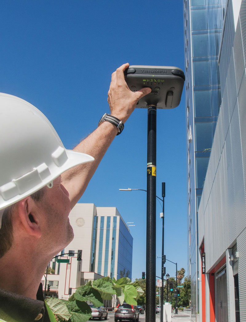
JAVAD GNSS’ Triump-1M Plus receiver has 874 channels for acquiring all available GNSS satellites and patented mobile antenna technology for robust UHF and cellular communications. (Image: JAVAD)
As most readers of this magazine know, GPS, like the other three GNSS, consists of three segments: the space segment — i.e., the satellites; the control segment — i.e., the monitoring and control stations on the ground around the world; and the user segment — i.e., the receivers. The first two are developed, operated and maintained by the U.S. Space Force, while the third one, for civilians, is totally in the hands of the private sector.
Most of the progress in receivers is evolutionary, with rare dramatic changes. To provide a snapshot of the current state of GNSS receivers, I asked several manufacturers three questions. What follows are short, etre dited excerpts of their answers that showcase the applications of GNSS receivers in a wide range of industries.
What is one of the most recent end-user applications for your receivers? What challenges does it pose and how do your receivers address them?
Sarah Alban (SA): Eos Positioning Systems is lucky to have innovative customers who span a variety of industries. In just these past few weeks, we’ve connected to customers who are using Arrow Series GNSS receivers to meet myriad business needs. Here are just a few examples: On the Caribbean island of Martinique, Odyssi uses an Arrow 100+ with RTK to get accurate water utility locations in a challenging environment. In Texas, midstream pipeline operator Kinetik and its GIS Manager Papillon Romero equip their field workers with an Arrow Gold to update the locations of previously unreliable legacy as-builts. In the Galápagos Islands, a researcher has been using the Arrow Gold+ and Galileo High Accuracy Service (HAS) to georeference drone imagery. In Colorado, GIS specialist Jim Casey uses an Arrow Gold to bring to life a Japanese internment camp in augmented reality.
Simon Baksh (SB): One of our customers is a leading construction contractor who uses our DELTA GNSS receiver for monitoring during deep crack grouting deformation to ensure that the natural state of the ground remains undisturbed during remedial work.
Stephen Ching (SC): One of the most exciting projects happening within Hexagon’s Autonomy & Positioning division is the automated road train platooning application within the mining industry. Transporting raw materials, iron ore in this case, has posed a huge challenge in terms of drivers’ safety, labor shortages and rising fuel costs. Our division is currently developing an autonomous hauling system that solves this challenge by integrating drive-by-wire, perception, positioning and path planning technologies. Our positioning system utilizes a PwrPak7D-E2 plus TerraStar-C PRO solution from Hexagon | NovAtel, which incorporates GNSS+INS technology and real-time kinematic (RTK) From the Sky technology.
Mobile mapping systems such as the Trimble MX50 allow survey companies to safely and accurately gather point cloud and immersive imagery of roads without the need to put a surveyor in the field. (Image: Trimble)
Karl Bradshaw (KB): Traditional survey methods or tripod-based scanning on highways can be time-consuming and dangerous. Survey companies do not want to put surveyors in danger of traffic while traversing along a road. Mobile mapping allows them to safely, accurately and productively gather detailed point cloud and immersive imagery of highways without needing to put a surveyor in the field.
Oreste Concepito (OC): At u-blox, we have seen an increasing demand for GNSS receivers to be used for advanced driver-assistance systems (ADAS) applications and for mobile robotics (such as robotic lawnmowers). GNSS technology is adopted when an accurate, trustworthy position with high availability is required. In the autonomous operations domain, customers are constantly pushing u-blox to improve dependability while maintaining or ideally improving position accuracy, even in challenging environments.
François Freulon (FF): One of our most recent end-user applications is related to resilient timing for mission-critical infrastructure, including finance, data centers, energy and telecommunications. The relevant Septentrio product is the mosaic-T. The recent addition of the AtomiChron timing service further enhances its timing precision, GNSS resilience and anti-spoofing by offering navigation message authentication (NMA) on all for GNSS constellations. The first customer integrating this technology is Meinberg.
Miles Ware (MW): The Galileo High Accuracy Service (HAS) has created new interest in a traditional GNSS market, GIS and mapping, in which the availability of global 20 cm accuracy is turning many heads. While there are many technologies to improve accuracy for this market, few are appropriate. Often the work takes place in remote areas where cellular connectivity is not available for delivering corrections. They may also be in regions of the world where satellite-based augmentation systems (SBAS) are not available or able to meet performance expectations. Galileo HAS resolves both of these concerns. We now support it in our Phantom and Vega receivers.
In the past few years, we have seen the completion of two new GNSS constellations and a large increase in the options for corrections services. How has this impacted the design and/or features of your receivers?
SB: Our 874 channel TRIUMPH ASIC design has capacity for all constellations and signals to utilize current and future GNSS technologies. Additionally, our J-Star PPP Service using geostationary satellite broadcast for global delivery and cm level positioning extends operations to remote areas where networks are absent or where a base station setup and operation is not feasible.
SC: With BeiDou and Galileo in addition to GPS and GLONASS, there can be upward of 40 satellites in view — compared to 20 years ago when having 10 or 12 satellites in view was considered good availability. This gives much more choice as to which measurements contribute to a position solution, provided that the receiver can make measurements to all the satellites in view. Hexagon | NovAtel’s OEM7 was designed to support all GNSS constellations and frequencies, which required supporting many channels as well. The benefits of more satellites in the sky come under challenging conditions with many obstructions and strengthened positioning geometry in unobstructed conditions. In addition to more satellites, BeiDou and Galileo also introduced a new frequency at E6/B3, in addition to L1/L2/L5, which is particularly useful in global PPP solutions, such as RTK From the Sky and TerraStar C-PRO Correction Services.
KB: We have onboarded these constellations into our mobile mapping portfolio in the same way as all other Trimble GNSS portfolios, through rigorous, tried and tested methodologies.
FF: Septentrio receivers already support all GNSS constellations for high precision and resilient positioning. We have added Galileo E6 support and OSNMA, BeiDou phase III satellites (PRN>37) and other new signals (B3I, B2b) to our products through our latest firmware releases. We are also contributing to the large increase of corrections services by providing the backend core technology through our base station receivers or reference receivers. For example, the PolaRx5 reference receivers are used worldwide in many correction network infrastructures. With the support of all in view constellations and signals, Septentrio products are becoming part of critical infrastructure. Therefore, it is essential they have reliable continuous operation as well as security to protect them from potential jamming or spoofing attacks. Additionally, Septentrio has recently launched the Agnostic Corrections Partner Program to help customers find their way in the growing maze of correction offerings and to facilitate the integration of the right service into their system.
Geneq Inc. employee Alex Arsenault operating an SXblue Platinum receiver in Anjou, Montreal. (Image: Nikita Sapeguine / Geneq)
OC: Our customers are increasingly operating in a global market. To respond to that need, u-blox receivers support both the global and the regional constellations, such as Japan’s Quasi-Zenith Satellite System (QZSS) and India’s Indian Regional Navigation Satellite System (IRNSS, aka NavIC). The offer for correction services has also evolved to be able to serve the global market, moving toward uni-directional streams, possibly distributed via L-band. We support a complete portfolio of correction services, responding to all commercial and performance requirements, from the soon available, free-of-charge, lower accuracy correction services, up to the dm-level functional safety-certified correction services for autonomous driving.
MW: Since 2019, our core receiver technology has been intrinsically both multi-GNSS and multi-frequency by design. This allows our engineering team members to rapidly adapt to new and emerging solutions, and for Hemisphere to meet user and market demands. Hemisphere has also worked with our integrators to recognize the need to simplify the decision process around selecting receivers. While it is possible to configure our receivers to track specific constellations only, Phantom and Vega are being offered with multi-GNSS as standard. Similarly, clients can choose L1-only, or all-frequencies. This is why many integrators will quickly be able to take advantage of Galileo HAS.
RP: We have upgraded our SXblueGPS receivers with new GPS chips and with firmware updates to keep up with the new constellations available. Regarding the new correction services, the SXblueGPS have used and use by default the SBAS correction service and its associated networks throughout the planet to improve their precision. Where correction services via internet or SBAS do not exist, they use L-band correction services to have global coverage. In some cases, for topography base and mobile solutions, UHF links provide a customized correction service.
Are jamming and spoofing significant challenges in your key markets? If so, how do you address them?
SB: Yes, and AJ/AS expands on existing RAIM for assured position quality. Patented anti-jamming and anti-spoofing techniques identify and suppress GNSS interference, while maintaining navigation from good signals. Updated firmware for Navigation Message Authentication extends AJ/AS protection further.
SC: GNSS interference such as jamming and spoofing do present significant positioning challenges in many of our markets, especially defense, marine and autonomy applications in which safety and 24-7 operation are paramount. How often GNSS interference happens (and is detected) and how seriously it affects the application depends on the market. It is a threat that can be mitigated by well-designed user equipment. Hexagon | NovAtel has developed a comprehensive GNSS resiliency portfolio to assure that our users’ position is protected with our interference mitigation technology, starting from the GAJT antennas all the way down to the receiver level. NovAtel’s OEM7 receivers include our GNSS Resilience and Integrity Technology (GRIT) firmware options, which provides spoofing detection, interference detection, and mitigation with digital filters, as well as time-tagged digitized samples for advanced situational awareness.
KB: As it applies to mobile mapping with the Trimble MX50, jamming and spoofing are not significant challenges.
OC: A team of engineers is constantly improving our anti-jamming and anti-spoofing technology. U-blox customers are today more mindful of the risks associated with GNSS interference, both intentional and unintentional. GNSS is adopted in critical infrastructures and autonomous vehicles, where jamming and spoofing could lead to severe consequences. While no system can be safe in absolute terms, increasing the sources of information can greatly improve the resilience against jamming and spoofing attacks. Multi-constellation GNSS receivers, multi-band constellations, inertial sensors and accelerometers, can all be individually used as additional safety layers contributing to a more robust solution. Additional measurements are implemented at the positioning engine level, as part of our functional safety program. The availability of authenticated signals, being introduced by Galileo’s Open Service – Navigation Message Authentication (OS-NMA), will also contribute to increasing the GNSS robustness against interference.
Hemisphere GNSS’ GradeMetrix is a machine guidance solution for GNSS-based machine control and guidance applications. (Image: Hemisphere)
FF: Definitely, and we are seeing a large increase in demand for resilience in many applications and for assured positioning, navigation and timing (PNT). Providing trustworthy information is critical now for many markets, such as machine control, robotics, timing, infrastructure and assured PNT. Our multi-frequency multi-constellation GNSS technology not only maximizes accuracy and availability in areas where the sky is partially obstructed, but also provides extra resilience against jamming and spoofing. All our GNSS receivers are resilient to jamming and spoofing thanks to the built-in Advanced Interference Mitigation (AIM+) technology, which suppresses the widest variety of interferers, from simple continuous narrow-band signals to the most complex wideband and pulsed transmissions.
MW: Fortunately, jamming and spoofing are not common occurrences in most of our markets. However, their nature is such that they can appear at any time, in any place, without warning. This can cause otherwise routine plans for users to suddenly grind to a halt. Hemisphere’s Cygnus interference solution provides protection against up to 60 dB of jamming and is built into our current generation products by default. Having Cygnus available can make the difference between working normally and searching for alternate solutions. A welcome tool offered through Galileo satellites is OS-NMA signal verification, which provides excellent protection against spoofing attacks. Firmware updates provide our current product platforms access to OS-NMA spoofing protection. As our standard products are already activated for multi-constellation operation, it simplifies integration for our users.
RP: Interference is inevitable given the enormous number of signals from telephone and electrical networks, among others, as well as buildings, trees and, of course, the weather. To mitigate this, we use multi-frequency and multi-GNSS antennas that allow us to obtain the best reception in areas of interference. Additionally, we have state-of-the-art GPS chips that block and purify signals that generate distortion. On the other hand, there is interference by intentional GNSS falsifications or by radio amateurs who transmit radio signals for drones and other devices that cause GPS signal loss, which are mitigated by the latest technology algorithms of our SXblueGPS.
The Mobile World Conference (MWC) returns to the Las Vegas Convention Center on September 26 to 28, 2023.
The event will feature exhibition from major U.S. operators, including AT&T business, T-Mobile business, and Verizon business as well as new sessions dedicated to sports and entertainment, software developers and the GSMA’s SEC CON event.
MWC, in partnership with the Cellular Telephone Industries Association (CTIA), invites industry leaders and attendees to connect and discuss topics such as the industry’s transition to a circular economy, the future role of artificial intelligence (AI) in society, and what comes after 5G.
To reflect the United States’ position as a global technology hub and a market at the forefront of 5G innovation, the event is centered around four key themes:
5G Acceleration, as adoption explodes to become the most common mobile technology in North America by 2025.
Age of AI, as the world awakes to the opportunities and challenges of generative AI.
Digital Everything, as the expansion of digital technologies is felt across every industry, from sports and entertainment to manufacturing, financial services and smart mobility.
Enterprise Mobility, as the revolutionary phase of 5G in enterprise is well underway.
The event will feature a variety of keynote speakers, including Amanda Toman, the director for the Public Wireless Supply Chain Innovation Fund at the National Telecommunications and Information Administration (NTIA) within the U.S. Department of Commerce.
For the first time, the GSMA will bring its SEC CON event to MWC Las Vegas on day two, welcoming leading security experts to explore the importance of keeping telecoms infrastructure secure in times of conflict.
A full directory and registration can be found on the MWC Las Vegas website.
Google has released three Google Maps application programming interfaces (APIs) for developers to map solar potential, air quality and pollen levels. The three APIs apply artificial intelligence (AI) and machine learning, along with aerial imagery and environmental data, to provide up-to-date information about these three variables, enabling developers, businesses, and organizations to build tools that map and mitigate environmental impact.
The Solar API utilizes mapping and computing resources to design detailed rooftop solar potential data available for more than 320 million buildings across 40 countries including the United States, France and Japan. To obtain this data, the AI model extracts 3D information about roof geometry from aerial imagery, while considering past weather patterns and energy costs, enabling quicker installation of solar panels.
The Air Quality API shows air quality data, pollution heatmaps, and pollutant details for more than 100 countries around the world. The API validates and organizes several terabytes of data an hour from multiple data sources — including government monitoring stations, meteorological data, sensors and satellites — to provide a local and universal index.
Google Maps uses machine learning and live traffic information to predict different pollutants in an area at a given time. The Air Quality API offers companies in healthcare, the automotive market and other forms of transportation the ability to provide accurate and timely air quality information to their users.
The Pollen API shows current pollen information for common allergens in more than 65 countries. The API provides localized pollen count data, heatmap visualizations, detailed plant allergen information, and actionable tips for allergy-sufferers to limit exposure. To obtain this information, Google Maps uses machine learning to determine where specific pollen-producing plants are located.
Hemisphere GNSS has released the A631 GNSS smart antenna for agricultural, marine, GIS, mapping and other applications.
The A631 combines Hemisphere’s Athena GNSS engine and Atlas L-band correction technologies with a new web user interface (WebUI). Optional features include 16 GB of internal storage, Bluetooth and Wi-Fi. The compact antenna is designed for rugged environments and meets IP67 requirements.
With multiple operating modes, A631 can be used as an RTK base station or rover. The device is supported by Hemisphere’s Atlas Portal, which empowers users to update firmware and enable functionality, including Atlas subscriptions for accuracies from meter to sub-decimeter levels.
A631 also supports BaseLink and SmartLink modes. SmartLink allows users to directly connect AtlasLink as an extension to any existing system that has industry-standard connectivity options. BaseLink automatically sets up AtlasLink as a permanent reference station, delivering corrections to any other GNSS receiver being used for positioning.
u-blox has partnered with ORBCOMM, a pioneer in Internet of Things (IoT) technology, to develop solutions for the convergence of terrestrial and satellite IoT communications markets.
According to the Ericsson Mobility Report, the number of cellular IoT connections is projected to reach around 5.5 billion by 2028. The satellite IoT communications market is also expected to triple by 2025. Combining these two technologies will provide gap-free global connectivity for IoT communications, even in previously uncovered areas, making it more accessible for IoT deployers.
With this partnership, u-blox will integrate ORBCOMM’s satellite communication protocols into its UBX-R52/S52 LPWA (low-power wide-area) modem SoC (system-on-a-chip) resulting in a smaller, less complex chipset that offers dual connectivity. This chipset will be used in future u-blox module products, enabling connected solutions across the globe.
The collaboration between ORBCOMM and u-blox will meet the increasing demand for IoT solutions capable of connecting devices in remote locations, areas with poor cellular coverage and isolated environments. Various industrial IoT applications can benefit from these solutions, such as asset tracking, equipment tracking in agriculture and construction industries, and industrial sensors.
“Pairing ORBCOMM’s satellite technology with u-blox’s innovative UBX-R52/S52 chipset will allow customers deploying IoT solutions in the supply chain, heavy equipment, and agriculture industries to benefit from ubiquitous coverage, device simplicity, along with optimal reliability and longevity,” said David Roscoe, ORBCOMM’s executive vice president of satellite communications and products.
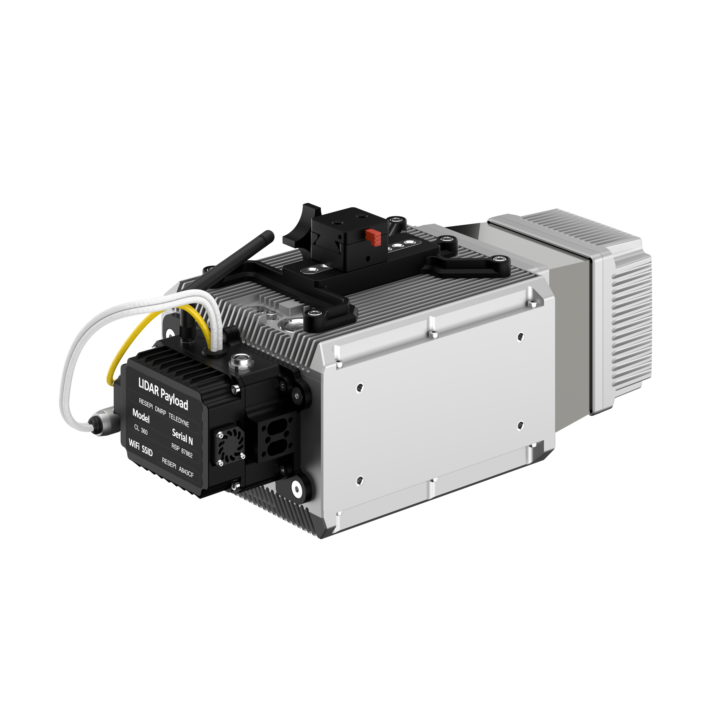
Inertial Labs has added a new scanning and mapping solution to its Resepi line, the Resepi Teledyne Optech CL-360-HD. The device has a powerful four-return laser and increased range of up to 750 m, making it ideal for mobile mapping, forestry and crack detection in critical infrastructure areas such as airport runways.
Resepi is a sensor-fusion platform designed for accuracy-focused remote sensing applications. Resepi utilizes a high-performance Inertial Labs INS and a high-accuracy dual antenna GNSS receiver, integrated with a Linux-based processing core and data-logging software. The platform also provides a WiFi interface, optional imaging module, and external cellular modem for RTCM corrections. Resepi can be operated by a single hardware button or from a wirelessly connected device via a simple web interface.
Resepi, equipped with Teledyne‘s CL-360HD lidar, offers various laser scan speeds and frequencies, allowing users to tweak the settings to match their individual needs.
ProStar Holdings Inc., a precision mapping company, has announced a technology integration with Leica Geosystems, part of Hexagon. The integration combines ProStar’s utility mapping software, PointMan, and Leica Geosystems’ precision GPS/GNSS receivers for GIS asset data collection.
The integration provides a precise and comprehensive data collection solution to capture, record and display the precise location of critical underground infrastructure across the globe using Leica Geosystems receivers.
“It only makes good business sense to work with other software providers and create mutually beneficial business relationships throughout the geospatial industry,” said Jason Hooten, GIS sales and support manager, Leica Geosystems.
Through the technology integration, PointMan now supports Leica Geosystems receivers for mobile devices running the Google Android operating system and Apple iOS, including the popular Zeno FLX100 plus GNSS receiver.
“The relationship adds significant value to our distribution network as Leica is recognized as a global leader in providing utility data collection solutions and precision GNSS receivers,” said Page Tucker, CEO of ProStar.
ProStar’s PointMan is natively cloud and mobile, offered as a Software as a Solution (SaaS). ProStar’s solutions are being adopted by some of the largest entities in North America, including Fortune 500 construction firms, the largest subsurface utilities engineering (SUE) firms, and government agencies.
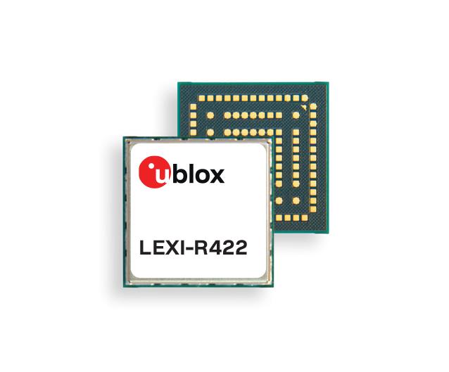
u-blox has released the LEXI-R4, a module customized for size-constrained application requirements. The device is suitable for small asset trackers, such as pet and personal trackers, micro-mobility devices, and luggage tags.
Image: u-blox
The LEXI-R4 module supports all LTE-M and NB-internet of things (IoT) bands, with an RF output power of 23 dBm. It is natively designed to support GNSS AT commands, and its dedicated port enables easy integration with any u-blox M10-based GNSS module, such as the MIA-M10.
Additionally, the module can connect to additional positioning services, such as AssistNow and CellLocate.
The compact size of the module, measuring 16 mm x 16 mm, results from a 40% footprint reduction in dimensions compared to the previous u-blox SARA-R4. Due to its small size, remaining space could host larger antennas, which can improve RF performance, or accommodate larger-size batteries.
Another feature of the LEXI-R4 is its 2G fallback capability. Whenever LTE-M/NB-IoT coverage conditions are not optimal, it continues to function by falling back onto a 2G network. The company said this feature could be helpful in countries where LTE-M/NB-IoT networks have yet to be fully deployed.
NextNav has successfully tested its positioning and timing solution that combines the company’s assured position, navigation and timing (PNT) TerraPoiNT system with existing LTE and 5G network signals. The test, which took place in San Jose, California, demonstrated how TerraPoiNT signals can be integrated with existing cellular signals to deliver accurate 3D positioning and timing information that is not reliant on GPS and GNSS signals.
Using dedicated terrestrial transmitters and LTE/5G signals, NextNav’s system delivers accurate and reliable 3D positioning and timing information and can augment or complement GPS in places where GPS signals may not be available. Integrating TerraPoiNT with LTE and 5G signals provides a rapid and cost-effective approach to scaling resilient PNT solutions in GPS-denied environments.
“Whether its utilities, banks, data centers, transportation, or emergency services, critical infrastructure today is reliant on GPS for position, navigation and timing services, making it highly vulnerable to GPS as a single point of failure” said Ganesh Pattabiraman, co-founder and CEO of NextNav. “With this integration, we have demonstrated a highly scalable and lower cost alternative — a 3D PNT solution which overcomes the vulnerabilities of GPS with a complementary ground-based resilient PNT layer that extends PNT capabilities in urban and indoor environments.”
Borderless Capital has invested in the Global Earth Observation Decentralized Network (GEODNET) Foundation via its EdgeFi Fund, the first web3 investment fund focused on decentralized physical infrastructure networks. The investment will be utilized to strengthen GEODNET’s mission with emphasis on growing reliable global coverage and a mobile operating-system software development kit.
The GEODNET Foundation manages the open network protocol and promotes service usage within the traditional GNSS and IoT industry.
With more than 3,000 reference stations online in every major continent, the real-time GEODNET network is the largest decentralized geospatial reference network. The GEODNET location service offers reliable centimeter-accurate location for applications such as UAVs, robotic vehicles, augmented reality, and IoT/mobile devices.
GEODNET station data is actively utilized by companies such as Hemisphere GNSS, Quectel Wireless Solutions and Rock Robotic. GEODNET stations owners set up a satellite mining station and are rewarded with the project’s native polygon token, GEOD.