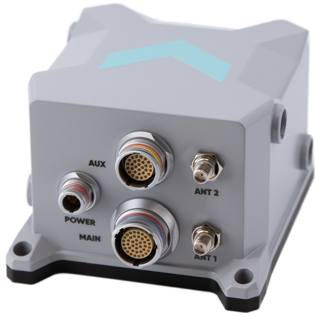
Exail has launched the Atlans 3, its new Inertial Navigation System (INS) dedicated to land and air mobile mapping applications. The technology was unveiled at INTERGEO 2023.
The Atlans 3 is an all-in-one positioning and orientation system integrating unique micro-electro-mechanical systems. Fiber optic gyroscope (MEMS-FOG) hybrid technology and a dual-antenna RTK GNSS receiver are housed within one compact device.
The INS offers North-keeping capability at FOG-level performance across a variety of land and air mobile mapping applications. It delivers real-time heading, even in GNSS-challenging environments such as urban canyons, mountainous terrain, or forested areas. The lightweight INS is designed to meet the requirements of high-performance lidars mounted on vehicles where space and weight constraints are critical.
The Atlans 3 is designed to be quick and simple to install on all platforms. It offers efficient “set-and-forget” operations for a wide range of land and air applications including road and rail asset inventory, pavement condition survey, vehicle automation, HD mapping, ground-truth, airborne surveys and precision pointing.
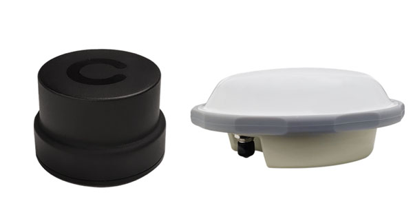
Harxon has launched its new survey GNSS antenna, HX-CSX600A, and helix antenna, HX-CUX615A, designed for high-accuracy positioning applications across the geospatial industry. These two antennas are set to debut at INTERGEO 2023.
Survey GNSS antenna HX-CSX600A
HX-CSX600A boasts a pre-filtered Low Noise Amplifier (LNA) offering exceptional out-of-band rejection, ensuring strong anti-interference performance even in challenging environments. It is designed for high-precision GNSS applications, including agricultural vehicles, small robots and surveying.
The new antenna offers reliable and consistent satellite signal tracking across a wide range of frequency bands, including GPS, GLONASS, Galileo, BeiDou, QZSS, IRNSS, SBAS, as well as L-Band correction services. With advanced multipoint feeding technology, HX-CSX600A maintains a stable phase center variation.
Built with an IP67-rated compact and ruggedized housing, this antenna is designed to withstand dust, rain, sunlight, shock and vibration. Its standard TNC-K connector and pole mount aims to simplify the integration process.
Helix antenna HX-CUX615A
HX-CUX615A is the housed version of Harxon’s HX-CUX012A, designed for UAVs. Its low profile design and simple integration process makes this antenna ideal for various UAV applications such as aerial photography, remote sensing, infrastructure inspection, traffic control and public security.
Equipped with a pre-filtered LNA, HX-CUX615A offers out-of-band interference rejection to mitigate unwanted electromagnetic interference and provide reliable GNSS signals for seamless integration into positioning solutions.
This light-weight antenna also adopts patented D-QHA (Dual-Quadrifilar Helix Antenna) technology, ensuring stable wide-angle circular polarization (WACP) performance. This results in low-elevation satellite tracking, while maintaining high gain and reliable signal tracking – even in challenging environments.
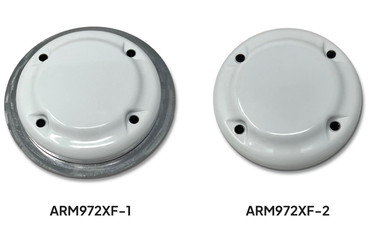
Tallysman Wireless has released the ARM972XF triple-band plus L-Band GNSS antenna.
The ARM972XF uses Tallysman’s accutenna technology providing GPS/QZSS L1/L2/L5, GLONASS-G1/G2/G3, Galileo E1/E5a/E5b, and BeiDou B1/B2a/B2b + L-Band coverage. The technology is designed for precision triple-frequency positioning where light weight and a low profile are required.
Tallysman’s ARM972XF is a small and lightweight housed triple-band precision mini ARINC GNSS antenna. It has an average phase center variation of less than 10 mm for all frequencies and overall azimuths and elevation angles. Additionally, both models are available with components qualified for low Earth orbit (LEO).
Housed in a weatherproof (IP67) enclosure, the ARM972XF is available in four versions. Model ARM972XF-1 (ARM972XF-1-S for LEO space-qualified components) has an integrated 100 mm ground plane, while model ARM972XF-2 (ARM972XF-2-S for LEO space-qualified components) is 83 mm in diameter.
The antenna also includes Tallysman’s eXtended filtering (XF) technology, designed to mitigate GNSS interference.
Hexagon’s Autonomy & Positioning division and Munhwa Broadcasting Corporation (MBC) have partnered to bring precise positioning to South Korea through the TerraStar-X Enterprise Correction Service. The hardware-agnostic correction service provides instant convergence and lane-level accuracy in automotive, mobile and autonomous applications.
As a leader in real-time kinematic (RTK) positioning across South Korea, MBC’s atmospheric data enhances the redundancy of Hexagon’s fast converging and reliable precise point positioning (PPP) network across the country. Through this collaboration, the TerraStar-X Enterprise service is now supported in testbeds across South Korea, China, Japan, Europe, and North America to accelerate development for advanced driver assistance systems, safety-critical applications, micromobility, industrial and smartphone applications.
“With TerraStar-X Enterprise Correction Services now available across autonomous and consumer market applications, developers can design once and then deploy that design at scale worldwide,” said Paul Verlaine Gakne, positioning services product manager at Hexagon’s Autonomy & Positioning division. “TerraStar-X Enterprise is designed to be as flexible as possible for large-scale testing and deployment.”
The phrase “positioning, navigation, and timing” (PNT) — widely used in our industry, including on this magazine’s cover — encapsulates a wide range of applications for global navigation satellite systems (GNSS) and for other technologies that provide some or all the same services. Subsumed under “positioning” is one of the most widespread uses of GNSS, which is data collection to make maps, enable geographic information systems (GIS), and populate the databases that power the many location-based services (LBS) applications on smartphones.
Increasingly, GNSS positioning is also integrated with systems for indoor positioning to enable seamless tracking of people, equipment and products, and with a variety of sensors to monitor their status and environmental conditions.
GNSS positioning and mapping will benefit from the advent of G5 cellular networks, which will vastly increase download speeds, decrease latencies and expand connectivity. While it will transform every industry, 5G’s impact will be especially felt in urban settings and pave the way for tomorrow’s smart cities.
In this month’s cover story, we focus on these aspects of GNSS by presenting three brief case studies:
Golf course irrigation planning and construction, using Trimble Catalyst.
Land surveys to update China’s national GIS, using a CHC Navigation LT700 receiver.
Safety with industrial automation
Industrial automation is an extremely wide area,” said Ludger Boeggering, u-blox senior principal segment manager, EMEA Energy & Automation. “It includes process and production automation, where it is used to automate the production environment. In more remote conditions, where it is less time-critical, it is used to understand what happens in the automation environment. Lastly, it is used to remotely supervise and monitor what is happening in such an environment.”
Nowadays, businesses want to monitor their production environment “all the way down to the production of a single device,” Boeggering said. “That’s the area in which we operate.”
One application of industrial automation on which u-blox is increasingly focusing is the safe, connected worker, which can refer to someone inside a building on a factory floor or someone outside, such as on a construction site. Another one is mobile robotics and collaborative robotics.
“Our customers are in all segments and verticals — including electronics, machine manufacturing, oil and gas, transportation, chemical, food, water, paper and energy,” Boeggering said. “It’s really a broad spectrum of industrial companies that are using these tools and products. We are focused on the leading customers in that area and are working with well-known players in the market.”
5G is an umbrella for different flavors of the technology that includes enhanced mobile broadband and ultra-low latency. “There has been much hype about this,” Boeggering said. “In the beginning, everyone focused on low latency and, potentially, high bandwidth. In reality however, customers realized that it would be too expensive to implement it so as to have both.” This led to the emergence of 5G RedCap, which stands for reduced capability. “It covers a bit of the low latency stuff and a bit of the higher bandwidth stuff, but also makes it more cost effective.”
For many applications, such as video and augmented reality, latency is less important than speed. Then there’s the question of reliability. “Nowadays, reliability and availability are the most important issues,” Boeggering said. “If you have an automation process with very high motion, you definitely need high reliability and low latency.”
Factories can now set up their own environment and combine communication technologies, using low latency and many sensors. “For example, on the campus of a chemical factory you have some critical processes that require reliable connectivity,” Boeggering explained. “There, 5G can provide that. At the same time, there are hundreds of thousands of sensors to be connected. This requires a private network environment that can be controlled.”
“The reason for going wireless is less about being mobile and more about being flexible — such as setting up or re-arranging a production line in a very short time,” Boeggering said. “It normally takes a car manufacturer nine to 12 months to set up a production line for a car. It requires a lot of cables and installations. These guys aim to bring that time down to three months. That means that when they are starting to rebuild a construction area, in the best case, they can make the connectivity for all the communications entirely wireless and just plug the machines into the power.”
Construction sites require a solution that provides a seamless indoor-outdoor location. For example, a construction company may want to know the location of all its tools on a large campus. When they are outside, they can be easily located with GNSS. More often, however, they are inside concrete walls. “Nowadays, we don’t really have a solution that covers that indoor-outdoor area seamlessly,” Boeggering said. “On a construction site, you can’t set up an infrastructure to do that. So, you need one that is already available. There 5G might be able to help.”
u-blox can provide solutions that fit across the communication technologies. “5G is not the only technology that will be used in industrial automation environments,” Boeggering pointed out. “We have the portfolio, starting with GNSS when it comes to location, and, when it comes to short range, wireless, Bluetooth, Wi-Fi, and of course, cellular. We are providing to these OEMs the right components to create the final solution, including positioning and communication services.”
“The customers, who want to know where their equipment is, do not care whether that information is derived using GNSS, Bluetooth, or Wi-Fi,” Boeggering said. “They just want to know in which room it is, on which level, or in which area of their factory. Of course, customers certainly would like centimeter precision. However, the question is whether they want to pay for it. GNSS plays a huge role for location outside and close to windows. However, once you can’t get this data, you need an alternative solution. This can be done in combination with any wireless technology. There are use cases in which Bluetooth might work independently from GNSS, but when it comes to Wi-Fi or cellular 5G, GNSS is definitely helping to get the location. So, we always play a role.”
Irrigating the green
“We’ve always used GPS equipment to map out our clients’ properties across the country,” said Michael Kuhn, owner of Michael Kuhn & Associates Inc., in Birmingham, Michigan, which specializes in irrigation systems for golf courses. “Very rarely do they have an accurate base map of the property. So, instead of going to third parties, we decided 20 years ago to buy our own GPS equipment and map these properties ourselves as a starting point to do our design work for new irrigation systems,” Kuhn said.
The Trimble Catalyst. (Image: Trimble)
Since starting his business, Kuhn is now on his third or fourth generation of Trimble equipment. “Convenience and time are always key factors with me,” he said. “As this equipment has evolved, it’s become more user friendly, and more convenient.”
He spends a lot of time on the road and needed a way to collect data on golf courses and get it to his staff back at the office, so that they could clean it up and get it ready for him as quickly as possible. Before Trimble released Catalyst, he had to go back to his hotel, remote into his office computer and transfer the data from his laptop through some kind of cloud-based device. “Now, with this new Catalyst equipment, it is so much more streamlined, and the price point has been fantastic,” Kuhn said. “Everything’s now going subscription-based anyway. Not just software but hardware as well. That allows me to do a few more things that I couldn’t do before.”
The golf courses around the country with which Kuhn works are constantly doing projects and updating infrastructure. “We end up being the gatekeepers for the overall mapping for our clients’ golf courses for infrastructure,” he said.
Before Trimble released Catalyst, Kuhn recalled, some of his clients spent up to $30,000 for equipment that would collect data sufficiently accurate to incorporate into his mapping.
“When Trimble came out with Catalyst and a subscription-based pricing, depending on what kind of accuracy you need, it was a no brainer. The first group that I thought of was my clients — giving them the ability to get entry-level subscriptions, but still be able to maintain centimeter-grade accuracy because they’re using an hourly subscription instead of paying thousands of dollars a year.”
Kuhn also uses aerial photogrammetry.
“Not that long ago, it was tough to get your hands on ortho-corrected aerial photography that could match up with my base maps,” he recalled. “I would typically go to municipalities. More and more of them have GIS departments now. Often, I could get access to ortho-corrected aerial photography from them, either for free or at a cost. It was accurate, but you would be at the mercy of whenever the county was doing its aerial photography,” Kuhn continued.
Then Kuhn came across Nearmap and began to use their aerial photography. “It wasn’t ortho-rectified at all, but they were flying multiple times a year,” Kuhn said. “It was nice to incorporate it into what we were doing, to make sure that I could see the latest and greatest overhead of whatever property I was looking at.” When Nearmap switched to a subscription-based business model, however, Kuhn did not sign up because the images were not georeferenced. “It’s a lot of work when you must manipulate an aerial and get it to match up to a base map. Then, probably two or three years ago, they started to geo-reference their aerial imagery and we signed up and they’ve been great.”
Right now, Kuhn’s equipment is close to centimeter-grade. “We were the first independent irrigation consulting partners to get this three-dimensional hydraulic modeling software to run our irrigation systems,” he said. “In a three-dimensional model, before we even finalized drawing, we were able to model the systems that we were designing that could tell us what pressure drops were across a 500-acre piece of property three dimensionally.” That required a topo map of the property, which he would get from the relevant county.
Pump stations for golf course irrigation systems pump 2,000 or 3,000 gallons a minute across hundreds of acres, sometimes in the mountains and typically full of steep inclines.
Image: Michael Kuhn & Associates Inc.
“It could be in Colorado or Salt Lake City or in a place flat as a pancake, but it is absolutely critical to still have the ability to run that hydraulic model and have accurate data flow horizontally and vertically,” Kuhn said. “With the data that we have now, I can run an irrigation cycle in multiple different ways and tell the end user what the pressure is in the back left corner of a green within 1/100 psi. It’s invaluable.”
Kuhn supports his clients in many ways. “Since the Trimble Catalyst equipment came out, I’ve recommended to my clients and to contractors that they switch to it. Golf course building contractors have always had good equipment, such as total stations, and this was just another tool that they could have to collect data quickly and easily.”
Additionally, Kuhn pointed out, Catalyst provides a sharing platform. “So, I could create a team for a golf course and then they could get the same equipment and create a project and we can make each other part of each other’s team. So, they have access to all the data that they collect and all the data that I collect, to the extent that I give them permission to use them. That’s critical. I mean, sharing data with contractors is another component that we really didn’t have before.”
Collecting data for GIS
Image: CHC Navigation
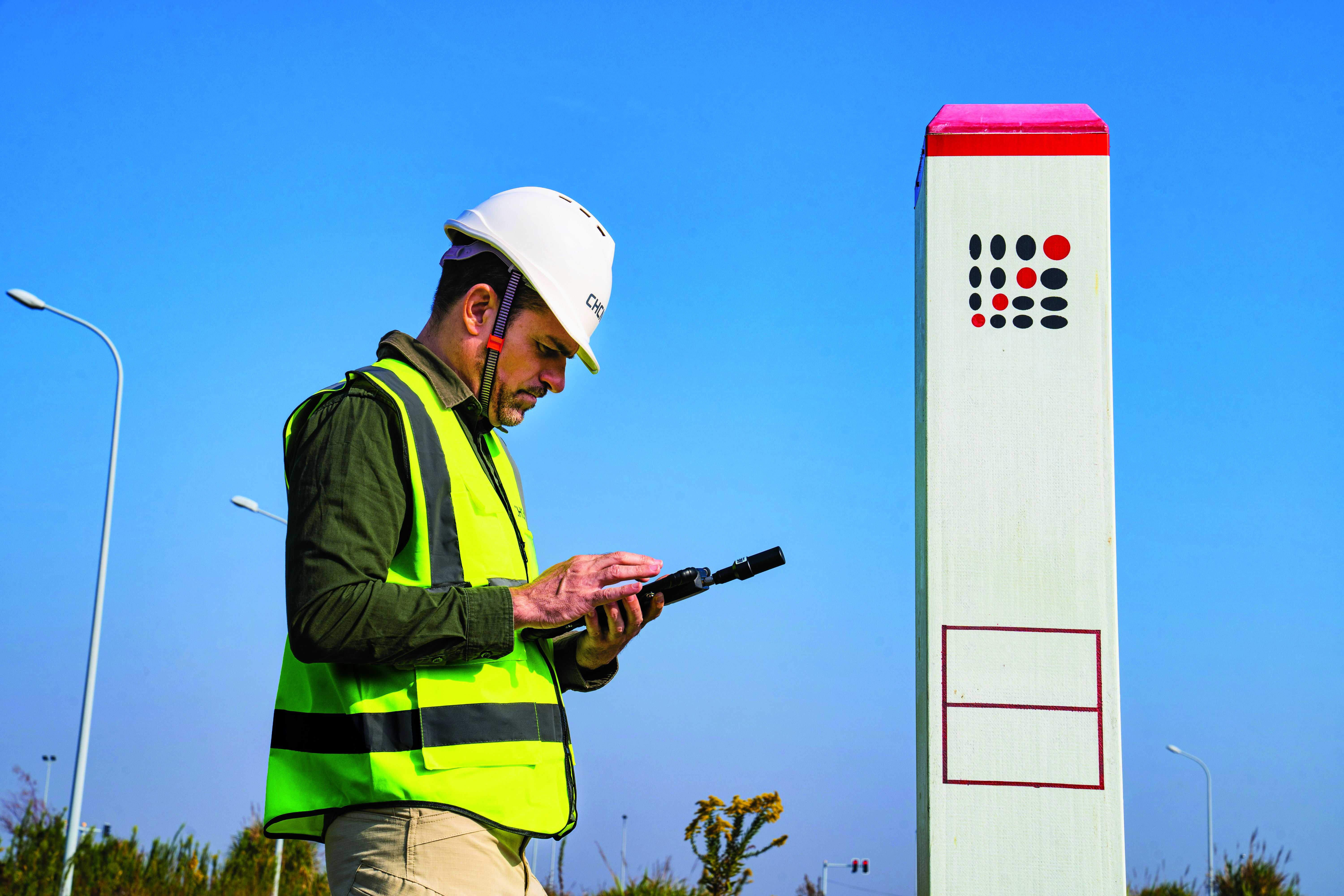
CHC Navigation is assisting China’s Ministry of Natural Resources to conduct its third national land survey. The ministry regularly organizes nationwide land surveys to update the country’s national GIS database, including spatial and attribute information. In addition, surveyors are required to take multiple high-resolution images of each area in different directions to provide verification information. As the project progresses, all data will be uploaded to a server via a cellular (4G) connection. In terms of accuracy, this project requires an expected accuracy in the order of one meter.
For this project, China’s Ministry of Natural Resources used the CHCNAV LT700 rugged Android tablet. Featuring an 8-in screen viewable in direct sunshine and in high-bright areas, the LT700 is well suited to display GIS data tables, complex vector and raster maps or high-resolution pictures. Unlike consumer tablets, the L700’s IP67 industrial design withstands daily use in harsh environments and conditions. Protected from dust, rain, extreme temperatures and accidental drops from 1.2 m, the LT700 is an advanced solution for such applications as forestry, utilities, asset management or environmental studies. Bearing the Google Mobile Service (GMS) certification, the LT700 runs seamlessly the most common professional data collection applications available from the Google Play store.
The main challenges associated with using data collectors in the field are related to the natural environment and the need to ensure reliable georeferencing accuracy down to the meter. Surveyors and GIS technicians work in a variety of environments, including cities, mountains, plateaus and forests. They can work for up to eight hours in rain, snow and extreme temperatures. As a result, their equipment must be well protected from shocks and bad weather, with long battery life and a high-brightness display.
A GIS specialist collecting the locations of assets using an LT700H RTK Android tablet by CHC Navigation, which has centimeter accuracy. (Image: CHC Navigation)
With the LT700 rugged tablet, surveyors can focus on collecting data in the field without interruptions or wasted time, and without worrying about weather conditions. The device delivers metric accuracy with SBAS support, which greatly improves the reliability of georeferencing and the consistency of collected data, regardless of the operator. Its lightweight construction and convenient size make it easy to transport on foot, especially when working in mountainous terrain or crossing rivers. The LT700’s 4G connectivity has made it possible to continuously update data and organize work sessions based on updated data.
“Seen & Heard” is a monthly feature of GPS World magazine, traveling the world to capture interesting and unusual news stories involving the GNSS/PNT industry.
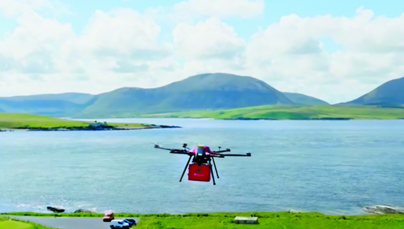
UK begins UAV deliveries
Image: Screenshot of video by BBC
Royal Mail and UAV company Skyports have launched the Orkney I-Port operation to distribute letters and packages between the Orkney Islands, Scotland, reported the BBC. In partnership with the council’s harbor authority and Scottish airline Loganair, mail will be transported from Royal Mail’s Kirkwall delivery office to the city of Stromness in Orkney. UAVs will then carry items to the islands of Graemsay and Hoy, where postal staff will complete the delivery routes. The UAV service will initially operate for three months and may continue on a permanent basis under existing regulatory frameworks due to Orkney’s unique landscape and the proximity of the islands to one another. The UAV service aims to improve service levels and delivery times to Graemsay and Hoy, as weather and geography typically cause disruption to delivery services. The use of UAVs to deliver mail also may bring significant safety improvements by ensuring that postal workers can deliver between ports without risk.
GNSS is taking a hike, literally
Image: Aleksandar Georgiev/iStock/Getty Images Plus/Getty Images
In July, officials in Taichung City, Taiwan, launched a GNSS-based app to aid lost hikers and to mitigate risk associated with outdoor activities in the area’s mountainous region, reported Tapei Times. The app was developed by the Taichung Fire Bureau in response to a surge in outdoor activities after the COVID-19 pandemic restrictions were lifted and, subsequently, an increase in medical emergencies linked to mountain activities. Wi-Fi towers have been built at major trailheads such as Toukeshan, Anmashan, Fushoushan and Snow Mountain to supplement the app as well as to help facilitate UAV deployment to find lost hikers.
In a biological preserve in Mexico’s Campeche state, a team of archaeologists have documented pyramids, palaces, a ball court and other remains of an ancient city they call Ocomtún, reported The New York Times. Archeologists surveyed the site for six weeks in May and June, finding 50-foot-tall structures resembling pyramids, as well as pottery and Mayan engravings they believe date to between 600 AD and 900 AD. The team determined the city was likely abandoned more than 1,000 years ago. Surveying of the area has been revolutionized over the past decade by lidar — allowing researchers to survey densely forested areas that are difficult to explore on foot. Archeologists were able to use airborne lasers to pierce through dense vegetation and reveal the ancient structures and human-modified landscapes beneath.
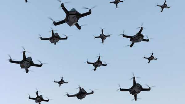
More than 350 UAVs were lost during a practice light display show in Melbourne, Australia, on July 14, ahead of a scheduled performance for the opening of the women’s World Cup. The UAVs appeared to stop mid-show and plummet into the Yarra River. Divers have since fished out hundreds of the UAVs. According to the Resilient Navigation and Timing Foundation, the likely cause of the mass-crash was interference with GPS signals.
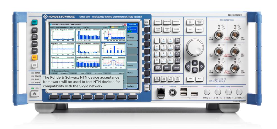
Rohde & Schwarz has partnered with Skylo Technologies, a global software-defined non-terrestrial network (NTN) operator, to set up a device acceptance scheme for Skylo’s NTN.
The proven device test framework from Rohde & Schwarz will be used to test NTN chipsets, modules and devices to validate their compatibility with the Skylo test specification.
The collaboration aims to reinforce and expand the testing capabilities for NTN, ensuring that chipsets, modules and devices using the NTN Narrowband Internet of Things (NB-IoT) protocol integrate seamlessly with Skylo’s network and are 3GPP Release 17 compliant.
The Rohde & Schwarz test framework is built on the R&S CMW500 wideband radio communication tester. The framework serves as the preferred choice for IoT testing, including research and development to GCF/PTCRB certification and carrier acceptance tests, covering both terrestrial and non-terrestrial IoT domains.
With the R&S CMW500 software stacks, the new framework offers reliable and repeatable results. It comes with NTN Release 17 features as well as support for different orbits.
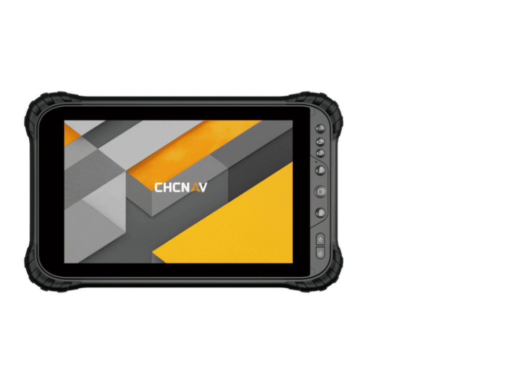
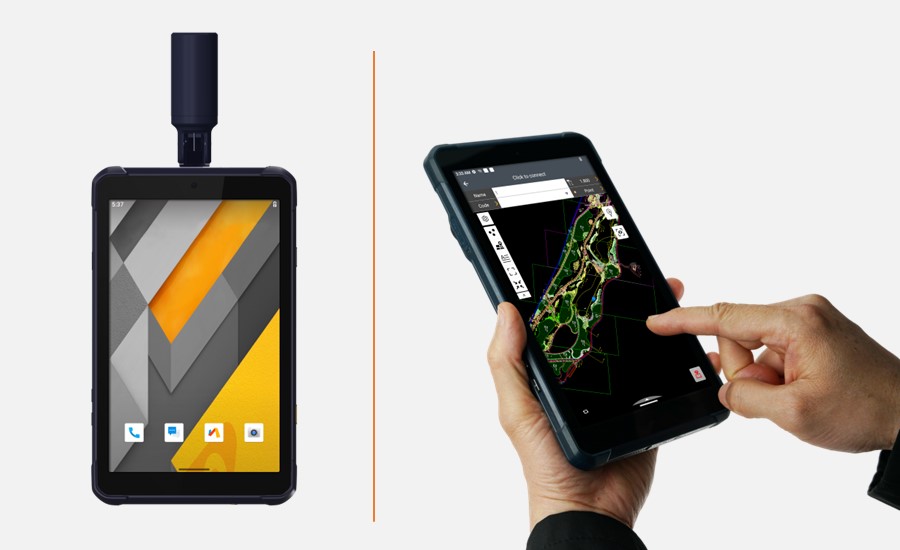
CHC Navigation (CHCNAV) released the LT800H, a rugged and versatile RTK GNSS tablet designed for geospatial and mapping operations in the field.
The LT800H offers users robust outdoor performance, data security and centimeter-level accuracy for a variety of applications, including construction, environmental surveying and any industry in which Android tablets are required.
Featuring a high-performance 1408 channel GPS, GLONASS, Galileo and BeiDou module and a tracking GNSS helix antenna, the LT800H RTK Android tablet offers centimeter-to-decimeter positioning accuracy in challenging environments. It also comes equipped with a 4G modem to simplify connectivity to GNSS RTK network corrections. The technology also offers an eight-hour battery life, allowing users to collect data in the field uninterrupted.
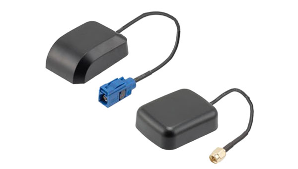
KP Performance Antennas has launched its line of vehicle GPS antennas designed for automotive applications.
These antennas come equipped with a high gain of 28 dB and high out-of-band rejection, allowing them to capture weak signals efficiently, even in challenging environments. By minimizing signal interference and multipath effects, the technology aims to provide signal quality and stability to users in applications such as personal vehicles, commercial fleets or autonomous systems.
With waterproof and dustproof ratings of IPX6 or IP66, the antennas can withstand varying outdoor conditions, offering uninterrupted performance even in inclement weather and rough terrains. This design makes them the ideal choice for vehicle tracking, fleet management, telematics and navigation systems.
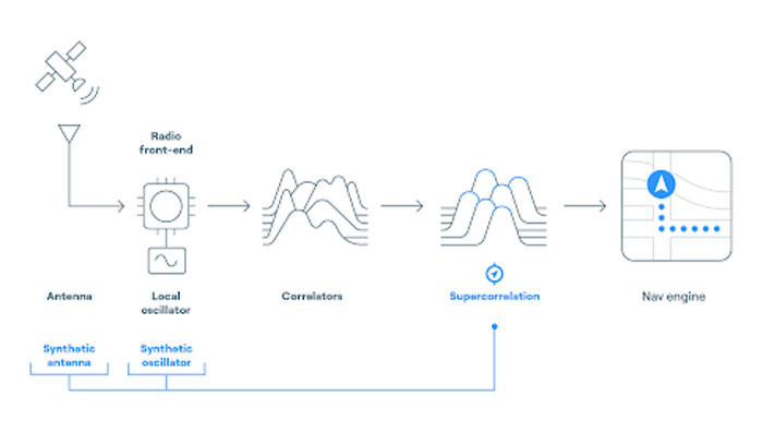
FocalPoint has added new functionality to its Supercorrelation technology, S-GNSS, to simplify the integration process for chipset companies.
The company has introduced an API interface between a GNSS chipset and an application or operating system that runs on its own navigation engine, easing deployment of Supercorrelation.
Based on the existing Android open-source interfaces, the S-GNSS API will allow a normal GNSS chipset to run S-GNSS in a separate external host processor. With this additional software added to the GNSS chipset, the overall system can get the performance improvements necessary to upgrade the GNSS receiver to a S-GNSS receiver and offer enhanced positional capabilities.
The S-GNSS API outputs the multipath-free line-of-sight correlation peak for each satellite and the corresponding corrected frequency, codephase and status flags. Optional outputs can be enabled with turn-on keys, spoofer detection and localization, and instantaneous magnetic-free heading estimation.
Supercorrelation has recently been awarded the National Technology award for Security Innovation of the Year and is recognized by the UK Royal Institute of Navigation and the Institute of Navigation. This development is the latest technical upgrade for the S-GNSS product portfolio.
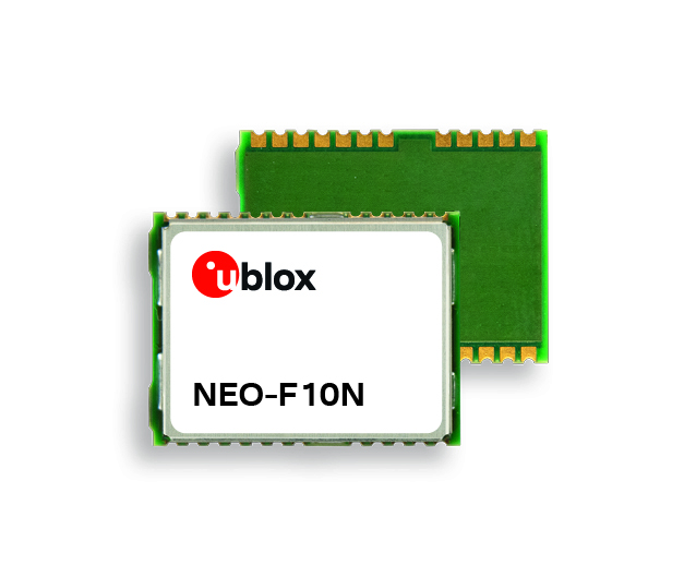
u-blox has released its latest positioning module, the NEO-F10N. The module is based on the u-blox NEO form factor and is equipped with u-blox F10 dual-band GNSS technology. It supports L1/L5 GNSS bands from multiple constellations, including NavIC, to provide solid meter-level position accuracy in urban areas.
The technology’s firmware is upgradeable and configurable to support a variety of applications such as vehicle aftermarket telematics and micromobility or industrial applications requiring meter-level position accuracy.
The NEO-F10N provides resilience against multipath interference and leverages signals from both the L1 and L5 bands. The module aims to increase accuracy, reduce power consumption and offer an alternative solution to users who do not want to deploy dead reckoning (DR) setups.
Users currently employing receivers based on modules, such as the u-blox NEO-M8 and NEO-M9, can seamlessly upgrade to the new NEO-F10N generation.
U-blox also introduces the new ANN-MB5 L1/L5 antenna to strengthen u-blox’s F10 dual-band solution. This tailored antenna offers an easy and reliable option for meter-level applications that require multi-band and multi-constellation support, even in challenging environments.
A roundup of recent products in the GNSS and inertial positioning industry from the September 2023 issue of GPS World magazine.
MOBILE
Commercial RF antennas Marine grade for ships/boats
The Fairview commercial RF antennas provide accurate positioning with L1 band and multiband capabilities and offer a 28 dBi gain for reliable positioning. The antennas offer full-spectrum connectivity and operate within the universal marine frequency range of 156 MHz to 163 MHz and CB-27 MHz, 10m-HAM, ensuring unbroken connections at sea. The antennas are also weatherproof, rated IP67 for water ingress. They are offered with three types of mounts, making it easier to integrate into any vessel. All antennas are crafted from robust stainless steel or fiberglass for durability and reliable performance. Various antenna lengths are available for users to select based on their signal performance needs..
Fairview Microwave, fairviewmicrowave.com
SURVEYING & MAPPING
Inertial Measurement Units Features ultra-high accuracy DFOG range and more
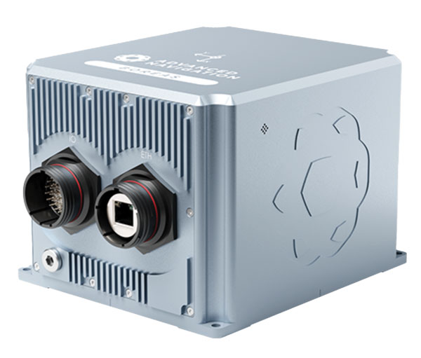
The Boreas A90 and A70 are strategic-grade inertial measurement units (IMU) that deliver acceleration and orientation with accuracy, stability and reliability under all conditions with no reliance on GNSS. They also feature automatic gyrocompassing. The IMUs contain ultra-high accuracy digital fiber-optic gyroscope (DFOG) range and high performance closed-loop accelerometers. The Boreas A90 and A70 are both suitable for surveying, mapping and navigation across subsea, marine, land and air applications. The Boreas A90 and A70 also offer an optional license to add inertial navigation system capabilities and enable integration with external GNSS receivers using Advanced Navigation’s range of interfaces and communication protocols. Advanced Navigation, advancednavigation.com
GNSS Receiver Suitable for surveying, mapping, and geographic information system applications
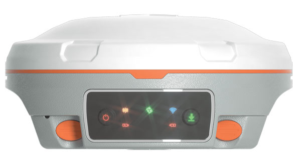
The Mars Laser RTK features a datalink modem that transmits and receives across the full frequency range from 410 MHz to 470 MHz. With adjustable transmit power of 0.5 w to 2 w and a maximum distance of 15 km, it meets the measurement demands of complex environments. It can also switch roles between a rover and a base, enabling more flexibility in demanding applications. The Mars Laser RTK is equipped with a Wi-Fi/4G modem and Bluetooth capabilities, facilitating reliable communication across various platforms. The Mars Laser RTK also features five LEDs on the front panel for satellite tracking, RTK corrections data and more. Powered by the SinoGNSS K8 high precision module, the device supports full-constellation and multi-frequency tracking, including GPS, GLONASS, BDS, QZSS, IRNSS, and Galileo, and supports precise-point positioning service. Additionally, the device tracks more than 60 satellites and has 1,590 channels. The Mars Laser RTK’s third-generation inertial measurement unit (IMU) supports 60° tilt with 2.5 cm accuracy. The IMU can be set to both traditional mode with range pole and to laser mode. ComNav Technology, comnavtech.com
Desktop Solution An Esri ArcGIS Pro add-in for field data collection software
With a streamlined user interface, the Terra Office add-in for ArcGIS Pro enables users to connect TerraFlex workflows directly to the ArcGIS platform from within ArcGIS Pro — Esri’s desktop GIS application. ArcGIS Pro users can now create and manage TerraFlex geospatial data collection projects without leaving ArcGIS. Organizations that collect data in TerraFlex and bring it into ArcGIS through the add-in can also use the Trimble Offline GNSS Corrections service for situations where real-time correction services are intermittent or unavailable. With this service, all data from the field is automatically processed in the cloud without user intervention, and the most accurate real-time or post-processed position is stored for each feature and made available for download through the Terra Office add-in for ArcGIS Pro. Trimble Geospatial, geospatial.trimble.com
Data Capture App A customizable mobile application for GIS data collection
1Capture is a mobile GIS editing application that is multi-use and configurable. It provides accurate and reliable data collection and editing in the field for a multitude of asset, job, and survey types. Customizable rules and actions work to improve data quality at the point of capture. This ensures that good quality data is captured at the source, minimizing re-surveys. The built-in rules engine automatically validates and corrects the GIS and non-GIS data collected, whether working online or offline. 1Capture connects with a variety of GIS environments, including Esri ArcGIS and open-source technologies such as PostGIS and Geoserver. 1Spatial, 1spatial.com/us/
AUTONOMOUS
Heavy-Lift Delivery UAV An off-the-shelf, ready-to-fly delivery aircraft for last mile delivery
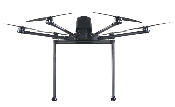
The RDST Longtail features a RDS2 drone winch, enabling payloads to be deposited safely from altitude so that spinning rotors are kept far from people and property. The UAV can deliver or retrieve payloads up to 5 kg and over a distance of 11 km, making it suitable for various applications such as local parcel or food delivery, emergency medical deliveries, water sampling programs, offshore logistics, search and rescue operations and more. The UAV can also auto-release packages without the need for a recipient to be present at the delivery location. This is made possible by the all-new bag auto-release mechanism, allowing for easy pickups and auto-releasing of bags during deliveries. Designed to meet FAA regulations, the RDST Longtail is remote ID compliant with a factory-integrated remote ID beacon. The Premium edition of the drone can fly in inclement weather and features a quick-release battery system for minimal downtime. A2Z Drone Delivery, a2zdronedelivery.com
GNSS INS Suitable for multiple applications
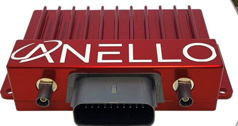
The ANELLO GNSS inertial navigation system (INS) is designed for reliable long-term GPS-denied navigation and localization. Powered by optical gyroscope technology and artificial intelligence-based sensor fusion engine, the ANELLO GNSS INS delivers robust, high-accuracy positioning and orientation for applications such as agriculture, construction, trucking, and autonomous vehicles. It comes equipped with unaided heading drift of less than 0.5°/hr, dual multi-band real-time kinematic-capable GNSS engines, ASIL-D-ready automotive qualified CPU, automotive 2-wire Ethernet, and dual high-speed CAN FD interfaces. It also features dual RS-232 interfaces, hardware precision time protocol, IEEE 802.1AS. The ANELLO GNSS INS is IP68 waterproof, as well as resistant to dust, salt spray and chemicals. ANELLO Photonics, anellophotonics.com
GPS-Guided Robot Designed specifically for painting athletic fields
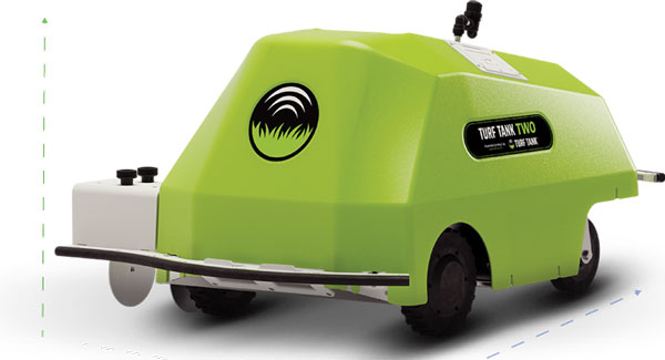
The Turf Tank Two features dual motor drives for enhanced torque and optimized wheels for traction. On its own and controlled through a tablet, the Turf Tank Two can paint a regulation soccer field for two teams of 11 players each in less than 24 minutes, a baseball or softball field in less than 11 minutes, a lacrosse field in less than 26 minutes, and a full 100-yard football field in less than 3.5 hours. It can also paint logos and numbers. The Turf Tank Two is 43 in x 33 in x 22.5 in. It weighs 123 lbs, without paint or the battery installed, and it can hold 5.5 gallons of paint. Enhanced features of the Turf Tank Two also include a revamped sprayer module and advanced control features — including a redesigned front panel that has convenient pause/resume options with LED indicators displaying the robot’s status and a start/stop sprayer button. An LED indicator also comes on the battery. Its batteries are rechargeable. Because of the robot’s precision and accuracy, it uses significantly less paint and eliminates the overspray that is common with either painting by hand or using many of the older paint machines and sprayers on the market. The GNSS-guided Turf Tank Two uses a base station to enhance its accuracy, while its onboard GNSS receiver acts as a rover. Turf Tank, turftank.com
DEFENSE
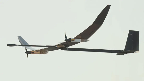
Solar-Electric HAPS UAS Provides an alternative to conventional sensing and communications systems
PHASA-35 is an ultra-light weight, solar-electric high altitude pseudo satellite (HAPS) unmanned aerial system (UAS) designed as an alternative to conventional systems such as satellites or conventionally powered aircraft for cost-effective imagery and communications. PHASA-35 uses photo-voltaic arrays to provide energy during the day, which is stored in rechargeable cells to maintain flight overnight. The UAS is designed to provide a persistent, stable platform for monitoring, surveillance, communications, and security applications. When connected to other solutions, it provides military and commercial customers with capabilities that are not currently available from existing air and space platforms. PHASA-35 can also be used to deliver communications networks including 5G, as well as provide other services, such as disaster relief and border protection. The UAS also has a flexible payload design that enables a large and varied range of sensor capabilities to be carried and updated. The PHASA-35 is suitable for military communications, military surveillance, commercial communications, maritime surveillance, border security, agricultural monitoring, and environmental monitoring. BAE Systems, baesystems.com
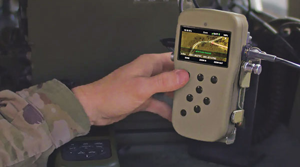
NavGuide is a field-installable replacement to the defense advanced GPS receiver (DAGR), designed for quick integration into current DAGR mounts and accessories without mission interruption. NavGuide features a 3 in, full-color, graphical user interface for dismounted soldiers, and easily integrates with existing mounted platforms and systems. The device leverages the advanced M-code GPS signal with enhanced jamming and spoofing protection. NavGuide is portable, versatile, and precise, and enables vehicular, handheld, sensor, and gun laying applications that enable the military to defeat adversaries in a variety of challenging threat environments. BAE Systems, baesystems.com
OEM
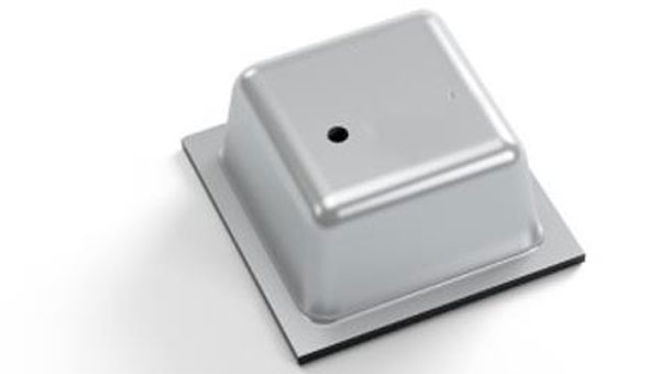
Vertical Location Device For a variety of applications that rely on precise PNT
Pinnacle delivers precise, floor-level, vertical positioning for geolocation applications. It offers altitude measurements that meet the Federal Communications Commission mandate of 3 m accuracy. Pinnacle works with existing barometric pressure sensors in devices to improve quality and accuracy. Pinnacle technology provides z-axis data and has been demonstrated in independent testing to deliver 94% accuracy. Pinnacle data is derived from a proprietary network built for public safety, operated and maintained by NextNav, for wide availability. SDK, API, and Unity plug-in options make it easy to integrate 3D geolocation technology into existing applications.
The device also offers consistent vertical location abilities available throughout large urban areas. Pinnacle is available across the United States, is currently being deployed across Japan, and is being tested in France for local emergency repsonse agencies. NextNav, nextnav.com
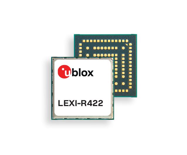
LTE-M/NB-IoT Module For small asset trackers
The LEXI-R4 module is customized for size-constrained application requirements. The device is suitable for small asset trackers, such as pet and personal trackers, micro-mobility devices, and luggage tags. The LEXI-R4 module supports all LTE-M and NB-internet of things (IoT) bands, with an RF output power of 23 dBm. It is natively designed to support GNSS AT commands, and its dedicated port enables easy integration with any u-blox M10-based GNSS module, such as the MIA-M10. Additionally, the module can connect to additional positioning services, such as AssistNow and CellLocate. The compact size of the module, measuring 16 mm x 16 mm, results from a 40% footprint reduction in dimensions compared to the previous u-blox SARA-R4. Due to its small size, it leaves room for larger antennas, which can improve RF performance, or for larger batteries. Another feature of the LEXI-R4 is its 2G fallback capability. Whenever LTE-M/NB-IoT coverage conditions are not optimal, it continues to function by falling back onto a 2G network. The company said this feature could be helpful in countries where LTE-M/NB-IoT networks have yet to be fully deployed. u-blox, u-blox.com