GPS World Editor-in-Chief, Matteo Luccio, met for an exclusive interview about Spirent Communications collaboration with Xona Space System‘s PULSAR, new releases, and more with Adam Price, Vice President – PNT Simulation, Spirent Communications.
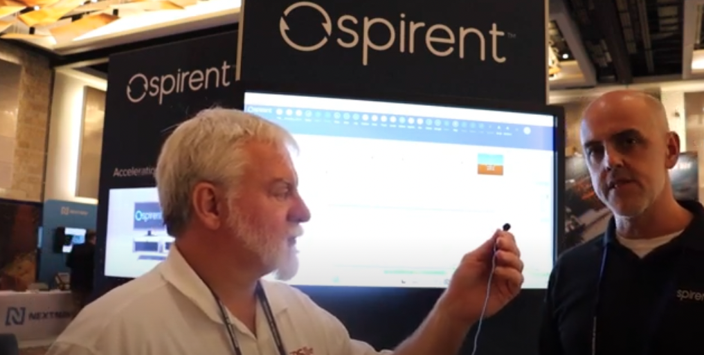
GPS World Editor-in-Chief, Matteo Luccio, met for an exclusive interview about Spirent Communications collaboration with Xona Space System‘s PULSAR, new releases, and more with Adam Price, Vice President – PNT Simulation, Spirent Communications.
An exclusive interview with Mark Holbrow, VP of Product Development, Spirent Communications and Roger Hart, Sr. Director of Engineering, Spirent Federal Systems. For more exclusive interviews from this cover story, click here.
MH: Our business is based in the UK. I am responsible for the vision and direction of the Technology portfolio required by Spirent’s Positioning Technology business unit.
RH: I am responsible for the U.S. add-on components to the simulator, the restricted signals, and support for the U.S. government labs and contractors.
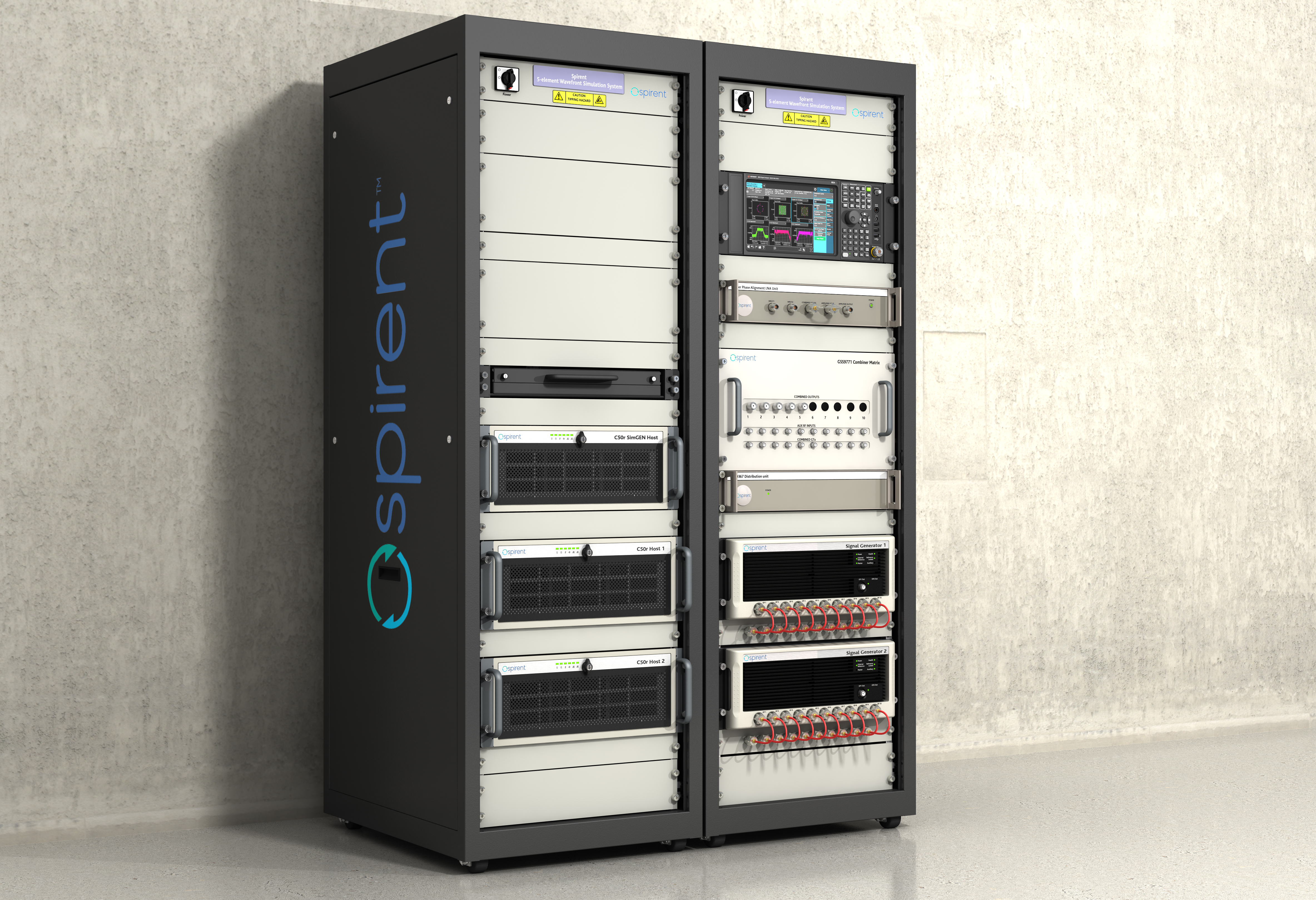
MH: I would say that the need for thorough and comprehensive testing has never been greater. That need is being driven on multiple fronts due to the understandable pressure on PNT systems needing to deliver enhanced accuracy, reliability and resilience, in the presence of emerging threat vectors and an expanding application space that’s utilizing ever more complex combinations of new and enhanced signals and sensors of opportunity. Underpinning Spirent’s leadership in ensuring the test needs for this evolving, challenging and increasingly diverse market are its team, its technology and its partners. That team is well-established, dedicated and highly experienced — their sole focus is designing, manufacturing and supporting PNT test solutions. The technology focuses around our pioneering dedicated SDR hardware platform and software simulation engine, which allied provide performance, scalability and flexibility, within an open accessible architecture. In addition, close collaboration with our selected partners ensures the opportunity to support and integrate new and emerging PNT technologies through their tools, applications and hardware.
You mention the advent of LEO. A key reason why Spirent was first to market and successfully supported an early LEO + GNSS receiver test-bed (through close and collaboration with Xona and NovAtel) was driven by team, technology and partners.
Two other important areas that have definitely continued to grow and evolve in importance and priority have to be increased realism and test automation. Both are areas in which Spirent continues to prioritize and invest R&D dollars.
MH: Good point. Again, a key element with the Spirent solution is that it is very scaleabale and flexible. Spirent has a generic SDR that can be re-purposed to simulate whatever signals are required. That way, we can compile different signals from either one radio or multiple radios coming from the same system. Together with being able to bring in multiple chassis to gradually grow the simulation solution, while also maintaining for each of those signals the fidelity, channel count, and accuracy that customers demand.
MH: Absolutely, sir. In fact, signals that are still on the drawing board as well. We can enable the user with effectively an arbitrary waveform simulator or ‘sandbox’ to experiment with different modulation schemes, different chipping rates, codes, bandwidths and navigation data content. So, in addition to using that architecture to generate the signals, we allow customers to experiment with it themselves. That’s certainly accelerated over these last five years, and there’s no sign of it stopping. We’re currently working with customers and partners all over the globe who are developing both brand new and emerging PNT systems, whilst also providing all the vital simulation tools to aid the R&D of existing and planned SIS evolutions.
RH: The increasing number of signals that we can support multiplies the permutations and combinations of test cases that users can do. There is a lot of emphasis also on the user interface side of things, so that from one interface you can also easily control all these interfaces with third-party tools, because proliferation of signals produces a huge possible test volume.
MH: Again, great question. The key reason Spirent excels in this arena is that the core simulation engine and SDR are agnostic of the constellation and signal type that’s being generated. So, the underlying principles of accuracy, range rate, pseudo-range control, and delay, together with the RF fidelity from Spirent’s SDR+ Sim engine, can be readily manipulated to simulate the wealth of emerging signals, including LEO.
The other area that becomes very important is that if we do not have sight of the ICD, we can enable customers to use our tools to readily populate elements of that ICD themselves. That way, the best of both worlds is achieved, i.e. a turnkey SIS solution, or we can just enable the customer to do it themselves.
MH: They are. Both current and emerging test needs are continuing to drive the need for enhanced simulation realism. Always a tough nut to crack, but our hard-won experience and expertise, allied with continuing adoption of latest-generation technology, is allowing us to take some significant strides forward. Real-world testing has an incredibly important role to play and that’s why at Spirent we continue to invest in and develop the GSS6450 Record & Playback System (RPS). However, we are also on that quest for the ‘Holy Grail’ that has all the well understood and necessary advantages of lab-based testing but with the simulation environment being as true to the real world as possible.
A further area where both current and emerging test needs are demanding more and more from the test environment is resilience testing. Spirent now supports a multitude of vulnerability and corresponding mitigation/prevention test cases. Those test cases become increasingly complex as multiple combinations of the threat/mitigation surface evolve — including jamming, spoofing, cyber-attack and CRPA.
Many of these test cases are driving the state of the art and, especially in the case of CRPA testing, Spirent’s purpose-designed SDR comes into its own. Technology bakeoffs and corresponding customer adoption have shown that only through the use of that dedicated purpose-built technology, the simulator test bed can deliver the necessary carrier and code phase stability, very low levels of uncorrelated noise across antenna elements and high J/S that is demanded.
Again, with respect to flexibility, we also support ways to let customers generate their own IQ data. That data can be streamed into the Spirent simulator and combined sympathetically and coherently with the signals generated inside the platform. So, you can layer new signals on existing ones, or introduce a completely new dedicated IQ stream.Finally, hardware-in-the -loop (HIL) testing requirements continue to be a crucial aspect in test coverage. Whether that application is automotive, projectiles or autonomous vehicles, the need for lower latency and higher 6DOF sampling to capture as many trajectory nuances as possible continues to grow. Spirent’s 2KHz system achieves very high iteration rates (SIR) and <2msec latency.
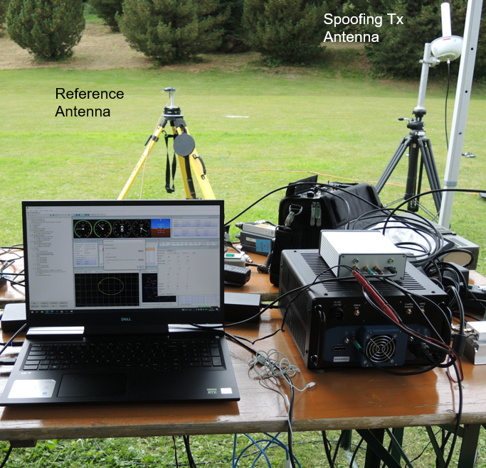
MH: We do support in-the-field test use cases. Spirent has record-and-replay (RPS) systems to take soundings in a wide-band RF environment, record them, then bring them back into the lab for replay. They are sized to fit into a backpack, battery-powered, accessible, and easy to use.
Recently, we have also taken some of our signal generator IP and been able to create a smaller form factor portable simulator for outside use. Its footprint is considerably smaller than that of one of our lab-based simulators. It’s primarily a mechanism for testing the resilience in the field of devices under test. Armed with a Spirent simulator and the appropriate transmit licenses, a customer can put their DUT through an array of vulnerability test cases in a live real-world environment.
Absolutely. Right. The details will vary depending on the jurisdiction, but you will need a license to transmit. And, as you rightly say, often those places will be very remote so as not to interfere with the public. We’ve had instances where we’ll work with a customer who has those appropriate licenses and then we can provide this equipment for them to be able to put it through a battery of tests.
It could be either. We can use our simulators to generate internally wide range of interference signals supporting a wide bandwidth, high max o/p power and large dynamic range. This is especially important in instances of CRPA testing, in which it is vital to accurately reproducing a jamming wavefront commensurate with the arrival angle and delay incident at each antenna element. Correspondingly, we support turn-key solutions to connect, control and integrate 3rd party external signal generators into the test scenario.
We have a Xona simulator. So, this is back on the topic of LEO. We’ve recently released that in partnership with Xona. We are also working closely with Hexagon. All those things I mentioned earlier about enabling the customer to use the flexible features that we have, that is where it came into its own. That’s certainly a significant recent success.
We’re continuing to add many realism-related capabilities, including simulating the vibration and temperature effects of inertial systems. Working with a Swiss partner called Space PNT, we’ve recently introduced another LEO-based product, called SimORBIT. That tool enables us to generate incredibly representative and accurate LEO orbits that also include gravitational effects based upon the SV size. We recently introduced a new software tool to support “GNSS Assurance” requirements.
We have a newly patented cloud-based software application called GNSS Foresight that enables users to understand the GNSS coverage they would expect during a particular time, date location and trajectory inclusive of the 3D environment they would be experiencing. We continue to evolve the tool to support real-time operation to enable it to deliver aiding content to appropriately equipped systems.
We continue to be able to support more and more automation. Automation has always been important, but with ever increasing demands of test asset utilization and in a post-pandemic world of remote working, it’s more important than ever right now. The number of test cases and corner cases required and the amount of equipment, coverage, and efficiency required, which was being demanded by using our kit means that automation is vital. So, we’ve introduced several new automation tools to build up on top of our current SimREMOTE interface.
Spirent has also developed a simulation test solution for the Galileo Open Service Navigation Message Authentication (OSNMA) mechanism. SimOSNMA is designed to work with Spirent’s GNSS simulation platforms to test OSNMA signal conformance, which will bring new levels of robustness for both civilian and commercial GNSS uses. SimOSNMA provides developers with vital new simulation tools to test for OSNMA, the security protocol that enables GNSS receivers to verify the authenticity of signals distributed from the Galileo satellite constellation. Designed to combat spoofing, OSNMA ensures that the data received is authentic and has not been modified in any way. It is currently completing the test phase before its formal launch, and SimOSNMA enables developers to simulate and test OSNMA signals and features, allowing GNSS receiver manufacturers and application developers to accelerate and assure development programs.


These are interesting and challenging times for the makers of GNSS signal simulators.
For decades, developers and manufacturers of GNSS receivers have needed to simulate the satellites’ signals to test receivers in their labs and in the field. Meanwhile, users of GNSS receivers for critical missions — such as military operations and rocket launches — have needed to simulate the exact conditions (the number of satellites in line of sight, the positional dilution of precision, etc.) at specific points in time and space.
As the number of constellations, satellites and signals grew — especially in the past few years, with the completion of the BeiDou and Galileo constellations — simulator manufacturers were challenged to keep up. Threats of jamming and spoofing also increased. Then, a few companies began to develop new positioning, navigation and timing (PNT) constellations in low-Earth orbit (LEO). Now, it is common for simulators to require several hundred channels.
I discussed these challenges and the prospect for the simulation industry with representatives of five companies:
For the full transcripts of my interviews, click here. If you like this article, you will love the interview transcripts, which cover much more than I had room for here.
Simulator manufacturers cite a variety of challenges. According to Erbes, a big one is determining users’ requirements. “Often,” he said, “they can’t determine what the specs need to be. All they know is that they need it to work.” This is particularly true when mixing and matching receivers, IMUs, and components from different manufacturers, he pointed out.
For decades, there were only two GNSS constellations (GPS and GLONASS). A couple of years ago, two more came online (BeiDou and Galileo). Meanwhile, several regional augmentation systems were developed (SBAS, EGNOS, NavIC, QZSS and KASS), some of which may later grow into global systems. Now, new LEO-based systems are being developed. For simulator manufacturers, what was once clear “began to get fuzzy,” Erbes said. “If you ask members of our team right now how many constellations we support, you will not get a quick answer. We’re trying to be forward-looking and add everything that might be up there so lab users can develop and test.”
Multi-constellation simulation is a particularly challenging problem for groups that don’t have simulators, Erbes pointed out. “We have the advantage of having a software-defined architecture. We designed the software so that it is easy to add new constellations to it. Basically, once we’re given a proper interface control document (ICD), we’re only a couple of months away from a first draft implementation of that new signal. Then we iterate.”
In the past few years, said Thomas, Racelogic “had to suddenly invent 15 new signals.” It makes a record-and-replay system — “You put a box in a car, on a bike, in a backpack, or on a rocket, and you record the raw GPS signals,” Thomas said — and another system in which it simulates the satellites’ signals “from pure principles.” The latter, he noted, has been “15 times the original work we thought it would be. However, as we add each signal it tends to get a bit simpler until they add new ways to encode signals, and then it gets complex again.”
Spirent Communications’ technology, Holbrow said, focuses around “its dedicated SDR hardware platform and software simulation engine, which provide performance, scalability and flexibility, within an open accessible architecture. Close collaboration with our selected partners ensures the opportunity to support and integrate new and emerging PNT technologies through their tools, applications and hardware.” Two other aspects that have continued to grow in importance have been “increased realism and test automation,” Holbrow said. “Both are areas in which Spirent continues to prioritize and invest R&D dollars.”
Spirent “can enable the user with effectively an arbitrary waveform simulator or ‘sandbox’ to experiment with different modulation schemes, different chipping rates, codes, bandwidths and navigation data content,” Holbrow said. “The increasing number of signals that we can support multiplies the permutations and combinations of test cases that users can do,” Hart added.
Not every simulator user is equally interested in simulating all the existing and emerging constellations. Those in the U.S. military market do not use foreign signals, pointed out Clark. However, they may want to understand how those signals could impact their vehicle, platform, or individual receiver.
LEO-based constellations “have become a buzzword in the last year or so,” Clark said. Because CAST Navigation’s simulators are modular and use an FPGA-based design, “we can add different satellite constellations or satellite protocols to our system,” he said. “However, we don’t offer anything commercially yet due to a lack of an official ICD, or any kind of documentation that defines any of these new LEO-based signals.”
Today, said Pielmeier, all high-end RF simulators must support “all existing GNSS systems with all related signal components on all frequencies.” Additionally, to remain competitive, they must be kept “up-to-date with the new and continuously evolving GNSS signals.” He added: “Beyond the L-band signals, we are also fully supporting the S-band signals of the NavIC constellation.”
The increased request for precise point positioning (PPP) corrections service, Pielmeier pointed out, was the driver for IFEN to add the High Accuracy Service (HAS) PPP-correction capability on Galileo’s E6-B signal to its next release. “We expect further improvements here during the next few years, especially to cover the emerging needs of the PPP-RTK market.” The advent of LEO-based PNT services, he said, makes this “the most important driver for the next five years, extending the signal frequencies beyond the current L- and S-band signals, seeing new modulations, two-way transfer and many more topics.”
Concern about jamming and spoofing has increased significantly over the past several years. These, however, are not new concepts for simulator manufacturers. “In a way, simulation is ahead of this state of the world,” said Erbes. “Spoofing is similar to simulation. So, we already know how to do that.” That could change, however. “If new requirements come up, such as higher data rates or wider bandwidth waveforms or different types of waveforms, then we would have to adapt and add support for that kind of stuff.”
“Because our systems record and replay, they’re used a lot to record real-world jamming,” said Thomas. Regarding spoofing, Racelogic has just improved its signal simulation. “We can do seamless takeover of a GNSS signal in real time. We can reproduce the current ephemeris and almanac. If we transmit a sufficiently powerful signal, we can completely take over that device.”
Over the past five years, most of CAST Navigation’s customers have become much more interested in being able to simulate jamming and spoofing, Clark said. “If you’re doing anything of any importance in a contested environment, you’re going to come up against some type of spoofing and/or jamming interference.”
Pielmeier agreed that simulation of jamming and spoofing threats has been a major market driver in recent years. “Our latest RF simulator generation, NCS NOVA+,” he said, “fully supports all types of jamming and spoofing and is fully integrated into our RF simulators to enable coherent signal generation. With the coming safety-of-life and automated driving applications based on DFMC (SBAS/GBAS dual-frequency multi-constellation), the need to support advanced jamming and spoofing simulation solutions will remain a continuous driver.”
The current GNSS constellations broadcast signals that can be recorded, played back, and used to generate accurate simulations. For systems still being developed, however, simulator manufacturers must rely on each system’s ICD, if and when it is available. Even for established systems, the live sky signals may diverge from the ICD. “Is the simulator supposed to match live sky,” Erbes wondered, “or is it supposed to match the intended final state of the constellation, according to the ICD? This is a huge topic for M-code, which is ever changing, and has a very large ICD that is released incrementally. We’re constantly having to make changes to the simulator to match those releases.”
A big challenge for simulator manufacturers is to keep pace with new and evolving ICDs. “There are more constellations than ever, and the technology makes it easier to change signal architectures,” said Erbes. “We’re going to start talking about signals that can be reprogrammed on the fly. That’s going to make simulation more and more challenging.”
Simulating signals for new systems that are not yet deployed is a matter of “pure signals simulation,” said Thomas. “You go through the ICD line-by-line and work out the new schemes. You are very much reliant on every single word in that ICD.”
New LEO-based systems are not the only ones to present this challenge to simulator manufacturers. “L1C is another one of those problem child signals that we have developed,” said Clark. “All we can do is buy all the makes and models of L1C receivers available for sale and utilize our simulator, along with those receivers, to see whether things are good. We’ve asked the government for an L1C code sample, but it will not be available until the satellite manufacturers launch the satellites in their final configuration. Until then, we’ll develop to the ICD that’s been released and defined, then cross our fingers.”
Spirent’s core simulation engine and SDR “are agnostic of the constellation and signal type that’s being generated,” Holbrow said. “So, the underlying principles of accuracy, range rate, pseudo-range control, and delay, together with the RF fidelity from Spirent’s SDR+ Sim engine, can be readily manipulated to simulate the wealth of emerging signals, including LEO.” Additionally, when an ICD is not available, the company can enable its customers to use its tools “to readily populate elements of that ICD themselves.”
“All our systems can be carried in a backpack, on a push bike, in a car,” said Thomas. “We do that deliberately, because we come from the automotive side of things, so we have to keep everything very small and compact. Some of our customers have put them in rockets, recording the signal as it goes up, or in boats. We have people walking around with an antenna on their wrist connected to one of our systems, so that they can simulate smartwatches.”
CAST Navigation has simulator packages that range “anywhere from shoebox size to nine-foot-tall racks,” said Clark. “They are all modular, so you can add options and capabilities over time. We have simulators that are used in the field. Some of the testing groups with the U.S. armed forces have used our simulators in the back of a Humvee along with other proprietary equipment to conduct their own field experiments.”
Spirent supports in-the-field use cases: its portable simulator can test PNT resilience while the DUT is receiving live-sky signals, and their record-and-playback system takes real-world soundings in a wideband RF environment for playback in the lab.
Currently, Pielmeier said, all IFEN simulators are designed for lab use. However, “we recognize an increased request for field-capable RF simulators, specifically to perform spoofing of real SIS to test deployed GNSS receivers in the field. Offering a portable in-field solution is in our mid-term planning, but not a current driver for our developments.”
How do simulators used by receiver manufacturers in their labs and in the field to tweak existing receivers or develop new ones differ from those used for mission planning? “In most lab simulations, they can just run with a default constellation for a given day,” Erbes explained. “They’ll run that scenario hundreds or thousands of times and never need to change it because they’re testing parts of the receiver that don’t care a whole lot about the specifics of what’s happening.”
Missions, by contrast, are time- and location-specific. Planners need to know which satellites will be overhead at an exact time and place. “When you’re doing real day mission planning, the big problem isn’t so much how to generate a signal, it’s how to find out what’s happening today.”
Like those for receivers, accuracy requirements for simulators are increasing to match those of emerging applications. “Everyone’s chasing the goal of getting smaller, faster, and more accurate systems,” said Thomas. “We do real-time simulators, and they want a smaller and smaller delay from when you input the trajectory to when you get the output. Luckily, we’re able to keep up on the hardware side as well, because much of our processing is done using software.”
As accuracy requirements rise, “Real-world testing has an incredibly important role to play,” said Holbrow. Additionally, as resilience testing places increasing demands on test equipment, Spirent Communications now supports “a multitude of vulnerability and corresponding mitigation/prevention test cases” to deal with jamming, spoofing, cyber-attack and CRPA
CAST Navigation’s simulators meet or exceed accuracy requirements, Clark said. “We have pseudo-range accuracy down to a millimeter, our phase coherence doesn’t wander, and we’re able to achieve 2.5 ps to 3 ps synchronization coherence during multi-element, phased-array antenna simulations. We see our customers interested in a higher performing simulator, and that is our commitment.”
Pielmeier had a different perspective on this: “We saw no increase in the required accuracy, as the typical requested accuracies are far beyond the real accuracy of the signals anyway.”
Racelogic has developed a system to replace or augment GPS in tunnels, which often pass over each other or match the routes of surface streets. “We’ve been talking to many cities around the world that are building new tunnels,” said Thomas. “It requires installing repeaters every 30 meters along each tunnel and software that runs on a server and seamlessly updates your position every 30 meters.”
Clark pointed out that CAST Navigation’s “bread-and-butter” for the past few years has been “larger systems that can drive phased array antennas, along with inertial units, and full high-dynamic aircraft, in real-time environments.” He added that “the smaller systems, which used to be popular, have mostly gone by the wayside.”
As a recent success, Holbrow cited Spirent Communications’ release of a Xona simulator, in partnership with Xona Space Systems, as well as the addition of “many realism-related capabilities, including simulating the vibration and temperature effects of inertial systems;” a cloud-based software application called Foresight that enables users to understand the GNSS coverage they would expect at a particular time, location and trajectory based upon accurate 3D scenes; and a simulation test solution for the Galileo Open Service Navigation Message Authentication (OSNMA) mechanism. Finally, he stressed Spirent’s increasing support for automation.
Pielmeier cited the Galileo second generation Test User Receiver contract that IFEN received from the European Space Agency as its most important recent success. “Within this contract, the NCS NOVA+ simulator as RF test tool will be upgraded to full G2G signal generation capability. The new already implemented G2G signals enable shorter time to first fix (TTFF) and improved acquisition performance but also higher updates rates (e.g., for PPP-RTK). Through the end of the year, the G2G signal will be fully implemented in our RF simulator, including the next generation of advanced authentication solutions.”

Advanced industrial societies are increasingly reliant on the fantastic capabilities of global navigation satellite systems (GNSS) — GPS, GLONASS, BeiDou and Galileo — and, therefore, increasingly vulnerable to their weaknesses. From providing our position on a map on our smartphone to timing financial transactions, cell phone base stations, and the internet; from steering tractors in the field to guiding first responders; from giving surveyors sub-centimeter accuracy to monitoring continental drift; from providing navigation to ship captains and airplane pilots, to enabling automated control of earth moving machinery, GNSS have become a critical infrastructure. Yet their well-known vulnerabilities — such as jamming, spoofing, multipath and occultation — continue to fuel the development of complementary sources of positioning, navigation and timing (PNT) data, especially for new and rapidly expanding user segments such as autonomous vehicles.
In a January 2021 report, the U.S. Department of Transportation pointed out that “suitable and mature technologies are available to owners and operators of critical infrastructure to access complementary PNT services as a backup to GPS.”1
Several new PNT systems are being developed and deployed that are partially or entirely independent of the four existing GNSS constellations. This cover story focuses on the following companies, products and services:
Due to the limited space available in print, this article only uses a small portion of these interviews. For full transcripts of them (totaling more than 10,000 words) click here.
1 Andrew Hansen et al., Complementary PNT and GPS Backup Technologies Demonstration Report, prepared for the Office of the Assistant Secretary for Research and Technology, Department of Transportation, January 2021, p. 195.
“Traditionally, augmentation to GNSS has been done through inertial navigation systems (INS),” Price said. “More recently, ground- and space-based augmentation systems have increased in usage. However, both technologies depend on the absolute positioning information provided by GNSS. They do not represent a true alternative PNT.”
To facilitate the development of advanced and autonomous applications, Price suggested incorporating terrestrial sources of PNT as well as ones based on LEO, medium-Earth orbit (MEO) and geostationary equatorial orbit (GEO) satellites. This, he added, would also keep costs from becoming prohibitive. “LEO brings many benefits in comparison to MEO in just about every industry to which it can be applied,” Jaramillo said.
While mass reliance on GNSS facilitates access to GNSS data and makes devices that use it increasingly cost-effective, over-reliance on a single sensor is risky, Austin pointed out.
“That’s where complementary PNT comes in: if you can put your eggs in other baskets, so you have that resilience or redundancy, then you can continue your operation — be it survey, automotive or industrial — even if GNSS falls or is intermittently unavailable or unavailable for a long time,” Austin said.
It has been said that “the only replacement for GNSS is another GNSS.” Inertial navigation, dead reckoning, lidar, and referencing local infrastructure that, in turn, has been globally referenced using GNSS, enable mobile platforms to maintain relative positioning during GNSS outages. However, absolute positioning will continue to require GNSS. “If you claim to be breaking free from GNSS you’re really saying, ‘I can navigate in this building, but I don’t know where this building is,’” Austin said.
GNSS and INS have always been natural allies because they complement each other. The recent completion of the BeiDou and Galileo constellations, which has greatly increased the number of satellites in view, has made the requirement for six satellites at any one time for real-time kinematic (RTK) “a much more reasonable proposition,” Austin said. Coupled with the drop in the price of inertial measurement units (IMU), this has made it possible to “make a more cost-effective IMU than ever or spend the same and get a much better sensor than you ever could before,” he said. “Your period between the GNSS updates is also less noisy and you have less random walk and more stability.”
It used to be that the performance of an accelerometer might far outweigh that of a gyroscope, resulting in excellent velocity but poor heading. “Now,” Austin said, “we can pick a much more complementary combination of sensors and manufacture and calibrate an IMU ourselves while using off-the-shelf gyroscopes and accelerometers. That allows us to make an IMU that is effectively not bottlenecked in any one major area.”
Autonomous vehicles require decimeter accuracy to keep to their lane, while their absolute position is irrelevant to that task. It is, however, essential for map navigation and to know about infrastructure such as traffic signs and stoplights that may not be in a vehicle’s line of sight.
“That’s where the global georeferencing comes in and where GNSS remains critical,” Austin said. “One of the key things we’re examining is GNSS-denied navigation: how we can improve our inertial navigation system via other aiding sources and what other aiding sensors can complement the IMU or inertial measurement unit to give you good navigation in all environments. Use GNSS when it’s good, don’t rely on it when it’s bad or completely absent.”
Nowadays, car makers are increasingly moving their research and development tests from indoor, controlled environments to open roads. Therefore, “they are looking for a technology that allows them to keep doing those tests that they did on the proving ground, but in real world scenarios,” Austin said. “So, they rely on the INS data to be accurate all the time. In autonomy and survey, on the other hand, the INS is used actively to feed another sensor to either georeference or, in the case of autonomy, actively navigate the vehicle. So, that data being accurate is critical because an autonomous vehicle without accurate navigation cannot move effectively and would have to revert to manual operation.”
Complementary PNT systems differ from legacy GNSS along several variables. One is coverage. For example, Satelles and Xona will provide global coverage, while Versa PNT and Locata are local. Another is encryption. Unlike GPS, which encrypts only its military SAASM/M-code signal, Xona’s PULSAR system will encrypt all its signals, Jaramillo said. “For autonomous applications, security is very important. If you’re riding in an autonomous car, you certainly don’t want somebody to be able to spoof the GNSS signal and veer it off course.”
Additionally, the design of Xona’s constellation includes a combination of polar and inclined orbits, which will greatly improve coverage in the polar regions compared to current GNSS coverage. This is particularly important as climate change makes the arctic more accessible. “The idea of having a LEO-based constellation is to take advantage of what can be done in LEO for GNSS,” Jaramillo said. “If you want the most resilient time and position, you need to use a combination of everything.”
Based on its architecture, Jaramillo said, Xona will provide better timing accuracy than GNSS does today. “Our satellites are designed to use GPS and Galileo signals, as well as inputs from ground stations, for timing reference and will share their time amongst themselves. We will average all these timing inputs and build a clock ensemble on the satellites. That enables much higher accuracies than just having a few single inputs.”
Satelles’ STL service can either substitute for GNSS where the latter is unavailable or supplement it where it is available. When used as a supplement, “the goal is having a solution that is resilient to an outage, interference, jamming, spoofing, those sorts of things,” O’Connor said. “In that case, the receiver card that might be provided by one of our partner companies would have both GNSS and STL capabilities and would take the best of both worlds.” Depending on the product configuration, its locational accuracy is generally in the 10- to 20-meter range, O’Connor said.
Orolia Defense & Security’s Versa PNT “is an all-in-one PNT solution that provides positioning, navigation, and very accurate timing,” Payne said. “Every type of sensor that you’re using for PNT has its strengths and weaknesses. That’s why we have a very accurate navigation filter solution that dynamically evaluates the sensor inputs.” In GNSS-degraded environments, the Versa’s software alerts users that GNSS signals are not reliable, automatically filters out those measurements, and navigates on the basis of the other sensors, such as an IMU, a speedometer, an odometer, or a camera.
Locata’s system is completely independent of GNSS because it does not require atomic clocks. At its heart is the company’s TimeLoc technology, which generates network synchronization of less than a nanosecond, Gambale said. “TimeLoc,” Locata literature states, “synchronizes the co-located signals with other LocataLites as the signals are slewed until the single difference range between it and the other LocataLites is the geometric range. This internal correction process is accurate to millimeter level.” Applications of this system include indoor positioning for consumer devices such as mobile phones, industrial machine automation for warehousing and logistics, positioning first responders within buildings, and military applications in GPS-jammed environments.
How long will it take to develop and/or complete these complementary PNT systems?
Xona is a start-up, and its timeline will depend on its success with investors.“We have basically locked down our signal and system architecture. Now, it’s a matter of building out the ground segment and launching satellites,” Jaramillo said.
Xona’s current target is to launch its first satellites into operation by the beginning of 2025 and to achieve full operational capability by 2027. The company will roll out PULSAR in phases. “In our first phase, we’re going to offer timing services and GNSS augmentation that only require one satellite in view,” Jaramillo said. “Then, as we roll out to phase two, we’ll be able to start to offer positioning services in mid-latitudes with multiple satellites in view. Phase three will include high-performance PNT and enhancements globally.”
Satelles’ STL is already on Iridium’s 66 active satellites, which are all relatively new, having been launched between 2016 and 2018, and cover the entire globe constantly. STL’s signal and capability are flexible, O’Connor said.
Orolia Defense & Security is now evaluating UWB computer technology from different vendors and integrating it in the Versa’s software. “We will probably begin performing full field tests in the first quarter of 2024,” Payne said.
Locata’s mission, Gambale said, “is to deliver technology advances which enable complete, independent sovereign control over PNT for companies, critical infrastructure systems, and in the future – entire nations. It’s designed for the many entities and nations which do not have – and can never afford – their own constellations”.
“Our business model,” Gambale added, “is based on enabling others – from companies through to nations – to develop their systems and products based upon our core technology developments. We do not dictate how our technology will be deployed. Locata’s technology can be available to any suitably qualified partner, to fashion our core developments for their own use.”

It is challenging for any new commercial entrant in the PNT field to challenge a free global service, such as GPS. While all these new services are the opposite of GPS, which is a gift from U.S. taxpayers to the world, their business models vary somewhat.
“We are targeting both mass market applications and high-performance ones,” Jaramillo said. “For the mass market applications, our business model includes a lifetime fee: a customer pays a fee one time, and the service works for the life of the device. For higher performance applications that have more capabilities associated with them, there will be different tiers, each with different services.”
These will include an integrity service that will verify that the signal has a certain level of performance thresholds, for use in critical applications. “If it drops below certain performance thresholds,” Jaramillo said, “we will flag that to the device so that it knows that, even though it is receiving a signal, it should not continue to use it due to signal degradation.”
Predictably, these new ventures have spawned a web of alliances.
The success of both Xona and Satelles will hinge in part on the availability of receivers for their signals. To manufacture them, Xona is “in discussions with just about every tier one manufacturer out there,” Jaramillo said. “We have a strong relationship with Hexagon | NovAtel. They have been supportive of us for a long time now and are very advanced in their development and support for our signals.” Additionally, Xona designed its signals “so that most receivers can support them with just a firmware upgrade.”
Satelles is also working with partners, including Adtran (through their Oscilloquartz product line), Jackson Labs (now VIAVI Solutions), and Orolia (now Safran Trusted 4D). “Companies like that provide the solutions that are favored by critical infrastructure providers today,” O’Connor said. “They ultimately integrate our STL capability into their solutions. They can use our reference designs or create their own custom designs based on our reference designs.”
Satelles uses a different process to take measurements of the STL satellite signals than legacy GNSS. “It’s not a single chip that’s measuring both satellites, it’s ultimately two chips that are making those measurements,” O’Connor explained. “Then, we leave it to our partners to determine how to perform the position calculation and the integration of those signals. It can be integrated loosely or tightly.”
The target markets and applications for these new PNT services also vary.
The markets in which Satelles has the highest adoption rates are data centers, stock exchanges and 5G networks, said O’Connor. He pointed out that 5G networks need about five to 10 times more nodes to cover a geographic area than 4G networks.
“GNSS has been used for years to time 4G networks, but most 5G network sites — such as femtocells and picocells — are indoors or in places where GNSS is challenged. We deliver that timing service indoors, outdoors, everywhere.” Generally, an STL-only solution is best suited for timing, O’Connor said. “It will do timing at about 100 ns, depending on what kind of oscillator is being used and the exact configuration of the product.”
Orolia provides precise position, timing, and situational awareness for different applications. “Our systems can be used for ground, air and sea-based applications,” Payne said. “At Orolia Defense and Security we market to the U.S. government, defense organizations and contractors.” Beyond those arenas, however, its systems can be used “anywhere accurate position and/or timing is needed.”
Simulation plays an important role in the development of new PNT systems. “Before the Xona constellation or any other emerging constellation has deployed any satellites, simulation is the only way for any potential end-user or receiver OEM to assess its benefits,” Ackermann said. “Before you can do live sky testing, a key part of enabling investment decisions — both for the end users as well as the receiver manufacturers, and everybody else — is to establish the benefits of an additional signal through simulation.”
Then, new receivers must be validated to ensure they perform as intended. “The best way to do that is with a simulator,” Jaramillo said. “Spirent works with two levels of customers: first, the receiver manufacturers, then all the application vendors that use those receivers.”
Spirent Communications did that for Xona’s system using its new SimXona simulator. “First, we did in-depth validation ourselves,” Ackermann said. “Then, we worked in a close partnership with Xona for them to certify that against their own developments. So, we followed a proven development approach. It’s just that, in this case, the signal comes out of a LEO.” Spirent Communications’ sister company Spirent Federal Systems also provided support to Xona, said Crampton.
The European Commission’s Joint Research Centre in Ispra, Italy, recently conducted an eight-month test campaign to assess the performance of alternative PNT (A-PNT) demonstration platforms, including Satelles and Locata. According to the final report, released in March 2023, the demonstrations “showcased precise and robust timing and positioning services, in indoor and outdoor environments. [T]ime transfer technologies over different means were demonstrated, including over the air (OTA), fiber, and wired channels. The results … showed that all A-PNT platforms under evaluation demonstrated performances in compliance with the requirements set.”
Satelles has also been working with the U.S. National Institute of Standards and Technology (NIST) to evaluate its system. “They have subjected STL to rigorous third-party, hands-off technology evaluations,” O’Connor said. “They confirmed the timing accuracy specifications to UTC and validated the operational characteristics of STL, such as the resilience in the absence of GNSS, the ability to receive the signal indoors, and having global availability.”
The industry is now focused on adoption. “All the providers of these capabilities ultimately need adoption in industry to remain active and viable,” O’Connor said.
With the recent completion of two new GNSS constellations, the growth in the number and variety of augmentation services, and the development and deployment of complementary PNT products and services, the geospatial industry is at an inflection point.
An exclusive interview with Jaime Jaramillo, Director of Commercial Services, Xona Space Systems. For more exclusive interviews from this cover story, click here.
JJ: The answer at a high level is “Yes, it will provide all the services that legacy GNSS provides and more.” Xona is developing a dedicated constellation of PNT satellites in Low Earth Orbit — this allows us to provide PNT signals and service with significant improvements to precision, protection, and power compared to what’s available today. Xona’s service, called PULSAR, is designed to meet a variety of commercial and modern applications that have been seeking performance improvements.
JJ: Yes, absolutely. Traditional GNSS constellations provide tremendous value to the world today, though we’ve seen market demand signals for even higher performance PNT and that we intend to deliver on.
JJ: The target is approximately 300 satellites. That will include several spares. There will be a diverse set of orbital planes and a combination of polar and inclined orbits.
JJ: You hit it on the head. Because we’re in the process of going through regulatory approvals for the full constellation, we can’t talk a lot about our frequencies and a lot of the specifics publicly though this will change over time.
JJ: As you can imagine, it is expensive to put up all 300 satellites — we’ll have a three-phase roll-out approach. Our target is to launch our next satellites at the end of 2024. In our first phase, we’re going to offer services beginning in North America and Europe that only require one satellite in view — for timing services and GNSS enhancements. IOC will be achieved in 2025. Then, as we roll out to phase two with more satellites in view, we’ll be able to start to offer positioning services in mid-latitudes. As we move to phase three, the service will provide even higher-performance PNT globally, and the services’ ability to operate independently from GNSS. We also designed the constellation with polar orbits to provide much better coverage in the polar regions which will be an improvement over what GNSS provides today.
JJ: Exactly. When we talk to potential customers today, that question comes up.
JJ: Our target for full operational capability is 2027.
JJ: We have basically locked down our signal and system architecture. Now, it’s a matter of building out the ground segment and launching satellites on schedule. There are several factors at play here, but those are the targets that we have today.
JJ: That decision will depend on the satellite manufacturers with which we proceed. But the demo satellite that we have in space was launched last year in May on a SpaceX Falcon 9 rocket.
JJ: We are targeting both mass market applications and high-performance ones. LEO brings many benefits in comparison to MEO in just about every industry to which it can be applied. Our business model supports industries that prefer a lifetime fee, as well as ones that prefer recurring subscriptions. We’ve also designed PULSAR with different performance tiers to support a wide variety of customer needs.
JJ: The PULSAR base service will include timing and positioning from Xona satellites. We have some in-band capabilities to broadcast additional services, such as GNSS enhancements, enhanced security features, and signal/service integrity. The integrity service will verify that the signal has a certain level of performance thresholds. Critical applications that need certain levels of performance will be able to receive the signal. If it drops below certain performance thresholds, we will flag that to the device so that it knows that, even though it is receiving a signal, it should not continue to use it due to signal degradation.
JJ: The initial service will not have two-way capabilities. However, we are leaving room in the signal and hardware designs to potentially offer that in the future.
JJ: Agreed that GPS is one of the greatest gifts US taxpayers have given to the world. While similar in function, GPS and Xona have different mission sets. As a commercial company, we have a mandate to listen to the commercial world’s needs and address them in a cost-effective manner. The world is evolving much faster than current GNSS can improve. This forces commercial industries to design around satnav limitations and use other navigation technologies that may not be as scalable or cost-effective.
JJ: Xona has established relationships with many of the receiver manufacturers out there. What’s publicly announced is that we have a strong relationship with Hexagon | NovAtel. They have been supportive of us for a long time now and are very advanced in their development and support for our signals. Some interesting announcements were made at JNC, with additional simulator and receiver manufacturer partners, with more to come. It’s going to be very exciting.
JJ: We have designed our signals to make it as easy as possible for receiver manufacturers to support them. We designed the signal so that most receivers can support them with just with a firmware upgrade. Many receiver manufacturers ask the same question that you just asked. For certain applications, maybe Xona PULSAR-only makes sense or maybe it’s just GPS and Xona or GPS and some other constellation and Xona. There are initiatives looking at all these scenarios but most of them today are GNSS plus Xona as a complement.
JJ: Correct. Given that we’re a startup we want to facilitate that as much as possible. For some of the advanced features — for example, enhanced signal security — the receiver needs more horsepower. So, it depends on the receiver. Some very optimized ASIC types of receivers may not have the horsepower for this.
JJ: Exactly. And there are other techniques, right? For example, some IoT receiver manufacturers are offloading a lot of the processing power to the cloud. So, the device is designed to have some sort of network connection. Then, if it needs to do heavy processing, it can do that in the cloud. That can be done in different ways. For future applications, some receiver manufacturers are looking to potentially add this capability to next generation receivers.
JJ: Right. It depends on the application. If it’s an IoT device or an asset tracker, maybe it’s not mission-critical. It just depends on the application.
JJ: Timing is a big area of focus for us for initial applications. The precision agriculture, construction, and surveying markets are on the cutting edge of GNSS technology and are seeking improvements to their existing capabilities as well. We’re in discussions with players in high-volume markets that see a lot of potential even in the initial PULSAR phases as well.
JJ: Our patented system architecture will provide better timing accuracy than what GNSS provides today. One of its key pieces is that our satellites are designed to use GNSS signals, inputs from ground stations, and from other Xona satellites via cross-links for timing reference. Satellite clock and ephemeris will be updated very frequently which enables much higher accuracies.
That raises a critical question, especially in the context of complementary PNT: will your satellites have their own atomic clocks or will they rely entirely on GNSS? If the latter, any problem with GNSS would also affect your system.
JJ: This was one of the key points that we kept in mind when we architected the constellation. Each Xona satellite uses timing inputs from a variety of sources (GNSS, ground, and other Xona satellites). If GNSS degrades or is removed entirely, the PULSAR service can continue to operate in this GNSS-independent mode indefinitely. In this scenario, the PULSAR service performance will degrade a bit since the number of quality timing inputs are reduced but can still meet about the same level of performance that GPS provides today.
JJ: I know where you’re going because I come from the timing industry. Since we’re a commercial company, one of the goals of the constellation design was to keep the cost of the satellites themselves as low as possible, so that we can deploy them at a low cost. We will leverage the very high-quality atomic clocks in GNSS satellites and ground stations in which governments have already invested. The type of clock that we use costs much less to keep the satellite cost down. The way to discipline these clocks properly is by updating them on a more frequent basis than traditional atomic clocks. This is done through the many inputs from GNSS, adjacent satellites, and the ground.
JJ: That’s a really good point. The idea of having another LEO-based constellation is to take advantage of what can be done in LEO for GNSS. It’s not intended to replace ground-based systems or alternative systems. If you want the most resilient time and position, you need to use a combination of everything. GNSS alone will not give you the best combination. We always like to say that we’re complementing GNSS.
An exclusive interview with Paul Crampton, Senior Solutions Architect, Spirent Federal and Jan Ackermann, Director, Product Line Management, Spirent Communications. For more exclusive interviews from this cover story, click here.
J.A.: Before the Xona constellation or any other emerging constellation has deployed any satellites, simulation is the only way for any potential end-user or receiver OEM to assess its benefits. Before you can do live sky testing, a key part of enabling investment decisions — both for the end users as well as the receiver manufacturers, and everybody else — is to establish the benefits of an additional signal through simulation. Once it’s all up there and running, there are still benefits to simulation, but then there’s an alternative. Right now, there really isn’t an alternative to simulation.
JA: Yes, but it is not an entirely novel one, at least to us at Spirent. We went through it with other constellations and signals -for example with the early days of Galileo. It’s often the case that ICDs or services are published before there is a live-sky signal with which to compare them. So, we do have mechanisms in terms of first generating it from first principle, putting out the RF, running tests with that RF, and then seeing that what we put out is actually what we expect based on our inputs and the ICD. Obviously, we always work off the ICD, which is essentially our master. Then, a lot of work needs to happen to turn what’s written in the ICD into an actual full RF signal, overlay motion, and all those things. So, we have a well-established qualification mechanism to make sure that whole chain works for signals when we don’t have a real-world constellation.
Another very important check is when you work with some of the leading receiver manufacturers who have done their own implementation and you bring the two things together and see if they marry up. Then there’s always a bit of interesting conversation happening when things don’t line up, but we have a lot of experience in resolving that. So, there’s the internal (mathematical) validation of things — which we do internally, before we bring something to market — and then there is validation with partners, be they the constellation developer or a receiver manufacturer – or both.
JJ: Then, one step further from the receiver manufacturers, what we call the OEMs, want to validate that the receiver is doing what it’s supposed to do. The best way to do that is with a simulator. You can try to get a live sky signal, but it can be difficult. You must get on a roof. It may not have an optimal environment for that. The best way to prove that in a controlled environment is with a simulator. Spirent works with two levels of customers: first, the receiver manufacturers, then all the application vendors or OEMs that use those receivers.
JA: What we’ve done with the SimXona product recently follows very closely along those lines. First, we did validation ourselves. Then, we worked in a close partnership with Xona for them to certify that against some of their own developments. So, we follow that same proven development approach. It’s just that, in this case, the signal comes out of a LEO.
PC: Spirent Federal has provided support to Xona but the equipment is the COTS equipment provided from the UK by Spirent Communications.
JA: This Xona product does not currently implement any restricted technology only accessible through Spirent Federal. That is very much the case, especially for the aspects of secure GPS, for which we have the proxy company, Spirent Federal. However, the SimXona product is a development through Spirent Communications, albeit heavily aided by Spirent Federal, from a technical perspective and others, but there are no Spirent-Federal-specific restricted elements to SimXona or the current Xona offering.
PC: If we ever had to go into a U.S. government facility to demonstrate SimXona or to sell it to them, that would be Spirent Federal that would be involved.
Due to the limited space available in print, I was able to use only used a small portion of the interviews I conducted for our July cover story. For full transcripts of them (totaling more than 12,000 words) see below:
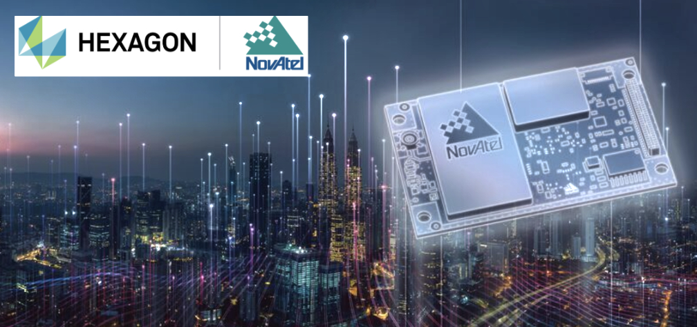
Hexagon│NovAtel’s OEM7 GNSS receivers have successfully tracked Xona Space Systems PULSAR signals generated by a simulator from Spirent Communications. This test proved NovAtel GNSS receivers can track a Spirent simulated L-band signal identical to the PULSAR signal broadcast by Xona’s low-Earth orbit (LEO) satellites.
The Xona LEO signals will complement GNSS, improving resiliency, security, and precision for positioning, navigation and timing (PNT).
“Using Spirent’s simulated PULSAR signal, we have successfully tested our receiver’s capability to track the L-band signal planned to be broadcast from Xona’s LEO satellites,” Sandy Kennedy, VP of innovation at Hexagon’s Autonomy and Positioning division, said. “The OEM7 is a powerful platform, designed for both resiliency and flexibility; it is exciting to test our forethought by trialing this new signal type.”
Join Hexagon│NovAtel on Thursday, June 15, at the ION Joint Navigation Conference (JNC) where it will co-present “Testing of LEO PNT for Resilience in GNSS Contested Environments.”

A roundup of recent products in the GNSS and inertial positioning industry from the March 2023 issue of GPS World magazine.
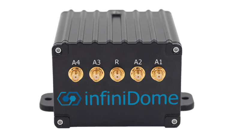
Anti-Jamming Device
Provides protection from three directions of attack
The GPSdome 2 is tailored to defend small- to medium-sized tactical UAVs as well as manned and unmanned ground vehicles. With a small form factor (500 g, 87 mm x 91 mm x 61.55 mm) and minimal power consumption, GPSdome 2 is suitable for loitering munitions as well as UAVs. Fully retrofit and completely standalone, the system is compatible with almost any off-the-shelf GNSS receiver as well as standard active GNSS antennas, meaning that it can be integrated into existing GPS systems or into new product lines, manned or unmanned. With sophisticated algorithms and a proprietary RFIC, GPSdome 2 analyzes RF interference in the environment and combines multiple antenna patterns to create and dynamically steer three nulls in the direction of any hostile signal. GPSdome 2 provides simultaneous dual-frequency protection (GPS L1 + L2 or GPS L1 + GLONASS G1), creating up to three nulls, protecting from three jamming directions within each band in real time, making it suitable for PNT applications. The GPSdome 2 is a dual-use, non-ITAR device and comes with optional mil-spec compliance.
InfiniDome, infinidome.com

Command and Control
Designed for easy integration
The SkyLine C2 management platform and muLTElink airborne radio systems (ARS) are designed to integrate, which enables a self-healing command-and-control network capable of both path and link diversity. This eliminates lost-link possibilities over broad terrain and altitude ranges. MuLTElink ARS consists of two models — muLTElink915 and muLTElink5060, the core of the uAvionix C2 system. The muLTElink915 model combines globally licensed aviation LTE, enhanced with frequency hopping 902 MHz – 928 MHz industrial, scientific and medical frequencies capability. The muLTElink5060 model combines global LTE with aviation-protected 5,030 MHz – 5,091 MHz C-band. Each muLTElink model allows up to one external CNPC radio to be optionally connected to allow simultaneous use of all three frequency ranges, higher power C-band operation or future radio integrations.
uAvionix, uAvionix.com

VTOL UAV
With Sony a7R mark III and IV camera
Atmos has integrated the Sony a7R mark III and IV cameras into its vertical take-off and landing (VTOL) fixed-wing UAV, the Marlyn Cobalt. This will increase coverage and accuracy achieved in a single flight for surveyors. Both cameras have an ISO of 32,000, which is expandable to 102,400, and camera sensors with high megapixel count — 42,4 MP for the a7R III and 61 MP for the a7R IV. When combined with Zeiss’ 35 mm and 21 mm lenses, it enables UAV surveyors to achieve ground sample distance levels below one 1 cm. The integration of the two cameras enables Marlyn Cobalt users to map an area of 210 ha with centimeter-level accuracy in a single flight.
Atmos, atmosuav.com


UAV and Lidar Systems
Suitable for geospatial professionals
TrueView 535 consists of updated lidar sensors, adding a third return, increasing mapping abilities below canopy. An additional third nadir camera offers another point of view and improves photogrammetry quality. It also includes a longer, usable lidar range to increase flexibility. TrueView 720 is a fourth-generation Riegl VUX-120 with three laser beam orientations. It provides high-point density corridor mapping. Using the Riegl VUX-120 with three laser beam orientations (nadir, +10 degrees forward and –10 degrees backward) and three oblique/nadir cameras enables data collection from more surfaces in one flight path. One application of TrueView 720 is scanning power lines. Users can capture the poles vertically, front and back. The extreme range of this system means it can be integrated with UAVs, airplanes or helicopters. In addition to the two sensor payloads, GeoCue has launched its LP360 software add-on for processing and visualization — the 3D Accuracy and the Accuracy Star hardware.
GeoCue, geocue.com
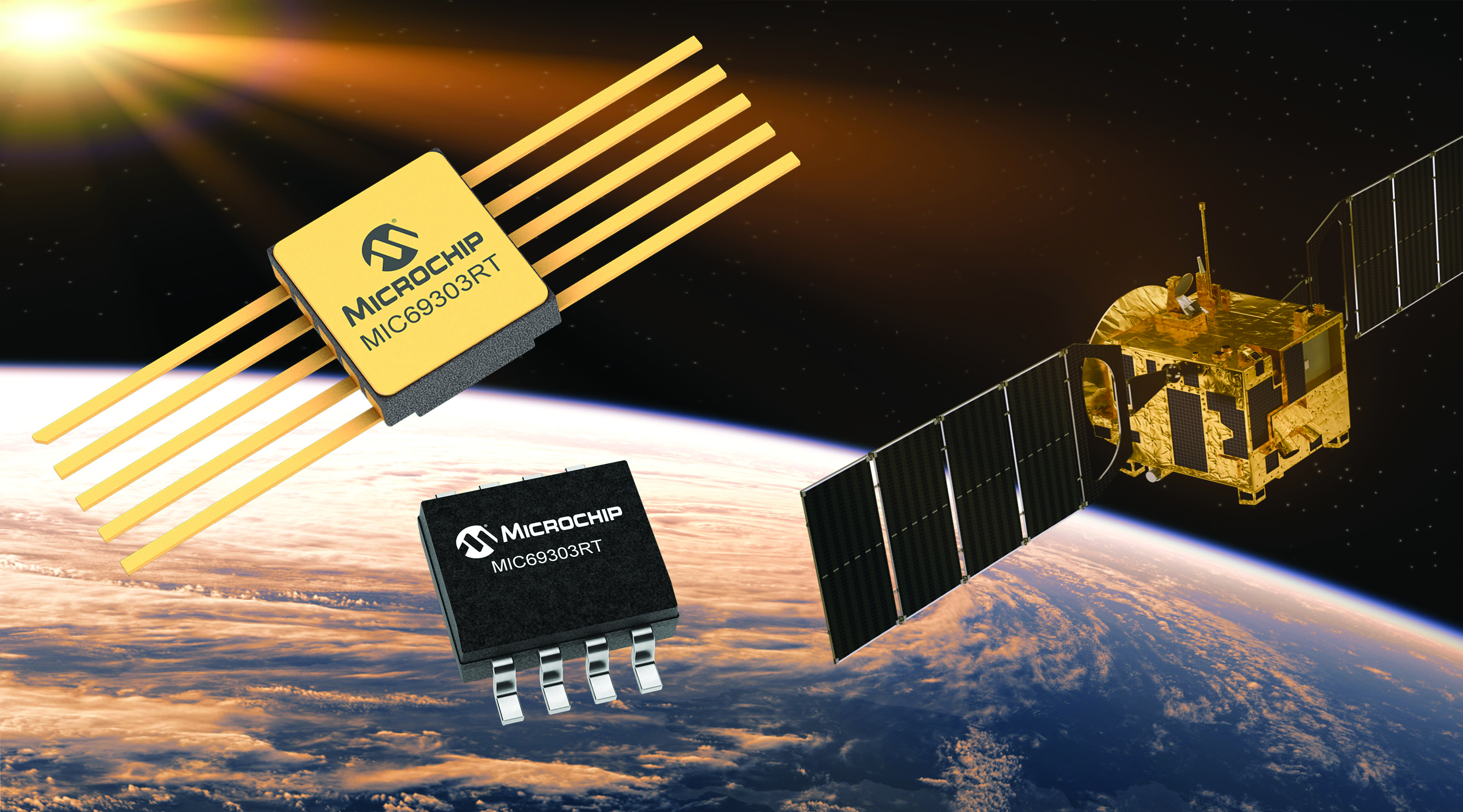
Voltage Regulator
Device for LEO space application
The MIC69303RT is a radiation-tolerant power management device for space application developers. It is a high-current, low-voltage device targeting low-Earth orbit space applications. The MIC69303RT operates from a single low-voltage supply of 1.65 v to 5.5 v and can supply output voltages as low as 0.5 v at high currents. It offers high-precision and low dropout voltages of 500 mv under extreme conditions. The MIC69303RT is a companion power source solution for microcontrollers, such as the SAM71Q21RT and PolarFire field-programmable gate arrays. MIC69303RT is designed for harsh aerospace applications and remains operational in temperature ranges from -55 C to +125 C.
Microchip Technology, microchip.com

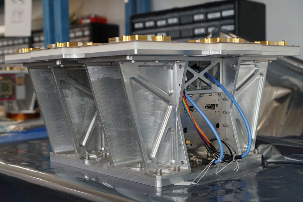
LEO Satellite Device
Designed for GNSS/PNT lab testing
SimORBIT is a low-Earth-orbit (LEO) satellite solution software designed to aid developers in determining LEO orbits more accurately for GNSS/PNT lab testing. The software replicates LEO orbits so that simulations can provide the realistic environment of a LEO satellite, including gravitational and atmospheric impacts the satellite could encounter in space. Developers can create non-ICD signals via I/Q injection, or by the “Flex” feature, generating space-centered PNT signals to be developed in the lab as realistically as possible. Spirent Communications developed SimORBIT in partnership with SpacePNT.
Spirent Communications, spirent.com
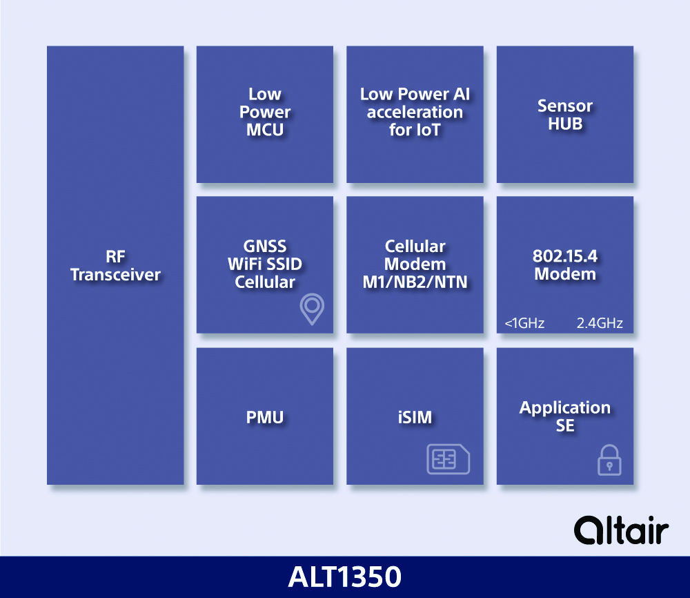
5G Chipset
Includes GNSS
The ALT1350 implements GNSS, cellular and Wi-Fi-based location in a single chipset. The cellular LTE-M/NB-IoT chipset is designed to enable additional low-power, wide-area (LPWA) communication protocols; intermittent LTE and GNSS (GPS/GLONASS) navigation for low-cost applications; and concurrent LTE and L1/L5 GNSS for tracking applications. The ALT1350 incorporates a sensor hub to collect data from the sensors while maintaining ultra-low power consumption. It also provides cellular and Wi-Fi-based positioning and is tightly integrated to provide power-optimized concurrent LTE and GNSS to accommodate various tracking applications, which can be demanding with a single chip. The chip is designed to enable deployments for the internet of things (IoT), including location technologies.
Sony, altair.sony-semicon.com
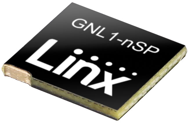
Embedded Antenna
Supports multiple satellite constellations
The ANT-GNL1-nSP is a surface-mount embedded GNSS antenna supporting GPS, Galileo, GLONASS, BeiDou and QZSS in the L1/E1/B1 bands. The ANT-GNL1-nSP antenna exhibits high performance in a compact size (10 mm x 8 mm x 1 mm) and features linear polarization and an omnidirectional radiation pattern. The antenna is available in tape and reel packaging and is designed for reflow-solder mounting directly to a printed circuit board for high-volume applications.
Linx Technologies, linxtechnologies.com
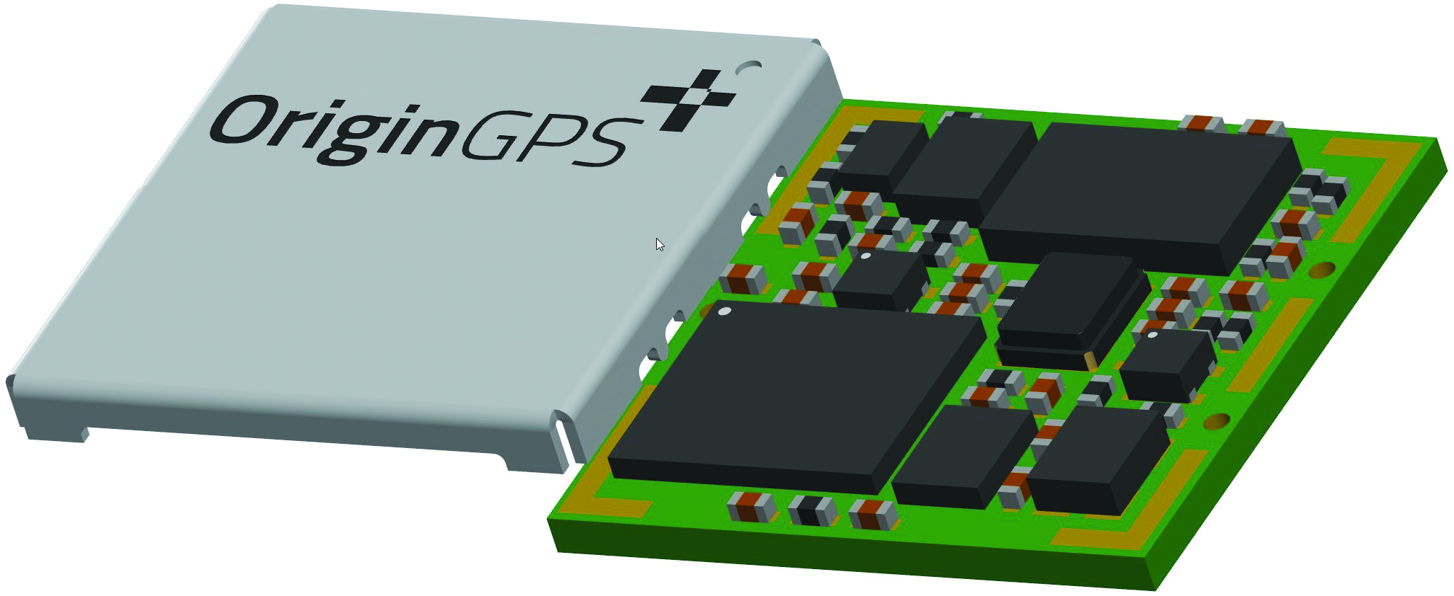
GNSS Module
Based on a MediaTek chipset
The ORG4600-MK01 dual-frequency module provides higher precision than the company’s previous modules. It has sub-1 m precision at a cost lower than that of the company’s first L1+L5 module, the ORG4600-B01, which is based on Broadcom’s chipset. The 10 mm x 10 mm ORG4600-MK01 was designed for applications deployed in challenging environmental conditions. The solution also includes RTCM, a logger and accurate orbit prediction.
OriginGPS, origingps.com
Navigation Software
Includes enhancements to existing software and more
Navigation software development kit version 2.9 provides pre-built applications compatible with Android and IOS. SDK v2.9 provides the primary navigation components across a workflow using lines of code instead of starting from square one. The drop-in user interface is customizable to reflect a developer’s brand, obviating the need to manually develop a full end-to-end application. Navigation SDK Copilot — a backend analytics tool for CX on navigation applications — collects trace files of navigation sessions and search analytics data from users. Developers can use this data to gather feedback and collective user data to create touch points with users and improve application experience based on their data-drawn conclusions. Matrix API has been updated to support scheduled departure times and provide optimal driving routes, creating a more accurate estimated time of arrival.
Mapbox, mapbox.com

Defense Platform
For developing Android applications
LuciadCPillar is designed for the development of mobile applications for dismounted soldiers in the field. Developers can build applications with 2D and 3D views. It features military symbology and supports many geospatial data types including vector data, raster data, elevation data, point clouds and 3D meshes. It has the same capabilities found in desktops, in-vehicle and browser applications built with LuciadLightspeed, LuciadCPillar and LuciadRIA. The platform offers capabilities to match high-resolution screens, graphic processing units and multi-core processors including the ability to display 3D data in mobile applications. LuciadCPillar supports ARM processors and an application programming interface, which aligns with the Android developer experience. Impact, a French system integrator, partnered with Hexagon to test LuciadCPillar and will integrate it into its Delta Suite product, which is used by the French Special Operations Command. LuciadCPillar is part of Luciad 2022.1, which is available now globally.
Hexagon, hexagon.com

Surface Mapping
Designed for 3D surface mapping
The Surfer package is designed for 3D surface mapping and provides robust subsurface visualization and modeling functionality by incorporating many true 3D gridding and visualization tools. With the enhanced functionality, users can now model an additional variable, a C variable, such as a contaminant or chemical concentration, along with the traditional X, Y, Z values. Surfer also includes the ability to create a 2D map of a slice-through 3D grid, which users can move up and down through the grid, illustrating how the C value changes with depth. Part of Surfer’s enhancements is isosurface creation, enabling visualization of the 3D grid in the 3D view as an isosurface, providing another way to see how C data varies with depth or elevation. The new 3D-rendered volume functionality also allows users to visualize the 3D grid in the 3D view as a solid body by assigning colors to different C values, highlighting variations in the data.
Golden Software, goldensoftware.com


As we begin 2023, GNSS development continues apace, as described in this issue’s annual “Directions” section by representatives of Galileo, GLONASS, and BeiDou. We plan to publish a similar update on the GPS program soon.
Galileo’s user base now stands at more than 3.5 billion, and the services it provides continue to improve and expand. Beginning early this year, free precise point positioning (PPP) corrections for Galileo and GPS (single- and multi-frequency) will improve real-time user position by up to 10 times. While the discontinuation of Soyuz launch services from the Kourou Space Centre in French Guiana, due to the Russia-Ukraine conflict, delayed the two Galileo launches that had been planned for last year, 2022 was a key year for the development of Galileo Second Generation (G2G) satellites. They will provide, among other innovations, a reconfigurable fully digital navigation payload, point-to-point connection between satellites, and advanced jamming and spoofing protection mechanisms.
On Nov. 29, 2022, Russia launched the 51st Glonass-M satellite, about 20 years after launching the first one. Currently, 13 of these satellites are operating beyond their guaranteed lifetime, with an average orbit lifetime of more than 10 years. Starting this year, the constellation will be renewed by Glonass-K and Glonass-K2 satellites, which provide CDMA signals to users.
Currently, 45 BDS satellites are operational in orbits, including 15 BDS-2 satellites and 30 BDS-3 satellites. The constellation says that it has reached a continuity of 99.996% and an availability of 99%, with a global positioning accuracy better than 1.5 meters horizontally and 2.5 meters vertically (95% confidence).
Tracy Cozzens, who has been a pillar of this magazine for 17 years, is retiring this month. We will miss her journalistic acumen, dedication to clarity and style, attention to detail, and wealth of institutional knowledge. We wish her a well-deserved retirement. At the same time, we welcome aboard Maddie Saines, our new managing editor, who is near the beginning of her career.
I am pleased to announce that Rob VanBrunt has joined GPS World’s Editorial Advisory Board. In mid-December, the board of directors of Spirent Federal Systems, a provider of PNT test solutions for the U.S. government and contractors, appointed him as the company’s president/CEO-designate, a role he will assume when the onboarding process is complete.
VanBrunt began his career at Spirent Communications in 1990 as product developer and manager, and then held posts of increasing responsibilities, moving to director and vice president roles focused on management, strategy and mergers and acquisitions. Most recently, he was executive vice president in the Office of Business Excellence. VanBrunt has a B.S. in electrical and electronics engineering from Rutgers University.
Spirent Communications is a global provider of automated test and assurance solutions for networks, cybersecurity and positioning. In July 2001, the company formed Spirent Federal Systems as a wholly owned subsidiary and U.S. proxy company. Spirent Federal markets and sells Spirent Communications’ products in North America. It also provides value-added features and ongoing customer support.
On Jan. 1, I lost my beloved mother, Maristella “Mimi” Luccio. She was 87.
Matteo Luccio | Editor-in-Chief
[email protected]

Spirent Communications announced that the Spirent GSS7000 GNSS simulator has been integrated into Microwave Vision Group (MVG) over-the-air (OTA) and passive antenna test systems.
MVG, an antenna measurement solutions company, enables the characterization and evaluation of antennas for testing wireless connectivity, reliability, and standards compliance. MVG near-field test systems perform fast and accurate measurements for OTA tests of antennas designed for satellite communications and other GNSS-enabled products, systems, and networks.
As connectivity in industries such as automotive, aviation and military becomes ever more sophisticated, the need to ensure that all the pieces of technology work together in the way they should increases. The integration of Spirent into MVG test systems enables R&D engineers to incorporate the antenna and the vehicle in a test environment that represents the real-world signal environment as closely as possible while maintaining full control and repeatability.
“Our integration into MVG over-the-air test systems, such as the multi-probe SG24 or StarLab, delivers a cutting-edge testing solution, helping to accelerate the development of next-generation products and systems,” says Adam Price, VP of PNT Simulation at Spirent.
GNSS positioning company recognized for continued international trade success
![]() The positioning technology business of Spirent Communications has been honored with a prestigious Queen’s Award for Enterprise.
The positioning technology business of Spirent Communications has been honored with a prestigious Queen’s Award for Enterprise.
Spirent is one of only 226 organizations in the United Kingdom to be recognized with the Queen’s Award, which acknowledges the company’s excellence in international trade.
Spirent is headquartered in the UK, with its positioning business in Paignton, Devon, developing and manufacturing positioning, navigation and timing (PNT) test solutions. It also has a research and development facility in Daventry, Northamptonshire.
“As reliance on PNT technology continues to grow, our positioning technology business is the trusted partner of the world’s foremost PNT developers, delivering maximum performance without compromise through our dedicated test and validation solutions,” said Martin Foulger, general manager, Spirent Positioning. “We are honored to receive the prestigious Queen’s Award accolade, which is testament to the hard work of our employees in enabling us to achieve such tremendous success worldwide.”
Powered by its international trade, its exports outside of the UK represent a significant proportion of its business, serving a global customer base across five continents and more than 40 countries. Its technology has represented the global gold standard for commercial and government research and development facilities since the inception of GPS.
Its core business is the simulation of GNSS signals in laboratories for the development of applications used in advanced aircraft, chipsets, satellites, smartphones, cars, autonomous systems, marine vessels and defense systems, as well as the navigation systems themselves.
“Market leaders who are developing PNT applications have placed their trust in our test solutions for decades due to our unrivaled performance, realism and reliability,” said Foulger. “Furthermore, Spirent expertise is directly enabling and driving innovation in connected and autonomous vehicles and machine learning, as well as helping to make the world more sustainable through working closely with fields such as smart cities and precision agriculture.”
Now in its 56th year, the Queen’s Award are the most prestigious awards for businesses in the UK and a globally recognized royal seal of approval for companies. As a winner of the award, Spirent is permitted to display the esteemed Queen’s Awards Emblem for the next five years.