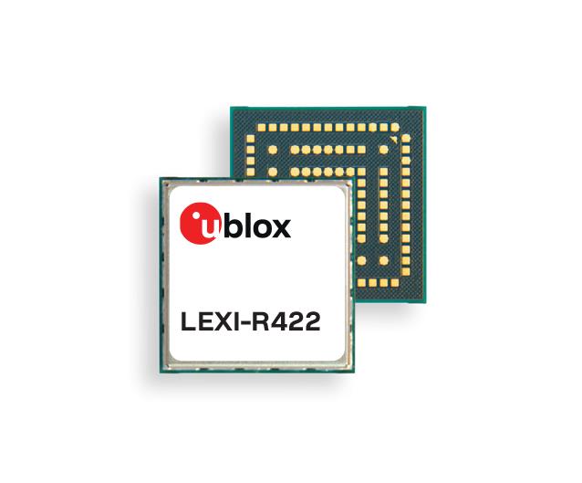
u-blox has released the LEXI-R4, a module customized for size-constrained application requirements. The device is suitable for small asset trackers, such as pet and personal trackers, micro-mobility devices, and luggage tags.
Image: u-blox
The LEXI-R4 module supports all LTE-M and NB-internet of things (IoT) bands, with an RF output power of 23 dBm. It is natively designed to support GNSS AT commands, and its dedicated port enables easy integration with any u-blox M10-based GNSS module, such as the MIA-M10.
Additionally, the module can connect to additional positioning services, such as AssistNow and CellLocate.
The compact size of the module, measuring 16 mm x 16 mm, results from a 40% footprint reduction in dimensions compared to the previous u-blox SARA-R4. Due to its small size, remaining space could host larger antennas, which can improve RF performance, or accommodate larger-size batteries.
Another feature of the LEXI-R4 is its 2G fallback capability. Whenever LTE-M/NB-IoT coverage conditions are not optimal, it continues to function by falling back onto a 2G network. The company said this feature could be helpful in countries where LTE-M/NB-IoT networks have yet to be fully deployed.
A roundup of recent products in the GNSS and inertial positioning industry from the July 2023 issue of GPS World magazine.
TIMING
PTP Firmware To synchronize accurate time from GNSS
The 7.09.00 firmware with a precise timing protocol (PTP) feature enables users to synchronize accurate time from GNSS with other devices and sensors on a shared network. The 7.09.00 firmware’s PTP feature brings stable timing to a user’s other sensor systems connected through a local network to best support positioning, navigation and timing (PNT) and automotive and autonomous applications. The firmware includes SPAN GNSS+INS technology improvements — including a secondary INS solution for built-in redundancy and reliability in challenging conditions. The enhancements are available on all OEM7 cards and enclosures, including all PwrPak7 and CPT7 enclosure variants. The 7.09.00 firmware also features improvements to the time to first fix, a secondary SPAN solution for a more accurate and reliable GNSS+INS output and more. The 7.09.00 firmware is not for precision agriculture applications and is not supported on NovAtel’s SMART antenna products. Hexagon | NovAtel, novatel.com
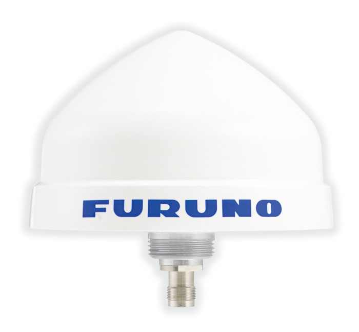
Timing Antenna A multi-GNSS and high-performance device
The AU-500 antenna is suitable for time synchronization applications. It supports all constellations in the L1 and L5 bands, including GPS, QZSS, GLONASS, Galileo, BeiDou, and NavIC. A built-in noise filter eliminates interference in the vicinity of 1.5 GHz caused by 4G/LTE mobile base stations as well as other radio waves that can adversely affect GNSS reception. The antenna is equipped with lightening protection and features a high-quality polymer radome that prevents snow accumulation. It is also waterproof and dustproof in compliance with IP67. The AU-500 achieves the best performance in time accuracy and robustness fundamental in critical infrastructure, when combined with Furuno’s GNSS receiver, GT-100. The antenna will be available this month. Furuno, furuno.com
Timing Module Dual-band and secure for 5G communications
The NEO-F10T offers nanosecond-level timing accuracy, meeting the stringent timing requirements for 5G communications. It is compliant with the u-blox NEO form factor (12.2 mm x 16 mm), allowing space-constrained designs to be realized without the need to compromise on size. The NEO-F10T is the successor to the NEO-M8T module, providing an easy upgrade path to dual-band timing technology. This allows NEO-M8T users to access nanosecond-level timing accuracy and enhanced security. Dual-band technology mitigates ionospheric errors and greatly reduces timing errors, without the need of an external GNSS correction service. Additionally, when within the operational area of a satellite-based augmentation system (SBAS), the NEO-F10T offers the possibility to improve the timing performance by using the ionospheric corrections provided by the SBAS system.
The NEO-F10T supports all four GNSS and L1/L5/E5a configurations, simplifying global deployments. It includes advanced security features such as secure boot, secure interfaces, configuration lock and T-RAIM to provide the highest-level timing integrity and ensure reliable, uninterrupted service. u-blox, u-blox.com
MOBILE
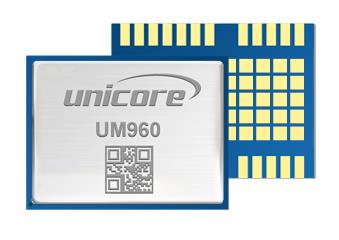
Image: Unicore Communications
GNSS RTK Module A high precision module for multiple applications
The UM960 module can be used for a wide range of applications, such as robotic mowers, deformation monitoring, UAVs, handheld GIS, and more. It features a high position fix rate and provides accurate and reliable GNSS positioning data. The UM960 module supports BDS B1I/B2I/B3I/B1c/B2a, GPS L1/L2/L5, Galileo E1/E5b/E5a, GLONASS G1/G2, and QZSS L1/L2/L5. The module also has 1,408 channels. In addition to its small size, the UM960 features low power consumption — less than 450 mW. The UM960 also supports single point positioning and real-time kinematic (RTK) positioning data output at 20 Hz. Unicore Communications, unicore.eu
CRPA System A GPS/GNSS anti-jamming system
This system eliminates interference by applying novel beam forming techniques. With an 8-array CRPA antenna, the system can assure the normal operation of a GNSS receiver in the presence of multiple jamming sources. The anti-jam GNSS CRPA system can be deployed using various configurations and operates with civil and military GPS receivers for land, sea, air platforms (including unmanned aerial systems), and fixed installations. The device has an embedded GNSS receiver that supports all satellite constellations. The device is lightweight and compact. It requires minimal integration training and easily integrates into new or legacy platforms. The antenna also offers assured positioning, navigation and timing. Tualcom, tualcom.com
IoT Antennas Rugged and designed to enhance connectivity
KP Performance Antennas’ internet of things (IoT) multiband combination antennas are designed to enhance connectivity for vehicle fleets and base stations. The IoT multiband combination antennas have dedicated ports for cellular, Wi-Fi and GPS bands. They are also indoor and outdoor IP69K rated and can withstand harsh environmental conditions, such as extreme temperatures, water and dust. The antennas are suitable for transportation emergency response and agriculture applications. The IoT multiband combination antennas are in-stock and available now.
KP Performance Antennas, kpperformance.com
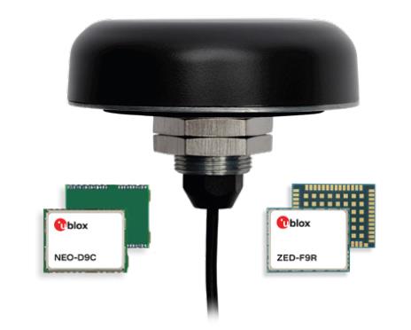
Smart Antennas With integrated technology for centimeter-accuracy
PointPerfect PPP-RTK augmented smart antennas combine the ZED-F9R high precision GNSS and the NEO-D9S L-band receivers from u-blox and Tallysman Accutenna technology. The multi-band (L1/L2 or L1/L5) architecture removes ionospheric errors, and the multi-stage enhanced XF filtering improves noise immunity while relying on the dual-feed Accutenna element to mitigate multi-path signal interference rejection. Some versions of the new smart antenna solutions include an inertial measurement unit (for dead reckoning) and an integrated L-band corrections receiver to ensure operation beyond terrestrial network reach. The PointPerfect GNSS augmentation service is now available in North America, Europe and parts of Asia Pacific. Tallysman Wireless, tallysman.com/u-blox, u-blox.com
SURVEYING & MAPPING
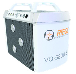
Airborne Laser Scanner Suitable for mapping applications
The compact and lightweight VQ-580 II-S meets the increasing requirements of compact laser scanners for medium- and wide-area mapping as well as for corridor mapping. The successor of the VQ-580 II airborne laser scanner, provides a maximum measurement range of 2.45 m. It can be integrated with gyro-stabilized mounts as well as into the VQX-1 Wing Pod. It features high accuracy ranging based on waveform-lidar technology. The VQ-580 II-S also has a mechanical and electrical interface for inertial measurement unit (IMU)/GNSS integration. RIEGL, rieglusa.com
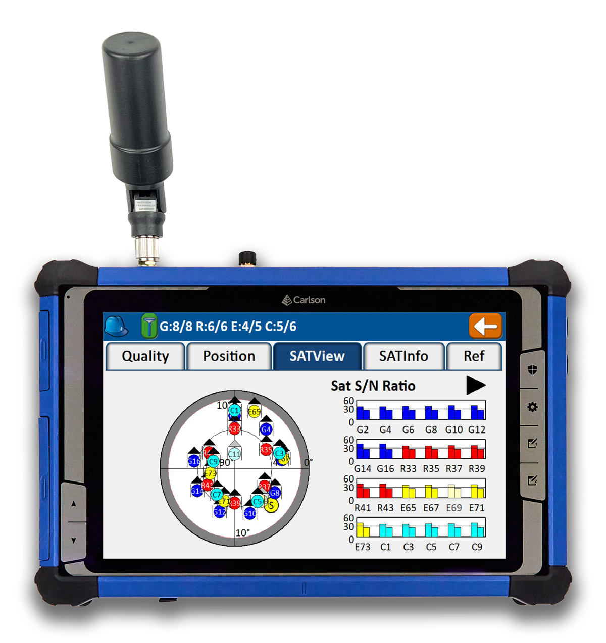
Tablet and GNSS Solution For surveying applications
The RT5 rugged tablet data collector and the RTk5 GNSS solution, which integrate the form factor of the RT5 with real-time kinematic GNSS performance, are suitable for land surveyors, engineers, GIS professionals, and users in need of advanced GNSS positioning with an RTK rover. The RT5 is designed for surveying, stakeouts, construction layout and GIS mapping, and is bundled with Carlson SurvPC — the Windows-based data collection program. The RT5 can run SurvPC with Esri OEM for use in the field. The RTk5 adds an advanced GNSS solution to the RT5, enabling accuracy in a compact, light and versatile package. It comes with a custom-built pole and cradle, a survey-grade antenna, and a small portable helix antenna for handheld GNSS use. Carlson Software, carlsonsw.com
Lidar and RGB Solution Suitable for aerial surveying
The Zenmuse L1 integrates a Livox lidar module, a high-accuracy inertial measurement unit (IMU), and a camera with a 1 in CMOS on a 3-axis stabilized gimbal. When used with Matrice 300 real-time kinematic (RTK) and DJI Terra, the L1 forms a complete solution that gives users real-time 3D data, capturing the details of complex structures and delivering highly accurate reconstructed models. Users can render centimeter-accurate reconstructions with the high-accuracy IMU, a vision sensor for positioning accuracy, and the incorporation of GNSS data. The solution’s IP54 rating allows the L1 to be operated in rainy or foggy environments. The lidar module’s active scanning method enables users to fly at night. DJI Enterprise, enterprise.dji.com
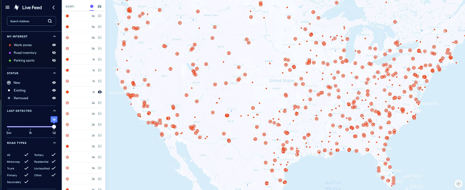
Mapping Platform Real-time, crowd-sourced map data
CityStream Live is a real-time mapping (RTM) platform that enables the mobility industry — including connected vehicles, maps, mobility services, digital twins or smart city applications — to access a continuous stream of crowdsourced road data. This platform provides real-time data on nearly every road across the United States at a reduced cost. Utilizing a crowdsourcing network and artificial intelligence software, CityStream Live offers users and developers a live data feed to increase situational awareness, enhance driving capabilities, increase safety and more. By combining massive data aggregation with real-time data curation, CityStream Live is the first platform to deliver road data streams in real time and at scale, supporting several urban and highway use cases. Nexar, us.getnexar.com
Leica iCON gps 160 (Image: Leica Geosystems)
Smart Antenna Contains features that increase productivity on construction sites
The iCON gps 160 is a versatile solution for various applications. It can be used as a base station, as a rover or for machine guidance. The device is a modernization and enhancement of the successful Leica iCON gps 60, which has been well accepted in the market. The result is a smaller, more compact GNSS antenna with additional features and a larger display for ease of use. The Leica iCON gps 160 is particularly suited to complex construction environments with different GNSS requirements because the ability to switch between the different applications is at the users’ fingertips. Besides checking grade, cut and fill, stakeout points and lines, users can also benefit from using this solution for basic-level GNSS machine guidance. It has an integrated color display, a user-friendly interface, smart setup wizards and an intuitive construction-specific workflow to help contractors get the most out of their investment from day one. Size and weight reductions make the iCON gps 160 easy to handle, while the latest GNSS and communication technologies improve data reception. Leica Geosystems, leica-geosystems.com
UAV
Positioning Solution For UAV delivery applications
The PX-1 RTX is designed for accurate, robust positioning and heading for commercial UAV delivery applications. This solution enables UAV integration companies to add precise positioning capabilities so operators can plan and execute takeoff, navigation and landing tasks as UAV delivery advances to take on more challenging operations. The PX-1 RTX leverages CenterPoint RTX corrections and small, high-performance GNSS-inertial hardware to provide real-time, centimeter-level positioning and accurate inertial-derived true heading measurements. This solution allows operators precise control of UAVs during takeoff and landing to tackle more demanding operations in tight or partially obstructed spaces. It also minimizes operational risks from poor sensor performance or magnetic interference by ensuring greater positioning redundancy, which is especially important as commercial UAV delivery operations venture into difficult urban and suburban environments. Trimble Applanix, applanix.com
Certification Reference Guide A guide for the AAM industry
Business and government leaders, engineers, members of the media and any user with an interest in the future of flight can use the Honeywell State of UAS and UAM Certification Guide to help navigate and communicate the complexities of vehicle certification and operational approval across multiple vehicle segments. Industry professionals can access the living document online at aerospace.honeywell.com/us/en/products-and-services/industry/urban-air-mobility. The certification reference guide summarizes evolving Federal Aviation Administration and European Union Aviation Safety Agency rules across multiple advanced air mobility (AAM) segments. It also links to documents that AAM professionals can reference to better understand detailed certification requirements. Honeywell Aerospace, aerospace.honeywell.com
Image: A2Z Drone Delivery
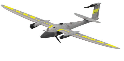
Delivery UAV Suitable for aerial mapping, UAV inspection, forestry services, search and rescue operations, water sample collection, offshore deliveries, mining, and more
The RDSX Pelican leverages a hybrid vertical takeoff and landing (VTOL) airframe with no control surfaces to combine the reliability and flight stability of a multirotor platform, with the extended range of a fixed-wing craft. With no ailerons, elevator, or rudder, the Pelican’s durable design eliminates common points of failure and extends operational time between maintenance overhauls. Designed to meet the 55 lb takeoff weight limitation for Federal Aviation Administration Part 107 compliance, the Pelican can carry payloads of 5 kg on missions up to 40 km, roundtrip. The Pelican can be optimized for extended range operations or to deliver payloads from altitude with the company’s RDS2 UAV delivery winch. Available in multiple configurations, the RDSX Pelican can be customized for an array of missions. The Pelican enables deliveries from altitude where spinning propellers are kept far from people and property, mitigating consumer privacy concerns of low-flying UAVs while abating intrusive rotor noise. Alternatively, for missions in which the UAV can safely land at its destination, a simple servo-release mechanism can release payloads and expand the Pelican’s payload capacity.
A2Z Drone Delivery, a2zdronedelivery.com
UAS Suitable for mapping applications
The Trinity Pro UAS features Quantum-Skynode autopilot, using a Linux mission computer. This provides additional onboard computing power, increased internal storage, versatility and interoperability. Included in the Trinity Pro system is QBase 3D operations software. As the Trinity Pro is built on the Trinity F90+ UAS, its new capabilities include planning functions for missions requiring takeoff and landing at different locations, allowing for efficient and safe long corridor flights and beyond visual line of sight operations. The platform also incorporates advanced self-diagnostics to ensure safe operation. The UAS now includes an enhanced terrain- following system. Additionally, improvements to trigger point calculations results in improved image overlap and higher data quality. The Trinity Pro features automatic wind simulation for crash avoidance in bad weather and a linear approach for landing. The UAS is equipped with a downfacing lidar scanner that provides highly accurate ground avoidance and landing control. The system features USB-C ports for faster data transfer. The Trinity Pro is protected against dust and water damage and features increased wind limits of up to 14 m/s in cruise mode and 11 m/s during hover.
Quantum Systems, quantum-systems.com
U-blox has released two modules based on the u-blox F9 high-precision GNSS platform. The low-power NEO-F9P supports precise navigation and automation of moving industrial machinery, and the ZED-F9P-15B provides customers in the mobile robotics market with an L1/L5 option in addition to the L1/L2 bands.
The NEO-F9P and the ZED-F9P-15B GNSS modules feature concurrent reception of GPS, Galileo, and BeiDou; multi-band L1/L5 real-time kinematic; short convergence times; and reliable performance. The modules deliver centimeter-level accuracy in seconds and comes in small, high-precision module form factors.
Image: u-blox
This small size, coupled with very low power consumption and ANN-MB1 antenna compatibility, makes the NEO-F9P suitable for a wide range of uses. Offering reliable and efficient positioning, the module supports open as well as standards-based correction services for enhanced performance, such as the u-blox PointPerfect GNSS augmentation service.
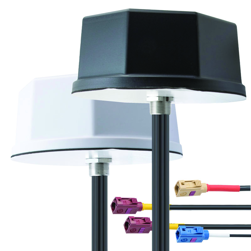
Tallysman Wireless and u-blox have partnered to develop PointPerfect precise point positioning real-time kinematic augmented smart antennas.
The ZED-F9R high precision GNSS and the NEO-D9S L-band receivers from u-blox have been integrated with Tallysman’s technology. The product integration will provide accuracy and precision.
The multi-band (L1/L2 or L1/L5) architecture removes ionospheric errors, and the multi-stage enhanced XF filtering improves noise immunity while relying on the dual-feed Tallysman Accutenna element to mitigate multi-path signal interference rejection. Some versions of the new smart antenna solutions include an inertial measurement unit (dead reckoning) and an integrated L-band corrections receiver to ensure operation beyond terrestrial network reach.
The PointPerfect GNSS augmentation service is now available in North America, Europe and parts of Asia Pacific.
Septentrio, a leader in high-precision GNSS positioning solutions, has launched the Agnostic Corrections Partner Program.
The program facilitates the use of Septentrio receivers with high-accuracy services that provide varying levels of accuracy, coverage and delivery methods. This also allows users to select the service that suits specific applications and business models.
The Agnostic Correction Partner Program, which includes Polaris from Point One, Skylark from Swift Navigation, and PointPerfect from u-blox, provides documentation for the use of Septentrio receivers with these high-accuracy services.
Agnostic GNSS corrections refer to correction services that are not specific to a particular GNSS receiver or device. It provides correction data that can be used by any receiver that can process the correction signal. Agnostic corrections are useful in situations where multiple types of GNSS receivers are being used, such as in a large-scale surveying project or in a fleet of vehicles that use different types of navigation systems.
U-blox has signed an agreement with GMV to combine GNSS receiver hardware from u-blox with GMV’s safe correction service and sensor fusion and positioning engine. This solution is suitable for automotive applications because it provides a holistic safety approach that maximizes performance and minimizes timetomarket costs.
Starting in April 2023, u-blox will directly commercialize the solution. This includes integration services and certification support provided jointly by u-blox and GMV for applications such as ADAS Level 2+ and vehicle autonomy.
The collaboration was forged at the recent Mobile World Congress (MWC), Barcelona 2023. The two companies will work hand in hand to integrate their technologies and provide a solution for the needs of future automotive application
A roundup of recent products in the GNSS and inertial positioning industry from the February 2023 issue of GPS World magazine.
SURVEYING & MAPPING
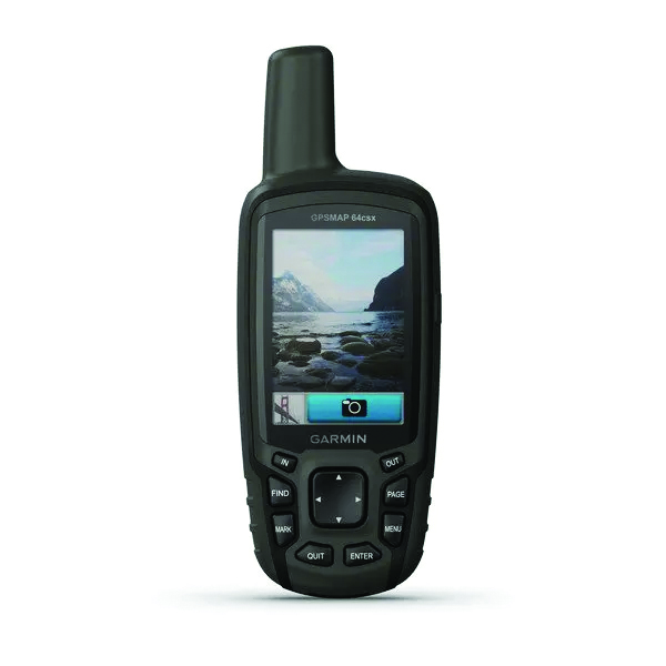
GPSMAP 64csx handheld GPS receiver (Image: Gamin)
Handheld GPS With navigation sensors and camera
The GPSMAP 64csx handheld GPS receiver comes with multi-GNSS support, TopoActive mapping, barometric altimeter, three-axis compass, and wireless connectivity via Bluetooth and ANT+ technology. It also has an 8 MP autofocus camera. The GPSMAP 64csx is built to withstand rugged terrain and is water-resistant. The highly sensitive receiver and quad helix antenna provide support from GPS, GLONASS and Galileo. Preloaded TopoActive maps include waterways, natural features, buildings and international boundaries. It is compatible with smartphones so users can receive email and text messages and share location data with others. Garmin, garmin.com
The Venus Laser RTK receiver comes with an inertial measurement unit. It can be used in its traditional mode with a range pole, or in laser mode without a pole, enabling GNSS surveying beyond typical limitations. In traditional mode, it has tilt compensation of up to 60° with an accuracy of 2.5 cm; in laser mode, it has the same tilt compensation but an accuracy of 5.5 cm. The receiver is powered by a SinoGNSS K8 high-precision module capable of up to 1,590 channels. It can survey using GPS, BDS-2, BDS-3, GLONASS, Galileo, QZSS and SBAS constellations. Other features include Bluetooth connectivity, more than 20 hours of battery life, and ruggedness (it is dust and waterproof and is designed to survive a two-meter drop). ComNav Technology Ltd., comnavtech.com
Leica iCON gps 160 (Image: Leica Geosystems)
Smart Antenna With features to increase productivity on the construction site
The Leica iCON gps 160 is a next-generation construction smart antenna designed to increase productivity in stakeout and measurement applications on the jobsite. It features a large color display with clear navigation for quick and easy setup without additional hardware. It is optionally available with an inertial measurement unit (IMU) for tilt-compensation functionality up to 20°. It seamlessly integrates with all Leica iCON construction instruments and controllers as well as the iCON field software for precise, real-time verification. Leica Geosystems, leica-geosystems.com
The Xsens Vision Navigator (Image: Movella)
GNSS inertial navigation Integrates position inputs from three high-accuracy sources
The Xsens Vision Navigator integrates position inputs from three high-accuracy sources including dual-antenna real-time kinematic (RTK) GNSS receivers; an inertial measurement unit (IMU) incorporating a three-axis accelerometer, a gyroscope and magnetometer; and a visual inertial odometry system. It can optionally accept input from an external wheel-speed sensor. The positioning sensor achieves centimeter-level accuracy when operating in GNSS mode with an RTK fix. When GNSS signals are not available, the product alone achieves accuracy of 2% of travel distance, or 0.75% when supplemented by wheel speed. Xsens Vision Navigator is suitable for outdoor positioning applications such as material handling equipment, commercial and specialist vehicles, last-mile delivery, inspection equipment and UAVs, agricultural equipment, mining equipment and utility robots. Movella, movella.com
SILC Eyeonic Vision System (Image: SiLC)
Coherent Vision Solution Delivers high levels of vision perception
The Eyeonic Vision System is a frequency-modulated continuous wave lidar solution, which delivers high levels of vision perception to identify and avoid objects with low latency. At the core of the Eyeonic Vision System is a fully integrated silicon photonics chip. It provides more definition and precision than legacy lidar solutions, with roughly 10 milli-degree of angular resolution coupled with millimeter-level precision. These features enable this solution to measure the shape and distance of objects with high-precision and at a large distance. The system combines the Eyeonic Vision Sensor and a digital processing solution based on a powerful field-programmable gate array. The flexible architecture enables synchronization of multiple vision sensors for unlimited points per second.
SiLC, silc.com
OEM
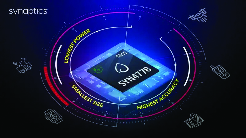
The SYN4778 (Image: Synaptics)
Integrated Circuit Designed for the internet of things
The SYN4778 is a small, low-power GNSS integrated circuit designed to extend battery life, reduce product size, and enhance performance of advanced location-based services for internet of things (IoT) devices — wearables, mobile accessories, asset trackers, UAVS and transportation devices. It includes advanced multipath interference mitigation using L5-band signals from GPS, Galileo, BeiDou, NAVIC, SBAS and QZSS. The chip also uses the L1 satellite band to reduce both the time to first fix, and the power consumed, improving the end-user experience and enabling product developers to add additional functionality and features to their IoT devices. Synaptics, synpatics.com
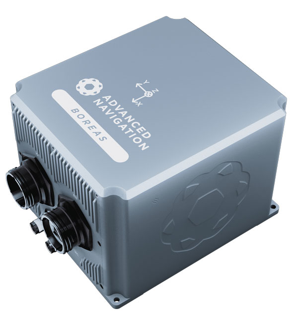
The Boreas D70 is a fiber-optic gyroscope (FOG) inertial navigation system (INS), part of the Boreas digital FOG series. The technology is suited to surveying, mapping and navigation across subsea, marine, land and air applications. It also could be adopted for vehicular applications, including autonomous vehicles and aircraft where weight and size are at a premium. The Boreas D70 combines closed-loop DFOG and accelerometer technologies with a dual-antenna real-time kinematic (RTK) GNSS receiver. These are coupled with an artificial-intelligence-based fusion algorithm to deliver accurate and precise navigation. Advanced Navigation, advancednavigation.com
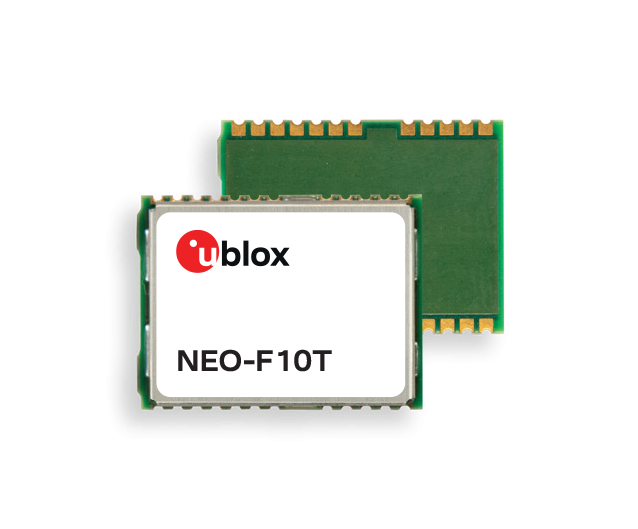
The u-blox NEO-F10T (Image: u-blox)
Timing Module Dual-band and secure for 5G communications
The u-blox NEO-F10T offers nanosecond-level timing accuracy, meeting the stringent timing requirements for 5G communications. It is compliant with the u-blox NEO form factor (12.2 mm x 16 mm), allowing space-constrained designs to be realized without the need to compromise on size. The NEO-F10T is the successor to the NEO-M8T module, providing an easy upgrade path to dual-band timing technology. This allows NEO-M8T users to access nanosecond-level timing accuracy and enhanced security. u-blox’s dual-band technology mitigates ionospheric errors and greatly reduces timing error, without the need for an external GNSS correction service. u-blox, u-blox.com
TRANSPORTATION
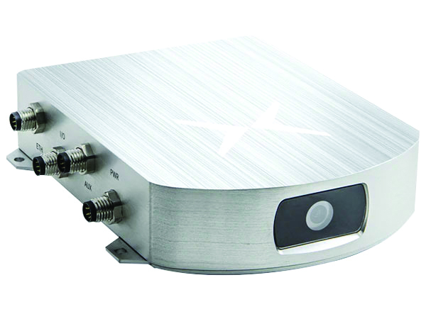
SafePilot P3 (Image: Trelleborg)
Maritime Systems Provides data on vessel positioning
The SafePilot P3 navigation system provides real-time data on vessel positioning and movement in tight waterways. It uses motion sensors and two GNSS antennas to measure the position and heading of vessels in three dimensions, minimizing time and difficulty associated with piloting procedures. SafePilot P3 has a backup battery to maintain functionality in the event of a power outage. This navigation system improves situational awareness while navigating waterways and ports globally, and also enhances communication between the captain, pilot, tug operators and canal personnel while vessels are transiting a canal and approaching a port.
Trelleborg, trelleborg.com
FusionEngine software (Image: Point One Navigation)
Positioning Engine Assures functional safety of ASIL-B
FusionEngine software, which is rated for automotive safety integrity level (ASIL), is now compatible with STMicroelectronics’ Teseo ASIL Precise Positioning GNSS chipset TeseoAPP. This assures functional safety of ASIL-B, a requirement for Level 3+ advanced driver assistance systems (ADAS). It can be integrated into several different host processors to enable high-level ADAS and autonomous driving systems. The combination of TeseoAPP’s receiver and the STA5365S external RF front-end provides dual-band measurement data for all visible GNSS satellites to the main host processor into which
FusionEngine is integrated. Point One Navigation, pointonenav.com
Ghost Autonomy Engine (Image: Ghost)
Autonomous driving software for level 4 driver assistance
The Ghost Autonomy Engine achieves the reliability required to bridge the gap between driver assistance capabilities L2 or L2+, and self-driving that does not rely on a human backup (L4). The software provides a stereo-vision neural network that delivers per-pixel depth in real time. It is capable of detecting and segmenting key features in a scene without needing to classify or recognize them. The physics-based perception system can handle the long tail of obstacles on the road, even those never seen before. Ghost, ghostautonomy.com
Vista-X120 Plus (Image: Cepton)
Lidar Provides 3D perception
The Vista-X120 Plus is a slim automotive lidar device for real-time adaptive 3D perception for advanced driver assistance. Its software-definable region of interest enables higher dynamic perception capabilities, while an adjustable central field of view with increased angular resolution improves accuracy in detection and classification of objects when driving. The region of interest is also configurable in real time in both horizontal and vertical directions. The Vista-X120 Plus is compact at 140 mm x 30 mm, improving OEM integration and placement options without disrupting vehicle appearance. Cepton, cepton.com
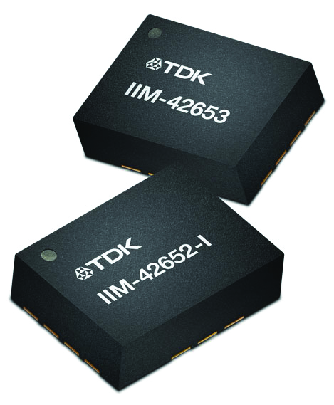
IIM-42653 and IIM-42652-I sensor platforms (Image: TDK Corporation)
Sensor Platforms Targets industrial and navigation applications
The IIM-42653 and IIM-42652-I sensor platforms consist of 6-axis IMUs, which target industrial and navigation applications requiring high force sensitive resistor (FSR) performance or inertial navigation software. The IIM-42653 platform — a robust, low-noise, low-power, 6-axis IMU — is capable of a gyro-programmable output of 4,000 dps and an accelerometer-programmable output of 32 g. These features make the IIM-42653 suitable for industrial-grade or high-end automated guided vehicles, automated mobile robots and unmanned aerial vehicles. The IIM-42652-I platform offers hardware authentication and can be integrated with TRACK dead-reckoning software from Trusted Positioning. TRACK filters GNSS multipath errors and provides a continuous navigation solution when GNSS signals are unavailable. TDK Corporation, invensense.tdk.com
VO Max 4T (Image: Autel Robotics)
Flight Platform
For enterprise and professional applications
The EVO Max 4T autonomous flight platform provides omnidirectional obstacle avoidance and tri-anti-interference capability to ensure flight safety and stability in high-interference environments. It is equipped with three high-quality cameras including a 48 MP telephoto camera, a 50 MP wide-angle camera and an infrared camera. The platform has a range of navigation and data-acquisition functions, including 3D flight routes, PinPoint Mode, Team Work, Polygon Mission, Waypoint Mission and Oblique Photography. EVO NEST is a base for automatic take-off, landing, charging and mission planning for EVO series UAVs. It is designed for all-weather operation and can be easily transported. Autel Robotics, autelrobotics.com
A Ukrainian intelligence assessment obtained by CNN and CBS reported an Iranian UAV downed in Ukraine contained technology from companies in the United States and other western countries. The White House has since launched an investigation as to how the technology — including semiconductors, GPS modules and engines — were obtained by Iran.
Screenshot: CBS video
The components removed from an Iranian Shahed-136 UAV totaled 52, 40 of which were manufactured by 13 different U.S. companies. The remaining components were manufactured by other western companies and companies based in Japan, Taiwan and China.The United States monitors exports and imposed restrictions and sanctions to prevent Iran from obtaining components for UAVs. Officials are now looking to enhance enforcement of the sanctions and are encouraging companies to monitor their supply chain, as well as identify third-party distributors who may be re-selling the technology to Iran.
U.S. companies are not alone in having to closely monitor their supply chains. U-blox, a Swiss semiconductor company, made a statement reinforcing its company policy, which bans the use of its technology in weapons. This was after u-blox GNSS modules were reportedly found in Russian UAVs.
On Dec. 20, u-blox banned the use of its GNSS modules in military UAVs in the war between Russia and Ukraine. The company had become aware that its GNSS modules were being used in certain Russian reconnaissance UAVs and stated that this use was against company policy.
U-blox obtained media reports that Russia had stocked up on components in anticipation of war, then integrated products from the company in UAVs it manufactured after attacking Ukraine.
After Russia began its invasion of Ukraine, the company halted all sales to Russia, Russian territories, and Russian-occupied areas, as it intends its GNSS modules and other products to be used only commercially. U-blox company policy bans the use of its products in weapons, including systems for target identification.
U-blox is investigating the infringement of its policy and plans to take legal action if it has been violated. The company also condemns the invasion of Ukraine by Russian forces.
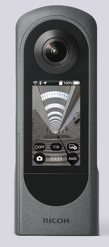
The Ricoh Theta X 360° camera uses a u-blox module for its location metadata. (Photo: Ricoh)
The ZOE-M8B GNSS module from u-blox is integrated into the new RicohTheta X camera. The camera allows users to shoot high-quality 360-degree spherical images and videos in one click and visualize them immediately on an LCD touch panel.
The u-blox ZOE-M8B enables the Ricoh Theta X’s built-in location system, one of its key features. The module is listed on the u-blox site as receiving GPS, BeiDou and GLONASS signals as well as QZSS, but the Ricoh Theta X specifications list only GPS + QZSS along with assisted GPS.
The u-blox receiver automatically embeds highly accurate location information for each image taken, without the need for a smartphone or another external device.
An icon on the LCD touch panel displays the availability of the GPS signals depending on the user’s location, ensuring the location information has been reliably acquired before shooting begins. The location is accurate down to a 5-meter radius, suitable for a wide range of industrial and consumer applications.
The u-blox ZOE-M8B GNSS module is an ultra-small (4.5 mm x 4.5 x 1.0 mm) system-in-package offering highly accurate positioning with concurrent reception of up to three satellite constellations. The Super-E (Super-Efficient) mode guarantees power consumption as low as 12 mW, and built-in SAW and LNA make it suitable for passive antennas. The u-blox ZOE-M8B targets applications that require a small size without compromising performance.
Part of a 360° spherical image shot with the Theta X. (Photo: Ricoh)
“We chose the u-blox module because of the highly accurate location information it offers, alongside easy integration and low power consumption,” said Kenji Daigo, GPS Function Developer for Theta X at Ricoh.
New receiver provides a path to the security and performance benefits of dual-band technology
Photo: u-blox
U-blox has announced a new, compact dual-band timing module that offers nanosecond-level timing accuracy, thereby meeting the stringent timing requirements for 5G communications.
The new u-blox NEO-F10T is compliant with the u-blox NEO form factor (12.2 mm x 16 mm), allowing space-constrained designs to be realized without the need to compromise on size.
The NEO-F10T is the successor to the NEO-M8T module, providing an easy upgrade path to dual-band timing technology. This allows NEO-M8T users to access nanosecond-level timing accuracy and enhanced security.
U-blox’s dual-band technology mitigates ionospheric errors and greatly reduces timing error, without the need of an external GNSS correction service. Additionally, when within the operational area of a satellite-based augmentation system (SBAS), the NEO-F10T offers the possibility to improve the timing performance by using the ionospheric corrections provided by the SBAS system.
As the NEO-F10T supports all four global satellite constellations and L1/L5/E5a configuration, it significantly simplifies global deployments because the same device can be used universally.
NEO-F10T includes advanced security features such as secure boot, secure interfaces, configuration lock and T-RAIM to provide the highest-level timing integrity. This ensures that reliable, uninterrupted service is delivered as any attempt to interfere with the receiver is unlikely to be successful. Additionally, advanced anti-jamming and anti-spoofing algorithms are included to further enhance security.
The module has a single RF input for all the GNSS bands and dual SAW filters for exceptional signal selectivity and out-of-band attenuation. It is compatible with u-blox’s ANN-MB1 L1/L5 multi-band antenna, making it simple to evaluate the performance of the timing modules. The devices operate from a single 2.7 V to 3.6 V supply and draw just 19 mA (@ 3.0 V) during continuous operation.
“NEO-F10T is designed to meet the timing synchronization requirements in 5G small cells and private networks on a global scale. By significantly reducing the time error of cellular network synchronization, the NEO‑F10T module will help operators maximize the performance of their networks and so optimize the return on their investment in 5G communications,” said Samuli Pietila, Director Product Line Management, Timing and Infrastructure, at u-blox.
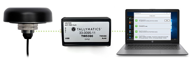
Tallymatics has introduced the TW5390 smart antenna with IP network and L-band augmentation service capability.
Tallymatics is a division of Tallysman Wireless, a Calian company, specializing in of precision geolocation applications and equipment.
To create the TW5390, Tallymatics leveraged its experience in GNSS applications, design and manufacturing, combining Tallysman’s GNSS antenna technology with the high-precision u-blox F9R GNSS receiver and DS9 L-Band receiver modules.
The combination delivers a reliable and convenient smart antenna yielding <6 cm accuracy, with precise point positioning/real-time kinematic (PPP/RTK) augmentation services via the PointPerfect subscription service.
The TW5390 solves the complexities of GNSS design — it sends the host system PPP/RTK corrected coordinates in NMEA format over a robust RS-485 interface, assuring results that meet customers’ high expectations.
Features of the TW5390
simultaneous dual-band coverage for GPS, Galileo, GLONASS and BeiDou
superior multipath rejection with Tallysman Accutenna technology
low noise amplifier
Tallysman’s eXtended Filtering (XF) technology, which mitigates saturation from nearby RF signals (targeting
LTE and Ligado)
tight, measured phase-center offset and low axial ratio, enabling accurate and precise positioning
direct decoding of PointPerfect, SPARTN formatted augmentation packets (u-blox specific)
IP network and L-band augmentation communications channels
built-in inertial measurement unit for UDR and ADR
fast convergence time of 40 seconds (PPP/RTK) with < 6 cm accuracy
IP69K package
RS-485 transceivers
Tallymatics SDK available with computer interface, TruPrecision software and 60 days of free PointPerfect