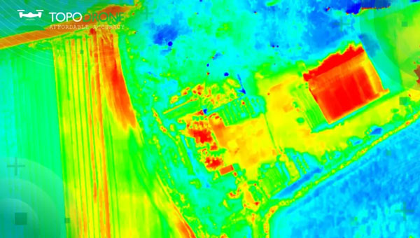
Topodrone has launched the PT61 camera, a thermal mapping solution designed for UAVs. The camera system aims to provide users with detailed thermal orthomosaic maps and accurate 3D models. Developed in partnership with Agrowing, the PT61 is a versatile tool aimed at meeting the growing demand for multispectral data collection in renewable energy and other domains, the company said.
The PT61 combines a 61-megapixel camera with integrated thermal imaging capability. It can also switch between RGB and multispectral modes. When integrated with Agrowing’s multispectral lenses, the camera offers detailed data across 10 spectral bands and an infrared band ideal for professionals in solar plant inspection and dam management.
The system can also be used in urban mapping, energy efficiency assessment and disaster management. The Topodrone post processing software complements the hardware by streamlining remote sensing tasks to offer surveyors and researchers high levels of efficiency.
Qualcomm Technologies will now support India’s Navigation and Indian Constellation (NavIC) recently launched L1 signals in select chipset platforms.
The company, which is working with the Indian Space Research Organization (ISRO), said the collaboration will accelerate the adoption of NavIC and enhance geolocation capabilities for use in mobile, automotive and IoT applications.
Qualcomm will offer a solution based on its Location Suite, which supports as many as seven satellite constellations simultaneously. These include all of NavIC’s L1 and L5 signals for location, faster time-to-first fix position collection and location-based service, the company said.
Additional support for the NavIC L1 signals will be available in select chipset platforms starting in the second half of 2024, the company said. However, the company said that commercial devices that support NavIC L1 signals will not be available until the first half of 2025.
The company plans to demonstrate its support for the NavIC L1 signals in the Snapdragon mobile platforms at its Qualcomm Innovation Forum event in December 2023.
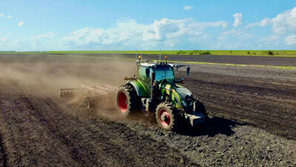
Trimble and Sabanto have partnered to integrate Trimble’s BX992 dual antenna with Trimble CenterPoint RTX into Sabanto’s autonomous solutions.
Farming requires a high level of uptime and reliability to avoid service disruption. By using Trimble’s BX992 GNSS receiver and satellite-delivered Trimble CenterPoint RTX corrections service, Sabanto’s autonomous solutions can now receive centimeter-level L-Band corrections across the globe. The integration aims to provide users with precise positioning, which can result in greater productivity, minimize downtime and alleviate workforce shortages through autonomous vehicles.
In addition to RTX corrections, Trimble will offer correction stream-switching enabling farmers to automatically switch from IP to satellite seamlessly, to offer the best signal in a variety of environments.
savvy navvy has partnered with ProtectedSeas to bring ProtectedSeas Navigator data to boaters through the savvy navvy app.
After eight years of research and development, boaters and watersport users worldwide can now have access to comprehensive data and resources of ocean regulatory information, including marine protection areas, through the savvy navvy app.
ProtectedSeas Navigator provides boaters with 22,000 marine protected and managed areas in more than 220 countries. These areas include speed-limit zones to protect marine mammals, fisheries management areas and more.
ProtectedSeas compiles marine protection information into the Navigator database of marine protected areas (MPAs). It collects both large and small amounts of data and created the first public digital maps for more than 2,400 areas.
savvy navvy – often referred to as ‘Google Maps for boats’ – is an award-winning boat navigation app. It integrates multiple sustainable data sources from different conservation agencies and bodies.
Since launching its first global view of marine life protections, ProtectedSeas has been complimented by several industry-renowned leaders and bodies, including the U.S. National Oceanic and Atmospheric Administration (NOAA), Dr. Sylvia Earle, American marine biologist and oceanographer, and Gavin Newsom, governor of California.
Some ProtectedSeas data is already available in the savvy navvy app, with more to follow soon. Click here to learn more about the sustainable data or to download the app.
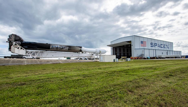
SpaceX’s Falcon Heavy rocket begins its roll out to the historic Launch Complex (LC)-39A at NASA’s Kennedy Space Center in Florida. (Image: SpaceX)
Space Systems Command (SSC) and SpaceX are preparing to launch the U.S. Space Force (USSF)-52 mission into orbit. The Falcon Heavy mission is set to launch on Dec. 10, 2023, from the historic Launch Complex (LC)-39A at NASA’s John F. Kennedy Space Center in Florida.
USSF-52 is the seventh mission of the X-37B Orbital Test Vehicle, an experimental program with technologies designed to provide the U.S. Space Force with a reliable, reusable, unmanned space test platform.
This launch adds to a notable year. The last NSSL Falcon Heavy launched in early January; that mission, USSF-67, was followed by a Falcon 9 launching a GPS satellite 61 hours later, both from the Eastern Range and using the same Space Systems Command crew. The Assured Access to Space team worked alongside SpaceX to complete both launches.
In preparation for a challenging and busy launch schedule, the U.S. Space Force is placing greater importance on being agile and resilient. The ability to conduct launch operations at a faster pace will be particularly crucial for successfully deploying multiple constellations, the Space Force said.
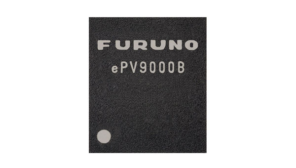
Furuno Electric Co. has released its dual-band GNSS receiver chip, eRideOPUS 9, which can achieve 50cm position accuracy without correction data.
The product is designed to provide absolute position information and can be used as a reference for lane identification, which is essential for services such as autonomous driving. It also serves as a reference for determining the final self-position through cameras, lidar and HD maps.
By using Furuno’s Extended Carrier Aiding technology, the product can achieve high-precision positioning, which eliminates the need for RTK reference stations, correction data usage and correction data reception components.
The eRideOPUS 9 supports all navigation satellite systems currently in operation, including GPS, GLONASS, Galileo, BeiDou, QZSS and NavIC. It can also receive L1 and L5 signals. The L5 band signals are transmitted at a chipping rate 10 times higher than L1 signals, which reduces the effects of multipath. The L5 signals also improve positioning accuracy in environments where radio waves are reflected or diffracted by structures, such as in urban areas.
A dual-band GNSS module incorporating eRideOPUS 9 is being jointly developed with Alps Alpine Co. and is scheduled for future release as the UMSZ6 series.
IBM, a global technology provider, has released its latest geospatial artificial intelligence (AI) initiative to address climate change. These efforts involve collaborations across various regions and uses advanced AI models designed for geospatial applications.
Central to these initiatives is IBM’s geospatial foundation model, developed jointly with NASA. These models aim to generate environmental insights and solutions related to climate change. Unlike traditional AI models, these use a vast amount of climate-relevant data to accelerate the analysis of various environmental aspects that are affected by climate change.
“AI foundation models utilizing geospatial data can be a game-changer, allowing us to better understand and address climate-related events with unprecedented speed and efficiency,” said Alessandro Curioni, IBM fellow and vice president of Accelerated Discovery.
Analyzing urban heat islands in UAE
IBM and the Mohamed Bin Zayed University of Artificial Intelligence (MBZUAI) have partnered to map urban heat islands in Abu Dhabi using a fine-tuned version of IBM’s geospatial foundation model. The goal of the project is to understand the impact of local landscapes on temperature anomalies, the company said. The initial results show a decrease in heat island effects, which can provide valuable insights for future urban design strategies.
Reforestation and water sustainability in Kenya
In partnership with Kenya’s Special Envoy for Climate Change, Ali Mohamed, IBM is supporting the National Tree Growing and Restoration Campaign. The initiative aims to plant 15 billion trees by 2032, particularly in critical water tower areas affected by deforestation. IBM’s geospatial model powers a digital platform to track tree planting activities, aiding local efforts in restoring forests and measuring carbon sequestration impact.
Elevating climate resiliency in the UK
In collaboration with the Science and Technology Facilities Council (STFC) and Royal HaskoningDHV, IBM is developing AI-driven tools for climate risk assessment in the UK. These tools will focus on assessing weather impacts on aviation operations, the company said. Additionally, the TreesAI research project aims to map areas suitable for tree planting to mitigate surface water flooding and offer urban developers a digital planning platform.
IBM extends collaboration with NASA for weather forecasting
IBM and NASA have partnered to develop an AI foundation model dedicated to weather and climate applications. The collaboration aims to enhance the accuracy and speed of weather forecasting, predict wildfire conditions and understand meteorological phenomena. IBM researchers will work closely with NASA to train and validate this model, IBM said.
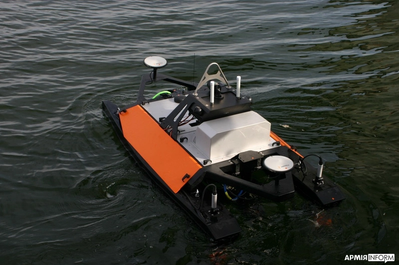
Maritime Robotics, a Norwegian provider of autonomous technology, and Teledyne Marine have delivered several unmanned surface vessels (USVs) to Ukraine’s Navy for advanced sensor data collection.
Maritime Robotics’ Otter USV, equipped with the Teledyne RESON SeaBAT T51-R multibeam echosounder, is now being used by Ukraine’s Navy. The USV is designed for critical data collection without endangering human lives, as the sensors are carried by an unmanned vehicle. The data and information collected by the USV aims to strengthen Ukraine’s defense, enhance maritime traffic security and support the safety of civilians in the areas.
Otter USV is part of Maritime Robotics’ portfolio of autonomous technologies capable of supporting military personnel in mapping and securing marine environments. Controlled and navigated remotely, Maritime Robotics’ USVs are designed to identify, locate and safely neutralize potential threats such as explosive devices and sea mines.
On Oct. 26, 2023, I participated in an American Society for Photogrammetry and Remote Sensing (ASPRS) Pacific Southwest Region Fall Technical webinar. The webinar provided an overview of the ASPRS Positional Accuracy Standards for Digital Geospatial Data (Edition 2, Version 1.0 – August 2023). The document can be downloaded here.
ASPRS Webinar Announcement. (Image: ASPRS)
I also participated — virtually — in the Nov. 2, 2023, California Spatial Reference Center (CSRC) Coordinating Council fall meeting where Dr. Riadh Munjy, California State University, Fresno, discussed the revisions to the ASPRS Positional Accuracy Standards for Geospatial Data.
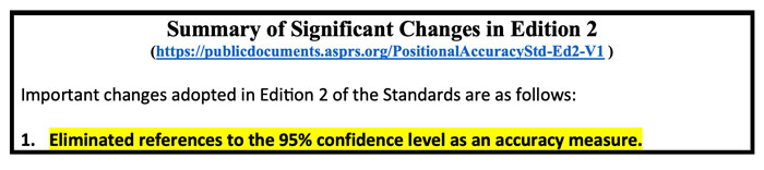
The most significant changes introduced in this second edition of the standards include:
Elimination of references to the 95% confidence level as an accuracy measure.
Relaxation of the accuracy requirement for ground control and checkpoints.
Consideration of survey checkpoint accuracy when computing final product accuracy.
Removal of the pass/fail requirement for Vegetated Vertical Accuracy (VVA) for lidar data.
Increase the minimum number of checkpoints required for product accuracy assessment from 20 to 30.
Limiting the maximum number of checkpoints for large projects to 120.
Introduction of a new term: three-dimensional positional accuracy.
Addition of Best Practices and Guidelines Addenda for:
General Best Practices and Guidelines
Field Surveying of Ground Control and Checkpoints
Mapping with Photogrammetry
Mapping with Lidar
Mapping with UAS
As outlined above, Edition 2 contains Best Practices and Guidelines for (1) General Best Practices and Guidelines and (2) Field Surveying of Ground Control and Checkpoints. The three addenda listed in the table of contents: Mapping with Photogrammetry, Mapping with Lidar, and Mapping with UAS will be available for public comment later, and will be added to Edition 2, Version 2.0.
Dr. Abdullah informed me that these addenda are on track to be put out for public comments during December 2023, therefore he believes they will probably be published in January or February 2024. The box titled “Summary of Significant Changes in Edition 2” provides the changes with the reason and justification for each change. The document can be downloaded from ASPRS here.
One of the changes is to relax the accuracy requirement for ground control and checkpoints. At first glance, this seems like the wrong thing to do. However, after understanding the justification, the requirement for ground truth still needs to be at least twice as accurate as the product.
Both Dr. Abdullah and Dr. Munjy’s emphasized in their presentations that the current accuracy requirements for ground controls in photogrammetric work of four-times better than the produced products, and the checkpoint accuracy requirement is three-times better than the assessed product. This makes it difficult, if it is not impossible, to use RTK-based techniques for this type of surveying. This by itself is not the reason for the change. During Dr. Abdullah’s presentation, he provided the following reasons for the change:
“Experience taught us that the requirements of four-times and three-times adopted in edition 1 of the standards are excessive and too restrictive, partly due to the reason outlined in (b) below.
Today’s sensors, software, and processing methodology are more accurate and the room for errors in the product is diminishing, therefore we do not need a safety factor of 3 or 4 to obtain accurate products.
Increasing demand for higher accuracy geospatial products.”
The new standards now factor in the accuracy of the survey checkpoints when determining the accuracy of the product. During Dr. Abdullah’s presentation, he provided the following reason for the change, “As we are producing more accurate products, errors in surveying techniques of the checkpoints used to assess product accuracy, although small, can no longer be neglected and it should be represented in computing the product accuracy.” He also highlighted that, “As product accuracy increases, the impact of error in checkpoints on the computed product accuracy increases.” The document provides equations used to compute the values. See below.
A very significant change, in my opinion, is the removal of the standards for Vegetated Vertical Accuracy (VVA) for lidar data. See below.
VVA not used as a criterion for acceptance. (Image: ASPRS)
I am not sure I agree with the reasoning, but I understand why it was done. GNSS-based surveys do not perform well in vegetated areas, and this is the technology used to validate the non-vegetated vertical accuracies (NVA). That said, there are non-GNSS technologies — sometimes denoted as traditional surveying methods — that could be used to validate VVA, so this seems like an elimination of a requirement based on the limitation of a particular technology.
Traditional surveying methods that use geodetic levels, theodolites, and total stations to measure distances, angles, and heights are still used by surveyors to perform certain projects. Since there are other surveying methods that could be used for evaluating the VVA, it does not seem like a valid reason for a change.
The ASPRS standards does state that, “for projects where vegetated terrain is dominant, the data producer and the client may agree on an acceptable threshold for the VVA.” Therefore, the client can require the surveyor to meet a specific accuracy level for vegetated areas. I am sure this was discussed during the working meeting, so I leave it to the experts to make the appropriate decisions and recommendations.
Finally, it should be noted that, as discussed above, the new ASPRS standards eliminated the reference to the 95% confidence level as an accuracy measure. The document provides the following statement about the National Standard for Spatial Data Accuracy (NSSDA):
“The National Standard for Spatial Data Accuracy (NSSDA) documents the equations for the computation of RMSEX, RMSEY, RMSER and RMSEZ, as well as horizontal (radial) and vertical accuracies at the 95% confidence levels — AccuracyR and AccuracyZ, respectively. These statistics assume that errors approximate a normal error distribution and that the mean error is small relative to the target accuracy. The ASPRS Positional Accuracy Standards for Digital Geospatial Data reporting methodology is based on RMSE alone, and thus differs from the NSSDA reporting methodology. Additionally, these Standards include error inherited from ground control and checkpoints in the computed final product accuracy.”
Appendix D of the ASPRS document provides the equations with an example for computing the accuracy statistics. The document also has a section with examples for users who wish to relate the ASPRS 2023 Standards to the FGDC National Standard for Spatial Data Accuracy (NSSDA).
Dr. Munjy ended his presentation at the CSRS 2023 fall meeting with the following statements:
“ASPRS Accuracy Standards 2023 have become more aligned with science and statistical theory,” and “These Standards are intended to be a living document which can be updated in future editions to reflect changing technologies and user needs.”
I would encourage all users to download the document to better understand the changes and reasons for the changes. It can be downloaded here.
Hexagon’s Safety, Infrastructure & Geospatial division has partnered with Pitkin County Regional Emergency Dispatch Center to upgrade its digital mapping and response for 911 calls in Colorado’s premier mountain tourist destination. The partnership aims to make the county safer for residents and visitors.
By using HxGN Connect software, Pitkin County can bring modern mapping capabilities to its computer-aided dispatch (CAD) system, as well as incorporate Smart Advisor, Hexagon’s assistive artificial intelligence solution.
Pitkin County, home of Aspen and its four major ski areas, hosts 1.5 million tourists per year. The upgrades will improve emergency response capabilities for major events such as the X Games and JAS Aspen music festival, the company says.
The cloud-based solution, hosted in Microsoft Azure, is designed to map 911 calls and conduct long-term resource planning. Smart Advisor will work in the background to help dispatchers and first responders connect related incidents and provide geofencing to concentrate resources on large events. Officials plan to expand the system to take advantage of its cross-organization collaboration capabilities by potentially linking the county’s CAD system with the fire department’s network of mountaintop smoke detectors and the Department of Public Works’ snowplows.
Pitkin County dispatchers will use HxGN Connect for digital mapping within its CAD system in the mountainous tourist destination.
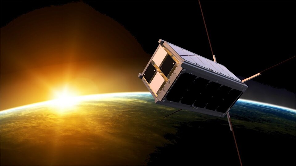
The Educational Irish Research Satellite, EIRSAT-1, has successfully launched from Vandenberg Space Force Base, California, on Dec. 1, 2023. Hitching a ride on a SpaceX Falcon 9 launcher, the small satellite has made history as Ireland’s first satellite.
Over the course of six years, EIRSAT-1 was designed, built and tested by students from University College Dublin (UCD) in Dublin, Ireland, participating in the European Space Agency (ESA) Academy’s Fly Your Satellite Program. The program is a hands-on initiative that helps university student teams develop their own satellites according to professional standards. The launch opportunity itself was provided by the ESA.
Throughout the development of the satellite, ESA experts provided training and guidance to dozens of UCD students, the ESA said. The students’ learning journey included test campaigns at ESA Education’s CubeSat Support Facility in Belgium, as well as dedicated spacecraft communications sessions at both ESA Academy’s Training and Learning Centre and the European Space Operations Centre in Darmstadt, Germany. These sessions were designed to teach the procedures for operating Ireland’s first spacecraft.
From low-Earth-orbit (LEO), EIRSAT-1 will carry out three main experiments, which were built from scratch by the students:
GMOD, a detector to study gamma ray bursts, which are the most luminous explosions in the universe and occur when a massive star dies or two stars collide.
EMOD, an experiment to see how a thermal treatment protects the surface of a satellite when in space.
WBC, an experiment to test a new method of using Earth’s magnetic field to change a satellite’s orientation in space.
Following EIRSAT-1’s deployment to orbit, the student team is now working to establish contact with the satellite and start operations from their dedicated ground control facility, also entirely operated by students and located at UCD in Dublin.
The U.S. Army has awarded Lockheed Martin and Northrop Grumman other transaction agreements (OATs) for the first phase of the Launched Effects (LE) program.
Launched Effects “will provide standoff sense and effect capabilities for soldiers while keeping air and ground forces outside the range of adversary weapon systems,” according to the service’s Program Executive Office for Intelligence, Electronic Warfare and Sensors. It also said LE will also support forces entering and exiting mission areas.
Northrop has been awarded for two payloads and Lockheed Martin has been awarded for one, with each award valued at about $100,000, according to the Army. The OTA will total about $37 million over all three phases.
The LE program consists of three phases. During that span, the Army aims to mature payloads from a technology readiness level of 6, a prototype system that has been tested in a relevant environment, to TRL 7, a prototype that has been demonstrated in an operational environment.
Launched effects have been successfully tested by the Army in the past, including at Project Convergence. In January 2023, General Atomics Aeronautical Systems announced its Eaglet launched-effect flew for the first time, dropping off an Army-owned Gray Eagle Extended Range UAV during a demonstration in Utah.