The European Union Agency for the Space Programme (EUSPA) has released its first EO and GNSS Market Report, where EO stands for Earth observation. The report is the result of a collaboration between 15 EUSPA experts from various fields and market research companies supporting EUSPA, backed by more than 50 external experts who helped validate the market trends and the data. In his foreword to the report, Rodrigo da Costa, EUSPA’s executive director, wrote: “Since its inception, the report has established itself as the most authoritative reference document for information on the global GNSS market. It is regularly referenced by policymakers and business leaders around the world.”
EUSPA’s EO and GNSS Market Report combines market and application data into one report that provides global coverage of EO and GNSS applications across 17 different market segments: agriculture; aviation and UAVs; biodiversity, ecoystems and natural capital; climate services; consumer solutions, tourism and health; emergency management and humanitarian aid; energy and raw materials; environmental monitoring; fisheries and aquaculture; forestry; infrastructure; insurance and finance; maritime and inland waterways; rail; road and automotive; space; urban development and cultural heritage.
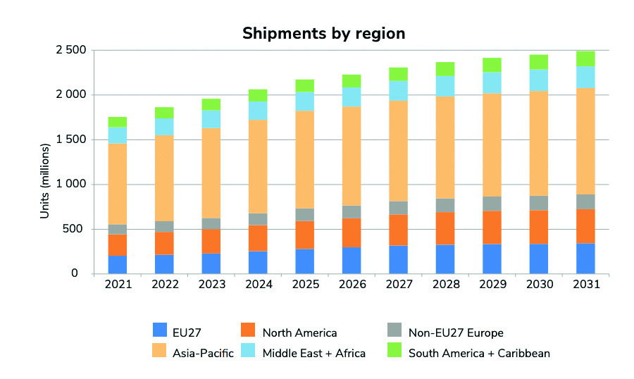
GNSS receiver shipments will grow continuously in the next decade, from 1.8 bn units in 2021 to 2.5 bn units by 2031. (All images courtesy of EUSPA)
Growth dominated by consumer solutions
Between 2021 to 2031, yearly shipments of GNSS receivers are projected to grow from 1.8 billion units to 2.5 billion units. The shipments will be dominated by the consumer solutions, tourism and health segments as the global sales of smartphones and wearables continues to increase.
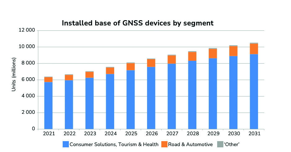
The overall installed base will increase from 6.5 bn units in 2021 to 10.6 bn units by 2031.
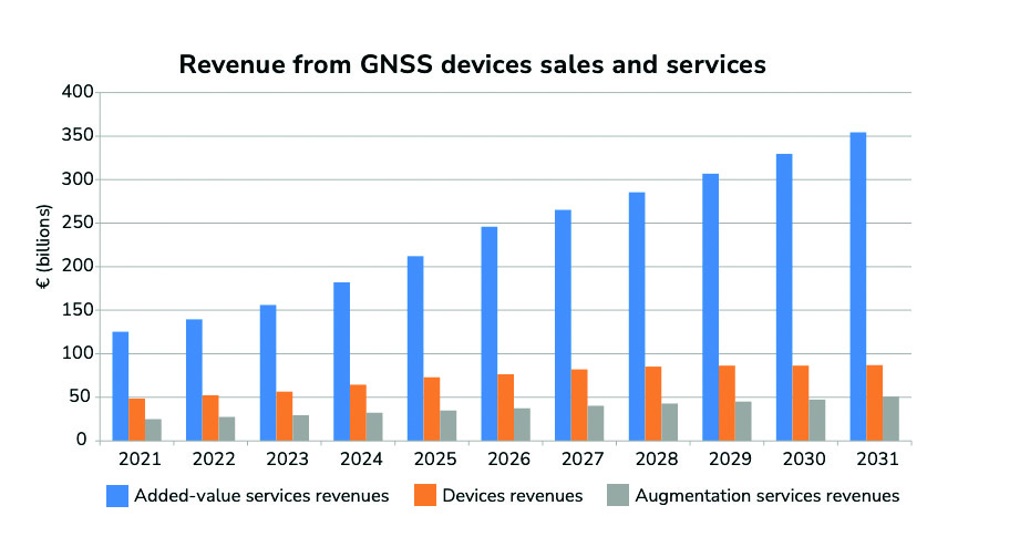
The global installed base of GNSS devices in use is expected to reach more than 10 billion units by 2031 — dominated by consumer solutions, tourism and health, and road and automotive market segments, which will contribute to 98% of all devices in use. The global GNSS downstream market revenues, which covers both device sales and service-related revenues, is expected to grow at a CAGR of 9.2% over the next decade, reaching €492 billion by 2031. More than 82% of the revenue will be generated by value-added services. Beyond the mass markets, the markets of agriculture, urban development and cultural heritage, and infrastructure will be the main contributors to the global GNSS revenue stream.
The Asia-Pacific region continues to be at the top of the GNSS revenue market both for device sales and service revenues based on demand. The region is expected to increase its share of the global services revenues, nearing 46% by 2031; however, it will see a decline of its market share of device revenues. The Asia-Pacific region will be challenged by the upcoming markets of South America and the Caribbean, Non-EU27 Europe, the Middle East, and African regions.
The GNSS market
The report defines the GNSS market as activities in which GNSS-based positioning, navigation and/or timing is a significant enabler for functionality. The GNSS market is comprised of device revenues, revenues derived from augmentation and added-value services attributable to GNSS.
The aviation and UAV market is expected to have significant growth, increasing from 42 m units in 2021 to 49 m units by 2031.The global GNSS downstream market revenues from both device sales and services will grow from €199 bn in 2021 to €492 bn by 2031 with a CAGR of 9.2%. This growth is mainly generated through the revenues from added-value services.
Augmentation services include software products, digital maps and GNSS augmentation subscriptions. Added-value service revenues include data downloaded through cellular networks specifically to run location-based applications, the GNSS-attributable revenues of smartphone apps, subscription revenues from fleet management services, and UAV service revenues across a range of industries. For multi-function devices such as smartphones, the revenues include only the value of GNSS-functionality, not the full device price, so, a case-specific correction factor is used.
About the charts
Data on the charts presented in the report start from the year 2020 and are estimated, projected and subject to update in the next edition of EUSPA’s Market Report. Historical figures are actual numbers based on reliable sources, per EUSPA. These will change if the number of applications is expanded in future reports.
Source: EUSPA EO and GNSS Market Report ISSUE 1, copyright EU Agency for the Space Programme, 2022
Inmarsat has partnered with Australia and New Zealand to deliver the Southern Positioning Augmentation Network (SouthPAN), which will provide accurate, reliable, and instant positioning services in the Asian Pacific region. The positioning service will be delivered on one of Inmarsat’s three new I-8 satellites in 2027.
SouthPAN will improve positioning accuracy to 10 cm for users in the maritime, agriculture and construction industries.
“SouthPAN represents extraordinary potential for the region,” Todd McDonell, president of Inmarsat Global Government, said. “It can save lives by enabling precision safety tracking, help farmers improve productivity through automated device tracking, or even support transport management systems of the future.”
The Inmarsat I-8 satellites will also be a critical part of a safety-of-life-certified SouthPAN for aviation and other applications, scheduled for 2028.
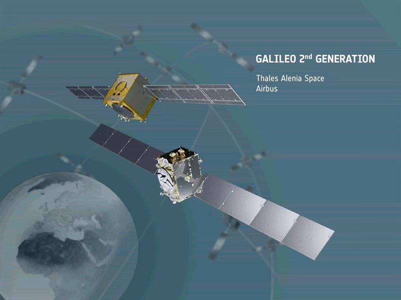
On May 31, the European Space Agency (ESA) announced the main procurement batch of Galileo Second Generation (G2), initiated in summer 2022, has been finalized. The system is now ready for its on-orbit validation development phase.
Following the opening session of the European Navigation Conference (ENC), Javier Benedicto, director of navigation for the ESA, invited Thales Alenia Space, Airbus Defence and Space, and Thales Six GTS to sign contracts commencing system engineering support for the next generation of Europe’s navigation satellite system.
Satellite-building contracts were awarded in May 2021 to Thales Alenia Space and Airbus Defence and Space to create two independent families of satellites amounting to 12 G2 satellites in total. Separate contracts were also awarded to Safran Electronics and Defence-Navigation and Timing and Leonardo to provide the ultra-precise atomic clocks carried aboard.
Employing electric propulsion for the first time, and hosting a higher-strength navigation antenna, the G2 satellites will incorporate six (rather than four) enhanced atomic clocks as well as inter-satellite links to communicate and cross-check with one another. They will be controllable with an increased data rate to and from the ground and will operate for 15 years on orbit.
In addition, G2’s fully digital payloads are being designed to be easily reconfigured on orbit, enabling them to respond to the evolving needs of users with novel signals and services.
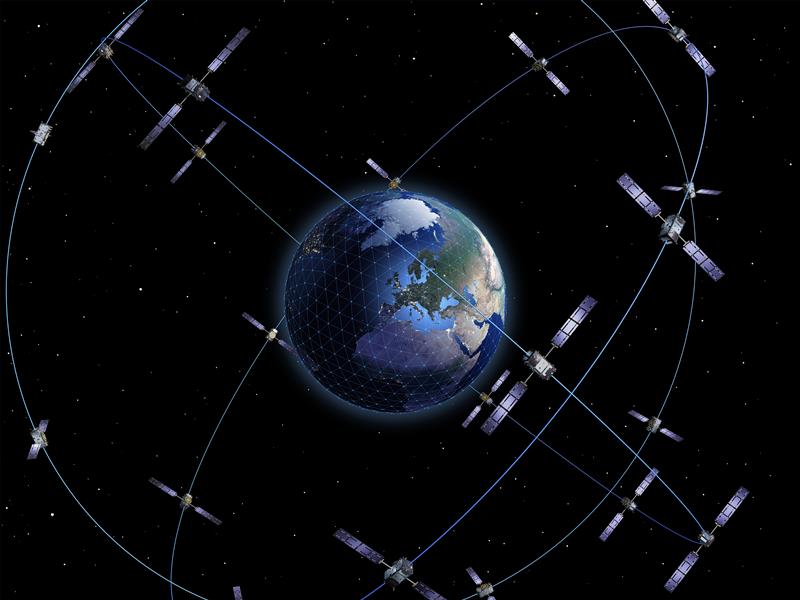
There are 28 Galileo satellites on orbit, making it the most precise satellite navigation system —providing meter-level accuracy to more than four billion users around the globe. There are 10 Galileo satellites due to be launched, after which the first of the G2 satellites with enhanced capabilities are expected to join the constellation in the next few years.
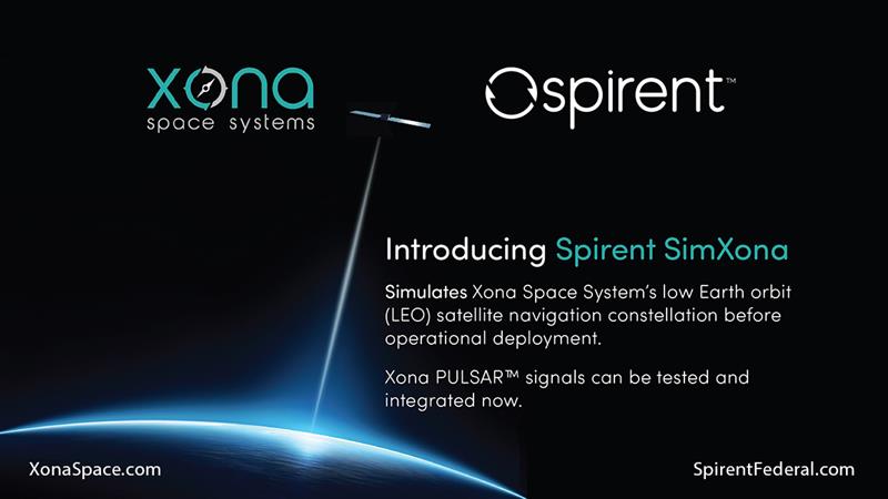
SimXona can simulate the Xona low-Earth orbit (LEO) constellation on its own, and in tandem with Spirent’s positioning, navigation, and timing (PNT) and threat simulation capabilities. Spirent has developed LEO simulation solutions for both the military and commercial sectors, including modeling software that combines the simulation of precise LEO orbits and highly accurate GNSS signals — delivering greater realism for applications that have no margin for error.
Spirent will be accepting orders for SimXona soon.
The European Union Agency for the Space Programme (EUSPA) and Naviair — a company that specializes in air navigation and related infrastructure services and is owned by the Danish state and represented by the Ministry of Transport — have partnered to strengthen the monitoring capabilities of the Galileo search and rescue (SAR) service by adding a new site in Greenland.
The partnership between EUSPA and Naviair will expand the ground segment and current SAR capabilities. As part of the agreement, Naviair will contribute to the Galileo Programme objectives by procuring, deploying, hosting, and operating a reference beacon (REFBE) near the Kangerlussuaq Airport in Greenland.
The new SAR/Galileo site and REFBE will be located around the margins of the declared service coverage area and will be fully integrated into the SAR ground segment, bringing the number of REFBEs to eight. The REFBEs provide data for service performance monitoring.
There are currently five REFBEs in the European coverage area and two in the Indian Ocean coverage area.
The REFBEs are fitted with vertical linear polarized antennas that transmit timely, synchronized signals equivalent to a standard 406 MHz Cospas-Sarsat beacon. This, combined with their well-known position, enables specific SAR/Galileo Service performance indicators to be derived.
The new site will be ready by the fourth quarter of 2023.
The SAR/Galileo component of the EU Space Programme plays a crucial role in the detection of emergency signals transmitted by distress beacons in support of the internationally recognized SAR Cospas-Sarsat program. As part of this program, the Galileo SAR Service utilizes SAR instruments onboard Galileo satellites, medium-Earth orbit local user terminals, and a network of SAR REFBEs located across Europe.
“Seen & Heard” is a monthly feature of GPS World magazine, traveling the world to capture interesting and unusual news stories involving the GNSS/PNT industry.
Image: Dennis Laughlin/iStock/Getty Images Plus/Getty Images
GNSS records Alaska earthquake data
Researchers in Alaska were able to compare the quality of GNSS and seismic station data when assessing the magnitude 8.2 Chignik earthquake near Dillingham, Alaska. Research recorded by Revathy Parameswaran and colleagues at the University of Alaska, Fairbanks, shows that GNSS and acceleration seismic data can be used interchangeably or in tandem to estimate rapid magnitude or ground motion. The research showed the Chignik earthquake velocity records were almost identical at co-located GNSS and seismic stations for observations at frequencies of less than 0.25 Hz.
No more high-speed chases
Image: Screenshot from CBS New York video
The Old Westbury Police Department of Long Island, New York, has chosen a high-speed pursuit alternative — GPS-equipped darts that relay the current location of suspects, reported CBS New York. It took $36,000 to equip six patrol cars with the air-powered dart launcher, called StarChase, which can be activated from inside the patrol car. When the launcher is activated, it shoots onto the suspect’s vehicle a dart with a GPS receiver inside and an adhesive exterior. It is considered a safe alternative to high-speed chases and safe to use around pedestrians.
Shou Zi Chew, CEO of the popular app TikTok, testified before Congress that TikTok does not collect precise location data from its users. During the hearing, which lasted for more than five hours, Chew assured committee members the app does not collect nor distribute location data. TikTok is under fire as a bipartisan Senate proposal is aimed at banning the social media app, arguing it poses cybersecurity risks. The House Committee interrogated Chew regarding the app’s algorithmic feed, policies for young users and — given TikTok’s Chinese ownership — the amount of access the Chinese government has to user data.
Just some water, please
Image: Bob Douglas/iStock/Getty Images Plus/Getty Images
Satellite mapping data analyzed at Graz University of Technology’s Institute of Geodesy has revealed long-term drought conditions in Europe, reported GIM International. The data confirmed groundwater levels have been low consistently since 2018. The drought situation was originally published by Eva Boergens in “Geophysical Research Letters” in 2020 when she noted there was a severe water shortage in Central Europe during the summers of 2018 and 2019. There has been no significant rise in groundwater levels since then, and groundwater levels have stayed constantly low.
A roundup of recent products in the GNSS and inertial positioning industry from the May 2023 issue of GPS World magazine.
SURVEYING
Image: Septentrio
Corrections Program Provides documentation for GNSS receivers
The Agnostic Correction Partner Program facilitates the use of Septentrio GNSS receivers with high-accuracy services that provide varying levels of accuracy, coverage and delivery methods. This enables users to select the service that suits specific applications and business models. The program — which includes Polaris from Point One, Skylark from Swift Navigation, and PointPerfect from u-blox — provides documentation for the use of Septentrio receivers with these high-accuracy services. Agnostic corrections are useful in situations where multiple types of GNSS receivers are being used, such as in a large-scale surveying project. Septentrio, septentrio.com
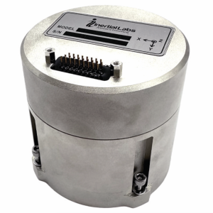
Image: Inertial Labs
Multi-Application IMU A compact, self-contained strapdown, advanced tactical-grade IMU device
The IMU-FI-200C measures linear accelerations and angular rates with its three-axis, tactical-grade, closed loop, fiber-optic gyroscopes and three-axis, high-precision MEMS accelerometers in motionless and high dynamic applications. The IMU-FI-200C is fully calibrated, temperature compensated and aligned to an orthogonal coordinate system. It contains more than 0.5°/hr gyroscopes and less than 2 mg bias repeatability over operational range accelerometers with low noise and high reliability. Continuous built-in test, configurable communications protocols, electromagnetic interference protection, and flexible input power requirements make the IMU-FI-200C suitable for a wide range of integrated system applications. Inertial Labs, inertiallabs.com
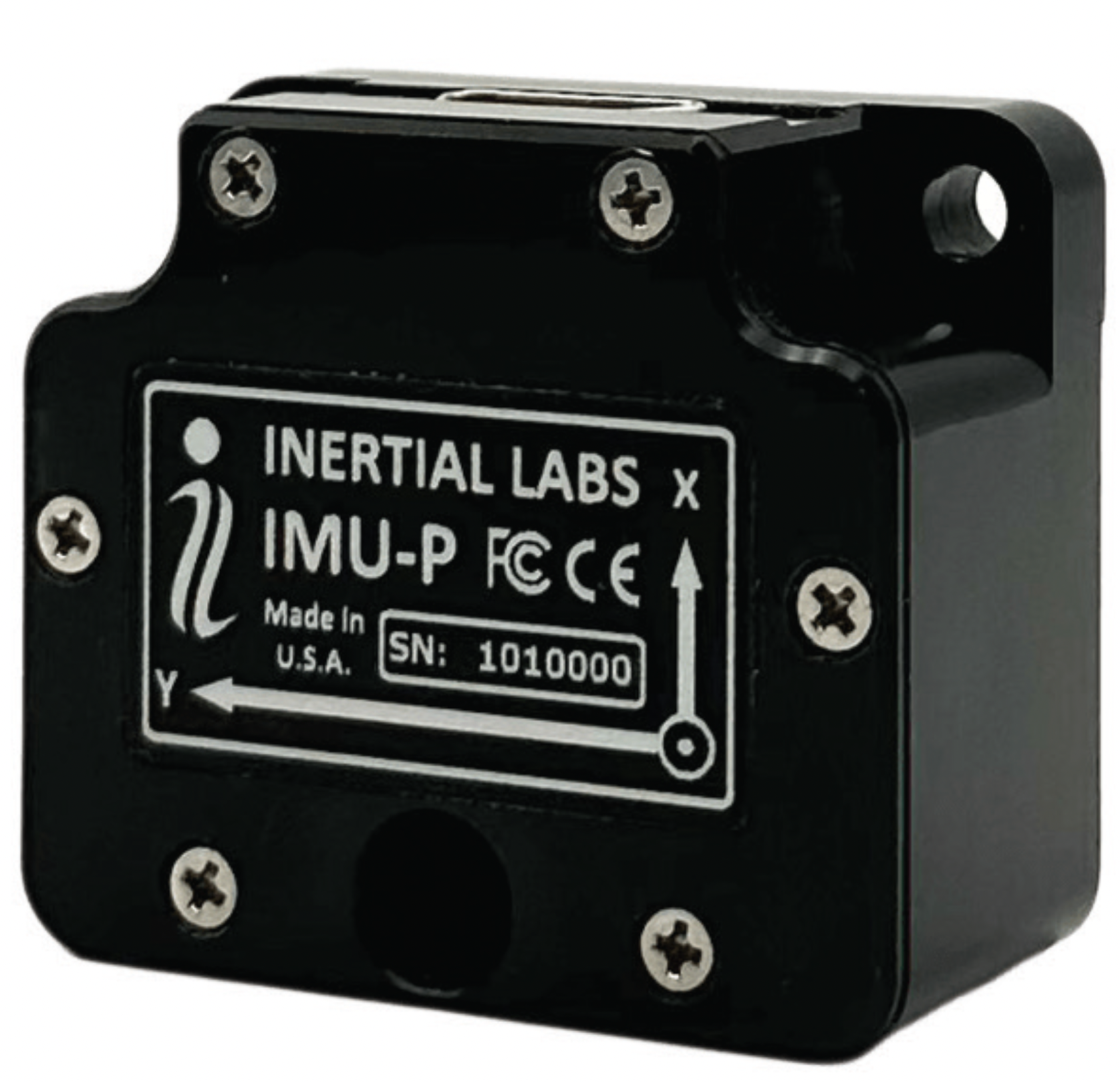
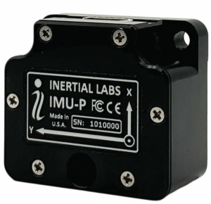
Image: Inertial Labs
MEMS IMU Suitable for applications such as antenna and line of sight stabilization systems, GPS-aided INS and more
The inertial measurement unit-P (IMU-P) is an advanced MEMS sensors-based, compact, self-contained strapdown, industrial- and tactical-grade inertial measurement system and digital tilt sensor that measures linear accelerations, angular rates and pitch-and-roll with three-axis, high-grade MEMS accelerometers and three-axis, tactical-grade MEMS gyroscopes. Angular rates and accelerations are determined with high accuracy for both motionless and dynamic applications. The IMU-P is fully calibrated, temperature compensated, and mathematically aligned to an orthogonal coordinate system. IMU-P demonstrates less than 1 deg/hr gyroscopes and 0.005 mg accelerometers bias inrun stability with low noise and high reliability. The IMU-P models collect data from an external source of GNSS to output full spectrum inertial navigation system data consisting of positions, attitude, velocity and time.
Inertial Labs, inertiallabs.com
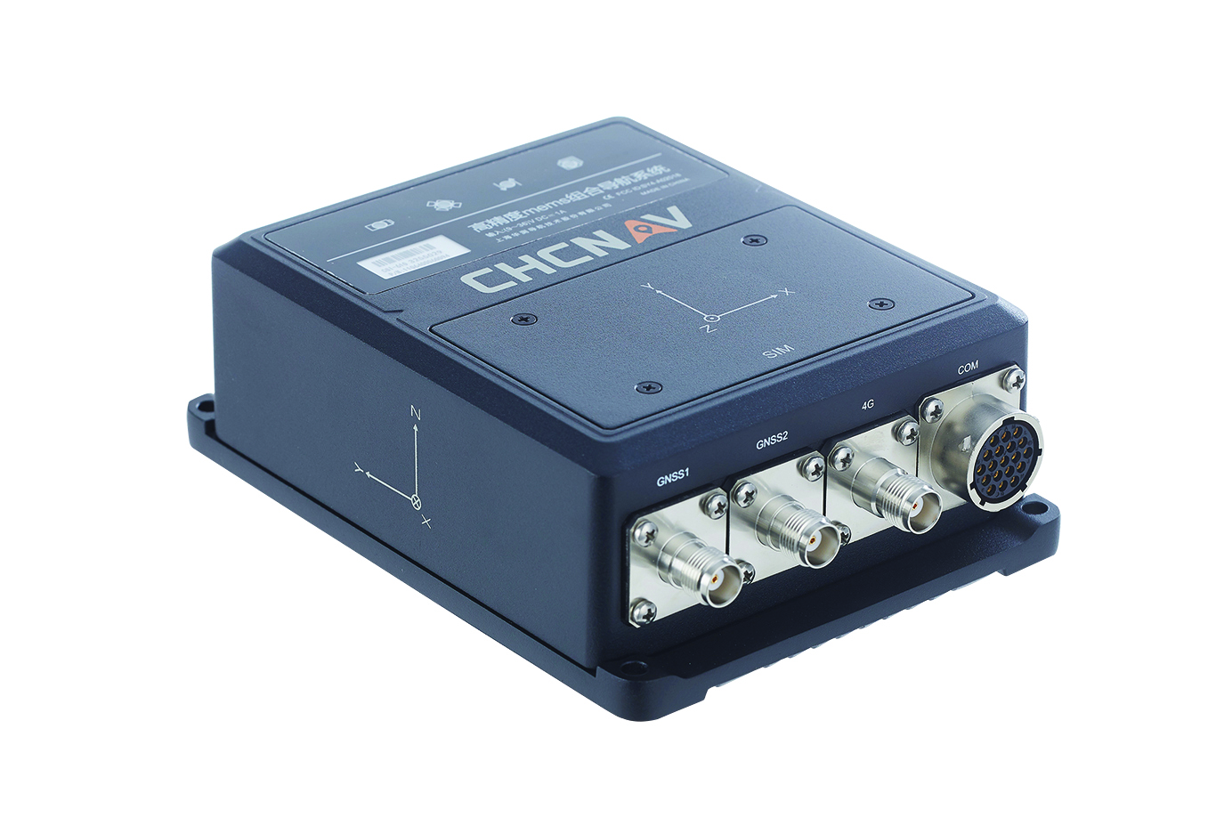
The CGI-610 GNSS/INS sensor is an advanced dual-antenna receiver designed for reliable and accurate navigation and positioning in challenging terrestrial, marine or airborne applications. Designed to meet the needs of 3D positioning and autonomous vehicle guidance applications, it provides high performance in urban canyons and other harsh environments where GNSS signals are lost or degraded. Incorporating GNSS technology and an industrial-grade inertial measurement unit, the sensor delivers accurate hybrid position, attitude and velocity data up to 100 Hz, driven by CHC Navigation algorithms. Its rugged and lightweight package ensures uninterrupted performance and meets high protection standards. CHC Navigation, chcnav.com
Image: uAvionix
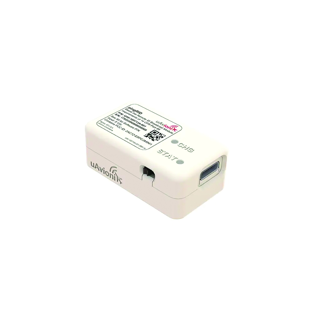
Remote ID Module
Meets FAA standards
The pingRID meets the Part 89 remote ID standards of the Federal Aviation Administration (FAA), which will become effective on Sept. 16, to keep operators safe and compliant throughout a flight. The pingRID comes pre-configured and ready for use out of the box. After assigning the pingRID unique identification number to the aircraft’s registration with the FAA, operators can attach the battery-powered device to their UAV and prepare for flight. A set of LED indicators provides status on the battery charge, device readiness for flight and inflight operations. The compact, lightweight design fits most aircraft without significantly impacting performance. The module also can be quickly recharged via USB-C. The FAA’s final rule on remote ID requires all UAV pilots to meet the operating requirements of Part 89. For most operators, this will require flying a UAV equipped with standard remote ID, a remote ID broadcast module such as the pingRID, or flying at a Federally Recognized Identification Area. uAvionix, uavionix.com
MOBILE
Image: Orolia
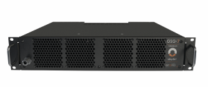
GNSS Simulator A positioning, navigation and timing test solution
GSG-7 delivers GNSS signal testing for location-aware applications and systems that require navigation or timing. The GSG-7 GNSS simulator features high-end performance with a 1,000 Hz simulation iteration rate, high dynamics, real-time synchronization, and simulation of all-in-view satellite signals. The GNSS simulator is suitable for development and integration projects that require high performance and an increased number of constellation licenses and satellites in view for a single antenna or trajectory. GSG-7 supports multi-constellation and multi-frequency GNSS simulations. It can be programmed to simulate operations with all current and future GNSS signals. Orolia, safran-navigation-timing.com
Image: Eos Positioning
GNSS Receiver Supports Galileo HAS
The Arrow Gold+ enables users to achieve better than 20 cm accuracy with 95% confidence using Galileo HAS. The Arrow Gold+ is one of the first high-accuracy GNSS receivers that supports Galileo HAS and is designed for the GIS market. Additional signal support for Arrow Gold+ includes: the concurrent use of the BeiDou B3 and GPS L5 signals as well as GLONASS, BeiDou, QZSS and IRNSS signals. Eos Positioning Systems, eos-gnss.com
Image: Pasternack
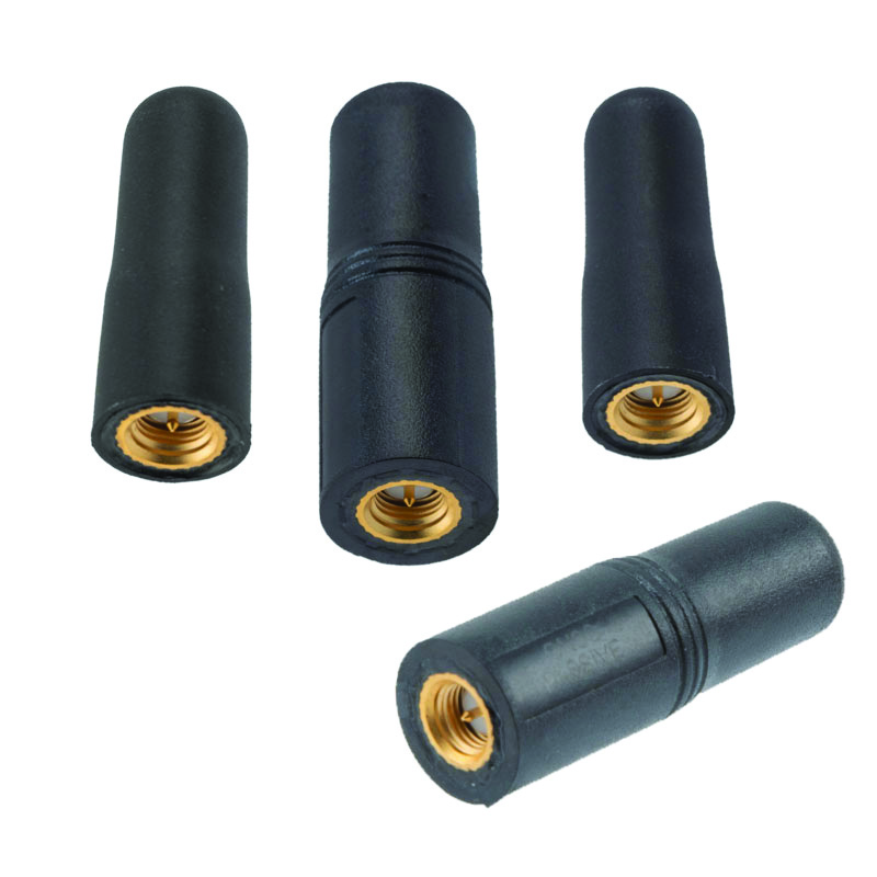
Mil-Spec GPS/GNSS Antennas Meets military specifications for use in several small form factor and mobile applications
The PEANGPS1006, PEANGPS1007, PEANGPS1008 and PEANGPS1009 mil-spec GNSS antennas are engineerered
for environmental performance according to the MIL-STD-810G standard and include multi-standard GPS L1, Galileo E1 and GLONASS options. They are IP67 rated and available in passive and active versions and provide coverage from 1,597 MHz to 1,607 MHz. The GNSS antennas feature linear polarization for cross-polarized isolation, nominal gain options of -3 dBic and 10 dBic, and SMA mounts. The mil-spec GNSS antennas are available now.
Pasternack, Pasternack.com
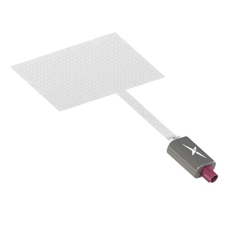
TFX62.A. (Image: Taoglas)
Near-Invisible Antennas Supports cellular Wi-Fi and GNSS technologies
The TFX62.A, TFX257.A and TFX125.A offer an alternative to standard opaque antennas, with “peel and stick” mounting capabilities to any nonmetal surface. The TFX62.A, TFX257.A and TFX125.A come with an adhesive and have an enclosed carrier terminated with a FAKRA connector for easy installation. The TFX series antennas leverage a sub-millimeter thick hybrid transparent conductive film that offers designers an invisible antenna solution. They are suitable for mobility, public infrastructure, medical devices, transportation and emerging IoT applications. Use cases for the antennas include electric vehicle chargers and parking meters, smart buildings and transportation vehicles.
Taoglas, taoglas.com
Image: CHC Navigation
3D Grade Control System For motor graders
The TG63 comes with a tightly coupled dual-GNSS positioning system and inertial sensor, and provides reliable 3D positioning and heading to ensure accuracy of the grader blade within ±2 cm. The TG63 is designed to withstand the harsh environment of construction sites and supports multiple applications, including real-time kinematic networked transport of RTCM via internet protocol and ultra-high frequency base stations.
CHC Navigation, chcnav.com
OEM
Image: ComNav Technology
GNSS Modules Now compatible with Galileo HAS
K8 series GNSS modules can use the Galileo High Accuracy Service (HAS) precise-point positioning (PPP). The PVT algorithm upgrade to the K8 series module supports Galileo HAS with an accuracy of 20 cm horizontally and 40 cm vertically. Galileo HAS provides free access to information necessary to estimate accurate positioning using a PPP algorithm in real-time through the Galileo signal E6-B and an internet connection. The improved performance capabilities provide a higher level of accuracy for industries such as UAV, autonomous driving, intelligent transportation, agriculture and more. ComNav Technology, comnavtech.com
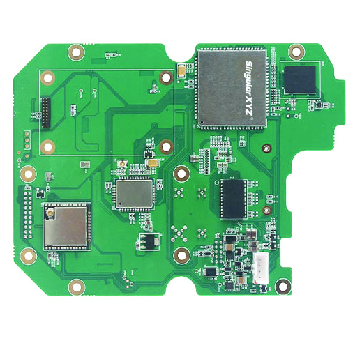
Images: SingularXYZ
Development Kit Designed for GNSS-related development integration
The DK100 development kit is a multi-functional kit with selectable single-antenna and dual-antenna modules, full constellation tracking and centimeter-level positioning. It is a ready-to-use kit designed to simplify integration efforts and increase compatibility with a variety of applications. The DK100 reserves standard adapter board interfaces to connect different GNSS modules and radio modules to meet specific needs. The development kits are coupled with a 4G module, Wi-Fi, Bluetooth, Ethernet modules, large memory and status indicators on a single PCBA. The DK100 comes with a web page for easy configuration. With Ethernet and Wi-Fi access, users can monitor device status and configure working mode and data transmission settings on the web page. The centimeter-level DK100 can be integrated in a range of horizontal and vertical applications, such as CORS construction, precision agriculture, construction machinery, smart navigation, monitoring, robotics, unmanned systems and more. Singular XYZ, singularxyz.com
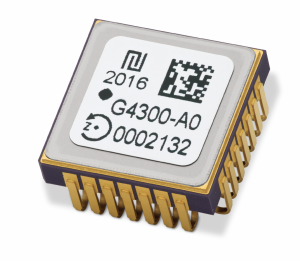
Image: TDK Corporation
Digital MEMS Gyroscope A high stability and vibration-tolerant gyroscope for dynamic applications
The GYPRO4300 features a ±300°/s input measurement range, 200 Hz bandwidth, and 1 ms latency with a closed-loop architecture that enables high linearity and stability. The GYPRO4300 has bias instability of 0.5°/h as a typical value and a maximum value of 2°/h. The GYPRO4300 is suitable for applications such as railways, land vehicles, vertical take-off and landing aircraft and UAVs, marine and subsea systems, borehole drilling and surveying instruments. The GYPRO4300 is available now for sampling and customer evaluations. Evaluations of the sensors also can be made with an Arduino-based evaluation kit that provides built-in testing functionalities such as output reading and recording, recalibration and digital self-tests. TDK Corporation, tdk.com
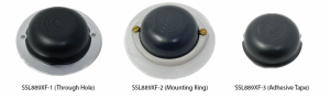
Image: Tallysman Wireless
GNSS Antenna Small, light, and dual-band
The SSL889XF employs Tallysman’s Accutenna technology providing GPS, QZSS L1/L2, GLONASS G1/G2/G3, Galileo E1/E5b, and BeiDou B1/B2b coverage. The SSL889XF antenna is designed for precision dual-frequency positioning where a light weight and a low profile are important. The SSL889XF antenna element is 48 mm in diameter and 20 mm tall and weighs ~50 g. It has a tight average phase center variation of less than 10 mm for all frequencies and overall azimuths and elevation angles. The SSL889XF is available in three versions. Model SSL889XF-1 has an integrated 61 mm ground plane and two mounting holes. Model SSL889XF-2 has a mounting collar, and model SSL889XF-3 is the antenna only and is attached using adhesive tape. All models have a female MCX connector. The SSL889XF antenna also supports Tallysman’s eXtended Filtering (XF) technology. Tallysman Wireless, tallysman.com
Image: ComNav Technology
Datalink Module Suitable for GNSS-based systems
The U702 datalink module is a RX/TX data link module that supports the LoRa modulation technique. Its compact, surface-mounted design and robust electromagnetic compatibility enable easy integration into GNSS systems such as robotic lawn mowers. With the LoRa modulation technique, the U702 has low power consumption, reception power of 0.025 w, and a working distance up to 1.5 km. It also enhances the ability to protect GNSS systems against various interference — making it possible to have high reception sensitivity, a low error rate, and high reliable data transmission even in harsh environments.
ComNav Technology, comnavtech.com
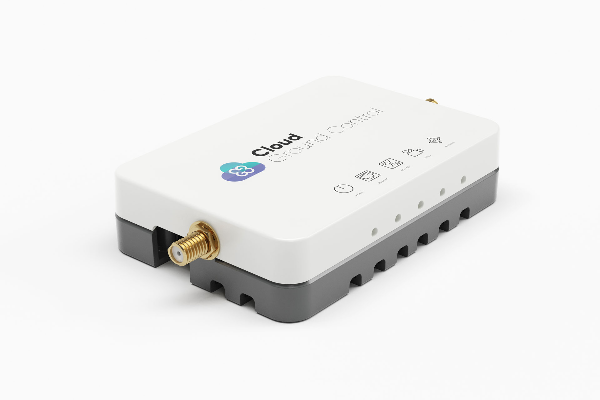
Image: Cloud Ground Control/Advanced Navigation
Fleet management device For air, land and sea vehicles
CGConnect can securely connect UAVs and vehicles into one autonomous fleet across land, sea and air, regardless of manufacturer or model. This provides mission planners and operators with full situational awareness for search and rescue, emergency response and disaster relief. Artificial intelligence (AI) algorithms are running in the cloud, relaying real-time camera feed data to the end user to support missions such as object detection, tracking and thermal imaging. The flexible and customizable open platform is operating on industry standards, which multiplies potential product applications and enables diverse autonomous vehicles and payloads to operate as a coordinated fleet. High-grade security safeguards data and IP from vulnerabilities and security breaches, helping users meet compliance obligations. Additionally, CGConnect supports edge AI to perform intensive object identification and classification directly on the vehicle for dynamic missions. CGConnect is available for pre-order. An OEM option is available. Cloud Ground Control/Advanced Navigation, cloudgroundcontrol.com/advancednavigation.com
On June 28-29, the European Union Agency for the Space Programme (EUSPA) will host Galileo High Accuracy Service (HAS) Days for users, industry stakeholders, application developers and international experts to learn more about HAS. This event provides an opportunity for all attendees to discuss and share expectations of Galileo HAS, its challenges, and benefits.
Over two days, participants will learn more about the status of Galileo HAS, including current performance, evolution plans and key user applications. There will also be dedicated user sessions, including live demonstrations allowing participants to experiment the Galileo HAS capabilities.
In addition, participants will visit the European GNSS Service Centre (GSC), the single interface between the Galileo system and the users. The GSC is a center of expertise, knowledge sharing, custom performance assessment, information dissemination and support to the provision of value-added services enabled by the Galileo services.
The GSC hosts the high accuracy data generator, which computes the HAS orbit and clock corrections as well as the signal biases that are broadcast through the Galileo constellation and over the internet.
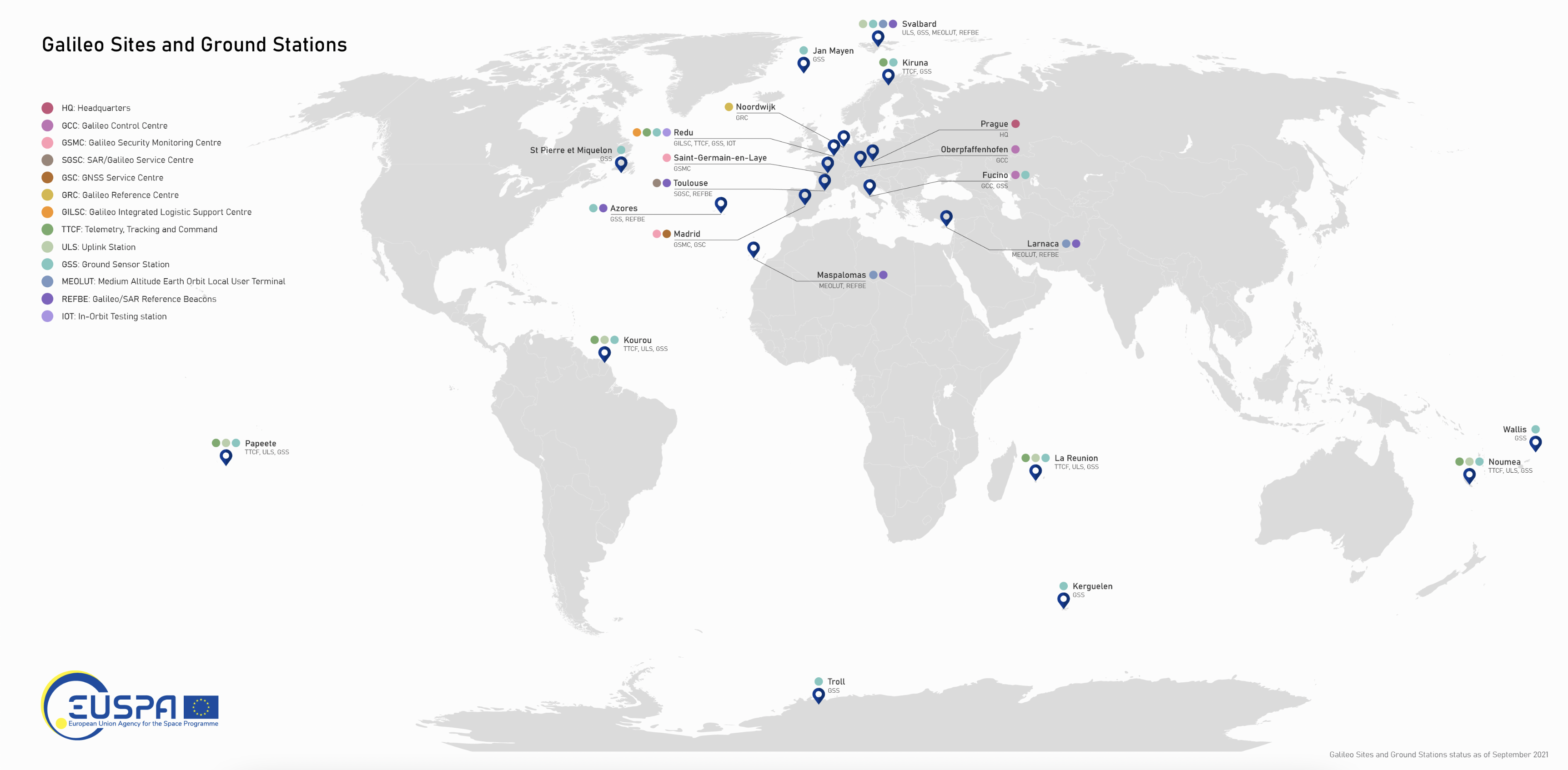
The newest addition to the network of Galileo sensor stations (GSS) is up and running in Wallis and Futuna, a French territory in the South Pacific consisting of three main islands and many tiny islets. It enables increased Galileo coverage in the southern hemisphere.
The European Union Agency for the Space Programme (EUSPA) reported that the decision for the new station was made in June 2020; however, due to COVID-19, its deployment did not begin until summer 2022. In October 2022, the second mission to Wallis and Futana took place to complete the deployment and connect the station to the ground mission segment network for data collection.
The GSS is a network of antennas deployed at remote locations around the world. They have small, omnidirectional receiving antennas 50 cm high that check the accuracy and signal quality of individual satellites and pinpoint current satellite orbits. Establishing GSS is difficult and requires security accreditation by EUSPA’s Security Accreditation Board.
To make the best use of the Galileo services, users rely on more than just the satellites. Dedicated facilities such as the Galileo control centers, sensors, and uplink stations are important components that make up the Galileo ground segment — which supports the service provision of Europe’s GNSS. The GSS is an important element of Galileo’s ground segment.
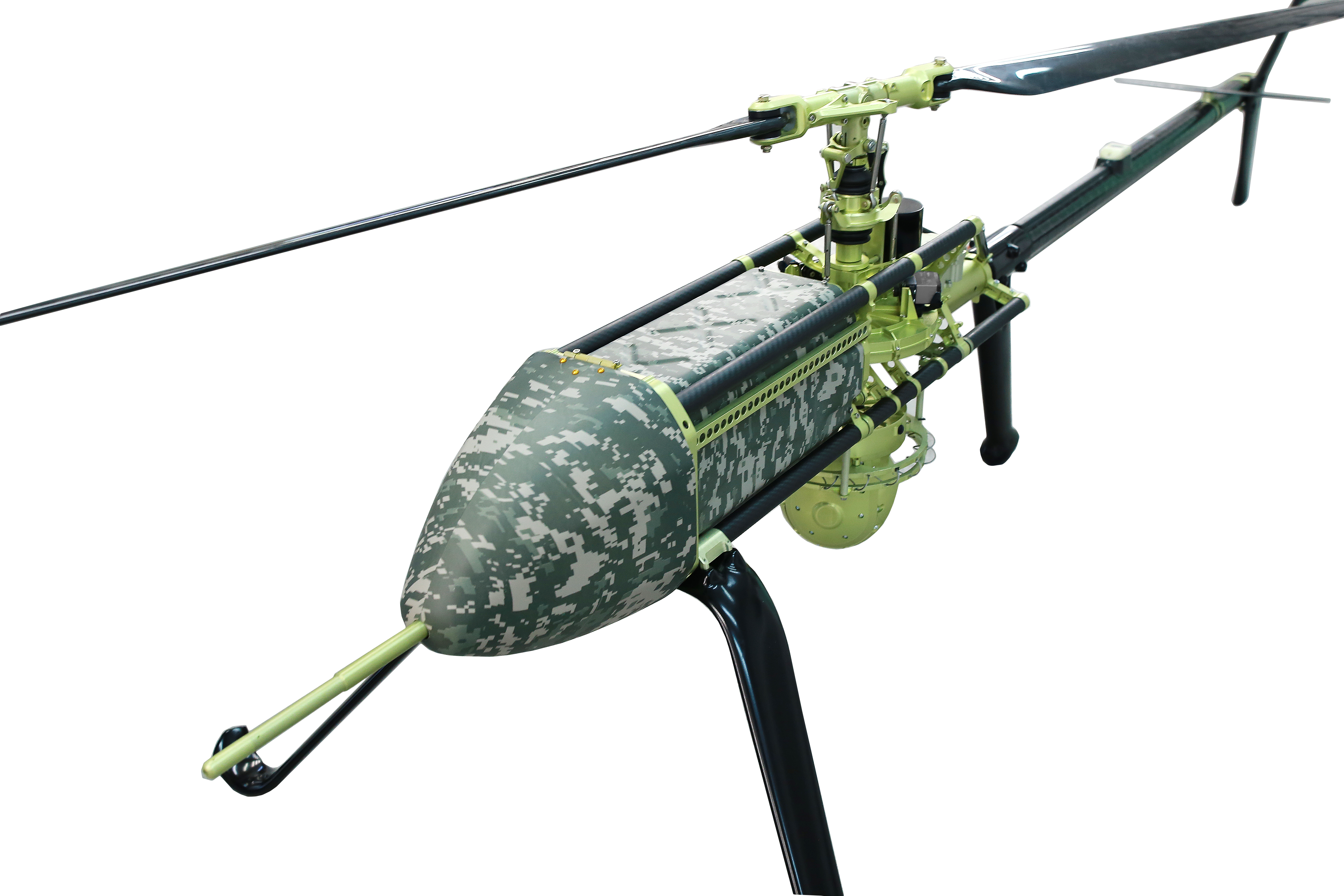
UAVOS has been selected by Bayanat, a provider of artificial intelligence-powered geospatial solutions, to deliver its unmanned aircraft system (UAS) for a variety of applications, including aerial photography and perimeter control. The UAS consists of two UVH 25EL unmanned autonomous helicopters powered by electric motors, a ground control station, and various sensor payloads — including a multispectral camera, lidar, and digital and thermal cameras.
The autonomous helicopter’s advanced capabilities of long endurance — up to 1.5-hours — along with its camera capabilities, enable the UVH 25EL to carry out accurate mapping within a radius of 67 km.
The UVH 25EL has a practical load weight of 5 kg. These capabilities enable high performance as well as maximum operational flexibility for applications such as coastal security, search and rescue, and advanced aerial photography missions.
UAVOS also provides full operational support, including training, and a fundamental review of the UAS’s possible uses.
Airbus Helicopters and the French Armament General Directorate (DGA) tested the unmanned aerial system (UAS) VSR700 for the first time in an operational configuration from a ship at sea.
The VSR700 performed 80 fully autonomous take-offs and landings from a civil vessel off the coast of Brittany in the west of France at the beginning of May.
In 2022, the autonomous take-off and landing capabilities of the VSR700 were tested from the same vessel using an optionally piloted vehicle based on a modified Guimbal Cabri G2 equipped with the autonomous take-off and landing (ATOL) system, developed for the VSR700. This time the test campaign took place with the SDAM demonstrator and fully validated the capabilities of the system as part of the Système de Drone Aérien pour la Marine study that was awarded to Airbus Helicopters and Naval Group in 2017.
Autonomous take-off and landing capabilities are a key asset of the VSR700 and are made possible with the use of the Airbus DeckFinder system. This enables autonomous launch and recovery of UAVs with an accuracy of 10cm-20cm during challenging operations in harsh environmental conditions, independently of GNSS/GPS and regardless of degraded visual conditions.
This test campaign follows two series of trials that were conducted with the DGA in late 2022 and early 2023, from the Levant Island test center located in the south of France. During these trials, the SDAM prototype demonstrated its ability to operate in a maritime environment.
The handling qualities of the aircraft were tested as well as the capabilities of the sensors (a maritime surveillance radar, an electro optical sensor, and an AIS receiver) alongside the mission system developed by Naval Group.
The next development steps will see the second VSR700 prototype perform its maiden flight ahead of flight testing onboard a French Navy FREMM during the second semester of this year.
On May 16, China launched a BeiDou satellite to replenish the constellation, reported Space News. This brings the constellation total to 56 satellites.
This backup satellite was aboard a Long March 3B rocket, which launched from the Xichang Satellite Launch Center in southwest China at 10:49 p.m. Eastern Time. The satellite aims to improve BeiDou’s stability, positioning precision and overall health.
In addition to launching the BeiDou satellite, China also launched satellites to study Earth and synthetic aperture radar test satellites (SAR) for disaster prevention.
On May 21, the Macau Science Satellite 1A and 1B launched on a Long March 2C rocket from the Jiuquan Satellite Launch Center at 4 a.m. Eastern Time. This satellite was designed to study the Earth’s magnetic field.
Also, on May 21, aboard the same rocket was the Luojia-2 (01), a Ka-band synthetic aperture radar test satellite for Wuhan University. The Luojia-2 (01) will test signal enhancement and integration of remote sensing imaging, meteorological detection and more.
The China Aerospace Science and Technology Corporation has planned more than 60 launches this year and has already completed 20 thus far.