Category: Space & Earth

  • First Fix: Very busy space

    First Fix: Very busy space

    Artist impression; size of debris exaggerated as compared to Earth. (Image: ESA)
    Artist impression; size of debris exaggerated as compared to Earth. (Image: ESA)

    So much going on up there!

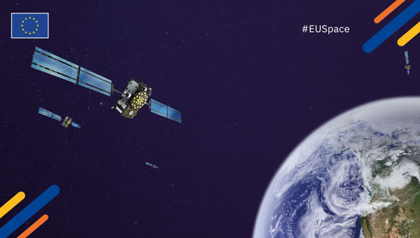
    On Jan.11, speaking at a press briefing in Paris, Javier Benedicto, director of navigation for the European Space Agency (ESA), announced the agency had completed the procurement process for the low-Earth Orbit Positioning Navigation and Timing (LEO PNT) program. ESA expects to have the new LEO PNT demonstration satellites, which will broadcast signals over several frequency bands, up and running by 2026. A positive outcome will most likely lead to the procurement and deployment of a full European LEO PNT constellation for global services.

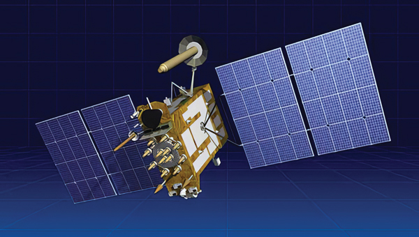
    Also in January, news broke that Google and two of the largest mobile network operators in the world, AT&T and Vodafone, had invested more than $200 million in AST SpaceMobile’s cellular broadband network based on LEO satellites and accessible directly by smartphones. AST SpaceMobile already operates the largest-ever commercial communications array in LEO, the BlueWalker 3 satellite, which, due to its size and brightness, is alarming astronomers.

    On Feb. 21, The New York Times reported about U.S. warnings to its allies that Russia might deploy a nuclear weapon in orbit this year. According to the paper, U.S. intelligence agencies told their closest European allies that, “if Russia is going to launch a nuclear weapon into orbit, it will probably do so this year — but that it might instead launch a harmless ‘dummy’ warhead into orbit to leave the West guessing about its capabilities.” A space weapon nested inside a satellite could destroy, jam, or otherwise disable dozens or hundreds of commercial and military satellites in LEO, such as the Starlink satellites that are revolutionizing global communications. See Dana Goward’s analysis.

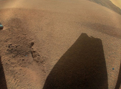
    The next day, Tim Crain, chief technology officer of the Houston-based company Intuitive Machines announced, “Houston, Odysseus has found its new home.” For the first time since Apollo 17 in 1972, a U.S.-built spacecraft had landed on the moon. Odysseus, described by the Times as “a bit bigger than a telephone booth,” (which most people under the age of 20 have never seen), was later confirmed to be upright and sending images. It was delivered into lunar orbit by a SpaceX rocket. NASA hopes this mission will help inaugurate a new era of economical spaceflights around the solar system. Intuitive Machines is one of several small companies the agency has hired to transport instruments to reconnoiter the surface of Earth’s only natural satellite in preparation for the return of NASA astronauts.


    My highly synthetic description of the Federal Aviation Administration (FAA) aircraft tracking systems in last month’s First Fix was a bit muddled. Fortunately, I can count on our Editorial Advisory Board member Mitch Narins to clarify:

    FAA systems determine an aircraft’s position using a combination of independent and dependent surveillance. Independent surveillance does not require the “cooperation” of the aircraft (e.g., primary radar), while dependent surveillance requires the aircraft to either respond to an interrogation signal or periodically transmit its position — e.g., Automatic Dependent Surveillance-broadcast (ADS-B).

  • EU to launch Galileo-based emergency alert system

    EU to launch Galileo-based emergency alert system

    Image: EUSPA
    Image: EUSPA

    The European Union Agency for the Space Program (EUSPA) has published a technical document detailing the main characteristics of the new Galileo Emergency Warning Satellite Service (EWSS).

    According to the document, Galileo satellites will transmit emergency warning messages directly to Galileo-enabled smartphones and other navigation devices. The satellites will offer information related to the hazard, such as type, severity, expected onset and duration, as well as the location of the affected area and instructions to follow. The alert content will be generated by national authorities and transmitted to Galileo for broadcast.

    “With this new document, some of our key stakeholders can already start to work with this new service,” said Fiametta Diani, head of market, downstream and innovation at EUSPA. “Civil protection authorities in the member states can start to prepare for how they will manage the alert messages they will send via Galileo. The same goes for the receiver and chipset communities, who will have to process this message.”

    In 2023, EUSPA began testing the EWSS in different locations in Europe. “We have run trials in Toulouse and in Germany, specifically with a simulated explosion,” Diani said, “like what you might see with an industrial accident. We have also tested a tsunami alert in Cyprus.” The Union is developing the tsunami application together with Japanese partners. EUSPA has also finished flood testing in Belgium and Luxembourg.

    EUSPA plans to launch the new EWSS in 2025, Diani said. “As for the receivers, we are working to get our chipset and receiver industry ready,” she said, adding that this process is also supported by the Fundamental Elements program.

    Fundamental Elements is an EU funding mechanism that supports the research and development of European GNSS-enabled chipsets, receivers and antennas. The projects are part of the overall strategy for European GNSS market uptake, said EUSPA.

    The member states and the correlating national civil protection authorities will initiate warnings, according to Ignacio Alcantarilla Medina of the European Commission.

    “[Authorities] will send a message to the Galileo system, and then Galileo will transmit that message through its satellite signals to the users,” he said.

    According to EUSPA, the service is designed to be used worldwide to serve as a backup to the already existing mobile network warning systems.

  • Iridium acquires Satelles to boost PNT capabilities

    Iridium acquires Satelles to boost PNT capabilities

    Image: Iridium
    Image: Iridium

    Iridium Communications, a satellite network operator, will acquire Satelles for $115 million. Satelles is a provider of secure satellite-based time and location services that complement and protect GPS and other GNSS-reliant systems.

    While Satelles primarily focuses on providing its satellite time and location (STL) services for digital infrastructure companies, there are potential applications for aviation, the company said. Satelles offers smaller form factor devices that can be integrated with data processing and storage servers to provide critical positioning, navigation and timing (PNT) data.

    According to Iridium, the STL service uses the stronger broadcast paging channels of the Iridium satellite constellation to deliver precise timing information. This aims to provide global, secure time and location signals that are more powerful than GNSS constellations, the company continued. The service is resilient to regional GNSS outages, works inside buildings and is being used to secure digital infrastructure for financial markets, governments and major corporations.

    The company is now working to reduce the size and cost barriers to improve integration with autonomous systems, consumer devices, vehicles and traditional markets such as aviation, maritime and land mobile. STL can help mitigate GNSS jamming and spoofing, with dedicated STL receivers incorporated into aircraft avionics.

    “The most immediate application would be in aviation/Federal Aviation Administration (FAA) ground infrastructure to support PNT resilience in their networks,” Iridium CEO Matt Desch told AIN. “[In the] longer term, there would be an opportunity for avionics providers to build STL into their avionics to protect the integrity of the GPS signals their boxes use and provide a way to tell if GPS signals were compromised or spoofed. We don’t think we’ll be an alternative to GPS or other GNSS applications—only a backup to constantly check signal integrity.”

    A long-standing investor in Satelles, Iridium had an ownership stake of 20% from three previous investments in the company. Iridium expects to complete the acquisition in the next few weeks.

  • Tough Times for Russian Navigation System

    Tough Times for Russian Navigation System

    The Russian satellite navigation system is experiencing tough times as Western sanctions and Russia’s ever-growing international isolation seriously complicate its further development.

    Prior to Feb. 24, 2022, when Russia invaded Ukraine, Russia’s navigation sector was developing well and had a healthy growth rate, which is reflected by the steady growth and improved performance of its satellite constellations. However, the start of Russia’s war with Ukraine and the consequent international sanctions regime against Russia has put an end to the hopes for further development of the sector and especially of its flagship GLONASS global navigation satellite system (GNSS).

    As for GLONASS, as academician Nikolai Testoedov, general designer of JSC Information Satellite Systems Reshetnev, one of Russia’s leading satellite manufacturing companies, said during a general meeting of the Russian Academy of Sciences, the main problem is that Western sanctions do not allow Russia to bring its positioning accuracy to the desired 30 cm or at least 50 cm.

    According to Testoedov, the main reasons for this are serious problems with the supplies of electronic components, most of which Russia traditionally imported. “Until 2014, when the first sanction restrictions were introduced, the share of imports in Russia’s entire satellite constellations reached 42%,” Testoedov said. “Currently we implement a strategy of import substitution in the sector, which is designed until 2030 and involves a transition to 100% domestic products. As of 2014, we had 6,000 electronic components of foreign origin. Since 2014, a lot of work has been done to combine various equipment. Now, it is used in Russia’s satellite constellations.”

    It has already brought some results. According to Ivan Revnivyh, head of the GLONASS department of the Russian space corporation Roscosmos, thanks to the new satellites that have been launched in recent years, the accuracy of GLONASS civil signals has increased up to 1.32 meters. According to Revnivyh, Russia plans to continue work in this direction as part of its existing federal project “Maintenance, development and use of the GLONASS system,” which intends to increase the accuracy of the signals up to 0.3 m.

    Russia plans to continue to improve GLONASS’s accuracy until it matches that of other GNSS and meets International Civil Aviation Organization (ICAO) requirements.

    “When landing a civil aircraft at unequipped airfields,” Testoedov said, “the signal should arrive with a delay of no more than 6 seconds, with an accuracy of no worse than half a meter.”

    Despite the sanctions, Russia plans to continue to develop GLONASS. As part of these plans, starting from 2025, it plans to launch modernized GLONASS-K2 satellites in an import-substituted and multifunctional version. Thanks to this, the signal will be 100 times more powerful than the standard one. That will be primarily achieved by using dedicated navigation satellites weighing about 1 ton.

    After 2030, Russia also plans to place six satellites in geosynchronous orbits (about 36,000 km), which will increase the availability of the signal in Russian cities and difficult terrains.

    There are also plans to create a constellation of 300 satellites in low-Earth-orbit (LEO) at an altitude of 500 to 100 km. They are expected to increase the strength Russian satellite signals by more than 1,000 times.

    In recent years, Russia has faced restrictive policies implemented by various international bodies, including the International Bureau of Weights and Measures and the International Association of Geodesy. According to Russian experts, many of these bodies are currently taking discriminatory measures against Russian systems and technologies.

    In this regard, Russia plans to propose to the countries members of BRICS — an intergovernmental organization comprising Brazil, Russia, India, China, South Africa, Egypt, Ethiopia, Iran and the United Arab Emirates — to design products and systems whose characteristics will be comparable to those of Western origin. According to Reshetnev Systems’ experts, however, this could improve results — mainly, accuracy — by only 20 percent, which would not be critical for Russia.

    GLONASS, which first achieved a full constellation of 24 satellites in 1995, currently consists of 24 satellites of three types: GLONASS-M, which has been produced since 2003, GLONASS-K which has been produced since 2011, and two GLONASS-K2, which Russia launched in 2023. All the satellites are part of the Cospas-Sarsat system.

    Despite the fact that the life expectancy for most Russian GLONASS satellites is seven to 10 years, many of them, according to Testoedov, are already more than twice as old. Russia plans to replace at least six GLONASS satellites within the next two to three years. In the first years of launching the constellation, Roscosmos usually launched nine satellites into orbit at once; currently, it is launching only one or two at a time.

    Still, it is possible that these rates will increase significantly, as by 2030 Russia plans to increase its constellation of satellites by up to 1,000 satellites. For this purpose, the country plans to produce 200-250 satellites per year.

    According to the head of Roscosmos, Yury Borisov, space industry enterprises should produce one satellite per day by 2030. According to him, the Russian Federation is ready to learn from the experience of other countries in this area, such as China.

  • Seen & Heard: Deep sea coral reefs and lava in Iceland

    Seen & Heard: Deep sea coral reefs and lava in Iceland

    “Seen & Heard” is a monthly feature of GPS World magazine, traveling the world to capture interesting and unusual news stories involving the GNSS/PNT industry.


    Photo: NOAA Ocean Exploration
    Photo: NOAA Ocean Exploration

    Exploring the Largest Deep-Sea Coral Reef

    Scientists have mapped the largest deep-sea coral reef, stretching hundreds of miles off the U.S. Atlantic Coast. While researchers have known since the 1960s that some corals were present off the Atlantic Coast, the reef’s size remained a mystery until new underwater mapping technology made it possible to construct 3D images of the ocean floor. The National Oceanic and Atmospheric Administration (NOAA) and a team of scientists recently published maps of the reef in the journal Geomatics. The reef extends for about 310 miles from Florida to South Carolina. The total area is nearly three times the size of Yellowstone National Park.

    Photo: ESA
    Photo: ESA

    Lava in Iceland

    Grindavík, a tiny town in Iceland, stands on the brink of volcanic lava flow in images captured by the European Space Agency (ESA). The lava originates beneath the Svartsengi volcano system — roughly 2.5 miles north of the town — which erupted on December 18 and January 14. ESA’s Sentinel2 satellite revealed the glow of the lava flow’s heat, not far from houses and other infrastructure within Grindavík. The town, with just 3,800 residents, has faced constant evacuations, as well as mini-earthquakes as a result, The Guardian reported.

    Photo: Maris Maskalans / iStock / Getty Images Plus / Getty Images
    Photo: Maris Maskalans / iStock / Getty Images Plus / Getty Images

    Lidar Reveals Lost Cities in the Amazon

    In the Amazon rainforest, archeologists have discovered a vast and highly complex system of ancient cities dating back nearly 3,000 years. Located in Ecuador’s Upano Valley, the structures lie in the eastern foothills of the Andes mountains, according to a study published in the journal Science. After more than 20 years of research, the ancient urban centers were only discovered when the Ecuadorean government employed lidar technology. Researchers from France, Germany, Ecuador and Puerto Rico conducted a lidar survey that covered roughly 300 km2, which revealed a landscape full of organized human activities, including more than 6,000 rectangular earthen platforms, as well as agricultural terraces and drainage systems. According to the study, these structures formed at least 15 distinct settlements, which were connected by a system of wide, straight roads.

    Photo: nickalbi / iStock / Getty Images Plus / Getty Images
    Photo: nickalbi / iStock / Getty Images Plus / Getty Images

    Tracking Cattle from Space

    Australian scientists are attempting to track 1,000 cattle and buffalo using artificial intelligence (AI), and GPS satellites, reported euronews.next. An estimated 22,000 cattle and buffalo roam free in a remote area of Arnhem Land, Australia, though the exact number is unknown. Scientists are now collaborating with stockmen and indigenous rangers in a four-year program that involves monitoring feral animals from space. Titled SpaceCows, the remote herd management system is backed by the Australian government’s Smart Farming Partnership initiative. Local rangers and stockmen are chasing and catching animals to attach solar-powered tags with GPS receivers.

  • Final grounding for Ingenuity?

    Final grounding for Ingenuity?

    NASA’s Ingenuity took this picture on Jan. 18, 2024. The sand-dune, rock-less area where Ingenuity last showing the shadow of its damaged rotor blade. (Image: NASA)
    NASA’s Ingenuity took this picture on Jan. 18, 2024. The sand-dune, rock-less area where Ingenuity last
    showing the shadow of its damaged rotor blade. (Image: NASA)

    It appears that the little extraterrestrial drone that could has come a cropper on Mars and now will not be flying again – it is permanently grounded. The Jet Propulsion Lab (JPL) crew managing Ingenuity was running a regular scouting trip over a featureless sand-dune area on Dec. 22, 2023. Suddenly, the UAV’s visual navigation system malfunctioned, which led to a hard emergency landing.

    When the autonomous navigation system did not have any landmarks to match its digital reference map, it reverted to an emergency landing. Maybe the poor guy should have had a few moments to gather its airborne wits and to come down softly, but alas at the same time the connection with the rover was lost, he dove for cover and broke a chunk off at least one of the counter-rotating blades. This now apparently prevents further take-offs. Mars’ atmosphere is only 1% as dense as Earth’s, so those rotors need all their designed lift capabilities to grab enough ‘air’ and get the 4 lb helicopter airborne. The flight control system may be unable to cope with the resulting compromised lift profile. Either way Ingenuity’s flying days are over, according to NASA.

    Conceptual design for the Sample Recovery Helicopters (Image: Aerovironment/ NASA/ JPL)
    Conceptual design for the Sample Recovery Helicopters
    (Image: Aerovironment/ NASA/ JPL)

    Ingenuity completed 72 flights over the course of three years, surpassing its original 30-day mission to prove the possibility of a miniature, autonomous helicopter flight on Mars. After its initial four flights, NASA and JPL chose the UAV to scout out safe paths for the Perseverance rover from an airborne perspective.

    All is not lost for Ingenuity, however. AeroVironment, the UAV manufacturer that co-developed Ingenuity with NASA/JPL, has been awarded another contract to design and develop two prototype ‘sample-return’ helicopters for NASA’s next major Mars expedition.

    Building on Ingenuity’s design, the new UAV will have wheels and a grappling contraption to pick up sample tubes, which could assist in the Mars sample recovery mission. Perseverance is currently expected to be the lead in transferring cached sample tubes to the new Sample Retrieval Lander for return to Earth, but the new helicopters provide a different backup option on Mars for pick-up and transport of the tubes.


    Back here on Earth, the latest tragic news from the Middle East — the UAV attack on the US Tower 22 military outpost in Jordan which cost three soldiers their lives and injured at least 34 others — appears to have been due to a lack of defensive capability. Earlier news releases indicated that the kamikaze UAV had arrived at the same time as the expected return of a U.S. UAV from the base, implying that defenses may have been taken down temporarily. It now seems that there was little active defense to prevent the attack.

    The attacking UAV reportedly came in very low, and the base was unable to track its approach. The base is said to have defensive signal jamming capabilities, but without radar visibility of the UAV and knowing an attack was in progress, the jammers may have been ineffective or inactive.

    Tower 22 was thought of as a low-risk-of-attack U.S. base, perhaps supporting another U.S. base in Syria with logistics, so no active drone suppression system had been provisioned. This assessment, and those for similar bases in the area and around the world, may perhaps have to be revised and sufficient active defenses may need to be installed.


    While U.S. and Ukrainian forces deal with attacking drones, Iran has unveiled its latest addition to its arsenal of one-way killer unmanned aircraft.

    Image: Iranian Military Media
    Image: Iranian Military Media

    Iran displayed the Shahed-238 in public in November 2023, so there may have already been enough time to get some of these very fast-flying vehicles through the manufacturing process and begin deliveries to Russia and Iranian proxy agents. The advantage of jet-power is of course significant speed over propeller-driven variants, while the range may be significantly less for the same fuel capacity. The disadvantage for the United States and Ukraine is that most fielded conventional UAV detection radars have difficulty seeing fast targets in time to activate and aim defensive weapons.

    The situation for Ukraine and the United States in the Middle East appears to be worsening as large numbers of Iranian-supplied and locally manufactured kamikaze UAVs are pumped into the war zone and ‘hot spots’ in the Middle East.

    It is sad that Mars aerial views may be limited as Ingenuity seems to be permanently grounded, and the Middle East doesn’t sound too safe to be hanging around in either! Further escalation of prices might be expected, too, as a good part of the volume of cargo ships settle into sailing around Africa. Let’s look for better news in the coming months.

  • Russia’s space-based nuclear weapon? Here’s an educated guess

    Russia’s space-based nuclear weapon? Here’s an educated guess

    Earlier this week House Intelligence Committee Chair Mike Turner sounded an alarm about a serious national security threat. It had to do with Russia, a weapon, space, and something nuclear.

    For many, these clues conjured up images of bombs falling to Earth from space, satellites destroyed by powerful electromagnetic pulses, shrapnel impacting the space station, and so on.

    Yet, putting nuclear weapons in space would be a clear violation of the 1967 Outer Space Treaty to which Russia and the United States are both signatories. It would also significantly increase East-West tensions at a time when Russia has enough tension and international condemnation to handle.

    Thursday evening the White House calmed the waters a bit by saying that Russia was pursing an anti-satellite weapon that cannot cause physical destruction on Earth.

    The most reasonable conclusion to draw from all of this is that Russia is closing in on its goal of having a nuclear-powered electronic warfare capability in space.

    Such a reusable weapon could be far more useful than any one-use nuclear explosive device.

    Threat = Intent + Capability

    A lengthy and detailed 2019 article on the site “Space Review” examined indications that Russia had begun construction of such a device. Titled “Ekipazh: Russia’s top-secret nuclear-powered satellite” it begins:

    “There is strong evidence from publicly available sources that a Russian company called KB Arsenal is working on a new type of military satellite equipped with a nuclear power source. Called Ekipazh, its mission may well be to perform electronic warfare [EW] from space.”

    The author, Bart Hendrickx, goes on to explain that development of such a weapon would be entirely in keeping with reported Russian government plans. Citing one Russian language source he says:

    “… the deployment of EW platforms in orbit would be in accordance with a policy for Russia’s electronic warfare program until 2020 approved by the Russian government in January 2012. A summary of this policy indeed mentions space-based electronic warfare as one of the objectives to be accomplished in the period before 2025. More specifically, it talks about the need to deploy ‘multifunctional space-based EW complexes for reconnaissance and suppression of radio-electronic systems used by radar, navigation and communications systems.’”

    When intelligence agencies assess the severity of a particular threat, they look at an adversary’s desire or intent to carry out a particular act, and their capability to do so. If the reporting is correct, Russia has intended to put a nuclear-powered EW satellite or spacecraft in orbit for some time. This week’s political dust up may mean that the decades of hard work described by Hendrickx in Space Review have paid off and given them the ability to do so.

    More Useful Than Orbiting Bombs

    The United States is far more dependent upon space than any other nation. As regular GPS World readers know, this is especially true for the essential positioning, navigation, and timing services that underpin virtually every technology.

    Destroying satellites would quickly lead to a shooting war that no one would want.

    On the other hand, electronic warfare doesn’t necessarily lead to casualties right away and is harder to recognize as actual warfare. For example, Russia has been attacking NATO countries, ships, and aircraft in the Baltic with GPS jamming and spoofing on and off since mid-December. No one has died (yet) and NATO, to the best of our knowledge, has not responded.

    Rather than destroying satellites, how much more useful is it to be able to temporarily disrupt the operation of one or more satellites? Or perhaps one type of satellite, such as GPS?

    Such attacks are reversable, so the attacked party is less likely to send bombs and bullets in return right away. And if the attacker gets what they want, or suddenly discovers they have gone a bit too far and are approaching a kinetic exchange, backing off is as easy as flipping a switch.

    Just the threat of being able to deny GPS or other satellite signals over a wide area would be useful.

    In fact, Russia has already made this kind of threat and it didn’t backfire.

    In November 2021, prior to its invasion of Ukraine, Russia used a ground-based missile to destroy one of its own defunct satellites. Shortly thereafter Russian state-sponsored media claimed the demonstration “… means that if NATO crosses our red line, it risks losing all 32 of its GPS satellites at once.” Aside from a strong diplomatic tongue-lashing, there were few consequences. Additionally, wherever the “red line” was, it seems that NATO did not cross it.

    Nuclear Powered EW Most Likely

    It’s hard to know what more will be revealed, if anything, about this week’s dust-up over Russia, weapons, space, and nuclear.

    But Russia has long prided itself on its electronic warfare prowess. It sees EW as a counterbalance to the West’s dominance in high tech weapons and warfare.

    It is highly likely that Russia is executing its plans to extend this prowess and advantage into space with a nuclear-powered EW satellite.

    Whether or not this is the root Washington’s kerfuffle, the possibility should be an on-going concern for the United States.

    Our dependance on space makes us vulnerable. Our critical over-dependence on space for PNT, especially in light of the terrestrial PNT alternatives available to Russia and China, exposes our jugular and virtually invites attack.

    We have placed most of our eggs in the same basket — and there are too many ways in which it can be knocked to the ground.

    Until the United States establishes a resilient national PNT architecture, one with GPS at its center supported by other diverse and robust sources, we will continue to unintentionally encourage such things as space-based nuclear-powered electronic warfare and be at severe risk.

  • US DOJ moves to dismiss Ligado lawsuit

    US DOJ moves to dismiss Ligado lawsuit

    The United States Department of Justice (DOJ) has filed to dismiss satellite communications firm Ligado Network’s October 2023 lawsuit against the federal government, arguing that the court does not have jurisdiction and the company’s claims have no legal basis.

    Ligado’s $40 billion suit alleged that officials at the U.S. Department of Defense (DOD) took “unlawful actions” to, in effect, improperly seize the firm’s L-band spectrum without compensation. Ligado was granted to build a 5G communications network by the Federal Communications Commission (FCC) in 2020.

    Ligado plans to use the L-band spectrum — normally used by satellites — to develop a wireless cell phone network. However, the DoD, and several other federal agencies, including the Department of Transportation (DOT), have expressed concerns that Ligado’s terrestrial operations could have harmful effects on GPS.

    According to Ligado, as long as the DOD continues to use the spectrum, Ligado will be unable to use it to launch its terrestrial communications services.

    The DOJ’s motion asserts that rather than the U.S. Federal Claims Court, the issue instead falls under the jurisdiction of the Federal Communications Act, which “established a comprehensive remedial scheme” for FCC licensing decisions.

    Secondly, the motion says Ligado’s complaint “fails to allege any authorized government actions that could give rise to takings liability, and instead, it contends that the government has been engaged in an unlawful effort to preclude Ligado from using its FCC license. These contentions necessarily preclude any takings liability.”

    The motion goes on to contest each of the Ligado suit’s four specific legal claims. The DOJ alleges, “Ligado fails to plead any plausible facts to support its purely speculative claim that the government has occupied its licensed spectrum. And its theory that the government required a spectrum ‘dead zone’ around the separate spectrum bands allocated for GPS use similarly fails because Ligado cannot identify any authorized government action that precluded it from actually using its modified license.”

    In response to the motion, Ligado provided a statement to Breaking Defense, reiterating its complaint that government officials deliberately deprived Ligado of its rightfully licensed property and must be held accountable.

    “This attack on an American business by the world’s most powerful institution is contrary to the rule of law and antithetical to the government’s years-long support for the deployment of 5G technology as a vital national priority,” the statement said. “We worked diligently and in good faith with government agencies to find a fair resolution but were left with no choice but to pursue litigation to defend our interests. We continue to stand firmly behind our complaint and will reply to the government’s motion in the appropriate forum.”

  • Geely expands satellite network for autonomous vehicles

    Geely expands satellite network for autonomous vehicles

    Image: Geely
    Image: Geely

    Geely, a Chinese automaker, has launched its second set of low-Earth orbit (LEO) satellites in its effort to enhance navigation capabilities for autonomous vehicles. The 11 satellites were launched from the Xichang Satellite Launch Center in Sichuan, China province.

    According to Geely, the company aims to have 72 satellites in orbit by 2025. The long-term goal is to establish a constellation of 240 satellites to create a comprehensive satellite network for various applications.

    Geely’s satellite network is designed to provide high-precision positioning support for autonomous vehicles. By using satellite technology, the company aims to enhance navigation accuracy to enhance safety and efficiency on the roads.

    The newly launched satellites are equipped with artificial intelligence (AI) remote sensing capabilities, which allows them to capture clear high-resolution imaging. With a resolution ranging from 3.2 ft to 16.4 ft, these satellites can provide valuable data and imagery for multiple applications, including surveillance, urban planning and infrastructure management.

    China’s satellite industry has seen a significant surge in commercial activities since the government allowed private investment in the space sector. With supportive policies and investments, numerous commercial companies, including Geely, have ventured into satellite manufacturing and launch vehicles.

  • GPS OCX delays continue

    GPS OCX delays continue

    Image: iLexx/ iStock / Getty Images Plus/ Getty Images
    Image: iLexx/ iStock / Getty Images Plus/ Getty Images

    New GPS ground stations that are contracted by Raytheon Technologies to replace the current ground stations have been delayed until July 2025, the Pentagon’s testing office reported.

    The Next Generation Operational Control System (OCX) is facing a new delay of 16 months, according to the 2023 Annual Report of the Director of Operational Test & Evaluation (DOT&E).

    More than seven years behind schedule, the continuous delays have caused the U.S. Department of Defense (DOD) to go over its yearly budget and have sparked discussions as to future budget allocations for the U.S. Space Force (USSF) to continue to control and enhance the GPS constellation.

    “These delays increase the risk that U.S. and allied warfighters will be unable to conduct successful operations in future contested environments due to the lack of access to modernized GPS position, navigation, and timing (PNT) information,” the Pentagon’s testing office said in a statement.

    The M-Code can now be broadcast on 21 of the 31 GPS satellites in orbit. However, it is only available to a small number of military personnel due to both the OCX issue and a lack of radios and receivers equipped to access it.

    The Space Force has a Military GPS User Equipment (MGUE) program underway to develop new computer chip-carrying cards to retrofit existing platforms, such as aircraft and ships, so they can ingest M-code signals, as well as to develop a new handheld receiver. This effort has also experienced delays, according to a June 2023 report by the Government Accountability Office.

    The 2024 DOT&E report notes that because of the delays in the development of the MGUE receiver cards, the Army and Marine Corps are now buying commercially developed receivers capable of ingesting the M-Code for fielding with ground vehicles.

    Additionally, the DOT&E report cautions that because the OCX software is designed to be the basis for an upgraded system, OCX Block 3F, designed to control the planned next generation of GPS satellites called GPS IIIF, that effort also is likely to be delayed. The Space Force intends to launch the first GPS IIIF satellite in 2027.

  • SSC launches inquiry for GPS prototype development

    SSC launches inquiry for GPS prototype development

    Image: SSC
    Image: SSC

    The U.S. Space Systems Command (SSC), part of the United States Space Force, is actively seeking insights from the GNSS industry through a Request for Information (RFI) regarding the development of a Global Positioning System (GPS) Rapid Prototype Demonstration, Tranche 0.

    This initiative is part of a strategic effort to upgrade GPS capabilities to meet modern challenges in space navigation and ensure continued operational superiority. This RFI aims to collect information about the industry’s capacity to innovate and deliver solutions that can enhance the GPS infrastructure. The focus is on identifying technologies and approaches that can reduce the size, weight, power and cost (SWaP-C) of future GPS satellites, streamline their production and launch processes and improve compatibility with a variety of launch vehicles.

    According to the SSC, the goal of Tranche 0 is to create a prototype satellite that can emit certain GPS signals that are compatible with existing user equipment. The operation of this prototype in medium-Earth orbit (MEO), approximately 20,000 km above Earth, aims to test and validate these innovations in a real-world setting. The SSC’s approach aims to encourage collaboration, inviting both established and emerging players in the industry to showcase their abilities in rapid development, fabrication, and integration of GPS payloads.

    Respondents to the RFI are reminded to adhere to security protocols to ensure that all submissions are unclassified, though they may include Controlled Unclassified Information (CUI) if properly marked. The SSC has also provided references to essential GPS Interface Control Documents (ICDs) and performance standards.

    View the full RFI here.

  • Korea’s KASS now certified and operational

    Korea’s KASS now certified and operational

    Image: imaginima/ iStock / Getty Images Plus/ Getty Images
    Image: imaginima/ iStock / Getty Images Plus/ Getty Images

    The Korea Augmentation Satellite System (KASS), designed and implemented by Thales Alenia Space, has been officially certified by Korean national authorities and has entered operational service. The system was developed in partnership with the Korea Aerospace Research Institute (KARI) on behalf of the Korean Ministry of Land, Infrastructure and Transport (MOLIT).

    The project has received support from various international and European entities, including the European Commission, the European Union Agency for the Space Programme (EUSPA), the European Space Agency (ESA), the European Aviation Safety Agency (EASA) and the French Space Agency (CNES).

    KASS, operational via the MEASAT-3d geostationary satellite launched in 2022, will soon be enhanced by the addition of KOREASAT 6A. It is currently under development by Thales Alenia Space for KT SAT Corporation, South Korea’s leading satellite communications operator.

    The addition of KOREASAT 6A — equipped with a satellite-based augmentation system (SBAS) payload by Thales Alenia Space — aims to improve the system’s service continuity and operational availability.

    Designed to meet international standards set by the International Civil Aviation Organization (ICAO), KASS will initially prioritize aircraft applications and focus on Safety of Life services critical during flight phases, including landing. This focus is intended to enhance flight safety and efficiency while minimizing the environmental impact of aviation. Additionally, KASS is designed to be interoperable with other SBAS satellite navigation systems worldwide to offer seamless flight safety across different zones.

    KASS, the second SBAS system developed by Thales Alenia Space following EGNOS (the European Geostationary Navigation Overlay System), is designed to optimize GPS constellation performance and includes upgrades compatible with the Galileo and Korean Positioning System (KPS) constellations. By enhancing the integrity, availability, continuity of services and positioning accuracy, KASS aims to reduce GPS positioning errors from the current 15 to 33 m to approximately 1 m across Korea.

    Future expansions of the KASS services are anticipated to include public safety, road transport, shipping, and scientific applications.