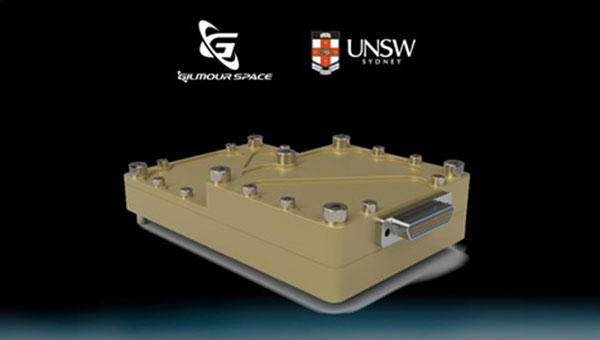
The Australian Space Agency has funded the development of an Australian aerospace-grade Global Navigation Satellite System (GNSS) receiver to use in rockets, satellites and aircraft under its Moon to Mars Supply Chain Capability Improvement Grants scheme.
Gilmour Space Technologies, in collaboration with the University of New South Wales (UNSW), will co-develop the GNSS receiver using an Australian supply chain and qualify it for use across a wide range of positioning, navigation and timing (PNT) applications. The GNSS receiver will be based on proven technology from UNSW, benefiting from Gilmour Space Technologies’ space manufacturing expertise and commercialization efforts.
Kody Cook, head of software, electrical, GNC and avionics at Gilmour Space Technologies, highlighted the importance of this initiative for the nation’s aerospace endeavors. “With the future becoming less certain, we’re thankful that Australia is investing in the sovereign development of exactly these types of fundamental capabilities,” he said. “If we could use more Australian-made avionics in our launch vehicles and spacecraft, we would.”
Iridium STL is being deployed by L3Harris to protect critical FAA data center infrastructure. (Photo: Iridium)
Iridium Communications has entered a five-year agreement with L3 Harris. Under the agreement, Iridium will provide its satellite time and location (STL) service to more than three dozen L3Harris-operated communications network backbone nodes and a similar number of Federal Aviation Administration (FAA) facilities throughout the United States.
L3Harris, responsible for operating a private network for the FAA, provides voice, data and video communications for the National Airspace System operations and mission support functions. Given the critical nature of timing synchronization within the L3Harris communications network, particularly for supporting various critical infrastructure applications, the Iridium STL service plays a pivotal role in the overall network timing architecture by eliminating dependencies on GPS as the primary timing source.
The solution for L3Harris includes compact devices provided by Adtran’s Oscilloquartz division, which are designed to receive Iridium STL signals. These devices seamlessly integrate into the network and meet nationwide network timing synchronization requirements.
In April 2024, Iridium acquired Satelles, a secure satellite-based time and location service provider.
Current state of the art multi-frequency GNSS receivers operate by receiving L1 first and then L5. L5-first is a viable answer to the call for more resilience in GNSS as is being discussed in government and technical circles to protect vital national infrastructure. It is suggested as part of “Toughening Category 4: Signal Alternatives” to protect, toughen and augment (PTA) the current GNSS systems described by Brad Parkinson’s article in the March 2022 issue of GPS World.
Paul McBurney
The need arises from attacks directed by bad actors on a large scale, such as electronic warfare, and on a more humane scale, by bad actors such as self-jammers and spoofers. On top of that, normal interference can cause desensitization and denial of service on GNSS receivers from myriad terrestrial and satellite communications.
The PTA plan presents the Denial Radius Reduction Ratio (DRRR) figure of merit and shows that a J/S increase of 15 dB produces a DRRR of 0.18. Whereas a receiver without this additional 15 dB of J/S could be denied fixing out to 1 km from a given transmitter, a receiver with an additional 15 dB J/S would be denied out to only 180 m from the same transmitter.
The improvement in terms of area is proportional to radius squared. The article identifies that the J/S capability is different among GNSS signals and the best performance is obtained with L5, mainly because it has the highest chipping rate. L1C has a code length of 10,230 chips, the same as L5, but it is spread over 10 msec and has the same chipping rate as L1 C/A.
There are currently 72 L5 signals between GPS, Galileo, BeiDou and QZSS transmitting the same physical layer features of 10.23 MHz chipping rate, 1 kHz overlay codes and higher transmit power compared to nearly all L1 signals with a 1.023 MHz chipping rate and lower transmit power. The combination of these features at L5 is close to achieving this 15 dB performance level over L1.
Unlike current hybrid receivers, L5-first survives L1 jamming. (Photo: Carkhe / iStock / Getty Images Plus / Getty Images)
One might conclude that the current start of the art of a receiver with both frequencies (aka, a hybrid L1+L5) has this resilience. However, the market does not currently offer the ability to directly acquire L5 signals overall use cases of GNSS assistance without first acquiring signals at L1. This means they can only achieve this resilience when the interference is encountered after acquiring and fixing at L1. As soon as the L1 is lost and the position and time uncertainty grow beyond the receiver’s capacity to autonomously search for L5 signals, the receiver is denied service at the interference level tolerable at L1. If you cut the receiver into L1 and L5 pieces, only the L1 side is capable of fixing autonomously. As noted by Dennis Akos et al. (“Testing COTS GNSS Receivers Using Only a Subset of Supported Signals,” ION JNC 2023), “support for several signals/frequencies provides integrity and robustness.” Specifically, “under jamming scenarios, signal diversity can allow a receiver to still generate an accurate position solution.”
Current receivers are not able to acquire L5 for reasons related to history, cost and power consumption. Historically, the promise of L5 accuracy was so attractive that it was added to legacy chipsets based on L1 even when it was only partially deployed. It was impractical at that time to require L5 acquisition when there were fewer L5 satellites than at L1. Cost and power are related to the fact that L1 receivers’ acquisition methods are sized to acquire the L1, E1, B1 and G1 signals. Memory and compute capacities, including the digital clock speed, are sized for slower chipping rates and hence shorter code lengths. At this performance level, conventional time domain correlation is adequate. Some receivers deploy frequency domain methods at L1 and achieve a lower cost and power than time domain methods with similar capacity. However, the L5 acquisition complexity with time domain correlation is 100 times more than L1 as its complexity increases with N2, meaning the cost and power to acquire L5 is out of reach. While using a time domain acquisition engine to acquire L5 may be possible for strong signals when the code and frequency search space is constrained for those signals, directly acquiring L5 with conventional methods would have serious shortcomings in many use cases.
Interestingly, the signal designers across all GNSS systems have cleverly designed the L5 signals so they can be easily acquired after acquiring their counterparts on L1. The L5 primary and secondary code is predictable based on learning the L1 primary code and navigation data bit phase. E5a and B2a primary and secondary codes can be predicted by learning the well-designed E1/B1 primary and secondary code phases that have the same total period: the combination of the 4 msec code lengths synchronous with 25 bits of secondary code are in phase with the E5a 100 msec overlay code. After an L1 fix with fine time, L5 can similarly be directly acquired easily with limited searching.
Aerospacelab and Xona Space Systems have entered a strategic partnership to integrate Xona Space Systems’ positioning, navigation and timing (PNT) technology into Aerospacelab’s satellite platforms.
Under the partnership, Aerospacelab will use its Versatile Satellite Platform (VSP) for the design, manufactureand launch of Xona Space Systems’ first navigation satellite equipped with its PNT payload.
Xona is developing a commercial PNT service through a constellation of low-Earth orbit (LEO) satellites. The company plans to offer the service as a backup to PNT provided by GPS.
The collaboration aims to use Aerospacelab’s capabilities in small satellite design, manufacturing and operations alongside Xona’s specialized knowledge in PNT payloads to provide enhanced navigation solutions that address current and future needs in satellite navigation and applications.
Keysight Technologies has outbid VIAVI Solutions for the acquisition of Spirent Communications, according to Bloomberg News.
The deal proposed by Keysight values Spirent at 201.5 pence per share, inclusive of a 2.5 pence special dividend, leading to an equity valuation of $1.46 billion, based on information from Keysight and Spirent.
Following the announcement, Spirent Communications’ stock witnessed an approximate 11% increase, reaching 198.6 pence per share on the London Stock Exchange.
The intent to purchase comes after VIAVI Solutions extended an all-cash proposal in March 2024 to acquire Spirent for about $1.3 billion. In response to Keysight’s offer, Spirent’s board has retracted their earlier endorsement of VIAVI’s bid.
The successful completion of Keysight’s acquisition hinges on the acceptance of the offer by investors with at least 75% of the voting rights, in addition to obtaining the necessary regulatory approvals.
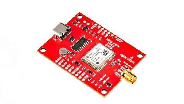
SparkFun Electronics has released the NEO-F10N GNSS L1/L5 Breakout board. This GNSS breakout board features the u-blox NEO-F10N module and a dual-band L1/L5 configuration designed to add precision to GNSS projects operating in urban and rural environments. Additionally, the L5 signal falls within a protected frequency band, which reduces RF interference on the incoming signal.
This breakout supports the concurrent reception of three GNSS constellations: GPS, Galileo, and BeiDou. The proprietary dual-band multipath mitigation technology from the u-blox F10 allows the module to choose the best signals from both bands to achieve a significantly better position accuracy in challenging urban environments than with the L1 band alone.
It has an integrated rechargeable battery that powers the RTC on the NEO-F10N, which reduces the time-to-first fix from cold to hot starts. The battery also maintains RTC and GNSS orbit data without external power to offer uninterrupted performance.
u-blox-based GPS products are configurable using u-center. This offers users extensive customization options such as baud rates, update rates, spoofing detection and more.
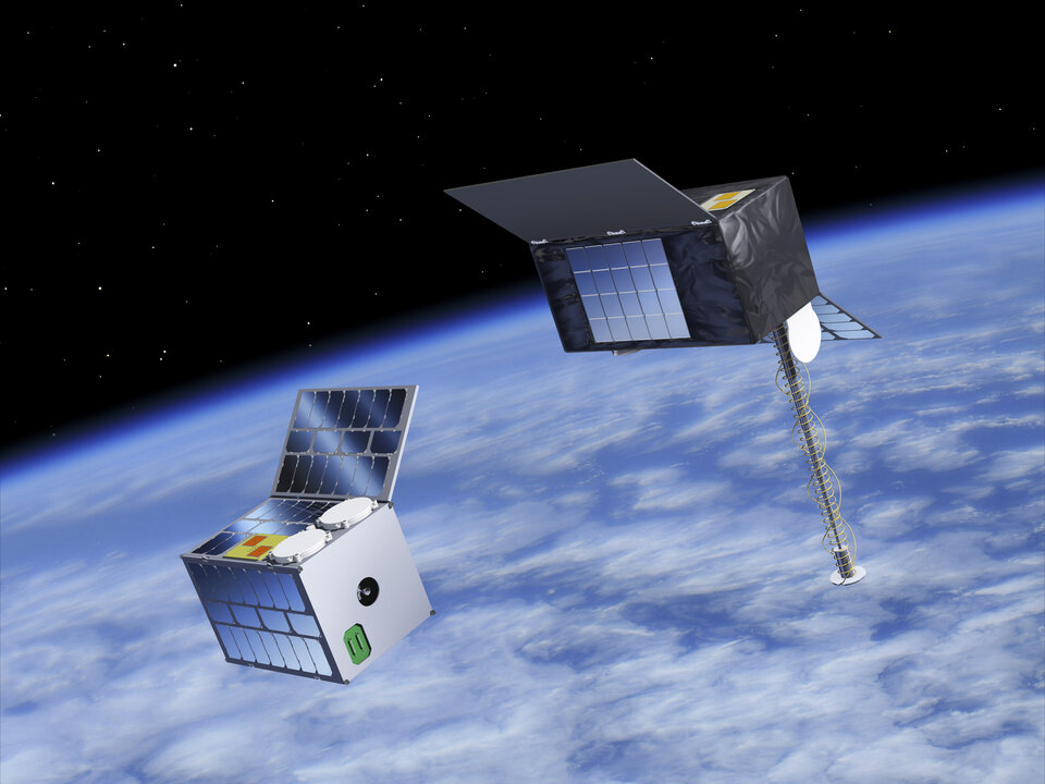
The European Space Agency (ESA) has initiated two navigation missions, Genesis and low-Earth-orbit positioning, navigation and timing (LEO-PNT) as part of its FutureNAV program. ESA has awarded contracts, totaling €233 million, to several European entities to begin the development of the missions. They are designed to address the growing demand for more resilient and precise navigation solutions in Europe.
Genesis, with a contract value of €76.6 million, involves a consortium led by OHB Italia, tasked with the development and operation of the Genesis satellite and its payloads, supported by contributions from Italy, Belgium, France, Switzerland, Hungary and the UK. The satellite is expected to launch in 2028, with subsequent years dedicated to scientific exploitation. Genesis aims to significantly improve the International Terrestrial Reference Frame (ITRF) and offer unprecedented precision for navigation and a myriad of Earth sciences applications.
For the LEO-PNT mission, ESA has distributed €78.4 million for each of the two contracts for the development of in-orbit demonstrators. These LEO-PNT satellites will explore new signals and frequency bands, designed to provide enhanced resilience, accuracy and speed in navigation. The projects are led by GMV Aerospace and Defense and Thales Alenia Space France and involve a broad consortium of more than 50 entities from 14 countries. The first LEO-PNT satellite is expected to launch within 20 months from the project’s commencement, with the complete constellation operational before 2027.
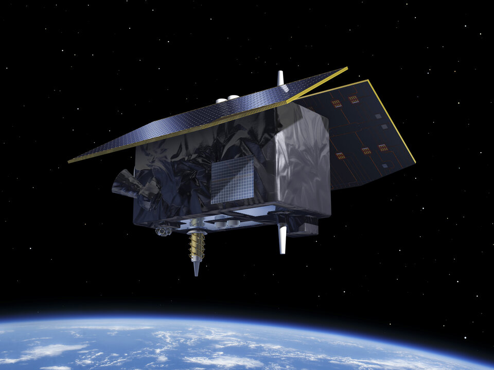
LEO-PNT satellite. (Image: ESA)
Genesis is designed as a flying observatory to refine the ITRF to an accuracy of 1 mm and a stability of 0.1 mm/year, serving as a crucial reference for all space- and ground-based observations. This enhanced reference frame is designed to directly benefit satellite-based systems and applications across various sectors, including aviation, traffic management and autonomous vehicles. It is intended to have have broader implications for meteorology, natural hazard prediction and climate change monitoring.
The LEO-PNT mission aims to establish a small constellation of demonstration satellites to test novel navigation signals and interoperability with GNSS to offer improved signal robustness and extended navigation services to challenging environments such as deep urban areas and indoors. This mission will explore the potential of LEO constellations in supporting a wide range of applications, from transportation and critical infrastructure to mobile devices and asset tracking using advancements in communication standards, such as 5G/6G.
OCX is more than seven years behind schedule. What are the consequences?
Greg Turetzky
“It’s more consequential than most people realize. The first and most impactful consequence is the limitation of the GPS constellation to
32 satellites. There are more healthy satellites in the sky and, more importantly, Block III satellites sitting in the barn. These additional satellites and their modernized signals would improve navigation globally with improved accuracy and resilience. Additionally, without OCX the L5 signals are labeled ‘unhealthy’ and therefore the constellation is labeled ‘pre-operational.’ Without OCX, L5 cannot reach initial operational capability (IOC), which prevents certain market segments from being able to officially use them. GPS will remain in third place if the delay continues.”
— Greg Turetzky Consultant
Michael Swiek
“OCX seems more than seven years behind when you consider that we have been hearing about it as a concept and then a proposal for years before it became an actual program. In the Hope and Crosby movie, “The Road to Rio,” Jerry Colonna leads a cavalry charge to rescue the heroine across several brief scenes. He never arrives, and the heroine is saved by other means. Colonna then proclaims, ‘Well, we didn’t make it, but we sure added some excitement!’ While waiting for the heroic arrival of OCX, might the evolution of technology, and regular updates to the current system, already provide some of the improvements promised by OCX? The OCS is already upgraded to accommodate Contingency Operations for GPS III satellites, M-Code early use and incorporated cyber security protections. Is it, maybe, time to just move beyond OCX and start anew with today’s context and assessment of future needs?”
The Federal Communications Commission (FCC) is investigating whether the use of Russian and Chinese foreign satellite systems by U.S. mobile phones and other devices poses security threats.
The FCC has concerns that U.S. handheld devices are receiving and processing GNSS signals from satellites controlled by foreign adversaries in violation of commission rules.
The FCC is seeking answers from handset manufacturers Apple, Google, Motorola, Nokia, Samsung and others that collectively cover more than 90% of the U.S. smartphone marketplace.
“There is no established record of what security threats, if any, these signals carry and whether the manufacturers of handheld devices are processing these signals in violation of the Commission’s rules,” an FCC spokesperson said in a statement.
Representative Mike Gallagher, chair of the U.S. House Select Committee on the Strategic Competition Between the United States and the Chinese Communist Party, wrote FCC Chair Jessica Rosenworcel earlier this week raising concern about reports that U.S. cell phones were receiving and processing signals from Chinese and Russian satellites.
The FCC has only approved U.S. phones to receive and process signals from the U.S. Global Positioning System (GPS) and the European Galileo GNSS.
Working in agriculture means facing a variety of challenges imposed by nature. Unfavorable weather conditions, such as irregular rainfall, strong winds and hail, are common obstacles for producers and companies involved in the sector. Additionally, a recent rise in solar flares has caused headaches for those who rely on precision agriculture technologies, such as satellite positioning technologies, to operate farm machinery.
Ionospheric scintillation is a phenomenon that causes rapid and irregular variations in the power of radio frequency signals that travel through the ionosphere, a region of the Earth’s atmosphere that has ionized particles, which makes it capable of reflecting and refracting radio signals, such as those used in satellite communications and GNSS.
These variations in the power of radio signals occur due to disturbances in the concentrations of free electrons in the ionosphere, which various factors, including solar activity, geomagnetic events and weather conditions in the upper atmosphere can influence. Fluctuations in the electron density of the ionosphere cause distortions in radio signals, leading to fluctuations in the signal’s power and phase. Some of the consequences of this phenomenon are almost imperceptible, such as a deviation of 1 m or 2 m in the position calculated by your cell phone’s GPS receiver. When it comes to precision farming, however, a few centimeters of error in machine positioning can severely impact operations by increasing input waste, reducing efficiency and decreasing production.
Many farmers, especially in Brazil, plant and harvest two crops a year, and rely on precision farming technology to sow and harvest quickly and accurately. With an estimated production of 317.5 million tons for the 2023/24 harvest, according to the Brazilian National Supply Company (Conab), these producers have buffer time to keep their machines idle. During planting and harvesting periods, farms often operate 24 hours a day, 7 days a week, and precise positioning via GNSS is essential for using solutions such as auto-steering and traffic control. When ionospheric scintillation affects the performance of location systems, it causes delays and inaccuracies, directly impacting the productivity of farms and damaging the operations’ efficiency and profitability.
To mitigate the impacts caused by ionospheric scintillation, as well as other problems that can affect receivers, farmers have several GNSS correction options at their disposal, such as precise point positioning (PPP) and real-time kinematics (RTK). These alternatives aim to increase positioning accuracy for high-precision applications and create different levels of resilience against ionospheric interference. However, it can still affect these services, causing errors in the receiver’s position calculations. In RTK systems, which rely on carrier phase measurements, scintillation can drastically impair positioning accuracy, especially at greater distances from the base station.
To overcome scintillation challenges, PPP positioning is a more reliable option. Unlike RTK, PPP estimates ionospheric errors at the receiver’s location and does not depend on corrections from a local base station. This allows users to achieve high precision anywhere within the global coverage area, regardless of the distance from the base station. In addition, PPP takes into account the immediate ionospheric environment, making it less sensitive to changes in atmospheric activity.
A study by Hexagon | NovAtel in 2020, analyzed the ionospheric activity in the central-western region of Brazil, comparing a standard RTK positioning solution and the PPP TerraStar-C PRO positioning solution, developed by NovAtel. A 24-hour data collection captured the nocturnal impacts of ionospheric activity and yielded some insights: while RTK position performance at 10 km from the base station was degraded for many hours, showing errors of up to 25 cm, the receiver using TerraStar-C PRO corrections continues to experience centimeter-level accuracy, with shorter maximum deviations of up to 10 cm.
In summary, ionospheric scintillation is a growing challenge for precision agriculture, affecting the productivity and efficiency of agricultural operations. To minimize its impacts, the adoption of correction services such as TerraStar-C PRO has proven to be a resilient and reliable solution, allowing farmers to continue their operations accurately and effectively, even in challenging conditions. The development of increasingly advanced precision solutions is crucial to ensuring the success of agriculture.
FrontierSI, a not-for-profit research organization specializing in positioning, geodesy, spatial infrastructures and rapid spatial analytics, has released a review of Australia’s resilient positioning, navigation and timing (PNT) policy to fortify the country’s PNT infrastructure. The review, expanded upon in a new white paper and technical report, was created in response to the increasing number of cyber threats.
“PNT is an essential utility we presently have no control over,” said Joshua Critchley-Marrows, FrontierSI’s space PNT lead. “Australia’s access to PNT is intrinsically linked to satellite-delivered services from foreign-owned and operated assets, such as the USA’s Global Positioning System (GPS). Investing in our infrastructure is crucial to ensure continuous access to this critical service that underpins nearly all aspects of our daily lives.”
According to FronteirSI, the reliance on foreign satellite systems exposes Australia to significant vulnerabilities, such as recent technological failures and cyber-attacks. These incidents emphasize the need for a self-reliant and robust PNT ecosystem capable of withstanding both unintentional and malicious disruptions.
FrontierSI aims to bolster PNT resilience by enhancing the systems’ robustness against disruptions and advocating for the development of assured, robust, augmented and alternative PNT solutions. The recommendations outlined in the white paper and technical report call for proactive measures, including legislative updates and supply chain risk assessments, to protect Australia’s critical infrastructure and economic vitality.
Abracon has introduced a new series of GNSS RF antennas designed to elevate location-based services with enhanced accuracy and precision. This new lineup aims to outperform conventional GPS technologies by offering faster signal acquisition, improved tracking capabilities and reduced power consumption.
The antennas support a full spectrum of bands, including L1, L2, L5, and L-band data correction services. It can be used in a variety of sectors — such as agriculture, surveying, the Internet of Things (IoT), mapping, defense and aviation.
The technology is designed to meet the rigorous demands for precise location data across various applications. These antennas offer multi-band and multi-constellation support to ensure broad compatibility. With centimeter-level accuracy, these antennas are crucial for aerospace, defense, asset tracking, geolocation, precision agriculture and industrial IoT.