Category: Space & Earth

  • FCC opens door to GPS alternatives, but risks undermining its greatest strength

    FCC opens door to GPS alternatives, but risks undermining its greatest strength

    On March 27, the Federal Communications Commission (FCC) unanimously approved a Notice of Inquiry (NOI) to explore GPS alternatives, amid escalating threats to security and system resiliency. The move signals growing federal concern about the reliability of space-based navigation and timing infrastructure amid rising global interference and spoofing incidents.

    But while the FCC’s broad consideration of alternative technologies is a welcome step forward, its framing also risks weakening one of GPS’s most important defenses: the growing adoption of multi-constellation strategies across the commercial sector.

    Rising Threats, Broader Mandates

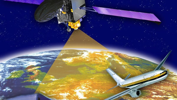
    The FCC’s decision follows the release of the International Air Transport Association’s (IATA) latest safety report, which documented a 175% increase in GPS interference and a 500% rise in spoofing attacks year-over-year. These incidents pose critical challenges to aviation safety, emergency services, telecommunications, and countless other sectors that rely on Positioning, Navigation, and Timing (PNT) services.

    Against this backdrop, the Commission’s vote reflects a bipartisan sense of urgency. The NOI invites public comment on a range of technologies that could serve as complements or alternatives to GPS, including low-Earth orbit (LEO) satellites, terrestrial signals, and enhanced end-user devices. This broad framing is encouraging and acknowledges the multifaceted nature of PNT resilience.

    A Multi-Layered Approach to PNT

    The FCC’s focus on diversification — across space-based, terrestrial, and user-level technologies — is not only prudent, but essential. Enhancing national security and system redundancy requires more than a single backup solution. It demands layered resiliency that integrates complementary modalities into a cohesive ecosystem.

    It is very encouraging that the NOI outlines a wide array of candidate technologies that could play a role in improving the U.S. PNT infrastructure. These range from inertial navigation systems and time transfer services to novel terrestrial radio signals and commercial LEO constellations. By casting a wide net, the FCC opens the door to innovation and allows market forces to contribute meaningfully to PNT modernization.

    Commercial Reality vs. Government Narrative

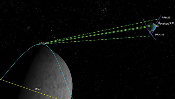
    However, the FCC’s discussion notably underplays a key reality: few commercial technologies today rely solely on GPS. The commercial PNT landscape has already moved beyond single-source dependency, with the vast majority of systems integrating multiple GNSS constellations (such as GPS, Galileo, BeiDou and GLONASS) alongside additional sensor and signal data to ensure robust coverage and accuracy.

    This multi-constellation approach is arguably the single most powerful tool we have to strengthen the resilience of GPS-dependent systems. By allowing receivers to pull data from multiple GNSS sources, users gain spatial and signal diversity, enabling them to cross-check signals, reject spoofed or erroneous data, and maintain accurate position and timing even in degraded environments. It’s important to remember that a device can’t selectively use GNSS networks depending on the user’s geography. If U.S. device makers disable BeiDou and GLONASS, then anywhere in the world that receiver goes it will be less performant and competitive. In recent field tests, we found that disabling the BeiDou constellation decreased a device’s positioning accuracy by 30% to 40%.

    This accuracy and resilience are especially important in sectors like aviation, autonomous systems, and emergency response, where signal fidelity and redundancy can be life-saving. Multi-constellation GNSS use isn’t theoretical: it’s already the industry standard.

    The International Tightrope

    Despite this, key elements of the NOI, as well as comments during the meeting, reflect a growing U.S. government skepticism toward the inclusion of foreign GNSS systems, especially BeiDou and GLONASS. While geopolitical caution is understandable, overly rigid restrictions on international signals could do more harm than good.

    These systems are not merely foreign-owned alternatives. They are integral components of the modern GNSS environment. Many U.S. commercial devices — ranging from smartphones to augmented reality, fleet tracking systems, drones, and more — already leverage multiple GNSS sources by default. Future technologies such as autonomous vehicles, robotics and urban air mobility will also require multiple GNSS signals to function. Prohibiting or restricting their use could mean rolling back years of progress in signal resilience, not to mention stymying future technologies, and all for a speculative and largely unquantified national security risk.

    While there are some valid concerns about adversarial control over PNT infrastructure, the FCC must weigh these carefully against the real, measurable benefits of an open and interoperable GNSS ecosystem. An overcorrection risks introducing new vulnerabilities in the name of mitigating others. In reality, the more vulnerable elements of the threat surface are GNSS receivers and mobile networks, particularly 5G systems, where user location is actually determined and tracked. Unlike the largely speculative and technically unproven threats tied to adversarial GNSS constellations, there are well-documented cases of compromised receivers and nation-state exploitation of mobile infrastructure – the very reason several countries have banned Chinese 5G providers. The FCC should focus on these clear and active risks, rather than reacting to theoretical scenarios that experts argue are not technically feasible.

    Innovation at Risk

    There is a significant opportunity at this moment. The NOI rightly identifies emerging technologies that can enhance U.S. resiliency, including advanced chipsets, LEO-based positioning, crowd-sourced signal verification, and next-generation timekeeping tools.

    However, that innovation cannot thrive in isolation. If the U.S. limits the ability of domestic systems to take full advantage of all available GNSS sources, it will undermine both resiliency and competitiveness. Even worse, it could widen the gap with foreign alternatives, especially China’s BeiDou system, which is already surpassing GPS in both accuracy and global coverage. GNSS has always thrived on multi-national cooperation and the opportunity of soft power influence. Both of which are diminished by exclusion, which is likely why there have not been bans by other countries to date.

    A Path Forward

    The FCC is right to prioritize this issue. It is urgent for the U.S. to build a more robust and secure PNT infrastructure in the face of these mounting threats. But its long-term success will depend on whether or not it embraces the full complexity of the PNT landscape.

    This means supporting:

    • Open, multi-constellation GNSS access for commercial users.
    • A flexible, layered approach that integrates space, terrestrial, and user-level technologies.
    • Public-private collaboration to accelerate innovation and deployment.
    • Clear regulatory guidance that balances national security concerns with commercial realities.

    The future of secure and reliable PNT lies not in isolating GPS, but in augmenting it through interoperability, diversity, and resilience at every layer of the system.

    If the FCC’s inquiry can steer the country in that direction, it will be a pivotal moment not just for GPS, but for the entire space-based infrastructure upon which modern life depends.

  • Beyond Gravity supplies high-power antenna for ESA mission

    Beyond Gravity supplies high-power antenna for ESA mission

    On April 29, the European forest satellite “Biomass” was launched into space from Kourou aboard a European Vega-C rocket operated by Arianespace.

    The company Beyond Gravity, based in Zurich, Switzerland, supplied several key products for this mission. Its high-power antenna and navigation receiver will provide the satellite’s precise position in orbit. Also, the satellite will be protected by the company’s thermal insulation.

    The European Space Agency’s (ESA) “Biomass” mission will measure forest biomass and will observe the state and development of forests and advance our knowledge of the carbon cycle. Knowing the amount of carbon bound up in forest biomass will sharpen our understanding of climate change and its likely effects on the global carbon cycle. The satellite will orbit Earth at an altitude of 666 kilometers. The mission’s expected lifetime is at least 5.5 years.

    “Forests are the green lungs of our planet, providing us with oxygen and storing carbon dioxide,” said Oliver Grassmann, Executive Vice President Satellites at Beyond Gravity. “With the environmental satellite Biomass, we are learning more about the importance of forests to our climate system. Contributing to the functioning of such a groundbreaking climate satellite with key products, like various antennas, our navigation receiver and our multi-layer thermal insulation is a great honor and extremely inspiring for all our colleagues.”

    The Biomass mission will feature a new high-power antenna from Beyond Gravity that serves the data downlink needs of new Earth-observing satellites as they gather ever larger quantities of environmental data. The antenna has the size and shape of a large ice cream cone. While more and more Earth observation data from satellites is gathered, the satellite itself becomes smaller. Thus, there was a clear need for a smaller, more powerful data downlink antenna.

    The X-band helix antenna design was developed for ESA by Beyond Gravity’s site in Gothenburg, Sweden. Beyond Gravity also provided the S-Band TTC (telemetry, tracking and command) antenna, which acts as a communication and control antenna for the satellite.

    A new antenna from Beyond Gravity for data downlink will serve Biomass. It was developed through an ESA General Support Technology program contract with Beyond Gravity in Sweden. (Photo: ESA, Beyond Gravity)
    A new antenna from Beyond Gravity for data downlink will serve Biomass. It was developed through an ESA General Support Technology program contract with Beyond Gravity in Sweden. (Photo: ESA, Beyond Gravity)

    Precise in-orbit position determination. The satellite’s position in space is determined to within centimeters using technology from Beyond Gravity’s site in Vienna, Austria. The more accurate the positioning, the more accurate the data provided by the satellite.

    The receiver can process both GPS and Galileo signals. Beyond Gravity’s navigation receivers determine the position of approximately 25 satellites in space. The Beyond Gravity site in Tampere, Finland, produced the Reflector Deployment Interface Unit.

    Multi-layer thermal insulation from Beyond Gravity made out of several layers of ultra-thin special polyimide foils will keep the satellite’s instruments at the required operating temperature despite the  harsh thermal environment in space. Nearly every European ESA satellite is protected by thermal insulation from Beyond Gravity, which is designed and produced at the company’s sites in Austria. Beyond Gravity also produced the Eddy Current Damper, which is part of the spacecraft’s solar array wing and is providing the damping to slow down the deployment and prevent shocks at deployment completion.

  • GNSS on the moon: Lunar PNT era begins

    GNSS on the moon: Lunar PNT era begins

    Historical context of GNSS in space

    The latest historic chapter in GNSS for space users was launched, as one would expect, at an Institute of Navigation (ION) GNSS+ conference — the one in Miami in 2019 — by a handful of technical and policy experts well positioned to “Go for the Gold” — GNSS on the moon! Thus, liquid refreshments in hand, the Lunar GNSS Receiver Experiment (LuGRE) concept was born, amongst excited discussion and scribbling on napkins by Oscar Pozzobon (Qascom), Joel Parker (NASA), Frank Bauer (NASA), Alberto Tuozzi (Agenzia Spaziale Italiana or ASI, Italian Space Agency), Lisa Valencia (NASA) and James “JJ” Miller (NASA).

    Long before this productive, informal brainstorming session, global navigation satellite systems (GNSS), such as the U.S. GPS, were originally designed for use on or near Earth, providing positioning, navigation and timing (PNT) services up to an altitude of about 3,000 km (the GPS Terrestrial Service Volume). Over the decades, experimental missions pushed GNSS use higher, and by 2006, GPS specifications defined a Space Service Volume, extending GNSS services out to 36,000 km (geosynchronous orbit). NASA missions then deftly demonstrated GNSS utility well beyond Earth orbit — notably in 2019 with the Magnetospheric Multiscale Mission spacecraft formation, which successfully tracked GPS signals roughly 192,500 km from Earth, setting the world record for farthest and fastest reception of any GNSS signals in the space domain.

    Building on this success, NASA proposed conducting the LuGRE in 2020 by using a combination of GPS and Europe’s Galileo signals at lunar distances. The flight opportunity for a lunar mission came through NASA’s new Commercial Lunar Payload Services (CLPS) initiative, and by early 2021, Firefly Aerospace was awarded the mission to carry LuGRE to the moon. The LuGRE team was very fortunate from the start, competing for and winning the last of 10 payload slots, and the only space operations flight demonstration amongst nine other science payloads focused more on assessing the lunar environment.

    The progress of this initiative reflects a broader national and international push based on NASA’s role in implementing the 2021 U.S. Space Policy Directive-7, which directs NASA to work with the U.S. Space Force and other partners to extend GNSS capabilities farther into cislunar space to benefit both government and commercial users. Internationally, GNSS providers further cooperate through the UN-sponsored International Committee on GNSS to develop interoperable PNT standards for space users beyond Earth. So, ASI was a natural fit to become NASA’s international partner. The Italian GNSS company Qascom was awarded the receiver development, while the Polytechnic of Turin provided academic support. This historic groundwork has thus set the stage for the recent LuGRE mission to achieve several accomplishments in lunar navigation, breaking three world records in the process.

    Mission overview: Blue Ghost Lander and CLPS

    The LuGRE payload traveled to the moon aboard Blue Ghost Mission 1, a robotic lunar lander built by Firefly Aerospace under NASA’s CLPS program. CLPS, started in 2018, is a public-private partnership model through which NASA contracts commercial landers to deliver science and technology payloads to the lunar surface. Blue Ghost Mission 1 launched on Jan. 15, 2025, via a SpaceX Falcon 9 rocket and touched down on March 2, 2025. This made Firefly the first U.S. commercial company to successfully land on the moon upright, delivering 10 NASA-sponsored payloads, including LuGRE. The lander targeted a site near Mons Latreille in Mare Crisium, achieving a precision landing within ~100 m of the aim point. Built as a solar-powered lander about 2 m tall and 3.5 m wide, Blue Ghost was designed for a mission duration of one lunar day (~14 Earth days). By leveraging CLPS, NASA rapidly deployed LuGRE and other instruments, demonstrating the effectiveness of commercial partnerships in advancing lunar exploration. Blue Ghost’s successful landing and operations validated this approach and set the stage for upcoming CLPS missions in support of Artemis.

    The LuGRE payload: Objectives and components

    LuGRE is a technology demonstration aimed at determining whether Earth-originated GNSS signals can be reliably received and used for navigation at the moon’s distance. The payload was jointly developed by NASA and ASI with engineering by Qascom. Hardware on LuGRE includes a specialized weak-signal GNSS receiver, a high-gain L-band patch antenna array with RF filtering and a low-noise amplifier. This design allows it to track faint GPS and Galileo signals nearly 400,000 km from their transmitters. LuGRE specifically listens on multiple frequencies — GPS L1 and L5, and Galileo E1 and E5a — to maximize signal acquisition opportunities. The experiment’s objectives are threefold: (1) acquire and characterize GNSS signals in lunar orbit and on the surface, (2) demonstrate navigation fixes (position/time) using those signals at the moon, and (3) return data to inform the development of future lunar-specific GNSS receivers. All three of LuGRE’s objectives were met. During the mission, LuGRE began collecting and processing data en route to the moon (during a ~45-day transit) and also on the lunar surface after landing. As one of the first demonstrations of GNSS use on another world, LuGRE set out to prove that combined GPS/Galileo signals could enable autonomous navigation for spacecraft far beyond Earth.

    A SpaceX Falcon 9 rocket carrying Firefly Aerospace’s Blue Ghost Mission 1 lander prepares for a launch to the moon on Jan. 14, 2025, from Launch Complex 39A at the agency’s Kennedy Space Center in Florida. (Photo: NASA / Kim Shiflett)
    A SpaceX Falcon 9 rocket carrying Firefly Aerospace’s Blue Ghost Mission 1 lander prepares for a launch to the moon on Jan. 14, 2025, from Launch Complex 39A at the agency’s Kennedy Space Center in Florida. (Photo: NASA / Kim Shiflett)

    Benefits of GNSS for lunar PNT

    If proven reliable, GNSS-based navigation at the moon offers significant benefits for future lunar missions. First, it provides a common PNT framework for lunar explorers, akin to GPS on Earth, enabling precise real-time positioning and time synchronization for astronauts and robotic systems. This could allow lunar crews and rovers to navigate autonomously across the surface without constant ground support, reducing astronaut workload and dependence on Earth-based tracking. Accurate GNSS-derived position data improves safety and efficiency — for example, helping rovers avoid hazards and chart optimal routes or aiding astronauts in pinpointing resources, such as water, ice or scientific targets. Using existing GNSS signals also means that missions might rely less on cumbersome radio tracking from Earth or lunar beacons, simplifying mission operations.

    In the long run, GNSS technology can support the development of lunar infrastructure: future base camps, power stations and landing pads could all reference a shared navigation grid, much as terrestrial infrastructure does. Additionally, leveraging well-known GPS/Galileo signals could reduce costs and technical risks, supplementing a proposed new lunar navigation satellite network.

    LuGRE’s results have affirmed these possibilities. During transit, LuGRE broke records by tracking signals at 395,900 km out in lunar orbit, proving multi-constellation GNSS can aid navigation to and around the moon. Shortly after landing, it further demonstrated an autonomous GNSS navigation fix on the lunar surface, 362,100 km from Earth. These achievements suggest that even existing Earth-centric satnav can be extended to serve lunar exploration, a promising development for upcoming Artemis endeavors.

    Challenges of GNSS reception on the moon

    Adapting GNSS to the lunar environment is challenging. The main difficulty is the weakness of signals by the time they reach the moon. GNSS satellites orbit around 20,000 km from Earth, beaming most of their signal power toward Earth’s surface. At nearly 10 times that distance, only the spillover (side-lobe) signals reach the moon, arriving attenuated and sparse. This necessitates high-sensitivity receivers and high-gain antennas (such as LuGRE’s) to even detect the signals, along with sophisticated algorithms to pull meaningful data from the noise. The geometry and coverage also pose issues: a receiver on the moon will often see a limited number of GNSS satellites above its horizon, potentially affecting the accuracy and availability of navigation fixes. Local lunar conditions add further complications. The moon’s lack of atmosphere means no ionospheric delay, which is a positive for signal clarity. However, it also means that there is nothing to refract or scatter signals over the horizon — thus, terrain plays a crucial role. Rugged topography (mountains, crater rims) can block line-of-sight to GNSS satellites, and deep craters or polar shadowed regions might have very poor reception.

    The pervasive lunar dust (regolith) can also be problematic because it may coat antenna surfaces or contribute electromagnetic noise, especially during landings or surface activities. These factors require advanced processing techniques and possibly integrating GNSS with other sensors to achieve reliable navigation. LuGRE’s design and operations were tailored to confront these challenges. For instance, using dual constellations doubles the pool of satellites and signals available, and collecting data both in orbit and on the surface helps characterize how signal quality changes in different lunar conditions. The knowledge gained will guide the development of next-generation lunar GNSS receivers with improved robustness against weak signals and intermittent coverage.

    Firefly aerospace’s Blue Ghost Mission 1 lander is carrying 10 NASA science and technology instruments to the moon as part of NASA’s CLPS initiative and Artemis campaign. (Photo: Firefly Aerospace)
    Firefly aerospace’s Blue Ghost Mission 1 lander is carrying 10 NASA science and technology instruments to the moon as part of NASA’s CLPS initiative and Artemis campaign. (Photo: Firefly Aerospace)

    Implications for Artemis and deep space navigation

    LuGRE’s success is a proof of concept that navigation aids from Earth can directly support moon missions. This is of immediate relevance to NASA’s Artemis program, which aims to return humans to the moon and establish a sustained presence there. Artemis crewed vehicles (such as the Orion spacecraft) and the planned Gateway lunar station could potentially use GNSS signals during transit or in lunar orbit to autonomously determine their trajectories. On the surface, future Artemis astronauts and rovers could carry GNSS-enabled devices to know their precise location without relying solely on Earth-based tracking. This capability will become increasingly important as activities expand — from pinpoint landing of resupply craft, to coordinating lunar base operations to enabling the first long-distance treks by crew or robots on the moon.

    By proving GPS/Galileo usability at the moon, LuGRE also paves the way for establishing a standardized lunar reference frame tied to existing GNSS, which all international partners can use for joint operations. In a broader sense, LuGRE is a stepping-stone toward more advanced navigation systems in deep space. It demonstrates techniques (such as combining multiple GNSS constellations and using high-sensitivity receivers) that could inform navigation around Mars or other distant targets. While Earth’s GNSS signals won’t reach Mars with useful strength, the lessons learned can drive the design of Mars-orbiting navigation satellites or better onboard autonomous nav systems for deep-space probes. In essence, the experiment is accelerating the development of a GPS-like interplanetary navigation capability, crucial for humanity’s expansion deeper into the solar system.

    A Graphic representation of the relative geometry of Earth-moon-acquired GNSS satellites. (Photo: Agenzia Sapaziale Italiana)
    A Graphic representation of the relative geometry of Earth-moon-acquired GNSS satellites. (Photo: Agenzia Sapaziale Italiana)

    Policy and international collaboration

    The LuGRE mission exemplifies how international and commercial partnerships are shaping the future of space exploration. It was born out of a long-running collaboration between NASA’s Space Communications and Navigation program and ASI, reflecting a shared strategic interest in extending GNSS interoperability to the moon and beyond. The receiver hardware was developed by Qascom with academic support from Politecnico di Torino, underlining the role of industry and academia in innovation.

    This NASA-ASI partnership built on earlier joint projects, such as GNSS receiver experiments on the ISS and suborbital flights, which tested using both GPS and Galileo for space navigation. Europe’s Galileo system, in particular, is a full partner in LuGRE. Its inclusion alongside GPS ensures that the experiment benefits from multi-constellation redundancy and also sends a message of GNSS interoperability, a key principle endorsed by the International Committee on GNSS. On the policy front, the mission aligns with U.S. space policy goals to develop services in cislunar space and encourages momentum in international standardization of lunar PNT frameworks.

    Data from LuGRE will be made public, contributing to global research and possibly the drafting of new standards for lunar navigation that any nation’s spacecraft can adopt. The CLPS program itself, which enabled LuGRE’s delivery, represents a policy shift toward commercial sourcing of lunar services — fostering a market where companies such as Firefly, intuitive Machines, Astrobotic and others compete and cooperate to advance lunar science. As NASA leads the Artemis coalition with agencies from Europe, Asia and beyond, the LuGRE experiment offers a tangible product of cooperation: a foundation for shared navigation infrastructure at the moon. This collaborative, forward-looking approach will be critical as humanity returns to the moon not just to visit, but to stay.

    Conclusion

    LuGRE on Firefly’s Blue Ghost lander has marked a milestone in space exploration: it demonstrated for the first time that navigational signals conceived for Earth can be harnessed on the lunar surface. By uniting cutting-edge technical work (in receivers and antennas) with visionary policy support (via NASA’s CLPS and international GNSS cooperation), LuGRE showcases a path toward robust, autonomous navigation for the Artemis generation of missions. Achieving a GPS/Galileo fix on the moon is more than a symbolic first — it is a practical step toward a future where astronauts and robots navigate the moon — and one day Mars — with the same confidence as we do on Earth. The lessons from LuGRE will inform how we guide our spacecraft across the cislunar void, how we set up the positioning networks of tomorrow’s lunar bases and how nations cooperating can build the navigation backbone for a new era of deep-space exploration. In short, LuGRE has opened the door for GNSS to become an integral part of the lunar toolkit, blending technology and policy into a giant leap for navigation beyond Earth.

  • Space Force prepares for accelerated GPS III mission to enhance warfighter capabilities

    Space Force prepares for accelerated GPS III mission to enhance warfighter capabilities

    The U.S. Space Force’s Space Systems Command and Space Operations Command are preparing to launch the National Security Space Launch GPS III-7 mission, designated Space Vehicle 08, aboard a SpaceX Falcon 9 rocket. The launch is planned to take place from Space Launch Complex 40 at Cape Canaveral Space Force Station, Florida, no earlier than late May 2025.

    This mission follows the successful Rapid Response Trailblazer launch in December 2024 and represents another accelerated effort. It involves a coordinated operation across multiple Space Force organizations to retrieve a GPS III satellite from storage, integrate it with the launch vehicle, and prepare it for launch on a compressed timeline.

    The GPS III satellite is equipped with M-Code technology, which offers three times greater accuracy and eight times more resistance to jamming compared to earlier systems. This capability aims to enhance Precision, Navigation, and Timing services for the Joint Force, ensuring modernized support for military operations.

    This effort builds on lessons learned from the previous Rapid Response Trailblazer mission and demonstrates the Space Force’s ability to reduce standard launch preparation timelines. While such preparations typically require up to 24 months, this mission is set to be completed within three months.

    Mission Delta 31 of Space Operations Command is overseeing pre-launch processing in collaboration with Lockheed Martin in Colorado. On April 2, 2025, the satellite was transported to Florida aboard a U.S. Air Force C-17 Globemaster III and is now undergoing final preparations for launch. Col. Andrew Menschner, commander of Mission Delta 31, emphasized the teamwork involved in rapidly deploying an M-Code-capable satellite and advancing traditional launch timelines.

    Key aspects of this mission include space vehicle-to-launch vehicle integration, satellite control preparation, and expedited contracting efforts.

    The satellite is named in honor of Katherine Johnson, whose mathematical contributions were pivotal to early U.S. spaceflight missions. Once operational, it will enhance communication capabilities critical to national security and align with the Secretary of Defense’s strategic objectives by supporting military readiness with anti-jamming technology.

  • Flawed spectrum proposal could cause disruption and risks to public safety

    Flawed spectrum proposal could cause disruption and risks to public safety

    On March 27, 2025, the Federal Communications Commission (FCC) launched a proceeding on commercial technologies that would complement GPS. “Although GPS is indispensable to America’s economic and national security, it represents a single point of failure that can be vulnerable to disruption or manipulation by our adversaries,” said the FCC’s announcement, highlighting the federal government’s bipartisan call to develop complementary systems that provide positioning, navigation and timing (PNT) data to to better achieve PNT resilience nationwide and protect America’s economic and national security.

    The Security Industry Association (SIA) commends the FCC’s commitment to protecting America’s economic and national security and exploring available PNT options. We believe the docket will show that there is a wide array of PNT technologies that can complement to GPS, and we look forward to providing information to the Commission about tradeoffs among these emerging PNT offerings and encouraging the Commission to avoid taking action that could disproportionately disrupt valuable public safety technologies.

    One company, the for-profit entity NextNav, has petitioned the FCC to reconfigure the 902-928 MHz band (the Lower 900 MHz frequency) and grant it a nationwide license for 15 MHz of spectrum so it can establish a 5G terrestrial-based PNT network. NextNav also seeks the removal of the current requirement that it not cause unacceptable levels of interference to Part 15 devices. These devices include low-power, radio frequency (RF) devices ranging from consumer electronics and appliances to wireless alarm systems, smart home equipment, electronic access control devices and a wide range of devices used to increase economic productivity and efficiency, bolster safety, deliver innovation and provide other important benefits to consumers. This proposal has a dangerous likelihood of causing significant interference in the band that would be adverse to the public interest and threaten public safety.

    The Lower 900 MHz band is vital for millions of security cameras, including popular models used in homes and small businesses. These devices are essential for protecting homes, preventing package theft and home intrusions, ensuring children’s safety and aiding law enforcement by capturing criminal activity. The changes proposed by NextNav would likely force these incumbent users into a shared portion of spectrum that is almost 60% smaller than the current Lower 900 MHz band — crowding that will cause many devices to stop operating reliably, compromising Americans’ safety and the security of our facilities and communities, and will be exacerbated by the growing concentration of devices using new technologies that require more spectrum bandwidth.

    Another important service likely to be disrupted by the proposed band restructuring would be Z-Wave technologies. Z-Wave technology enables comprehensive home automation and security solutions —such as smart locks, thermostats and security systems — to integrate seamlessly with various smart home devices, while preserving advanced security features such as encrypted communication and secure inclusion. Z-Wave devices are not designed to withstand interference from fixed and/or mobile devices operating at commercial macro power limits and out-of-band emission limits, such as those in NextNav’s proposed high-power operations.

    Additionally, millions of electronic access control and other wireless connected devices that are now in use in residential, institutional, commercial and government buildings across the United States would be impacted. The interference generated from NextNav’s higher-power communications would significantly impact the reliability of these important safety and security products and ecosystems, effectively making them unusable in the same spectrum.

    In addition to these public safety and security uses, more critical systems that could be disrupted include:

    • Municipal infrastructure, including such systems as traffic control, street lighting, weather monitors and flood warning systems that are deployed in this band to make communities safer and more energy efficient.
    • Critical infrastructure, including utilities’ use of the band for remote monitoring and management of power, gas and water distribution networks.
    • Railroad operations and safety, including the Automatic Equipment Identification network that enables tracking of rail cars and equipment, as well as essential traffic control, sensors and other devices necessary for operational safety and efficiency.
    • Highway infrastructure and tolling, including the operation of electronic tolling systems, such as E-ZPass and other similar toll collection systems.
    • Retail, manufacturing and supply chain operations, including building control systems, tank and leak monitoring system and inventory control systems.
    • Agriculture solutions used for connecting modern farms’ Internet of Things devices and equipment to keep our farms connected.

    As other concerned parties have pointed out, there are a number of existing backup GPS options available to establish a terrestrial PNT without any reallocation of spectrum.   While a backup GPS system is ultimately necessary, the other solutions that would be much less disruptive. The tradeoffs required by implementing the NextNav proposal are simply not worth the risk to our nation’s security and safety.

  • Thales Alenia Space secures contract to extend EGNOS service life

    Thales Alenia Space secures contract to extend EGNOS service life

    Thales Alenia Space — a joint venture between Thales and Leonardo — has secured a €51 million ($56 million) contract from the European Union Agency for the Space Programme (EUSPA) to extend the operational life of the European Satellite-Based Augmentation System (EGNOS).

    Named Life Extension Phase 1 (LIFEX), this contract will ensure that EGNOS V2 continues to provide reliable, secure and high-performance navigation services for Europe’s aviation, maritime, land transport, mapping and agricultural sectors beyond 2028.

    EGNOS system is designed to enhance the accuracy, reliability and integrity of positioning signals by improving the performance of GNSS, such as GPS and, in the future, Galileo. As part of this contract, Thales Alenia Space will address EGNOS V2 critical system upgrades and infrastructure improvements, reinforcing the system’s resilience and operational durability. These updates will focus on enhancing security measures, modernizing components, and ensuring the ongoing reliability of EGNOS’s Safety of Life Service, which plays a key role in aviation, enabling accurate approaches at European airports without requiring ground guidance systems. Operational since 2011, this service has significantly improved operational safety and efficiency for the greater benefit of European operators.

  • Sierra Space successfully tests resilient GPS technology for US Space Force

    Sierra Space successfully tests resilient GPS technology for US Space Force

    Sierra Space has successfully demonstrated its Resilient GPS (R-GPS) technology for the U.S. Space Force (USSF). This milestone, achieved in collaboration with General Dynamics Mission Systems, involved generating all GPS navigation signals required for the R-GPS mission. The technology seeks to address the growing need for resilient GPS systems capable of countering threats such as jamming and spoofing, which pose risks to the current GPS infrastructure.

    GPS technology is integral to modern life, supporting civilian applications from smartphone navigation to critical military operations. However, as adversarial threats become increasingly advanced, there is a pressing need to enhance GPS resilience. To tackle this challenge, the USSF’s Quick Start program is focused on integrating smaller, cost-effective satellites into the existing GPS framework. These satellites would provide a rapidly deployable layer of protection against emerging threats, according to the USSF.

    The demonstration evaluated hardware, firmware, and software performance, including the generation of P(Y), M-code and C/A signals at L1 and L2 frequencies. These capabilities ensure that R-GPS satellites can produce accurate and secure navigation signals compatible with devices used globally.

    Sierra Space was awarded an R-GPS contract by the USSF Space Systems Command in September 2024 to develop design concepts for smaller and more affordable satellites. Following an internal Systems Requirements Review later that year, the company has now demonstrated its technological capabilities within months of the program’s inception.

  • JAXA selects Spirent’s PNT simulation solution for lunar navigation program

    JAXA selects Spirent’s PNT simulation solution for lunar navigation program

    The Japan Aerospace Exploration Agency (JAXA) has selected Spirent Communications to supply its lunar positioning, navigation and timing (PNT) simulation solution. The solution will support JAXA’s lunar exploration efforts and aid in developing essential navigation infrastructure for future moon missions.

    Spirent’s PNT X solution allows JAXA to simulate lunar PNT services in a controlled laboratory setting before their deployment on the moon. This capability is critical for testing and validating navigation equipment for lunar missions in accordance with the emerging LunaNet specifications, which include adaptable S-band frequency solutions. The system also ensures scalability for future space exploration.

    Using the PNT X system, JAXA can experiment with novel S-band signals and evaluate the performance of receivers that rely on standalone S-band Lunar PNT signals or a combination of Lunar PNT and Earth-based L-band GNSS infrastructure. The simulation of these signal combinations demands high levels of precision, which Spirent’s specialized architecture is designed to meet.

    This collaboration builds on a longstanding relationship between Spirent and JAXA. In 2011, JAXA utilized Spirent’s simulation technology to verify the performance of early Quasi-Zenith Satellite System (QZSS) receivers. Since then, Spirent simulators have supported multiple advancements in QZSS.

    Spirent’s lunar PNT simulation solution seeks to present new opportunities for space agencies developing lunar constellations, satellite and receiver developers and organizations planning lunar missions or seeking to establish additional PNT infrastructure on the moon.

  • GMV to support the advancement of the Galileo Reference Centre

    GMV to support the advancement of the Galileo Reference Centre

    The European Union Agency for the Space Programme (EUSPA) has awarded GMV a framework contract to advance the Galileo Reference Centre (GRC), a key facility for monitoring and evaluating the performance of the Galileo satellite navigation system. Located in Noordwijk, the Netherlands, the GRC independently assesses Galileo’s operations, signal quality, and user-level service performance and compares its performance with that of other GNSS.

    The upcoming GRC V2 version will introduce real-time monitoring capabilities, enhancing EUSPA’s ability to oversee GNSS services. This evolution will support additional Galileo services, including:

    • Signal Authentication Service (SAS): Strengthening trust in Galileo signals.
    • Time Dissemination Service: Enabling precise synchronization for critical infrastructure.
    • Search and Rescue (SAR): Improving emergency response operations.
    • Emergency Warning Satellite Service (EWSS): Facilitating public alerts for natural disasters and emergencies.

    Key operational improvements in GRC V2 include:

    • Enhanced monitoring using data from multiple institutions.
    • Real-time processing for faster user notifications.
    • Seamless system upgrades without disrupting operations.
    • Advanced cybersecurity measures integrated into a platform-as-a-service model.

    The upgraded GRC is expected to be operational by 2026 without impacting ongoing functions.

  • Xona Space Systems, Trimble to deliver advanced navigation services

    Xona Space Systems, Trimble to deliver advanced navigation services

    Xona Space Systems and Trimble have collaborated to integrate Trimble correction services with Xona’s PULSAR high-performance navigation service.

    Initial satellite launches are expected in late 2026 with service starting in 2027 through the PULSAR satellite network, enabling secure, high-precision positioning for applications ranging from geospatial to low-power mass mobile and IoT. In support of this new and developing collaboration, Xona has received an investment from Trimble Ventures.

    Xona PULSAR, powered by Xona’s planned network of small satellites in low-Earth orbit (LEO), is being developed to deliver robust and secure high-precision positioning and navigation services directly to current GNSS hardware. The PULSAR service, which will include high precision correction services through this collaboration, has the potential to provide scalable, cost-effective solutions for industries with demanding positioning and navigation requirements, such as civil construction, surveying and mapping, and automotive and IoT applications. Xona’s signals are also expected to enable operations inside low-rise buildings, as well as improve resistance to jamming and interference compared to current GNSS capabilities.

    Precision positioning solutions from LEO constellations are intended to provide new enhanced capabilities along with high levels of uptime to meet the rapidly evolving needs of industries around the world. Including Trimble correction services with Xona PULSAR is expected to enhance the reliability of Trimble correction services delivery, which is crucial for users in areas without reliable cell coverage, limited sky visibility environments, including high-latitude regions and other challenging geographies.

  • Astranis advances resilient GPS technology for US Space Force

    Astranis advances resilient GPS technology for US Space Force

    Astranis has completed a critical demonstration for the U.S. Space Force’s Resilient GPS (R-GPS) program, showcasing its ability to transmit core GPS waveforms using software-defined radio hardware. Conducted ahead of schedule and within budget, the demonstration highlights Astranis’ ability to adapt its flight-heritage high-orbit satellite hardware to meet new resilience requirements for the Space Force.

    The test took place at Astranis’ headquarters in San Francisco, California, using a flight-like software-defined radio and positioning, navigation and timing algorithms provided by Xona Space Systems, a partner and subcontractor for the R-GPS program. Astranis transmitted a GPS Course Acquisition (C/A) navigation signal through its resilient GPS payload and demonstrated signal acquisition and recovery of Legacy Navigation messages with an off-the-shelf GPS receiver. According to Astranis, this validated that its resilient GPS design, Nexus, complies with GPS specifications “out of the box,” ensuring compatibility with existing user equipment without requiring costly upgrades.

    Astranis was selected in September 2024 as one of four contractors to design next-generation resilient GPS satellites under the Space Force’s initiative. The company received its Authority to Proceed on Sept. 19, 2024, and has since exceeded program objectives ahead of schedule. The R-GPS program aims to augment the existing GPS constellation with smaller, cost-effective satellites to enhance resilience against threats such as jamming or spoofing.

    Astranis is advancing its satellite design in preparation for the Space Force’s goal of launching the first eight R-GPS satellites by 2028. The company’s approach leverages its MicroGEO satellite design and software-defined radio technology to deliver resilient capabilities while maintaining compatibility with legacy equipment.

  • US Air Force to test Xona LEO GPS alternative

    US Air Force to test Xona LEO GPS alternative

    The Air Force Research Laboratory awarded Xona Space Systems a contract to demonstrate and refine its commercial positioning, navigation and timing (PNT) solutions for Department of Defense (DOD) missions. The agreement, facilitated through the Space Technology Advanced Research — Fast-tracking Innovative Software and Hardware (STAR-FISH) program, increases Xona’s total contracted commitments to more than $20 million.

    Under the contract, Xona will evaluate its PULSAR satellite navigation service across commercial user devices in scenarios where GPS/GNSS signals may be denied or challenged. Testing will focus on assessing resistance to jamming and spoofing, reducing multipath interference and implementing secure key distribution protocols. The initiative aims to expedite the development of advanced alternative PNT capabilities in commercial off-the-shelf equipment, aligning with DOD requirements for rapid deployment.

    Xona has collaborated with GPS/GNSS hardware providers QinetiQ, StarNav and Locus Lock to integrate PULSAR-enabled devices. These partners will participate in performance demonstrations as part of the multi-year effort, which includes leveraging Xona’s simulation tools and plans to utilize the first PULSAR satellite scheduled for launch in June 2025.