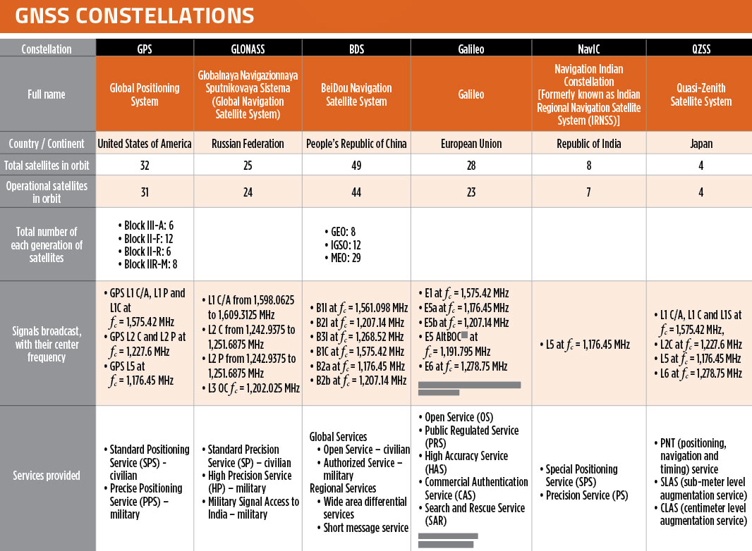
In our October 2021 issue, we celebrated the availability of four global navigation satellite system (GNSS) constellations. Below is the status (as of Feb. 23, 2023) of these four GNSS and their two regional cousins.
Many thanks to Mohamed Tamazin, Ph.D., Senior GNSS Architect for GNSS Simulation with Orolia — a Safran Electronics & Defense company, who provided or confirmed these data. While the data on GPS and Galileo are easily accessible, those for the other constellations are difficult, in some cases very difficult, to find.
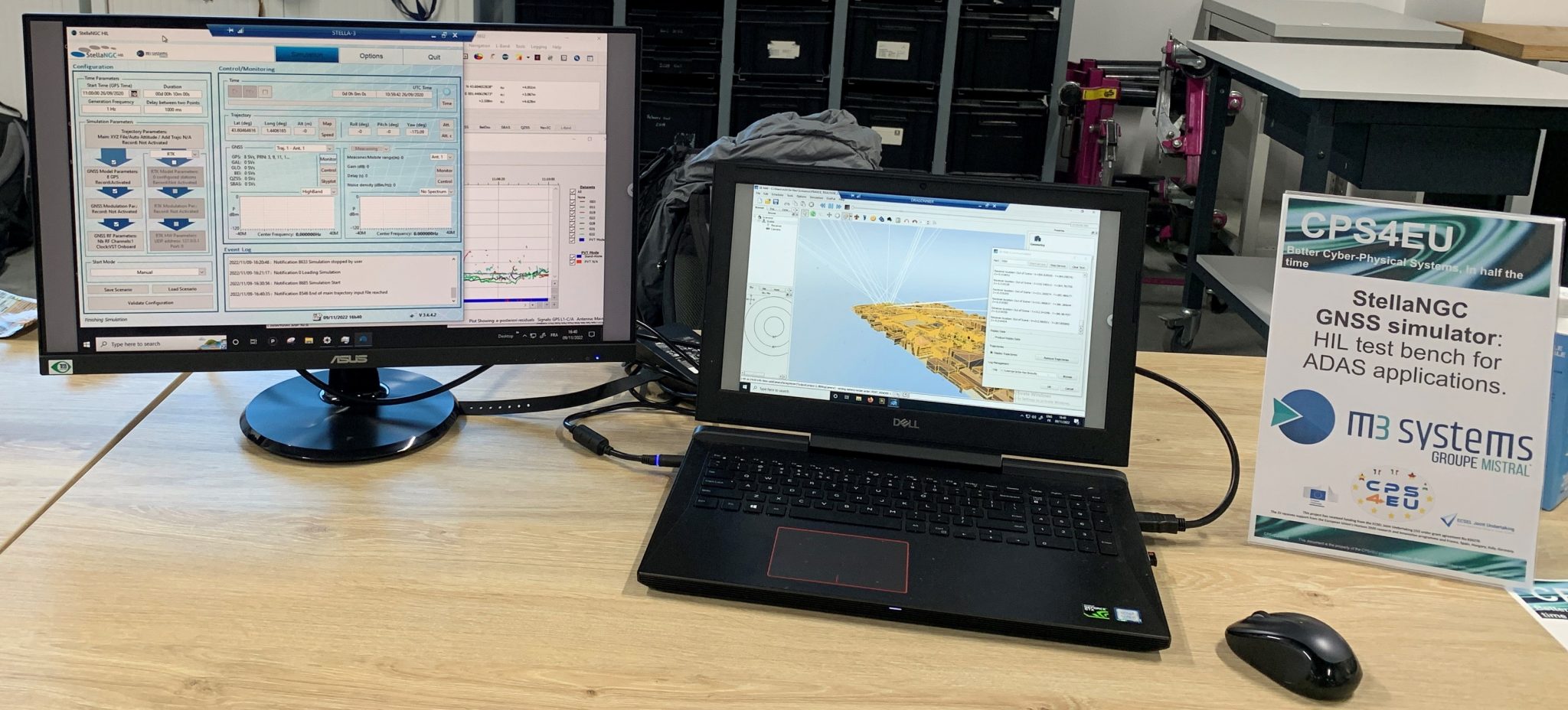
M3 Systems has played an important role in the CPS4EU European project by providing use cases and solutions centered around the company’s GNSS simulator, StellaNGC.
The project aims to develop new Cyber-Physical Systems (CPS) technologies that will improve the efficiency and reliability of critical infrastructures, such as transportation systems, energy networks and communication systems.
The CPS4EU project involves 36 partners from various European countries, including M3 Systems, working to develop new standards and guidelines for the design, deployment and operation of CPS.
The M3 Systems’ flagship product was integrated into a new test bench, to be used by position systems, to assess reliability for autonomous driving and intelligent mobility applications.
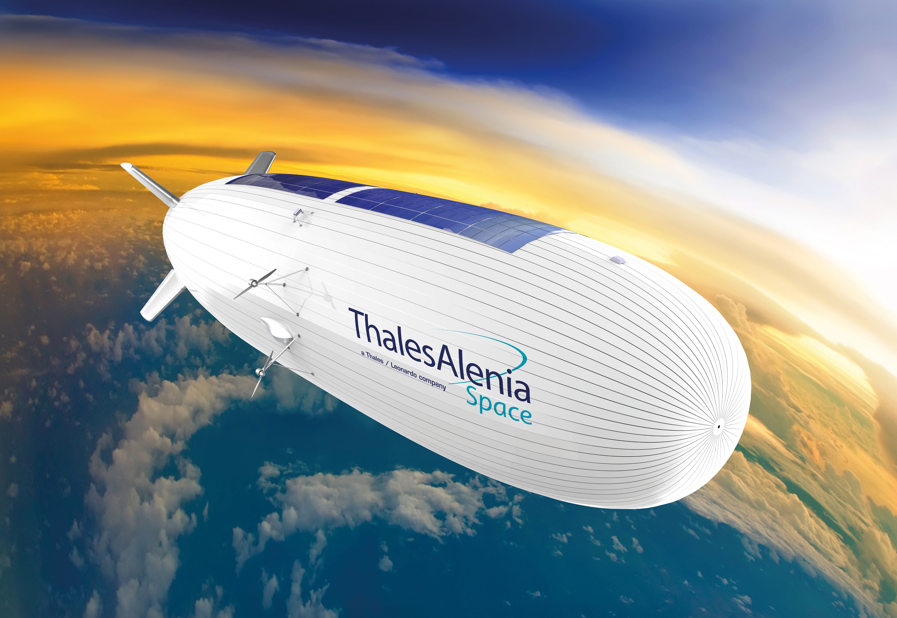
Thales Alenia Space has signed a €43 million contract for the Euro High-Altitude Platform Systems (HAPS) demonstration project. EuroHAPS was selected by the European Commission on July 20, 2022, for collaborative defense research and development projects from the European Defense Fund.
EuroHAPS aims to develop several stratospheric demonstrators for missions designed to improve intelligence, surveillance and reconnaissance and communications capabilities. Project partners include companies from Italy, Spain, Germany and France.
The project will conduct flight demonstrations for three types of complementary stratospheric platforms: A reduced-scale Stratobus from Thales Alenia Space, a solar-powered airship designed for long-endurance missions and offering large payload capacity, Hybrid High Altitude Airship from the Italian Aerospace Research Centre capable of generating extra lift with a wing airfoil, and autonomous stratospheric balloon system from ESG and TAO consisting of a series of three altitude-controllable balloons.
These three types of platforms are complementary and feature different operating times, capacity and operational restrictions. They will give Europe a broad spectrum of solutions to meet a variety of different requirements.
The platforms will test a range of missions, including lidar observation to detect and classify targets at sea or on land and the ability to detect them in environments with vegetation cover. Communications intelligence and electronic intelligence missions will also be tested, as well as a meshed broadband communications network for air and land players.
HAPS offer a new opportunity to complement ground-based, satellite-based or airborne assets with unique capabilities tailored to operational requirements. These flight demonstrations of HAPS will enable demonstrations of different platforms and address the main technical risks associated with these new technologies while refining operational requirements to ultimately enable development of future HAPS systems.
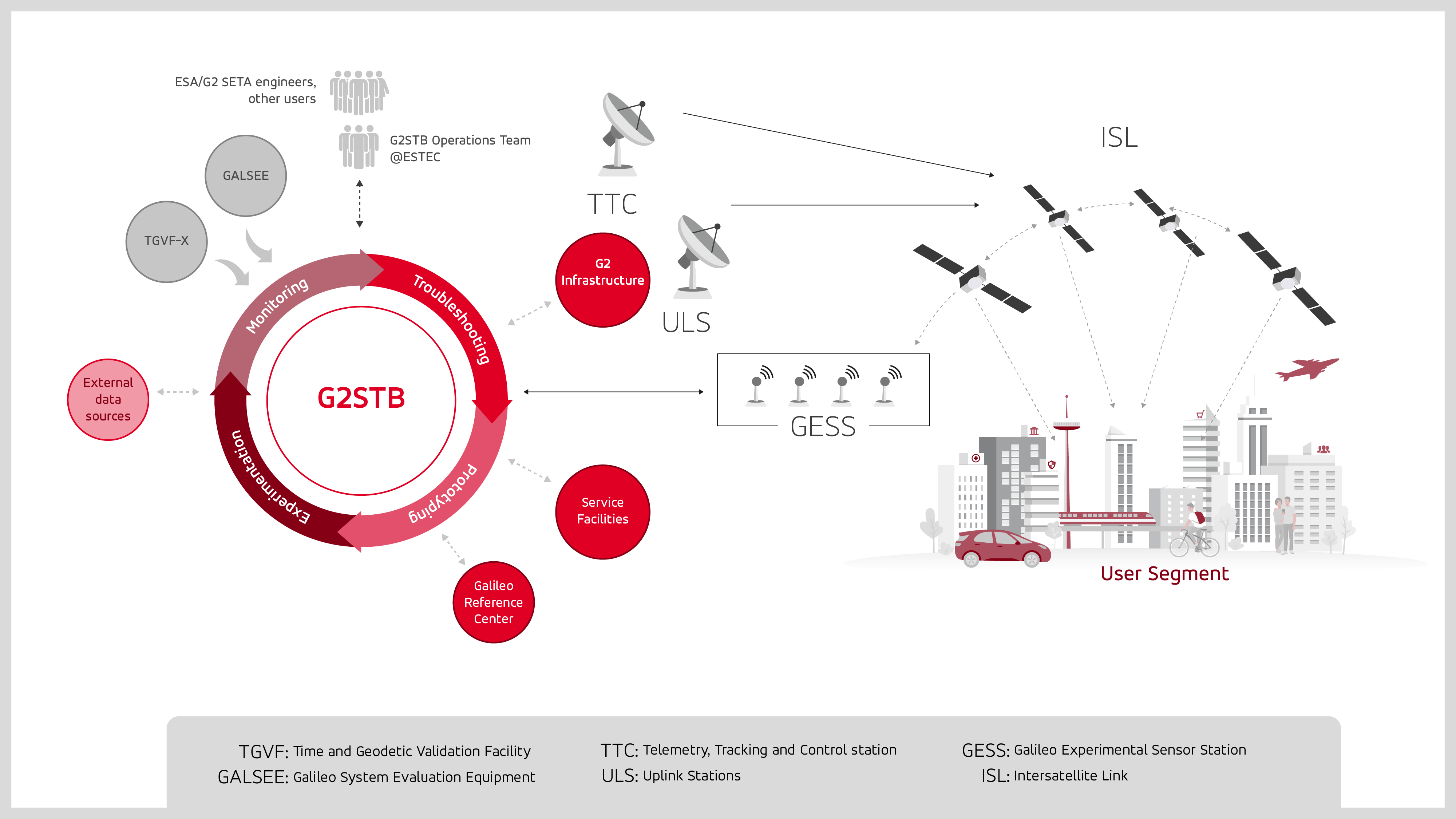
GMV has been selected by the European Space Agency (ESA) and the European Union Agency for the Space Programme (EUSPA) to develop the Galileo second-generation system test bed (G2STB). The G2STB will provide ESA with a key system verification and validation facility in support of its role as Galileo system development prime, enabling a wide range of Galileo system monitoring, troubleshooting, prototyping and experimentation activities.
GMV will deliver four G2STB versions over five years. Among these modules, the G2 high accuracy service (HAS) data generator and monitor aims to improve the Galileo HAS that was declared operational in January.
Other early capabilities of the G2STB include an upgraded orbit determination and time synchronization facility — capable of processing inter-satellite link data, a time service monitoring module, an integrity support message generator, a signal authentication service, an authentication validation module, an emergency warning service module, an ISL simulator and a G2G message composer.
The G2STB project aims for a smooth transition from the Galileo first-generation to the second-generation, building onto the G1G legacy system tools. The G2STB is one of the key infrastructure elements that ESA is developing for the correct functioning of the Galileo second-generation satellites.
The G2STB will eventually replace and upgrade the capabilities of the two first-generation facilities, the Galileo system evaluation equipment and the time and geodetic validation facility (TGVF-X). The latter, developed and operated by GMV over the last decade, has played a key role in monitoring the Galileo signals and system validation activities during the Galileo exploitation phase. The TGVF-X is also contributing to the early validation of new capabilities and elements being rolled out in recent and upcoming Galileo System updates.
In parallel to the development phase, the G2STB will help upgrade the network of Galileo experimental sensor stations to process new signals and capabilities to ensure the availability of a G2-capable, worldwide, multi-constellation network of receivers and bit-grabbers — independent from the operational Galileo sensor stations.
What would be required for the United States to develop and deploy a GPS high-accuracy service analogous to Galileo’s HAS?
Ismael Colomina
“Galileo HAS is a particular implementation of a PPP-RTK service. U.S. companies are already providing similar fee-based services that are even more accurate than HAS. Therefore, there is no big technical challenge for the United States to provide a GPS HAS. Actually, the European Union already provides a HAS for GPS. It is more a question of strategy for GPS policy makers: which user segment to service with a HAS-like augmentation? What about other services analogous to Galileo’s OSNMA and the upcoming CAS [commercial authentication service] for resiliency purposes? In short, a HAS-like service would just require including it in the U.S. GNSS evolution roadmap.”
— Ismael Colomina GeoNumerics
John Fischer
“The challenge is probably more political than technical. The U.S. government usually refrains from competing with commercial services. The prevailing attitude in the United States is that the private sector is more efficient than the public sector. Maybe the most practical approach is for the government to provide the authentication mechanism and open access to the data required, then allow the private sector to offer services. There isn’t a pressing need for high-accuracy GPS for transportation — it needs resiliency/reliability. However, precision agriculture needs it, so maybe sponsorship from the Department of Agriculture would be more effective than from the Department of Transportation.”
— John Fischer Orolia
Mitch Narins
“When I saw this question, my first impression (as a systems engineer) was to ask ‘For whom? For what applications? For which services?’ (Positioning? Navigating? Time/frequency?) Many have concentrated on accuracy, competing in a GNSS Olympics to see who can achieve ‘the best’ position accuracy and precision (repeatability). Finally, (thanks to Logan Scott) integrity is being pushed beyond just SBAS and GBAS, and real civil authentication of signals is being pursued. I can promise nanometers/nanoseconds if I don’t have to prove it’s true. While we finally understand the need for zero trust, we must still address loss of service by establishing real complementary PNT.”
The Navigation Support Office at the Mission Control Centre of the European Space Operations Center (ESOC) has been tasked with providing independent precise orbit determination for European space missions. ESOC, which is based in Darmstadt, Germany, is a part of the of the European Space Agency (ESA). ESA aims to use high-quality signals from Galileo alongside GPS to sharpen the orbital positioning levels for future space missions.
The Navigation Support Office has used the positive results of the Copernicus Sentinel-6 mission — one of the first missions to fly a joint Galileo-GPS capable receiver, which improved positioning capabilities — to prove to ESA mission teams that future missions can harness the power of Galileo to improve positioning accuracy.
Missions in the works
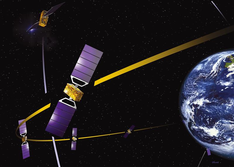
Proba-3 is a precision formation flying mission that aims to launch in 2024. The mission consists of two small satellites launched together that will separate to fly in tandem to prepare for future multi-satellite missions flying as one virtual structure. This mission will require millimeter-scale positioning precision and use a variety of positioning methods, including optical, radio and laser links and GNSS such as Galileo.
The ESA-supported Lunar Pathfinder will be launched into lunar orbit in 2024 with the intent of using it as a communication satellite for future moon missions. The spacecraft will incorporate a specially designed GPS- and Galileo-capable receiver that aims to demonstrate the feasibility of positioning fixes from 400,000 km away.
The future of Galileo
Galileo serves Europe and the world with accurate and reliable navigation services as well as a catalyst for future space missions — making it a critical aspect of both everyday life and the enhancement of accurate navigation. The constellation will continue to grow with 10 more Galileo first-generation satellites planned for launch in the next few years. Second-generation Galileo satellites with enhanced capabilities are being built for testing and qualification at ESA’s European Space Technology and Research Centre as well.
The University of New South Wales has developed an advanced GNSS receiver that can receive signals from GPS and Galileo satellites across multiple frequencies. The Australian Space Agency provided funding for the project via the International Space Investment initiative.
The receiver may play a key part in the future for Australian space missions.
Professor Andrew Dempster, director of the Australian Centre for Space Engineering Research (ACSER), led the development of the receiver and notes that it is an upgrade of Kea, a receiver made in Australia and New Zealand.
“The idea was to take that work (on Kea) and upgrade it for this multi-frequency, multi-system solution,” Professor Dempster said. “We needed to scale up the performance of many of the components on the boards – in particular, where the digital processors and hardware live.”
ACSER aims to have the receiver support upcoming satellite missions. The receiver can provide precise positioning, timing and velocity information. It enables satellites to produce higher quality images from space with better pointing.
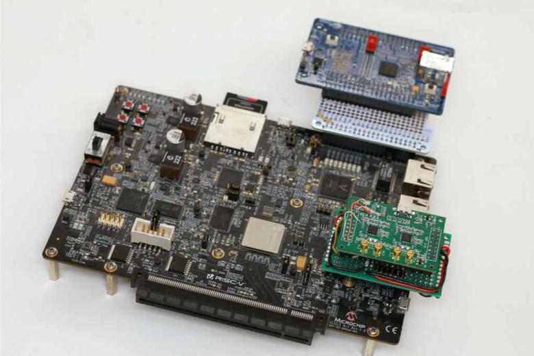
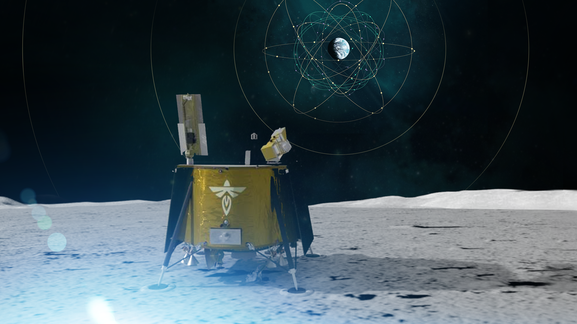
As a part of the NASA Commercial Lunar Payload Services initiative, Firefly Aerospace will land the Blue Ghost lander on the lunar surface in 2024. Onboard, the Lunar GNSS Receiver Experiment (LuGRE) payload will determine whether signals from two GNSS constellations can reach the lander and provide precise navigation on the moon for future missions.
During a 12-day mission in the moon’s Mare Crisium basin, LuGRE will obtain the first GNSS fix on the lunar surface and receive signals from both GPS and Galileo. The LuGRE payload is managed by NASA’s Space Communications and Navigation program office.
This payload is a collaborative effort between NASA and the Italian Space Agency to expand the capabilities of Earth-based navigation systems. Navigation engineers at NASA’s Goddard Space Flight Center in Greenbelt, Maryland, have been testing the payload’s GNSS receiver and low noise amplifier. The receiver was developed and built by the Italian company Qascom.
These components will be critical to LuGRE obtaining signals from the GPS and Galileo satellites. To prepare for operating on the moon, NASA engineers used a GNSS simulator to test and configure the payload to accurately receive and process the signals.
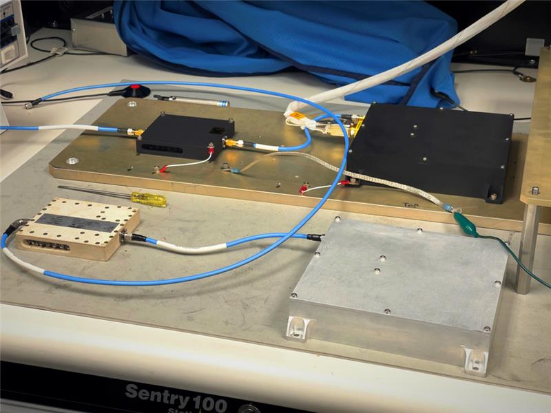
The LuGRE payload GNSS receiver and low noise amplifier. (Image: NASA/Dave Ryan)
The Goddard team delivered in February the flight hardware to Firefly Aerospace in Cedar Park, Texas, where it will be integrated into the Blue Ghost lander.
Astronauts and rovers traversing the lunar surface will need precise location and tracking data for their exploration endeavors. The data gathered from the LuGRE payload will be used to further develop GNSS-based navigation systems for future missions to the moon.
CHC Navigation has released the NX510 SE Auto-Steer, an automated steering system that retrofits several types of new and old farm tractors and other vehicles. It can be connected to local real-time kinematic (RTK) networks or GNSS RTK base stations.
NX510 SE is a guidance controller powered by multiple corrections sources and five satellite constellations: GPS, GLONASS, Galileo, BeiDou and QZSS. It has a built-in 4G and UHF modem that connects to all industry-standard differential GPS and RTK corrections to achieve centimeter-accuracy steering.
NX510 SE contains GNSS and inertial navigation system terrain compensation technology, which maintains high accuracy in challenging environments and terrain. This makes NX510 SE suitable for ditching, planting and harvesting applications.
In addition, AgNav multilingual software, operating on a 10.1 in industrial display, supports multiple guideline patterns that include AB line, A+ line, circle line, irregular curve and headland turn.
On Friday, March 3, Alex Murdaugh was convicted of killing his son Paul Murdaugh and wife Maggie Murdaugh on June 7, 2021. With limited evidence, the prosecution used a phone video and vehicle navigation data to prove Alex’s guilt.
During the trial, Alex claimed he was visiting his mother during the time the murders took place. However, General Motors OnStar data accessed by investigators from his Chevrolet Suburban contradicted the alibi, putting Alex at the scene of the crime during the time of the murders.
In addition to the navigation data, in a phone video taken by Paul on the night of the murders near the Murdaugh’s dog kennels at their Moselle property, Alex’s voice could be heard in the background. That video also placed Alex at the scene around the time Paul and Maggie were shot and killed.
After deliberating for less than three hours, the jury found Alex guilty of the double murders. The judge then sentenced him to life in prison without the possibility of parole.
Since the trial began, the South Carolina Law Enforcement Division has reopened several investigations connected to the Murdaugh family. This includes the case of Stephen Smith who was found dead on the side of the road in 2015 allegedly from a hit-and-run.
Tracy Cozzens has helped to run GPS World for more than 17 years—first as Managing Editor and then, since June 2019, as Senior Editor. She has covered everything under the sun pertaining to GNSS, always providing readers real-time and fascinating news. She has also maintained the website, helped with print magazine production, and performed many other tasks. Now, Tracy is retiring and handing the reigns over to our new Managing Editor, Maddie Saines. Tracy has worked diligently to pass on her knowledge and enthusiasm to ensure the ongoing success of this publication.
Her ideas, angles, journalistic experience and passion will be dearly missed. GPS World’s staff wishes Tracy a wonderful and relaxing retirement!
TRACY’S TOP 17
One of her recent stories with the greatest number of hits for each of her 17 years with GPS World:
GPS is the gold standard for precise positioning, navigation, and timing (PNT), impacting the lives of more than six billion users worldwide. The United States economy alone depends on the free, government-provided service across 900 million GPS receivers supporting vehicle navigation systems, general aviation, financial transactions, the electrical grid, precision agriculture, surveying and construction. The GPS enterprise must remain consistent and reliable, while keeping pace with emerging technology without interruption for the end user.
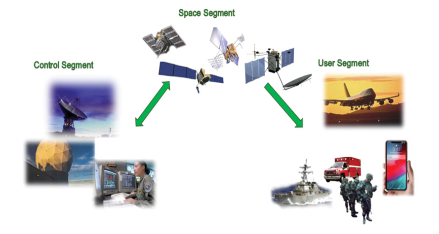
Space Systems Command (SSC) at Los Angeles Air Force Base in El Segundo, California — the U.S. Space Force’s space development, acquisition, launch and logistics field command — is responsible for maintaining and modernizing the GPS enterprise. The enterprise consists of three segments: the space segment, the control segment and the user segment. Each achieved specific milestones during an exciting and productive 2022.
A new MGue for warfighters is moving closer to completion. (Image: EvgeniyShkolenko/iStock /Getty Images Plus/Getty Images)
Space Segment
There are currently 37 GPS satellites on-orbit with 31 set healthy. The constellation requires 24 operational satellites for worldwide coverage and a receiver needs to receive transmissions from four of them to determine its position in three dimensions. GPS continues to operate impressively with an average 45-cm accuracy throughout the past year with the most precise day on record at 31.5 cm. The space segment of GPS modernization focuses on GPS III and GPS IIIF satellite development with significant milestones rounded out in 2022.
For GPS III, after the successful launch of Space Vehicle 5 (SV05) on June 17, 2021, it was set healthy (usable) on May 25, 2022. The significance of SV05 is its full operational capability of the improved civilian L2 (L2C) signal. L2C improves service speed for commercial users via access to two frequencies, improves accuracy when combined with legacy civil GPS signals (L1 C/A), and is less susceptible to ionospheric interference. SV05 is the 24th satellite enabled with the Military Code (M-code), providing worldwide M-code coverage. M-code is designed to give military receivers better defense against jamming, improved accuracy, a more secure and flexible cryptography architecture, and the ability to detect and reject false signals.
On Jan. 18, 2023, SV06 successfully launched into orbit aboard a SpaceX Falcon 9 Block 5 rocket from Cape Canaveral Space Force Station, Florida. The launch of SV06 marks a key step in the larger goal of modernizing the GPS constellation. Additionally, the 10th and final satellite in the GPS III fleet finalized production and has a target launch date of 2026. GPS III Space Vehicles 7–10 are in storage and available for launch.
The next generation of GPS satellites continues development. The October 2022 contract award for GPS III Follow-On (GPS IIIF) satellites will onboard additional capabilities. In addition to introducing new civil signals designed to enhance search-and-rescue efficacy and aviation safety, laser retroreflector array for precise ranging, and a fully digital navigation payload, the GPS IIIF satellites will offer a new Regional Military Protection (RMP) capability providing up to 60 times greater anti-jamming measures. A new port on the Lockheed Martin LM2100 Combat Bus supports a substantial increase in flexibility, providing rapid integration of payloads in response to emerging threats in space.
GPS Enterprise interrelated segments. (Image: Space System Command)
Control Segment
The Next Generation Operational Control System (OCX) will replace the current GPS Operational Control System (OCS), supporting the latest U.S. Department of Defense standards and practices for cybersecurity. The updated system includes a modernized and expanded monitor station network, improved anti-jam capabilities, and enhanced operational capability to control modernized military signals.
In March 2022, OCX completed its fourth and final legacy ground antenna element (LGAE) installation on Kwajalein Island in the Republic of the Marshall Islands. OCX Block 1 and 2 are undergoing Hewlett Packard (HP) Formal Qualification Test (FQT). This event will qualify much of the system’s previously certified mission software functions. The event will also demonstrate system maturity and readiness for system acceptance, operator training, and specific developmental testing milestones with both GPS space and user segments.
The next-generation control system, OCX 3F, will modify OCX Blocks 1 and 2 to use the enhanced capabilities of GPS IIIF satellites. OCX 3F received Milestone B and Acquisition Program Baseline (APB) approval from the Milestone Decision Authority (MDA) and was authorized to enter the Engineering and Manufacturing Development (EMD) phase in May. In November, the OCX 3F program deployed 3F mission software into OCX’s Near Operations Environment (NOE) for the first time after completion of the program’s first Integration Readiness Review (IRR). The IRR event ensures that the software meets integrity standards and receives approval to be integrated and tested on the NOE prior to software releases to the operational users. OCX 3F anticipates achieving operational acceptance in 2027.
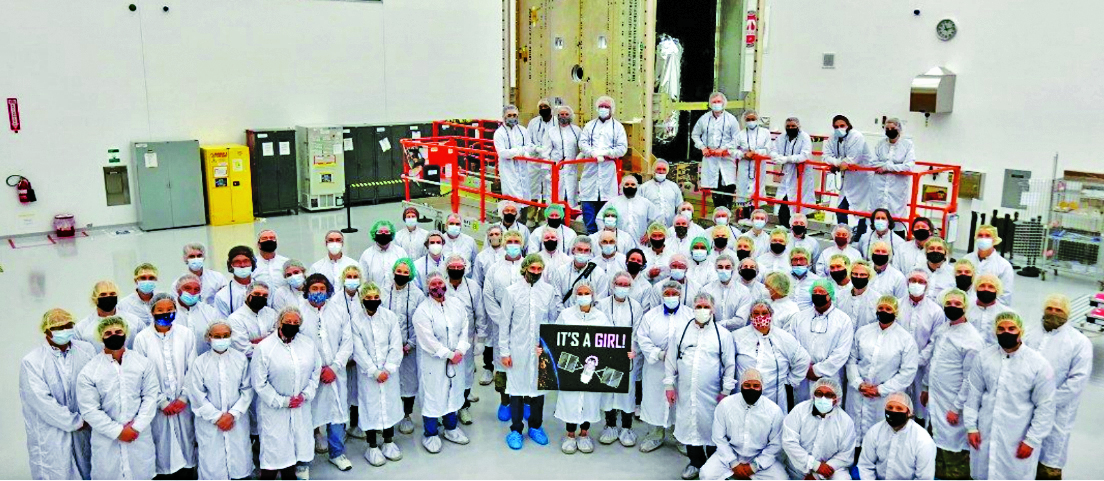
The GPS III government and industry team recently core mated GPS III SV10 and nicknamed it “Hedy Lamarr” after the actress and inventor. (Image: Lockheed Matin)
User Equipment Segment
Among the arsenal of GPS user equipment, very few pieces have the technology to use the M-code signal. Maintaining a competitive advantage against the adversary requires use of these signals; the GPS Enterprise is focused on developing Modernized GPS User Equipment (MGUE) capable of accessing these signals. The MGUE program is a joint service program developing modernized M-code-capable military GPS receivers. The program is broken into two increments (Inc 1 and Inc 2). Both are designed to deliver secure PNT performance, allow navigation warfare operations, enhance anti-jam, enhance anti-spoof and anti-tamper, and enable Blue Force Electronic Attack.
As part of the multiple elements under the MGUE Inc 1 umbrella, L3Harris delivered its final Build 7 ground card to the government on Nov. 16, 2021, and completed regression testing on that kit in February 2022. The final Delta Security Certification and Approval were completed on April 13 and April 29, 2022, respectively. Development of the L3H Ground-Based GPS Receiver Applications Module (GB-GRAM-M) card, which delivers geolocation and precise positioning capabilities for space-constrained applications while providing increased security and anti-jam capabilities, is complete and available for services procurement. MGUE Inc 1 completed qualification testing for the aviation and maritime cards on Sept. 9, 2022, with updated software builds. This build allows the program to progress to 98% of the requirements verified and enables B-2 Bombers and Guided Missile Destroyers (DDG) to continue progress toward operational testing. Completion of this commitment means significant progress toward operational testing for stakeholders and warfighters.
MGUE Inc 2 held Preliminary Design Reviews for the Miniature Serial Interface (MSI) in summer 2022, bringing the project another step closer to finalizing the EMD phase. Once all closure and action items are completed for the reviews, the government will consider each event complete. Critical Design Review (CDR) is scheduled for this summer and will validate the system design and the ability to meet system performance requirements. MGUE Inc 2 continues to execute the second competitive objective under Phase I for the Joint Modernized Handheld component; the effort is moving closer to completion of the handheld prototype and will ultimately make for a more seamless transition to operations.
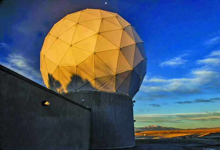
GPS ground antenna at Schriever Space Force Base in Colorado. (Image: U.S. Air Force)
Conclusion
The SSC’s mandate is paramount to maintaining our modern way of life. The space professionals dedicated to developing GPS technology are committed to delivering advanced capabilities to the warfighter, the civil sector, and the world. An interconnected world is ready for us. We’re on our way.
SSC is the U.S. Space Force field command responsible for acquiring and delivering the capabilities needed by warfighters to protect our nation’s strategic advantage in and from space. It manages an $11B budget for the U.S. Department of Defense and works in partnership with joint forces, industry, government agencies, academic and allied organizations to outpace emerging threats.
For analogous updates on the other three GNSS constellations, please see: