Category: Opinions

  • GNSS at the front end and back end  of Intelligent Transportation

    GNSS at the front end and back end of Intelligent Transportation

    Image: Hexagon | NovAtel
    Image: Hexagon | NovAtel

    It has been a wild decade, with so many players in the autonomous vehicle (AV) market, all striving for a leg up. Until the dominant design of present AV stacks emerged, there was no small amount of experimentation and less-than-successful alternate approaches. For instance, there was one big-name player that initially sought to create an AV solution without GNSS. Reality set in, and they soon embraced GNSS as an essential component.

    Gordon Heidinger, segment manager, automotive and safety critical systems at Hexagon’s Autonomy and Positioning division, has had a front-row seat from which to observe, and contribute to the evolution of AV.

    “I’ve been in the automotive industry for 20 years, all the way from OEMs like Chrysler to tier ones like Harman,” Heidinger said. “I’ve worked on the engineering side, on the project management side, and have now joined Hexagon | NovAtel to help further their involvement in the automotive industry. NovAtel was there for aviation 20 years ago, helping develop systems for planes to take off and land autonomously — we have a deep bench when it comes to applying such expertise for vehicular autonomy.”

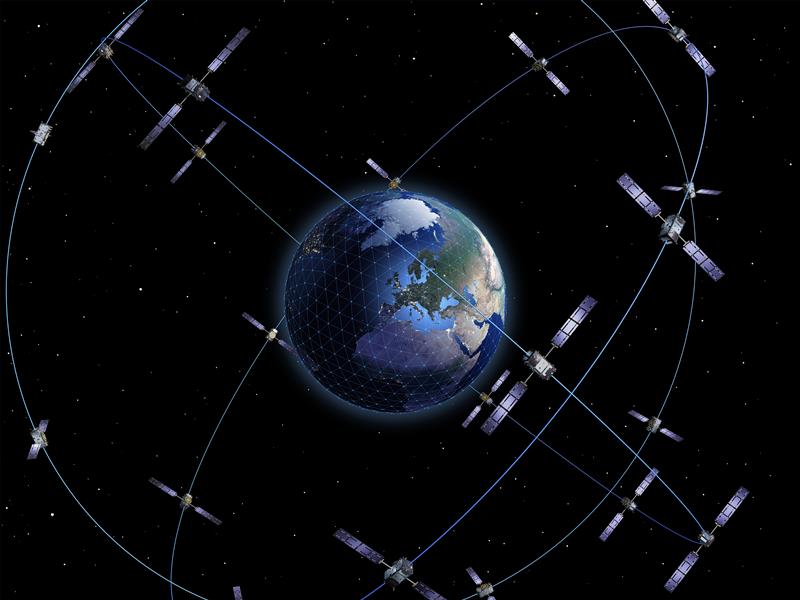
    NovAtel has long provided GNSS and IMU products and solutions, as well as real-time positioning services. Each are key elements of AV sensor stacks and overall autonomy solutions. Parent company Hexagon has multiple divisions contributing to intelligent transportation — on both the front end and back end.

    The Front End

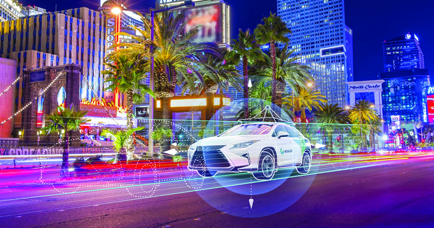
    AV systems require highly reliable and smart sensor stacks that typically include cameras, radar, lidar and sonic sensors; these provide the relative positioning for advanced driver assistance systems (ADAS), which are becoming commonplace for newer vehicles. There are also implementations that include GNSS/IMU for navigation and lane keeping.

    “Lane keeping is possible to a limited degree with combinations of the other sensors; however, you need GNSS to let you know where you truly are for autonomous driving,” Heidinger said. “Are you on the right freeway lane in Ottawa, or is this an exit ramp? This was a big problem with today’s simple single frequency solution; a car can assume highway speeds on an exit ramp, not realizing it was an exit ramp.”

    Only with the absolute precise positioning that GNSS provides, and a high-definition map, level 4 autonomy — and potentially level 5 someday — could be achieved. With current sensor stacks, when the car is moving, it can reliably detect the other cars moving in its vicinity. Furthermore, vehicle-to-vehicle (V2V) solutions are being developed and tested, which enable a vehicle to share data about where it is going, its speed and acceleration, and its current location. We may remain far from full autonomy until such solutions are broadly deployed, however we will see some of the vehicle-to-everything (V2X) solutions sooner than later.

    Various developers and departments of transportation around the world are testing short range V2X communication systems.
    “We would need real-time construction zone updates,” Heidinger said. “It would be tough to do lane keeping if a construction site closes or diverts lanes during the course of a day. Or if cameras detect crashes, or blocked lanes, this will need to be broadcast immediately and continuously in real-time.”

    A representative example of a production high precision positioning system was demonstrated at the recent Consumer Electronics Show 2023 (CES 2023). ZF Friedrichshafen AG (ZF) has developed ProConnect — a dedicated short-range communication (DSRC) solution that enables positioning and communication for use in applications with roadside infrastructure, such as traffic lights. It can be scaled to include other over-the-air alerts that could include first responder vehicle proximity and construction site status. At CES, the GNSS positioning was demonstrated with an autonomous vehicle platform from Hexagon.

    “The precise map and the real-time updates from V2V and V2X systems all need precise absolute positions to relate objects to each other,” Heidinger stated. The question then becomes “…how reliable and trustworthy is that solution”?

    There are international automotive-grade requirements such as the ISO 26262 standard for electrical/electronic systems, and automotive safety integrity levels. For instance, ASIL-B(D), and cybersecurity standard ISO/SAE 21434. The latter provides protection against external access without authorization.

    “The level of reliability required is extremely high,” Heidinger said. “After all, these are human lives, in metal boxes hurtling along at highways speeds. There are ASIL standards that call for a probability of 10-8, or 1 in 100 million, in an hour that the system is wrong. These levels of reliability need to apply to electronic components, communications, and the availability of the GNSS positioning solution to really automate any type of vehicles. You’ll encounter similar AV standard references to five-nines, or 99.999%.”

    Positioning Services

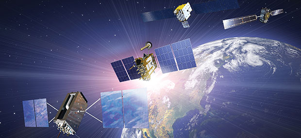
    Heidinger explained that for most aspects of autonomy, GNSS can be “good enough”, even just to a foot. However, uncorrected, GNSS can never meet even those needs — achieving an accuracy of a few meters at best. Then there is the matter of reliability. Augmentations like real-time kinematics (RTK) and precise point positioning (PPP) apply broadcast “correctors” that can yield centimeter positions. RTK is not practical for broad areas or highway and road networks as it requires dense infrastructure and two-way communication with the vehicle, which can introduce security challenges.

    Solutions for autonomy are typically PPP. While there are many applications of PPP that use clock, orbit and ionospheric model data broadcast from geostationary L-band satellites, for applications such as surveying, mapping, maritime and agriculture, this would not meet the reliability requirements for AV. The Achilles heel of broadcast PPP is that the satellites are usually limited in number and positioned over the equator; the vehicle can often lose sight of these. Instead, PPP services, such as that provided by NovAtel and others, are tapped by vehicles via mobile internet connections; this means cellular networks. While cellular services can often meet reliability goals, there are still vast areas of highways where availability is sparse.

    The other challenge for PPP is the convergence time needed to get reliable sub-foot precision.

    “No one wants to wait five minutes or more for it to converge,” Heidinger said. “By processing data from semi-dense networks of reference receivers, our PPP can converge rapidly enough to be ready to roll as soon as you start driving.”

    The Back End

    A free-for-all of autonomy is not going to happen on highways and roads that are not precisely mapped and kept up to date.
    “There are visions of crowd sourcing map updates from the sensors in cars,” Heidinger said.

    Crowd-sourced data is not systematic enough, though, and could be inconsistent. After all, there are privacy considerations, and how many vehicle owners would be willing enough to participate?

    There are numerous mapping and imaging “buggies” plying road and highway networks on an ongoing basis; this could provide a base layer. But how precise? The specific applications these mapping buggies support may not need high precision. And operators may not be willing to invest in high precision/accuracy. The precision of the 3D maps would need to be higher than the target range of the AV systems. The technology exists and is broadly used for various applications in the form of centimeter precision 3D mobile mapping — at highway speeds. Such systems with lidar scanners, cameras, and positioning solutions can include GNSS, IMU, wheel speed encoders, and SLAM lidar for enhanced position stabilization. An example is the Pegasus TRK from Hexagon | Leica Geosystems.

    GNSS is the key component — the provider of precise absolute positioning. When people drive, they are the sensor stack, and they are (mostly) aware of the context of where they are and can see and hear what is going on around them. Before we can hand over the driving duties to machines, and fully accept any autonomous driving technology, it will not only need to be as smart and aware as humans, but much better and more aware than humans. Autonomy sensor stacks can tell a car what it is doing, and what other things are doing in its immediate vicinity, but without a precise map, and knowing precisely where it is in real-time, a car would be still tip-toeing around in a fog of uncertainty.

  • California Spatial Reference Center (CSRC) 2023 Spring Meeting

    California Spatial Reference Center (CSRC) 2023 Spring Meeting

    On April 27, I attended (virtually) the spring 2023 meeting of the California Spatial Reference Center (CSRC) coordinating council. See the agenda below. This column will highlight some activities with which the CSRS is involved and how it’s advancing the science of geodesy. Anyone who has been following my latest columns knows that I am an advocate for any person or organization that promotes the advancement of geodesy and recognizes that the United States is experiencing a geodetic crisis.

    First, I would like to state that Yehuda Bock, the director of CSRS, has been instrumental in advancing accurate geodetic positioning for as long as I have known him. I first met Bock in 1978 while I was attending the Ohio State University.

    A video of the meeting is available from the CSRC here.

    During the meeting, Bock presented the director’s report. He started with mentioning how geodetic infrastructure and methodologies are essential to mitigating the effects of natural hazards. That is something that affects everyone in the world, especially California, and one of the reasons that I always end my email messages and presentations with the following statement: “Geodesy is the foundation for all geospatial products and services.”

    Geodetic infrastructure and methodologies. (Image: Yehuda Bock, Scripps Institution of Oceanography)
    Geodetic infrastructure and methodologies. (Image: Yehuda Bock, Scripps Institution of Oceanography)

    Bock highlighted how GNSS is important to explaining natural phenomena and hazards of the Earth. Most individuals use GNSS to know where they are on a map on a phone, but GNSS (and geodesy) is so much more important to the average citizen than just knowing their location on Earth. As you can see from the image below, GNSS positioning provides information about many of Earth’s systems, such as changes in local mean sea level, the values of atmospheric parameters, the status of water resources, and the movement of the Earth’s surface due to tectonic plates, glaciers, earthquakes and volcanoes. One or more of these activities are important to every individual in the world.

    (Image: Yehuda Bock, Scripps Institution of Oceanography)
    (Image: Yehuda Bock, Scripps Institution of Oceanography)

    Bock provided examples of how GNSS has been used to investigate and monitor earthquakes, which is extremely important in California. See the image below  

    Displacement due to earthquakes. (Image: Yehuda Bock, Scripps Institution of Oceanography)
    Displacement due to earthquakes. (Image: Yehuda Bock, Scripps Institution of Oceanography)

    He highlighted a methodology of a kinematic datum that uses an intra-frame velocity model to estimate positions at any location and at anytime with respect to a reference frame and epoch.  This concept is part of the National Geodetic Survey’s new, modernized, National Spatial Reference System (NSRS). Several of my previous columns have discussed NGS’ NSRS and time-dependent coordinates (for example, see my August 2022 column). 

    (Image: Yehuda Bock, Scripps Institution of Oceanography)
    (Image: Yehuda Bock, Scripps Institution of Oceanography)

     California’s geodetic network is significantly affected by crustal movement. To help address this issue, the CSRS updated the NAD 83 coordinates. It’s denoted as CSRS epoch 2017.5 (NAD 83). See the image below for the project report on the update. This is important to anyone surveying in California because of the crustal movement affecting the coordinates of the monuments. California is well positioned to implement NGS’ NSRS. Part of the implementation of the CSRC epoch 2017.50 (NAD 83) was to have the new epoch-date coordinates transmitted with RTCM 3.0 data streams. This is something that other RTN operators from around the nation will have to do after NGS publishes the NSRS coordinates. The CSRS is a model from which others can learn. 

    Excerpt from CSRC epoch 2017.5 project report. (Image: http://sopac-csrc.ucsd.edu/index.php/epoch2017/)
    Excerpt from CSRC epoch 2017.5 project report. (Image: http://sopac-csrc.ucsd.edu/index.php/epoch2017/)

    Users that access CSRC’s epoch 2017.50 website, can find the coordinates of marks published in CSRC epoch 2017.50 (NAD83). See the image below for an example. 

    Mark p530 in CSRC epoch 2017.50 (NAD83). (Image: CSRC Website)
    Mark p530 in CSRC epoch 2017.50 (NAD83). (Image: CSRC Website)

    Bock discussed the integration of InSAR and GNSS to estimate accurate land changes over large areal extents. This type of research can help in developing an accurate intraframe deformation model (IFDM) to account for movement between survey epoch coordinates (SEC) and reference epoch coordinates (REC). See my August 2022 column for more on NGS’s definition of SEC and REC coordinates.   

     (Image: Yehuda Bock, Scripps Institution of Oceanography)

    (Image: Yehuda Bock, Scripps Institution of Oceanography)
     (Image: Yehuda Bock, Scripps Institution of Oceanography)

    (Image: Yehuda Bock, Scripps Institution of Oceanography)
    (Image: Yehuda Bock, Scripps Institution of Oceanography)
    (Image: Yehuda Bock, Scripps Institution of Oceanography)

    The rest of the director’s report included the following topics: 

    • reference surfaces for unified reference frame 
    • observation systems: terrestrial and marine geoids 
    • unified reference frame 
    • GNSS-IR 
    • airborne gravity 
    • geoid model 
    • machine l;earning 
    • tracking atmospheric rivers with GNSS meteorology 
    • tracking extreme weather events with GNSS meteorology 
    • cluster analysis to unsupervised analysis of GNSS time series isolate geophysical effects 
    • proposed geodesy curriculum at SIO. 

    The last one was the most important one to me because developing educational curriculums that include geodetic topics will help advance the science of geodesy.   

    (Image: Yehuda Bock, Scripps Institution of Oceanography)
    (Image: Yehuda Bock, Scripps Institution of Oceanography)


    Other speakers at the coordinating council meeting discussed the use of geodetic science in projects such as measuring sea level rise along the California coast as well as performing geodesy on the seafloor.  

    There was an interesting presentation by Humberto Gallegos discussing how to fill the skill gaps through the Geo-Spatial Engineering and Technologies (GSET) program at East Los Angeles College (ELAC). This program is helpful in developing future surveyors and geodesists. 

    (Image: EarthScope)
    (Image: EarthScope)

    There also was a presentation on EarthScope by Bill Funderburk. See below for a few slides from Bill’s presentation. The presentation discussed the update on the Network of the Americas (NOTA). Bill provided information on NOTA partners, NOTA network and data, NOTA in California, and the EarthScope merger. His presentation also highlighted the many partners that support the NOTA, which includes 1,147 GPS/GNSS stations across the United States, Mexico and the Caribbean. Many individuals may not know it, but UNAVCO and IRIS merged on January 1, to become the EarthScope Consortium. Readers can find more information on this new organization here

    Photo:
    (Image: EarthScope)
    (Image: EarthScope)
    (Image: EarthScope)

    I only highlighted a few items from the meeting. Please see the video of the meeting for more details.  

    During the meeting, Bock was also presented with the CSRC Founders Award. It was a great honor for me to say a few words recognizing the important contributions that Bock has made to the geodetic community over the past five decades. It is in large part due to his leadership that California has progressed so much in geospatial positioning services. The following are a few photos from the ceremony and a statement from the CSRS. 

    Recognition Statement from the California Spatial Reference Center

    “Distinguished Research Scientist, Yehuda Bock, was recognized by the California Spatial Reference Center (CSRC: http://sopac-csrc.ucsd.edu/index.php/csrc/) with the Founders Day Award. Presented by Dana Caccamise, Bock was honored for the “thriving science and community outreach facilitated through [his] vision and implementation of the Center for decades.” With Bock’s guidance, CSRC was established in 1997 as a partnership with surveyors, engineers, GIS professionals, the National Geodetic Survey (NGS), the California Department of Transportation (Caltrans), and the geodetic and geophysical communities, and has become of IGPP’s most successful outreach efforts.”

    (Image: Karissa Duran, Scripps Institution of Oceanography)
    From left to right: Gregory Helmer, Sharona Benami, Yehuda Bock, Dana J Caccamise II (Image: Karissa Duran, Scripps Institution of Oceanography)
    The dedicated plaque and monument. (Image: Karissa Duran, Scripps Institution of Oceanography)
    The dedicated plaque and monument. (Image: Karissa Duran, Scripps Institution of Oceanography)


    In my opinion, integrated and collaborative organizations are necessary for the successful development of geospatial products and services.  

    I would like to highlight how the Ohio State University is integrating geodesy in a geology program. The Ohio State University Geology Field Camp is a geology class that is held every year. This year, the OSU Geodetic Department is going to participate in the program to explain how the science of geodesy is helpful to geologists. The plan is to provide exercises to explain how the camp’s activities can be enhanced with geodetic techniques. 

    The 2023 geology summer field course lasts six weeks. This year, the course starts on Thursday, June 1, and ends on Friday, July 14. Students receive six semester credit hours for completion of the course. 

    The course emphasize the following: 

    • observation of stratigraphic units and their characteristics 
    • interpretation and synthesis of structures, paleoenvironments, and geologic history 
    • presentation of results by means of geologic maps and cross-sections 
    • experience with 3D visualization, GIS, GPS and computer analysis of field data 

    In conclusion, on June 22, NGS is hosting a webinar that will discuss some of the benefits and challenges of transitioning to the modernized NSRS. The presenters are not NGS employees.  They are guest speakers from the geospatial community. I would encourage all users to register for this webinar. 

    (Image: NGS Website)
    (Image: NGS Website)
  • Editorial Advisory Board: GNSS constellations and receivers

    Editorial Advisory Board: GNSS constellations and receivers

    Which GNSS constellations do most receivers currently use? How is that mix changing?

    Ellen Hall

    “Most modern commercial receivers today are moving to receive all GNSS signals: GPS, GLONASS, Galileo, BeiDou, QZSS, IRNSS and so forth. Also important, in which bands does the receiver operate, and how many channels does it have for optimum accuracy and quicker cold start? Application and location for local stability are also factors. If the operation is in India, IRNSS would be important, in Japan QZSS, and so forth.”

    — Ellen Hall
    Imminent Federal


    Jean-Marie Sleewaegen

    “The current standard in commercial receivers is to exploit the interoperability between the various GNSS signals and to make use of all satellites in view, regardless of their constellation. While the L1/E1/B1 frequency band continues to be the primary frequency in almost all GNSS systems, the legacy L2 band is gradually losing its importance as most satellites are already broadcasting more advanced signals in the L5/E5 band.”

    — Jean-Marie Sleewaegen
    Septentrio


    Bernard Gruber

    “The newest phones offered by Google and the largest manufacturers in the world — Apple, Samsung, OPPO and Vivo — support the following positioning systems: Google — Pixel 7 and Pixel 7 Pro: GPS, GLONASS, Galileo, BeiDou, QZSS, and other // Apple — iPhone 14: GPS, GLONASS, Galileo, QZSS, and BeiDou // Samsung — S23 and most other recent versions: GPS, Galileo, GLONASS, and BeiDou // Xiaomi — Xiaomi 13 Pro: GPS (L1+L5), Galileo (E1+E5a), GLONASS (G1), BeiDou, NavIC (L5A-GPS supplementary positioning) // OPPO — F21: GPS, A-GPS, BeiDou, GLONASS, Galileo, and QZSS // Vivo — Vivo X90: GPS, A-GPS, GLONASS, Galileo, BeiDou, QZSS, NavIC, Cell ID, Wi-Fi. // For farming, John Deere’s SF-RTK uses GPS, GLONASS, BeiDou and Galileo.”

    — Bernard Gruber
    Northrop Grumman


    Bradford W. Parkinson “All modern generation cell phones use virtually all GNSS signals. This includes GPS, Galileo, GLONASS and BeiDou. In addition, they receive the correction signals, such as WAAS and EGNOS. This capability is embedded in the chips that are currently used. We are told that they have the capability to track on the order of 50 satellites at once. We expect that dual frequency is close to realization and the use of the new civil L5 signal will make cell phones even more capable.”

    — Bradford W. Parkinson
    Stanford Center for Position, Navigation and Time 

  • First Fix: Controlling the constellation

    First Fix: Controlling the constellation

    Image: U.S. Space Force photo by Tiana Williams
    Image: U.S. Space Force photo by Tiana Williams

    Colorado Springs, Colorado, and its vicinity are home to several key U.S. military organizations.

    To the northwest is the U.S. Air Force Academy, which educates cadets for service in the officer corps of the United States Air Force and United States Space Force.

    To the southwest, deep inside Cheyenne Mountain, is the North American Aerospace Defense Command (NORAD), a United States and Canadian organization charged with detecting, validating and warning of attacks against North America, whether by aircraft, missiles, or space vehicles. In a crisis, the four-star general in command of NORAD would pick up a direct line to the White House and tell the president whether nuclear armed missiles were on their way to the United States. He also commands the United States Northern Command, which is charged with defending the continental United States and Alaska.

    I visited these two facilities 35 years ago, when I was a graduate student in international security at MIT. (The Air National Guard flew our group of MIT and Harvard students from Hanscom Air Force Base, near Boston, to Colorado Springs, with a stop at Offutt Air Force Base, home of the U.S. Strategic Command. One of the first Northrop B-2 Spirit, aka the Stealth Bomber, was there, under a tarp. A Harvard student decided to use the stop to go for a run. The MPs promptly arrested him and his professor had to bail him out, much to the amusement of us MIT students.)

    In the southeast corner of the city is Peterson Space Force Base. To the east is the one that is of greatest interest to readers of this magazine: Schriever Space Force Base, the home of the GPS Master Control Station.

    I recently visited the MCS at the invitation of Lt. Col. Robert O. Wray, Commander, 2nd Space Operations Squadron, which operates it. You can read excerpts of my interview with him here.

    Wray gave me a tour of the MCS operations floor. During the tour, I was able to look at the dozens of computer monitors used by the GPS operators and to ask them many questions about their jobs. At any moment, 10 of them are on duty — eight uniformed military personnel and two civilian contractors. Later, I followed up with two members of the GPS Warfighter Collaboration Cell, which supports warfighters, combatant commands and, through the U.S. Coast Guard Navigation Center, more than four billion global civilian users.

    Near the end of the tour, Wray surprised me with a question: “Would you like to send a command to a GPS satellite?” You can imagine my prompt answer. A moment later, I was seated at one of the consoles and entering an alpha-numeric string that I was copying from one of the screens. I was so delighted by the opportunity and so focused on entering the sequence correctly that I forgot to ask what command I was sending! Whatever it was, I assume it will help you get to your destination.

    Matteo Luccio | Editor-in-Chief
    [email protected]

  • Inside the box: GNSS antenna designs

    Inside the box: GNSS antenna designs

    sea level changes are monitored using a VeraChoke antenna at a GNSS observing station in Canada.
    Sea level changes are monitored using a VeraChoke antenna at a GNSS observing station in Canada. (Image: Natural Resources Canada)

    All antennas for global navigation satellite systems (GNSS) receivers serve the same fundamental function: to capture, filter, amplify the observed signals and relay them to the receiver. For high precision applications, certain design techniques allow for more accurate signal acquisition. These techniques involve the three main components of a GNSS antenna: the radiating element, additional ground plane, and the radio frequency (RF) frontend also called low noise amplifier (LNA).

    Ceramic Patch Antennas

    First, we will look at the antenna radiating element. Let us look at a common style of antenna that you might see in a surveying rover, a “patch” and associated ground plane. The patch, typically a metalized square or disk printed on a dielectric substrate, set in the middle of the ground plane, can have one or more feed points connecte to the RF frontend. For certain applications we may use only one feed point, which yields a narrow bandwidth; in other words, the circular polarization bandwidth of a single feed patch is very narrow. Single feed patches are then generally used for GPS L1-only applications. With two or more feed points, the circular polarization of the antenna is drastically improved over wider bandwidth. Putting it simply, for a two feed point antenna, the orthogonal currents flowing on the metalized surface of the patch are detected independently in both axes, one feed for each axis. The two signals are then combined using a 90 degrees hybrid coupler to reconstruct the GNSS information from the satellite. To cover multiple bands, such as L1 and L2, or L1 and L5, multiple patches can be stacked together.

    Precision and Helicals

    High performance dual feed patch antennas typically deliver phase information error of about 10 mm, though that does not mean you cannot achieve any higher. Depending on design specifics, other antenna technologies can achieve even higher precision. Helical antennas, another common design, yield a precision of at least 5 mm. They are taller than patch antennas, with a coil of four metallic elements pointing upwards. A key advantage is that helical antennas are less impacted by the absence of ground plane and still mitigate multipath interference in such a situation. Although being exceptionally light, a clear disadvantage of helical antennas is their height. However, a reduced height version of the technology is being developed that performs on par to the original technology.

    Higher Accuracy

    The key to even higher precision, down to an accuracy of less than 1 mm, is in the design of the individual components of the antenna element. Traditionally, the highest performing elements are quite sophisticated and difficult to manufacture, therefore they are quite expensive, and can be in limited supply. For certain legacy geodetic antennas, typically built into a choke ring, the element alone might cost several thousand dollars. We have taken inspiration from these designs and developed variations that have been able to deliver higher performance at a much lower cost.

    Crossed Dipole Antennas

    One of those approaches is an element that uses two wide band crossed dipoles mounted at 90 degrees from each other. The dipoles are connected directly to the RF frontend. Again, we combine two linearly polarized components through a 90 degrees phase coupler to reconstruct the right hand circular signal. Using RF engineering techniques these dipoles are coupled to other antenna element components, such as metalized “petals”, to improve or enhance performance in various ways. These enhancements include a wider bandwidth enabling the coverage of the entire GNSS spectrum, a more favorable radiation pattern; high low-elevation gain, and higher gain at zenith. This technology is the basis of our VeroStar, VeraPhase, and VeraChoke lines of antennas.

    the rate of crustal motion is estimated using data collected by a VeraChoke antenna at a GNSS observing station at Rankin Inlet, Canada.
    The rate of crustal motion is estimated using data collected by a VeraChoke antenna at a GNSS observing station at Rankin Inlet, Canada. (Image: Natural Resources Canada)

    Ground plane and ChokeRings

    Two additional elements that enhance certain antennas’ performance are ground planes and choke rings. An antenna does not necessarily need an external ground plane, a prime example being helical antennas. However, some antennas, such as patches, perform optimally with one. A choke ring is often used to attenuate signals from the horizon or below it, which are generally unwanted signals as they are typically due to multipath. To an extent, the concentric rings of a choke ring create a highly resistive surface for any low-elevation signals. Beyond the physical and electrical design aspects of the antenna, remaining interference from multipath may be mitigated algorithmically in the receiver.

    RF Frontend

    Coming after the radiating element is the RF frontend, another key component of high precision antennas. RF frontends include amplifier stages — which, as the name implies, amplify signals — and filters, such as ceramic or surface acoustic wave (SAW) filters, which reduce out-of-band signals while allowing in-band signals through. The GNSS signals from space are very weak and need to be amplified, often by a factor of 1,000 or more. There are two techniques for using filters: pre-filtering and in-line filtering. Pre-filters come before the first amplifier stage and prevent in band harmonics. In today’s congested RF spectrum, nearby signals or their harmonics can affect the RF frontend to the point that a non-prefiltered antenna will put the whole GNSS system at risk. A pre-filter mitigates this, but there is no free ride. Including a pre-filter in the RF frontend slightly increases the noise figure, which will slightly reduce the receiver signal-to-noise ratio (C/N0). However, a pre-filtered antenna will ensure the GNSS system to continue to operate in the presence of interference. Filters may also be applied between amplifier stages to further attenuate out-of-band interference.

    In conclusion, a GNSS antenna is the optimal sum of three components: a well-designed radiating element, carefully selected external ground plane, and a high performing RF frontend. Technologies and models are available for every specific application that may arise. For example, patches are good general purpose antennas with a low-profile, helicals are lightweight and operate well without a ground plane, and crossed dipole antennas are ideal full GNSS rover and base station applications.

  • Spooky UAVs

    Spooky UAVs

    Photo:
    Image: georgealmanza/iStock/Getty Images Plus/Getty Images

    This month’s column is an irresistible departure from sensible, autonomous UAVs and artificial intelligence (AI) news. We’re taking a small leap into who knows where.

    How many of GPS World’s readers have interest in sci-fi, or at least are somewhat interested in the weird and wonderful stuff that shows up on some TV “reality” shows? Or maybe have a passing interest in the U.S. Navy’s Unidentified Aerial Phenomena Task Force, the U.S. Congress’s interest in unidentified flying objects (UFOs) and now the Airborne Object Identification and Management Synchronization Group (AOIMSG) of the Department of Defense (DOD)?

    Yes, this a short meandering around what we now apparently call unidentified aerial phenomena (UAP), but mostly because one of those reality shows made use of UAVs in an effort to find out how or why UAPs may be concentrated in a particular location. That’s a location in northeastern Utah where Robert Bigelow may have previously spent millions of dollars of the Pentagon’s money conducting a study on UFOs. You may have heard of Bigelow Aerospace and their efforts to build inflatable orbital space stations. Bigelow was apparently intent on finding a logical answer to the UFO phenomenon and may have been involved for a while in the gathering of UFO sighting data on behalf of the Federal Aviation Administration (FAA).

    The UFO/UAP flame has apparently been carried since around 2020 by a “scientific team” that puts out a regular TV program called “The Secret of Skinwalker Ranch,” which is broadcast on the History channel. There is a side of this program that also tries to deal with apparent paranormal “giant-red-eyed-wolf” activity at this location, but for today’s story, we are focusing on slightly more plausible, significant scientific efforts to identify UAP phenomena, not the less likely investigation of worm-holes at a site on the ranch (there goes all credibility, but please keep reading).

    The cast of this show includes lead investigator, actor/scientist, Dr. Travis Taylor, who has two doctorates and three master’s degrees in engineering, physics and astronomy. He’s been involved with and has authored several articles in scientific journals, as well as nonfiction books and novels, appeared in TV presentations and worked for NASA and DOD on various programs.

    The instruments of choice for this effort include forward-looking infra-red (FLIR), hand-held and UAV-mounted thermal and HD video cameras, wide-band frequency synthesizers and monitors, lidar scanners, and a data acquisition and display system that collects and analyzes all of the outputs of these systems, and GPS data. So, somewhat serious tech.

    There are two areas on the ranch where UAP activity has been observed and has even been apparently stimulated by launching short-range rockets: a triangular intersection of three pathways or roads — referred to not surprisingly as the “Triangle” — and a field some distance off to the east, both at the foot of a mesa or flat-topped, raised area of land. As a side investigation, there were earlier efforts to determine what might lay buried inside the mesa, via video poked inside small caves, and then a horizontal drilling rig that apparently turned up exotic material similar to heat-shield re-entry coatings on spacecraft. This may be another diversion from the true search for UAPs, but then again maybe not.

    Finally, some UAV involvement — a UAV aerial survey of the whole 512 acres of the Skinwalker site was carried out collecting data over a seven day period by VCTO Labs in Washington state with GPS RTK, acquiring the necessary 1 cm accuracy for a 3D model created by PIX4Dmatic processing.


    Photo:
    DJI M300 embarks on Skinwalker aerial survey.
    Image: Pete Kelsey

    About 32,000 images were captured and the resulting 3D model is now used as the geolocation truth model for the site. Nevertheless, surveying efforts over the last three years may have been hampered by the loss of three UAVs, thought to be due to some form of electromagnetic interference that brought them down.

    When the team focused on the Triangle, there seemed to be one “anomaly” of some description at the center of the area at about 2,500 ft. So, to stimulate the anomaly or to create some sort of reaction, high density lasers were located at the corners and focused at about 2,500 ft. With these beams highlighting the suspect area, a large rocket was fired straight up toward the focus point. After a launchpad explosion that destroyed the first rocket, another was hustled into position, and launched successfully. At about 1,000 ft, the rocket was diverted some 30° off to the side, with no apparent high-level winds or other apparent influence, perhaps from some sort of guidance error.

    As a follow-up and to gain more insight into another anomaly found flying a hand-held lidar in a helicopter at 300 ft above the triangle, it was decided to bring in a UAV lightshow by Sky Elements Drone Shows — an outfit based in Fort Worth, Texas, associated with SPH Engineering in Riga, Latvia. They run a heap of UAV shows in the United States and ran a recent 600-UAV show for the coronation in the United Kingdom and claim to have worked in 75 countries around the world. The object of the UAV show at Skinwalker was to see whether any “anomalies” would affect UAV guidance, and obviously many lighted UAVs in formation at altitude would make for good TV. The show uses a GPS RTK set-up, and the drones are guided by u-blox M8P GPS/GLONASS GNSS receivers.

    So, with a rocket launched and the 1.6 GHz signal detected — it may have also been rebroadcast — the Sky Elements UAVs were powered up, lit up, lifted off and flown to altitude above the Triangle. All seemed well with all 200 lighted UAVs hovering in the night sky until a couple of UAVs “disconnected” — presumably from the 5 GHz Wi-Fi control channel, which has a secondary 915 MHz back-up. Then pandemonium erupted as the whole UAV display collapsed from the middle section, and the UAVs returned to the ground. To be sure, the 200 lighted UAVs were spun up again, flown up to altitude, and after a few minutes, the drop-out happened again as the fleet of UAVs returned to the ground.

    The UAV show was moved to the notorious East Field and everything was repeated. However, other than what looked like a timing error as one UAV left early and was joined at altitude by the rest of the two hundred UAVs, no anomalies disturbed the formation.

    The Skinwalker research team had instrumented the four corner UAVs of the display with a separate GPS receiver (and radio link?), so that their recorded position data could be used for subsequent analysis. Therefore, when the team huddled round the replay of the Triangle show in their control room, they had access to the UAVs’ location data from all the UAVs and the GPS location information from the four corners. Unfortunately (for our purposes) or fortunately (for the team), as the video/data analysis ran, a UAP was noticed flying over the proceedings. The image was clear enough for Travis Taylor to come up with a drawing of it, similar to a foreshortened dumb-bell.

    Other than noting that the GPS altitude data for the UAVs that landed had been recorded as negative, or below the surface of the ground, the drone show analysis was put aside for extensive review of the UAP video — after all, the whole effort is prioritized to stimulate and analyze UAP anomalies, right?

    So, what could we make of all this? Certainly, for me, the presence of the 1.6 GHz signal seems to be an indication that the UAVs’ GPS receivers and the GPS RTK reference receiver may have been jammed at L1. However, for the UAVs to return to their ground location, they may be programmed to do so when GPS guidance is lost.

    So, why didn’t they behave the same at the East Field? Perhaps the jamming signal was localized at or near the Triangle? So, the next step would be to determine where this 1.6 GHZ signal originates. If it is re-broadcast by the team it might be a good idea not to do so. The u-blox M8P receiver includes GLONASS, but it doesn’t sound like there was associated RTK for GLONASS, so when GPS RTK was lost, GLONASS positioning alone may not have been able to meet the requirements of formation flight. So, the UAVs probably default to return-to-base logic, even though they may dead-recon back to the ground?

    I asked my friends in Latvia whether they could confirm this layman’s hypothesis, but they needed the logs stored on the UAVs from those shows, and they were not apparently downloaded. It seems like there might be an opportunity for a re-run with post-show access to the individual UAV logs.

    What about the analysis of the apparent UAP? Now, I must go watch more Skinwalker Ranch shows.

  • NGS replacing NGS 58 and 59 documents: Specifications for GNSS geodetic control surveys using OPUS projects

    NGS replacing NGS 58 and 59 documents: Specifications for GNSS geodetic control surveys using OPUS projects

    On April 13, the National Geodetic Survey (NGS) held a webinar that described the classifications, accuracy standards and general specifications for GNSS geodetic control surveys using OPUS Projects. The webinar provided a summary of NOAA Technical Memorandum NOS NGS 92, which will be published after it has been through a final review. The presentation can be downloaded here and here. I will highlight some important sections of the webinar, but would also encourage readers to download it and watch it in its entirety.

    NGS April 2023 Webinar (Credit: NGS Website)
    NGS April 2023 Webinar (Credit: NGS Website)

    As described in my March column, OPUS Project 5.1 routine now allows the use of RTN vectors and post-processed vectors from vender software. See my March column or NGS’ January 2023 webinar to learn more about OPUS Project 5.1.

    The April webinar described the specifications that are required for GNSS surveys that will be submitted to NGS for publication. It was noted that these specifications are limited to the use of OPUS Project (version 5) for the establishment of North American Datum of 1983 (1983) coordinates and orthometric heights of vertical datums that are part of the current National Spatial Reference System (NSRS). The intent of the NOAA Technical Memorandum NOS NGS 92 is to replace NOAA Technical Memorandum NOS NGS 58 — “Guidelines for Establishing GPS-Derived Ellipsoid Heights, (Standards: 2 cm and 5 cm), Version 4.3” of November 1997, and NOAA Technical Memorandum NOS NGS 59 — “Guidelines for Establishing GPS-Derived Orthometric Heights” of March 2008.

    Why replace the guidelines now?

    First, there have been improvements in GNSS processing and technology since NOS NGS 58 was published in 1997. The guidelines did not consider the use of real-time kinematic (RTK) technology, the number of NOAA CORS has significantly increased since the 1990s, and NGS’ web-based software OPUS Project 5.1 now allows the use of RTN vectors and post-processed vectors from vender software. In my opinion, there is a difference between guidelines and specifications. Guidelines provide recommended procedures to meet a specific outcome or standard while specifications are an explicit set of requirements that need to be satisfied to meet a specific outcome or standard. In other words, guidelines are general recommendations, and by nature, should be open to interpretation and revised to meet new technological developments.

    The webinar described the standards and specifications in 10 tables, which are displayed below. I will highlight a few of these tables that address how RTN vectors and post-processed vectors from vender software can be included in OPUS Project 5.1.

    List of Tables: 

    1. Classifications of Network and Local Accuracy
    2. Description of Mark Types and Anticipated Usage
    3. Observation Method Requirements for Mark Types
    4. Standards for Observation Requirements by Method
    5. Standards for Network Design
    6. Standards for Monumentation
    7. Standards for Session Processing and Adjustment Results
    8. Standards for Achieving Valid Orthometric Heights
    9. Standards for Equipment Used in Field Observations and Office Procedures
    10. Standards for Required Documentation

    First, NGS has defined three classifications for network and local accuracies in Table 1 — primary, secondary and local. As expected, the accuracy values are different based on the classification. See Table 1. Table 4 provides the observation specifications for each classification.

    Table 1. (Credit: NGS Website)
    Table 1. (Credit: NGS Website)

    Table 2 provides definitions that are important to understand. NGS designates three different types of marks in the network design — NCN CORS, GVX base, and passive. See Table 2. Each of these types of marks has its own observation requirements which is described in Table 4.

    Table 2. (Credit: NGS Website)
    Table 2. (Credit: NGS Website)

    Information about the GVX vector format can be obtained here. Basically, the GNSS Vector Exchange provides a standard file format for exchanging GNSS vectors derived from varying GNSS survey methods and manufacturer hardware. NGS’s goal for developing GVX is to make it possible to upload vector data to OPUS-Projects. There are different observation specifications for OPUS Project processing GNSS data and for OPUS Projects accepting GNSS data observed and processed by manufacturer hardware and software — that is GVX data.

    Please see my October 2021 column for more information on NGS’s GVX format.

    A note on abbreviations: PP stands for post-processed; that is, OPUS PP are baselines processed in OPUS Project. GVX PP are baselines processed using a vendor’s software. GVX NRTK and SRTK are baselines from a vendor’s RTK systems.

    Table 4 provides the observation requirements for primary, secondary, and local marks. I have highlighted the following items in that table:

    • All methods must repeat occupations and repeat sessions/occupations must be offset by 3 to 21 hours. 
    • Required total static GNSS observation time for OPUS PP is greater than total static GNSS observation time for GVX PP data. That said, OPUS PP requires at least two sessions while GVX PP requires at least three sessions. 
    • For GVX PP session, the duration of each session increases with distance and a GVX PP baseline cannot exceed 50 km (this is provided in Table 5: Standards for Network Design). 
    • For GVX NRTK, the number of sessions increases to six for primary marks, the duration of occupations decreases to 5 minutes, a GVX NRTK baseline cannot exceed 40 km (this is provided in Table 5 – Standards for Network Design), and the mark requires at least three occupations on different days. 
    • The use of GVX SRTK is not permitted for primary marks. 
    Table 4. (Credit: NGS Website)
    Table 4. (Credit: NGS Website)

    Table 5 provides the specifications for network design; that is, the number of NOAA CORS required and the allowable distance from the HUB CORS. The image titled “Project includes 3 or more NCN CORS” provides a depiction of the specifications.

    Table 5. (Credit: NGS Website)
    Table 5. (Credit: NGS Website)

    Not all CORS are created equal, so users should evaluate the CORS they plan to include in their GNSS project. My December 2021 column discusses using NGS Map service to evaluate CORS data and plots. Some of the criteria that are used to evaluate CORS include the following: designated as “operational,” computed (measured) velocities rather than modeled (predicted) velocities, “consistent” data depicted in short-term time-series plots, network accuracies ~1 cm to 1.5 cm horizontally and less than ~2 cm to 3 cm in ellipsoid height.

    Project includes 3 or more NCN CORS. (Credit: NGS Website)
    Project includes 3 or more NCN CORS. (Credit: NGS Website)

    Specifications for GVX vectors are also provided in Table 5. As indicated in Table 5 and previously stated, GVX PP baselines are limited to 50 km and GVX NRTK vectors are limited to 40 km.   

    Table 5 continued. (Credit: NGS Website)
    Table 5 continued. (Credit: NGS Website)

    An important specification that needs to be highlighted is that the maximum number of vector steps in a vector chain is two. This means there can only be one OPUS PP plus one GVX vector (either GVX PP or GVX RTK) in a vector chain. This is demonstrated in an example in the image below. Also, specification 5.4 states that if GVX vectors are uploaded to the project, then a project needs one or more OPUS PP verified passive marks as checkpoints (these are denoted as GVX Validation Stations). The checkpoint marks have been highlighted in the image below as well.  

    NETWORK 4A - Submittable to NGS. (Credit: NGS Website)
    NETWORK 4A – Submittable to NGS. (Credit: NGS Website)

    If your state has many CORS with an NRTK, as North Carolina does, then the image below provides an example of how OPUS projects and GVX vectors can be used to efficiently and effectively establish primary control marks.

    NETWORK 8A – submittable to NGS. (Credit: NGS Website)
    NETWORK 8A – submittable to NGS (Credit: NGS Website)

    Table 7 provides session processing and adjustment results. The achieved network standard highlighted in the image is the same as the classification standard provided in Table 1, which is what should be expected.   

    Table 7. (Credit: NGS Website)
    Table 7. (Credit: NGS Website)

    The maximum residual values in dN, dE, and dU are also provided in Table 7. This requirement is important because it helps to ensure that outliers are detected and removed, especially in the height component.

    Table 7 continued. (Credit: NGS Website)
    Table 7 continued. (Credit: NGS Website)

    The webinar also had tables and diagrams for establishing orthometric heights. Table 8 and Figure 12 from the webinar provide a summary of the specifications. My January column described the specifications for establishing vertical control in the NSRS in more detail.

    Figure 12 from the webinar. (Credit: NGS Website)
    Figure 12 from the webinar. (Credit: NGS Website)

    The image below describes specification 8.3 in Table 8. It is important to recognize that the marks that will be used as vertical constraints need to be observed for two to six hours depending their distance from newly established marks.  

    Allowable distance to vertical constraints to achieve orthometric height. (Credit: NGS Website)
    Allowable distance to vertical constraints to achieve orthometric height. (Credit: NGS Website)

    A lot of information was presented at the webinar and I only highlighted some important sections of it in this column. I would encourage everyone to download the webinar and watch it in its entirety. It should also be noted that NOAA Technical Memorandum NOS NGS 92 is in draft status and is awaiting several final approvals before it is made available for public comment. That said, the webinar’s contents are subject to minor changes as NGS receives feedback. I would encourage everyone to contact the authors with questions and comments. 

  • Ancient City and University Promote Cutting-Edge Technology

    Ancient City and University Promote Cutting-Edge Technology

    LEUVEN is a city with a bustling atmosphere full of shops, restarants and more. The culturally rich city is inhabited by more than 100,000 people — 60,000 of them being students. (Image: lavio Vallenari/iStock Unreleased/Getty Images)
    LEUVEN is a city with a bustling atmosphere full of shops, restarants and more. The culturally rich city is inhabited by more than 100,000 people — 60,000 of them being students. (Image: lavio Vallenari/iStock Unreleased/Getty Images)

    Follow the cobblestone road through the narrow streets of Leuven, Belgium, and you will likely come out to the medieval-looking main square surrounded by a gothic church, lavishly architected restaurants and the breathtaking city hall, ornamented by hundreds of historical statues. Don’t let it fool you — this culturally rich city produces some of the most cutting-edge technology today, right next to the world-famous Stella Artois beer factory. In fact, Leuven was named as the European Capital of Innovation by the EU Council in 2020.

    In this city is the headquarter of Septentrio, a manufacturer of high-precision GNSS positioning solutions and a fast growing company. Septentrio’s recently launched products, including the compact mosaic-X5 GNSS module and AsteRx-i3 GNSS/INS OEM board, are further fueling its growth and market share gains.

    There is an intricate link between the city of Leuven, its university, and the high-tech industry that results in such a bubbling cauldron of innovation. The powerful synergy between the university and the city makes Leuven unique. Established in 1425, the Catholic University of Leuven (KU Leuven) is one of the oldest universities in Europe. It uniquely combines a very high standard of education with openness and inclusiveness.

    This combination of excellence and inclusiveness is rather unique, as most top-quality universities have a more exclusive approach. While ranked as one of the top universities by Reuters, KU Leuven is accessible to students from around the world and actively collaborates with industry players in the surrounding area. At the same time, Leuven’s local government enables and supports the university with housing, student life, events, grants and more. With more than 150 nationalities living in Leuven, the city is a hotspot of diversity in terms of cultural background, experience and talent.

    SEPTENTRIO headquaters is nestled near KU Leuven University ­— one of Europe’s top sources for talent in the areas of signal processing and advanced algorithms. (Image: Matteo Luccio)
    SEPTENTRIO headquaters is nestled near KU Leuven University ­— one of Europe’s top sources for talent in the areas of signal processing and advanced algorithms. (Image: Matteo Luccio)

    As early as 1972, the university established the Leuven Research and Development Tech Transfer office, to valorize know-how. Since then, hundreds of spin-offs have emerged and settled in the Leuven area, including the Haasrode Research-Park, where 12,000 professionals work today and where Septentrio is situated.

    Another important player tightly linking KU Leuven and the industry is the IMEC research center. IMEC is the world’s largest independent research center dedicated to semiconductor technology, housing the most advanced wafer fab equipment and employing more than 5,000 researchers. It has more than 4,000 active patents today. As the chairman of its board, I can personally vouch for IMEC as a center of excellence, with the highest standards for quality, fueled by the most talented post-graduates of KU Leuven and professionals from all around the world. For example, IMEC has recently built a new clean room, totaling 12,000 square meters, operating 24/7 to produce next-generation integrated circuit technology and nanoelectronics. Once a new idea or technology is identified, it is sometimes spun-off as a company. That’s exactly how Septentrio started 22 years ago, and it still works very closely with IMEC as a partner and a source of talent for semiconductor and hardware development.

    Another key partner of Septentrio is the European Space Agency (ESA), which enables us to be at the forefront with the latest GNSS technology. From the very inception of Galileo, the European GNSS constellation, ESA has given us the opportunity to be involved as the developer of the Test User Receiver, which acquired the very first signals. Septentrio has also been providing reference receivers for the ground segment of the European Geostationary Navigation Overlay Service (EGNOS), which is Europe’s regional satellite-based augmentation system (SBAS), aimed at providing higher accuracy positioning for airplanes. Working with ESA as a strategic partner allowed us to gain the expertise and insights needed to be the first to market with many key technologies, for example the Open Service Navigation Message Authentication (OSNMA) anti-spoofing authentication on the mosaic module.

    Our strategic partnership with ESA and close collaboration with the IMEC semiconductor technology hub has enabled Septentrio to produce mosaic-X5. This compact module is one of the highest performing and resilient GNSS receivers on the market. It is used in a wide array of applications, especially where the position is mission-critical. Examples include a wide variety of autonomous devices, including UAVs that benefit from mosaic’s lightweight and low-power design. The mosaic-H provides accurate heading and is used in applications such as faster set-up and directing of 5G telecom antennas

    In short, Leuven offers us an exciting and innovative working environment, as we continue to push out the limits of technology to deliver better solutions to our customers.

  • UAV and AI update

    UAV and AI update

    A couple of stories about unmanned air vehicles in the war in Ukraine and a response to the recent Open Letter by the “Future of Life Institute” with more than 200,000 signatures on advanced AI, which urged a six-month moratorium to allow the development of seemingly much needed AI regulations.


    The war in Ukraine

    It has been reported that Ukrainian forces were operating the commercially available Chinese Mugin 5 UAV, presumably for surveillance of Russian forces inside Russian-occupied territory. The Mugin 5 can be bought commercially for $10-15,000 and is manufactured by Mugin, which is based in the port city of Xiamen, on China’s eastern coast. In a previous statement posted on the company’s website on March 2, Mugin Limited said that it “condemns” the use of its products during warfare and that it ceased selling products to Russia or Ukraine at the start of the war. However, Russian forces claimed in January 2023 that it had actually shot down one of these Chinese-made UAVs being flown by Ukrainian forces over their territory.

    Then, just this week, Ukrainian forces apparently were able to track a low level, slow-moving air vehicle coming at them from Russian occupied territory. After some time, they were able to intercept the UAV, which carried a flashing navigation light, from the ground, and were able to bring it down using small arms. The remains of the crashed UAV were found in a clearing in the forest; a single 44 lb bomb was removed from the wreckage and safely exploded by the Ukrainian team.

    Weaponized Mugin 5 following crash in Ukraine forest. (Image: Screenshot from video from Kanal13 Youtube)
    Weaponized Mugin 5 following crash in Ukraine forest. (Image: Screenshot from video from Kanal13 Youtube)

    Somewhat worse for wear, the Mugin 5 UAV appears to have been held together in places by duct tape and other patches. Is it possible that having shot down a Ukrainian surveillance UAV the Russians recovered these remains and crudely restored the unit to flying and navigating capability, then sent it back to Ukraine owners carrying a bomb? Anything is possible in this conflict.

    Staying with this conflict and the use of UAVs by both sides, its seems that Australia has come up with a low-cost surveillance UAV that is virtually undetectable and it’s proving quite popular with the Ukrainians. Most defensive detection involves some form of radar scanning, which relies on radar returns bouncing off a flying target. The Australian company SYPAC in Melbourne has developed the Corvo Precision Payload Delivery System (PPDS). It is a wax-coated cardboard UAV, held together with elastic bands and glue, but carrying sophisticated guidance and control electronics.

    Image: Screenshot of video posted by 7 News Australia 
    (Image: Screenshot of video posted by 7 News Australia)

    SYPAQ has developed the CORVO UAV under an AU $1.1 m government contract with the objective of creating a low-cost, disposable UAV to deliver urgent needs — such as medical supplies or to resupply small arms ammunition to the Australian military. CORVO is autonomous once launched, using GNSS guidance, or dead reckoning if GNSS signal is lost or jammed. Apparently, hundreds of these disposable UAVs have already been shipped to Ukraine.

    While a surveillance role was originally envisaged in Ukraine, it is reported that, “They have been very good at inflicting lots of damage on the enemy,” according to Ukraine’s ambassador to Australia. So, CORVO UAVs may well have already been weaponized.

    Open Letter on AI development

    Following a recent open letter supported by Elon Musk and Steve Wozniak that proposes a six-month halt on advanced AI development, I was recently approached on behalf of Professor Ioannis Pitas, director of the Artificial Intelligence and Information Analysis (AIIA) lab at the Aristotle University of Thessaloniki (AUTH) and management board chair of the AI Doctoral Academy (AIDA) with somewhat different views.

    In order to further the on-going discussion, I thought it would be appropriate to give some space to an alternate view on AI development. So here are some paraphrased comments approved by Pitas:

    Could AI research be stopped even for a short time? It is doubtful. Further AI progress is necessary for us to transition from an information society to a knowledge society.

    Maybe we have reached the limits of AI research carried out primarily by Big Tech, which appears to treat powerful AI systems as black boxes whose functionality may be poorly understood.

    It seems that the open letter reflects welcome and genuine concerns on social and financial risk management. Are expensive lawsuits in an unregulated and unlegislated environment inevitable as a consequence of ill-advised AI pronouncements?

    However, it is doubtful whether the proposal for a six-month ban on large-scale experiments is the solution. It’s impractical for competitive commercial and geopolitical reasons, with very few benefits.

    Of course, AI research can and should become more open, democratic and scientific.

    Here are a number of suggested options:

    • Should elected parliaments and governments make the important decisions on AI rather than corporations or individual scientists?
    • Every effort should be made to facilitate the positive aspects of AI social and financial progress and to minimize any negative aspects.
    • The positive impact of AI systems can greatly outweigh their negative aspects if proper regulatory measures are taken.
    • It is possible that the biggest threat is that AI systems could deceive too many people who have little related knowledge. This can be extremely dangerous.
    • We should counter the big threat coming from the use of AI in illegal activities — cheating on university exams is a rather benign use — while the possibility of criminal exploitation may be very much worse.
    • The impact of AI on labor and markets will be very positive in the medium to long term.
    • AI systems should be required by international law to be a) registered in an ‘AI global register’, and b) users should be notified when they converse with or use the results of an AI system.
    • As AI systems have a huge impact on society, and in order to maximize their benefit and socio-economic progress, it is recommended that:
      o advanced key AI system technologies should become mostly open
      o AI-related data should be at least partially open.
    • However, strong financial compensation schemes should be established now for AI technology developers to compensate them for any component that becomes open source.

    Well, this is a bit of a departure from our nominal UAV/AI report, but there does seem to be a growing number of voices calling for some form of AI regulation and more extensive discussion might well help this movement come to a conclusion. And it would seem that the U.S. administration is listening, as the U.S. Commerce Department has announced that it is seeking inputs from interested parties for methods to test the safety of AI systems — to ensure that they are “legal, effective, ethical, safe and otherwise trustworthy.” In order to enforce these standards, the department is investigating whether audits and inspections to certify AI systems should be required before their release on the unsuspecting public.

    The U.S. Commerce Department is apparently not alone in these concerns, as China is also looking to ensure that systems such as Alibaba Cloud’s Tongyi Qianwen, a competitor to OpenAI’s ChatGPT, are socially beneficial. Meanwhile, following the release of ChatGPT and similar products from Microsoft and Google, awareness has grown of the capabilities of the latest AI tools that generate human-like text passages, and even new images and video. The UK Department for Science, Innovation and Technology and the Office for Artificial Intelligence on the other hand, seem to be looking for an approach to regulation that will not restrict AI innovation.

  • GPS technology helps communities across the globe

    GPS technology helps communities across the globe

    The C-130 Hercules aircraft is used to rapidly drop cargo to provide relief after disasters or troops into battle zones. (Image: USAF Devin Doskey- 341st Missile Wing Public Affairs)
    The C-130 Hercules aircraft is used to rapidly drop cargo to provide relief after disasters or troops into battle zones. (Image: USAF Devin Doskey- 341st Missile Wing Public Affairs)

    GPS Innovation Alliance (GPSIA) member companies are leaders in technology, transforming the digital and physical world around us. With countless essential applications, GPSIA members improve the industries that feed, build, move and connect communities across the globe. In times of need, the GPS industry is proud to rise to the occasion, whether through agriculture technologies, surveying equipment, navigation systems, essential communications tools, or humanitarian relief efforts. Simply put, GPSIA members are continually investing in lifesaving services at home and abroad.

    Take, for example, the urgent need for humanitarian relief created by the ongoing war in Ukraine. Trimble has stood united to support the many affected and displaced Ukrainians; in addition to contributing through the Trimble Foundation to relief efforts in Ukraine and neighboring countries, Trimble also has provided GPS signal corrections to Ukrainian farmers at no cost, supplied 3D scanners for surveying damaged buildings, and worked closely with The HALO Trust to support demining activities in Ukraine by providing funding and commercial surveying systems to assist in precision mapping of landmines and unexploded ordnances.

    Lockheed Martin’s C-130 Hercules aircraft has assisted essential humanitarian relief across the globe. Since its inaugural flight in 1954, this aircraft has enabled aid delivery, natural disaster relief, medevac services, search and rescue and more. Now equipped with GPS technology, the C-130 fleet has provided aid across the globe for decades — with L3Harris’ missionization solutions often at work to maximize the C-130’s utility. Similarly, Collins Aerospace’s state-of-the-art navigational technology has provided essential support to U.S. Coast Guard helicopters, with avionics upgrades that help pilots save time in emergencies and enhance situational awareness.

    Garmin inReach devices can send and receive messages, navigate routes, track and share journeys and can trigger an SOS if needed. (Image: Garmin)
    Garmin inReach devices can send and receive
    messages, navigate routes, track and share journeys and can trigger an SOS if needed. (Image: Garmin)

    More broadly, Garmin inReach satellite communication devices have helped more than 10,000 individuals access emergency services, providing critical communications in natural disasters and humanitarian emergencies. In 2022, a powerful underwater volcanic eruption and tsunami devastated the island nation of Tonga, severing traditional communications channels for several weeks. Roy Neyman, a sailor equipped with this Garmin device, set up a communication center at a local restaurant to allow other residents to reach family and friends. Over two weeks, Tonga residents sent about 1,600 messages to loved ones around the world, offering peace of mind in the face of unthinkable destruction. Similarly, Apple recently launched an “Emergency SOS” service, which led to one of the first successful rescue efforts of two people who had driven off a highway in the Angeles National Forest.

    CalAmp’s Fusion routers enable lifesaving emergency services to more than 400,000 residents in Oakland, California. Equipped with GPS, LTE and WiFi technology, these routers help Oakland Fire first responders quickly locate emergencies and access additional resources, such as building layouts or fire records, to provide the best possible emergency response. CalAmp’s technology provides an essential service to residents of Oakland and can be adapted to meet the changing needs of the community.

    As the world of agriculture has come to depend on GPS technology, John Deere’s GPS-based agricultural services have helped farmers become more efficient. In turn, this has allowed farmers to harvest more crops for the masses and meet the ever-growing demand for food. With the annual growth in food demand estimated to be 1.4% over the next decade, John Deere’s critical investment in food banks in Mexico and training for farmers in Africa will help to ensure that all communities are able to access the food they need.

    Across industries and government, GPS technology makes for a safer, more connected world. GPSIA is proud of its members’ dedication to global humanitarian efforts as well as critical services close to home. By constantly innovating, GPSIA member companies are creating technologies that provide critical services for everyday emergencies, natural disasters, and humanitarian crises across the globe.

  • Editorial Advisory Board Q&A: NATO Galileo and GPS integration

    Editorial Advisory Board Q&A: NATO Galileo and GPS integration

    How do/will/should North Atlantic Treaty Organization (NATO) forces integrate GPS and Galileo for position, navigation and time?

    Ellen Hall
    Ellen Hall


    For improved resiliency, it would be a great move for NATO to integrate Galileo with GPS into their system. The ‘how’ will be difficult. Some of the challenges are that the EU consists of more than a single nation with which to negotiate complex security issues, such as whether NATO will be treated as a ‘third nation entity’ for the use of PRS. The initial Galileo development was difficult for all these reasons and the Europeans managed to sort it all out, so I’m confident that, if the desire is to do this, it can be done successfully.

    — Ellen Hall
    Imminent Federal


    Photo: Orolia
    John Fischer


    In the interest of operational robustness and the criticality of the use case, NATO should integrate GPS and Galileo capability at the earliest. Both GPS’ M-code and Galileo’s PRS are encrypted, providing anti-spoof capability and extra frequency diversity, making jamming of our forces more difficult. Crypto key management for both systems may be an extra burden, but a single receiver capable of operating with either system individually or both simultaneously would be key for interoperability — always a driving factor for NATO. The capability is available, and NATO should take advantage of it.

    — John Fischer
    Orolia

  • First Fix: How GNSS helps farmers’ profits

    First Fix: How GNSS helps farmers’ profits

    Matteo Luccio
    Matteo Luccio

    Precision agriculture (PA) — which uses electronic information to better manage spatial and temporal variability in crops, livestock, forestry and other biological systems — is profitable, as proven by the rapid and widespread adoption of GNSS guidance for mechanized agriculture. Other enablers of PA include variable rate technology (VRT), remote-sensing using satellites and unmanned aerial vehicles, geographic information systems (GIS) and soil sampling.

    In my introduction to our January cover story, I requested pointers to any “independent, reliable and comprehensive study” as to PA’s return on investment. In response, Professor Won Suk Lee, of the Department of Agricultural and Biological Engineering of the University of Florida Gainesville, introduced me to Professor James Lowenberg-DeBoer, who has more than 30 years of worldwide experience in agricultural research, teaching, outreach and leadership and was the president of the International Society of Precision Agriculture. His research focuses on the economics of agricultural technology.

    Dr. Lowenberg-DeBoer wrote to me that “thousands of studies of profitability of precision agriculture” using “a wide range of methods and assumptions” arrive at “a relatively consistent set of conclusions.” He detailed them in a chapter on the economics of PA he wrote for a book published in 2019 (Precision agriculture for sustainability, edited by Dr. John Stafford, Silsoe Solutions, UK and published by Burleigh Dodds Science Publishing) and pointed out to me that additional studies of the topic conducted since then have not altered its conclusions.

    Lowenberg-DeBoer used adoption of PA as a proxy for its profitability, because, he wrote, “Farming is a business and technology is adopted if it provides benefits for the farmer and farm household.” He focused on PA for crops on relatively large-scale mechanized farms, but the same principles and general conclusions apply to livestock, forestry and other biological production systems and to medium and small farms.

    “Since GNSS guidance was introduced for ground-based agricultural equipment in the late 1990s,” he wrote, “almost all economic studies have shown positive economic benefits which could be quantified and substantial qualitative benefits which were more difficult to measure.”
    He reported that within about 10 years of the introduction of both lightbars and autosteer, GNSS was used by about 80% of the dealers. Adoption of PA sensors, on the other hand, was slower. “While GNSS guidance is being adopted quickly almost wherever agriculture is mechanized, VRT is more likely to be found in ‘hot spots’ where the profit potential and soil variability combine to motivate adoption.”

    Advances in autonomous robots will further revolutionize agriculture, Lowenberg-DeBoer predicted. “Implementing cropping tasks with swarms of small robots will change agronomic practices and the geography of agriculture. For example, with robotic pesticide application, it might be possible to spray each pest individually instead of broadcast application. This could reduce the amount of pesticide applied by [more than] 90% and reduce the negative effects on beneficial species.”

    For more on how GNSS is central to PA and how Lowenberg-DeBoer’s vision is beginning to take shape, see “Integrity Is Integral to Precision Agriculture.

    Matteo Luccio | Editor-in-Chief
    [email protected]