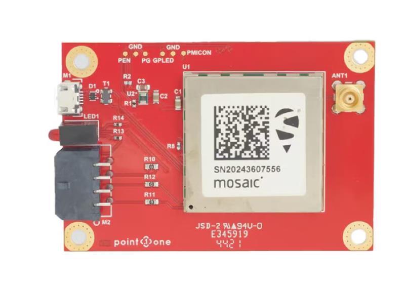
GNSS interface board – mosaic. (Image: Point One Navigation)
Point One Navigation and Septentrio have partnered to expand upon the companies’ precision location solutions throughout Western Europe. The new developer compatibility is suitable for demanding applications, including industrial autonomy, precision agriculture, logistics and delivery, robots and autonomous vehicles.
Point One’s Polaris is a correction network that enables high-precision GPS and computer vision-based localization. Polaris has recently extended coverage to now include Western Europe, further expanding the reach of the network. This solution is powered by Septentrio’s GNSS receivers, including the mosaic compact multi-constellation GNSS receiver.
The mosaic module — a multi-band, multi-constellation receiver in a low-power surface-mount module with a wide array of interfaces — is designed for mass market applications such as robotic and autonomous vehicle guidance systems. The module integrates GNSS and RF ASIC technology, as well as the robust positioning engine from Septentrio.
Septentrio real-time kinematic (RTK) receivers can be used directly with Polaris to provide centimeter-level accuracy in seconds.
This technology is complemented by Point One’s FusionEngine software, which further integrates cameras and additional sensors to achieve the desired level of precision — even in the complete absence of satellite signals.
FusionEngine has the accuracy and the resilience to inclement weather required by Level 2 applications, such as highway lane keeping and V2X, while offering the robustness necessary for mission-critical Level 4 and Level 5 robotaxi and full autonomy applications.
Harxon has released two high-precision GNSS antennas suitable for robotic lawn mowers.
The HX-CSX014A is a high gain, low profile and compact antenna with a new structure that simplifies integration into lawn mowers and minimizes the overall machine dimension. It features small size, high sensitivity and low power consumption.
The HX-CSX231A, is a ready-to-use GNSS antenna with a highly reliable structure that makes it small and lightweight. It exhibits 4.5 dBi high gain performance with ultra-low signal loss. It also delivers wide beam width that covers wide frequencies with high marginal gain, a perfect option in complex environments.
Additionally, the HX-CSX231A’s advanced LNA features improved signal filtering, out-of-band rejection, restrained unwanted electromagnetic interferences and a strong multi-path reduction capacity.
To learn more about Harxon high precision GNSS solutions for lawn mowers, click here.
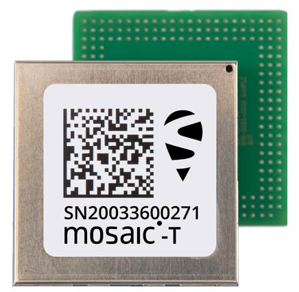
Septentrio’s compact GNSS timing module, mosaic-T, now supports the AtomiChron timing service from Fugro. The mosaic-T module already includes several layers of security against GNSS jamming and spoofing with AIM+ integrated technology and OSNMA Galileo authentication; however, AtomiChron further strengthens the anti-spoofing security of the mosaic-T receiver by offering navigation message authentication on all four major GNSS constellations.
Fugro AtomiChron includes navigation message authentication, which ensures timing resilience through reception of only genuine GNSS signals. The AtomiChron eliminates time drift caused by clocks counting time at slightly different rates. This achieves sub-nanosecond accuracy and provides extreme stability that surpasses current precision frequency standards. This is a lightweight and scalable solution, which removes the need for atomic clocks in critical infrastructure.
The mosaic-T delivers accurate timing with multi-frequency, multi-constellation GNSS technology and offers dedicated timing features and inputs for time and clock synchronization. AtomiChron capability can be obtained via a software upgrade for new receivers or for receivers which are already operational in the field.
The AtomiChron service is optional and can be activated through Fugro. To find out more about mosaic-T or the secure positioning receivers from Septentrio use the Product Finder tool or contact the Septentrio team.
Tallysman’s custom XF filtering has been tested to mitigate new (Europe and Japan) and existing LTE signals, enabling the XF antennas to produce clean and pure GNSS radio frequency data.
Image: Tallysman Wireless
The TW7972XF surface mount Accutenna antenna has a metal base and robust IP67 military-grade radome. Attachment methods include screws, adhesive tape, and magnet mount.
Many antenna connectors and cable options are available.
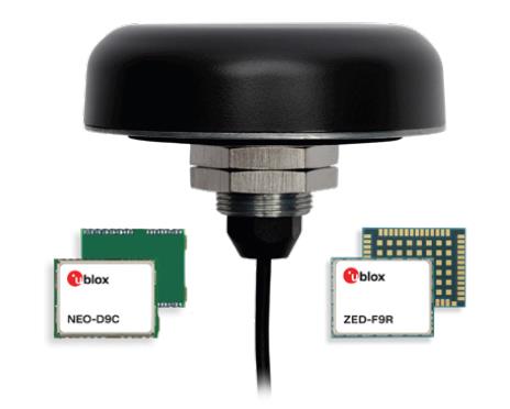
Tallysman Wireless and u-blox have partnered to develop PointPerfect precise point positioning real-time kinematic augmented smart antennas.
The ZED-F9R high precision GNSS and the NEO-D9S L-band receivers from u-blox have been integrated with Tallysman’s technology. The product integration will provide accuracy and precision.
The multi-band (L1/L2 or L1/L5) architecture removes ionospheric errors, and the multi-stage enhanced XF filtering improves noise immunity while relying on the dual-feed Tallysman Accutenna element to mitigate multi-path signal interference rejection. Some versions of the new smart antenna solutions include an inertial measurement unit (dead reckoning) and an integrated L-band corrections receiver to ensure operation beyond terrestrial network reach.
The PointPerfect GNSS augmentation service is now available in North America, Europe and parts of Asia Pacific.
A roundup of recent products in the GNSS and inertial positioning industry from the May 2023 issue of GPS World magazine.
SURVEYING
Image: Septentrio
Corrections Program Provides documentation for GNSS receivers
The Agnostic Correction Partner Program facilitates the use of Septentrio GNSS receivers with high-accuracy services that provide varying levels of accuracy, coverage and delivery methods. This enables users to select the service that suits specific applications and business models. The program — which includes Polaris from Point One, Skylark from Swift Navigation, and PointPerfect from u-blox — provides documentation for the use of Septentrio receivers with these high-accuracy services. Agnostic corrections are useful in situations where multiple types of GNSS receivers are being used, such as in a large-scale surveying project. Septentrio, septentrio.com
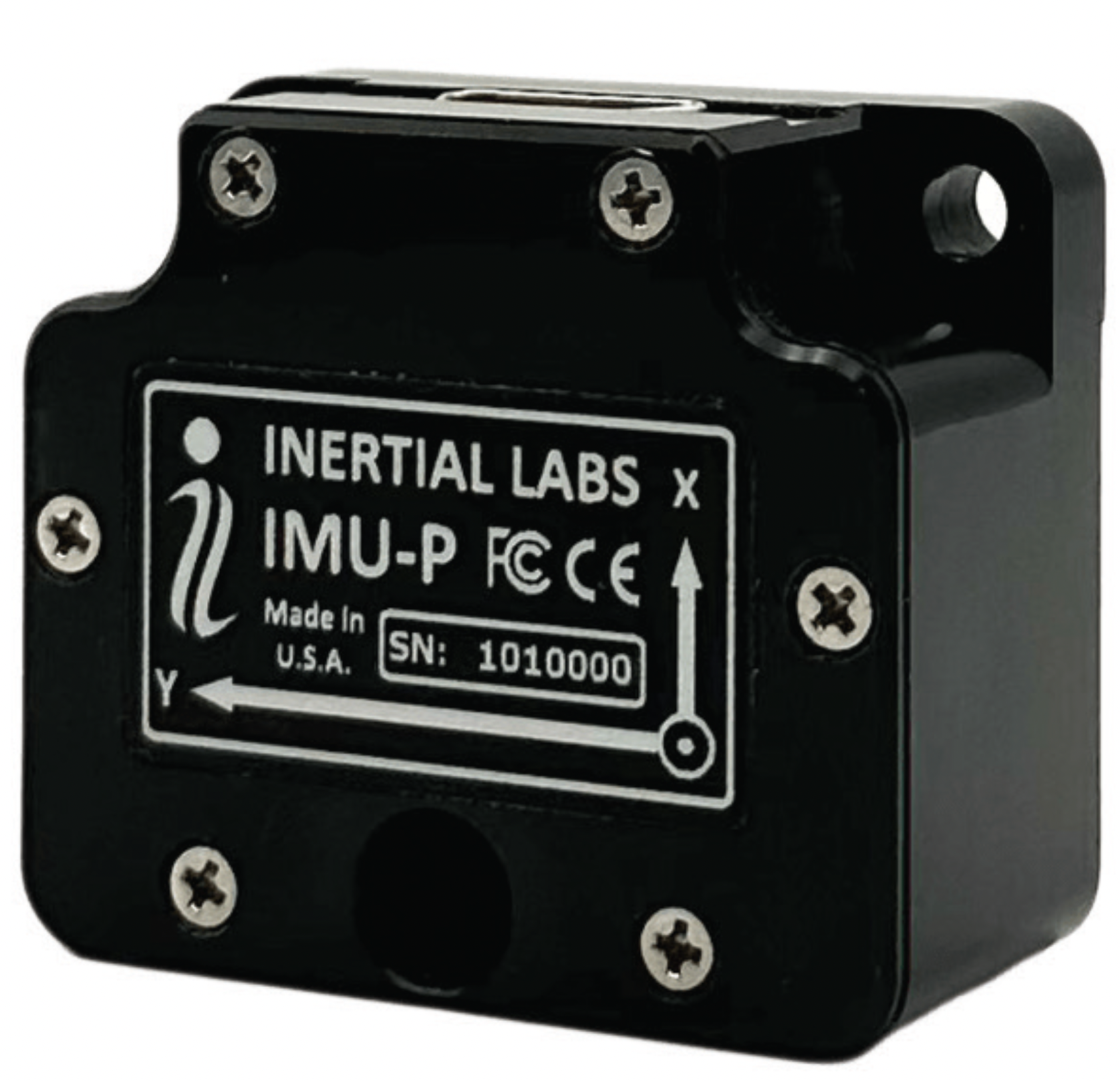
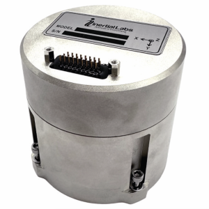
Image: Inertial Labs
Multi-Application IMU A compact, self-contained strapdown, advanced tactical-grade IMU device
The IMU-FI-200C measures linear accelerations and angular rates with its three-axis, tactical-grade, closed loop, fiber-optic gyroscopes and three-axis, high-precision MEMS accelerometers in motionless and high dynamic applications. The IMU-FI-200C is fully calibrated, temperature compensated and aligned to an orthogonal coordinate system. It contains more than 0.5°/hr gyroscopes and less than 2 mg bias repeatability over operational range accelerometers with low noise and high reliability. Continuous built-in test, configurable communications protocols, electromagnetic interference protection, and flexible input power requirements make the IMU-FI-200C suitable for a wide range of integrated system applications. Inertial Labs, inertiallabs.com
Image: Inertial Labs
MEMS IMU Suitable for applications such as antenna and line of sight stabilization systems, GPS-aided INS and more
The inertial measurement unit-P (IMU-P) is an advanced MEMS sensors-based, compact, self-contained strapdown, industrial- and tactical-grade inertial measurement system and digital tilt sensor that measures linear accelerations, angular rates and pitch-and-roll with three-axis, high-grade MEMS accelerometers and three-axis, tactical-grade MEMS gyroscopes. Angular rates and accelerations are determined with high accuracy for both motionless and dynamic applications. The IMU-P is fully calibrated, temperature compensated, and mathematically aligned to an orthogonal coordinate system. IMU-P demonstrates less than 1 deg/hr gyroscopes and 0.005 mg accelerometers bias inrun stability with low noise and high reliability. The IMU-P models collect data from an external source of GNSS to output full spectrum inertial navigation system data consisting of positions, attitude, velocity and time.
Inertial Labs, inertiallabs.com
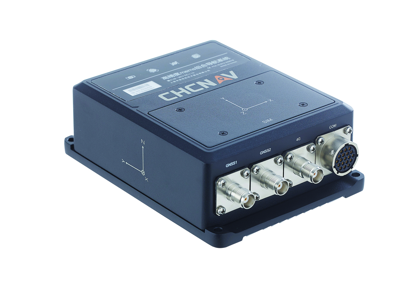
The CGI-610 GNSS/INS sensor is an advanced dual-antenna receiver designed for reliable and accurate navigation and positioning in challenging terrestrial, marine or airborne applications. Designed to meet the needs of 3D positioning and autonomous vehicle guidance applications, it provides high performance in urban canyons and other harsh environments where GNSS signals are lost or degraded. Incorporating GNSS technology and an industrial-grade inertial measurement unit, the sensor delivers accurate hybrid position, attitude and velocity data up to 100 Hz, driven by CHC Navigation algorithms. Its rugged and lightweight package ensures uninterrupted performance and meets high protection standards. CHC Navigation, chcnav.com
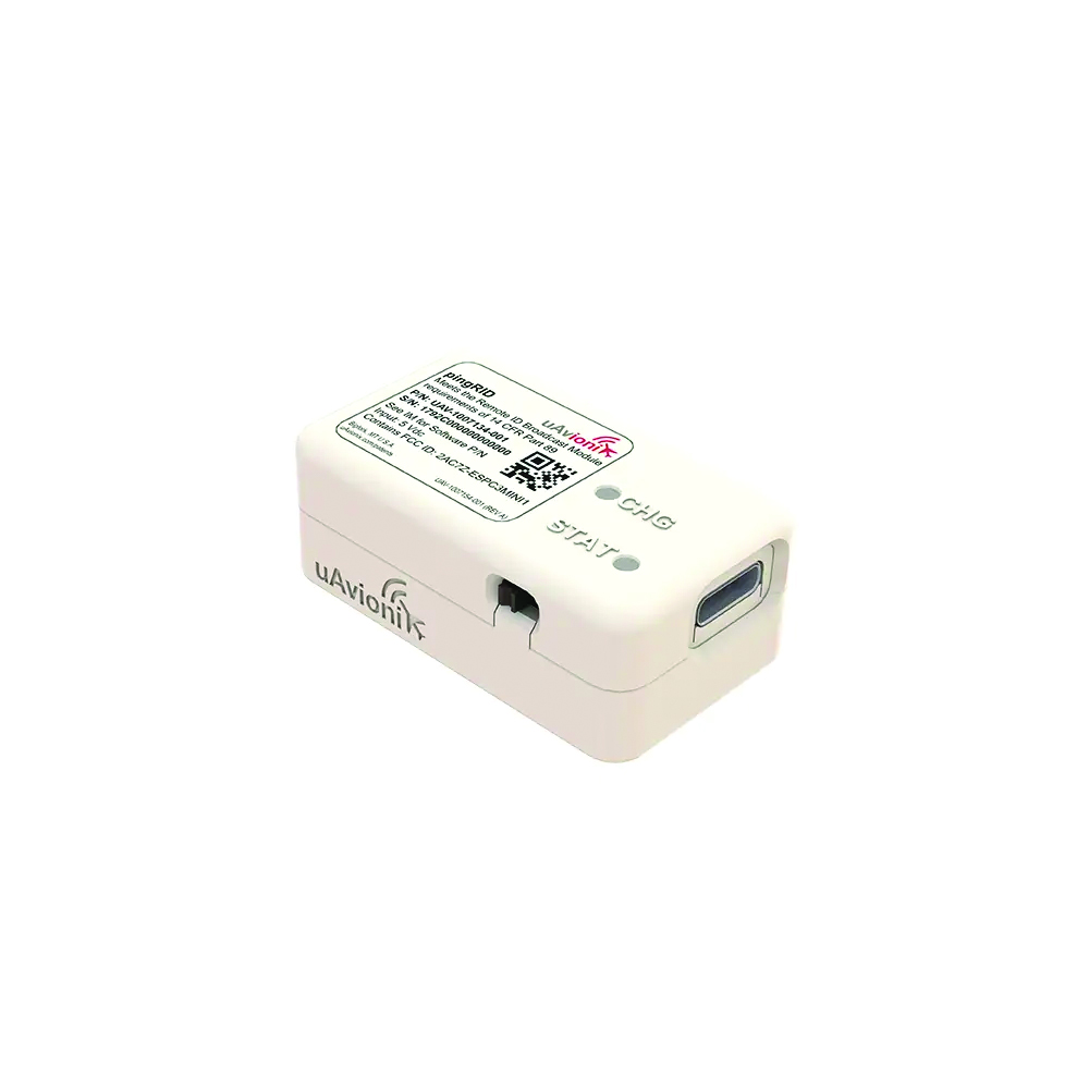
Image: uAvionix
Remote ID Module
Meets FAA standards
The pingRID meets the Part 89 remote ID standards of the Federal Aviation Administration (FAA), which will become effective on Sept. 16, to keep operators safe and compliant throughout a flight. The pingRID comes pre-configured and ready for use out of the box. After assigning the pingRID unique identification number to the aircraft’s registration with the FAA, operators can attach the battery-powered device to their UAV and prepare for flight. A set of LED indicators provides status on the battery charge, device readiness for flight and inflight operations. The compact, lightweight design fits most aircraft without significantly impacting performance. The module also can be quickly recharged via USB-C. The FAA’s final rule on remote ID requires all UAV pilots to meet the operating requirements of Part 89. For most operators, this will require flying a UAV equipped with standard remote ID, a remote ID broadcast module such as the pingRID, or flying at a Federally Recognized Identification Area. uAvionix, uavionix.com
MOBILE
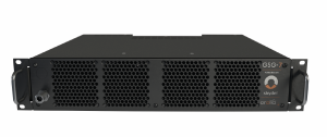
Image: Orolia
GNSS Simulator A positioning, navigation and timing test solution
GSG-7 delivers GNSS signal testing for location-aware applications and systems that require navigation or timing. The GSG-7 GNSS simulator features high-end performance with a 1,000 Hz simulation iteration rate, high dynamics, real-time synchronization, and simulation of all-in-view satellite signals. The GNSS simulator is suitable for development and integration projects that require high performance and an increased number of constellation licenses and satellites in view for a single antenna or trajectory. GSG-7 supports multi-constellation and multi-frequency GNSS simulations. It can be programmed to simulate operations with all current and future GNSS signals. Orolia, safran-navigation-timing.com
Image: Eos Positioning
GNSS Receiver Supports Galileo HAS
The Arrow Gold+ enables users to achieve better than 20 cm accuracy with 95% confidence using Galileo HAS. The Arrow Gold+ is one of the first high-accuracy GNSS receivers that supports Galileo HAS and is designed for the GIS market. Additional signal support for Arrow Gold+ includes: the concurrent use of the BeiDou B3 and GPS L5 signals as well as GLONASS, BeiDou, QZSS and IRNSS signals. Eos Positioning Systems, eos-gnss.com
Image: Pasternack
Mil-Spec GPS/GNSS Antennas Meets military specifications for use in several small form factor and mobile applications
The PEANGPS1006, PEANGPS1007, PEANGPS1008 and PEANGPS1009 mil-spec GNSS antennas are engineerered
for environmental performance according to the MIL-STD-810G standard and include multi-standard GPS L1, Galileo E1 and GLONASS options. They are IP67 rated and available in passive and active versions and provide coverage from 1,597 MHz to 1,607 MHz. The GNSS antennas feature linear polarization for cross-polarized isolation, nominal gain options of -3 dBic and 10 dBic, and SMA mounts. The mil-spec GNSS antennas are available now.
Pasternack, Pasternack.com
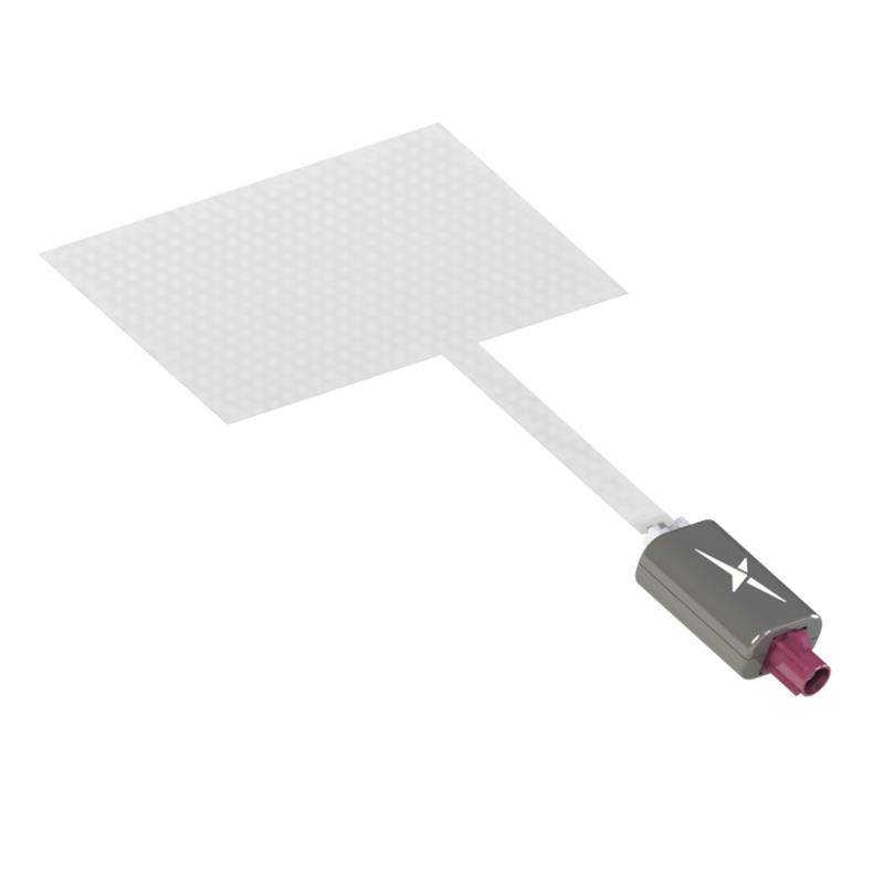
TFX62.A. (Image: Taoglas)
Near-Invisible Antennas Supports cellular Wi-Fi and GNSS technologies
The TFX62.A, TFX257.A and TFX125.A offer an alternative to standard opaque antennas, with “peel and stick” mounting capabilities to any nonmetal surface. The TFX62.A, TFX257.A and TFX125.A come with an adhesive and have an enclosed carrier terminated with a FAKRA connector for easy installation. The TFX series antennas leverage a sub-millimeter thick hybrid transparent conductive film that offers designers an invisible antenna solution. They are suitable for mobility, public infrastructure, medical devices, transportation and emerging IoT applications. Use cases for the antennas include electric vehicle chargers and parking meters, smart buildings and transportation vehicles.
Taoglas, taoglas.com
Image: CHC Navigation
3D Grade Control System For motor graders
The TG63 comes with a tightly coupled dual-GNSS positioning system and inertial sensor, and provides reliable 3D positioning and heading to ensure accuracy of the grader blade within ±2 cm. The TG63 is designed to withstand the harsh environment of construction sites and supports multiple applications, including real-time kinematic networked transport of RTCM via internet protocol and ultra-high frequency base stations.
CHC Navigation, chcnav.com
OEM
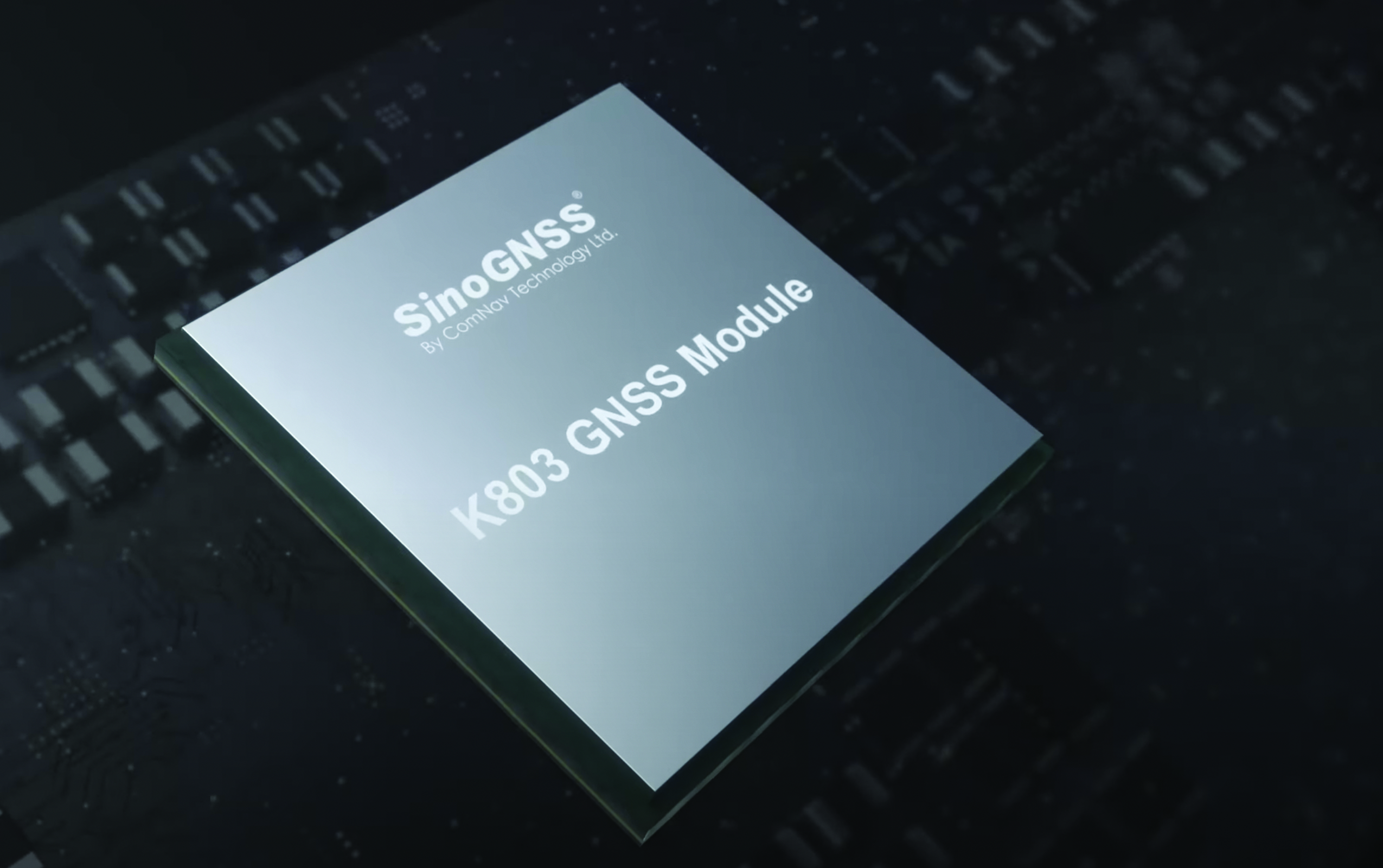
Image: ComNav Technology
GNSS Modules Now compatible with Galileo HAS
K8 series GNSS modules can use the Galileo High Accuracy Service (HAS) precise-point positioning (PPP). The PVT algorithm upgrade to the K8 series module supports Galileo HAS with an accuracy of 20 cm horizontally and 40 cm vertically. Galileo HAS provides free access to information necessary to estimate accurate positioning using a PPP algorithm in real-time through the Galileo signal E6-B and an internet connection. The improved performance capabilities provide a higher level of accuracy for industries such as UAV, autonomous driving, intelligent transportation, agriculture and more. ComNav Technology, comnavtech.com
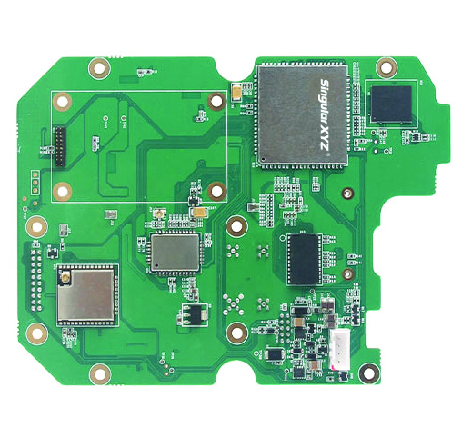
Images: SingularXYZ
Development Kit Designed for GNSS-related development integration
The DK100 development kit is a multi-functional kit with selectable single-antenna and dual-antenna modules, full constellation tracking and centimeter-level positioning. It is a ready-to-use kit designed to simplify integration efforts and increase compatibility with a variety of applications. The DK100 reserves standard adapter board interfaces to connect different GNSS modules and radio modules to meet specific needs. The development kits are coupled with a 4G module, Wi-Fi, Bluetooth, Ethernet modules, large memory and status indicators on a single PCBA. The DK100 comes with a web page for easy configuration. With Ethernet and Wi-Fi access, users can monitor device status and configure working mode and data transmission settings on the web page. The centimeter-level DK100 can be integrated in a range of horizontal and vertical applications, such as CORS construction, precision agriculture, construction machinery, smart navigation, monitoring, robotics, unmanned systems and more. Singular XYZ, singularxyz.com
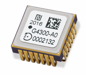
Image: TDK Corporation
Digital MEMS Gyroscope A high stability and vibration-tolerant gyroscope for dynamic applications
The GYPRO4300 features a ±300°/s input measurement range, 200 Hz bandwidth, and 1 ms latency with a closed-loop architecture that enables high linearity and stability. The GYPRO4300 has bias instability of 0.5°/h as a typical value and a maximum value of 2°/h. The GYPRO4300 is suitable for applications such as railways, land vehicles, vertical take-off and landing aircraft and UAVs, marine and subsea systems, borehole drilling and surveying instruments. The GYPRO4300 is available now for sampling and customer evaluations. Evaluations of the sensors also can be made with an Arduino-based evaluation kit that provides built-in testing functionalities such as output reading and recording, recalibration and digital self-tests. TDK Corporation, tdk.com
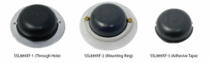
Image: Tallysman Wireless
GNSS Antenna Small, light, and dual-band
The SSL889XF employs Tallysman’s Accutenna technology providing GPS, QZSS L1/L2, GLONASS G1/G2/G3, Galileo E1/E5b, and BeiDou B1/B2b coverage. The SSL889XF antenna is designed for precision dual-frequency positioning where a light weight and a low profile are important. The SSL889XF antenna element is 48 mm in diameter and 20 mm tall and weighs ~50 g. It has a tight average phase center variation of less than 10 mm for all frequencies and overall azimuths and elevation angles. The SSL889XF is available in three versions. Model SSL889XF-1 has an integrated 61 mm ground plane and two mounting holes. Model SSL889XF-2 has a mounting collar, and model SSL889XF-3 is the antenna only and is attached using adhesive tape. All models have a female MCX connector. The SSL889XF antenna also supports Tallysman’s eXtended Filtering (XF) technology. Tallysman Wireless, tallysman.com
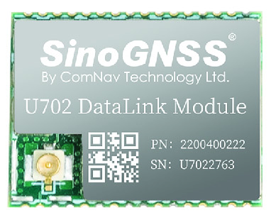
Image: ComNav Technology
Datalink Module Suitable for GNSS-based systems
The U702 datalink module is a RX/TX data link module that supports the LoRa modulation technique. Its compact, surface-mounted design and robust electromagnetic compatibility enable easy integration into GNSS systems such as robotic lawn mowers. With the LoRa modulation technique, the U702 has low power consumption, reception power of 0.025 w, and a working distance up to 1.5 km. It also enhances the ability to protect GNSS systems against various interference — making it possible to have high reception sensitivity, a low error rate, and high reliable data transmission even in harsh environments.
ComNav Technology, comnavtech.com
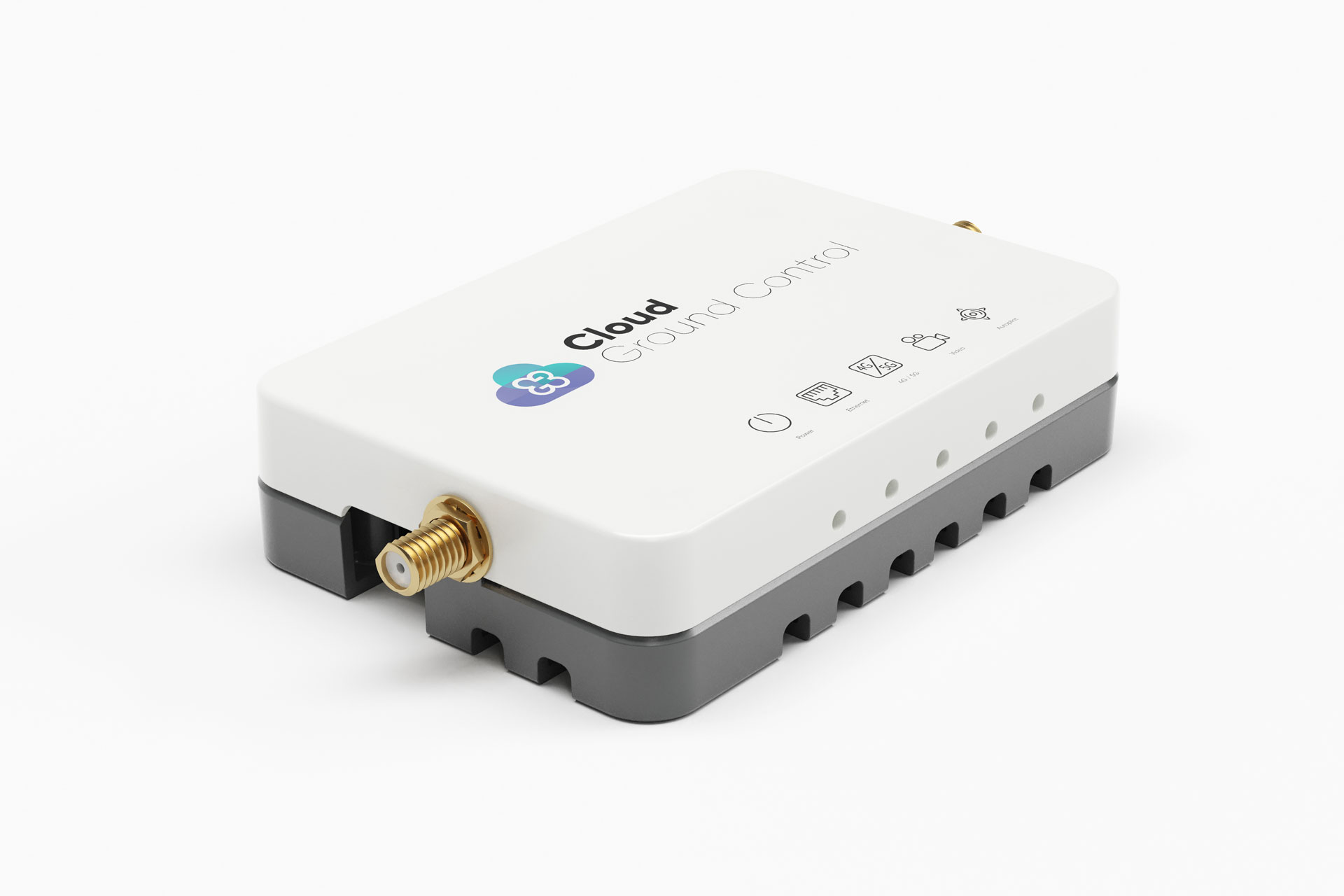
Image: Cloud Ground Control/Advanced Navigation
Fleet management device For air, land and sea vehicles
CGConnect can securely connect UAVs and vehicles into one autonomous fleet across land, sea and air, regardless of manufacturer or model. This provides mission planners and operators with full situational awareness for search and rescue, emergency response and disaster relief. Artificial intelligence (AI) algorithms are running in the cloud, relaying real-time camera feed data to the end user to support missions such as object detection, tracking and thermal imaging. The flexible and customizable open platform is operating on industry standards, which multiplies potential product applications and enables diverse autonomous vehicles and payloads to operate as a coordinated fleet. High-grade security safeguards data and IP from vulnerabilities and security breaches, helping users meet compliance obligations. Additionally, CGConnect supports edge AI to perform intensive object identification and classification directly on the vehicle for dynamic missions. CGConnect is available for pre-order. An OEM option is available. Cloud Ground Control/Advanced Navigation, cloudgroundcontrol.com/advancednavigation.com
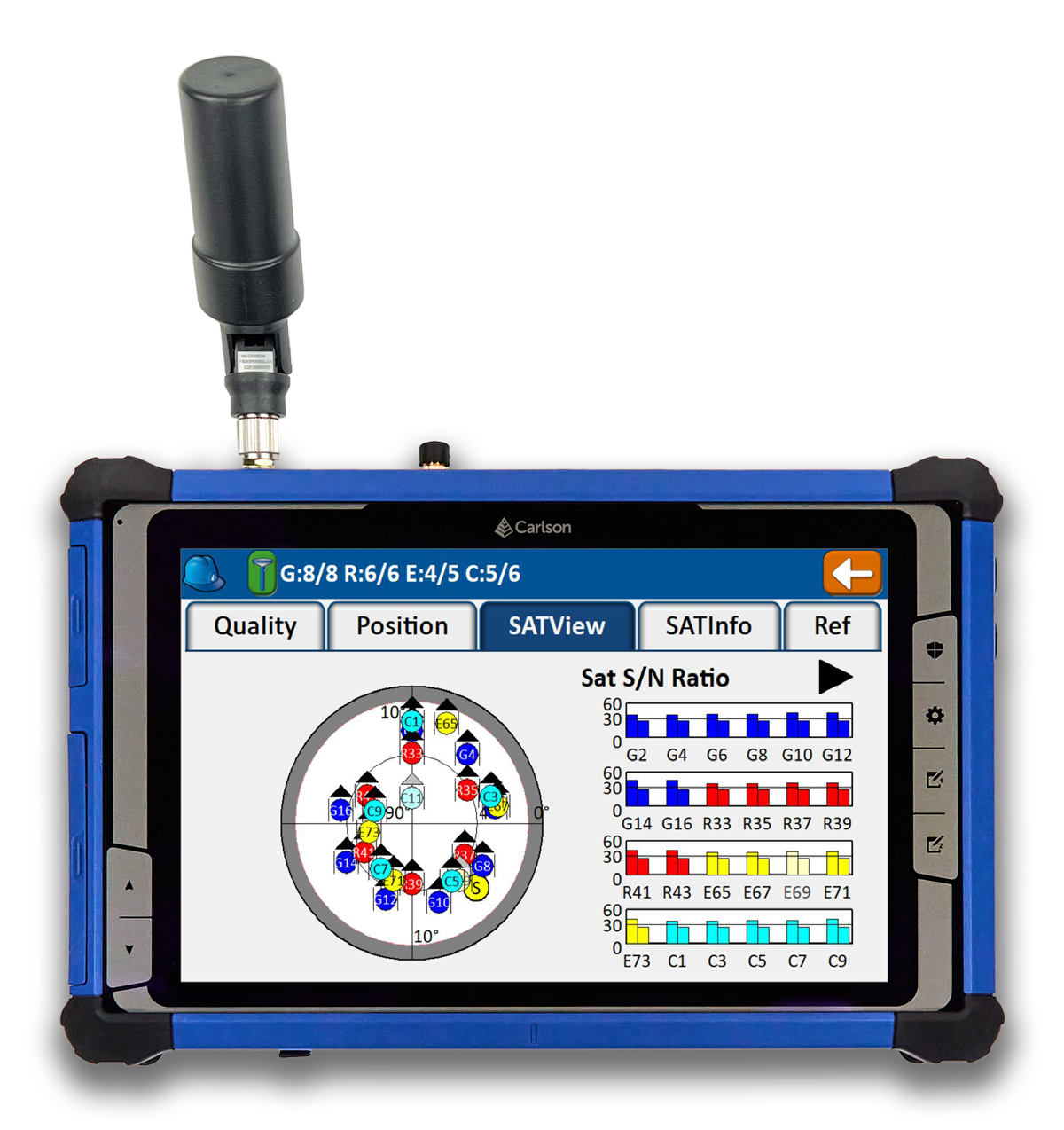
Carlson Software has released the RT5 rugged tablet data collector and the RTk5 GNSS solution, which integrates the form factor of the RT5 with real-time kinematic GNSS performance.
The Carlson RT5 is designed for surveying, stake-outs, construction layout and GIS mapping, and is bundled with Carlson SurvPC — the Windows-based data collection program. The RT5 can run SurvPC with Esri OEM for use in the field.
The Carlson RTk5 adds an advanced GNSS solution to the RT5, enabling accuracy in a compact, light and versatile package. It comes with a custom-built pole and cradle, a survey-grade antenna, and a small portable helix antenna for handheld GNSS use. It is suitable for land surveyors, engineers, GIS professionals, and users in need of advanced GNSS positioning with an RTK rover.
Tallysman Wireless has announced a distribution partnership with Mouser Electronics, a global authorized distributor of electronic components and semiconductors.
Under the agreement, Mouser Electronics will offer Tallysman’s full range of GNSS antennas, including the Accutenna, VeroStar and helical antennas, to its users worldwide.
These antennas feature advanced technology for enhanced precision and signal quality, making them suitable for demanding applications in industries such as automotive, aerospace, defense, surveying and precision agriculture.
For more information about the Tallysman GNSS antenna solutions offered at Mouser Electronics, click here.
Hexagon | NovAtel has released the 7.09.00 firmware with a precise timing protocol (PTP) feature, enabling users to synchronize accurate time from GNSS with other devices and sensors on a shared network.
The 7.09.00 firmware’s PTP feature brings stable timing to a user’s other sensor systems connected through a local network to best support positioning, navigation and timing (PNT) and automotive and autonomous applications.
The firmware includes SPAN GNSS+INS technology improvements — including a secondary INS solution for built-in redundancy and reliability in challenging conditions. The enhancements are available on all OEM7 cards and enclosures, including all PwrPak7 and CPT7 enclosures variants.
The 7.09.00 firmware also features improvements to the time to first fix, a secondary SPAN solution for a more accurate and reliable GNSS+INS output and more.
The 7.09.00 firmware is not for precision agriculture applications and is not supported on NovAtel’s SMART antenna products.
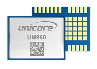
Unicore Communications has released a GNSS, high precision, real-time kinematic (RTK) module, the UM960. This module can be used for a wide range of applications, such as robotic mowers, deformation monitoring, UAVs, handheld GIS, and more.
It features a high position fix rate and provides accurate and reliable GNSS positioning data. The UM960 module supports BDS B1I/B2I/B3I/B1c/B2a*, GPS L1/L2/L5, Galileo E1/E5b/E5a, GLONASS G1/G2, and QZSS L1/L2/L5. The module also has 1,408 channels.
In addition to its small size, the UM960 features low power consumption — less than 450 mW. The UM960 also supports single point positioning and RTK positioning data output at 20 Hz.
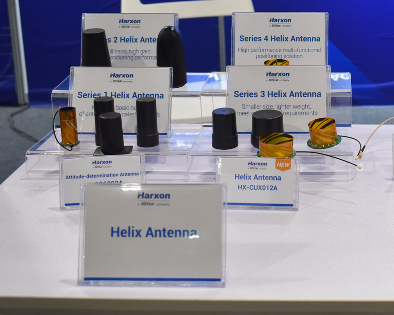
The HX-CUX012A, HX-CUX005A, HX-CH7609A and HX-CHX600A antennas at Harxon’s XPONENTIAL 2023 booth.
Harxon has added to its helix antenna family with a series of four devices that are suitable for unmanned system applications.
HX-CUX012A is designed with extremely low profile, making it suitable for integration into UAVs, surveying and monitoring devices. It reduces the overall weight of applications, enables multipath mitigation and more.
HX-CUX005Ais asolution for integrated helix antenna applications. It is designed with the integration of a GNSS antenna and Bluetooth/Wi–Fi antenna, enabling communication and navigation without mutual interference.
HX-CH7609A is a low profile and small size housed helix antenna. Ithas comprehensive GNSS support including GPS, GLONASS,Galileo, BeiDou, as well as L-band correctionservices.HX-CH7609Afeatures centimeterphase center repeatability and high gainat a low elevation. With signal filtering and multipath rejection, it provides reliable and stable GNSS signals.
HX-CHX600A is a high-performance helix antenna thatreceives GPS, Galileo, BeiDou, GLONASS, as well as L-band signals. With 4.2dBi high gain, it providessuitable tracking performance at a low elevation angle. Its low noise figure design reduces transmission interference and improves signal quality.
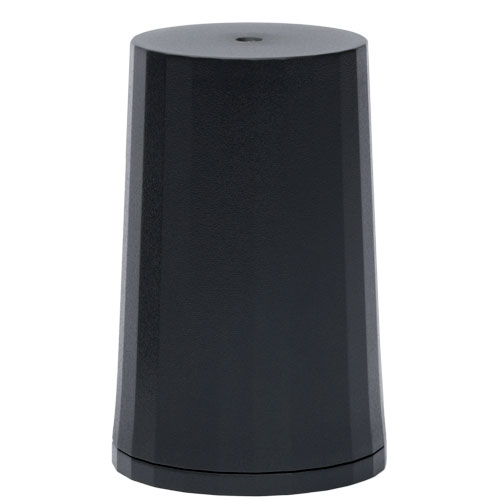
Tallysman Wireless has released its dual-band low-profile helical GNSS antenna, the HC871SXF. It is designed for precise positioning, covering the GPS/QZSS-L1/L2, GLONASS-G1/G2, Galileo-E1, and BeiDou-B1 frequency bands, including the satellite-based augmentation system (SBAS) available in the region of operation — WAAS (North America), EGNOS (Europe), MSAS (Japan), or GAGAN(India).
The HC871SXF has a precision-tuned, high-accuracy helical element that provides a suitable axial ratio and operates without a ground plane. These features make the HC871SXF suitable for lightweight, UAV navigation and a variety of precision applications.
The HC871SXF low-profile helical antenna is approximately 10 mm shorter than the HC871 and provides the same performance. The antenna base has a male SMA connector. To facilitate installation, the base also has two threaded inserts and an O-ring to waterproof the SMA connection.
The HC871SXF antenna also supports Tallysman’s eXtended Filtering (XF) technology.