Author: Jesse Khalil

  • GMV provides vehicle positioning solution to BMW

    GMV provides vehicle positioning solution to BMW

    Image: BMW Group
    Image: BMW Group

    GMV has been selected by BMW Group to supply its safe and precise positioning technology, GMV GSharp, for the next generation of BMW Group’s autonomous vehicles.

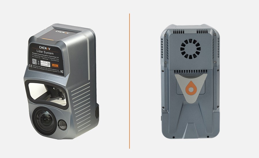
    GSharp is equipped with an onboard positioning engine (PE) software and a GNSS corrections service, allowing vehicles to collect augmentation data and safety-related information for computing an accurate and reliable user position.

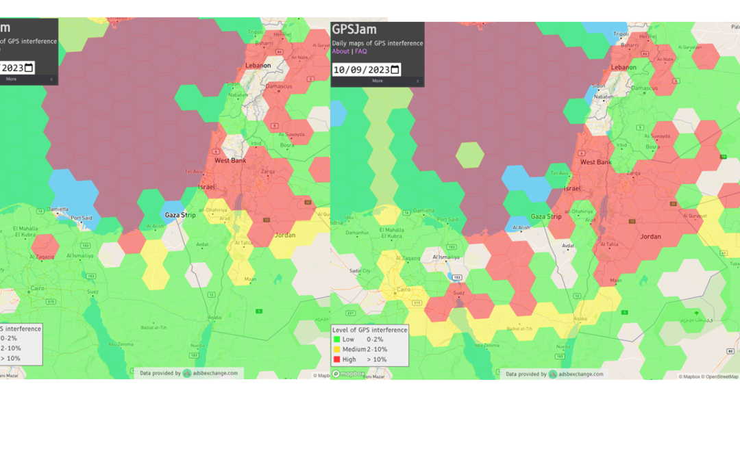
    Both the correction service and positioning engine are developed following the ISO 26262 and ISO 21448 standards to ensure compliance with safety requirements. The solution also complies with the concept of security-from-design as per ISO 21434, including the necessary counter-measures in the SW and system and in the GNSS related attack detection or anti-spoofing and anti-jamming schemes.

    The most demanding automotive project management practices and industry standards for software engineering (A-SPICE CL3) have been applied during its development.

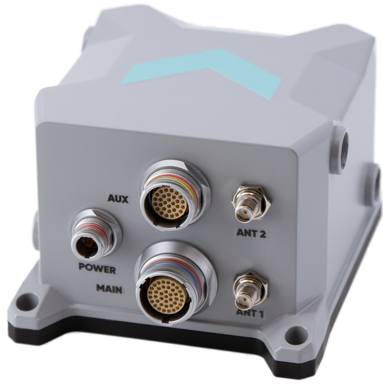
    In addition to the software side, GMV’s solution relies on a secure and redundant physical infrastructure. GMV owns and operates a worldwide GNSS station network, which provides the GNSS raw data needed to generate the corrections. These corrections are computed within two physically independent data centers, providing GMV’s solution the required availability levels for automated driving applications.

  • Leica Geosystems develops first-person laser scanner

    Leica Geosystems develops first-person laser scanner

    Image: Leica Geosystems
    Image: Leica Geosystems

    Leica Geosystems, part of Hexagon has developed the Leica BLK2GO PULSE, its first-person laser scanner that combines lidar sensor technology with the original Leica BLK2GO form factor. The technology is set to be released in early 2024.  

    The scanner offers users a rapid, simple and intuitive first-person scanning method that can be controlled with a smartphone, and delivers full-color 3D point clouds instantly in the field.

    The BLK2GO PULSE was built in collaboration with Sony Semiconductor Solutions Corporation to combine Sony’s advanced time-of-flight (ToF) image sensors with Leica Geosystems’ GrandSLAM technology, resulting in a dual ToF handheld scanner.

    The product is designed for indoor applications such as the creation of 3D digital twins and 2D floor plans. It includes first-person scanning capabilities and instant data availability, allowing users to immediately download, view and share colorized 3D point clouds and images from the field.  Scans can then be uploaded to Reality Cloud Studio, Hexagon’s cloud application for reality capture data visualization, collaboration and storage.  

  • CHCNAV launches aerial surveying solution

    CHCNAV launches aerial surveying solution

    Image: CHCNAV
    Image: CHCNAV

    CHC Navigation (CHCNAV) has released the AlphaAir 10 (AA10), an advanced aerial surveying solution designed for UAV mapping and photogrammetry.

    Leveraging CHCNAV’s lidar technology, the AA10 seamlessly integrates high-precision lidar, accurate GNSS positioning, IMU orientation and an industrial-grade full-frame orthophoto camera. Combined with CHCNAV point cloud and image fusion modeling software, this solution offers an efficient survey-grade approach to 3D data acquisition and processing.

    The AlphaAir 10 can detect up to eight target echoes utilizing advanced multi-target capabilities, which greatly enhances its ability to penetrate dense vegetation and acquire precise ground surfaces.

    Complementing the solution, the CoPre and CoProcess software suite streamlines post-processing and feature extraction with an easy-to-use and efficient data workflow. High-quality point cloud data is used to create a mesh model, followed by efficient 3D model reconstruction with realistic point cloud colorization using high-resolution image mapping textures.

    In addition, the AA10 is IP64-rated, ensuring the system’s ruggedness and providing consistent, reliable performance in a wide range of operating conditions.

  • ANELLO adds to its optical-gyroscope based navigation systems

    ANELLO adds to its optical-gyroscope based navigation systems

    ANELLO Photonics has added real-time centimeter-accurate positioning and localization capabilities to its line of optical-gyroscope based navigation systems.

    Its real-time centimeter accuracy is achieved by using real-time kinematic (RTK) correction data from GEODNET, a community-based decentralized network of over 3,000 GNSS reference stations worldwide.

    Under the agreement, ANELLO Photonics users will have access to a free trial of RTK services and competitive options for long-term, high-volume correction data requirements.

    By combining the ANELLO silicon photonics optical gyroscope (SiPhOG) with GEODNET’S global RTK correction network, users now have access to a new global cyber-infrastructure for reliable measurements.

    The partnership offers users a combination of optical gyroscope technology and a reliable and global RTK correction network that enables centimeter-accuracy for industries operating in challenging RF and GNSS-denied environments. These environments include city centers, construction sites and orchards.

    The agreement aims to address the challenging applications by using SiPhOG and its GNSS-denied dead-reckoning algorithms with GEODNET’s distributed global network of RTK stations. This combined technology offers high-level accuracy while reducing the total solution costs.

    The companies aim to simplify performance intensive applications such as high-definition mapping and aerial or terrestrial autonomous vehicle deployment.

    ANELLO is currently engaged in trials with users in the construction, farming, robotics, trucking, UAVs, autonomous vehicles, and defense space.

  • Pasternack releases vehicle GPS antennas

    Pasternack releases vehicle GPS antennas

    Image: Pasternack
    Image: Pasternack

    Pasternack, a manufacturer of microwave- and millimeter-wave products, has released a series of vehicle GPS antennas.

    The antennas come equipped with a high gain of 28 dB or 30 dB, enabling them to capture signals in challenging terrains and conditions. One of their standout features is the use of right-hand circular polarization (RHCP), which reduces signal interference and multipath effects.

    With waterproof and dustproof ratings ranging from IPX6 to IP66, these antennas are engineered to excel in the harsh environments and are ideal for vehicle tracking, fleet management, telematics, navigation systems and autonomous vehicles.

    The antennas also come with both SMA and FAKRA connector options, ensuring wide-ranging system compatibility. They are tailored for the GPS L1 frequency and are available in both passive and active versions. Mounting them is user-friendly, with options for direct vehicle mount or the added convenience of a magnet mount.

  • Exail releases INS for mobile mapping

    Exail releases INS for mobile mapping

    Image: Exail
    Image: Exail

    Exail has launched the Atlans 3, its new Inertial Navigation System (INS) dedicated to land and air mobile mapping applications. The technology was unveiled at INTERGEO 2023.

    The Atlans 3 is an all-in-one positioning and orientation system integrating unique micro-electro-mechanical systems. Fiber optic gyroscope (MEMS-FOG) hybrid technology and a dual-antenna RTK GNSS receiver are housed within one compact device.

    The INS offers North-keeping capability at FOG-level performance across a variety of land and air mobile mapping applications. It delivers real-time heading, even in GNSS-challenging environments such as urban canyons, mountainous terrain, or forested areas. The lightweight INS is designed to meet the requirements of high-performance lidars mounted on vehicles where space and weight constraints are critical.

    The Atlans 3 is designed to be quick and simple to install on all platforms. It offers efficient “set-and-forget” operations for a wide range of land and air applications including road and rail asset inventory, pavement condition survey, vehicle automation, HD mapping, ground-truth, airborne surveys and precision pointing.

  • GPS jamming increases amid Israel Hamas conflict

    GPS jamming increases amid Israel Hamas conflict

    Image: GPSJam.org
    Image: GPSJam.org

    Israel has declared war on the Palestinian militant group  Hamas after it carried out an unprecedented attack by air, sea and land on October 7, 2023.

    The large-scale surprise attack has left more than 1,200 dead in Israel, said Israel Defense Forces spokesperson Lt. Col. Jonathan Conricus in an update on October 11. It has since prompted retaliatory Israeli airstrikes on Gaza that have killed more than 1,055 people.

    During the ongoing conflict between Israel and Hamas, the Middle East is witnessing a significant shift in the patterns of GPS interference, with data showing an increase in disruptions compared to just a week prior, according to Defence and Security Middle East.

    Reports have surfaced indicating Hamas has actively jammed Israeli communication systems during the initial stages of the conflict. This strategic move highlights the increase of jamming GPS and communication networks in modern warfare scenarios, where precision and coordination are imperative.

    Positioning, navigation and timing (PNT) services play a role in a variety of military systems and civil technologies. These services not only guide precision warfare, but also facilitate efficient transportation, communication and various civilian applications.

    The Middle East has a history of being a focal point for jamming and spoofing activities, impacting not only security but also regional stability and even commercial flights.

    For example, there have been recent reports of recurring interference allegedly caused by Russian systems in Syria, which frequently disrupts air traffic at Tel Aviv’s Ben Gurion airport. Regulatory bodies, such as the Federal Aviation Administration, the European Union Aviation Safety Agency, and Israel’s aviation authority, advised airlines to exercise caution when operating in the airspace of the region. Multiple airlines have now canceled or suspended flights.

    With airlines reducing services and regulatory bodies advising caution, the conflict’s repercussions extend well beyond the battlefield, highlighting the critical need for security assessments or alternative PNT systems to protect civilians.  

  • Harxon introduces new GNSS and helix antennas

    Harxon introduces new GNSS and helix antennas


    Image: Harxon
    Image: Harxon

    Harxon has launched its new survey GNSS antenna, HX-CSX600A, and helix antenna, HX-CUX615A, designed for high-accuracy positioning applications across the geospatial industry. These two antennas are set to debut at INTERGEO 2023.

    Survey GNSS antenna HX-CSX600A 

    HX-CSX600A boasts a pre-filtered Low Noise Amplifier (LNA) offering exceptional out-of-band rejection, ensuring strong anti-interference performance even in challenging environments. It is designed for high-precision GNSS applications, including agricultural vehicles, small robots and surveying.

    The new antenna offers reliable and consistent satellite signal tracking across a wide range of frequency bands, including GPS, GLONASS, Galileo, BeiDou, QZSS, IRNSS, SBAS, as well as L-Band correction services. With advanced multipoint feeding technology, HX-CSX600A maintains a stable phase center variation.

    Built with an IP67-rated compact and ruggedized housing, this antenna is designed to withstand dust, rain, sunlight, shock and vibration. Its standard TNC-K connector and pole mount aims to simplify the integration process.

    Helix antenna HX-CUX615A 

    HX-CUX615A is the housed version of Harxon’s HX-CUX012A, designed for UAVs. Its low profile design and simple integration process makes this antenna ideal for various UAV applications such as aerial photography, remote sensing, infrastructure inspection, traffic control and public security.

    Equipped with a pre-filtered LNA, HX-CUX615A offers out-of-band interference rejection to mitigate unwanted electromagnetic interference and provide reliable GNSS signals for seamless integration into positioning solutions.

    This light-weight antenna also adopts patented D-QHA (Dual-Quadrifilar Helix Antenna) technology, ensuring stable wide-angle circular polarization (WACP) performance. This results in low-elevation satellite tracking, while maintaining high gain and reliable signal tracking – even in challenging environments.

  • Tallysman releases new L-band GNSS antenna

    Tallysman releases new L-band GNSS antenna

    Image: Tallysman
    Image: Tallysman

    Tallysman Wireless has released the ARM972XF triple-band plus L-Band GNSS antenna.

    The ARM972XF uses Tallysman’s accutenna technology providing GPS/QZSS L1/L2/L5, GLONASS-G1/G2/G3, Galileo E1/E5a/E5b, and BeiDou B1/B2a/B2b + L-Band coverage. The technology is designed for precision triple-frequency positioning where light weight and a low profile are required.
    Tallysman’s ARM972XF is a small and lightweight housed triple-band precision mini ARINC GNSS antenna. It has an average phase center variation of less than 10 mm for all frequencies and overall azimuths and elevation angles. Additionally, both models are available with components qualified for low Earth orbit (LEO).

    Housed in a weatherproof (IP67) enclosure, the ARM972XF is available in four versions. Model ARM972XF-1 (ARM972XF-1-S for LEO space-qualified components) has an integrated 100 mm ground plane, while model ARM972XF-2 (ARM972XF-2-S for LEO space-qualified components) is 83 mm in diameter.

    The antenna also includes Tallysman’s eXtended filtering (XF) technology, designed to mitigate GNSS interference.

  • OxTS introduces INS for land and air applications

    OxTS introduces INS for land and air applications

    Image: OxTS
    Image: OxTS

    OxTS has released the xRED3000, its lightest and smallest inertial navigation system (INS) suitable for land- and air-based applications.

    Combining two survey-grade GNSS receivers and OxTS’ latest IMU10 inertial technology, the xRED3000 is designed to be the GNSS/INS component for products requiring accurate localization, even in harsh environments.

    The xRED3000 uses OxTS lidar inertial odometry (LIO), which takes data from a lidar in post-processing to reduce IMU drift and improve accuracy in areas with poor or no GNSS signal such as urban canyons. The technology also provides a position accuracy of 0.5 m, even after 60 seconds of no GNSS signal.

    The INS is compatible with OxTS Georeferencer, a post-processing and calibration software that aims to improve the accuracy and clarity of user’s pointcloud data. It warms up to specification in three minutes, even with low-dynamic movement, increasing flight time for aerial applications and reducing the space needed for land-based warmups.

  • Syntony launches CRPA GNSS receiver

    Syntony launches CRPA GNSS receiver

    Image: Syntony GNSS
    Image: Syntony GNSS

    Syntony GNSS has released CERBER, a GNSS receiver embedded in a CRPA solution.

    A classic CRPA system consists of embedded GNSS antennas and antijamming treatments. However, CERBER relies on the tight integration of a CRPA treatment (with a 4-array antenna) and the embedded GNSS receiver.

    The estimation of GNSS direction of arrival (DoA) is enabled and allows the receiver to check whether those DoA estimations are compatible with GNSS constellations or originate from very few directions. Therefore, users will be able to detect and locate spoofing devices or receivers instantly.
    The receivers are also able to constantly recalibrate the chains of reception based on the DoA and GNSS signals.

    CERBER’s embedded approach also enables a 6dB power gain in satellites’ directions, the continuity of GNSS signals’ phase when the space-time adaptive processing (STAP) filter is updated, the absence of additional noise that a GNSS receiver would imply with the re-generation and re-digitalization of RF signals and an improved rejection performance when compared to a classic CRPA + independent GNSS receiver solution.
    This technology is designed for the protection and the surveillance of civil critical infrastructures, including Galileo’s and EGNOS’ ground segments, airports or any infrastructure requiring precise and resilient GNSS timing.

  • SBG Systems unveils Qinertia 4

    SBG Systems unveils Qinertia 4

    Image: SBG Systems
    Image: SBG Systems

    SBG Systems will release the newest version of its Qintertia technology, Qinertia 4, on November 7, 2023. This version introduces several innovative features that provide users with a complete solution for precise trajectory and motion analysis.

    Qinertia is a post-processing software delivering better precision and reliability compared to RTK systems. Qinertia 4 has an enhanced Geodesy engine to boasts an extensive selection of preconfigured coordinate reference systems (CRS) and transformations, making it a versatile solution in applications that use diverse geodetic data, including land surveying, hydrography, airborne surveys, construction and more.

    To tackle the challenges of variable ionospheric activity, the new technology uses Ionoshield PPK mode. This feature compensates for ionospheric conditions and baseline distances, allowing users to perform post-processing kinematics (PPK) even for long baselines or harsh ionospheric conditions.

    Another addition to Qinertia 4 is extended continuously operating reference stations (CORS) network support. This feature offers users a vast network of 5000 SmartNet for reliable GNSS data processing.

    Qinertia has more than 10,000 bases in 164 countries. This global coverage ensures that Qinertia remains a reliable and efficient solution, regardless of geographic location. In addition, users can import their own base station data and verify its position integrity with precise point positioning (PPP).

    For data that cannot be processed using PPK, Qinertia 4 offers an alternative solution with its new tightly coupled PPP algorithm. This new processing mode, available for all users with active Qinertia maintenance, provides post-processing anywhere in the world without a base station, with a horizontal accuracy of 4cm and a vertical accuracy of 8cm.

    Qinertia’s new functionalities will be demonstrated live at Intergeo 2023 in Berlin.