Virtual Surveyor has added UAV photogrammetry capabilities to its Virtual Surveyor smart UAV surveying software. The new Terrain Creator app photogrammetrically processes UAV images to generate survey-grade terrains which then transfer into the traditional Virtual Surveyor workspace.
The Virtual Surveyor software is now two desk apps in one subscription package, creating a seamless end-to-end UAV survey workflow, said Tom Op‘t Eyndt, Virtual Surveyor’s CEO.
Terrain Creator aims to simplify the aerial photogrammetry process by offering a visual and intuitive application to produce an orthomosaic and digital surface model (DSM) from UAV photos, the company said.
Virtual Surveyor software was originally developed to bridge the gap between UAV photogrammetric processing applications and engineering design packages.
Prior to this new release, users had to rely on third-party software to generate elevation models and an orthomosaic on which they could work with the Virtual Surveyor toolset. Now, users can derive the 3D topographic information necessary for construction, surface mining and excavation projects in one package.
Once the survey-grade terrains flow from the Terrain Creator into the Virtual Surveyor desktop app, users can access an interactive virtual environment and robust toolsets to generate CAD models, create cut-and-fill maps and calculations, or calculate volume reports.
Users currently subscribed to Virtual Surveyor Ridge and Peak editions will see their software updated automatically with Terrain Creator. A flexible licensing setup will allow two users within a subscribing organization to use the Terrain Creator and Virtual Surveyor applications simultaneously from different computers.
Back in the late 1980s, as project manager of the new adjustment of the North American Vertical Datum of 1988 (NAVD88), I worked with federal and state agencies to perform geodetic leveling and replace lost benchmarks. One of the reasons for the NAVD 88 project was to address the issue that thousands of benchmarks placed in previous decades had been subsequently destroyed and many others had been affected by crustal motion, postglacial rebound, and subsidence due to the withdrawal of underground fluids. NGS along with its partners performed thousands of kilometers of leveling to replace lost benchmarks. That said, the loss of control marks, denoted by some as “passive marks,” still seems to be a problem today.
California surveying agencies played a part in replacing and updating lost marks for the NAVD 88 project and it seems that they are doing it again. On Sept. 21, the importance of saving passive marks was discussed at the 2023 CLSA Geomatics Conference at Cal Poly Pomona/College of Engineering.
Defining passive marks
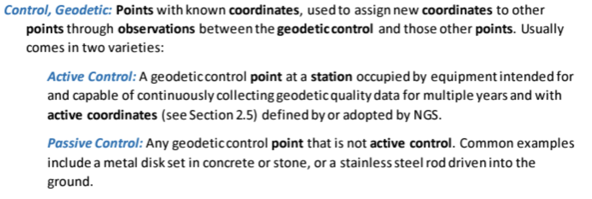
Several of my previous columns have highlighted the new, modernized NGS National Spatial Reference System (NSRS), and how active and passive control will be part of the new system.
Active and passive control. (Image: NGS)
For all practical purposes, passive marks are marks that are not continuously operating reference stations (CORS).
On June 22, NGS held a webinar on the benefits and challenges of transitioning to the modernized NSRS at which the presenters were not NGS employees. Users can download the presentation here.
NGS webinar on June 22. (Image: NGS)
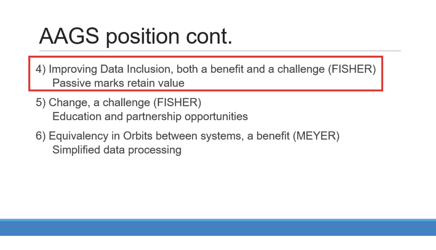
I want to highlight a few statements made by Brian Fisher, director of the American Association for Geodetic Surveying (AAGS). Readers can find more information about AAGS here. First, one of Brian’s slides stated that passive marks retain value and that improving data inclusion is both a benefit and a challenge. During his presentation, Brian stated that “passive marks are always going to have some level of value.” He also mentioned that “NGS has done a great job on improving the data submitting process.” NGS is developing models and tools for users to transition to the new NSRS. Tools such as OPUS Projects aim to help facilitate incorporating passive marks into the new, modernized NSRS.
(Image: NGS)
Brian is not the only one who knows the importance of passive marks. As previously mentioned, the importance of saving surveying control marks was highlighted at the 2023 CLSA Geomatics Conference at Cal Poly Pomona/College of Engineering.
2023 CLSA Geomatics Conference. (Image: Cal Poly Pomona)
At the conference there was a panel session on saving survey monuments.
The following is the abstract of the panel session:
“To discuss an ongoing problem of the destruction of land survey monuments and what the League of California Surveying Organizations (LCSO) and the California Land Surveyor’s Association aredoing about it.”
The panel consisted of five California County surveyors including David Farrell (LA Deputy County surveyor), Tom Herrin (San Bernardino County surveyor), Michael Lafontaine (Orange Deputy County surveyor), David McMillan (Riverside County surveyor), and Warren Smith (Tuolumne County surveyor). The presentation included discussion of a Monument Preservation Brochure and a Monument Preservation Guide.
Surveyors, engineers, and GIS professionals realize that inaccurate measurements can lead to boundary disputes, errors in construction projects, and environmental impacts. Passive marks are useful for validating measurements and spatial analysis. The panel noted that marks across California are in danger of being damaged or destroyed due to construction or insufficient public awareness. It was noted that addressing the loss of passive marks is important for maintaining California’s geographic information systems and preventing/averting legal disputes.
A goal of the guide is to provide individuals that oversee engineering work with strategies to save passive marks that are important to land boundaries and geospatial data.
The panel realized that survey monument preservation requires a collaborative effort from various stakeholders. By incorporating outreach, accurate locating techniques, efficient reporting systems and meticulous replacement strategies, California can safeguard its survey monuments for current and future generations.
The proposed guide will address the problem and outline a solution. The problem section would include topics such as lack of awareness, inadequate reporting, lack of funding, and the responsibility of the community. I have been informed that the guide will be posted here soon.
The panel members understood that the solution starts with outreach efforts and their draft guide lists the following potential outreach activities:
Educational campaigns at local schools, community centers, and public events to introduce the importance of survey monuments and their role in land ownership, land surveying and mapping.
Community workshops with local civic organizations, homeowners’ associations (HOAs), and chambers of commerce to conduct workshops focused on survey monument preservation.
Public awareness materials such asinformational brochures, posters, and online resources that explain the significance of survey monuments and the potential consequences of their damage or loss can be distributed through public libraries, city halls, and online platforms.
Media engagement with local media outlets can elevate public awareness and reinforce the importance of preserving these markers.
As part of the public awareness material the group has prepared a draft brochure. They mentioned that having a website, such as the CLSA website, be a hub for contacts and information for research may help support the “save the mark” campaign. They included that GIS web maps will be a common place to find monuments and survey control.
The draft brochure states, “destruction of survey monuments within the public rights-of-way, mainly as the result of public works projects and private developments permitted by public agencies, is increasing, due to a lack of oversight and education concerning the importance of these monuments.”
The draft brochure addresses the following questions:
What Are Survey Monuments, Bench Marks & Geodetic Control?
Why Are They Important?
What Can You Do to Preserve Survey Monuments?
Who Is Responsible?
How Many Survey Monuments Are Really Needed?
The use of passive marks is well known to land surveyors since they use these marks in their daily operations as described in the statement above. It is crucial to be informed of the importance of passive marks and what they can do to help preserve them. Any professional involved in urban development can have a role in saving passive marks from destruction.
The draft brochure outlines the following actionable steps that others can take: show all existing land survey monuments on improvement plans, grading plans, site plans, etc.; educate engineers, surveyors, plan checkers, inspectors, GIS professionals, and the public about the importance of monuments and the requirements to preserve them; prior to filing notice of completion for any project, have a licensed land surveyor validate that the monuments are in place; and request acknowledgement via a written statement in the permit process, that a licensed land surveyor has performed a field inspection and that no monuments are subject to destruction within the scope of the project, or that existing monuments have been referenced and perpetuated per Business and Professions Code §8771.
The section “How Many Survey Monuments Are Really Needed?” is kept simple and straightforward: all of them! These monuments are set to allow for the retracement (or to mark the location) of features and legal rights on Earth’s surface.
There are many scientists who believe that active control stations are the solution to the surveying and mapping community’s positioning requirements.
I believe active control stations such as NOAA CORS Network (NCN) that NGS promulgates are extremely important to the development and implementation of the NSRS. In the new, modernized NSRS access to the geometric component of the NSRS will effectively be defined by CORS and their coordinate functions. That said, this does not diminish the importance and requirement for maintaining and updating the coordinates of passive marks.
The brochure is still a draft document and was not ready for publication at the time of this newsletter, but I have been told that it will be sent to all California county surveyors with instructions on what the goal is. Also, I have been informed that, as soon as it is publicly available, it will be placed on the websites of the California Land Surveyors Association and The League of California Surveying Organizations.
I am encouraged by what California surveyors are doing to highlight the importance of passive marks. I would be interested in hearing from others on what they are doing to save passive marks or their thoughts on the importance of passive marks. Please feel free to email me at [email protected].
On a different topic, I would like to highlight that the NGS has announced the recipients of the NOAA FY 23 Geospatial Modeling Competition Awards. NGS awarded $4 million in grant funding to four institutions — Oregon State University, Scripps Institute of Oceanography, Michigan State University, and the Ohio State University — for projects that will research emerging problems in the field of geodesy, develop tools and models to advance the modernization of the NSRS, and help address a nationwide deficiency of geodesists.
This is great news for the advancement of geodesy. I will address this in more detail in my November column.
The facility is designed to boost the manufacturing of the company’s world-first AI navigation systems for GPS-denied environments, including its digital fibre-optic gyroscope (DFOG) technology, Boreas.
Advanced Navigation is one of only four companies across the globe able to manufacture strategic-grade fiber-optic gyroscopes, which are designed to enable reliable navigation for marine vessels, space missions, aerospace, defense, autonomous vehicles and flying taxis.
The new facility will be home to extensive research collaborations between Advanced Navigation and the University of Technology Sydney. The collaborations aim to accelerate the production of new technologies, including its light detection, altimetry, and velocimetry (LiDAV) system, cloud ground control and indoor positioning technology designed to guide visually impaired passengers in underground train stations.
The new facility is aligned with the Australian government’s ongoing commitment towards building a STEM workforce and aims to boost employment in robotics, manufacturing, photonics, mechatronics, mechanical engineering and more.
Rohde & Schwarz has partnered with Skylo Technologies, a global software-defined non-terrestrial network (NTN) operator, to set up a device acceptance scheme for Skylo’s NTN.
The proven device test framework from Rohde & Schwarz will be used to test NTN chipsets, modules and devices to validate their compatibility with the Skylo test specification.
The collaboration aims to reinforce and expand the testing capabilities for NTN, ensuring that chipsets, modules and devices using the NTN Narrowband Internet of Things (NB-IoT) protocol integrate seamlessly with Skylo’s network and are 3GPP Release 17 compliant.
The Rohde & Schwarz test framework is built on the R&S CMW500 wideband radio communication tester. The framework serves as the preferred choice for IoT testing, including research and development to GCF/PTCRB certification and carrier acceptance tests, covering both terrestrial and non-terrestrial IoT domains.
With the R&S CMW500 software stacks, the new framework offers reliable and repeatable results. It comes with NTN Release 17 features as well as support for different orbits.
[SPONSORED CONTENT] What if the biggest receiver upgrade came with the smallest mission interruption and impact to your budget? BAE Systems is delivering the latest in portable M-Code GPS technology. The NavGuide™ receiver is a portable, secure GPS receiver made for handheld and vehicular operations with the added protection of anti-spoofing. Future-proofed with a modular open system architecture, the NavGuide receiver gives you the power to outpace the threat.
The Department of Homeland Security (DHS) Science and Technology Directorate (S&T) has announced plans for a new testing program to evaluate how well GPS systems perform against spoofing and disruption exploits.
DHS S&T’s 2024 GPS Testing for Critical Infrastructure (GET-CI) event is scheduled for Fall 2024. It will allow critical infrastructure owners and operators (CI O&O) and GPS equipment manufacturers to identify any weaknesses in their equipment.
“Accurate and precise positioning, navigation and timing (PNT) information is vital to the nation’s critical infrastructure,” said Dimitri Kusnezov, DHS under secretary for science and technology. “The GET-CI test series are part of the S&T PNT Program’s collaborative efforts designed to help industry partners test and evaluate their technologies to become more resilient against PNT disruptions.”
Typical commercial testing and data collection occurs in a closed environment. This DHS S&T test will provide an “opportunity for CI O&O and manufacturers of commercial GPS receivers used in critical infrastructure to perform equipment evaluations in a rarely available live-sky spoofing and jamming environment,” said DHS.
The testing event also aims to create a live-sky GPS environment primarily for fixed infrastructure applications but will also support some ground-based mobile applications, according to DHS.
DHS is calling on commercial, academic and civil society organizations to submit applications by October 20, 2023, to participate in the testing event next year.
For submission instructions and further information, see the Request for Information for Participation (RFIP) announcement on SAM.gov.
Trimble and Kyivstar, Ukraine’s largest telecommunications company, have partnered to install a new Continuously Operating Reference Station (CORS) network to provide GNSS correction services across the country.
Available to users as an annual subscription service, the new network will be built using Trimble’s hardware and software positioning technology. This technology provides users with reliable high-accuracy real time or post-processed GNSS corrections data for agriculture, construction, geospatial, Internet of Things (IoT) and other commercial operations.
The network will be installed on Kyivstar’s communication towers and will use Trimble Alloy reference receivers and Trimble Zephyr model 3 antennas.
Trimble Alloy offers current and near-future constellation GNSS tracking and absolute positioning capabilities. The Zephyr 3 antenna’s capabilities provide optimal functionality in permanent installations. The network will also leverage the Trimble Pivot Platform software, a solution that manages CORS stations and generates accurate GNSS corrections to provide the network operator and end users with a reliable, seamless and efficient workflow.
The first phase of the installation will include 41 communication towers and is expected to be completed by the end of 2023. The second phase will consist of 150 additional towers and is expected to be completed in 2024. Subscriptions to the service will be available through Kyivstar.
The European Union Aviation Safety Agency (EASA) has certified Madrid-based European Satellite Services Provider (EESP) as a pan-European communication services provider for Iris data link services.
Iris, a project supported by the European Space Agency (ESA) and various European partners, aims to develop a satellite-based air-ground communication system to enhance air traffic management. By 2028, Iris will enable full 4D trajectory management of airspaces globally, making it a crucial means of communication between cockpit crews and controllers.
The certification of ESSP as an Iris data link services provider comes after more than a year of testing and audits at both ESSP and Inmarsat premises. The certification establishing compliance with relevant regulations and associated industrial standards for data link services.
Additionally, ESSP recently signed a long-term contract with Viasat/Inmarsat to act as the Service Provider for Iris data link services, powered by Viasat’s SwiftBroadband Safety (SB-S) connectivity. As The European Geostationary Navigation Overlay Service (EGNOS) service provider, ESSP is already under a long-term contract with the European Agency for the Space Program (EUSPA), where it carries out EGNOS operations and maintenance.
Iris is scheduled to be fully operational in Europe by 2024, providing services to airlines such as easyJet and ITA Airways. ESSP will lead the commercialization of Iris services, targeting European Air Navigation Service Providers (ANSPs). The service provision consortium includes ESSP SAS, Inmarsat, and SITA, with other communication network providers expected to join in the future.
CHC Navigation (CHCNAV) released the LT800H, a rugged and versatile RTK GNSS tablet designed for geospatial and mapping operations in the field.
The LT800H offers users robust outdoor performance, data security and centimeter-level accuracy for a variety of applications, including construction, environmental surveying and any industry in which Android tablets are required.
Featuring a high-performance 1408 channel GPS, GLONASS, Galileo and BeiDou module and a tracking GNSS helix antenna, the LT800H RTK Android tablet offers centimeter-to-decimeter positioning accuracy in challenging environments. It also comes equipped with a 4G modem to simplify connectivity to GNSS RTK network corrections. The technology also offers an eight-hour battery life, allowing users to collect data in the field uninterrupted.
KP Performance Antennas has launched its line of vehicle GPS antennas designed for automotive applications.
These antennas come equipped with a high gain of 28 dB and high out-of-band rejection, allowing them to capture weak signals efficiently, even in challenging environments. By minimizing signal interference and multipath effects, the technology aims to provide signal quality and stability to users in applications such as personal vehicles, commercial fleets or autonomous systems.
With waterproof and dustproof ratings of IPX6 or IP66, the antennas can withstand varying outdoor conditions, offering uninterrupted performance even in inclement weather and rough terrains. This design makes them the ideal choice for vehicle tracking, fleet management, telematics and navigation systems.
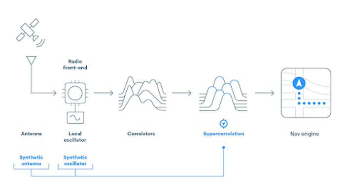
FocalPoint has added new functionality to its Supercorrelation technology, S-GNSS, to simplify the integration process for chipset companies.
The company has introduced an API interface between a GNSS chipset and an application or operating system that runs on its own navigation engine, easing deployment of Supercorrelation.
Based on the existing Android open-source interfaces, the S-GNSS API will allow a normal GNSS chipset to run S-GNSS in a separate external host processor. With this additional software added to the GNSS chipset, the overall system can get the performance improvements necessary to upgrade the GNSS receiver to a S-GNSS receiver and offer enhanced positional capabilities.
The S-GNSS API outputs the multipath-free line-of-sight correlation peak for each satellite and the corresponding corrected frequency, codephase and status flags. Optional outputs can be enabled with turn-on keys, spoofer detection and localization, and instantaneous magnetic-free heading estimation.
Supercorrelation has recently been awarded the National Technology award for Security Innovation of the Year and is recognized by the UK Royal Institute of Navigation and the Institute of Navigation. This development is the latest technical upgrade for the S-GNSS product portfolio.
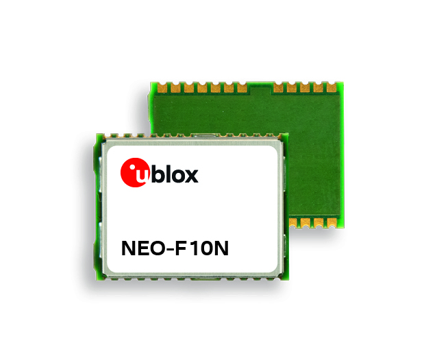
u-blox has released its latest positioning module, the NEO-F10N. The module is based on the u-blox NEO form factor and is equipped with u-blox F10 dual-band GNSS technology. It supports L1/L5 GNSS bands from multiple constellations, including NavIC, to provide solid meter-level position accuracy in urban areas.
The technology’s firmware is upgradeable and configurable to support a variety of applications such as vehicle aftermarket telematics and micromobility or industrial applications requiring meter-level position accuracy.
The NEO-F10N provides resilience against multipath interference and leverages signals from both the L1 and L5 bands. The module aims to increase accuracy, reduce power consumption and offer an alternative solution to users who do not want to deploy dead reckoning (DR) setups.
Users currently employing receivers based on modules, such as the u-blox NEO-M8 and NEO-M9, can seamlessly upgrade to the new NEO-F10N generation.
U-blox also introduces the new ANN-MB5 L1/L5 antenna to strengthen u-blox’s F10 dual-band solution. This tailored antenna offers an easy and reliable option for meter-level applications that require multi-band and multi-constellation support, even in challenging environments.