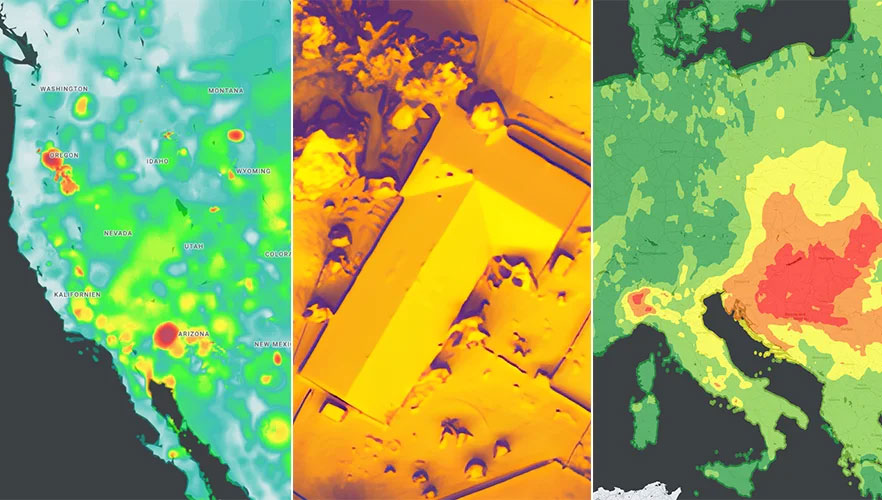
Google has released three Google Maps application programming interfaces (APIs) for developers to map solar potential, air quality and pollen levels. The three APIs apply artificial intelligence (AI) and machine learning, along with aerial imagery and environmental data, to provide up-to-date information about these three variables, enabling developers, businesses, and organizations to build tools that map and mitigate environmental impact.
The Solar API utilizes mapping and computing resources to design detailed rooftop solar potential data available for more than 320 million buildings across 40 countries including the United States, France and Japan. To obtain this data, the AI model extracts 3D information about roof geometry from aerial imagery, while considering past weather patterns and energy costs, enabling quicker installation of solar panels.
The Air Quality API shows air quality data, pollution heatmaps, and pollutant details for more than 100 countries around the world. The API validates and organizes several terabytes of data an hour from multiple data sources — including government monitoring stations, meteorological data, sensors and satellites — to provide a local and universal index.
Google Maps uses machine learning and live traffic information to predict different pollutants in an area at a given time. The Air Quality API offers companies in healthcare, the automotive market and other forms of transportation the ability to provide accurate and timely air quality information to their users.
The Pollen API shows current pollen information for common allergens in more than 65 countries. The API provides localized pollen count data, heatmap visualizations, detailed plant allergen information, and actionable tips for allergy-sufferers to limit exposure. To obtain this information, Google Maps uses machine learning to determine where specific pollen-producing plants are located.
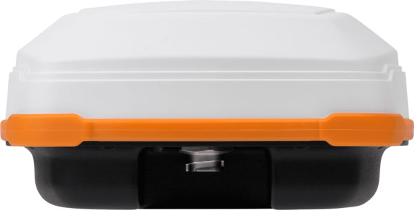
Hemisphere GNSS has released the A631 GNSS smart antenna for agricultural, marine, GIS, mapping and other applications.
The A631 combines Hemisphere’s Athena GNSS engine and Atlas L-band correction technologies with a new web user interface (WebUI). Optional features include 16 GB of internal storage, Bluetooth and Wi-Fi. The compact antenna is designed for rugged environments and meets IP67 requirements.
With multiple operating modes, A631 can be used as an RTK base station or rover. The device is supported by Hemisphere’s Atlas Portal, which empowers users to update firmware and enable functionality, including Atlas subscriptions for accuracies from meter to sub-decimeter levels.
A631 also supports BaseLink and SmartLink modes. SmartLink allows users to directly connect AtlasLink as an extension to any existing system that has industry-standard connectivity options. BaseLink automatically sets up AtlasLink as a permanent reference station, delivering corrections to any other GNSS receiver being used for positioning.
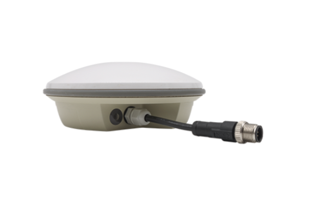
Harxon has launched its TS122 family of smart antennas for demanding precision agriculture applications to increase GNSS availability, accuracy and reliability.
The smart antenna family is designed for high-performance semi-autonomous or autonomous applications that require centimeter-level accuracy – even in highly variable terrain and GNSS-obstructed environments. The TS122 family can be used for agriculture OEMs, integrators that develop precision agriculture solutions, autonomous solution providers and more.
There are two models for the new TS122 smart antenna: EUAA and EUUB. Each model has different performance options to fit users’ individual needs.
TS122 EUAA, with ±10cm P2P accuracy and standalone technology, is best for high-performance semi-autonomous or autonomous applications requiring centimeter-level accuracy, even in challenging GNSS-obstructed environments.
TS122 EUUB has single point 1.5 m circular error probable (CEP) and ±15cm P2P accuracy. Both models support RS-232 serial ports and Bluetooth communication for easy configuration of the smart antenna via users installing a configuration app on a phone or tablets, the company said.
An exclusive interview with Mark Holbrow, VP of Product Development, Spirent Communications and Roger Hart, Sr. Director of Engineering, Spirent Federal Systems. For more exclusive interviews from this cover story, click here.
What are your roles?
MH: Our business is based in the UK. I am responsible for the vision and direction of the Technology portfolio required by Spirent’s Positioning Technology business unit.
RH: I am responsible for the U.S. add-on components to the simulator, the restricted signals, and support for the U.S. government labs and contractors.
How have the need for simulation or the requirements for it changed in the past five years, with the completion of the BeiDou and Galileo GNSS constellations, the rise in jamming and spoofing threats, the sharp increase in corrections services, and the advent of new LEO-based PNT services?
MH: I would say that the need for thorough and comprehensive testing has never been greater. That need is being driven on multiple fronts due to the understandable pressure on PNT systems needing to deliver enhanced accuracy, reliability and resilience, in the presence of emerging threat vectors and an expanding application space that’s utilizing ever more complex combinations of new and enhanced signals and sensors of opportunity. Underpinning Spirent’s leadership in ensuring the test needs for this evolving, challenging and increasingly diverse market are its team, its technology and its partners. That team is well-established, dedicated and highly experienced — their sole focus is designing, manufacturing and supporting PNT test solutions. The technology focuses around our pioneering dedicated SDR hardware platform and software simulation engine, which allied provide performance, scalability and flexibility, within an open accessible architecture. In addition, close collaboration with our selected partners ensures the opportunity to support and integrate new and emerging PNT technologies through their tools, applications and hardware.
You mention the advent of LEO. A key reason why Spirent was first to market and successfully supported an early LEO + GNSS receiver test-bed (through close and collaboration with Xona and NovAtel) was driven by team, technology and partners.
Two other important areas that have definitely continued to grow and evolve in importance and priority have to be increased realism and test automation. Both are areas in which Spirent continues to prioritize and invest R&D dollars.
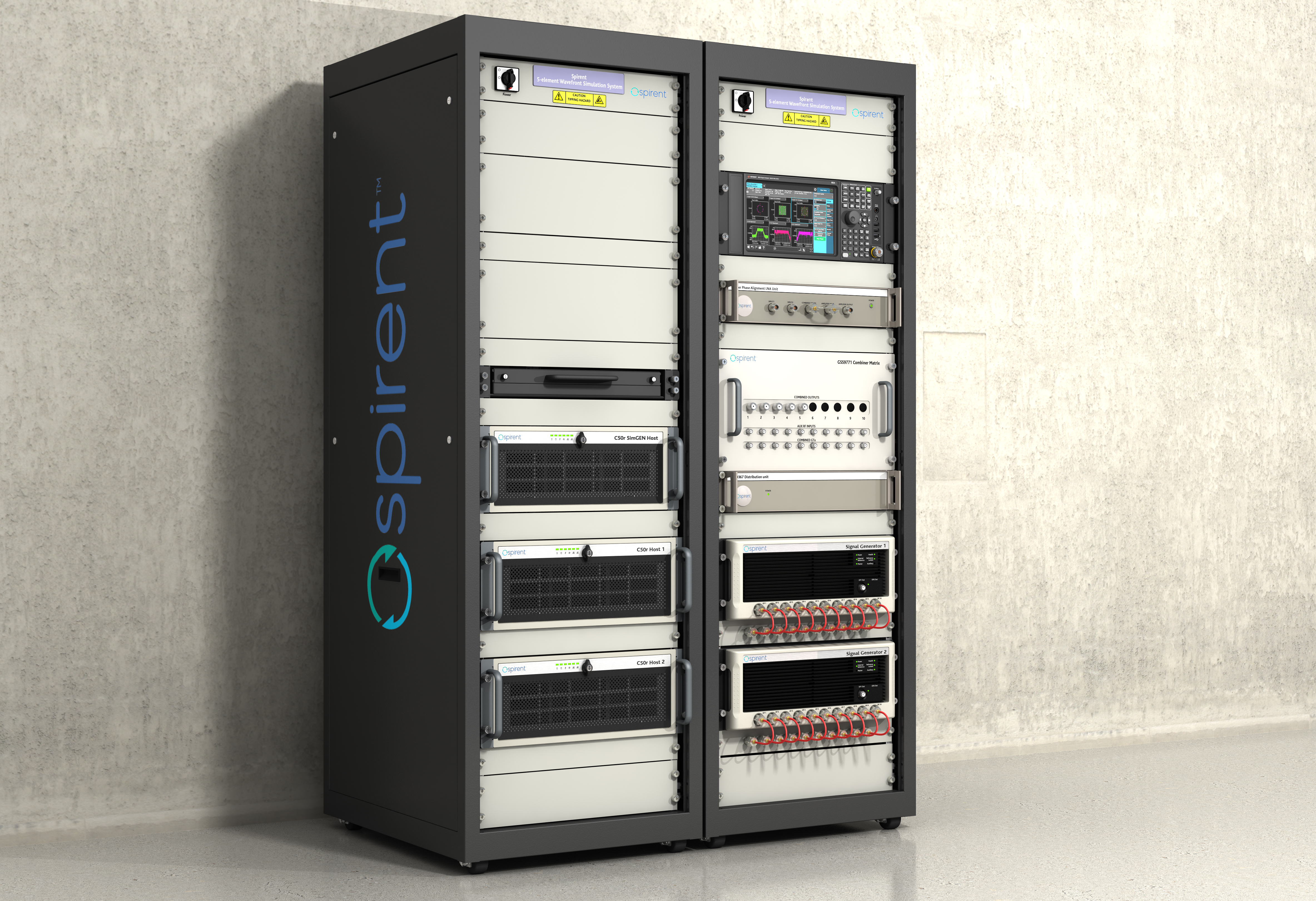
Spirent’s integrated, software-defined wavefront simulation system for a 5-element controlled reception pattern antenna (CRPA). Spirent solutions support 16+ antenna elements. (Image: Spirent)
With all these additional signals, is it still a single simulator or do you have to somehow split it up into different modules?
MH: Good point. Again, a key element with the Spirent solution is that it is very scaleabale and flexible. Spirent has a generic SDR that can be re-purposed to simulate whatever signals are required. That way, we can compile different signals from either one radio or multiple radios coming from the same system. Together with being able to bring in multiple chassis to gradually grow the simulation solution, while also maintaining for each of those signals the fidelity, channel count, and accuracy that customers demand.
Including every signal currently available?
MH: Absolutely, sir. In fact, signals that are still on the drawing board as well. We can enable the user with effectively an arbitrary waveform simulator or ‘sandbox’ to experiment with different modulation schemes, different chipping rates, codes, bandwidths and navigation data content. So, in addition to using that architecture to generate the signals, we allow customers to experiment with it themselves. That’s certainly accelerated over these last five years, and there’s no sign of it stopping. We’re currently working with customers and partners all over the globe who are developing both brand new and emerging PNT systems, whilst also providing all the vital simulation tools to aid the R&D of existing and planned SIS evolutions.
RH: The increasing number of signals that we can support multiplies the permutations and combinations of test cases that users can do. There is a lot of emphasis also on the user interface side of things, so that from one interface you can also easily control all these interfaces with third-party tools, because proliferation of signals produces a huge possible test volume.
What are the specific challenges in realistically simulating new LEO-based signals and any new services being developed for which you don’t have any live sky signals to record yet, only ICDs and other documents?
MH: Again, great question. The key reason Spirent excels in this arena is that the core simulation engine and SDR are agnostic of the constellation and signal type that’s being generated. So, the underlying principles of accuracy, range rate, pseudo-range control, and delay, together with the RF fidelity from Spirent’s SDR+ Sim engine, can be readily manipulated to simulate the wealth of emerging signals, including LEO.
The other area that becomes very important is that if we do not have sight of the ICD, we can enable customers to use our tools to readily populate elements of that ICD themselves. That way, the best of both worlds is achieved, i.e. a turnkey SIS solution, or we can just enable the customer to do it themselves.
Are accuracy requirements or any other requirements for simulation increasing to enable emerging applications?
MH: They are. Both current and emerging test needs are continuing to drive the need for enhanced simulation realism. Always a tough nut to crack, but our hard-won experience and expertise, allied with continuing adoption of latest-generation technology, is allowing us to take some significant strides forward. Real-world testing has an incredibly important role to play and that’s why at Spirent we continue to invest in and develop the GSS6450 Record & Playback System (RPS). However, we are also on that quest for the ‘Holy Grail’ that has all the well understood and necessary advantages of lab-based testing but with the simulation environment being as true to the real world as possible.
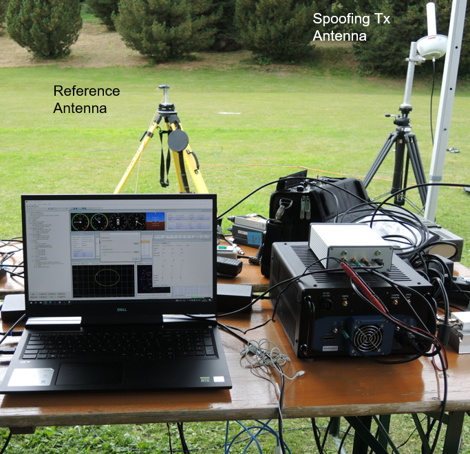
A German Armed Forces test center, WTD-61, recently used Spirent’s new Field Simulator to conclusively demonstrate the susceptibility of some UAS to spoofing. (Image: Spirent)
A further area where both current and emerging test needs are demanding more and more from the test environment is resilience testing. Spirent now supports a multitude of vulnerability and corresponding mitigation/prevention test cases. Those test cases become increasingly complex as multiple combinations of the threat/mitigation surface evolve — including jamming, spoofing, cyber-attack and CRPA.
Many of these test cases are driving the state of the art and, especially in the case of CRPA testing, Spirent’s purpose-designed SDR comes into its own. Technology bakeoffs and corresponding customer adoption have shown that only through the use of that dedicated purpose-built technology, the simulator test bed can deliver the necessary carrier and code phase stability, very low levels of uncorrelated noise across antenna elements and high J/S that is demanded.
Again, with respect to flexibility, we also support ways to let customers generate their own IQ data. That data can be streamed into the Spirent simulator and combined sympathetically and coherently with the signals generated inside the platform. So, you can layer new signals on existing ones, or introduce a completely new dedicated IQ stream.Finally, hardware-in-the -loop (HIL) testing requirements continue to be a crucial aspect in test coverage. Whether that application is automotive, projectiles or autonomous vehicles, the need for lower latency and higher 6DOF sampling to capture as many trajectory nuances as possible continues to grow. Spirent’s 2KHz system achieves very high iteration rates (SIR) and <2msec latency.
What are the key differences between your simulators for use in the lab and those for use in the field? I assume that the latter are lighter, smaller, and less power hungry. Do they use modules so that users can pick the ones they need for a particular test?
MH: We do support in-the-field test use cases. Spirent has record-and-replay (RPS) systems to take soundings in a wide-band RF environment, record them, then bring them back into the lab for replay. They are sized to fit into a backpack, battery-powered, accessible, and easy to use.
Recently, we have also taken some of our signal generator IP and been able to create a smaller form factor portable simulator for outside use. Its footprint is considerably smaller than that of one of our lab-based simulators. It’s primarily a mechanism for testing the resilience in the field of devices under test. Armed with a Spirent simulator and the appropriate transmit licenses, a customer can put their DUT through an array of vulnerability test cases in a live real-world environment.
You mentioned licenses. As far as jamming, specifically, and maybe spoofing, I presume that you’ll need a license for a specific time and place and that you will have to be far away from, say, an airport.
Absolutely. Right. The details will vary depending on the jurisdiction, but you will need a license to transmit. And, as you rightly say, often those places will be very remote so as not to interfere with the public. We’ve had instances where we’ll work with a customer who has those appropriate licenses and then we can provide this equipment for them to be able to put it through a battery of tests.
You generate the spoofing in your simulator, of course. Do you also generate the jamming inside the same box or from a separate jammer nearby?
It could be either. We can use our simulators to generate internally wide range of interference signals supporting a wide bandwidth, high max o/p power and large dynamic range. This is especially important in instances of CRPA testing, in which it is vital to accurately reproducing a jamming wavefront commensurate with the arrival angle and delay incident at each antenna element. Correspondingly, we support turn-key solutions to connect, control and integrate 3rd party external signal generators into the test scenario.
Are you at liberty to describe any recent success stories?
We have a Xona simulator. So, this is back on the topic of LEO. We’ve recently released that in partnership with Xona. We are also working closely with Hexagon. All those things I mentioned earlier about enabling the customer to use the flexible features that we have, that is where it came into its own. That’s certainly a significant recent success.
We’re continuing to add many realism-related capabilities, including simulating the vibration and temperature effects of inertial systems. Working with a Swiss partner called Space PNT, we’ve recently introduced another LEO-based product, called SimORBIT. That tool enables us to generate incredibly representative and accurate LEO orbits that also include gravitational effects based upon the SV size. We recently introduced a new software tool to support “GNSS Assurance” requirements.
We have a newly patented cloud-based software application called GNSS Foresight that enables users to understand the GNSS coverage they would expect during a particular time, date location and trajectory inclusive of the 3D environment they would be experiencing. We continue to evolve the tool to support real-time operation to enable it to deliver aiding content to appropriately equipped systems.
We continue to be able to support more and more automation. Automation has always been important, but with ever increasing demands of test asset utilization and in a post-pandemic world of remote working, it’s more important than ever right now. The number of test cases and corner cases required and the amount of equipment, coverage, and efficiency required, which was being demanded by using our kit means that automation is vital. So, we’ve introduced several new automation tools to build up on top of our current SimREMOTE interface.
Spirent has also developed a simulation test solution for the Galileo Open Service Navigation Message Authentication (OSNMA) mechanism. SimOSNMA is designed to work with Spirent’s GNSS simulation platforms to test OSNMA signal conformance, which will bring new levels of robustness for both civilian and commercial GNSS uses. SimOSNMA provides developers with vital new simulation tools to test for OSNMA, the security protocol that enables GNSS receivers to verify the authenticity of signals distributed from the Galileo satellite constellation. Designed to combat spoofing, OSNMA ensures that the data received is authentic and has not been modified in any way. It is currently completing the test phase before its formal launch, and SimOSNMA enables developers to simulate and test OSNMA signals and features, allowing GNSS receiver manufacturers and application developers to accelerate and assure development programs.
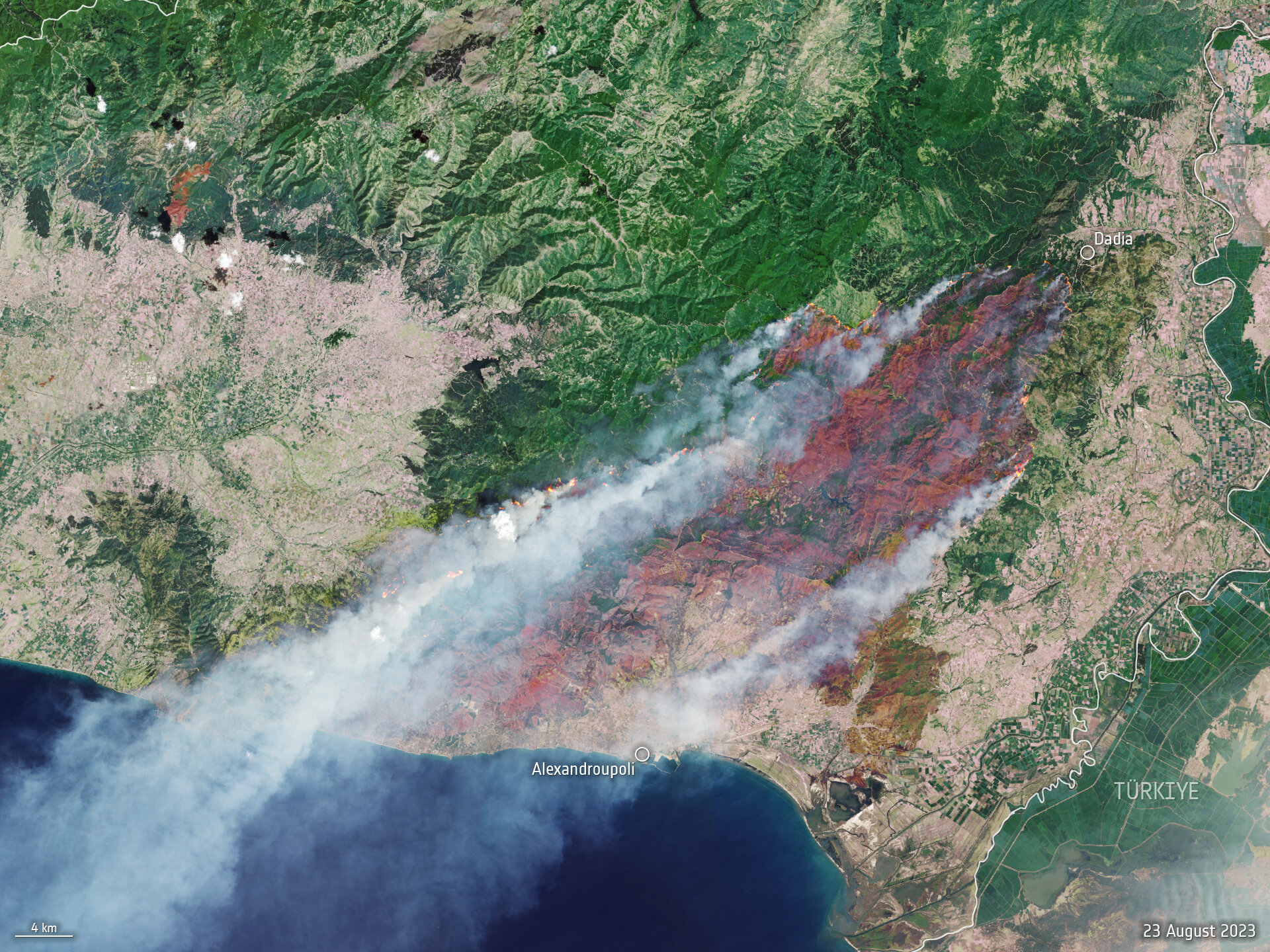
One month after fire blazed through the Greek island of Rhodes in July 2023, more fires have ripped through Greece amid a heatwave in southern Europe, reported the European Space Agency (ESA).
A Copernicus Sentinel-2 image (Figure 1) shows the ongoing blaze near Alexandroupoli in the Evros region of northeast Greece – close to the Türkiye border.
The satellite image is a blend between a natural color and a shortwave infrared composite to highlight the fire front, which was approximately 70 km long as of August 23. The fire has produced a plume of smoke that stretched 1,600 km southwest towards Tunisia. Burned areas can be seen in the image in dark brown.
Figure 1. (Image: ESA)
The Copernicus Sentinel-2 mission is based on a constellation of two identical satellites, each carrying a wide swath high-resolution multispectral imager with 13 spectral bands for monitoring changes in the Earth’s land and vegetation.
In response to the fires, the Copernicus Emergency Mapping Service has been activated in North Attica, Rodopi, Euboea Island, the Sterea Ellada Region, and East Macedonia. The service uses satellite observations to help civil protection authorities and the international humanitarian community respond efficiently to emergencies.
Greece has experienced daily outbreaks of dozens of fires over the past week as gale-force winds and hot, dry summer conditions combined to whip up flames and hamper firefighting efforts. On August 26, firefighters tackled 122 fires, including 75 that broke out in the 24 hours between August 25 and August 26, the fire department (formally the Hellenic Fire Service) said.
Scientists have warned that climate change and land-use changes are projected to make wildfires more frequent and intense. In response, the ESA has reopened its World Fire Atlas, which provides a detailed analysis and map of wildfires across the globe.
The causes of Greece’s two largest fires have not yet been determined. For some of the smaller blazes, officials have said arson or negligence is suspected, and several people have been arrested, reported NBC News.
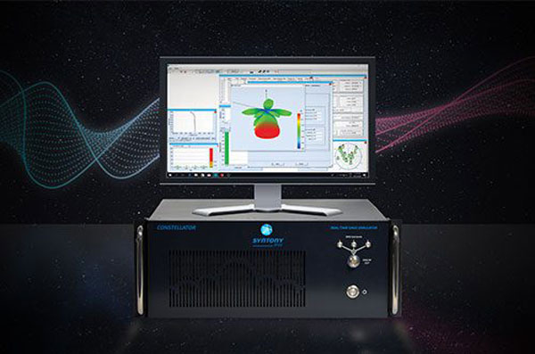
Syntony GNSS has doubled the SDR L1C/A equivalent signals of its multi-GNSS simulation solution, Constellator.
With Constellator’s computation power doubled from 660 L1C/A equivalent signals to 1200, users can simulate a complex RF environment for GNSS testing with a powerful and high-fidelity machine, the company said. Additionally, users can now test equipment with multiple traditional GNSS constellations and new ones to come, such as Xona’s PULSAR.
As a result of doubled computation, massive new constellations can be simulated. When fully deployed, the Xona constellation will count hundreds of satellites on multiple bands, in complex RF environments including specific atmospheric parameters, jamming, spoofing and multipath. It also introduces the controlled reception pattern antenna (CRPA) testing capacities of the device, when the demand is increasing for resilient multi-GNSS and low-Earth orbit (LEO) position, navigation and timing (PNT) solutions.
Syntony said it was the first PNT services provider to integrate all Xona demo signals into Constellator, in 2022. However, to offer a full testing solution, Syntony also developed a Xona-enabled GNSS receiver.
An exclusive interview with Jürgen Pielmeier, managing director, IFEN. For more exclusive interviews from this cover story, click here.
In which markets and/or applications do you specialize?
IFEN is offering RF simulation solutions for all GNSS markets, except the defense market with encrypted signals. The major market in recent years was the ‘New Space’ market, mainly focused to design and test PNT navigation solutions as part of (primarily) LEO satellite constellations using existing GNSS systems. With the many new players around the world, there are many market opportunities. To be successful in this ‘New Space’ market requires simulation support of all GNSS systems and signals, modelling LEO dynamics and environment and providing multiple RF-outputs (enabling systems with several GNSS antennas located on the satellite). With our latest ‘NCS NOVA+’ RF simulator, support of up to 4 RF-antenna simulations is possible. From basic RF system up to integrated SIL and HIL systems, the level of required solutions is very diverse by the different applications. The IFEN RF simulator is also offering a full ‘radio occultation’ simulation capability specifically for this market.
The second important market is the automotive/maritime PNT market requiring fully integrated HIL simulation solutions. Excellent integration capability into external environment simulation systems with a rich set of interfaces and short latencies are keys for this market. To further penetrate this market, IFEN will implement some major enhancements during this and next year within its RF simulator products.
How has the need for simulation changed in the past five years, with the completion of the BeiDou and Galileo GNSS constellations, the rise in jamming and spoofing threats, the sharp increase in corrections services, and the advent of new LEO-based PNT services?
Today, supporting all existing GNSS systems with all related signal components on all frequencies is a must have for all high-end RF simulators. Keeping the RF simulators up-to-date with the new and continuously evolving GNSS signals is required to be sustainably competitive. Specifically, beyond the L-band signals, we are also fully supporting the S-band signals of the NavIC constellation. The continuously increasing number of available GNSS satellites and signals requires that the RF simulator capabilities are fully scalable to provide sufficient resources to simulate all signal channels. Our new NCS NOVA+ simulator is our first RF simulator with strong scalability capabilities, to be further extended in the coming years.
In recent years, adding support for the simulation of jamming and spoofing threats was a major driver for the market. Our latest RF simulator generation ‘NCS NOVA+’ is fully supporting all types of jamming and spoofing, fully integrated into our RF simulators to enable coherent signal generation. With the coming ‘DFMC’ (SBAS/GBAS dual-frequency multi-constellation) based safety-of-life and automated driving applications, the need to support advanced jamming and spoofing simulation solutions will be a continuous driver also for the future.
Adding the ‘High Accuracy Service’ (HAS) PPP-correction capability on Galileo E6-B signal in our coming V2.9 release is driven by the increased request for PPP corrections services. We expect further improvements here in the coming years, especially to cover the emerging PPP-RTK market needs.
With the coming age of LEO-PNT services, this is the most important driver for the next five years, extending the signal frequencies beyond the current L- and S-band signals, seeing new modulations, two-way transfer and many more topics. This will require strong development efforts on the RF simulator side, to provide suited RF test tools in time to LEO-PNT system designers and developers, but also the related user terminal developers. IFEN is currently preparing to take this next major step in its RF simulator capability portfolio.
In particular, regarding some of the new PNT services being developed, how do you simulate them realistically without the benefit of recordings of live sky signals?
Facing the lack of live sky signals when developing RF simulator capabilities is a continuous challenge. It requires to a certain signal simulation flexibility designed into the receiver, good and theoretical understanding of specific implications of new designed signals. As soon as real signals are then available, simulation and real signals will be compared and if required the simulation fidelity will be adjusted to meet the real signals.
Are accuracy requirements for simulation increasing, to enable emerging applications?
Concerning the core accuracy parameters requested in recent years, we saw no increase in required accuracy, as the typical requested accuracy are anyway far beyond the real signals accuracy.
Are all your simulators for use in the lab or are some for use in the field? If the latter, for what applications and how do they differ from the ones in the lab? (For starters, I assume that they are smaller, lighter, and less power-hungry…)
Currently all our simulators are designed for usage within the laboratory. However, we recognize an increased request for in-field capable RF simulators, specifically to perform spoofing of real SIS to test deployed GNSS receivers in the field. Offering a portable in-field solution is in the mid-term planning, but not a current driver for our developments.
What are some of your recent successes?
The most important recent success is the Galileo 2nd generation Test User Receiver contract from the European Space Agency. Within this contract, the ‘NCS NOVA+’ simulator as RF test tool will be upgraded to full G2G signal generation capability. The new already implemented G2G signals enabling shorter TTFF, improved acquisition performance but also higher updates rates (e.g. for PPP-RTK). Up to end of the year the G2G signal will be fully implemented in our RF simulator, including the next generation of advanced authentication solutions.
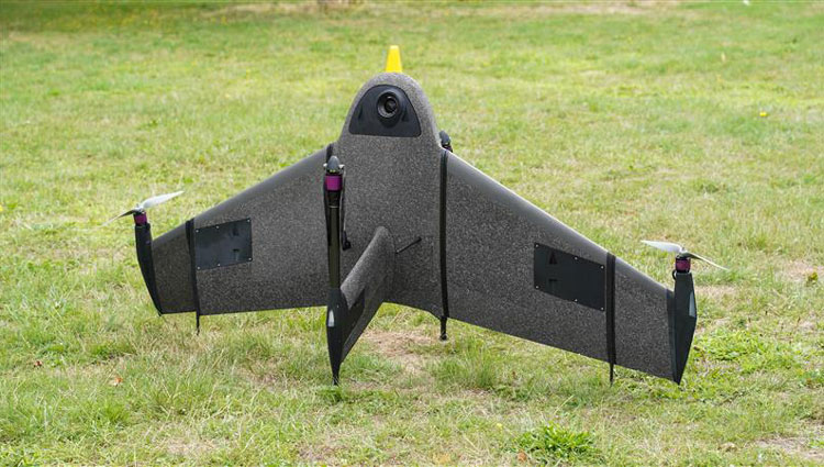
Atmos has integrated the new Sony a6100 Oblique camera into its vertical take-off and landing (VTOL) fixed-wing UAV, the Marlyn Cobalt. The device can be used by professionals in the geospatial mapping and surveying sectors.
The Sony a6100 Oblique camera is an innovative addition to the Marlyn Cobalt because it combines Sony’s 24MP a6100 with a Meike 12mm lens to provide users with a solution for lower-resolution surveying that produces 3D models for urban surveys.
With the integration, the Marlyn Cobalt boasts a 350-hectare coverage at 400 feet, reducing operational time and costs. The resulting ground sampling distance (GSD) of 4cm at that altitude ensures high-resolution data acquisition, delivering detailed images for precise analysis.
The map below (Figure 1) was surveyed by one of Atmos’ customers. The UAV enabled them to identify and inspect the built and natural environment through different processing ways for urban planning in the town of Sancta Maria in the Netherlands.
Figure 1: 3D reconstruction of the Sancta Maria urban area. (Image: Atmos)
To learn more about the integration, visit the Atmos website.
Hexagon’s Geosystems division has updated high-resolution aerial data covering the entire Commonwealth of Puerto Rico and the U.S. Virgin Islands as part of the HxGN Content Program.
Captured during the 2021-2023 flying seasons, the data set includes four-band, 6-inch resolution orthorectified imagery of Puerto Rico — except Isla Mona and Isla Desecheo, which are offered at 12-inch resolution. In the U.S. Virgin Islands, four-band orthorectified imagery of St. Thomas and St. John Islands are offered at 6-inch resolution and St. Croix Island at 12-inch resolution.
Additionally, updated 12-inch resolution digital surface model data of both regions are available.
In the past, aerial imagery from the HxGN Content Program has served as baseline data sets with unbiased records of property and infrastructure conditions prior to events such as Hurricanes Irma and Maria in 2017 and the earthquake of 2019. The imagery has also provided information for emergency preparation, response, and management.
In addition to emergency management, the HxGN Content Program aerial imagery is used in engineering, agriculture, utility, mapping, and artificial intelligence/machine learning applications.
The HxGN Content Program offers a large library of high-resolution aerial imagery, elevation data, 3D models and analytics of North America and Western Europe.
The refreshed Puerto Rico and U.S. Virgin Islands orthoimagery and DSMs are available now through a streaming subscription using standard mapping APIs or via pixel download on the Hexagon Digital Reality (HxDR) Data Store.
Ukraine’s allies in Europe are sending the country new UAVs and counter-UAV equipment, reported The Defense Post.
German weapons provider Rheinmetall is preparing to send its LUNA NG (next generation) unmanned reconnaissance UAV to Kyiv, the company announced August 14. The system should be delivered by the end of the year, according to Rheinmetall.
The LUNA NG is part of a sizable military aid package for Ukraine initiated by the German government in July. Per Rheinmetall, the package includes a ground control station and several UAVs, as well as a launch catapult, an optional net equipment for catching landing UAVs and equipment for rapid repair. The system is mounted on a Rheinmetall HX truck with a swap body system.
The UAV is designed for a range of mission-specific payloads — including LTE network and electronic warfare support measures such as detection, classification and analysis of electromagnetic radiation for threat detection.
UAV can remain aloft for more than 12 hours and maintain a datalink range of up to 100 kilometers normally, and up to 300 kilometers when fitted with optional satellite communication equipment, according to Rheinmetall.
The Bundeswehr (the German military) has operated LUNA UAV systems since the early 2000s. Those were originally developed by German manufacturer EMT Penzberg, which was acquired by Rheinmetall in 2021.
Berlin has already delivered several reconnaissance UAVs to Ukraine, including 88 Vector UAVs from Quantum Systems, 20 RQ-35 Heidrun systems Sky-Watch, and 32 unspecified reconnaissance UAVs, as of August 9.
Ukraine will also soon receive a series of Cortex Typhon counter-UAV systems made by Norway’s Kongsberg, after the company signed an agreement via the International Fund for Ukraine.
The delivery consists of several Cortex Typhon systems — developed to counter a wide spectrum of UAVs with solutions to either physically harm or disable an aerial threat, Kongsberg said.
An exclusive interview with Julian Thomas, managing director, Racelogic. For more exclusive interviews from this cover story, click here.
In which markets and/or applications do you specialize?
We originally designed our LabSat simulator for ourselves, because we supply GPS equipment to the automotive market. Then, we decided to sell it into that market, which is our primary market, for other people to use. That’s where we started, but it has moved on since then. We supply many of the automotive companies who use it for testing their in-car GPS-based navigation systems.
However, we’ve moved on to our second biggest market, which is the companies that make deployment systems for internet satellites, which use it for end-of-life testing. Several of our customers use it. That’s because we do space simulations, so we can simulate the orbits of satellites. That’s very useful when they’re developing their satellites.
We supply many of the major GPS board manufacturers — such as NovAtel, Garmin, and Trimble — when they’re developing their boards and testing their devices. We supply many of the phone companies — such as Apple and Samsung — and many of the GPS chip manufacturers — such as Qualcomm, Broadcom, and Unicom. More or less any company that’s into GNSS.
How has the need for simulation changed in the past five years, with the completion of the BeiDou and Galileo GNSS constellations, the rise in jamming and spoofing threats, the sharp increase in corrections services, and the advent of new LEO-based PNT services?
It all started off very simple, with just GPS, which was one signal and one frequency. We got that up and working very well and it helped us a lot. Then we got into this market. In the last few years, we’ve had to suddenly invent 15 new signals. We do two systems, really: one is a record-and-replay system. You put a box in a car, on a bike, in a backpack, or on a rocket, and you record the raw GPS signals; then you can replay those on the bench. That requires greater bandwidth, greater bit depth, smaller size, battery power, all of that.
The other is pure signal simulation. We simulate the signals coming from the satellites from pure principles. So, we’ve had to dive into how those signals are structured, reproduce them mathematically, and then incorporate that in into our software. That’s been 15 times the original work we thought it would be, but as we add each signal it tends to get a bit simpler until they add new ways to encode signals, and then it gets complex again. We’ve had to increase our bandwidth, increase our bit depth for the recording to cover all of these new signals.
Because our systems record and replay, they’re used a lot to record real-world jamming. In many scenarios, our customers will take one of our boxes into the field and record either deliberate jamming or jamming that’s been carried out by a third party. Then they can replay that in the comfort of their lab.
With regards to spoofing, we’ve just improved our signal simulation. So, we can completely synchronize it with real time. We can do seamless takeover of a GNSS signal in real time. We can reproduce the current ephemeris and almanac. If we transmit a sufficiently powerful signal, we can completely take over that device. Then we can insert a new trajectory into it. That’s a very recent update we’ve done.
If the complexity and amount of your work has gone up so much in the last few years but you cannot increase your prices at the same rate, what does that do to your business model?
It’s the same people that produce the signals in the first place, so they still have a job. However, as we add more signals and capabilities, we tend to get more customers as well.
Oh, so, you’re expanding your market!
Right, right.
Regarding some of the new PNT services being developed, how do you simulate them realistically without the benefit of recordings of live sky signals?
It is all pure signals simulation. You go through the ICD line-by-line and work out the new schemes. Here’s an interesting anecdote. Our developer who does a lot of the signal development is Polish and is also fluent in Russian. When we were developing the GLONASS signals, he was working from the English version of the GLONASS ICD. He said that it didn’t make any sense. So, he looked at the Russian version and discovered that the English one had a typo. When he used the Russian version, everything worked perfectly. He told this to his contacts at GLONASS and they thanked him and updated the English translation of their document. So, you are very, very much reliant on every single word in that ICD.
Are there typically differences between the published ICD and the actual signal?
No, no. Apart from the Russian one, which had a typo, they’re very good. For example, we’ve recently implemented the latest GPS L1C signal. My developer spent six months recreating it and getting all the maths right and the only way you could test it was to connect it to a receiver and hit “go.” It just worked the first time. He almost fell off his chair. The ICD in that case was very, very accurate.
Hope that Xona’s ICD is just as good.
Yeah.
Are accuracy requirements for simulation increasing, to enable emerging applications?
Yes, absolutely. No one can have too much accuracy. Everyone’s chasing the goal of getting smaller, faster, and more accurate systems. They want greater precision and better accuracy from their simulators, as well as a faster response. We do real-time simulators and they want a smaller and smaller delay from when you input the trajectory to when you get the output. Luckily for us, Moore’s law is still in effect, so, as the complexity of the signals and the accuracy requirements increase, computers can churn through more data. Luckily, we’re able to keep up on the hardware side as well, because much of our processing is done using software. Some companies do it in hardware and some companies do it in software. We concentrate on the software side of things.
Here’s another interesting anecdote from my Polish guy. He noticed that the latest Intel chips contain an instruction that multiplies and divides at the same time but that it wasn’t available in Windows. So, he put in a request with Microsoft for that operational code and they incorporated it into the very latest version of dotnet, which has improved our simulation time by 7%. I see little improvements like that all the time.
Are all your simulators for use in the lab or are some for use in the field? If the latter, for what applications and how do they differ from the ones in the lab? (Well, for starters, I assume that they are smaller, lighter, and less power-hungry…)
All our systems are designed to be used inside and outside the lab. They can all be carried in a backpack, on a push bike, in a car. We do that deliberately, because we come from the automotive side of things, so we have to keep everything very small and compact.
Besides automotive, what are some field uses?
Some of our customers have put them in rockets, recording the signal as it goes up, or in boats. We have people walking around with an antenna on their wrist connected to one of our systems, so that they can simulate smartwatches. There are many portable applications. We have a very small battery-powered version, which makes it very independent.
Are there any recent success stories that you are at liberty to discuss?
Our most exciting one is a seamless transition for simulation that we developed to replace or augment GPS in tunnels. We’ve been talking to many cities around the world that are building new tunnels. Because modern cars automatically call emergency services when they crash or deploy their airbags, they need to know where they are, of course. Cities need to take this into account when they are building new tunnels, which can pass over each other or match the routes of surface streets. Therefore, accurate 3D positioning in the tunnels has become essential. It requires installing repeaters every 30 meters along each tunnel and software that runs on a server and seamlessly updates your position every 30 meters. As you enter a tunnel, your phone or car navigation system instantly switches to this system. It’s been received very well because it’s mainly software and the hardware is pretty simple. We’ve brought the cost down to a fifth of the cost of standard GPS simulators for tunnels. So, we’re talking to several cities about some very long tunnels, which is very exciting.
The Open Geospatial Consortium (OGC) has released the first iteration the Integrated Geospatial Information Framework (IGIF)-M (Marine) Spatial Data Infrastructure (SDI) Maturity Roadmap for both marine and terrestrial domains.
“The IGIF-MSDI maturity roadmap is an important step that supports a holistic understanding of data-exchange and processing environments,” said OGC Chief Technology Innovation Officer, Ingo Simonis.
According to the OGC, the core of the IGIF-(M)SDI Maturity Roadmap is formed by the World Bank SDI Diagnostic Toolkit where, with contributions from IHO and OGC, its terrestrial heritage was augmented to maximize its benefits to the marine domain.