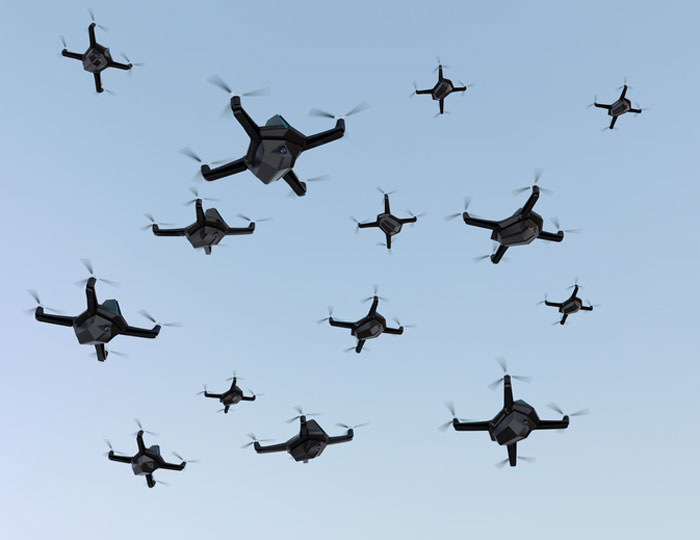
More than 350 UAVs were lost during a practice light display show in Melbourne, Australia, on July 14, ahead of a scheduled performance for the opening of the women’s World Cup.
The UAVs appeared to stop mid-show and plummet into the Yarra River. Divers have since fished out hundreds of the UAVs.
According to the Resilient Navigation and Timing Foundation, the likely cause of the mass-crash was caused by interference with GPS signals. This incident shows that having multiple and robust navigation sources is important for safe UAV operation.
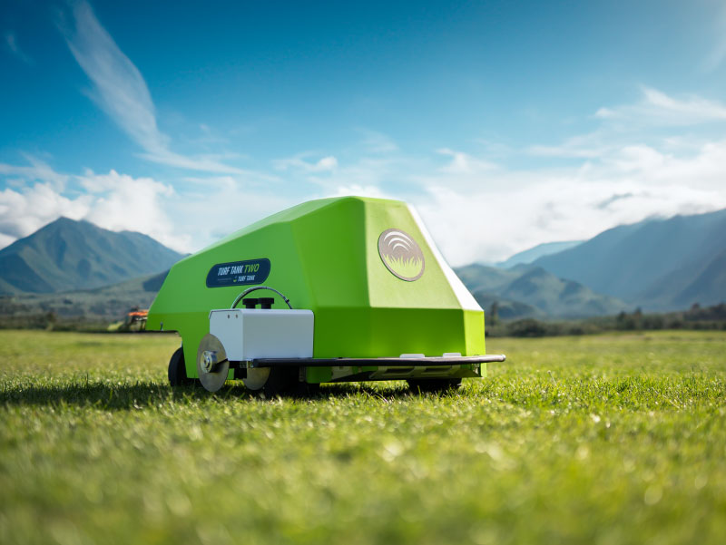
Turf Tank — inventor of an autonomous, GPS-guided line marking robot, built and designed specifically for painting athletic fields — has released the Turf Tank Two.
This robot features dual motor drives for enhanced torque and optimized wheels for traction. On its own and controlled through a tablet, the Turf Tank Two can paint a regulation 11 versus 11 soccer field in less than 24 minutes, a baseball or softball field in less than 11 minutes, a lacrosse field in less than 26 minutes, and a full 100-yard football field in less than 3.5 hours. It can also paint logos and numbers.
The Turf Tank Two is 43 in x 33 in x 22.5 in. It weighs 123 lbs, without paint or the battery installed, and it can hold 5.5 gallons of paint.
Enhanced features of the Turf Tank Two also include a revamped sprayer module and advanced control features — including a redesigned front panel that has convenient pause/resume options with LED indicators displaying the robot’s status and a start/stop sprayer button. An LED indicator also comes on the battery.
Turf Tank Two is both eco- and environmentally friendly, the company says. Its batteries are rechargeable and because of the robot’s precision and accuracy, it uses significantly less paint and eliminates the overspray that is common with either painting by hand or using many of the older paint machines and sprayers in the market.
Guided by GPS, the Turf Tank Two uses a base station to ensure its accuracy. The base station becomes a fixed point from which the robot knows to paint the same exact field every time it is dispatched. The base station communicates with satellites to ensure the accuracy of the field dimensions.
Once the user installs a particular field layout, it becomes a simple drag and drop process through the tablet. From there, it’s as simple as setting one to four points on each field to give the robot a starting point, and then the robot will paint that field autonomously.
The Federal Aviation Administration (FAA) has released an implementation plan outlining the steps it and others will need to take to enable advanced air mobility (AAM) operations safely. The plan, called Innovate28, includes various components and a timeline for their implementation to hopefully be completed by 2028.
This plan serves as a foundation for making entry into service routine and predictable by maximizing the use of existing procedures and infrastructure. It addresses how the agency and partners will certify aircraft and pilots, manage airspace access, ensure pilot training, develop infrastructure, maintain security and engage communities.
The plan also includes a planning guide that can be applied to any site, laying out key integration objectives and sequences.
Among the entities that play a role in this plan include: the FAA; the advanced air mobility industry; labor partners, NASA; United States Department of Homeland Security; United States Department of Energy; power industry; and state, local and tribal communities.
Pilots will be able to fly the new advanced mobility aircraft to and from multiple locations at the sites, using predetermined flight schedules with pilots aboard.
Advanced air mobility aircraft likely will operate up to 4,000 feet altitude in urban and metropolitan areas, using existing or modified low altitude visual flight rules (VFR) routes where possible within controlled Class B and C airspace around major airports.
Infrastructure
Operators, manufacturers, state and local governments, and other stakeholders will be responsible for planning, developing and enabling heliport/vertiport infrastructure.
Advanced air mobility will initially operate at existing heliports, commercial service airports and general aviation airports. Modifications may be necessary to install charging stations, parking zones and taxiing space.
Power Grid
The electrical power grid may require upgrades to serve advanced air mobility operations.
The FAA has an interagency agreement with the Department of Energy’s National Renewable Energy Lab to determine how aircraft electrification affects a vertiport, heliport or airport’s electrical grid.
Security
The Department of Homeland Security will determine what type of security is necessary.
The Transportation Security Administration and FAA are evaluating the need for expanded cybersecurity requirements due to the use of advanced technology and operational protocols.
Environment
The FAA will consider the environmental impacts of advanced air mobility operations, including factors such as noise, air quality, visual disturbances and disruption to wildlife.
Community Engagement
The FAA will engage with airports, and local, state, and tribal communities to better understand community concerns about advanced air mobility operations, including noise and mitigations.
Many other stakeholders, such as advanced air mobility operators and airport and vertiport operators will have important roles in community engagement.
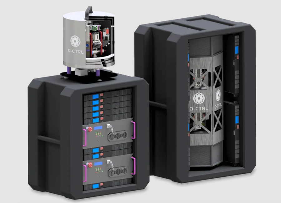
Q-CTRL, a quantum technologies company, has partnered with Australia’s Department of Defence to develop quantum sensors that will deliver quantum-assured navigation capability for military platforms.
The company’s partnership is a multi-year effort to field-deploy and validate miniaturized systems on defense platforms. It represents one of the first international partnerships between government and the private sector to apply quantum technology in real defense settings.
Quantum-enhanced navigation technology enables accurate vehicle positioning over long periods when GPS is unavailable. In air, space, underground and underwater, quantum navigation enables long-endurance missions that are otherwise impossible and is resilient against jamming or spoofing.
Q-CTRL announced its quantum sensing division in 2022. The company has worked with partners including Advanced Navigation and the Australian Army to demonstrate and deliver its technology for applications that include remote drone detection.
The United Kingdom’s first fully electric self-driving bus began service on public roads from the Didcot Parkway railway station in June, reported the BBC.
First Bus, the UK’s largest bus operator, said the bus’ radar, lidar and artificial intelligence technology could safely steer, accelerate and brake without human intervention.
While the bus is fully autonomous, it does have a safety driver who is able to override operations if needed.
The 15-seat bus makes a six-mile loop from the station to Milton Park in Oxfordshire, UK, and runs six days a week every 40 minutes.
The U.S. government has visibly and physically conveyed its interest in getting air taxis into operation, through a visit of 70 people — attached to the newly formed Advanced Air Mobility (AAM) Coordination group — to Archer Aviation. The group talked with the executives of the company developing the “Midnight’ air-taxi aircraft and watched a flight test.
The AAM group includes members from leading government agencies concerned with making and keeping this segment of aviation successful, including the Federal Aviation Administration (FAA), the Department of Transportation (DOT), the National Aeronautics and Space Administration (NASA), the Department of Defense (DOD) and other agencies.
AAM group visits Archer Aviation. (Image: Archer Aviation)
Gathering the views of Archer and other electric vertical takeoff and landing (eVTOL) developer executives should be an essential part of the AAM group’s information collection task. And while it’s great to see that the interagency group has every intention of promoting the AAM concept of air taxis, it would perhaps be better if the group also had access to representatives of manufacturers, developers, and those with UAS experience. It’s clear that we need to start by spreading the word, but also by including people in the group who have dedicated themselves to bringing these capabilities to market — that may make the process more efficient.
Along the way, it may also help to understand that the processes we have used in the past to get airframes like this into passenger carrying operations might not work well with this new industry. It’s understandable that it should take a lengthy period to assess, verify, qualify and certify such vehicles in the name of safety, but if companies run out of cash and fold in the interim — which is highly likely with this “start-up industry” — then shouldn’t we be looking for a better way to get these guys off the ground?
No one wants safety to be sacrificed, but could there be some way to streamline, speed up, or simplify the process without skipping essential steps — a way to get new technology into use before it’s obsolete, or a lack of start-up money dooms its progress? The forecast for the economy in the near future is in the billions of dollars. So, providing funding to improve the current processes does make sense. DOD has started to put serious effort into speeding up its acquisition process and has empowered the Defense Innovation Unit (DIU) to find quicker ways to bring commercial technologies into defense.
The processes used to bring new technologies into use are tried and proven, but they are lengthy. In defense, if our opposition can field things quicker than we do, they have an edge in strategy, tactics and a higher probability of winning in battle. These countries are using the same approaches in the commercial world too, and we need to be wary that they may also have a greater chance of winning the “economic war.”
Nevertheless, Archer in California and others such as Joby, also in California, and Liliam in Germany, plod on through varying stages of FAA and European Union Aviation Safety Agency (EASA) certification paths. An example of the effort that a company has been required to put into fulfilling the requirements of a certification agency is that of Lilium, which first applied for its Design Organization Approval (DOA) in 2017, is still churning through the qualification efforts and does not expect approval until 2025. Of course, the answer is “Don’t get on the certification ‘hamster-wheel’ unless you can stand the journey.” However, we do want these systems and vehicles to make it in order to overcome some of the traffic nightmare that we are living through in our major cities and to contribute to the growth in the economy.
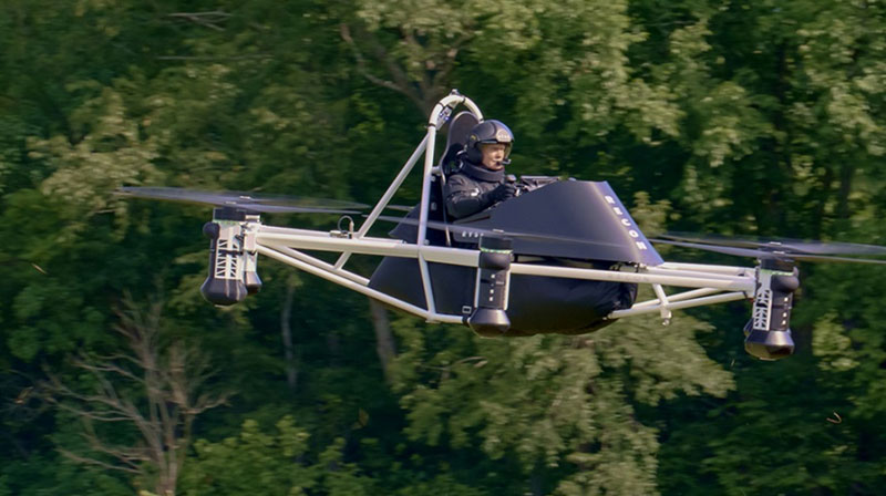
Meanwhile, the great hope (even expectation) of the “flying car” is being kept alive by Doroni in Miami with its two seat H1 eVTOL. Having largely burnt through its $3.6 million StartEngine launch money, Doroni is looking for its second round of funding to build more prototypes and join the certification race. However, other single seat eVTOL flying cars have taken the easier route to certify under the FAA Ultralight category.
Doroni H1 prototype. (Image: Doroni)
The H1 has semi-autonomous capability, which Doroni claims will make its eVTOL easy to fly, and allow general sales to any car driver. With air bags, an aerodynamic fuselage — which generates lift — 10 independent propulsion systems (four double prop ducted fans and two forward thrust props), an airframe that can behave as a parachute and “dissipate energy” in case of a crash, and landing gear, the H1 also has multiple independent batteries — all aimed at safety, which will help make it through certification verification. So, if you happen to have the $250,000 proposed sale price and are willing to wait on the completion of FAA certification, you could own your own “flying car.”
Doroni just announced that they have already made 50 test flights within their manufacturing facility along that test and qualification road.
Meanwhile, Ryse Aerotech in Ohio, recently demonstrated a manned test flight of its single seat Recon eVTOL — billed as an aid to farmers, with a top speed around 58 mph, a range of about 25 miles and with the right FAA clearance it could even reach an altitude of 700 ft — an airborne ATV for inspecting crops and the like.
Recon manned test flight in June 2023. (Image: Ryse Aerotech)
The path to market that Ryse has selected, however, should see more vehicles in earlier use than Doroni’s H1. All you may need is a driver’s license to take off in a Recon because it’s qualified as an Ultralight craft — just buy and fly. Beware, you cannot fly anywhere near an airport or after dark. FAA has restrictions on Ultralight craft.
So, progress on the semi-autonomous “flying-car” front and a plea to consider the economic benefits and to look to how to improve the efficiency of the existing certification process — not a request to cut corners, rather a request to speed up the processes and save this start-up industry before it goes broke.
A roundup of recent products in the GNSS and inertial positioning industry from the July 2023 issue of GPS World magazine.
TIMING
PTP Firmware To synchronize accurate time from GNSS
The 7.09.00 firmware with a precise timing protocol (PTP) feature enables users to synchronize accurate time from GNSS with other devices and sensors on a shared network. The 7.09.00 firmware’s PTP feature brings stable timing to a user’s other sensor systems connected through a local network to best support positioning, navigation and timing (PNT) and automotive and autonomous applications. The firmware includes SPAN GNSS+INS technology improvements — including a secondary INS solution for built-in redundancy and reliability in challenging conditions. The enhancements are available on all OEM7 cards and enclosures, including all PwrPak7 and CPT7 enclosure variants. The 7.09.00 firmware also features improvements to the time to first fix, a secondary SPAN solution for a more accurate and reliable GNSS+INS output and more. The 7.09.00 firmware is not for precision agriculture applications and is not supported on NovAtel’s SMART antenna products. Hexagon | NovAtel, novatel.com
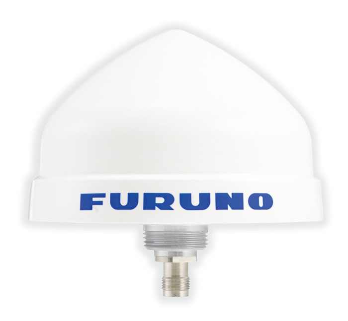
Timing Antenna A multi-GNSS and high-performance device
The AU-500 antenna is suitable for time synchronization applications. It supports all constellations in the L1 and L5 bands, including GPS, QZSS, GLONASS, Galileo, BeiDou, and NavIC. A built-in noise filter eliminates interference in the vicinity of 1.5 GHz caused by 4G/LTE mobile base stations as well as other radio waves that can adversely affect GNSS reception. The antenna is equipped with lightening protection and features a high-quality polymer radome that prevents snow accumulation. It is also waterproof and dustproof in compliance with IP67. The AU-500 achieves the best performance in time accuracy and robustness fundamental in critical infrastructure, when combined with Furuno’s GNSS receiver, GT-100. The antenna will be available this month. Furuno, furuno.com
Timing Module Dual-band and secure for 5G communications
The NEO-F10T offers nanosecond-level timing accuracy, meeting the stringent timing requirements for 5G communications. It is compliant with the u-blox NEO form factor (12.2 mm x 16 mm), allowing space-constrained designs to be realized without the need to compromise on size. The NEO-F10T is the successor to the NEO-M8T module, providing an easy upgrade path to dual-band timing technology. This allows NEO-M8T users to access nanosecond-level timing accuracy and enhanced security. Dual-band technology mitigates ionospheric errors and greatly reduces timing errors, without the need of an external GNSS correction service. Additionally, when within the operational area of a satellite-based augmentation system (SBAS), the NEO-F10T offers the possibility to improve the timing performance by using the ionospheric corrections provided by the SBAS system.
The NEO-F10T supports all four GNSS and L1/L5/E5a configurations, simplifying global deployments. It includes advanced security features such as secure boot, secure interfaces, configuration lock and T-RAIM to provide the highest-level timing integrity and ensure reliable, uninterrupted service. u-blox, u-blox.com
MOBILE
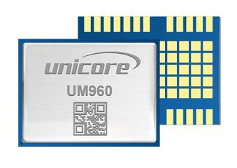
Image: Unicore Communications
GNSS RTK Module A high precision module for multiple applications
The UM960 module can be used for a wide range of applications, such as robotic mowers, deformation monitoring, UAVs, handheld GIS, and more. It features a high position fix rate and provides accurate and reliable GNSS positioning data. The UM960 module supports BDS B1I/B2I/B3I/B1c/B2a, GPS L1/L2/L5, Galileo E1/E5b/E5a, GLONASS G1/G2, and QZSS L1/L2/L5. The module also has 1,408 channels. In addition to its small size, the UM960 features low power consumption — less than 450 mW. The UM960 also supports single point positioning and real-time kinematic (RTK) positioning data output at 20 Hz. Unicore Communications, unicore.eu
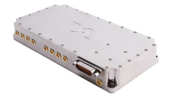
CRPA System A GPS/GNSS anti-jamming system
This system eliminates interference by applying novel beam forming techniques. With an 8-array CRPA antenna, the system can assure the normal operation of a GNSS receiver in the presence of multiple jamming sources. The anti-jam GNSS CRPA system can be deployed using various configurations and operates with civil and military GPS receivers for land, sea, air platforms (including unmanned aerial systems), and fixed installations. The device has an embedded GNSS receiver that supports all satellite constellations. The device is lightweight and compact. It requires minimal integration training and easily integrates into new or legacy platforms. The antenna also offers assured positioning, navigation and timing. Tualcom, tualcom.com
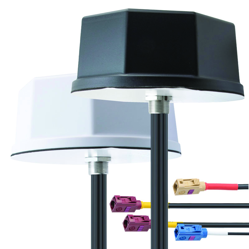
IoT Antennas Rugged and designed to enhance connectivity
KP Performance Antennas’ internet of things (IoT) multiband combination antennas are designed to enhance connectivity for vehicle fleets and base stations. The IoT multiband combination antennas have dedicated ports for cellular, Wi-Fi and GPS bands. They are also indoor and outdoor IP69K rated and can withstand harsh environmental conditions, such as extreme temperatures, water and dust. The antennas are suitable for transportation emergency response and agriculture applications. The IoT multiband combination antennas are in-stock and available now.
KP Performance Antennas, kpperformance.com
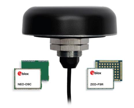
Smart Antennas With integrated technology for centimeter-accuracy
PointPerfect PPP-RTK augmented smart antennas combine the ZED-F9R high precision GNSS and the NEO-D9S L-band receivers from u-blox and Tallysman Accutenna technology. The multi-band (L1/L2 or L1/L5) architecture removes ionospheric errors, and the multi-stage enhanced XF filtering improves noise immunity while relying on the dual-feed Accutenna element to mitigate multi-path signal interference rejection. Some versions of the new smart antenna solutions include an inertial measurement unit (for dead reckoning) and an integrated L-band corrections receiver to ensure operation beyond terrestrial network reach. The PointPerfect GNSS augmentation service is now available in North America, Europe and parts of Asia Pacific. Tallysman Wireless, tallysman.com/u-blox, u-blox.com
SURVEYING & MAPPING
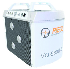
Airborne Laser Scanner Suitable for mapping applications
The compact and lightweight VQ-580 II-S meets the increasing requirements of compact laser scanners for medium- and wide-area mapping as well as for corridor mapping. The successor of the VQ-580 II airborne laser scanner, provides a maximum measurement range of 2.45 m. It can be integrated with gyro-stabilized mounts as well as into the VQX-1 Wing Pod. It features high accuracy ranging based on waveform-lidar technology. The VQ-580 II-S also has a mechanical and electrical interface for inertial measurement unit (IMU)/GNSS integration. RIEGL, rieglusa.com
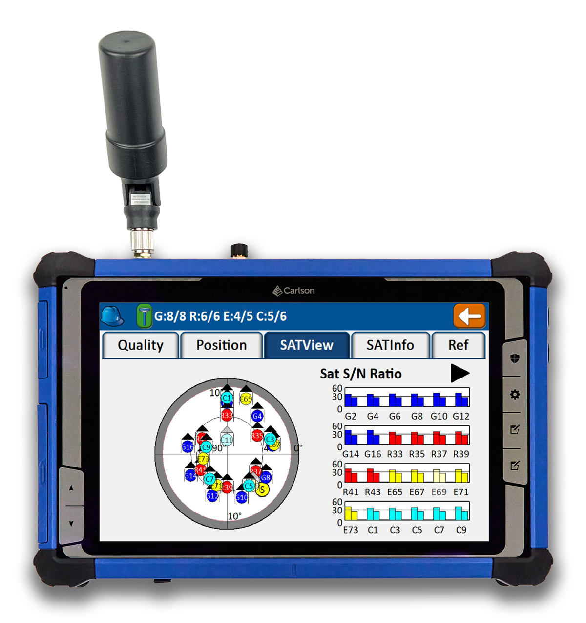
Tablet and GNSS Solution For surveying applications
The RT5 rugged tablet data collector and the RTk5 GNSS solution, which integrate the form factor of the RT5 with real-time kinematic GNSS performance, are suitable for land surveyors, engineers, GIS professionals, and users in need of advanced GNSS positioning with an RTK rover. The RT5 is designed for surveying, stakeouts, construction layout and GIS mapping, and is bundled with Carlson SurvPC — the Windows-based data collection program. The RT5 can run SurvPC with Esri OEM for use in the field. The RTk5 adds an advanced GNSS solution to the RT5, enabling accuracy in a compact, light and versatile package. It comes with a custom-built pole and cradle, a survey-grade antenna, and a small portable helix antenna for handheld GNSS use. Carlson Software, carlsonsw.com
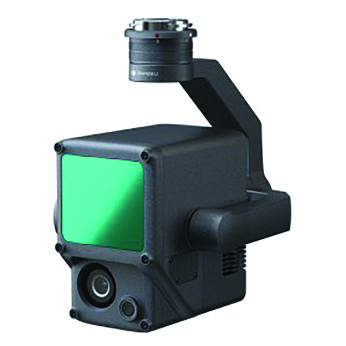
Lidar and RGB Solution Suitable for aerial surveying
The Zenmuse L1 integrates a Livox lidar module, a high-accuracy inertial measurement unit (IMU), and a camera with a 1 in CMOS on a 3-axis stabilized gimbal. When used with Matrice 300 real-time kinematic (RTK) and DJI Terra, the L1 forms a complete solution that gives users real-time 3D data, capturing the details of complex structures and delivering highly accurate reconstructed models. Users can render centimeter-accurate reconstructions with the high-accuracy IMU, a vision sensor for positioning accuracy, and the incorporation of GNSS data. The solution’s IP54 rating allows the L1 to be operated in rainy or foggy environments. The lidar module’s active scanning method enables users to fly at night. DJI Enterprise, enterprise.dji.com
Mapping Platform Real-time, crowd-sourced map data
CityStream Live is a real-time mapping (RTM) platform that enables the mobility industry — including connected vehicles, maps, mobility services, digital twins or smart city applications — to access a continuous stream of crowdsourced road data. This platform provides real-time data on nearly every road across the United States at a reduced cost. Utilizing a crowdsourcing network and artificial intelligence software, CityStream Live offers users and developers a live data feed to increase situational awareness, enhance driving capabilities, increase safety and more. By combining massive data aggregation with real-time data curation, CityStream Live is the first platform to deliver road data streams in real time and at scale, supporting several urban and highway use cases. Nexar, us.getnexar.com
Leica iCON gps 160 (Image: Leica Geosystems)
Smart Antenna Contains features that increase productivity on construction sites
The iCON gps 160 is a versatile solution for various applications. It can be used as a base station, as a rover or for machine guidance. The device is a modernization and enhancement of the successful Leica iCON gps 60, which has been well accepted in the market. The result is a smaller, more compact GNSS antenna with additional features and a larger display for ease of use. The Leica iCON gps 160 is particularly suited to complex construction environments with different GNSS requirements because the ability to switch between the different applications is at the users’ fingertips. Besides checking grade, cut and fill, stakeout points and lines, users can also benefit from using this solution for basic-level GNSS machine guidance. It has an integrated color display, a user-friendly interface, smart setup wizards and an intuitive construction-specific workflow to help contractors get the most out of their investment from day one. Size and weight reductions make the iCON gps 160 easy to handle, while the latest GNSS and communication technologies improve data reception. Leica Geosystems, leica-geosystems.com
UAV
Positioning Solution For UAV delivery applications
The PX-1 RTX is designed for accurate, robust positioning and heading for commercial UAV delivery applications. This solution enables UAV integration companies to add precise positioning capabilities so operators can plan and execute takeoff, navigation and landing tasks as UAV delivery advances to take on more challenging operations. The PX-1 RTX leverages CenterPoint RTX corrections and small, high-performance GNSS-inertial hardware to provide real-time, centimeter-level positioning and accurate inertial-derived true heading measurements. This solution allows operators precise control of UAVs during takeoff and landing to tackle more demanding operations in tight or partially obstructed spaces. It also minimizes operational risks from poor sensor performance or magnetic interference by ensuring greater positioning redundancy, which is especially important as commercial UAV delivery operations venture into difficult urban and suburban environments. Trimble Applanix, applanix.com
Certification Reference Guide A guide for the AAM industry
Business and government leaders, engineers, members of the media and any user with an interest in the future of flight can use the Honeywell State of UAS and UAM Certification Guide to help navigate and communicate the complexities of vehicle certification and operational approval across multiple vehicle segments. Industry professionals can access the living document online at aerospace.honeywell.com/us/en/products-and-services/industry/urban-air-mobility. The certification reference guide summarizes evolving Federal Aviation Administration and European Union Aviation Safety Agency rules across multiple advanced air mobility (AAM) segments. It also links to documents that AAM professionals can reference to better understand detailed certification requirements. Honeywell Aerospace, aerospace.honeywell.com
Image: A2Z Drone Delivery
Delivery UAV Suitable for aerial mapping, UAV inspection, forestry services, search and rescue operations, water sample collection, offshore deliveries, mining, and more
The RDSX Pelican leverages a hybrid vertical takeoff and landing (VTOL) airframe with no control surfaces to combine the reliability and flight stability of a multirotor platform, with the extended range of a fixed-wing craft. With no ailerons, elevator, or rudder, the Pelican’s durable design eliminates common points of failure and extends operational time between maintenance overhauls. Designed to meet the 55 lb takeoff weight limitation for Federal Aviation Administration Part 107 compliance, the Pelican can carry payloads of 5 kg on missions up to 40 km, roundtrip. The Pelican can be optimized for extended range operations or to deliver payloads from altitude with the company’s RDS2 UAV delivery winch. Available in multiple configurations, the RDSX Pelican can be customized for an array of missions. The Pelican enables deliveries from altitude where spinning propellers are kept far from people and property, mitigating consumer privacy concerns of low-flying UAVs while abating intrusive rotor noise. Alternatively, for missions in which the UAV can safely land at its destination, a simple servo-release mechanism can release payloads and expand the Pelican’s payload capacity.
A2Z Drone Delivery, a2zdronedelivery.com
UAS Suitable for mapping applications
The Trinity Pro UAS features Quantum-Skynode autopilot, using a Linux mission computer. This provides additional onboard computing power, increased internal storage, versatility and interoperability. Included in the Trinity Pro system is QBase 3D operations software. As the Trinity Pro is built on the Trinity F90+ UAS, its new capabilities include planning functions for missions requiring takeoff and landing at different locations, allowing for efficient and safe long corridor flights and beyond visual line of sight operations. The platform also incorporates advanced self-diagnostics to ensure safe operation. The UAS now includes an enhanced terrain- following system. Additionally, improvements to trigger point calculations results in improved image overlap and higher data quality. The Trinity Pro features automatic wind simulation for crash avoidance in bad weather and a linear approach for landing. The UAS is equipped with a downfacing lidar scanner that provides highly accurate ground avoidance and landing control. The system features USB-C ports for faster data transfer. The Trinity Pro is protected against dust and water damage and features increased wind limits of up to 14 m/s in cruise mode and 11 m/s during hover.
Quantum Systems, quantum-systems.com
Inertial Labs has been awarded a General Services Administration (GSA) Multiple Award Schedule (MAS) contract. With the contract in place, federal, state and local government agencies will gain streamlined access to Inertial Labs’ products and services.
The GSA Schedule contract aims to simplify the procurement process, allowing government entities to acquire solutions for navigation, positioning and motion-sensing systems. The products and services offered by Inertial Labs cater to a wide range of applications, including unmanned systems, defense, aerospace, transportation and more.
“We are extremely proud to have been awarded a GSA Schedule contract,” Jamie Marraccini, CEO of Inertial Labs said. “We look forward to supporting the critical missions of our government partners and providing them with the advanced technology they require.”
Russia released a large number of attack UAVs targeting Kyiv, Ukraine, in the early morning of June 20, reported the New York Times. The UAV attack on Kyiv was the first in several weeks after Russian forces repeatedly targeted the city throughout May.
The air-raid alert started in Kyiv around 3 a.m. local time and lasted for more than three hours, as UAVs came in waves from all directions. According to the New York Times, Ukraine’s Air Force said Russian forces had launched 35 Iranian-made UAVs around Kyiv.
Ukraine air defenses shot down 32 of the UAVs, which included more than a dozen near the capital.
On June 21, Reuters reported that Russian air defense had downed three UAVs in the Moscow region in what they believe to have been a Ukrainian attack. The Defence Ministry stated that Russian forces had used electronic jamming, which caused the UAVs to lose control and crash.
Reuters could not independently verify details of this incident or who had launched the UAV attack.
Borderless Capital has invested in the Global Earth Observation Decentralized Network (GEODNET) Foundation via its EdgeFi Fund, the first web3 investment fund focused on decentralized physical infrastructure networks. The investment will be utilized to strengthen GEODNET’s mission with emphasis on growing reliable global coverage and a mobile operating-system software development kit.
The GEODNET Foundation manages the open network protocol and promotes service usage within the traditional GNSS and IoT industry.
With more than 3,000 reference stations online in every major continent, the real-time GEODNET network is the largest decentralized geospatial reference network. The GEODNET location service offers reliable centimeter-accurate location for applications such as UAVs, robotic vehicles, augmented reality, and IoT/mobile devices.
GEODNET station data is actively utilized by companies such as Hemisphere GNSS, Quectel Wireless Solutions and Rock Robotic. GEODNET stations owners set up a satellite mining station and are rewarded with the project’s native polygon token, GEOD.
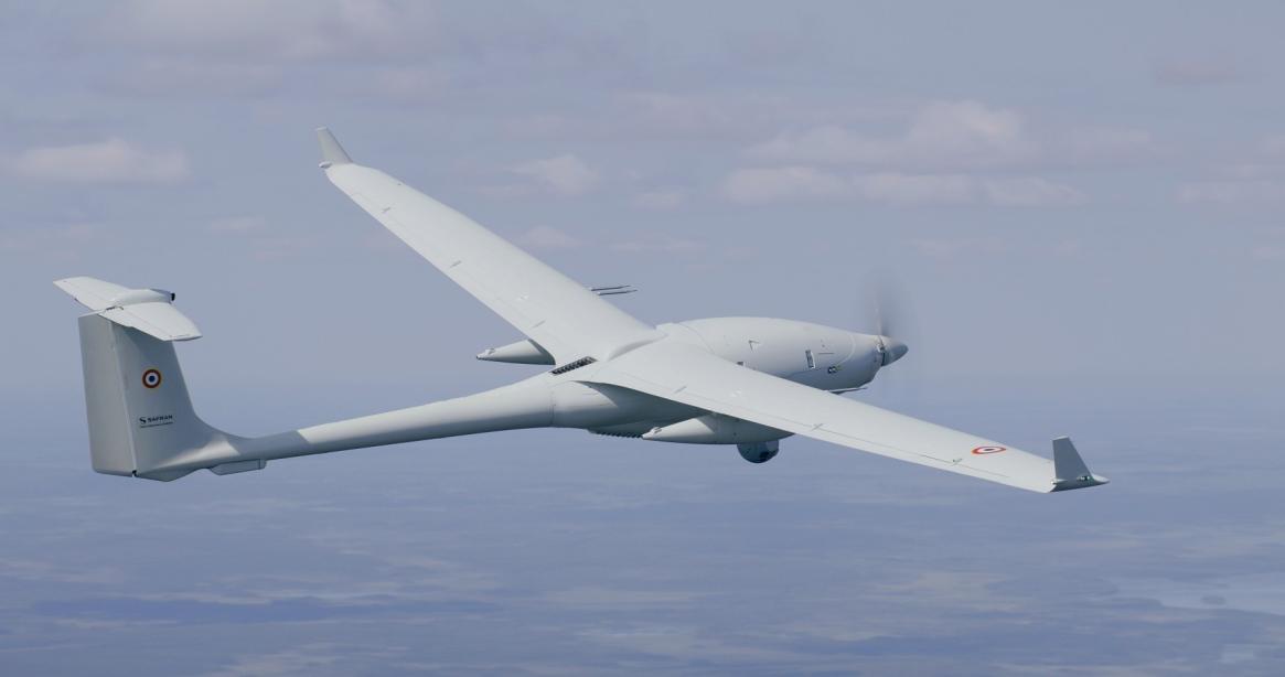
Safran Electronics & Defense has been selected by the Greek army (officially called the Hellenic Armed Forces) to enhance its tactical UAV fleet by incorporating four Patroller tactical UAVs. NATO‘s Support and Procurement Agency (NSPA) facilitated the contract on behalf of the Greek army during the Paris Air Show 2023.
Set to be implemented by 2024, the Patrollers will operate alongside Greece’s current fleet of 16 Sperwer tactical unmanned aircraft from Sagem, a French defense company. Greece also requested three ground stations.
The Patroller achieved a milestone in February 2023 when it became the first tactical UAV system officially certified to NATO airworthiness standard STANAG 4671.
Equipped with multiple sensors designed for intelligence missions, the Patroller UAV serves the needs of armies and homeland security forces. With an autonomy of more than 15 hours, the Patroller UAV also features a high payload capacity — allowing the integration of various specialized sensors and weapons, which enables it to meet diverse operational requirements.
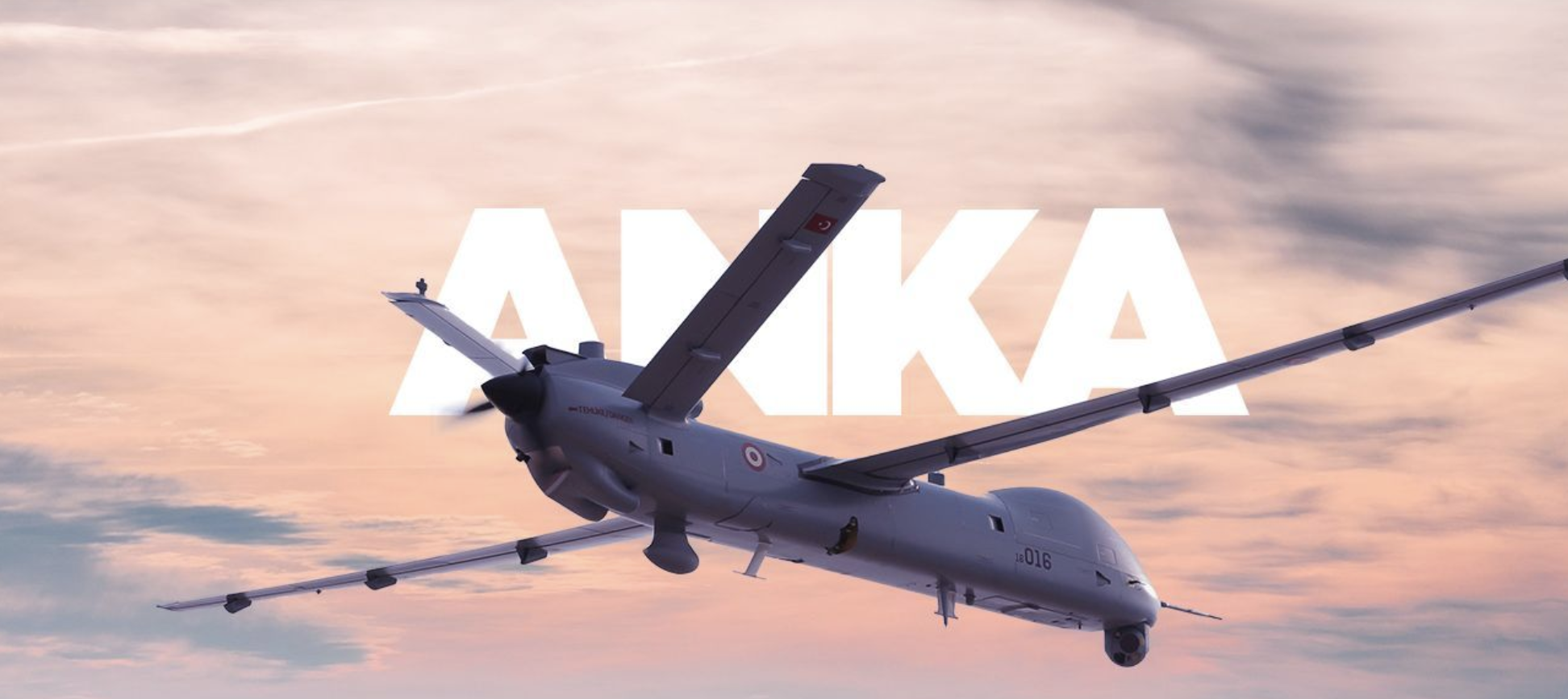
Turkish Aerospace Industries (TAI) will begin distributing Anka, its medium-altitude long-endurance class UAVs, to several countries this year, reported the Daily Sabah. Chief Product Engineer, Ziya Dogan, added that an export deal was signed with another country for the delivery in 2024, but did not mention anything specific.
The Anka UAV has more than 30 hours of endurance and a payload capacity of more than 350 kg. It is designed primarily for the Turkish Air Force.
Anka performs day and night all-weather reconnaissance, target detection and identification and intelligence missions. The UAV also features autonomous flight capability, including automatic takeoff and landing.