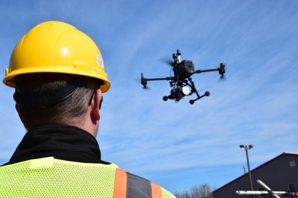
AllTerra, a Trimble geospatial dealer, has joined the GeoCue distribution network. AllTerra will provide GeoCue’s full line of TrueView 3D imaging sensors, a UAV, lidar and photogrammetry solution. The technology enables fast, automated generation of true 3D colorized point clouds, oblique imagery and orthophotos from a single UAV flight.
AllTerra is also authorized to sell LP360 lidar and photogrammetry 3D point cloud software. LP360, an advanced desktop lidar software package, simplifies extracting information and generating deliverables in a GIS environment.
The company offers Trimble and Spectra Precision solutions in surveying, MGIS, marine, forensics, mobile mapping and infrastructure. Alltera also offers mobile/airborne lidar and photogrammetry solutions from GeoCue and Microdrones.
Orolia, a Safran Electronics and Defense company, announced its Skydel GNSS simulation engine will support Galileo Open Service Navigation Message Authentication (OSNMA) simulation in the form of two-phased and separate solutions. These solutions will be available to users who have purchased simulation access to the Galileo constellation, which will be available in the next few months.
OSNMA is an emerging authentication service that allows GNSS receivers to verify the authenticity of received data to protect against potential jamming or spoofing attacks that can result in service disruptions, denial incidents and more.
The first solution is well-suited for most receiver integrators that want to test the OSNMA capability of a GNSS receiver with the official test vectors from the European Union Agency for the Space Programme (EUSPA). This solution will support the available official test vectors sample data, which supports the verification of OSNMA functionality implementation.
The second option will provide full flexibility in the configuration of the scenario as well as the OSNMA authentication parameters. It will be suitable for advanced users that test receivers in a wide range of edge and corner cases.
Available later in 2023, this phase will include the following elements in Skydel: authentication of the Galileo E1 OS navigation message, a new Skydel engine supporting OSNMA SIS ICD 1.0, support for the timed efficient stream loss-tolerant authentication protocol, and useful crypto material for running user-programmable simulation test scenarios.
This feature will be ready for future software updates in accordance with the next phases recommended by EUPSA.
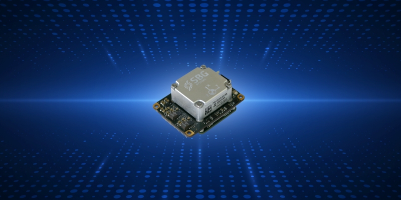
The Quanta Micro inertial navigation system (INS) has been named a finalist for the AUVSI XCELLENCE Awards — “Enabling Components & Peripherals.” The winners will be announced during an awards ceremony at AUVSI XPONENTIAL 2023 at the Colorado Convention Center in Denver.
The AUVSI XCELLENCE Awards honor innovators who demonstrate commitment to advancing technology, leading and promoting safe operations and developing programs that use unmanned systems to improve the human conditions.
Quanta Micro is a GNSS-aided INS designed for space-constrained applications. Quanta Micro leverages a survey-grade inertial measurement unit (IMU) for heading performance in single antenna applications, and temperature calibration from -40° C to +85° C. An optional secondary antenna enables fast heading initialization in low dynamic applications.
“This year, XPONENTIAL is all about designing a shared plan for the future of autonomy,” Brian Wynne, president and CEO of AUVSI, said. “There’s no better place to announce the 2023 XCELLENCE award finalists.”
The Joint Counter-Small Unmanned Aircraft Systems office successfully tested BAE Systems’ APKWS laser-guidance kits in a counter-unmanned aircraft systems (C-UAS) mission.
During the Department of Defense-led exercise at Yuma Proving Ground, Arizona, the 70 mm APKWS-guided rockets demonstrated 100% effectiveness when fired against 25-to-50-pound UAVs traveling at more than 100 miles an hour. The APKWS C-UAS solution is platform agnostic, permitting multiple options to accelerate fielding.
APKWS transforms unguided rockets into smart munitions for precision strikes on soft and lightly armored targets. An updated proximity fuse for the standard M151 warhead enables laser-guidance kits to target Class-2 and Class-3 UAVs, which typically weigh less than 55 lbs. The fuse retains the legacy point denotation capability for flexibility of the weapon in the field.
APKWS now enables rockets to engage and destroy UAVs at a fraction of the cost of existing C-UAS systems with unprecedented precision.
The kits are available to all U.S. armed forces, as well as allies via foreign military sales.
NV5 Geospatial has mapped more than 26 million acres of North America’s shoreline and riverine environments across more than 200 projects.
The projects have spanned from the Nuyakuk River in Alaska, Lake Tahoe in California, the Rio Grande in Texas, the entire coasts of South and North Carolina, the Achigan River in Quebec, Chesapeake Bay in Maryland and the Florida Keys.
In 2022, the company mapped and acquired topobathymetric lidar data for 14 projects including the Yellowstone River, Wyoming; Hells Canyon, Indiana; Revillagigedo Island, Alaska and Iles de la Madeleine in Quebec.
NV5 Geospatial first mapped these environments in 2012 using high-resolution bathymetric lidar and natural color imagery. The company mapped 34,051 acres of shoreline along the Sandy River, located in northwestern Oregon, to study the ever-changing basin geomorphology.
NV5 has also signed a two-year contract with the National Geodetic Survey of the National Oceanic and Atmospheric Administration to provide topobathymetric lidar, 4-band imagery and mapping of 3,115 sq miles of the Maine shoreline.
“For a decade we have been helping local, state, and federal government agencies as well as commercial and private entities gain the insights they need to solve some of their most challenging nearshore and riverine projects through our mapping technologies including topobathymetric lidar,” Kurt Allen, vice president of NV5 Geospatial, said. “Whether it be mapping the shoreline after a hurricane, updating the national shoreline, assisting water boards with flood planning, or hundreds of other possible use cases, we are constantly improving our technology and scalability to always be at the ready for our customers.”
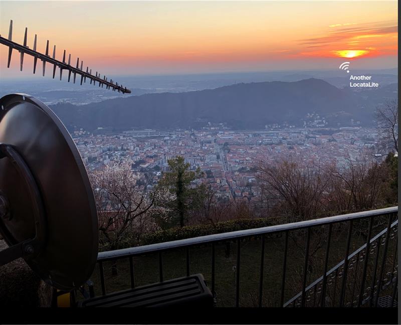
Locata dish antenna pointed back to EU’s JRC, 44 km away, just under the setting sun. The Yagi antenna above is pointed to a cell tower in Como and used to connect the system for remote control and data logging. Image: Locata
A new European Commission (EC) Technical Report, published after exhaustive and completely independent testing of several candidate A-PNT (Alternative Positioning, Navigation, and Timing) technologies, confirms that Locata has demonstrated positioning and timing performance across every test environment, delivering:
cm-level positioning accuracy in all tests, indoor and outdoor, under static and kinematic conditions
picosecond-level time transfer using Locata’s proprietary TimeLoc technology, over multiple media types including RF over distances of more than 105 kilometres and over fibreoptic and/or coaxial cables, without requiring satellites or atomic clocks.
The rigorous scientific test campaign was conducted over a period of eight months by experts from the EC’s Joint Research Centre (JRC) in Italy. Its purpose was to establish the foundations for European navigation and timing policy, including the upcoming European radio navigation plan, in the context of growing concerns about the single-point-of-failure that GPS and other Global Navigation Satellite Systems (GNSS) pose.
According to Locata, their validated capabilities promise to open previously unattainable, satellite-free A-PNT performance for autonomous vehicles, logistics, indoor positioning, critical national infrastructure, and aviation, as well as better levels of synchronization to improve mobile phone and digital data networks.
Locata’s products have been deployed commercially for a decade, delivering cm-level positioning (via sales and IP licenses) to globally recognized partners, including systems now certified for safety-of-life level operation of autonomous vehicles. Prominent government customers include NASA and the United States Air Force, which runs a large Locata network that covers more than 6,500 sq km for aviation use when GPS is being jammed or spoofed.
This performance evaluation assessment was run under a globally-open tender launched by the EC’s Directorate-General for Defence Industry and Space (DEFIS). The tender sought applications from around the world, from every potential candidate claiming they could provide “an alternative to GNSS-based PNT.” More than 30 companies applied, and this number was then down-selected by an expert panel to the seven technologies that were, in the end, independently evaluated. Locata was the only technology that was granted two contract slots, and the only technology that completed every timing and positioning test, in every indoor and outdoor environment, sought by the EU.
CHC Navigation has released the TG63, a 3D Grade Control System designed for motor graders.
With a tightly coupled dual-GNSS positioning system and inertial sensor, the TG63 provides reliable 3D positioning and heading to ensure accuracy of the grader blade within ±2 cm.
The TG63 is designed to withstand the harsh environment of construction sites and supports multiple applications, including real-time kinematic networked transport of RTCM via internet protocol and ultra-high frequency base stations.
In addition, GradeNav software, operating on a 10.1 in industrial display, supports standard AutoCAD DXF design files to manage multiple grading operations, including surfaces, slopes, TINs and road features.
Leica Geosystems, part of Hexagon, has launched the Leica HawkEye-5, a new high-performance airborne bathymetric lidar solution for deep water surveying.
Leica’s HawkEye-5 increases survey efficiency by up to 25% compared to previous generations. The technology expands the capabilities of the Leica Chiroptera-5 bathymetric lidar system, enhancing the productivity of applications such as nautical charting, environmental monitoring, and maritime surveillance in deep waters.
The technology is designed to fit the Leica PAV100 gyro-stabilized mount, which isolates the sensor from unwanted aircraft movements — resulting in consistent data density and more efficient area coverage.
The HawkEye-5 combined with the Chiroptera-5 features three lidar sensors, one four-band camera, and a QC camera to collect data from the seabed to land.
The Lidar Survey Studio software suite provides full waveform analysis, automatic data classification and advanced turbid water enhancement to support multiple applications.
Septentrio, a leader in high-precision GNSS positioning solutions, has launched the Agnostic Corrections Partner Program.
The program facilitates the use of Septentrio receivers with high-accuracy services that provide varying levels of accuracy, coverage and delivery methods. This also allows users to select the service that suits specific applications and business models.
The Agnostic Correction Partner Program, which includes Polaris from Point One, Skylark from Swift Navigation, and PointPerfect from u-blox, provides documentation for the use of Septentrio receivers with these high-accuracy services.
Agnostic GNSS corrections refer to correction services that are not specific to a particular GNSS receiver or device. It provides correction data that can be used by any receiver that can process the correction signal. Agnostic corrections are useful in situations where multiple types of GNSS receivers are being used, such as in a large-scale surveying project or in a fleet of vehicles that use different types of navigation systems.
Thales Alenia Space, along with Viettel and MKE, have been selected by Vinamarine to provide Vietnam with a MEOLUT Next ground station. MEOLUT Next will operate as a part of the COSPAS-SARSAT global medium orbit search-and-rescue (SAR) network.
The SAR solution will enable the detection and location of distress signals from COSPAS-SARSAT beacons on land, in the air, and at sea over a radius of 2,500 km around Haiphong, Vietnam, mainly using signals from Galileo.
Thales Alenia Space’s MEOLUT Next solution employs a phased array antenna and can track more than 30 satellites, which enhances distress beacon detection and expands coverage. The solution can detect and locate distress signals from more than 5,000 km away.
MEOLUT Next is used by other COSPAS-SARSAT users including Canada, the United States, France, the European Union, Togo and Thailand.
“Seen & Heard” is a monthly feature of GPS World, traveling the world to capture interesting and unusual news stories involving the GNSS/PNT industry.
Image: Reviver
Digital license plates gone wrong
A security research team has gained administrative access to Reviver, the only company in California that sells digital license plates, which has allowed them to track the physical location of all of Reviver’s customers. With this vulnerability, anyone could remotely update, track and delete someone’s Reviver plate. The access also enabled the researchers to change a section of the text at the bottom of the plate, designed for personalized messages, to anything they want, according to Vice.com. California launched the option to buy a digital license plate in October 2022, and Reviver has since addressed the license plates’ security vulnerability.
Image: David Peperkamp/iStock / Getty Images Plus/ Getty Images)
Bill makes secret tracking illegal
Indiana state legislators have filed a bill that would make tracking someone with a GPS-based device without their knowledge a crime, reported WTHR of Indianapolis. The bill is in response to the growing number of criminal cases involving Apple AirTags and other GPS-based tracking devices. Tracking someone secretly is not currently a crime in Indiana; however, laws vary from state to state. Under the proposed bill, the penalty would be increased from a Class C misdemeanor to a Class A misdemeanor if the person tracked is under a protective order. The penalty could be enhanced for someone convicted of using a tracking device when committing a felony. Similar incidents are on the rise around the United States involving the use of AirTags and other tracking devices for criminal purposes.
On New Year’s Day, six rockets were launched from a United States-made Himars rocket system at a vocational college in Ukraine, killing at least 89 Russian soldiers. Russia is blaming this on illegal cellphone usage by Russian soldiers, defying a ban. Ukrainian officials say 400 Russian soldiers were killed and another 300 were wounded, contradicting Russia’s report. However, this is the largest number of deaths Russia has acknowledged during the war. Russia says that the obvious cause of the attack was the use of mobile phones, as the enemy was able to locate and determine the troops’ coordinates for the strike. Two of the rockets were shot down before reaching Makiivka in the occupied Donetsk area of Ukraine.
Researchers at the Department of Marine Geology and Geophysics at the Cochin University of Science and Technology in Kochi, India, say that heavy rainfall can be detected more than six hours in advance using GPS signals, reported The Hindu. During rainy seasons, as GPS signals pass through the atmosphere, how much they are delayed depends on the amount of water vapor present. By using continuous GPS signals and rainfall data collected in Thiruvananthapuram, the study showed that any heavy rainfall could be detected using this delay.
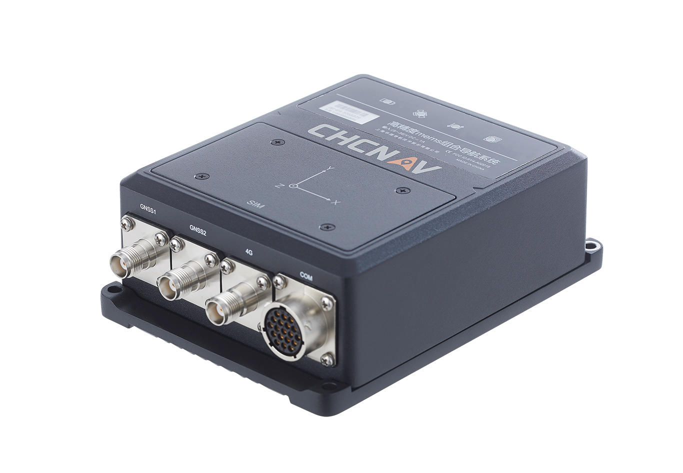
The CHCNAV CGI-610 GNSS/INS sensor is an advanced dual-antenna receiver designed for reliable and accurate navigation and positioning in challenging terrestrial, marine or airborne applications.
Designed to meet the needs of 3D positioning and autonomous vehicle guidance applications, it provides high performance in urban canyons and other harsh environments where GNSS signals are lost or degraded. Incorporating the latest GNSS technology and an industrial-grade inertial measurement unit, the sensor delivers accurate hybrid position, attitude and velocity data up to 100 Hz, driven by CHCNAV algorithms.
Its rugged and lightweight package ensures uninterrupted performance and meets high protection standards.