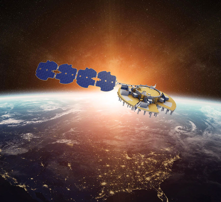
PlantiQ — an atmospheric observing systems company — will begin daily delivery of its signal to noise ratio GNSS-radio occultation (RO) data to the National Oceanic Atmospheric Administration (NOAA) under the NOAA’s IDIQ-2 operational Delivery Order-2.
The NOAA has allocated $59.6 million over the next five years to use commercial satellite data to achieve high-quality weather forecasting and atmospheric research.
“By incorporating PlanetiQ’s commercial high quality GNSS-RO data, coupled with our deep understanding of RO technology, NOAA will have the information to significantly improve short and medium-range weather forecasts, and provide essential insights to enhance climate change research for the government, military and the private sector,” Ira Scharf, PlanetiQ CEO, said.
PlanetiQ supplies GNSS-RO data to NOAA from its growing constellation of satellites, which has become a critical part of the global observing system.
The U.S. Air Force Research Laboratory has pushed back the launch of the Navigation Technology Satellite-3 (NTS-3) until spring 2024 as the debut of the Vulcan Centaur rocket from the United Launch Alliance (ULA) — that NTS-3 was set to be launched on — has been delayed, reported Defense News.
NTS-3 was scheduled to launch later this year aboard and would remain in a near-geosynchronous orbit for an inaugural year of testing. The experimental satellite aims to shape the future of U.S. positioning, navigation and timing capabilities and to help U.S. forces to operate in GPS-denied environments and areas prone to spoofing.
According to Defense News, ULA delayed the debut of the Vulcan Centaur rocket as it is incorporating a fix to a testing anomaly, which was discovered in March.
NTS-3 minimizes the impacts of GPS jamming through rapidly reprogrammable signal waveforms, frequency agility and increased signal strength. Its embedded software and firmware are reprogrammable on-orbit.
When paired with reprogrammable receivers, the U.S. Air Force and U.S. Space Force can react in real time as threats evolve on the battlefield. In addition, NTS-3 has enhanced processors to support more complex signals.
In January, L3Harris delivered the NTS-3 vehicle to Kirtland Air Force Base, New Mexico, to prepare the satellite for launch. The Air Force Research Laboratory and L3Harris are working together to complete space vehicle testing, as well as to launch vehicle integration and enterprise integration to confirm compatibility between the control segment, ground receivers and the satellite vehicle.
More than 350 UAVs were lost during a practice light display show in Melbourne, Australia, on July 14, ahead of a scheduled performance for the opening of the women’s World Cup.
The UAVs appeared to stop mid-show and plummet into the Yarra River. Divers have since fished out hundreds of the UAVs.
According to the Resilient Navigation and Timing Foundation, the likely cause of the mass-crash was caused by interference with GPS signals. This incident shows that having multiple and robust navigation sources is important for safe UAV operation.
Turf Tank — inventor of an autonomous, GPS-guided line marking robot, built and designed specifically for painting athletic fields — has released the Turf Tank Two.
This robot features dual motor drives for enhanced torque and optimized wheels for traction. On its own and controlled through a tablet, the Turf Tank Two can paint a regulation 11 versus 11 soccer field in less than 24 minutes, a baseball or softball field in less than 11 minutes, a lacrosse field in less than 26 minutes, and a full 100-yard football field in less than 3.5 hours. It can also paint logos and numbers.
The Turf Tank Two is 43 in x 33 in x 22.5 in. It weighs 123 lbs, without paint or the battery installed, and it can hold 5.5 gallons of paint.
Enhanced features of the Turf Tank Two also include a revamped sprayer module and advanced control features — including a redesigned front panel that has convenient pause/resume options with LED indicators displaying the robot’s status and a start/stop sprayer button. An LED indicator also comes on the battery.
Turf Tank Two is both eco- and environmentally friendly, the company says. Its batteries are rechargeable and because of the robot’s precision and accuracy, it uses significantly less paint and eliminates the overspray that is common with either painting by hand or using many of the older paint machines and sprayers in the market.
Guided by GPS, the Turf Tank Two uses a base station to ensure its accuracy. The base station becomes a fixed point from which the robot knows to paint the same exact field every time it is dispatched. The base station communicates with satellites to ensure the accuracy of the field dimensions.
Once the user installs a particular field layout, it becomes a simple drag and drop process through the tablet. From there, it’s as simple as setting one to four points on each field to give the robot a starting point, and then the robot will paint that field autonomously.
The Federal Aviation Administration (FAA) has released an implementation plan outlining the steps it and others will need to take to enable advanced air mobility (AAM) operations safely. The plan, called Innovate28, includes various components and a timeline for their implementation to hopefully be completed by 2028.
This plan serves as a foundation for making entry into service routine and predictable by maximizing the use of existing procedures and infrastructure. It addresses how the agency and partners will certify aircraft and pilots, manage airspace access, ensure pilot training, develop infrastructure, maintain security and engage communities.
The plan also includes a planning guide that can be applied to any site, laying out key integration objectives and sequences.
Among the entities that play a role in this plan include: the FAA; the advanced air mobility industry; labor partners, NASA; United States Department of Homeland Security; United States Department of Energy; power industry; and state, local and tribal communities.
Pilots will be able to fly the new advanced mobility aircraft to and from multiple locations at the sites, using predetermined flight schedules with pilots aboard.
Advanced air mobility aircraft likely will operate up to 4,000 feet altitude in urban and metropolitan areas, using existing or modified low altitude visual flight rules (VFR) routes where possible within controlled Class B and C airspace around major airports.
Infrastructure
Operators, manufacturers, state and local governments, and other stakeholders will be responsible for planning, developing and enabling heliport/vertiport infrastructure.
Advanced air mobility will initially operate at existing heliports, commercial service airports and general aviation airports. Modifications may be necessary to install charging stations, parking zones and taxiing space.
Power Grid
The electrical power grid may require upgrades to serve advanced air mobility operations.
The FAA has an interagency agreement with the Department of Energy’s National Renewable Energy Lab to determine how aircraft electrification affects a vertiport, heliport or airport’s electrical grid.
Security
The Department of Homeland Security will determine what type of security is necessary.
The Transportation Security Administration and FAA are evaluating the need for expanded cybersecurity requirements due to the use of advanced technology and operational protocols.
Environment
The FAA will consider the environmental impacts of advanced air mobility operations, including factors such as noise, air quality, visual disturbances and disruption to wildlife.
Community Engagement
The FAA will engage with airports, and local, state, and tribal communities to better understand community concerns about advanced air mobility operations, including noise and mitigations.
Many other stakeholders, such as advanced air mobility operators and airport and vertiport operators will have important roles in community engagement.
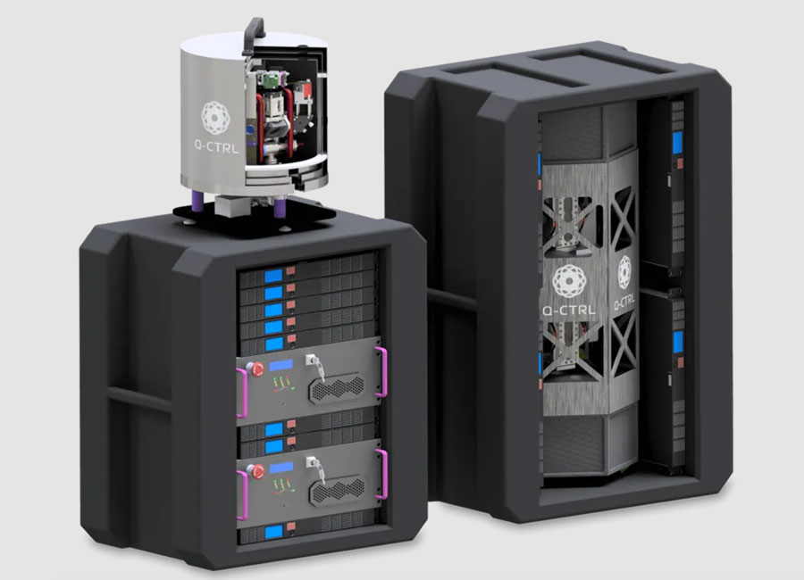
Q-CTRL, a quantum technologies company, has partnered with Australia’s Department of Defence to develop quantum sensors that will deliver quantum-assured navigation capability for military platforms.
The company’s partnership is a multi-year effort to field-deploy and validate miniaturized systems on defense platforms. It represents one of the first international partnerships between government and the private sector to apply quantum technology in real defense settings.
Quantum-enhanced navigation technology enables accurate vehicle positioning over long periods when GPS is unavailable. In air, space, underground and underwater, quantum navigation enables long-endurance missions that are otherwise impossible and is resilient against jamming or spoofing.
Q-CTRL announced its quantum sensing division in 2022. The company has worked with partners including Advanced Navigation and the Australian Army to demonstrate and deliver its technology for applications that include remote drone detection.
The United Kingdom’s first fully electric self-driving bus began service on public roads from the Didcot Parkway railway station in June, reported the BBC.
First Bus, the UK’s largest bus operator, said the bus’ radar, lidar and artificial intelligence technology could safely steer, accelerate and brake without human intervention.
While the bus is fully autonomous, it does have a safety driver who is able to override operations if needed.
The 15-seat bus makes a six-mile loop from the station to Milton Park in Oxfordshire, UK, and runs six days a week every 40 minutes.
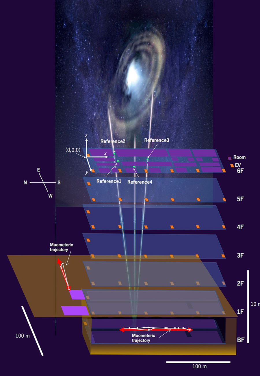
By using muon-detecting ground stations synchronized with an underground muon-detecting receiver, researchers at the University of Tokyo were able to calculate a receiver’s position in the basement of a six-story building without requiring GPS signals. The muometric positioning system (muPS) team was led by Hiroyuki Tanaka.
As GNSS cannot penetrate rock or water, muon technology could be used in future search and rescue efforts, to monitor undersea volcanoes, and guide autonomous vehicles underground and underwater. Muons are fast, subatomic-sized particles that have been used to wirelessly navigate underground.
MuPS was first created to help detect seafloor changes caused by underwater volcanoes or tectonic movement. It uses four muon-detecting reference stations above ground to provide coordinates for a muon-detecting receiver underground.
Early versions of muPS required the receiver to be connected to a ground station by a wire. However, new research uses high-precision quartz clocks to synchronize the ground stations with the receiver. The four parameters provided by the reference stations plus the synchronized clocks used to measure the muons’ “time-of-flight” enables the receiver’s coordinates to be determined. This system is called the muometric wireless navigation system (MuWNS).
To test the navigation ability of MuWNS, reference detectors were placed on the sixth floor of a building while a researcher took a receiver detector to the basement floor. They slowly walked up and down the corridors of the basement while holding the receiver. Rather than navigating in real time, measurements were taken and used to calculate their route and confirm the path they had taken.
OEM products are vital to many industries. Companies such as Septentrio and SBG Systems design and produce a variety of OEM devices for many different applications. (Image: sankai/E+/Getty Images)
OEM devices are an integral part of many applications requiring precise positioning technology. As the OEM market grows and performance requirements become more demanding, it is critical for OEM devices to be reliable, accurate, and easy to integrate. From precision agriculture, to surveying and mapping, to UAV missions, there are OEM devices on the market suitable for demanding applications.
Survey and Map Like a Pro
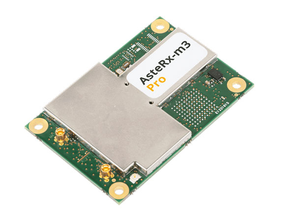
Surveying and mapping is one area in which OEM boards are embedded deep in many products. Septentrio designs and manufactures multi-frequency, multi-constellation, GPS/GNSS positioning technology and offers a variety of OEM products for demanding applications.
Image: Septentrio
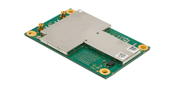
The AsteRx-m3 Pro is an ultra-low power GNSS rover receiver. It is compact and high-performance, making it suitable for integration into high-precision industrial applications. It incorporates multi-frequency, multi-constellation GNSS technology as well as anti-jamming algorithms for availability and reliability. The AsteRx-m3 Pro features AIM+ advanced anti-jamming and anti-spoofing technology as a part of Septentrio’s GNSS+ Technology Suite.
This receiver is designed for rover (mobile) applications, making it an easy-to-integrate solution for any kinematic application where reliable high-accuracy positioning is needed. It is available in single or dual antenna mode, for high quality heading and pitch, or heading and roll information.
GNSS heading is available directly from initialization and removes reliance on vehicle dynamics or magnetic sensors. This is an optional feature.
“Septentrio OEM receivers come in a variety of form factors, from compact modules to credit-card boards,” Danilo Sabbatini, OEM product manager at Septentrio, stated. “Our multi-frequency OEM receiver portfolio includes products that fit various user needs from purely rover GNSS high accuracy positioning to heading receivers, as well as GNSS/INS boards for inertial navigation or mapping.”
Image: Septentrio
Aside from surveying and mapping, the AsteRx-m3 Pro is suitable for assured position, navigation and timing (PNT), autonomous vehicles, precision agriculture, logistics and port operations, mining and construction, rail, robotics, space and UAV applications.
Plowing the Way
The increase in demand for food due to population growth challenges farmers to increase production. To help them do this, Septentrio is working with manufacturers of agricultural machinery to enable them to achieve centimeter-level positioning accuracy.
Image: Septentrio
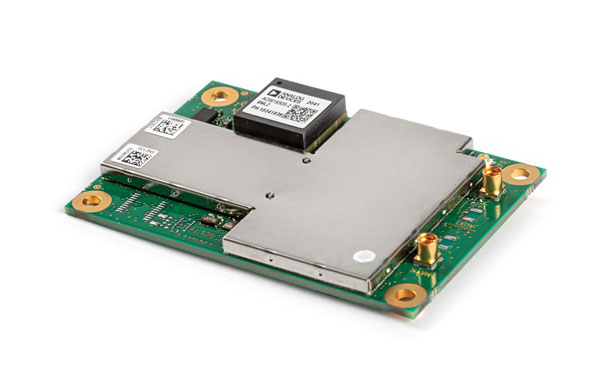
The AsteRx-i3 D Pro is a ready-to-use GNSS/INS single-board receiver that delivers reliable centimeter-level positioning combined with 3D orientation (heading, pitch and roll) in demanding environments. Its inertial sensor provides orientation and positional dead-reckoning, making it suitable for systems that require continuous positioning even during short GNSS outages. It provides reliable and accurate positioning by enhancing GNSS with an inertial measurement unit (IMU).
Image: Septentrio
The AsteRx-i3 D Pro is quad-constellation and multi-frequency. It provides all-in-view real-time kinematic positioning and features AIM+ unique interference monitoring and mitigation system and other advanced GNSS+ algorithms.
Like the AsteRx-m3 Pro, the AsteRx-i3 D Pro is also suitable for assured PNT, autonomous vehicles, logistics and port operations, mining and construction, rail, robotics, space, survey and mapping, and UAV applications.
For more information about Septentrio’s OEM boards, click here.
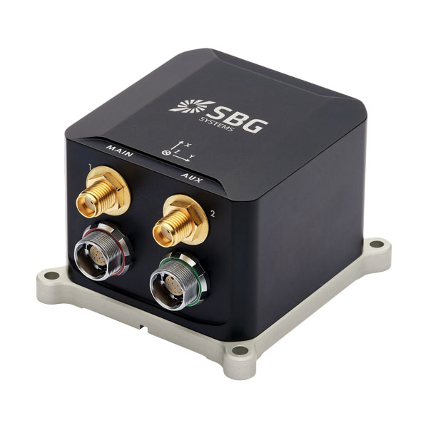
Flying High
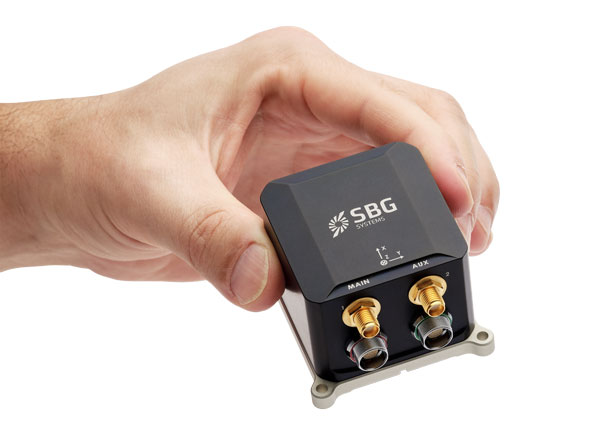
SBG Systems has released Ekinox Micro, a compact and rugged high-performance inertial navigation solution designed to deliver accuracy in challenging environments. Ekinox Micro combines a high-performance MEMS tactical inertial sensor with a quad-constellation, dual-antenna GNSS receiver, making it suitable for mission-critical applications.
Image: SBG Systems
GPS World caught up with Yoann Plénet, head of products at SBG Systems, at AUSVI XPONENTIAL in May. He elaborated on Ekinox Micro’s key markets and features.
“This is Quanta Micro in a box with the same performance and the same benefits that you get [with the Quanta Micro]: inertia, enhanced GNSS, and complement[ing] the GNSS,” Yoann said. “At the same time, we are targeting very rough environments, especially larger drones which are most likely military ones. So, [Ekinox Micro] is a very rugged product.”
Ekinox Micro includes pre-configured motion profiles for land, air and marine applications, enabling the sensor and algorithms to be tuned for maximum performance in any condition. The device is designed for ease of use and integration, with simple connectors, a web configuration interface, a datalogger, Ethernet connectivity, a PTP server, a REST API for configuration, and multiple input and output formats.
Image: SBG Systems
Ekinox Micro is compatible with real-time kinematic (RTK) and based on a tactical 0.8°/h class inertial measurement unit calibrated across the entire operating temperature range. It features accuracy roll/pitch of 0.015°, accuracy heading of 0.035°, and accuracy position of 1.2 m without any corrections or 1 cm in RTK.
Yoann also said that with the rise of jamming and spoofing, Ekinox Micro is designed with enhanced technology to mitigate those threats.
“Jamming and spoofing is ongoing and is an issue for more and more of our clients. So, we have worked a lot — and that is something that is beneficial to all of our product ranges — on enhancing our algorithms and our technology so we can better detect jamming and spoofing than we could before,” Yoann said.
Ekinox Micro will be commercially available in September. Click here for more information on Ekinox Micro.
Bonus Device
Image: Septentrio
The Septentrio mosaic-X5 is a multi-band, multi-constellation GNSS receiver in a low power surface mount module with a wide array of interfaces. It is designed for mass market applications such as robotics and autonomous systems — capable of tracking all GNSS constellations, supporting current and future signals.
The mosaic-X5 has an update rate of 100 Hz, is easy to integrate, and is optimized for automated assembly.
Antoon De Proft, Septentrio’s CEO, mentioned in the April 2023 issue of GPS World the company’s innovation in Leuven, Belgium.
“Septentrio’s 20 years of experience in GNSS technology as well as our strategic partnership with the European Space Agency and close collaboration with the IMEC semiconductor technology hub has enabled us to produce the mosaic-X5 receiver,” he said. “This compact module is one of the highest performing and resilient GNSS receivers on the market. It is used in a wide array of applications, especially where the position is mission critical. Examples include a wide variety of autonomous devices, including drones that benefit from mosaic’s lightweight and low-power design.”
Francois Freulon, head of product management, added, “Reliability and resilience to GNSS vulnerabilities is a key pillar on which we base our receiver design. RF interference in the form of jamming and spoofing* is increasingly common, which is why we are investing heavily in securing our receivers at the core with the latest hardware and software techniques. In addition to the AIM+ patented technology, the mosaic module already includes OSNMA functionality, which will offer end-to-end authentication on Galileo’s civilian signals, protecting receivers from GNSS spoofing attacks.”
For more information about Septentrio’s mosaic GPS/GNSS modules, click here.
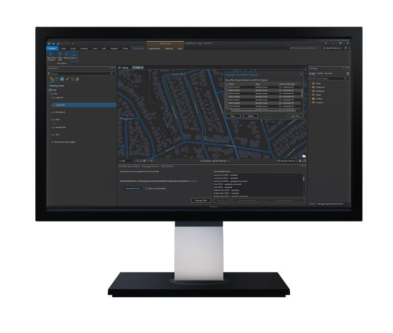
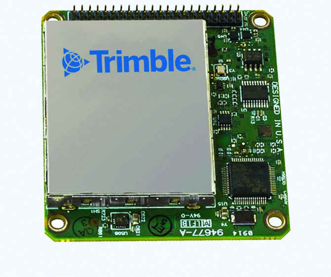
Trimble has released the Trimble Terra Office add-in for Esri ArcGIS Pro. The add-in is a part of Trimble’s Terra Office suite of desktop solutions for integrating Trimble TerraFlex field data collection software with GIS systems of record.
With a streamlined user interface, the new Terra Office add-in for ArcGIS Pro enables users to connect TerraFlex workflows directly to the ArcGIS platform from within ArcGIS Pro — Esri’s desktop GIS application. ArcGIS Pro users can now create and manage TerraFlex geospatial data collection projects without leaving ArcGIS.
Organizations that collect data in TerraFlex and bring it into ArcGIS through the add-in can also use the Trimble Offline GNSS Corrections service, for situations where real-time correction services are intermittent or unavailable. With this service, all data from the field is automatically processed in the cloud without user intervention, and the most accurate real-time or post-processed position is stored for each feature and made available for download through the Terra Office add-in for ArcGIS Pro.
For more information on the Terra Office add-in and its availability, click here.
A roundup of recent products in the GNSS and inertial positioning industry from the July 2023 issue of GPS World magazine.
TIMING
PTP Firmware To synchronize accurate time from GNSS
The 7.09.00 firmware with a precise timing protocol (PTP) feature enables users to synchronize accurate time from GNSS with other devices and sensors on a shared network. The 7.09.00 firmware’s PTP feature brings stable timing to a user’s other sensor systems connected through a local network to best support positioning, navigation and timing (PNT) and automotive and autonomous applications. The firmware includes SPAN GNSS+INS technology improvements — including a secondary INS solution for built-in redundancy and reliability in challenging conditions. The enhancements are available on all OEM7 cards and enclosures, including all PwrPak7 and CPT7 enclosure variants. The 7.09.00 firmware also features improvements to the time to first fix, a secondary SPAN solution for a more accurate and reliable GNSS+INS output and more. The 7.09.00 firmware is not for precision agriculture applications and is not supported on NovAtel’s SMART antenna products. Hexagon | NovAtel, novatel.com
Timing Antenna A multi-GNSS and high-performance device
The AU-500 antenna is suitable for time synchronization applications. It supports all constellations in the L1 and L5 bands, including GPS, QZSS, GLONASS, Galileo, BeiDou, and NavIC. A built-in noise filter eliminates interference in the vicinity of 1.5 GHz caused by 4G/LTE mobile base stations as well as other radio waves that can adversely affect GNSS reception. The antenna is equipped with lightening protection and features a high-quality polymer radome that prevents snow accumulation. It is also waterproof and dustproof in compliance with IP67. The AU-500 achieves the best performance in time accuracy and robustness fundamental in critical infrastructure, when combined with Furuno’s GNSS receiver, GT-100. The antenna will be available this month. Furuno, furuno.com
Timing Module Dual-band and secure for 5G communications
The NEO-F10T offers nanosecond-level timing accuracy, meeting the stringent timing requirements for 5G communications. It is compliant with the u-blox NEO form factor (12.2 mm x 16 mm), allowing space-constrained designs to be realized without the need to compromise on size. The NEO-F10T is the successor to the NEO-M8T module, providing an easy upgrade path to dual-band timing technology. This allows NEO-M8T users to access nanosecond-level timing accuracy and enhanced security. Dual-band technology mitigates ionospheric errors and greatly reduces timing errors, without the need of an external GNSS correction service. Additionally, when within the operational area of a satellite-based augmentation system (SBAS), the NEO-F10T offers the possibility to improve the timing performance by using the ionospheric corrections provided by the SBAS system.
The NEO-F10T supports all four GNSS and L1/L5/E5a configurations, simplifying global deployments. It includes advanced security features such as secure boot, secure interfaces, configuration lock and T-RAIM to provide the highest-level timing integrity and ensure reliable, uninterrupted service. u-blox, u-blox.com
MOBILE
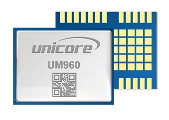
Image: Unicore Communications
GNSS RTK Module A high precision module for multiple applications
The UM960 module can be used for a wide range of applications, such as robotic mowers, deformation monitoring, UAVs, handheld GIS, and more. It features a high position fix rate and provides accurate and reliable GNSS positioning data. The UM960 module supports BDS B1I/B2I/B3I/B1c/B2a, GPS L1/L2/L5, Galileo E1/E5b/E5a, GLONASS G1/G2, and QZSS L1/L2/L5. The module also has 1,408 channels. In addition to its small size, the UM960 features low power consumption — less than 450 mW. The UM960 also supports single point positioning and real-time kinematic (RTK) positioning data output at 20 Hz. Unicore Communications, unicore.eu
CRPA System A GPS/GNSS anti-jamming system
This system eliminates interference by applying novel beam forming techniques. With an 8-array CRPA antenna, the system can assure the normal operation of a GNSS receiver in the presence of multiple jamming sources. The anti-jam GNSS CRPA system can be deployed using various configurations and operates with civil and military GPS receivers for land, sea, air platforms (including unmanned aerial systems), and fixed installations. The device has an embedded GNSS receiver that supports all satellite constellations. The device is lightweight and compact. It requires minimal integration training and easily integrates into new or legacy platforms. The antenna also offers assured positioning, navigation and timing. Tualcom, tualcom.com
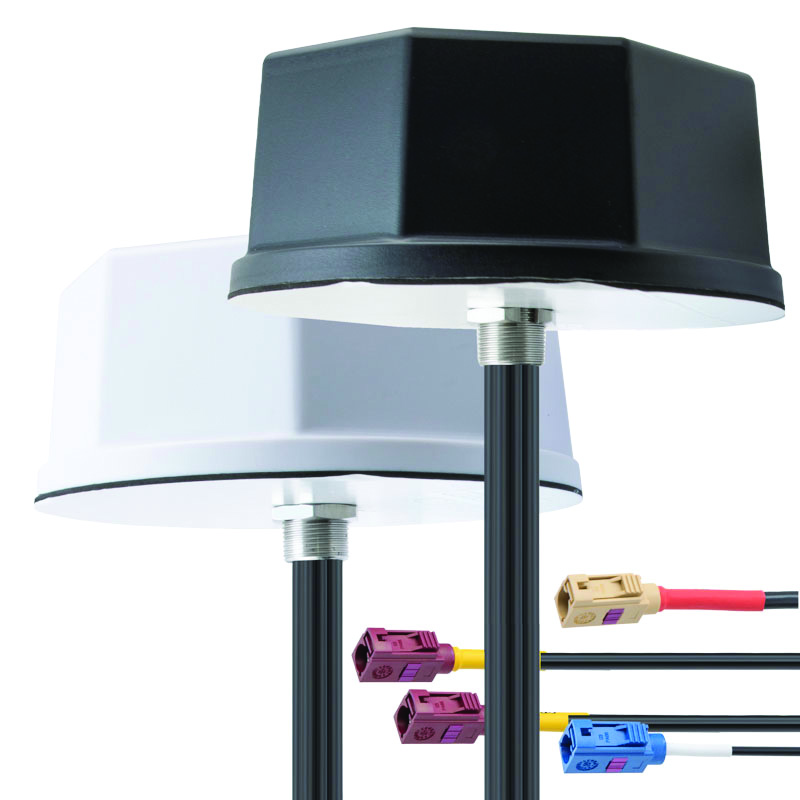
IoT Antennas Rugged and designed to enhance connectivity
KP Performance Antennas’ internet of things (IoT) multiband combination antennas are designed to enhance connectivity for vehicle fleets and base stations. The IoT multiband combination antennas have dedicated ports for cellular, Wi-Fi and GPS bands. They are also indoor and outdoor IP69K rated and can withstand harsh environmental conditions, such as extreme temperatures, water and dust. The antennas are suitable for transportation emergency response and agriculture applications. The IoT multiband combination antennas are in-stock and available now.
KP Performance Antennas, kpperformance.com
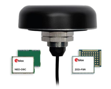
Smart Antennas With integrated technology for centimeter-accuracy
PointPerfect PPP-RTK augmented smart antennas combine the ZED-F9R high precision GNSS and the NEO-D9S L-band receivers from u-blox and Tallysman Accutenna technology. The multi-band (L1/L2 or L1/L5) architecture removes ionospheric errors, and the multi-stage enhanced XF filtering improves noise immunity while relying on the dual-feed Accutenna element to mitigate multi-path signal interference rejection. Some versions of the new smart antenna solutions include an inertial measurement unit (for dead reckoning) and an integrated L-band corrections receiver to ensure operation beyond terrestrial network reach. The PointPerfect GNSS augmentation service is now available in North America, Europe and parts of Asia Pacific. Tallysman Wireless, tallysman.com/u-blox, u-blox.com
SURVEYING & MAPPING
Airborne Laser Scanner Suitable for mapping applications
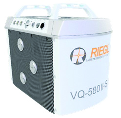
The compact and lightweight VQ-580 II-S meets the increasing requirements of compact laser scanners for medium- and wide-area mapping as well as for corridor mapping. The successor of the VQ-580 II airborne laser scanner, provides a maximum measurement range of 2.45 m. It can be integrated with gyro-stabilized mounts as well as into the VQX-1 Wing Pod. It features high accuracy ranging based on waveform-lidar technology. The VQ-580 II-S also has a mechanical and electrical interface for inertial measurement unit (IMU)/GNSS integration. RIEGL, rieglusa.com
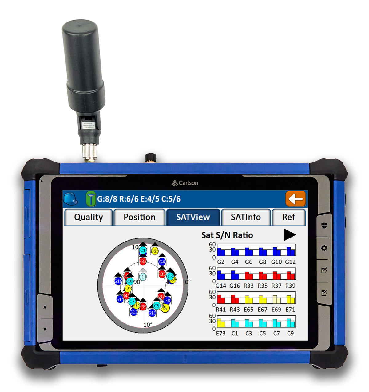
Tablet and GNSS Solution For surveying applications
The RT5 rugged tablet data collector and the RTk5 GNSS solution, which integrate the form factor of the RT5 with real-time kinematic GNSS performance, are suitable for land surveyors, engineers, GIS professionals, and users in need of advanced GNSS positioning with an RTK rover. The RT5 is designed for surveying, stakeouts, construction layout and GIS mapping, and is bundled with Carlson SurvPC — the Windows-based data collection program. The RT5 can run SurvPC with Esri OEM for use in the field. The RTk5 adds an advanced GNSS solution to the RT5, enabling accuracy in a compact, light and versatile package. It comes with a custom-built pole and cradle, a survey-grade antenna, and a small portable helix antenna for handheld GNSS use. Carlson Software, carlsonsw.com
Lidar and RGB Solution Suitable for aerial surveying
The Zenmuse L1 integrates a Livox lidar module, a high-accuracy inertial measurement unit (IMU), and a camera with a 1 in CMOS on a 3-axis stabilized gimbal. When used with Matrice 300 real-time kinematic (RTK) and DJI Terra, the L1 forms a complete solution that gives users real-time 3D data, capturing the details of complex structures and delivering highly accurate reconstructed models. Users can render centimeter-accurate reconstructions with the high-accuracy IMU, a vision sensor for positioning accuracy, and the incorporation of GNSS data. The solution’s IP54 rating allows the L1 to be operated in rainy or foggy environments. The lidar module’s active scanning method enables users to fly at night. DJI Enterprise, enterprise.dji.com
Mapping Platform Real-time, crowd-sourced map data
CityStream Live is a real-time mapping (RTM) platform that enables the mobility industry — including connected vehicles, maps, mobility services, digital twins or smart city applications — to access a continuous stream of crowdsourced road data. This platform provides real-time data on nearly every road across the United States at a reduced cost. Utilizing a crowdsourcing network and artificial intelligence software, CityStream Live offers users and developers a live data feed to increase situational awareness, enhance driving capabilities, increase safety and more. By combining massive data aggregation with real-time data curation, CityStream Live is the first platform to deliver road data streams in real time and at scale, supporting several urban and highway use cases. Nexar, us.getnexar.com
Leica iCON gps 160 (Image: Leica Geosystems)
Smart Antenna Contains features that increase productivity on construction sites
The iCON gps 160 is a versatile solution for various applications. It can be used as a base station, as a rover or for machine guidance. The device is a modernization and enhancement of the successful Leica iCON gps 60, which has been well accepted in the market. The result is a smaller, more compact GNSS antenna with additional features and a larger display for ease of use. The Leica iCON gps 160 is particularly suited to complex construction environments with different GNSS requirements because the ability to switch between the different applications is at the users’ fingertips. Besides checking grade, cut and fill, stakeout points and lines, users can also benefit from using this solution for basic-level GNSS machine guidance. It has an integrated color display, a user-friendly interface, smart setup wizards and an intuitive construction-specific workflow to help contractors get the most out of their investment from day one. Size and weight reductions make the iCON gps 160 easy to handle, while the latest GNSS and communication technologies improve data reception. Leica Geosystems, leica-geosystems.com
UAV
Positioning Solution For UAV delivery applications
The PX-1 RTX is designed for accurate, robust positioning and heading for commercial UAV delivery applications. This solution enables UAV integration companies to add precise positioning capabilities so operators can plan and execute takeoff, navigation and landing tasks as UAV delivery advances to take on more challenging operations. The PX-1 RTX leverages CenterPoint RTX corrections and small, high-performance GNSS-inertial hardware to provide real-time, centimeter-level positioning and accurate inertial-derived true heading measurements. This solution allows operators precise control of UAVs during takeoff and landing to tackle more demanding operations in tight or partially obstructed spaces. It also minimizes operational risks from poor sensor performance or magnetic interference by ensuring greater positioning redundancy, which is especially important as commercial UAV delivery operations venture into difficult urban and suburban environments. Trimble Applanix, applanix.com
Certification Reference Guide A guide for the AAM industry
Business and government leaders, engineers, members of the media and any user with an interest in the future of flight can use the Honeywell State of UAS and UAM Certification Guide to help navigate and communicate the complexities of vehicle certification and operational approval across multiple vehicle segments. Industry professionals can access the living document online at aerospace.honeywell.com/us/en/products-and-services/industry/urban-air-mobility. The certification reference guide summarizes evolving Federal Aviation Administration and European Union Aviation Safety Agency rules across multiple advanced air mobility (AAM) segments. It also links to documents that AAM professionals can reference to better understand detailed certification requirements. Honeywell Aerospace, aerospace.honeywell.com
Image: A2Z Drone Delivery
Delivery UAV Suitable for aerial mapping, UAV inspection, forestry services, search and rescue operations, water sample collection, offshore deliveries, mining, and more
The RDSX Pelican leverages a hybrid vertical takeoff and landing (VTOL) airframe with no control surfaces to combine the reliability and flight stability of a multirotor platform, with the extended range of a fixed-wing craft. With no ailerons, elevator, or rudder, the Pelican’s durable design eliminates common points of failure and extends operational time between maintenance overhauls. Designed to meet the 55 lb takeoff weight limitation for Federal Aviation Administration Part 107 compliance, the Pelican can carry payloads of 5 kg on missions up to 40 km, roundtrip. The Pelican can be optimized for extended range operations or to deliver payloads from altitude with the company’s RDS2 UAV delivery winch. Available in multiple configurations, the RDSX Pelican can be customized for an array of missions. The Pelican enables deliveries from altitude where spinning propellers are kept far from people and property, mitigating consumer privacy concerns of low-flying UAVs while abating intrusive rotor noise. Alternatively, for missions in which the UAV can safely land at its destination, a simple servo-release mechanism can release payloads and expand the Pelican’s payload capacity.
A2Z Drone Delivery, a2zdronedelivery.com
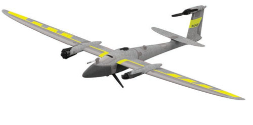
UAS Suitable for mapping applications
The Trinity Pro UAS features Quantum-Skynode autopilot, using a Linux mission computer. This provides additional onboard computing power, increased internal storage, versatility and interoperability. Included in the Trinity Pro system is QBase 3D operations software. As the Trinity Pro is built on the Trinity F90+ UAS, its new capabilities include planning functions for missions requiring takeoff and landing at different locations, allowing for efficient and safe long corridor flights and beyond visual line of sight operations. The platform also incorporates advanced self-diagnostics to ensure safe operation. The UAS now includes an enhanced terrain- following system. Additionally, improvements to trigger point calculations results in improved image overlap and higher data quality. The Trinity Pro features automatic wind simulation for crash avoidance in bad weather and a linear approach for landing. The UAS is equipped with a downfacing lidar scanner that provides highly accurate ground avoidance and landing control. The system features USB-C ports for faster data transfer. The Trinity Pro is protected against dust and water damage and features increased wind limits of up to 14 m/s in cruise mode and 11 m/s during hover.
Quantum Systems, quantum-systems.com
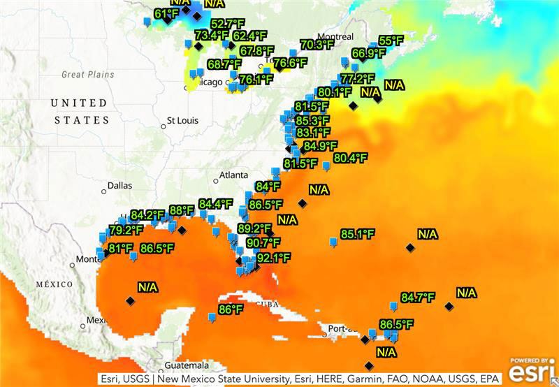
The ocean off the Gulf of Mexico is undergoing a marine heat wave that could pose a threat to coral reefs, as water temperatures reach 90°F. A coral reef watch map, provided by the National Environmental Satellite, Data, and Information Service of the National Oceanic and Atmospheric Administration (NOAA), shows that the water near the Florida Keys is significantly higher than usual, which causes coral bleaching and other marine life concerns.
Image: NOAA
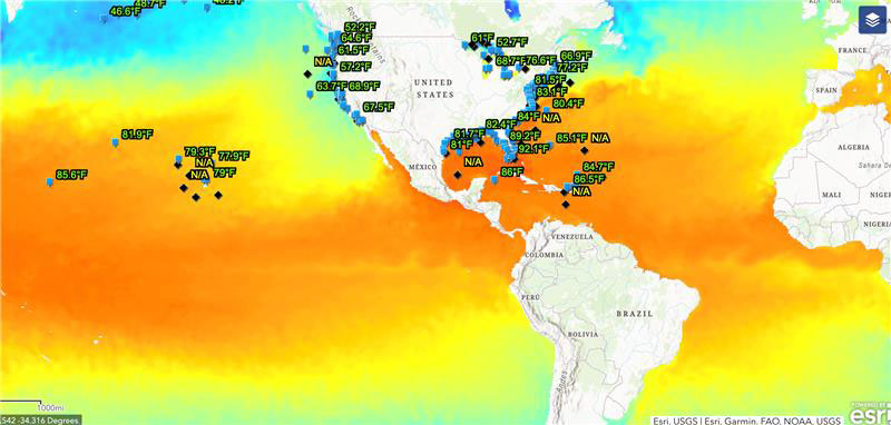
The Gulf of Mexico is not the only place that is suffering this marine heat wave. 40% of the globe is experiencing extreme temperatures,Dillon Amaya, a physical scientist at NOAA, stated in an interview with the New York Times.
This map provides water temperatures globally. The blue-green colors represent cooler temperatures whereas yellow-orange colors represent hot temperatures. (Image: NOAA)
The current water temperatures are the hottest ever recorded. Scientists say that these high temperatures are typical, but not until August or September. It is only July.
The marine heat wave is mainly due to a climate phenomenon, El Niño, that typically brings warmer ocean temperatures. However, now El Niño is coming on top of long-term warming caused by greenhouse gas emissions and worldwide contribution to global warming.
When sea temperatures rise too high, corals bleach, expelling the algae they need to live. If the water does not cool quickly enough, and if bleaching events happen frequently, the corals die. Coral reefs are vital to the marine life that relies on them and 25% of all marine life — including more than 4,000 kinds of fish — depends on reefs, according to NOAA.