Rx Networks, a GNSS data services provider, has released TruePoint | LITE, a correction service designed for power-conscious applications that require precise and reliable location data.
TruePoint | LITEaims to deliver sub-meter and lane-level accuracy with global coverage for low-power usage. It is engineered with power efficiency in mind, focusing on applications such as smartphones, wearables, asset tracking and Internet of Things (IoT) devices.
TruePoint | LITE uses patent-pending predictive technologies designed to reduce dominant GNSS ranging errors—including ionospheric, orbital, and clock errors—to ensure accurate GNSS positioning while minimizing data traffic and conserving battery life.
TruePoint | LITE leverages proprietary predictive technologies to correct key GNSS ranging errors, particularly ionospheric range errors, according to the company.
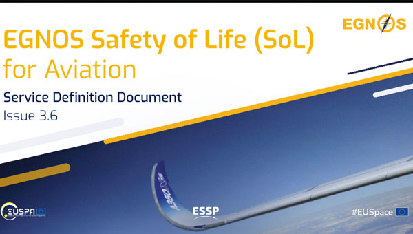
The European Geostationary Navigation Overlay Service (EGNOS) has released version 3.6 of its Safety of Life (SoL) Service for Aviation Service Definition Document (SDD), introducing several critical updates to enhance EGNOS satellite navigation-based operations.
SDD v3.6 describes improvements in EGNOS architecture for the space and ground segments. For the space segment, the document presents the latest technical information on the geostationary (GEO) satellites that deliver EGNOS services. In the ground segment, the ranging integrity monitoring station (RIMS) network has been expanded to include a new site in Kuusamo, Finland. The addition of this station in the far northern reaches of Europe extends coverage and heightens the robustness of SoL service in this remote and challenging environment.
SDD v3.6 also provides a detailed analysis of the impact of ionospheric activity during Solar Cycle 25, which began in December 2019 and is expected to peak around 2025. This extreme solar activity poses challenges to satellite navigation, and the document offers insights into how EGNOS maintains reliable performance under adverse ionospheric conditions.
The new updates aim to improve the precision, reliability and safety of satellite navigation services in aviation. The SoL service supports various transport domains, primarily focusing on civil aviation, covering localizer performance with vertical guidance (LPV) procedures.
OneWeb Technologies has launched Astra, which is designed to maintain low-Earth orbit (LEO) SATCOM connectivity in GNSS-compromised environments.
The package includes a software-defined outdoor receiver that leverages assured positioning, navigation and timing (A-PNT) broadcast services, significantly enhancing connectivity resilience. Astra can process PNT signals from GNSS and alternative sources across multiple frequency bands to offer continuous connectivity and situational awareness, even in challenging spectrum-contested environments.
The system is compatible with non-GNSS A-PNT broadcast services, such as Iridium. It can identify the optimal PNT source while producing an output signal compatible with the standard GPS L1 interface. In addition to its commercial applications, Astra aligns with the military’s Primary, Alternate, Contingency, Emergency (PACE) communications plan.
Telespazio, a joint venture between Leonardo and Thales, has been selected by the Italian Space Agency (ASI) to lead the creation of the “National GNSS Competence Centre” in Italy. As the primary contractor, Telespazio will head a team composed of Italian universities, research centers, and industrial companies to establish this new center, which will be headquartered at Telespazio’s offices in Rome.
The center’s primary goal is to develop a laboratory network that utilizes resources distributed throughout Italy to advance capabilities, solutions, and technologies in satellite navigation. The project team includes notable institutions such as the National Institute of Metrology Research (INRiM), the Italian Aerospace Research Centre (CIRA), Qascom and the National Inter-University Consortium for Telecommunications (CNIT), along with research units from the University of Pisa, the Polytechnic of Turin, the University of Padua and the University of Roma Tre.
The center will focus on creating new software tools for monitoring GNSS service performance and testing receivers. A cloud-based collaborative platform will be implemented to facilitate shared software development among all project participants. Additionally, the center seeks to expand its network by involving other academic and industrial partners while establishing itself as a national hub for satellite navigation expertise through workshops and training courses.
Telespazio will focus on developing precise, resilient, and robust navigation systems, particularly for emerging technologies such as autonomous vehicles in the aviation, rail, and automotive industries.
Telespazio operates one of two Galileo control centers at its Fucino Space Centre.
Locus Lock has partnered with Xona Space Systems to develop a GNSS receiver that uses Xona’s multi-frequency PULSAR service. Locus Lock aims to provide a robust software-defined GNSS receiver for commercial and military applications.
According to the company, Xona’s PULSAR service will be delivered via a constellation of low-Earth orbit (LEO) satellites, which orbit the Earth approximately 20 times closer than traditional GNSS satellites. This proximity allows PULSAR to offer higher signal power and a modernized signal design to offer improved multipath mitigation, higher accuracy and increased protection against radio frequency interference and spoofing compared to current GNSS systems.
The technology is suitable for various applications, including vehicles navigating dense urban areas, agriculture and construction, UAVs, high-speed aircraft and defense applications. Locus Lock’s GNSS software stack can be deployed on existing customer computational infrastructure, ranging from small embedded devices to larger centralized computers. This flexibility allows for adaptation and configuration of the software to suit specific deployed environments.
The system features inertially aided carrier-phase differential GNSS (CDGNSS) for maintaining precision in challenging ecosystems, advanced interference mitigation and detection technology to ensure authentic GNSS signals are received, and the dual-antenna, triple-frequency RadioLion RF front-end for capturing raw GNSS signals. These features offer signal situational awareness, anti-spoofing, and interference mitigation.
Propeller, a cloud-based worksite mapping and UAV analytics company, has partnered with GEODNET to upgrade its survey-grade mapping solutions. By integrating GEODNET stations into the Propeller Corrections Network, Propeller can now deliver more precise data to its users in the construction, mining, aggregates and waste management industries.
Propeller has developed a fully integrated post-processing kinematic (PPK) mapping workflow for various commercial UAVs. Surveyors and contractors can visualize geospatial data from one central system using AeroPoint GPS-enabled smart ground control points and Propeller’s cloud-based platform.
GEODNET’s global network of more than 9,000 registered full-constellation GNSS reference stations offers Propeller users the GNSS corrections data needed to align AeroPoints and UAVs to thousands of published coordinate systems.
Propeller has completed the initial integration of GEODNET stations into its network, allowing both existing and new customers to benefit from these enhancements immediately.
China’s BeiDou high-precision navigation and positioning service platform has entered trial operation, The National Geomatics Center of China reported.
Developed under the leadership of the Ministry of Natural Resources, the platform integrates satellite navigation and positioning base stations nationwide within the natural resources system. This initiative consolidates more than 3,300 base stations into a unified network, offering centralized management of station resources.
The network offers seamless, high-precision positioning services nationwide, delivering real-time, accurate and reliable navigation for sectors including public welfare mapping, resource surveying, intelligent transportation, autonomous driving, precision agriculture and social governance.
The service is available both online and offline. Online, it offers real-time observation data and enhanced positioning services. Offline, the platform delivers coordinate results, post-event observation data files, and related products.
The BeiDou Navigation Satellite System (BDS) was initiated in 1994. The construction of BDS-1 and BDS-2 was completed in 2000 and 2012. When BDS-3 was completed and put into service on July 31, 2020, China became the third country to have an independent global navigation satellite system.
The European Union Agency for the Space Programme (EUSPA) has completed the testing of the Galileo Open Service Navigation Message Authentication (OSNMA) and is now gearing up for its operational launch.
Galileo, similar to any other GNSS, is used by many critical applications in transportation, finance, telecommunications, information technology, energy, utilities, manufacturing, health services, emergency services and law enforcement.
However, the rise in spoofing attacks, which can disrupt these services, has prompted the development of OSNMA. This capability, integrated into the Galileo infrastructure by EUSPA, the European Commission (EC), and the European Space Agency (ESA), aims to enhance the security of GNSS signals.
The OSNMA Public Observation phase began in November 2021, supported by the release of the Signal in Space Interface Control Document (SIS ICD) and the Receiver Guidelines, which facilitated early testing of OSNMA receivers worldwide. Since then, users have reported that the OSNMA signal has been transmitted by Galileo satellites with high stability and performance.
In December 2022, EUSPA and the EC published the OSNMA SIS ICD and Receiver Guidelines for the service phase, with further updates released between October 2023 and January 2024. Additionally, the OSNMA Internet Data Distribution (IDD) ICD was published in July 2023 and updated in January 2024, alongside the operational cryptographic material. The OSNMA signal has been transmitted following these specifications since August 2023.
According to EUSPA, Testing activities by industry and public actors have confirmed the readiness of the service, with the latest cryptographic material published by EUSPA in January 2024. This material and necessary certificates are available through the EUSPA and GSC websites for the Initial Service provision phase.
The testing activities concluded in early June 2024 with the execution of cryptographic keychain renewal and revocation processes. The program is now preparing for the OSNMA Initial Service declaration, which will include an EC communication, the publication of the OSNMA Service Definition Document (SDD) and the transition of the OSNMA Status Flag from “test” to “operational” following a process similar to that used in 2023 for the Galileo High Accuracy Service (HAS) Declaration. According to EUSPA, a dedicated Galileo Service Notice will soon be published to announce the conclusion of the testing activities of the Public Observation Phase.
Furuno will participate in Jammertest 2024 in Andøya, Norway, from Sept. 9 to 13, 2024. This event is widely recognized as the world’s largest GNSS resilience testing event, providing a unique opportunity for companies to evaluate their GNSS receivers in real-world environments.
Jammertest 2024 will expose participants’ GNSS receivers to jamming and spoofing signals, allowing companies to gather valuable data on their product tolerance levels. The event is organized by several Norwegian institutions, including the Norwegian Public Roads Administration, Norwegian Communications Authority and Norwegian Space Agency.
Furuno will be testing its GT-100 timing multi-GNSS receiver module at the event. This module supports dual-frequency band reception in the L1 and L5 bands, making it suitable for critical infrastructure applications such as 5G mobile base stations, TV broadcasting and power grids.
GT-100. (Photo: Furuno)
Key Features of GT-100:
Automatic mitigation of jamming and spoofing signals.
Real-time notification of jamming signal frequency and strength.
Ability to maintain L5 band signal reception if L1 band is lost.
By participating in Jammertest 2024, Furuno aims to evaluate and analyze the GT-100’s resistance to jamming and spoofing in real-world conditions. The company plans to use the results further to enhance the robustness of its GNSS receiver technology, ultimately contributing to more resilient critical infrastructure systems.
onocoy has launched the onocoy real-time kinematic (RTK) service designed to offer positioning capabilities worldwide.
The service utilizes blockchain technology and a decentralized network of reference stations, offering users accurate correction data for applications requiring centimeter-level positioning. onocoy RTK offers global coverage with data quality controls in place to verify correction information before distribution.
According to onocoy, the service offers quick convergence times and high accuracy due to its dense network of reference stations. It outputs data in the standardized RTCM format for integration with various systems.
onocoy RTk targets industries such as agriculture, construction, mining, robotics and autonomous systems that require flexible and reliable high-precision positioning. onocoy says it is also developing business-to-business offerings, including access to station data and customized solutions.
With this launch, onocoy aims to expand access to RTK technology and advance high-precision positioning capabilities across sectors.
In June, the Navigation Innovation and Support Program (NAVISP) Advisory Committee (NAVAC) of the European Space Agency (ESA) issued a paper titled PNT Vision 2035. It provides an interesting overview of the state of positioning, navigation and timing (PNT) and where it will be a decade from now.
According to ESA’s website, key findings in the paper include:
Increasing Dependence on PNT Services – particularly for consumer and autonomous solutions. Accurate timing remains a critical use case, especially in telecom and power distribution.
Geopolitical and Technological Challenges: Rising cyber-attacks, jamming and spoofing, advancements in AI, ML and quantum computing will have significant impacts. Anticipate new regulations.
Technological Trends Driving PNT Demand: The proliferation of connected devices (IoT), autonomous driving, advanced air mobility, smart grids and autonomous vehicles will drive the demand for resilient and robust PNT.
System Architecture Evolution: Future PNT systems will utilize a combination of data sources, including multiple GNSS constellations, cellular networks (5G/6G), terrestrial systems, augmentation systems, and autonomous sensors. This “system of systems” approach will enhance performance and ensure independence from single points of failure.
Emerging Technologies and Sensor Integration: Advances in space segment technologies, receiver designs and sensor integration, new signal designs, flexible payloads, advanced clocks, inter-satellite links, and higher power amplifiers are highlighted.
Luis Mayo
We spoke with Luis Mayo, NAVAC’s chair, to get his take on this seminal work.
Question: To set the stage, what is NAVAC?
Luis Mayo: NAVAC is a group of external PNT experts that ESA has assembled to provide independent advice on navigation issues, and especially for NAVISP.
Q: Where can NAVAC’s formal recommendations be found?
Mayo: We perform an assessment of the NAVISP status every two years. We provide our recommendations as a conclusion of this assessment. Beyond that, our formal recommendations are collected in documents like this white paper or in proposals for modifications or adjustments to the work plans of the programs.
Q: How does ESA leadership generally view and react to NAVAC conclusions and recommendations? Does it act upon every recommendation?
Mayo: They are generally receptive. However, we are just an advisory body, so it is up to them to take on our recommendations. They often do so and use our advice to add weight to their proposal to the Navigation Programme Board, but they do not necessarily have to.
Q: PNT Vision 2035 is a substantial document. Clearly it involved some time and effort. Why was it written? Is it something ESA requested?
Mayo: The paper was the initiative of NAVAC members to inform the ESA Ministerial Conference in 2025. These conferences take place every three years to define the roadmap for the next period. New European space programmes, extensions or redirections of existing ones, and budgets are approved at these meetings.
Q: We thought we might make a modest contribution to the definition of the future ESA navigation programmes. What, if anything, did NAVAC find surprising or unexpected about findings included in the Vision?
Mayo: I would say that we hardly found anything too unexpected or surprising. The findings are the conclusion of multiple discussions on the subject over the past few years. We have just expressed them in a more articulated way.
If anything, and from my personal perspective, I would like to highlight that this exercise helped me realize that the deployment of some of the most exciting or expected applications of PNT technologies — such as autonomous driving — depend on the development and deployment of multiple other technologies that might not be necessarily available in the mid-term.
AVAC’s first meeting in 2018. From left to right: Javier Benedicto, ESA Navigation Director, and NAVAC members Alessandra Fiumara, Peter Grognard, Giorgio Solari, Rafael Lucas Rodriguez, Pierluigi Mancini, Roger McKinlay, Stefano Debei, Nityaporn Sirikan, Bernd Eissfeller and Luis Mayo. (Photo: ESA)
Q: What are the three most important things policymakers should understand from the document?
Mayo: First is that many infrastructures or services critical to the daily lives of the citizens are dependent on PNT technology.
Second, they cannot take for granted that GPS or Galileo services will be always available, not to mention GLONASS or BeiDou. Satellite navigation systems are vulnerable and are continuously under threat. Enabling assured PNT service is a must.
And third, there is more to PNT than satellite navigation. Other complementary or alternative technologies should not be abandoned. In fact, some of those technologies might even change the way in which we have traditionally conceived satellite-based navigation.
Q: What are the most important things policymakers should do to enable the PNT needed by 2035?
Mayo: I think they have to sustain the existing satellite-based navigation systems and foster the development of new technologies and systems that improve the robustness of the services. We have done a lot so far to provide PNT services globally. When you come to think of that, it’s really wonderful what we have achieved this far. We cannot afford to lose what we have, but that has proven not to be enough. Therefore, policymakers should keep helping the development of new technologies and services that complement what we have, improve the quality of the services and ensure its continuous availability and integrity.
They should also look beyond the current service volume. Spacefaring nations should be aware of the fact that they will need this kind of technology to support future missions. Deploying systems able to provide PNT services beyond the coverage of the current GNSS is an absolute necessity to support such missions.
Q: The vision says the EU must consider no longer having access to GLONASS and BeiDou. There are a number of threats that are common to all GNSS. Why not consider loss of access to all either temporarily or permanently?
Mayo: We have not considered a completely catastrophic situation such as losing access to all GNSS in our vision. We understand that GPS, Galileo and eventually other constellations or augmentation systems will remain available and provide at least partial coverage for PNT services.
Q: The vision makes recommendations about mitigating interference, using AI and extending the GNSS service volume. What else should policy and technology decision-makers take from the document and act upon?
Mayo: We must not forget there is a clear case for investing in future PNT systems. ESA should keep up to pace with foreign competitors that seem ready to increase their expenditure in these types of problems.
They also have to be conscious that satellite-based navigation is not enough. We have to look for alternative and complementary systems to reach the level of confidence that we need on PNT solutions.
Q: Perhaps you are thinking of all the PNT systems China has deployed?
Mayo: I am really thinking about what we are not doing in Europe or in the United States. We need to build alternatives that might not have global coverage but would allow us to maintain essential PNT services running at home.
Q: Resilience seems to be an important theme in the document, but it was not the subject of a specific recommendation. Could you speak to that?
Mayo: Resilience is a pervasive theme throughout the whole document. This is a major concern. We have to find a way to build a system of systems that can deliver to the user a trustworthy PNT solution at any time.
Resilience is, today, a key consideration in PNT, and we cannot do anything but acknowledge this fact. We might not have insisted enough on the importance of this feature for future PNT systems, but policymakers must undertake any actions required to improve the resilience of the existing PNT systems and services, probably by promoting the development of alternative independent PNT systems.
Q: What else should GPS World readers know about the Vision?
Mayo: Read the document. It is not that long. Also, think that it has been written from an independent and experienced standpoint. We at NAVAC do not pretend to hold the full truth, but I believe that we have a quite comprehensive view of the matter and that this would be useful for the reader.
The Federal Communications Commission (FCC) has issued a public notice seeking comment on NextNav’s filing to reconfigure the Lower 900 MHz band (902 to 928 MHz band).
This action comes in response to NextNav’s April 2024 filing, which proposes a comprehensive restructuring of the band to enable the deployment of a 5G terrestrial positioning, navigation, and timing (PNT) network.
NextNav’s proposal aims to create a 5 MHz uplink in the 902-907 MHz band paired with a 10 MHz downlink in the 918-928 MHz segment. This reconfiguration is designed to complement and serve as a backup to GPS while also freeing up spectrum for 5G broadband services.
NextNav CEO Mariam Sorond said the spectrum band reconfiguration complements GPS to continue location mapping and tracking services and national security needs. “Our plan creates abundance from scarcity in this band by unleashing much-needed spectrum for wireless technology. These common-sense solutions can benefit consumers and our national interests at no cost to taxpayers,” Sorond said.
However, the FCC’s public notice raises several questions regarding the protection of incumbent users, including federal radiolocation systems, industrial, scientific, and medical (ISM) equipment, and unlicensed Part 15 devices. The Commission seeks input on how these existing operations would be safeguarded under NextNav’s proposal.
Comments are due Sept. 5, 2024. Following this comment period, the Commission will review the feedback to develop proposed rules for the potential reconfiguration of the Lower 900 MHz band.