Tag: digital edition

  • Join the upcoming Resilient Navigation and Timing Foundation reception

    Join the upcoming Resilient Navigation and Timing Foundation reception

    Gen. David Thompson
    Gen. David Thompson

    Join the Resilient Navigation and Timing Foundation for a reception with the President’s National Space-based Positioning, Navigation, and Timing Advisory Board on April 23 at The Antlers Hotel in Colorado Springs. The event begins at 6:00 PM. General David Thompson, U.S. Space Force (retired) will discuss his experience as the first Vice Chief of Space Operations, the state of GPS, and the future of PNT.

    For more information and to RSVP, contact [email protected] by April 17.

  • PNT Advisory Board at 20:  Still serving up big ideas

    PNT Advisory Board at 20: Still serving up big ideas

    • Quickly prototype a GNSS interference detection and reporting system.
    • Implement an internet-based High Accuracy and Robustness Service (HARS)for GPS.
    • Relax export controls that currently restrict use of adaptive anti-jam antennas.

    These are just three of the efforts the U.S. government is pursuing as a result of recommendations from the President’s National Space-based Positioning, Navigation and Timing (PNT) Advisory Board.

    For 20 years the PNT Advisory Board has been providing the government independent expert advice about GPS and PNT.

    Established by presidential directive in 2004 and administered under the Federal Advisory Committee Act by NASA, its charter has been regularly renewed. The charter provides that the board shall:

    • Be composed of experts from outside the United States government.
    • Seek input from state and local governments, industry and academia on developments in the application of space-based PNT technologies.
    • Evaluate national and international needs for changes in space-based PNT capabilities and assess possible trade-offs among options.
    • Provide independent advice and recommendations to the National PNT Executive Committee (co-chaired by the Deputy Secretaries of Defense and Transportation) on policy, system requirements, and program needs.

    While “space-based” is in its name and charter, the board has long recognized that terrestrial assets also can play an important role in serving PNT users by augmenting, reinforcing, and complementing GPS. The use of complementary systems, for example, could help demotivate intentional jammers and spoofers and help safeguard users during any interference event. Thus, the board often considers a wide range of capabilities and systems.

    The board also discusses policy, education, international relations and other issues important to the PNT community. As one board member commented, “Technology doesn’t exist in a vacuum. It is developed by, and intended to serve, people. If you don’t recognize that, you are missing most of the picture.”

    The current board’s membership includes an impressive array of experts in PNT policy and technology. Its 29 members include a former governor, a retired admiral, three retired generals, GPS’ original chief architect, a former undersecretary, a former assistant secretary, three former presidents of the Institute of Navigation (ION), three international members and experts from across academia and industry.

    Chaired by former Coast Guard Commandant Admiral Thad Allen, the board’s primary efforts are driven by its six subcommittees, reflecting a holistic approach to effective PNT:

    • Strategy, Policy & Governance
    • Protect, Toughen & Augment
    • Emerging Capabilities, Applications & Sectors
    • Education & Science Innovation
    • International Engagement
    • Communications & External Relations

    While the subcommittees meet in fact-finding sessions to gather data, the PNT Advisory Board’s deliberations are public. Semi-annual meetings in  Washington, D.C. and other locations may be attended by anyone, either in person or virtually. Announcements on the board’s webpage and in the Federal Register provide details before each meeting. By law, the minutes of each meeting are available to the public, and video recordings of meetings are normally posted as well.

    Input from the public about PNT issues of concern is also welcome to inform the board’s current and future deliberations. Information on how to send input will be posted with the meeting announcement here

    According to board member Jeff Shane, former undersecretary at the U.S. Department of Transportation (DOT), the PNT Advisory Board is evidence of government at its best. “The very fact that the board was established underscores our government’s willingness to hear and consider the widest variety of views and input. It should be a source of optimism, and even pride, for the entire PNT community.”


    National Space-based PNT Advisory Board

    The next meeting will be from 9:00 a.m. to 6:00 p.m. MDT, April 24, 2024, and from 9:00 a.m. to noon April 25 at The Antlers Hotel in Colorado Springs, Colorado. Click here for information on a reception on April 23, featuring Gen. David Thompson.

  • EAB Q&A: OCX is more than seven years behind schedule. What are the consequences?

    EAB Q&A: OCX is more than seven years behind schedule. What are the consequences?

    OCX is more than seven years behind schedule. What are the consequences?


    Greg Turetzky Principal Engineer Intel
    Greg Turetzky

    It’s more consequential than most people realize. The first and most impactful consequence is the limitation of the GPS constellation to
    32 satellites. There are more healthy satellites in the sky and, more importantly, Block III satellites sitting in the barn. These additional satellites and their modernized signals would improve navigation globally with improved accuracy and resilience. Additionally, without OCX the L5 signals are labeled ‘unhealthy’ and therefore the constellation is labeled ‘pre-operational.’ Without OCX, L5 cannot reach initial operational capability (IOC), which prevents certain market segments from being able to officially use them. GPS will remain in third place if the delay continues.

    — Greg Turetzky
    Consultant


    F. Michael Swiek
    Michael Swiek

    OCX seems more than seven years behind when you consider that we have been hearing about it as a concept and then a proposal for years before it became an actual program. In the Hope and Crosby movie, “The Road to Rio,” Jerry Colonna leads a cavalry charge to rescue the heroine across several brief scenes. He never arrives, and the heroine is saved by other means. Colonna then proclaims, ‘Well, we didn’t make it, but we sure added some excitement!’ While waiting for the heroic arrival of OCX, might the evolution of technology, and regular updates to the current system, already provide some of the improvements promised by OCX? The OCS is already upgraded to accommodate Contingency Operations for GPS III satellites, M-Code early use and incorporated cyber security protections. Is it, maybe, time to just move beyond OCX and start anew with today’s context and assessment of future needs?

    — Michael Swiek
    GPS Alliance

  • Research Report: A Black Hole in Earth science

    Research Report: A Black Hole in Earth science

    Figure 1: Scientific observations with GNSS radio occultation (GNSS-RO), GNSS grazing-angle reflectometry (GNSS-GR) and GNSS reflectometry (GNSS-R) techniques from low-Earth orbit (LEO). (Figure provided by the author)
    Figure 1: Scientific observations with GNSS radio occultation (GNSS-RO), GNSS grazing-angle reflectometry (GNSS-GR) and GNSS reflectometry (GNSS-R) techniques from low-Earth orbit (LEO). (Figure provided by the author)

    Global navigation satellite systems (GNSS) for peaceful uses are facing a hard reality due to increasing regional conflicts in recent years. As a dual-use technology, GNSS for civil, commercial and scientific applications is vulnerable to both denied/degraded service and flex power operation from GNSS satellites and to jamming from the ground.

    One of the vulnerable scientific applications is the use of GNSS receivers on low-Earth orbit (LEO) satellites that utilize the civil navigation signals for Earth observation. These remote sensing techniques, such as GNSS radio occultation (GNSS-RO), GNSS grazing-angle reflectometry (GNSS-GR) and GNSS reflectometry (GNSS-R) (see figure 1), are designed to observe weak GNSS signals either bounced off from Earth’s surface or refracted by the atmosphere. Thus, GNSS flex power operation and intentional radio frequency interference (RFI) can severely degrade the quality of the scientific data or even prevent Earth observation.

    One example of such impacts is a dramatic decrease of GNSS-RO observations over Europe and the Middle East during 2023. Monthly statistics from Spire show the region without GPS-RO measurements grew substantially from the localized Ukraine-Russia conflict zone in January to a much wider area in Eastern Europe and the Middle East in December 2023 (see figure 2).

    Figure 2: Number density distribution of monthly GNSS-RO measurements from the GPS tracking by the Spire constellation over Europe and the Middle East in 2023. The black area indicates no data. (Figure provided by the author)
    Figure 2: Number density distribution of monthly GNSS-RO measurements from the GPS tracking by the Spire constellation over Europe and the Middle East in 2023. The black area indicates no data. (Figure provided by the author)

    This vast data void in the science observation is likely a result of the intensified electronic warfare used in Ukraine-Russia and the nearby conflict regions. The Spire RO receivers are configured to track the civil signals from GPS, GLONASS and Galileo. To increase signal protection against jamming in a conflict zone, GNSS service providers often use flex power operation. However, flex power operations can cause poor quality tracking with the RO receiver due to weaker signal power. Unlike a precise orbit determination (POD) antenna, the GNSS-RO antennas typically have a high gain to improve the detection of weak GNSS signals at limb and occulted views. However, if the transmitter power of civil signals drops below a quality-control (QC) threshold, the data are flagged as bad. This results in a poor coverage of Spire GNSS-RO in the conflict zones.

    Lost or degraded GNSS-RO, GNSS-R and GNSS-GR observations are unfortunate, as these all-weather sensing, long-term stability, and high-accuracy measurements are becoming increasingly important in scientific research. GNSS-RO is a remote sensing technique that uses the GNSS-LEO link to profile Earth’s atmosphere and ionosphere with high vertical resolution. Since the first GNSS-RO six-satellite constellation, known as Constellation Observing System for Meteorology, Ionosphere and Climate-1 (COSMIC-1), these high-quality RO profiles have become a key data source for weather forecasting, climate monitoring, model evaluation, and space weather research. The current backbone of GNSS-RO observations comes from the COSMIIC-2 and Spire constellations, which have been producing more than 20,000 profiles per day since 2020. GNSS-R is a bi-static radar technique that uses the GNSS signals reflected by the surface for altimetry, ocean surface wind speed, wave height sea ice, soil moisture, and inundation measurements. At a view angle between GNSS-RO and GNSS-R, GNSS-GR can provide complementary measurements for sea ice and atmospheric column water vapor. Because of low-cost LEO SmallSat/CubeSat constellations with the GNSS receivers, geoscience studies have benefited greatly from the sampling density and coverage of these new data.

    Civilization and science have been diverted by wars before. Despite the increased dependence on GNSS in recent years, their vulnerability to jamming and flex power operation poses a great challenge for scientific observations that need uniform global coverage.

  • Guiding machines: Combining GNSS and other sensors is key to effective machine control

    Guiding machines: Combining GNSS and other sensors is key to effective machine control

    Building a solid foundation for any construction requires that the ground be adequately compacted and leveled. Construction workers and contractors operating earthmoving machines know it is nearly impossible to do that by eyesight alone. For a few decades, leveling was accomplished using rotating lasers mounted on tall tripods, which could typically cover a little more than 1,500 ft on a job site and laser receivers mounted on masts on the earth-moving machines. However, these systems only provide elevation, not position, and must be repositioned frequently.

    Photo: Steer
    Photo: Steer

    In recent years, laser leveling has been increasingly replaced by machine control systems that enable operators to compare the position of their machine’s blade with a digital grading map, and then guide it very precisely to cut the proper elevation. These machine control systems combine global navigation satellite system (GNSS) receivers, to provide the position of the machine; inertial navigation systems (INS), to bridge short gaps in GNSS availability and to provide the platform’s attitude (pitch, roll, and yaw); and a variety of other sensors, to determine the movement of the machine’s attachments, such as booms, arms and buckets.

    In this month’s cover story, we feature perspectives on machine control from:

    • Microchip, which makes inductive position sensors that monitor the angular and linear movements of the attachments.
    • Septentrio, which makes the AntaRX series of smart antennas.
    • Gundersen & Løken, which makes the DigPilot kit for excavators.

    Besides grading, other areas for machine control include trenching at a specific depth, spot-bulldozing to better prepare a site for grading, mass excavation and contouring edges. Artificial intelligence (AI) will soon start taking over the operators’ duties, but that’s for a future article.

  • Microchip: Inductive position sensors measure movements

    Microchip: Inductive position sensors measure movements

    Controlling an earthmoving machine to perform a task requires knowing exactly where its bucket or blade contacts the dirt. Therefore, in addition to knowing the machine’s position, it is necessary to model, in real-time, the rotation at each pivot point and apply some mathematics and trigonometry.

    Microchip makes an integrated circuit, known as an inductive position sensor, that is very well suited for machine control because it is not affected by the harsh conditions on most construction sites — temperature extremes, water, dust and dirt — and the vibrations caused by the machine itself. Additionally, it is not affected by the stray magnetic fields generated by electric motors, which are increasingly common on those machines.

    Inductive position sensors are used in many automotive systems. (Photo: Microchip)
    Inductive position sensors are used in many automotive systems. (Photo: Microchip)

    “We use our inductive position sensing to measure the angle or the linear movement of some sort of target to get a machine to perform its task,” said Mark Smith, product line manager for many different mixed signal products at Microchip. “For example, to control a blade on an earthmoving machine to do something, you need to have feedback about its current angle.”

    Microchip also makes sensors for human interfaces, such as accelerator pedals in cars, which no longer have cables that run up to the motor. “Any sort of movement, such as the angles of rotation of a robotic arm, must be monitored and measured. Inductive position sensing is one of the up-and-coming ways to do it,” said Smith.

    To direct a task, a central processing unit must then analyze and integrate the data from the sensors. For that, Microchip makes many types of computing elements — including mini-computers and microcontrollers.

    “One of the things that’s coming up with many of these vehicles is ambient magnetic noise in the system,” said Smith, “because you’re next to electric motors these days. You want sensors that are immune to stray magnetic fields. We started with automotive, but we’re also seeing it now in industrial environments, including earthmoving vehicles.” Inductive position sensors, Smith said, are simpler, cheaper, lighter, and better able to withstand extreme temperatures than what they are replacing. “Also, because they are non-contact, the circuit board can be environmentally protected.”

    Vibrations also are a concern. “There is an air gap between the target and the sensor itself,” Smith said. “We have an automatic gain control at the sensing side that is constantly adjusting the gain to get the maximum signal strength. This is a fast-moving control algorithm that can adjust the gain to ensure that the vibration does not affect the performance. When everything is operating at its maximum torque, this starts to matter.”

  • Septentrio: Smart antenna reduces cabling

    Septentrio: Smart antenna reduces cabling

    Septentrio’s AntaRx GNSS smart antenna — a box containing a receiver, an antenna and supporting electronics — is designed for machine automation and control in construction, precision agriculture and logistics. The smart antenna is enclosed in a rugged and compact housing for simplified installation. It can handle strong shocks and vibrations, which makes it ideal for harsh industrial environments such as construction and mining.

    Septentrio’s AntaRx GNSS smart antenna is designed for machine automation and control. (Photo: Septentrio)
    Septentrio’s AntaRx GNSS smart antenna is designed for machine automation and control. (Photo: Septentrio)

    From the early stages of the product’s design and development process, Septentrio collaborated with a leading heavy construction machinery OEM, which provided feedback that helped improve the product’s specifications.

    I discussed the use of AntaRx for machine control with Silviu Taujan and Danilo Sabbatini, both product managers for the product — the former with a focus on the machine automation market and the latter with a focus on INS.

    What type of customers were you addressing?

    Taujan: Mainly OEMs and integrators for machine control systems looking for a GNSS receiver with this kind of form factor to build into their control, automation or guidance systems.

    Photo: Septentrio
    Photo: Septentrio

    A smart antenna is easy to install on various machines, correct?

    Taujan: Yes. It saves space and the cabling is much simpler. We have a single rugged connector for power and data. Our latest generation of GNSS boards has dual antenna support. You can deploy one smart antenna and feed an auxiliary antenna — the AntaRx-AUX — into it for dual antenna heading capability.

    Where does the INS come in?

    Sabbatini: The GNSS/INS version is the AntaRx-Si3. It has an industrial-grade IMU that gives very high quality sensor fusion to bridge gaps in GNSS or correction signals. It also provides accurate attitude — pitch, roll and heading. We use this INS mostly for applications that require full 3D attitude, and for integrity and availability. It is built for one minute without GNSS.

    Does all the processing happen inside the box?

    Sabbatini: The output is a 100 Hz fused position. It will be fused by default to GNSS, plus IMU. The system can also accept the platform’s velocity as an extra input for sensor fusion. The output can include the raw GNSS position, the GNSS-only position and the raw IMU data.

    What are some use cases?

    Sabbatini: For INS, the most important use case is precision agriculture. For many ag robots, a smart antenna is the form factor of choice and most of them require INS sensor fusion. This INS product is the easiest to integrate because everything is fused inside the enclosure. Also, compared to other form factors, the customers do not need to worry about the lever arm between the antenna and the IMU because it’s inside the box, so it’s already taken into account. So, this form factor eliminates all the installation problems inherent to an INS system. The German company Sodex is creating a real time mapping system to install on top of machine controls. Another application is for users who want to close gaps in signals, especially in smaller machines that are going more often between buildings and close to structures.

    Taujan: For the version without INS, we’re looking at the more mainstream machine control customers and applications. Even from the conceptual phase of this, we started by engaging with some customers, including one large OEM in the Asian excavator market. Then, from the aftermarket or integrator side, one machine control integrator integrated it into a system for asphalt pavers. These are not yet commercially available systems, but we’re in the development phase with them.

  • Gundersen & Løken: Tracking the tip of the bucket

    Gundersen & Løken: Tracking the tip of the bucket

    Photo: Septentrio
    Image: Septentrio

    Gundersen & Løken AS, in Oslo, Norway, founded in 1899, develops equipment for the construction industry. It uses Septentrio’s AntaRx in its Dig Pilot 3D machine guidance system, which it began to develop in 2007. The company is now launching the next-generation DigPilot to assist excavator drivers. Its DigPilot Terra user interface and graphics offer a wide range of functionalities for efficient earthwork. The development of DigPilot Terra is funded partly by Innovation Norway.

    DigPilot uses multi-axial CAN bus angle sensors on all moving parts — chassis, boom, arm and bucket — to calculate the position of the bucket tip with centimeter precision. The sensors are gyro-stabilized and hold firmware that predicts angles in the coming milliseconds based on angles from the previous milliseconds. These calculated angles are pushed to the computer in the cabin, which can visualize the bucket position in real-time.

    DigPilot is a two-antenna system. Until now, it relied on two Septentrio GNSS antennas installed on the rear of the excavator — one to determine the machine’s position and one to determine its heading. These data are fed to the Septentrio GNSS receiver (rover) inside the machine, which also receives correction data via internet or radio. The data from the GNSS rover is pushed to the computer in the cabin and, when combined with the angular sensor data, provides the exact coordinates of the bucket tip and the delta value of the finished project.

    Now, Septentrio’s AntaRx technology makes DigPilot’s installation simpler and more robust because the built-in GNSS rover in one of the rear antennas greatly reduces the amount of cabling and the number of connectors.

    I discussed DigPilot with Eric Floberg, the company’s managing director since 2019 when he took over from his father, and Erik Sørngård, the company’s R&D manager, who has been working with Septentrio products for 12 years.

    When did you start working with Septentrio on AntaRx for DigPilot? At what stage of deployment is it?

    Sørngård: We began to discuss features about four years ago. At that time, we had worked with other Septentrio products for eight years. So, they appreciated our cooperation and wanted to show us where their next stage in development was heading. Last year, they approached us again, to see whether we could start looking further into it.

    Floberg: We now have one system here for testing and we have experience from the previous Septentrio products, such as the rover GNSS receivers, which have always given us the best of accuracy. Of course, now, we see the potential to make our system more robust and simpler. As soon as we have sold out the existing Septentrio products, we will incorporate the AntaRx into our next-generation machine control system.

    Is DigPilot receiver-agnostic, even though you have a preference for the AntaRx?

    Floberg: All the connections, the cabling and the components themselves are exposed to very tough environments and stresses of different kinds, such as extreme temperatures and vibrations. So, reducing the number of components and connections and cabling would definitely give us a higher uptime, which is the most important thing for our end users.

    Having the antenna and the receiver in the same box means less cabling and easier installation, correct?

    Floberg: Definitely. The anti-theft aspect here is also very important. In certain parts of the world, you will appreciate the opportunity to easily remove it from your excavator or bulldozer when you leave at night.

    What are the key challenges?

    Floberg: This winter has been the toughest one in Norway in 30 years. We have also had the chance to do some testing in very low temperatures and harsh environments. When we see it work as well as it does, we feel very confident about it.

    What accuracy have you been getting?

    Sørngård: When it comes to machine control, we look at the end result on the tip of the bucket. We have several sensors, and we have to calibrate the machine accurately. The receiver is not the biggest contribution to the noise in the algorithms. We trust that the Septentrio receiver delivers accurate numbers, and we must push ourselves to make the rest of the system meet the same standards.

    Floberg: On 30-ton or 40-ton excavators with booms up to 10 meters long we are able to get sub-centimeter accuracy, but the tip of the bucket in such a machine is 1 in thick. Of course, there are many other factors, such as the wear and tear of the machine.

    Is DigPilot typically factory-installed or aftermarket?

    Floberg: We’ll do both. We are often called by the distributor — say, Volvo or Hitachi or Kobelco — to install an integrated system.

  • Topcon boosts support for Get Kids into Survey project

    Topcon boosts support for Get Kids into Survey project

    Topcon Ninja Wildcat, one of the sponsored characters featured in the Get Kids into Survey campaign. (Image: Topcon)
    Topcon Ninja Wildcat, one of the sponsored characters featured in the Get Kids into Survey campaign. (Image: Topcon)

    Topcon Positioning Systems has expanded its support for the Get Kids into Survey (GKiS) project, now serving as the exclusive sponsor of the Global Brand Ambassador Hub. This new platform will offer a comprehensive range of resources to the project’s Brand Ambassadors, a worldwide community of volunteers who visit schools to advocate for surveying as a career and introduce students to the surveying and geospatial industries.

    Get Kids into Survey originated in 2017 and was initiated by cofounder Elaine Ball through the creation of a poster that surveyors could use to explain the profession to children. Since its inception, the project has continued to highlight the work of surveyors for young audiences, backed by an industry keenly aware of the necessity to attract the next generation of surveyors.

    The Hub will allow GKiS to develop and host resources for the global network of ambassadors and aims to increase participation in career fairs, workshops and educational activities across more than 30 countries.

    By sponsoring a homework project with GKiS, Topcon will also have its own unique GKiS cartoon character, Yumi the Wildcat Survey Ninja. Yumi will be the face of the Topcon brand to young aspiring surveyors and be given her own Character Spotlight on the GKiS blog.

    Research conducted by Topcon has shown that nearly a third of construction managers throughout Europe have identified skill shortages as a major challenge in their projects.
    According to Topcon, this shortage stems from a combination of experienced employees leaving the industry and a lack of recruits. Programs such as GKiS represent just one example of the outreach and educational initiatives designed to address and reverse this trend.

    “The GKiS project is about lifting the lid on the geospatial and survey industries for young people, and showing that they are exciting, future-gazing and technology-driven careers,” said Elaine Ball, co-founder of GKiS.

  • Tough Times for Russian Navigation System

    Tough Times for Russian Navigation System

    The Russian satellite navigation system is experiencing tough times as Western sanctions and Russia’s ever-growing international isolation seriously complicate its further development.

    Prior to Feb. 24, 2022, when Russia invaded Ukraine, Russia’s navigation sector was developing well and had a healthy growth rate, which is reflected by the steady growth and improved performance of its satellite constellations. However, the start of Russia’s war with Ukraine and the consequent international sanctions regime against Russia has put an end to the hopes for further development of the sector and especially of its flagship GLONASS global navigation satellite system (GNSS).

    As for GLONASS, as academician Nikolai Testoedov, general designer of JSC Information Satellite Systems Reshetnev, one of Russia’s leading satellite manufacturing companies, said during a general meeting of the Russian Academy of Sciences, the main problem is that Western sanctions do not allow Russia to bring its positioning accuracy to the desired 30 cm or at least 50 cm.

    According to Testoedov, the main reasons for this are serious problems with the supplies of electronic components, most of which Russia traditionally imported. “Until 2014, when the first sanction restrictions were introduced, the share of imports in Russia’s entire satellite constellations reached 42%,” Testoedov said. “Currently we implement a strategy of import substitution in the sector, which is designed until 2030 and involves a transition to 100% domestic products. As of 2014, we had 6,000 electronic components of foreign origin. Since 2014, a lot of work has been done to combine various equipment. Now, it is used in Russia’s satellite constellations.”

    It has already brought some results. According to Ivan Revnivyh, head of the GLONASS department of the Russian space corporation Roscosmos, thanks to the new satellites that have been launched in recent years, the accuracy of GLONASS civil signals has increased up to 1.32 meters. According to Revnivyh, Russia plans to continue work in this direction as part of its existing federal project “Maintenance, development and use of the GLONASS system,” which intends to increase the accuracy of the signals up to 0.3 m.

    Russia plans to continue to improve GLONASS’s accuracy until it matches that of other GNSS and meets International Civil Aviation Organization (ICAO) requirements.

    “When landing a civil aircraft at unequipped airfields,” Testoedov said, “the signal should arrive with a delay of no more than 6 seconds, with an accuracy of no worse than half a meter.”

    Despite the sanctions, Russia plans to continue to develop GLONASS. As part of these plans, starting from 2025, it plans to launch modernized GLONASS-K2 satellites in an import-substituted and multifunctional version. Thanks to this, the signal will be 100 times more powerful than the standard one. That will be primarily achieved by using dedicated navigation satellites weighing about 1 ton.

    After 2030, Russia also plans to place six satellites in geosynchronous orbits (about 36,000 km), which will increase the availability of the signal in Russian cities and difficult terrains.

    There are also plans to create a constellation of 300 satellites in low-Earth-orbit (LEO) at an altitude of 500 to 100 km. They are expected to increase the strength Russian satellite signals by more than 1,000 times.

    In recent years, Russia has faced restrictive policies implemented by various international bodies, including the International Bureau of Weights and Measures and the International Association of Geodesy. According to Russian experts, many of these bodies are currently taking discriminatory measures against Russian systems and technologies.

    In this regard, Russia plans to propose to the countries members of BRICS — an intergovernmental organization comprising Brazil, Russia, India, China, South Africa, Egypt, Ethiopia, Iran and the United Arab Emirates — to design products and systems whose characteristics will be comparable to those of Western origin. According to Reshetnev Systems’ experts, however, this could improve results — mainly, accuracy — by only 20 percent, which would not be critical for Russia.

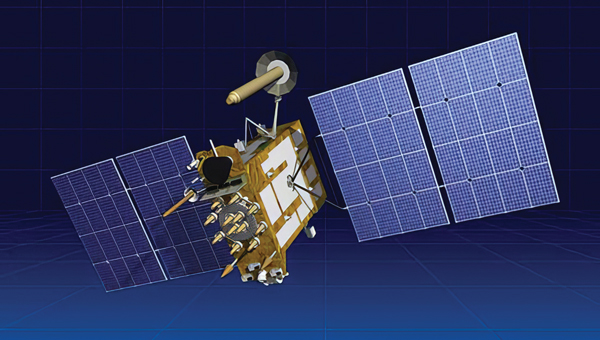
    GLONASS, which first achieved a full constellation of 24 satellites in 1995, currently consists of 24 satellites of three types: GLONASS-M, which has been produced since 2003, GLONASS-K which has been produced since 2011, and two GLONASS-K2, which Russia launched in 2023. All the satellites are part of the Cospas-Sarsat system.

    Despite the fact that the life expectancy for most Russian GLONASS satellites is seven to 10 years, many of them, according to Testoedov, are already more than twice as old. Russia plans to replace at least six GLONASS satellites within the next two to three years. In the first years of launching the constellation, Roscosmos usually launched nine satellites into orbit at once; currently, it is launching only one or two at a time.

    Still, it is possible that these rates will increase significantly, as by 2030 Russia plans to increase its constellation of satellites by up to 1,000 satellites. For this purpose, the country plans to produce 200-250 satellites per year.

    According to the head of Roscosmos, Yury Borisov, space industry enterprises should produce one satellite per day by 2030. According to him, the Russian Federation is ready to learn from the experience of other countries in this area, such as China.

  • In the Field: Help survey monuments complement GNSS

    In the Field: Help survey monuments complement GNSS


    Figure 1: Utility access box installed over CORS reference mark Whitefish Pt A (NGS PID AA8050) at USCG lighthouse. (Photo: Jeff Olsen)
    Figure 1: Utility access box installed over CORS reference mark Whitefish Pt A (NGS PID AA8050) at USCG lighthouse. (Photo: Jeff Olsen)

    GNSS users who appreciate that physical monuments can provide verification of GNSS observations can do four things to preserve those monuments and make them more accessible. References below are to U.S. national agencies, but most countries have equivalent agencies.

    1. Install a valve box over each buried control point recovered or set, whether the point is for boundary or geodetic surveying. Include National Geodetic Survey (NGS) deep-rod marks that have a buried logo cap.
    2. Advocate with the Secretary of the Interior and United States Geological Survey (USGS) director that USGS scan its paper geodetic data sheets and post the scanned pdf files online.
    3. Adopt the geodetic marks in your area. Visit them. Keep them free of brush or other blockages. Maintain descriptions and photos up to date by submitting recovery notes to NGS as needed. Participate in the NGS GPS on Benchmarks program.
    4. Consider recovering all the marks in an NGS level line. Alternatively, all the USGS marks in a 15’ quadrangle, the geographic unit USGS uses to publish its geodetic data.
    Figure 2: Example of USGS vertical data published by 15’ quadrangle.
    Figure 2: Example of USGS vertical data published by 15’ quadrangle.

    Regarding the first of these actions, a valve box is a utility standard. It identifies to non-surveyors that there is something under the box to which one should pay attention, thus increasing the mark’s chances of survival.

    The box lid is generally obvious, eliminating or at least reducing the search time for surveyors, who only need to walk up to the box.

    It replaces the soil that previously covered the mark, reducing excavation time. A surveyor only needs to open the lid and brush off the mark. Rectangular and round boxes in several sizes are available to accommodate different-sized monuments. While the time and materials to install a box may be an overhead cost to your company, it is well worth the investment.

    Regarding the second of these actions, the positions and heights published for most USGS control marks are based on superseded datums. However, that old data can be useful for evaluating trends. The marks are usually stable and can be reused in new projects.

    While NGS has observed some of these marks and published datasheets for them, they are by far the minority of all the USGS marks in the country.

    There are thousands of these sheets, 50 shelf-feet of them, organized by 15’ quad. Some sheets, mainly in the East, have been scanned and put online by various state agencies or utility companies. The USGS Rolla office has scanned most of the eastern states but has not posted the files online.

    Generally, a request for USGS geodetic data turns into a request for paper sheets, such as those shown in Figure 2, to be scanned and emailed. Putting them online would preserve this record of what it took to survey and map our country, allowing the marks to be tied into new control surveys.

  • Aligning the trades: GNSS for architecture, engineering and construction

    Aligning the trades: GNSS for architecture, engineering and construction

    Surveyors for architecture, engineering, and construction projects require GNSS receivers that have high accuracy and are rugged enough to survive the dust, water, and inevitable drops that they will endure at construction sites. They also need to be able to easily share data with architects, engineers, planners, and tradespeople, both at the sites and at the office.

    Photo: Juniper Systems
    Photo: Juniper Systems

    Juniper Systems, which has more than 30 years of experience in mapping and data collection in a wide variety of applications across industries, recently released a real time-kinematics (RTK) activation for its Geode GNSS receiver that allows mapping accuracy down to a centimeter. Pairing a Geode with the company’s Uinta mapping and data collection software and a Mesa rugged tablet makes it easy for users to share their data — such as the locations of fiberoptic telecommunication lines or of utility manhole covers — with other people working on site or at the office. The Geode and the Mesa meet IP68 protection certification for water and dust ingress; they also have MIL-STD-810G certification against drops, vibration, and extreme temperatures.

    In this month’s cover image, the Geode is at the top of the survey pole, the Mesa Rugged Tablet is mounted near the user’s hand, and the screen on the Mesa depicts the Uinta mapping software.

    On construction sites, surveying is an ongoing process. Surveyors are the first on the site, before any other work begins, and the last ones there, to map the project “as built.” Total stations with GNSS receivers, as well as tablets and other mobile digital devices are their essential tools, increasingly complemented by unmanned aerial vehicles (UAV) and lidar scanners. Accuracy is their key contribution. In this month’s cover story on GNSS for architecture, engineering, and construction (AEC), we highlight three building projects: a skyscraper in Sweden, a highway in China, and a luxury resort in the Caribbean.

    Check out these perspectives on architecture, engineering and construction:

    ComNav Technology: Building Sweden’s Tallest Tower

    CHCNAV: Expanding a Highway in China

    EOS Positioning Systems: Building a System to Build an Island Resort