A roundup of recent products in the GNSS and inertial positioning industry from the November 2024 issue of GPS World magazine.
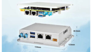
OEM
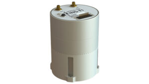
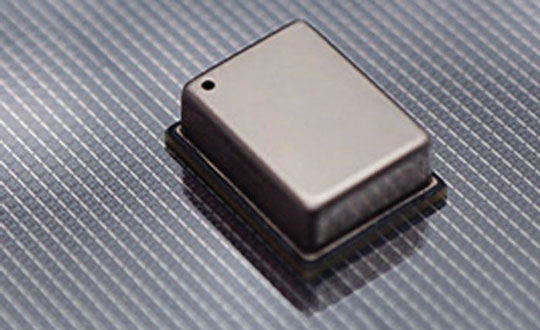
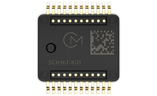
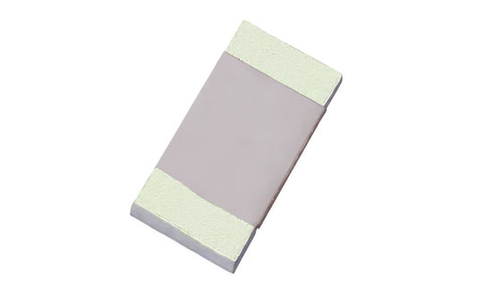
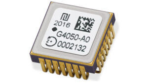 High-Dynamics MEMS Gyro
Designed for precision navigation applications
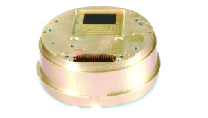
The GYPRO4300 is a high-dynamics MEMS gyro designed for precision navigation applications. It features a ±300 °/s input range, 200 Hz bandwidth and 1 ms latency, making it ideal for dynamic environments. With a bias instability of 0.4 °/h and an angular random walk of 0.07 °/√h, the GYPRO4300 offers high-performance sensing in a compact, digital and low size, weight and power (SWaP) package.
Building on the GYPRO4300, the GYPRO4050 is a specialized north-seeking gyro for low-dynamics applications. This derivative offers 2° azimuth accuracy and is currently in the customer sampling stage. The GYPRO4050 maintains the same miniature package design as its predecessor, ensuring consistency across the product line.
At INTERGEO 2024, TDK showcased a prototype based on an ongoing research and development project. This new development utilizes the same miniature package as the GYPRO4300 and GYPRO4050 but demonstrates ultra-low noise capabilities, achieving an azimuth accuracy of less than 1°. This product is slated for launch in 2025.
Tronics Microsystems, tronics.tdk.com
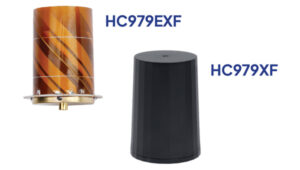
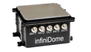
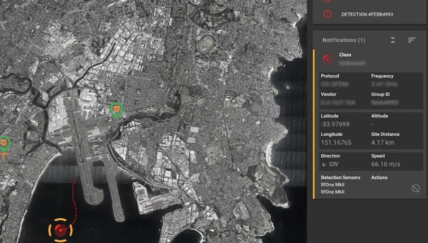
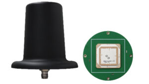 Anti-Jamming
For challenging GNSS environments
This series of anti-jamming antennas comes in two models, PT023 and PT024. The antennas are specifically engineered to operate in challenging environments characterized by complex electromagnetic interference, high-power signals and strong multipath effects.
They are well-suited for scenarios involving low-elevation angle interference, high-power interference sources and radio communication system noise. The PT023 model utilizes multiple array elements combined with amplitude and phase manipulation to achieve spatial radiation shaping. This antenna also incorporates advanced multi-level filtering technology, effectively suppressing out-of-band noise power.
The PT024 model features vertical and horizontal two-dimensional polarization suppressors. This design effectively mitigates the reception of both odd and even LHCP and RHCP signals originating from the rear of the antenna, according to the company. It can also suppress low-elevation multipath signals at the same frequency and out-of-band noise signals. These features seek to enhance the antenna’s performance in complex electromagnetic environments.
Harxon Corporation, harxon.com
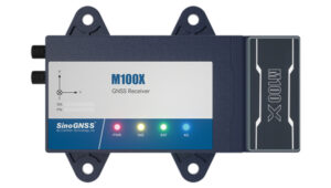
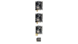 Triple-Band RTK Receivers
Integrated into ArduSimple’s evaluation boards
The UM980, UM981 and UM982 RTK modules are integrated into the ArduSimple simpleRTK3B series to accelerate high-precision GNSS integration. Supporting Galileo High Accuracy Service (HAS) and fast update rate (50Hz), these devices are suitable for applications that require reliable and precise navigation.
- SimpleRTK3B Budget (UM980): The most affordable step into triple-band precision.
- SimpleRTK3B Fusion (UM981): Ideal for projects that need GNSS and inertial measurement unit (IMU) sensor fusion or tilt compensation.
- SimpleRTK3B Compass (UM982): Designed for setups requiring dual antennas to determine the heading on moving platforms.
ArduSimple has also integrated Unicore UM980, UM981 or UM982 modules into the simpleRTK3B Micro Unicore, part of its compact Micro-format lineup. It is designed for simple PCB integration, which can significantly speed up the development process and the time to market for new products.
Unicore, en.unicore.com
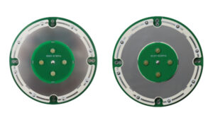 OEM GNSS Antenna
Full-band, full-frequency antennas
The HX-SE402A and HX-SE403A are full-band, full-frequency antennas that integrate GNSS capabilities with a low-profile radio antenna to support 858-878MHz and 902-928MHz frequency bands. This addresses the growing need for devices requiring both navigation and communication functionalities. Harxon’s new low-profile technology achieves the same functionality at 10 mm height, allowing greater versatility in applications that demand precise positioning alongside wireless communication. Additionally, Harxon offers custom tuning services to optimize integration into OEM end-user modules for specific applications.
Harxon Corporation, harxon.com
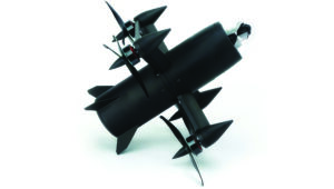
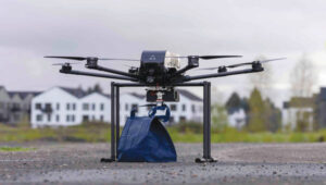
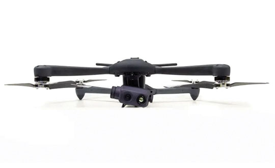
UAV
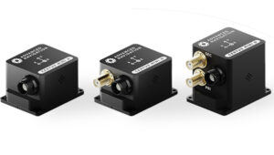 OEMs
OEMs
Engineered for autonomous applications
Advanced Navigation has expanded its Certus product line by introducing the Certus Mini series. This development marks a significant advancement in compact and high-performance navigation technology for field robots, autonomous vehicles and UAVs.
The Certus Mini series comes in three variants:
- Certus Mini D: A dual-antenna inertial navigation system (INS).
- Certus Mini N: A GNSS-aided INS.
- Certus Mini A: An attitude and heading reference system (AHRS).
These lightweight systems, weighing no more than 55 grams (1.9 oz), offer impressive performance and cost-efficiency for their size. The Certus Mini D utilizes dual-antenna GNSS for accurate heading, position and velocity measurements. It operates on L1/L5 multi-constellation GNSS and offers enhanced interference immunity and position accuracy, particularly in challenging urban environments. The Certus Mini series suits various applications, including surveying, agricultural robotics, open-pit mining and asset tracking.
Advanced Navigation, advancednavigation.com
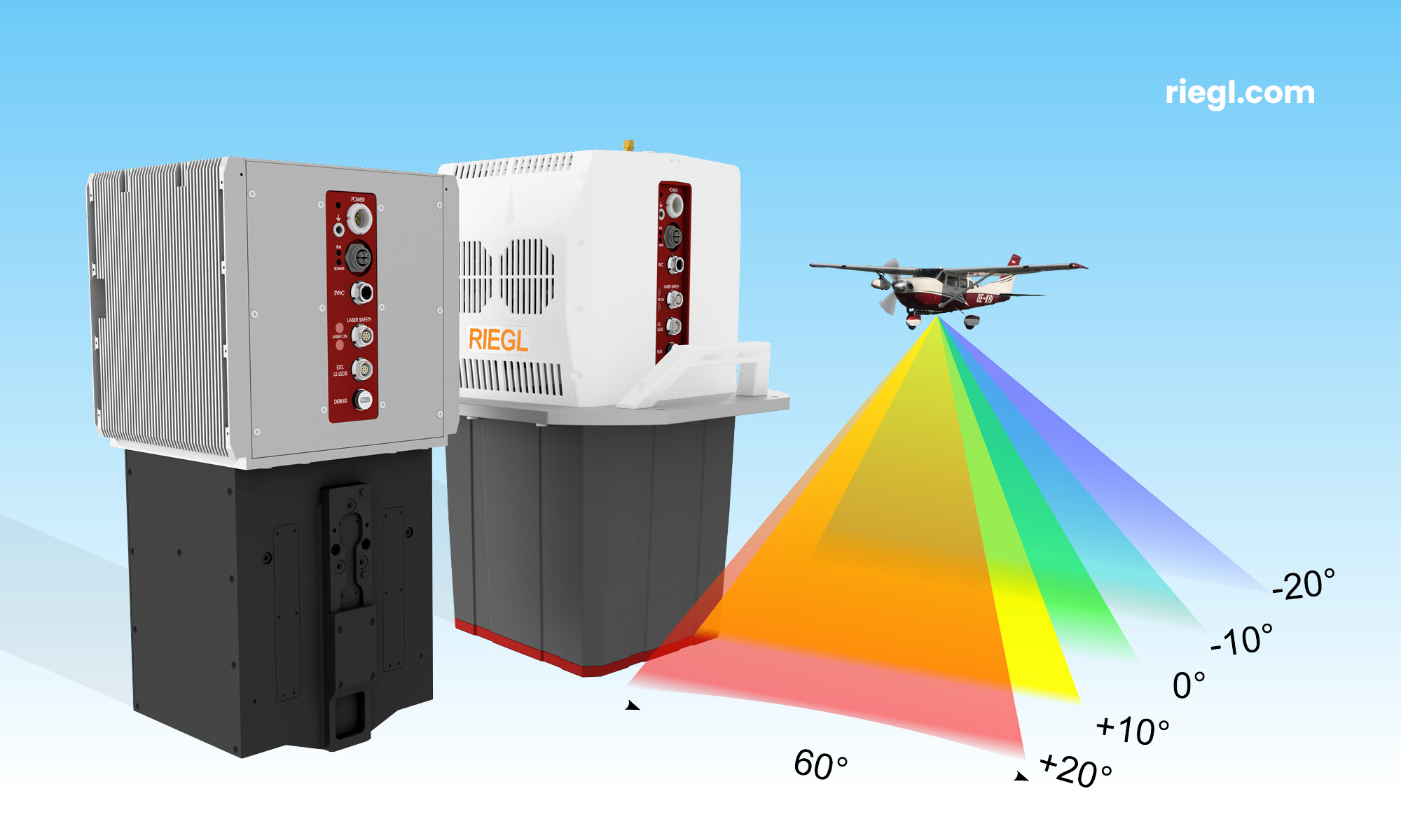
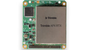 Direct Georeferencing Solution
Designed for UAV mapping
The APX RTX portfolio is a new line of direct georeferencing solutions designed for UAV mapping sensors. This system enables high-accuracy mapping across diverse environments, ideal for OEMs and UAV payload integrators. At the core of the APX RTX portfolio is the Trimble CenterPoint RTX technology, which offers both real-time and post-mission direct georeferencing. This capability allows for centimeter-level accuracy without the need for base stations, making it compatible with various sensors, including cameras, lidar and hyperspectral mapping devices.
Trimble, trimble.com
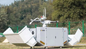
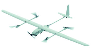
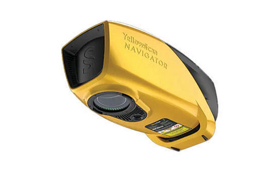
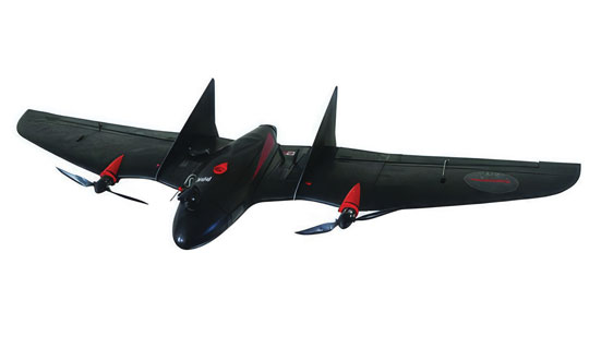
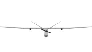 Fixed-Wing UAV
Integrates YellowScan Voyager lidar
The DT46 lidar UAV is a fixed-wing system designed for long-distance inspections and the creation of precise digital twins. The DT46 model integrates the YellowScan Voyager lidar with a high-resolution RGB camera. Equipped with a laser scanner with a 100° field of view and an acquisition rate of up to 2400 kHz, the YellowScan Voyager offers optimal point density for demanding projects.
With a flight range of up to 300 km, depending on whether vertical take-off and landing (VTOL) or catapult take-off is employed, the UAV is designed for long-distance operations and can be deployed in under 15 minutes without requiring specialized tools. This autonomous solution offers a seamless end-to-end solution for various industries requiring aerial surveying and inspection capabilities.
DELAIR, delair.aero
Surveying
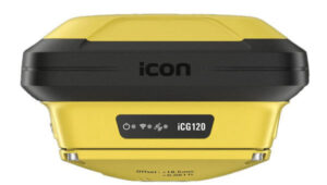
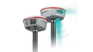
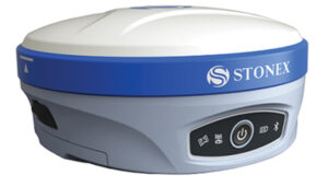 GNSS Receiver
Featuring a multi-constellation antenna
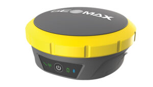
The Stonex S900 GNSS receiver features a high-accuracy, multi-constellation antenna, a powerful UHF transmitter and the GSM 4G modem for a fully integrated communications choice, combined with a light and modern design. It tracks signals from GPS, GLONASS, BeiDou, Galileo and QZSS satellites. On the S900, two smart hot-swappable batteries can be inserted simultaneously, ensuring a maximum of 12 hours of operation. The power level can be checked and seen on the controller or directly on an LED bar on the battery.
Stonex, stonex.it
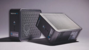
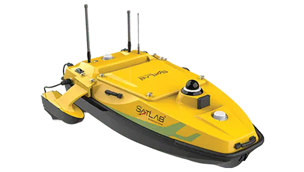
 USV
USV
For underwater topographic surveying
The HydroBoat 1500 is a versatile unmanned surface vessel (USV) driven by four powerful thrusters and designed to carry out underwater topographic surveys of lakes, rivers, reservoirs and other bodies of water. With a payload capacity of 60 kg, it can be integrated with the SatLab HydroBeam M4 portable multibeam echosounder, as well as a variety of other payloads such as side scan sonars and ADCPs. The vessel is IP67-rated and includes a millimeter-wave radar and 360° omnidirectional camera for accurate obstacle detection and safe navigation. It is also equipped with a dual RF and 4G cellular communications system.
SatLab, satlab.com
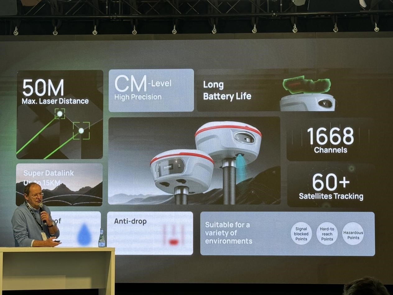
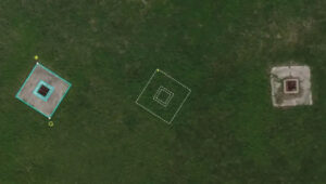
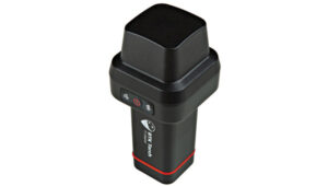
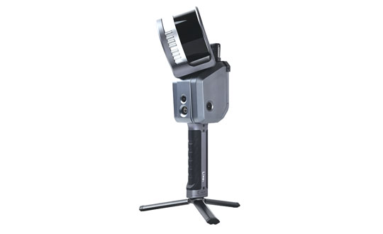
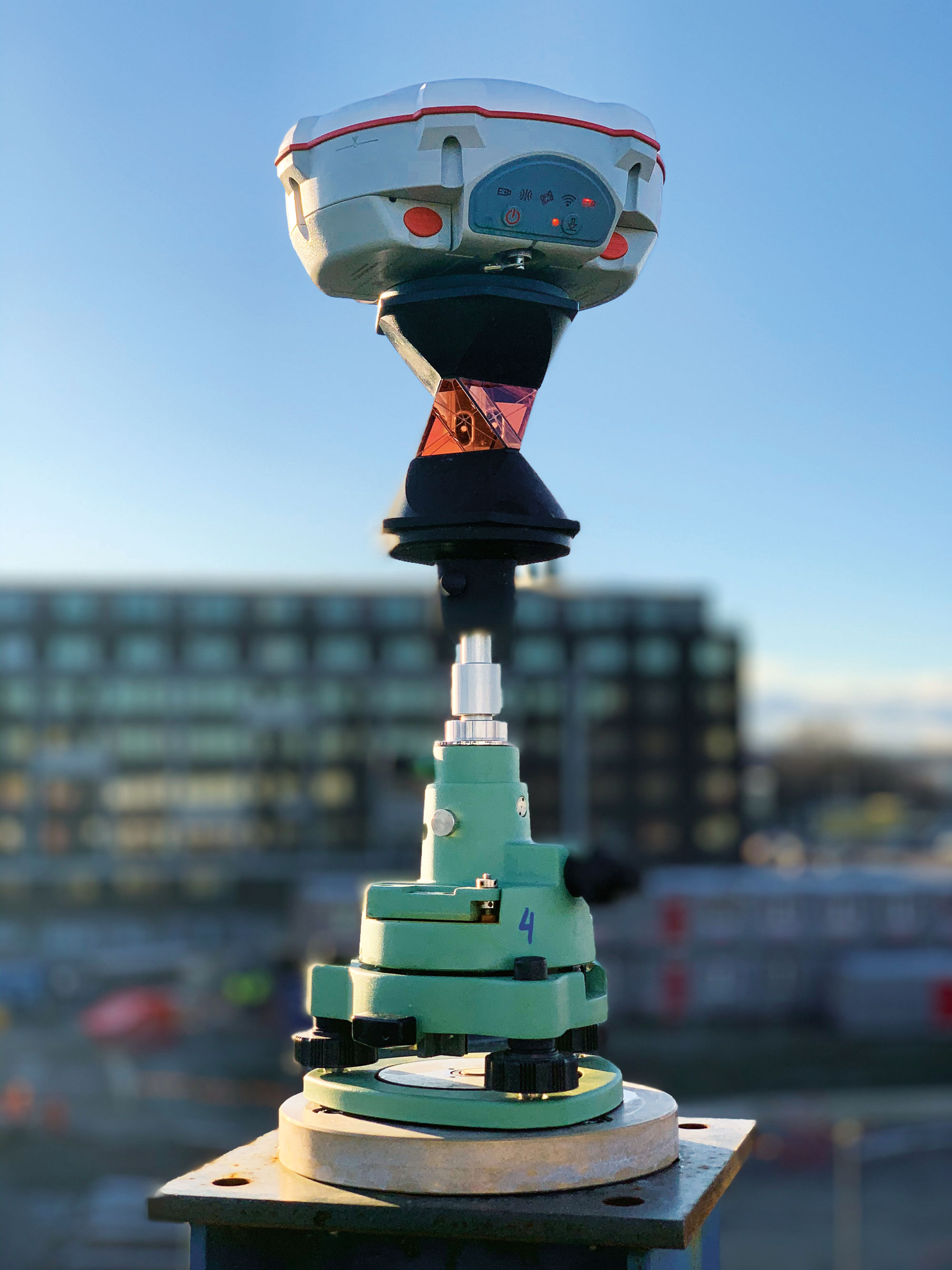
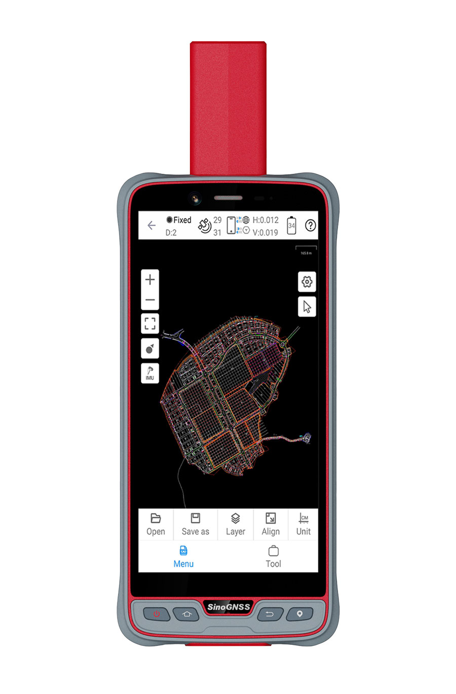
 Laser RTK
With a laser range of up to 50 m
The Jupiter Laser RTK integrates GNSS, auto-IMU (inertial measurement unit), laser and dual-camera systems into a single unit. It incorporates a precise green laser that remains visible even in bright daylight. This feature allows for precise measurements of points in hard-to-reach, signal-blocked or potentially hazardous locations. It also features a night vision camera, allowing users to see feature points even in low-light conditions.
The RTK system’s laser range is up to 50 m, making it suitable for challenging surveying environments. It incorporates visual technology to offer surveyors an immersive experience during surveying and stakeout operations, improving working efficiency and productivity.
Comnav Technology, comnavtech.com
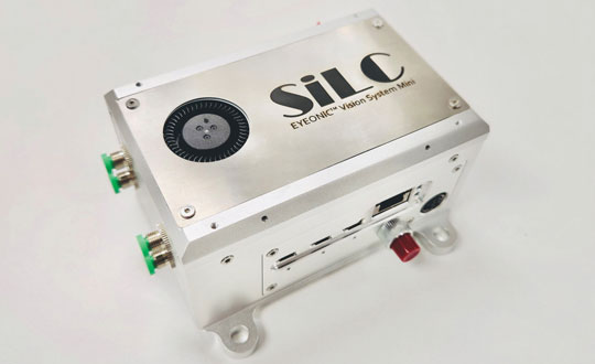
 UAV Lidar Scanner
Designed for aerial surveying
EchoONE combines Teledyne’s lidar and camera technology with Inertial Labs’ remote sensing payload instrument (RESEPI). EchoONE is designed for industries requiring precise aerial surveying and mapping solutions, such as land surveying, electric utility vegetation management, asset modeling, as well as transportation and infrastructure projects. Users can create detailed 3D models for infrastructure and asset management, offering valuable insights for maintenance and planning. EchoONE also generates fully undecimated georeferenced point clouds in real time, which allows for in-field verification. This capability is complemented by rapid post-processing through RESEPI’s “one-click” PC-Master Pro solution.
Teledyne Geospatial, teledyneimaging.com
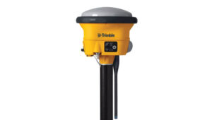
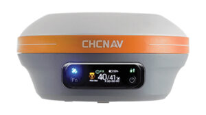 Receiver
With IMU tilt compensation
The i83 Pro is an inertial measurement unit (IMU) real-time kinematic (RTK) GNSS receiver. This receiver combines GNSS capabilities with extensive compatibility options to address the diverse needs of surveying, construction, and mapping professionals. It incorporates CHCNAV’s third-generation GNSS antenna and the latest iStar algorithm, designed to boost GNSS signal tracking efficiency by 30%, according to the company. With 336 channels supporting GPS, GLONASS, BeiDou, Galileo and QZSS constellations, it can achieve centimeter-level precision rapidly, even in challenging environments.
The i83 Pro supports various GNSS surveying modes, such as RTK Networks NTRIP and UHF base-rover configurations. It features an IP68-rated enclosure for dust and water protection, a compact and lightweight design for enhanced portability, a high-resolution color display for clear status information and a 20-hour battery life for continuous operation in rover mode.
CHC Navigation, chcnav.com
Mapping
 Software Solution
Featuring a GIS interface
LP360 Land is designed to process lidar, GNSS and SLAM data from handheld sensors, particularly the TrueView GO handheld scanner. It features a GIS interface that allows users to combine various geospatial datasets and offers SLAM point cloud processing capabilities. Additionally, LP360 Land includes advanced visualization tools that support multiple synchronized windows for 2D, 3D, profile and immersive views.
Its coordinate system management includes datum and projection transformations. The software also offers quality assurance and control (QA/QC) tools, along with data editing and cleaning functionalities. Users can perform manual and automatic registration of point clouds and utilize an image explorer for contextual analysis by linking point clouds to photos, which allows for the generation of accurate and colorized point clouds even in GPS-denied environments.
GeoCue, geocue.com