A roundup of recent products in the GNSS and inertial positioning industry from the December 2023 issue of GPS World magazine.
SURVEYING AND MAPPING
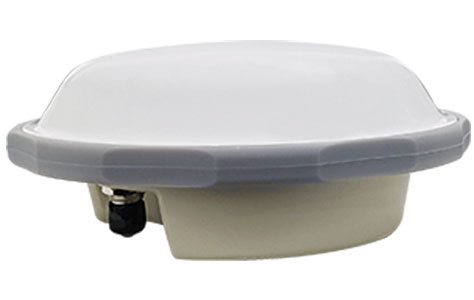
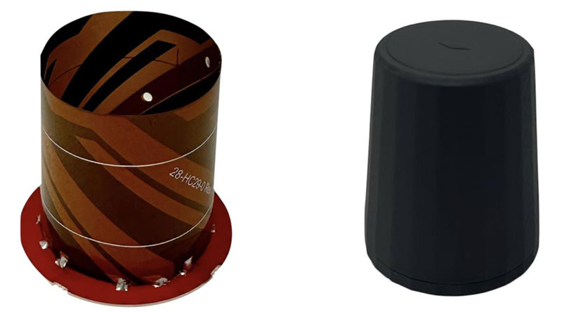
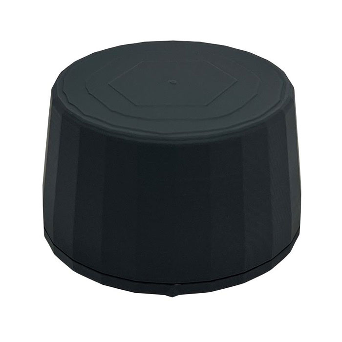
Survey Antenna
Designed for high-accuracy positioning applications
HX-CSX600A boasts a pre-filtered low noise amplifier (LNA) offering out-of-band rejection, ensuring strong anti-interference performance even in challenging environments. It is designed for high-precision GNSS applications, including agricultural vehicles, small robots and surveying. The antenna offers reliable and consistent satellite signal tracking across a wide range of frequency bands, including GPS, GLONASS, Galileo, BeiDou, QZSS, IRNSS, SBAS, as well as L-band correction services. With advanced multipoint feeding technology, HX-CSX600A maintains a stable phase center variation. Built with an IP67-rated compact and ruggedized housing, this antenna is designed to withstand dust, rain, sunlight, shock and vibration. Its standard TNC-K connector and pole mount aim to simplify the integration process.
Harxon, harxon.com
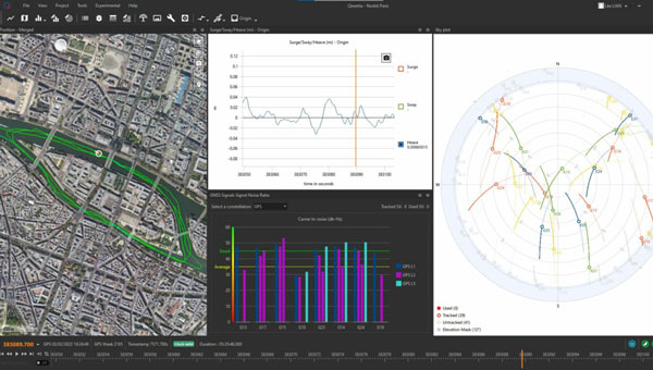
INS/GNSS Post-Processing Software
Designed for surveying applications
The Qinertia 4 introduces several features that provide users with a complete solution for precise trajectory and motion analysis. Qinertia is a post-processing software delivering better precision and reliability compared to real-time kinematic systems. It has an enhanced geodesy engine that boasts an extensive selection of preconfigured coordinate reference systems (CRS) and transformations, making it a versatile solution in applications that use diverse geodetic data, including land surveying, hydrography, airborne surveys, construction and more. To tackle the challenges of variable ionospheric activity, the technology uses Ionoshield PPK mode. This feature compensates for ionospheric conditions and baseline distances, allowing users to perform post-processing kinematics (PPK) even for long baselines or harsh ionospheric conditions. Another addition to Qinertia 4 is extended continuously operating reference stations (CORS) network support. This feature offers users a vast network of 5,000 SmartNet stations for reliable GNSS data processing.
Qinertia has more than 10,000 bases in 164 countries. This global coverage ensures Qinertia remains a reliable and efficient solution, regardless of geographic location. In addition, users can import their own base station data and verify its position integrity with precise point positioning (PPP). For data that cannot be processed using PPK, Qinertia 4 offers an alternative solution with its new tightly-coupled PPP algorithm. This new processing mode, available for all users with active Qinertia maintenance, provides post-processing anywhere in the world without a base station, with a horizontal accuracy of 4cm and a vertical accuracy of 8cm.
SBG Systems, sbg-systems.com
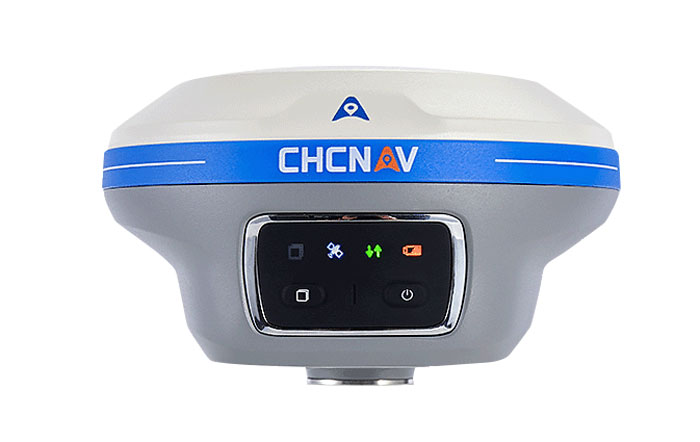
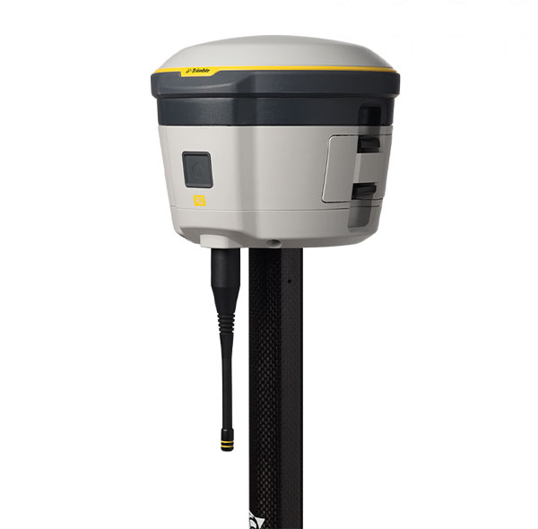
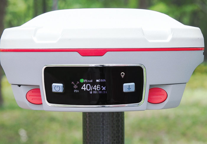
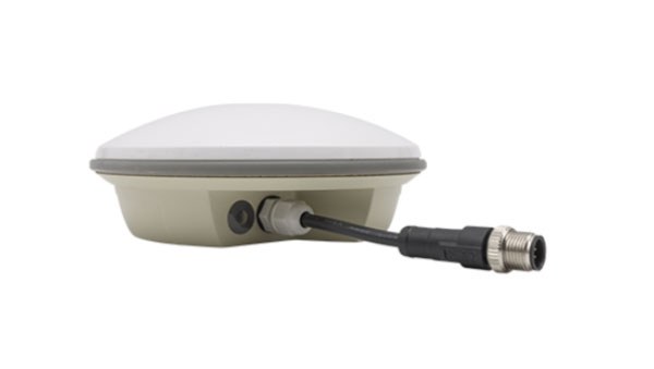
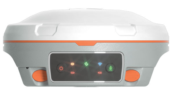
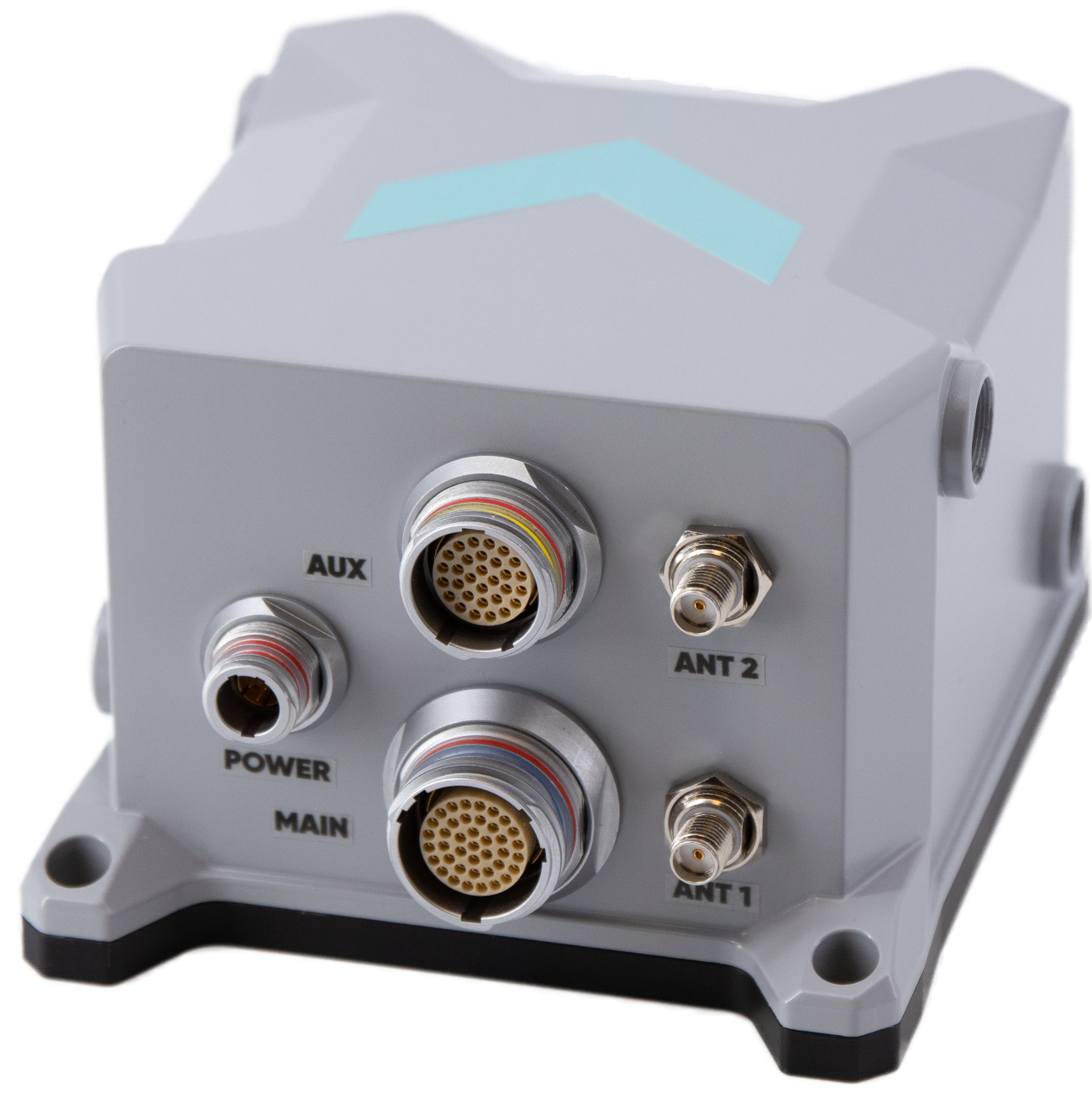
IMU-RTK GNSS Receiver
A compact, high-performance receiver with high-end dual camera technology
The i89 visual inertial measurement unit (IMU) GNSS receiver is a surveying device equipped with a 1,408-channel GNSS module that enhances real-time kinematic (RTK) availability, even in challenging environments. Its iStar 2.0 software incorporates advanced ionospheric modeling algorithms, achieving a high integrity RTK fix rate, particularly critical in regions of intense solar activity. The implementation of AUTO-IMU technology eliminates the need for manual initialization, streamlining field operations for increased efficiency. The i89 offers 16.5 hours of battery life and a lightweight 750 g design. The combination of panoramic capture mode and integrated IMU significantly improves the accuracy and efficiency of photogrammetric surveys.
CHC Navigation, chcnav.com
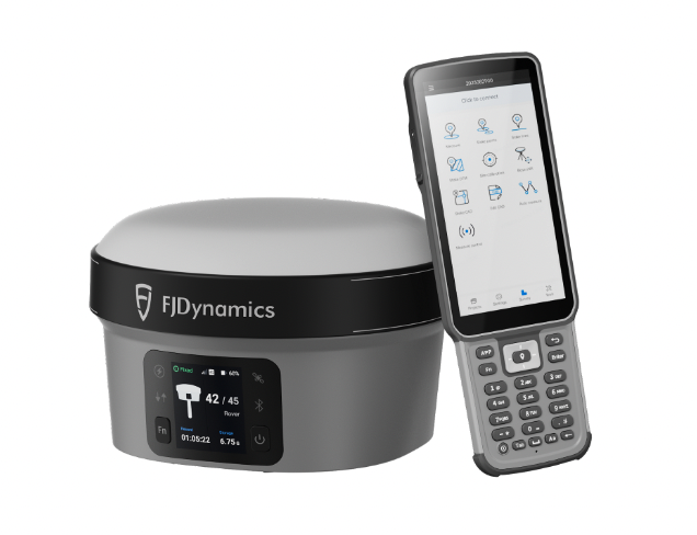
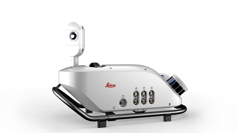
GNSS System
Features visual positioning capabilities
The Trion V10i GNSS System integrates two cameras for vision-guided surveying operations, an inertial measurement unit (IMU) for tilt surveys and an OLED screen for easy status checks. This device is designed to enhance productivity in the field, even in hard-to-access locations. It features IMU-based tilt compensation for precise measurements of up to 60° with no calibration needed. It also comes with a built-in 4G LTE and UHF and supports NFC, Wi-Fi and Bluetooth. It also offers users seamless connectivity through Trion Survey Cloud for real-time data sharing between field and office teams.
FJDynamics, fjdynamics.com
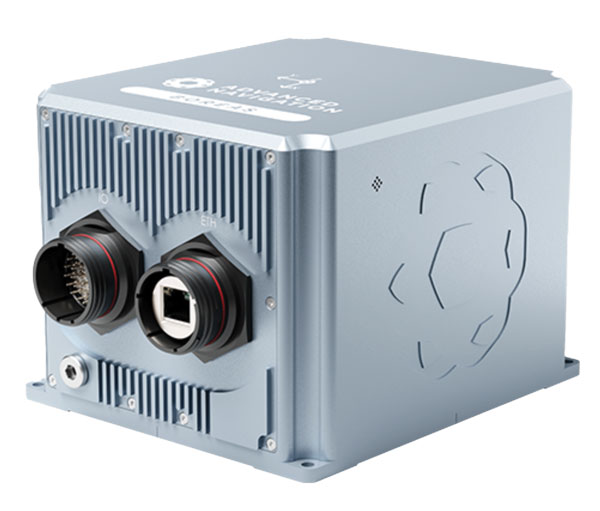
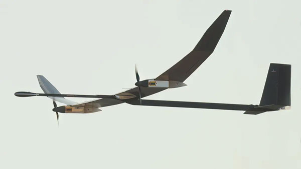
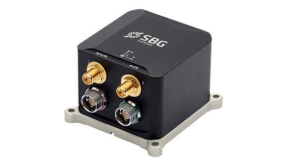
INS
For mobile mapping applications
The Atlans 3 is an inertial navigation system (INS) designed for land and air mobile mapping applications. The device is an all-in-one positioning and orientation system integrating unique micro-electro-mechanical systems. MEMS-FOG hybrid technology and a dual-antenna real-time kinematic GNSS receiver are housed within one compact device. The Atlans 3 offers north-keeping capability at FOG-level performance across a variety of land and air mobile mapping applications. It delivers real-time heading, even in GNSS-challenging environments such as urban canyons, mountainous terrain, or forested areas. The lightweight INS is designed to meet the requirements of high-performance lidars mounted on vehicles where space and weight constraints are critical. The Atlans 3 is designed to be quick and simple to install on all platforms. It offers efficient “set-and-forget” operations for a wide range of land and air applications including road and rail asset inventory, pavement condition survey, vehicle automation, HD mapping, ground-truth, airborne surveys and precision pointing.
Exail, exail.com
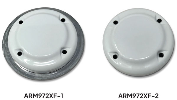
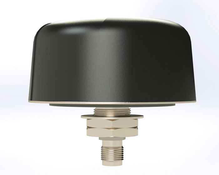
L-Band GNSS Antennas
Available in four models
The ARM972XF triple-band plus L-band GNSS antennas provide GPS/QZSS L1/L2/L5, GLONASS-G1/G2/G3, Galileo E1/E5a/E5b, and BeiDou B1/B2a/B2b + L-band coverage. The technology is designed for precision triple-frequency positioning where light weight and a low profile are required. The ARM972XF are small and lightweight housed triple-band precision mini ARINC GNSS antennas. They have an average phase center variation of less than 10 mm for all frequencies and overall azimuths and elevation angles. Additionally, both models are available with components qualified for low-Earth orbit (LEO). Housed in a weatherproof (IP67) enclosure, the ARM972XF is available in four versions. Model ARM972XF-1 (ARM972XF-1-S for LEO space-qualified components) has an integrated 100 mm ground plane, while model ARM972XF-2 (ARM972XF-2-S for LEO space-qualified components) is 83 mm in diameter. The antennas also include Tallysman’s eXtended filtering (XF) technology, designed to mitigate GNSS interference.
Tallysman Wireless, tallysman.com
UAV
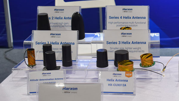
Helix Antenna
Designed for UAVs
The HX-CUX615A has a low-profile design and simple integration process that makes it a suitable antenna for various UAV applications such as aerial photography, remote sensing, infrastructure inspection, traffic control and public security. Equipped with a pre-filtered LNA, HX-CUX615A offers out-of-band interference rejection to mitigate unwanted electromagnetic interference and provide reliable GNSS signals for seamless integration into positioning solutions. This lightweight antenna also adopts patented dual-quadrifilar helix antenna technology, ensuring stable wide-angle circular polarization performance. This results in low-elevation satellite tracking, while maintaining high gain and reliable signal tracking — even in challenging environments.
Harxon, harxon.com
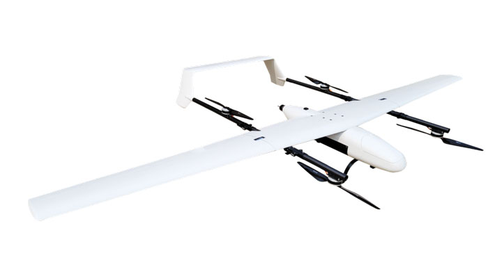
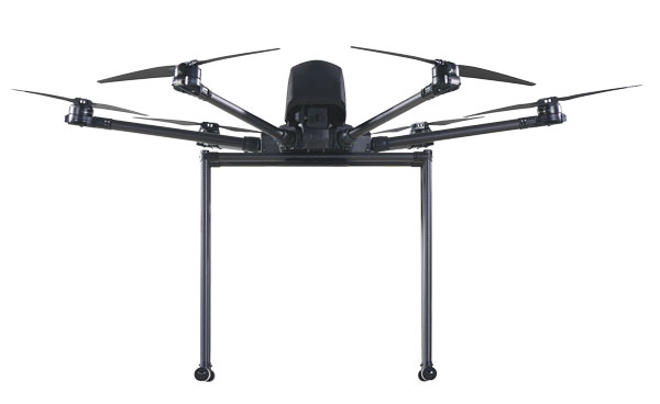
VToL UAV
A fully autonomous fixed-wing VTOL UAV with multiple power configurations and a heavier payload
The E455 is a fixed wing, vertical takeoff and landing (VTOL) UAV. At 55lbs, the E455 offers a 2-hour flight endurance operating on battery power alone. It is designed to carry a variety of payloads, including mapping sensors, lidar and EO/IR surveillance sensors. Where allowed, the E455 can fly at gross weights up to 65 lbs, which offers users more versatility in payload selection. The E455 also features an open control payload bay, which allows for the seamless integration of custom payloads.
EVENT 38, event38.com
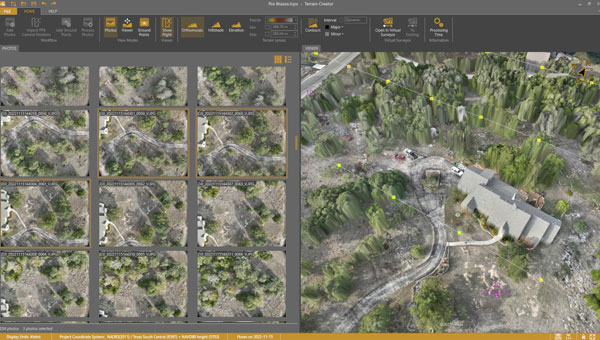
UAV Surveying Software
With added UAV photogrammetry capabilities
The Terrain Creator app photogrammetrically processes UAV images to generate survey-grade terrains that then transfer into the traditional Virtual Surveyor workspace. Terrain Creator aims to simplify the aerial photogrammetry process by offering a visual and intuitive application to produce an orthomosaic and a digital surface model (DSM) from UAV photos, the company said. The software was originally developed to bridge the gap between UAV photogrammetric processing applications and engineering design packages. Prior to this new release, users had to rely on third-party software to generate elevation models and an orthomosaic on which they could work with the Virtual Surveyor toolset. Now, users can derive the 3D topographic information necessary for construction, surface mining and excavation projects in one package. Once the survey-grade terrains flow from the Terrain Creator into the Virtual Surveyor desktop app, users can access an interactive virtual environment and robust toolsets to generate CAD models, create cut-and-fill maps and calculations, or calculate volume reports. Users currently subscribed to Virtual Surveyor Ridge and Peak editions will see their software updated automatically with Terrain Creator. A flexible licensing setup will allow two users within a subscribing organization to use the Terrain Creator and Virtual Surveyor applications simultaneously from different computers.
Virtual Surveyor, virtual-surveyor.com
MOBILE
Antenna
Designed for high-precision and autonomous multi-frequency applications
The M10HCT-TNC GNSS L1/L2/L5 antenna is ground-plane independent and offers extremely low power consumption and minimal phase-center variation over azimuth crafted for GNSS high-precision applications. The antenna offers suitable axial ratio, ensuring multipath error is mitigated. Several filtering groups allow this antenna to have superb filtering capabilities and RF antijamming mitigation capabilities.
Maxtena, maxtena.com
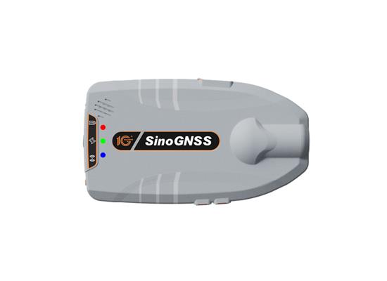
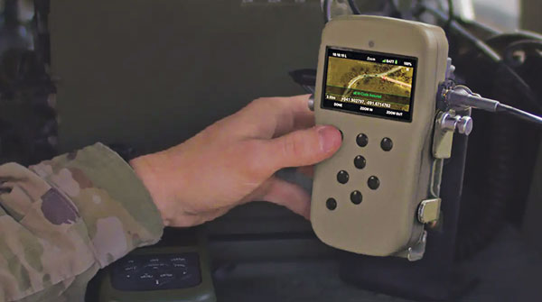
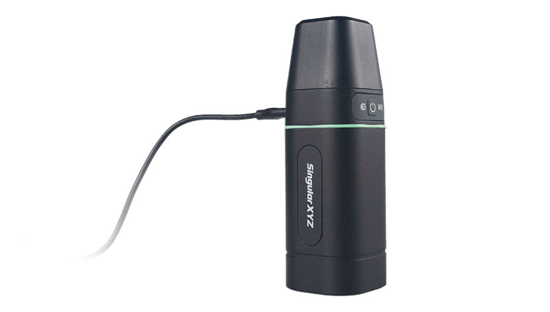
GNSS Receiver
Suitable for personnel positioning, IoT, railway patrols, vehicle tracking, and search and rescue missions
Equipped with the SinoGNSS K8 platform, the Z30 can track full constellations and multiple frequencies, providing centimeter-level accuracy. With 965 channels, it is capable of tracking more than 60 GPS, BeiDou, GLONASS, Galileo, QZSS, IRNSS and SBAS satellites. The Z30 features an integrated antenna for stable signal reception. The device is also equipped with two side buttons for power, one-click SOS alerts and three Indicator LEDs for power, satellite, and differential status checks. It supports NTRIP and TCP protocols, enabling various personnel positioning applications by uploading position data. The Z30 integrates with NaviCloud, offering functions such as real time location display, historical trajectory query, remote control, and electric fence. In addition, it can be customized to meet specific customer requirements. With indoor and outdoor positioning capabilities, the Z30 is a suitable solution for various fields. It supports outdoor real-time kinematic positioning with centimeter-level accuracy and indoor Bluetooth positioning with sub-meter-level accuracy.
ComNav Technology, comnavtech.com
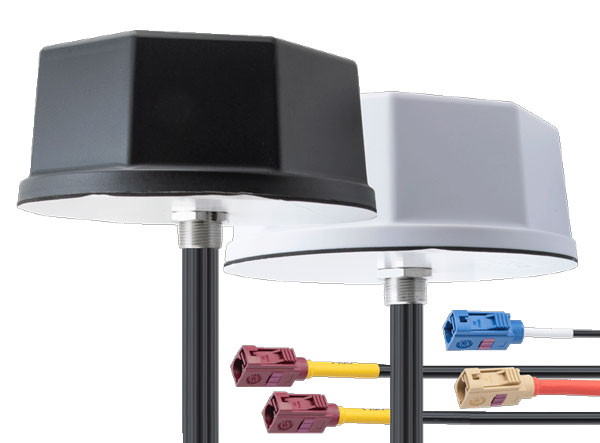
Antennas
IoT multiband antennas designed for multiple mobile applications
The Pasternack IoT multiband combination antennas are designed for vehicles, fleets and pivotal base stations. The technology aims to revolutionize how industries perceive and use mobile connectivity. The antennas integrate 4G, 5G, Wi-Fi and GPS bands to offer emergency teams, on-the-move fleets and first responders an unwavering link, even in harsh environments. Facilitated with both FAKRA and SMA connectors and extended 17-foot cable leads, users can seamlessly integrate the technology. It also has an IP69K rating, certifying it for both indoor and outdoor deployments. MIMO capabilities improve data transmission speeds and reliability, ensuring consistent high-bandwidth connections. The antenna’s GPS/GNSS component, enhanced with LNA and amplified by a 26 dB gain, offers users improved navigation and tracking precision.
Pasternack, pasternack.com