A roundup of recent products in the GNSS and inertial positioning industry from the October 2023 issue of GPS World magazine.
SURVEYING & MAPPING
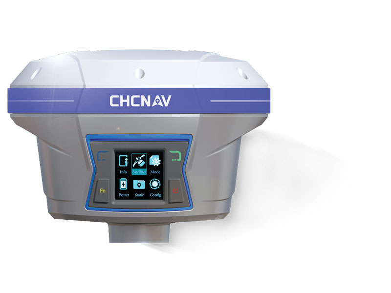
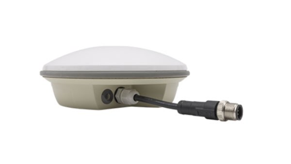
GNSS Receiver
For GIS and survey professionals
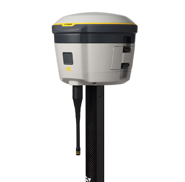
The R2 GNSS system is a compact, durable, and flexible GNSS receiver that collects highly accurate data in a wide range of geospatial applications with submeter to centimeter positioning accuracy. The R2 can track the full range of GNSS satellite constellations and augmentation systems, and also comes with an integrated Trimble Maxwell 6 chip and 220 channels. Users can achieve higher accuracy in real-time with the ability to choose correction sources from traditional real-time kinematic, VRS networks, to Trimble RTX correction services delivered by both satellite and internet/cellular. The R2 can provide improvements to position availability and accuracy when heavy overhead cover, such as tree canopy and buildings, obstruct satellite signals. The receiver is also IP65-rated, making it suitable for rugged environments.
Trimble Geospatial, geospatial.trimble.com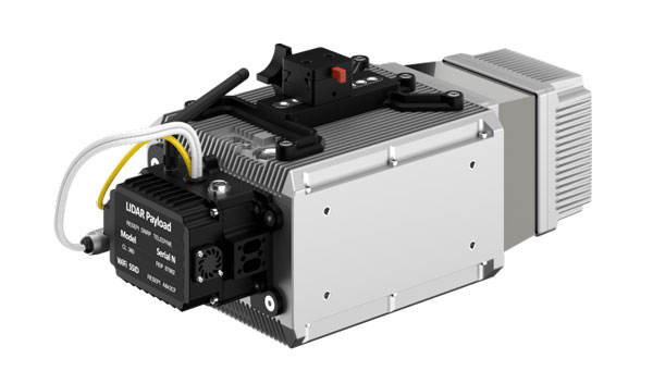
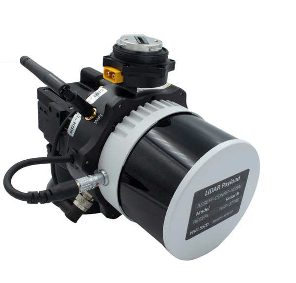
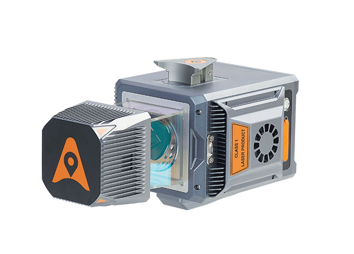
Scanning and Mapping Solution
Designed for accuracy-focused remote sensing applications
The Resepi Teledyne Optech CL-360-HD has a powerful four-return laser and increased range of up to 750 m, making it ideal for mobile mapping, forestry and crack detection in critical infrastructure areas such as airport runways. Resepi is a sensor-fusion platform designed for accuracy-focused remote sensing applications. Resepi utilizes a high-performance INS and a high-accuracy dual antenna GNSS receiver, integrated with a Linux-based processing core and data-logging software. The platform also provides a Wi-Fi interface, optional imaging module, and external cellular modem for RTCM corrections. Resepi can be operated by a single hardware button or from a wirelessly connected device via a simple web interface. Resepi, equipped with Teledyne’s CL-360HD lidar, offers various laser scan speeds and frequencies, allowing users to tweak the settings to match their individual needs.
Inertial Labs, inertiallabs.com
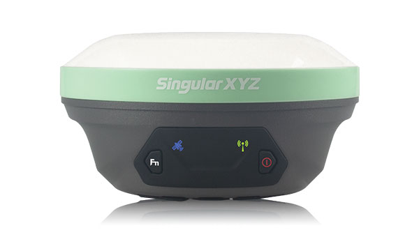
GNSS Receiver Series
Available in three different models for various applications
The Xtraordinary X1-series GNSS receivers include X1 and X1 Lite and X1 Pro. The X1-series adopts Linux OS, which improves the stability of the system and the synergistic compatibility of each module. This series of GNSS receivers features improvements to satellite tracking, the inertial measurement unit (IMU), battery life, and more. Optimized with a new generation of IMU module, users can easily initialize the IMU in 5-sec and start tilt measurements up to 60°. The X1-series GNSS receivers supports both 4G/radio correction data transmission and can reach up to 15 km range in enhanced internal UHF mode, 20 km range in external mode, and more than 50 km via internal GSM or PDA CORS mode.
SingularXYZ, singularxyz.com
GNSS Smart Antenna
For agricultural, marine, GIS, mapping and other applications
The A631 combines the Athena GNSS engine and Atlas L-band correction technologies with a new web user interface (WebUI). Optional features include 16 GB of internal storage, Bluetooth and Wi-Fi. The compact antenna is designed for rugged environments and meets IP67 requirements. With multiple operating modes, A631 can be used as an RTK base station or rover. The device is supported by the Atlas Portal, which empowers users to update firmware and enable functionality, including Atlas subscriptions for accuracies from meter to sub-decimeter levels. A631 also supports BaseLink and SmartLink modes. SmartLink allows users to directly connect AtlasLink as an extension to any existing system that has industry-standard connectivity options. BaseLink automatically sets up AtlasLink as a permanent reference station, delivering corrections to any other GNSS receiver being used for positioning.
Hemisphere GNSS, hemispheregnss.com
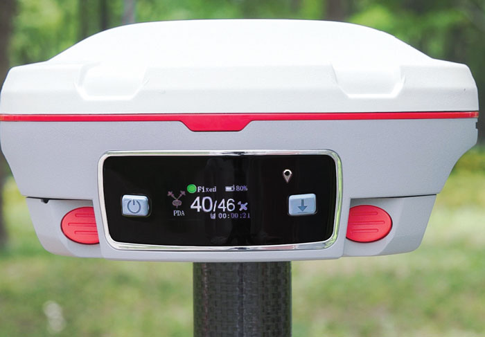
GNSS Receiver
For land surveying, GIS, and construction applications
The Mars Pro combines GNSS, inertial measurement unit (IMU), and laser technologies. When set to laser mode, the Mars Pro can carry out measurements by selecting a signal-friendly spot within a 10-m radius, which aids in measuring hard-to-reach, signal-obstructed, and hazardous areas. With its millimeter-level laser distance meter integrated on its rear, the Mars Pro facilitates the utilization of the laser mode in scenarios involving surveying and stakeout. The integrated IMU sensor offers 60° tilt compensation, which remains functional even when operating in laser mode, allowing for uncompromised efficiency and accuracy. Equipped with the latest K8 platform, it boasts full-constellation support, offering 1,668 tracking channels and more than 60 satellite tracking capabilities across all existing and planned constellations — GPS, GLONASS, Galileo, BDS, QZSS and IRNSS. The Mars Pro offers support for precise point positioning (PPP) service, enabling rapid fixing within seconds. Its dynamic OLED color screen is sunlight readable and offers real-time visualization of essential data — satellite count, fixed state, on-off state, power, and more. It is compatible with mainstream brands and multiple protocols, such as Transparent, TT450S, SATEL, Trimtakl3, CHC and South.
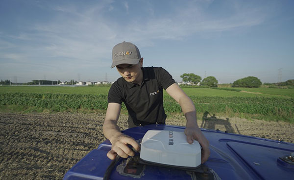
ComNav Technology, comnavtech.com
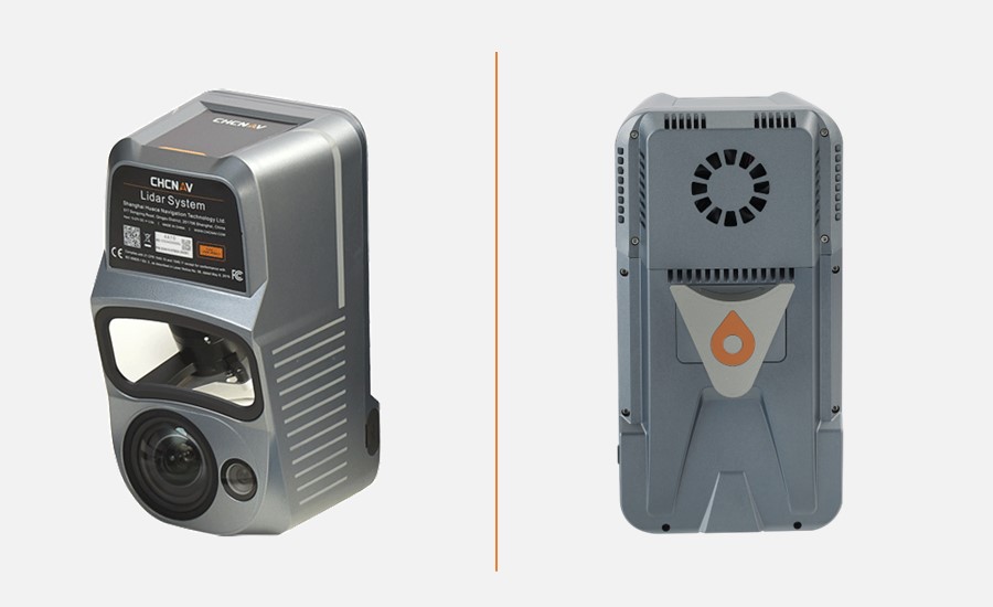
Lidar System
For mobile mapping applications
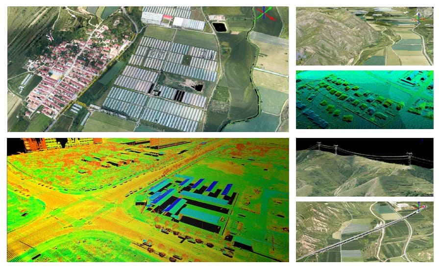
The AlphaUni 20 lidar system (AU20) features advanced multi-target capabilities that support up to 16 target echoes for vegetation penetration. The AU20 captures ground surfaces with extreme precision, producing accurate digital elevation models and digital surface models in challenging environments. The lidar system has an accuracy of 2 cm to 5 cm. It has a lightweight, compact design that weighs 2.82 kg in its airborne configuration and a total of only 10.7 kg with its car mount kit, including a Ladybug5+. Its flexible multi-platform design allows users to install it on manned or unmanned aircraft for aerial scanning, integrate it into a variety of land vehicles, and even use it as a backpack-mounted system for mapping narrow areas.
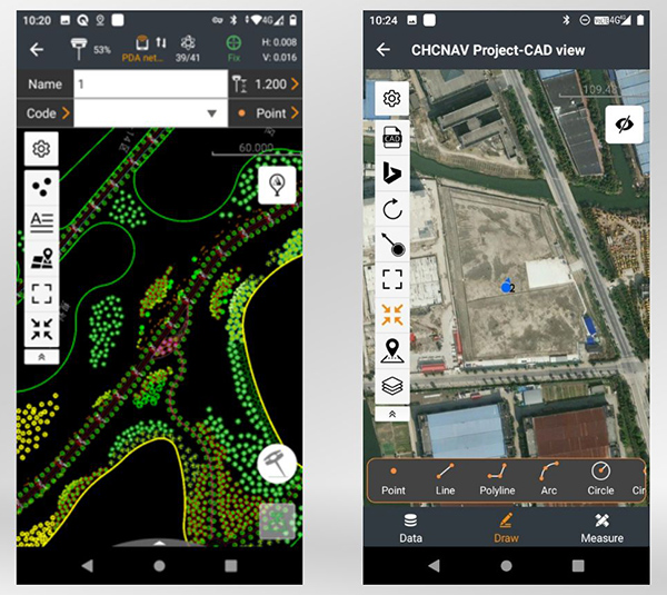
CHC Navigation, chcnav.com
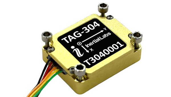
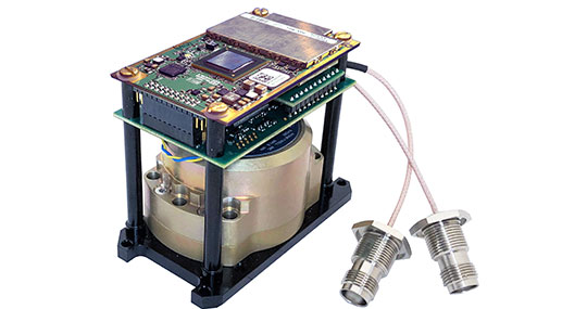
Gyroscope
An advanced performance, tactical-grade MEMS gyroscope solution
Developed for use in particularly harsh environments, the TAG-304 gyroscopes can withstand extreme shock and vibrations in accordance with MIL-STD-810 standards. Additionally, TAG-304 gyroscopes are fully digitized (RS-422 interface), include built-in test (BIT) functionalities, and have no moving parts. TAG-304 is an advanced performance, tactical-grade MEMS gyroscope, of which size, power consumption, reliability and performance are ideal for accomplishing complex tasks requiring accurate stabilization of assorted platforms. Very low latency (group delay), small size, 4K Hz data rate, 1K Hz bandwidth, and low noise make TAG-304 gyroscopes a suitable solution for miniature electro-optical systems, gimbals, line-of-sight, and pan and tilt platforms stabilization and pointing applications.
Inertial Labs, inertiallabs.com
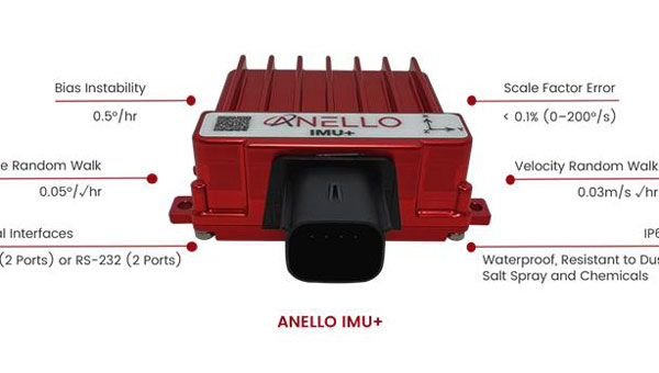
IMU
For GNSS-challenged environments
The ANELLO IMU+ provides robust and reliable autonomous navigation and positioning in GNSS-denied or GNSS-compromised environments. Powered by optical gyroscope technology, the ANELLO IMU+ delivers high precision and reliability in demanding conditions, including shock, vibration, electromagnetic interference and temperature. The ANELLO IMU+ is suitable for autonomous applications in the construction, robotics, mining, trucking and defense industries.The device delivers long-term dead reckoning in high-temperature and high-vibration environments.The ANELLO IMU+ features unaided heading drift of < 0.5°/hr, dual high-speed CAN FD interfaces, and dual RS-232 interfaces; has ASIL-D ready, automotive-qualified CPU and OS; and is IP68 waterproof, resistant to dust, salt spray and chemicals.
ANELLO Photonics, anellophotonics.com

Flying Laser Scanner
Captures colorized 3D point clouds for producing 3D models, drawings, and visualizations
BLK2FLY is a fully integrated lidar UAV laser scanner with advanced obstacle avoidance for reality capture from the air. It can scan inaccessible areas such as rooftops, facades and large building interiors. BLK2FLY autonomously captures interior and exterior dimensions and features of buildings with a few taps on a tablet. Users can select an area within the map on their tablet and the BLK2FLY will create its own flight path to scan it quickly and safely. Users can send the BLK2FLY to scan a new area by tapping anywhere on the 3D view in the app. The BLK2FLY also can be piloted manually with virtual joysticks on a user’s tablet.
BLK2FLY can scan interiors of large arenas, stadiums, facilities, plants, and even obscured or confined outdoor areas with its Indoor Mode, which allows the BLK2FLY to get closer to objects with reduced flight speed and to fly within confined spaces without access to GNSS. With advanced obstacle avoidance and increased visual SLAM capabilities, the BLK2FLY’s Indoor Mode makes scanning inside fast and versatile.
Leica Geosystems, leica-geosystems.com
MOBILE
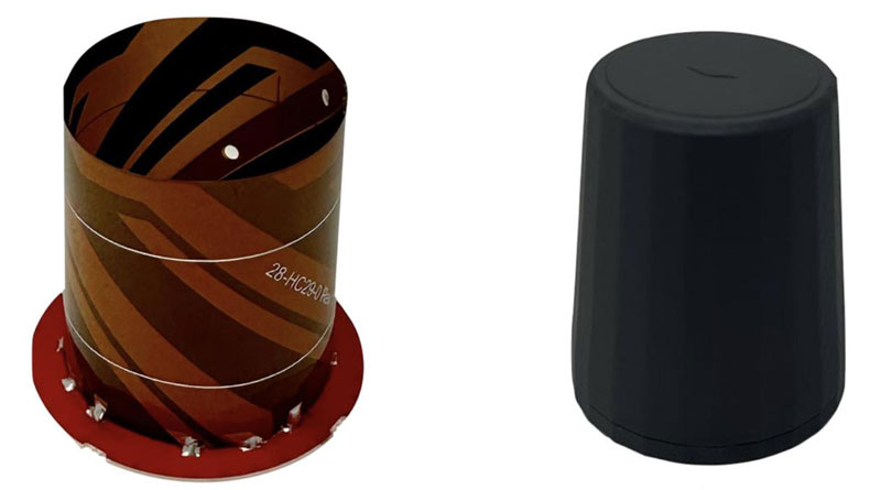
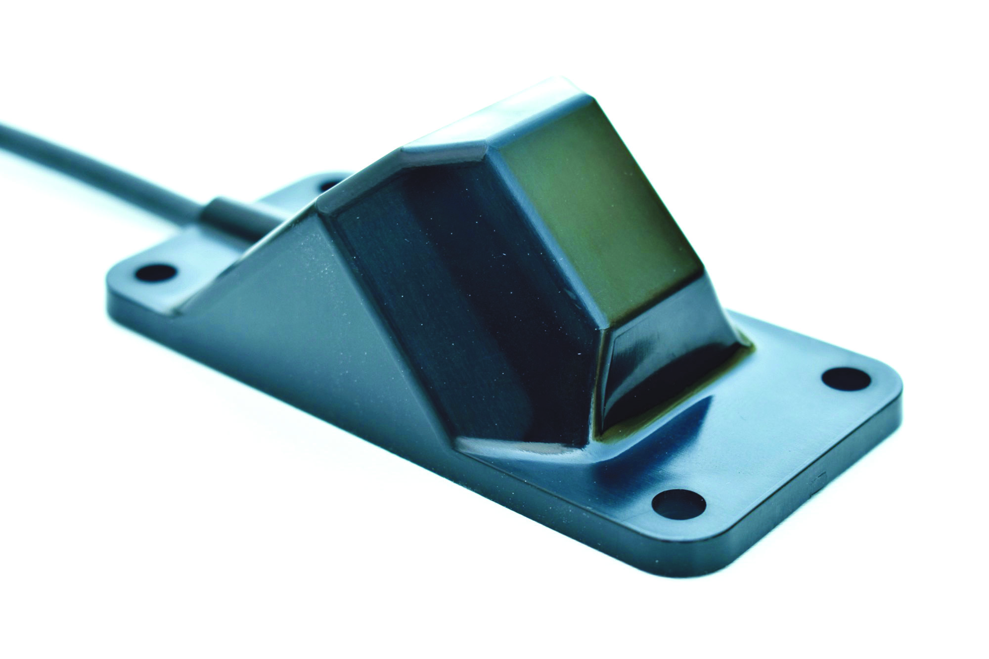
Smart Antenna
Suitable for multiple applications
The HCS885XF/HCS885EXF smart helical GNSS antenna is suitable for UAV, land survey devices, automotive positioning, and other precise positioning/heading applications. The HCS885XF/HCS885EXF combines the performance and light weight of the Tallysman dual-band (GPS/QZSS L1/L5, GLONASS G1/G3, Galileo E1/E5a/b, BeiDou B1/B2/B2a) HC885SXF antenna with the low power consumption and GNSS augmentation capabilities of the u-blox NEO-F9P GNSS receiver. HCS885XF/HCS885EXF employs L5 signals (1160-1217 MHz), which transmit stronger signal power and a higher bandwidth chipping rate than L2 signals, thereby offering high performance when challenged with strong multipath signals. It also employs Tallysman’s eXtended Filtering system, which mitigates near-band and out-of-band interference, such as LTE signals and their harmonics and the planned Ligado service in North America, enabling operation in the most challenging deployments. The HCS885XF/HCS885EXF integrated receiver can simultaneously monitor four constellations, support base/rover RTK configurations (<1 cm), and use u-blox PointPerfect PPP-RTK augmented services over a terrestrial control network (3-6 cm). A moving-base precise heading configuration is available with base/rover antenna pairs.
Tallysman Wireless, tallysman.com
Antenna
Multi-constellation antenna for precision agriculture and semi-autonomous or autonomous applications
The TS122 EUAA provides centimeter-level accuracy in highly variable terrain and challenging GNSS-obstructed environments with ± 10 cm P2P accuracy and STANDALONE technology. The TS122 EUAA smart antenna receives dual-frequency multiple constellation signals from GPS, GLONASS, Galileo and BeiDou, with output position information up to 10 Hz. The antenna is capable of correcting deviations caused by a vehicle’s roll and pitch while working on uneven groups or slopes.
Harxon, harxon.com