A roundup of recent products in the GNSS and inertial positioning industry from the June 2024 issue of GPS World magazine.
SURVEYING & MAPPING

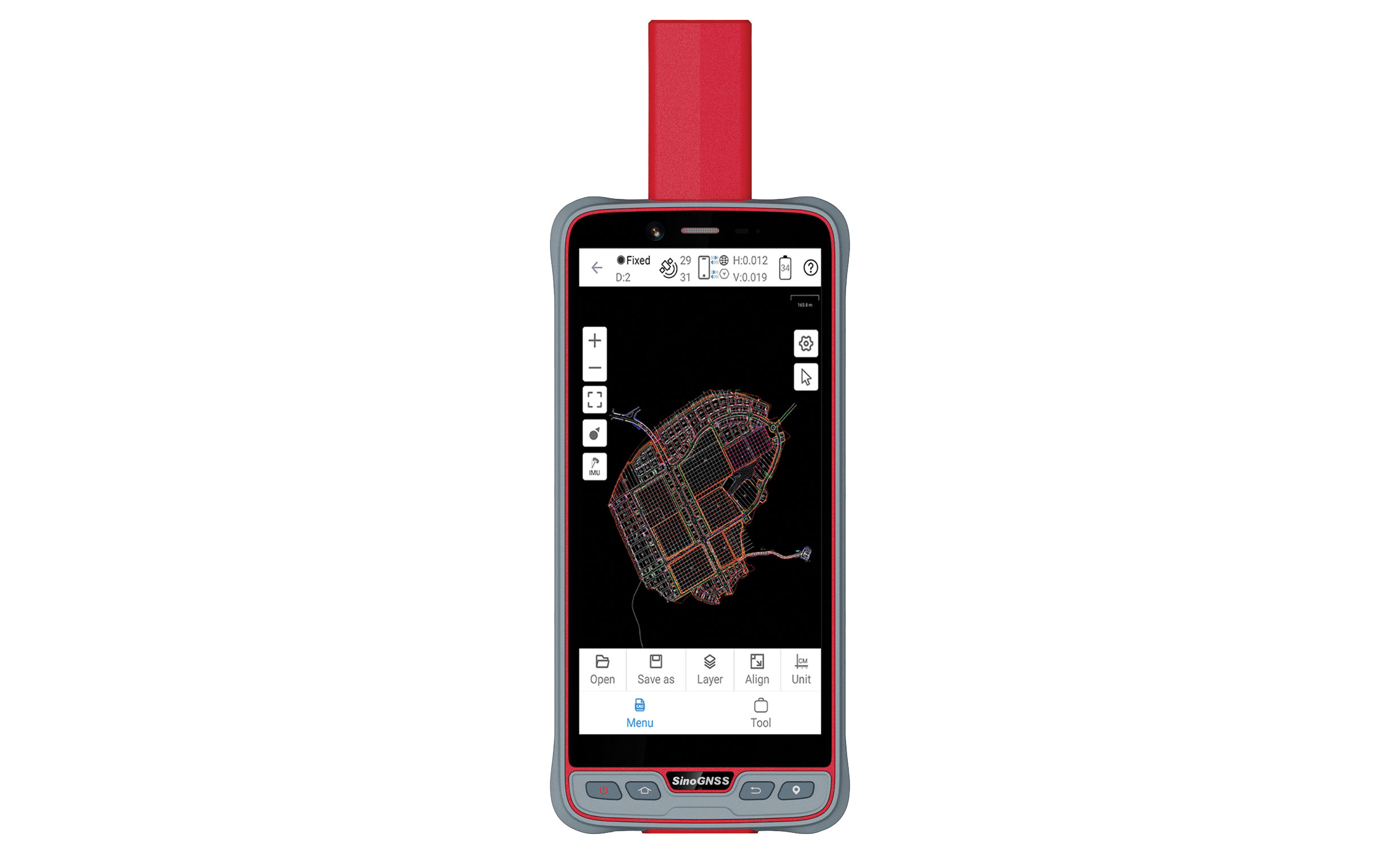
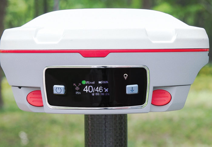
Upgraded surveying software
With an improved CAD engine
Survey Master 3.5.0 includes an enhanced CAD engine. A measurement grade has been added to the CAD to improve the software’s utility in design and planning projects. Additionally, the latest version features expanded CAD drawing and survey functions to offer users a comprehensive toolset — including point, line, polyline, curve, arc, square, rectangle, polygon, circle and text. Survey Master 3.5.0 features CAD capture mode from any point and allows users to easily display or hide point icons.
The system added the Dominican predefined coordinate system, SBAS configuration, PPP and RTK PPP fusion, updated satellite frequencies and an external datalink CDL7 configuration. Existing software users can update directly in Survey Master.
Comnav Technologies, comnavtech.com
Scanning kit
Combines photogrammetry with RTK precision
The Pix4D & Emlid Scanning kit combines advanced photogrammetry with real-time kinematics (RTK) precision for quick data capture when documenting trenches and as-builts, performing volumetric measurements and enhancing aerial data with terrestrial scans. It includes the PIX4Dcatch app and the Emlid Reach RX RTK rover.
The PIX4Dcatch app allows precise scanning for both photogrammetry and lidar projects. The hardware features the Emlid Reach RX RTK rover, which comes with an ergonomic handle and accessories. It is integrated with PIX4Dcatch and provides real-time positioning through NTRIP.
The kit works with any correction network or GNSS base station broadcasting RTCM3. The rover gets a fix in less than five seconds, offering centimeter-accurate positioning in challenging conditions. It can also be used with the survey pole as an RTK rover for data collection and stakeout.
Designed for urban surveying, the Reach RX rover is lightweight, rated IP68, sealed and protected from water and dust.
The PIX4Dcatch mobile app allows users to use a smartphone for scanning, access RTK precision data through integration with Reach RX and generate a digital model within minutes. Users can also store, annotate, measure and share data online in PIX4Dcloud as well as verify geolocated positions and visualize the project in AR. It extracts insights from both terrestrial and aerial data and features online and offline processing, advanced photogrammetry capabilities, team collaboration and AR for CAD overlays.
Emlid, emlid.com
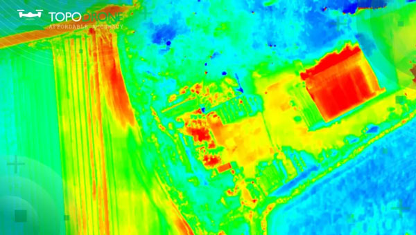
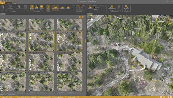
UAV surveying software
Now with planimetric survey capabilities
Virtual Surveyor version 9.5 is a smart UAV surveying program featuring new planimetric survey capabilities. Users can survey 2D features from UAV orthophotos and add them to a 3D topographic model generated from the same data set.
The integrated Terrain Creator app photogrammetrically processes UAV photos to build survey-grade digital surface models (DSMs) and orthomosaics. These transfer seamlessly to the traditional Virtual Surveyor app where users can generate CAD models, create cut-and-fill maps and gather other 3D topographic information.
No third-party software is needed to create surveys from UAV data. The system is ideal for users in construction, surface mining and excavation projects.
Virtual Surveyor, virtual-surveyor.com
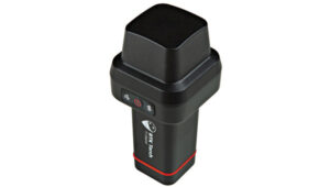
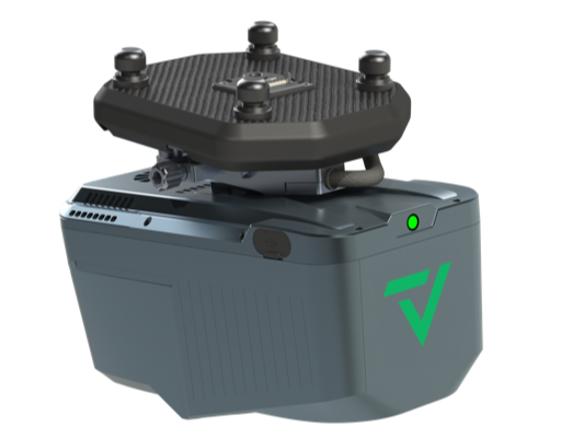
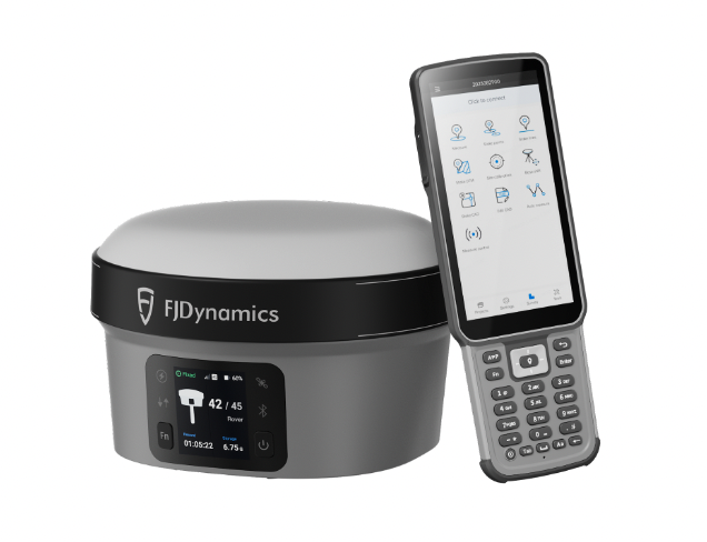
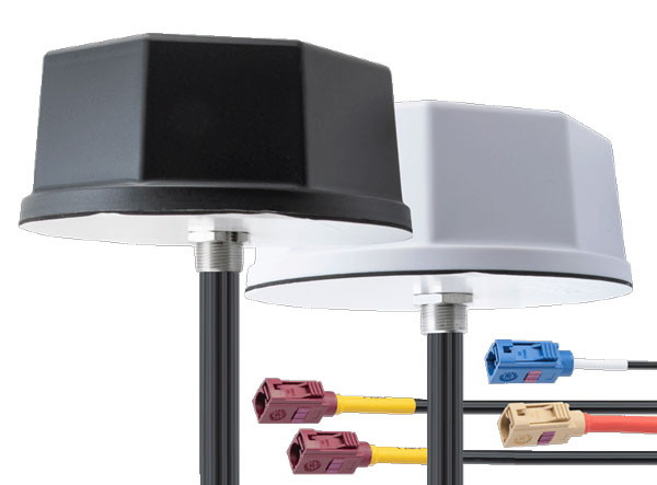
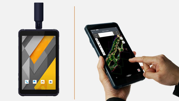
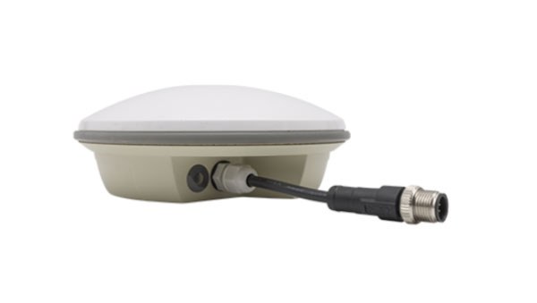
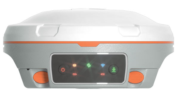
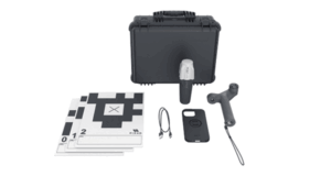
RTK technology
For GIS needs
RTK Torch is designed for high-precision geolocation and GIS needs. It has tri-band reception and tilt compensation.
The RTK Torch can provide millimeter-grade measurements. Users can connect a phone to the device over Bluetooth and receive the NMEA output and work with most GIS software.
The RTK Torch features Zero-Touch RTK technology, which gives connected devices WiFi credentials for a hotspot or other WiFi network. The device will begin receiving corrections without any further setup, with no NTRIP credentials required. These corrections are obtained over WiFi from u-blox PointPerfect and are available in the United States, Europe and various parts of Australia, Canada, Brazil and Korea.
The RTK Torch includes a one-month free subscription to PointPerfect. Additional subscriptions can be purchased if desired. If PointPerfect coverage is not available in the area, corrections from a local base station or service can be provided to the device over NTRIP, delivered via Bluetooth or WiFi.
It is housed in an IP67-rated enclosure. It is waterproof when submerged up to 1 m for up to 30 minutes when the USB cover is closed. Under the hood of the SparkFun RTK Torch is an ESP32, a UM980 L1/L2/L5 high precision GNSS receiver from Unicore, and an IM-19 for tilt compensation. The addition of the L5 reception makes this portable GNSS device ideal for densely canopied areas where normal L1/L2 reception may have problems.
SparkFun, sparkfun.com

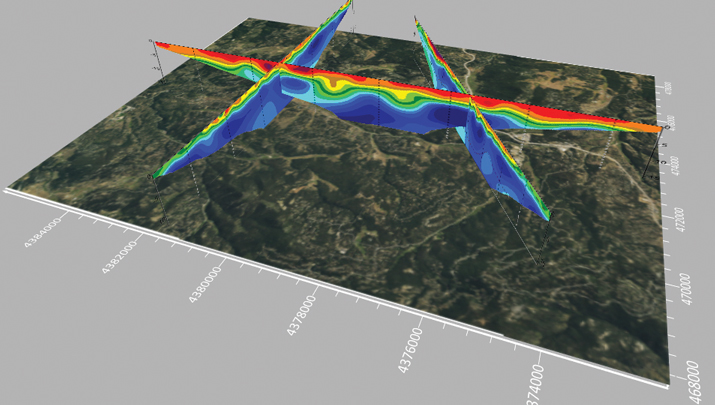
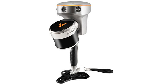
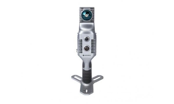
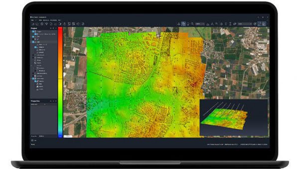
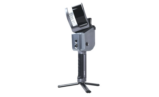
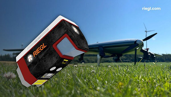
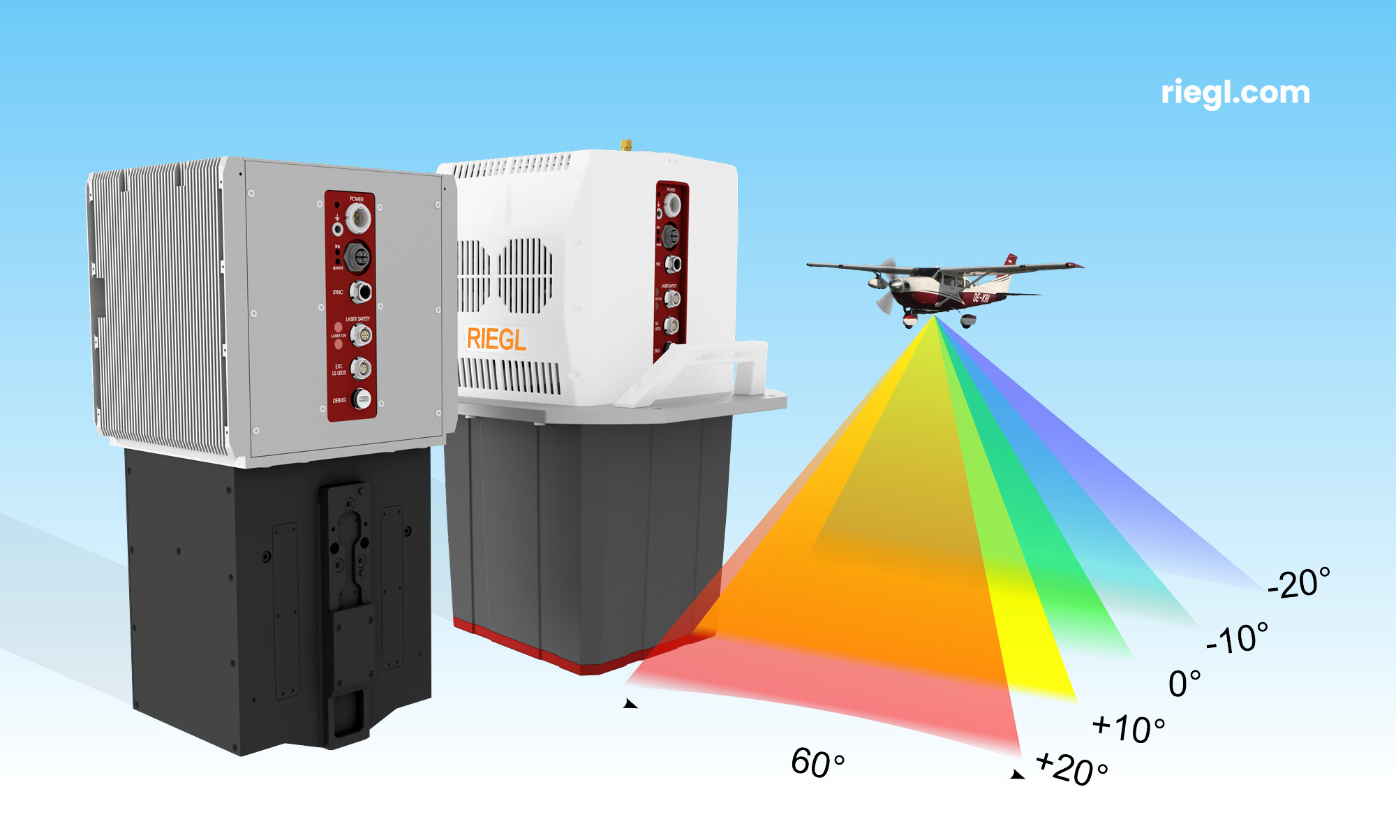
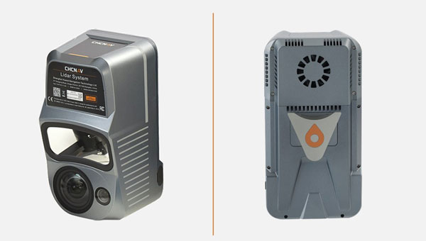
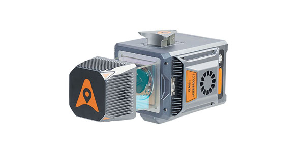
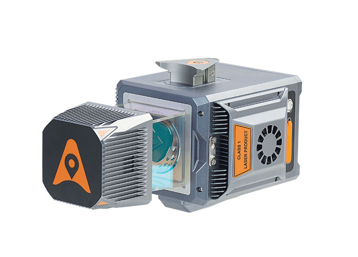
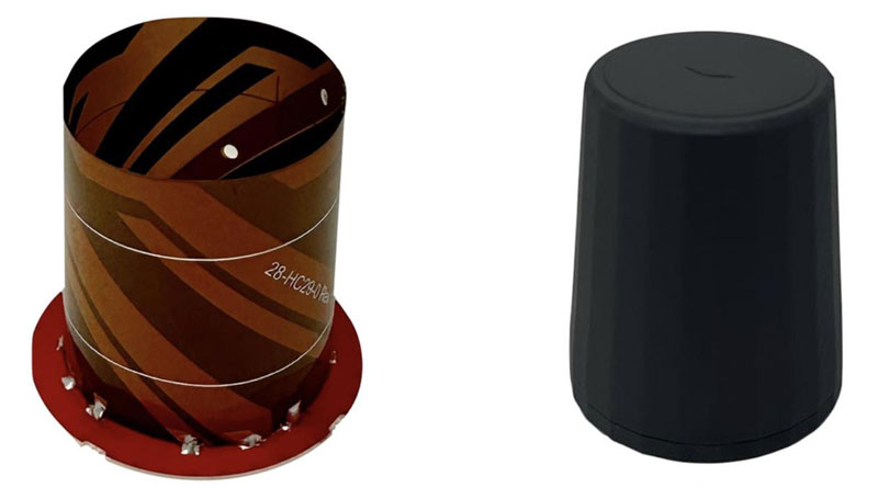
3D laser scanner
For indoor and outdoor mapping
The VZ-600i terrestrial laser scanner offers a broad range capability from 0.5 m up to 1,000 m and is suitable for indoor and outdoor 3D mapping applications. It features 3D position accuracy of 3 mm, less than 30 sec scan time for high-resolution scans with 6 mm point spacing at 10 m, weight less than 6 kg (13 lbs), 2.2 MHZ PRR, three internal cameras and is GNSS integrated.
Designed for mobile mapping applications, the system is suitable for architecture, engineering and construction (AEC), building information modeling (BIM), as-built surveying, forensic and crash scene investigation, archeology, forestry and more.
RIEGL, riegl.com
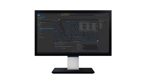
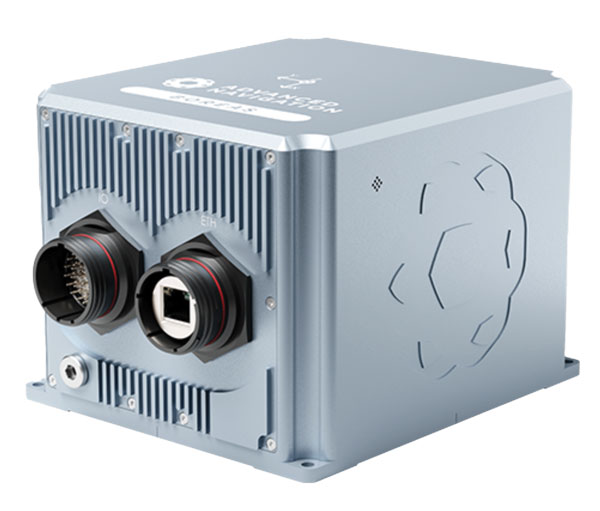
OEM

Application suite
Featuring GRIT Technology
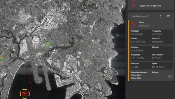
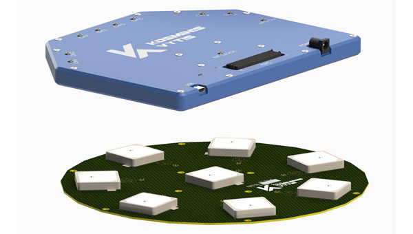
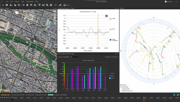
The NovAtel Application Suite Version 2.0 now includes GNSS Resilience and Integrity Technology (GRIT). The GRIT Monitor application allows users to observe radio frequency (RF) interference through a comprehensive dashboard to make informed decisions to maintain robust positioning.
GRIT is RF interference detection and mitigation technology available on all OEM7 GNSS receiver products, including individual cards and enclosures such as smart antennas, PwrPak and MarinePak.
It includes positioning and device status overviews to serve as a mitigation assistant that indicates whether interference is detected. It features an interactive spectrum viewer, which shows all constellations and frequency bands (spectrum and waterfall), and a signal matrix indicating the signal quality and interference status by frequency band and constellation.
The updated suite also introduces firmware compatibility and improvements to the user interface and extends support to include MarinePak, among other enhancements. The Manage application, previously known as Setup and Monitor, now supports satellite tracking for L-Band and SBAS and offers a global map view of connected receivers.
Version 2.0 of the NovAtel Application Suite is designed to assist users in maintaining accurate GNSS positioning by quickly identifying and responding to RF interference. This update is targeted to industries that require precise location data, such as aerial mapping, agriculture and autonomous vehicle navigation.
NovAtel, novatel.com
DEFENSE
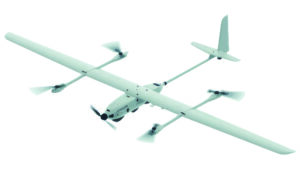
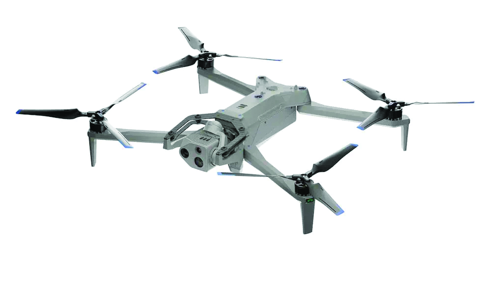
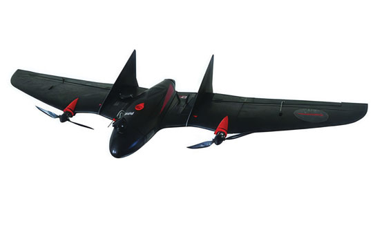
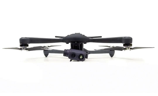
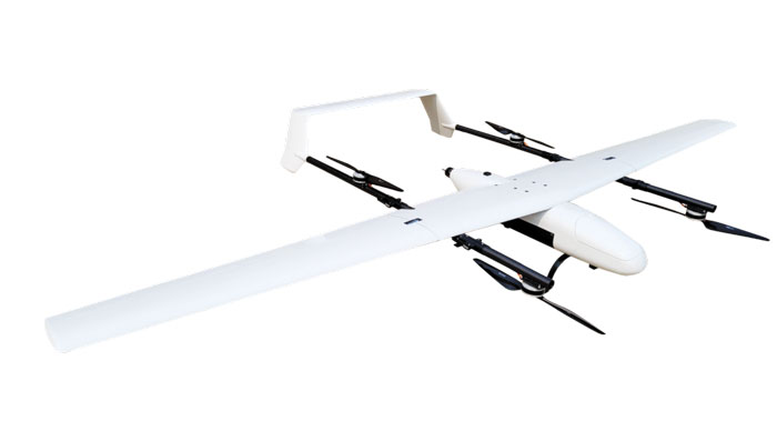
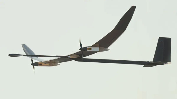
Upgraded UAS
With silent VTOL capabilities
The VXE30 Stalker unmanned aerial system (UAS) features the new “Havoc” configuration, designed to double the system’s flight endurance and payload capacity.
With the Havoc upgrades, the VXE30 can now support the complex demands of both small tactical units and larger brigade-level operations without extensive reconfiguration. The upgrades are designed to make the UAS more versatile across various military applications.
The VXE30 Stalker UAS has silent, vertical take-off and landing (VTOL) capabilities and is payload agnostic with the Havoc configuration. It supports easy integration of third-party payloads and subsystems through a Modular Open Systems Approach (MOSA), requiring no additional training for current operators.
Edge Autonomy, edgeautonomy.io
CUAS technology
Adheres to NDAA standards
This counter-unmanned aircraft system (CUAS) is a high-speed kinetic interceptor UAS that utilizes advanced autopilot algorithms for calculating and tracking precise target trajectories, neutralizing Group 1 and 2 aerial threats with pinpoint accuracy.
The system is manufactured in accordance with the National Defense Authorization Act (NDAA) to ensure it meets the federal requirements necessary for immediate deployment in both military and industrial settings in the United States.
Nearthlab, nearthlab.com

GPS integrity module
Seamlessly integrates with existing platforms
The Shift5 GPS integrity module is a platform-agnostic solution for military, aviation, rail, maritime and space applications.
With real-time access and analysis of onboard data, the module assesses changes in navigational position through multi-faceted anomaly detection methods, which alert operators to GPS spoofing attacks as they happen.
Using data collected from onboard systems, the module uses algorithmic position analysis to identify significant position deviations and GPS data validation to verify GPS information accuracy. Discrepancies or deviations that indicate tampering trigger an immediate notification, allowing operators to initiate standard operating procedures (SOPs) rapidly and accurately.
The module is designed for cross-platform deployment, across commercial and military planes, locomotives, vessels and aircraft, as well as on other critical systems such as radar, unmanned aircraft systems (UAS) and weapon guidance systems. It seamlessly integrates with existing platforms and can deploy directly to onboard hardware.
It offers multi-faceted detection and alerts for GPS spoofing attempts, designed to improve the safety and reliability of navigation systems. It uses physics-based spoofing detection to determine whether reported changes in position are physically possible to provide an effective method for initial spoofing detection. The system analyzes data from all sources to detect subtle, sophisticated spoofing attempts, which is essential for identifying more complex spoofing strategies that may evade traditional spoofing detection techniques.
Shift5 alerts can be integrated into existing SOPs to help preempt contamination of other positioning and navigation data, such as inertial navigation calibration against false GPS data. Metadata about the time, location, duration and estimated position of the attack can be passed for inclusion in threat mapping and other geospatial systems for future route avoidance.
Shift5, shift5.io
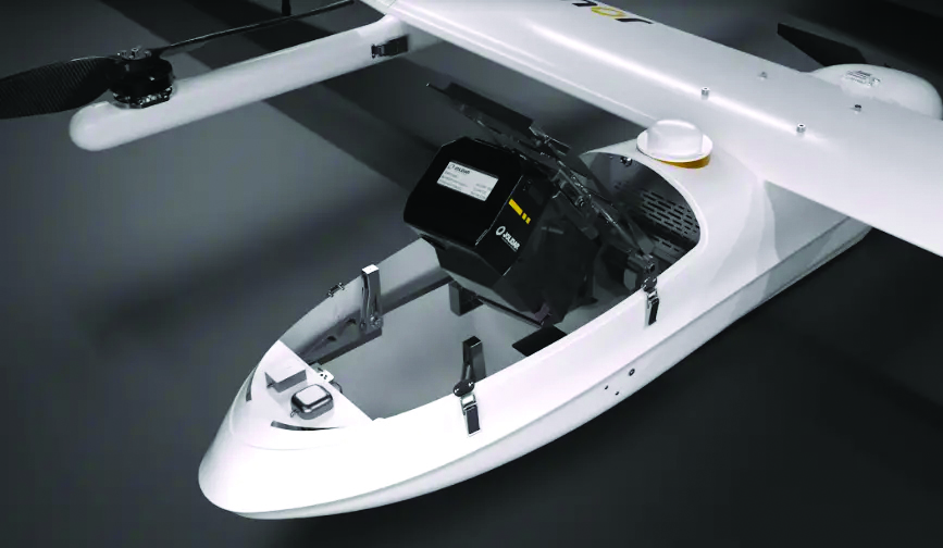
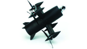
VTOL UAS
Designed for military forces
The Rogue 1 loitering munition UAS is designed to provide military forces with enhanced versatility, survivability and lethality in modern combat environments.
The Rogue 1 is an optionally lethal, vertical takeoff and landing (VTOL) capable of engaging both moving and stationary targets, including armored vehicles and dismounted threats. It features a unique mechanical interrupt fuzing system that allows for the drone to be safely recovered and reused if the mission is aborted or targets are disengaged.
Equipped with advanced electro-optical and FLIR Boson 640+ thermal cameras, Rogue 1 offers day and night long-range reconnaissance and surveillance capabilities. The system’s gimballed payload allows for precise targeting, facilitated by a novel coupling between sensors and warhead. Operators can customize the munition with various modular, mission-specific payloads to effectively engage different types of enemy targets.
It has a flight time of 30 minutes, can reach burst speeds exceeding 70 mph and has an operational range of over six miles, making it suitable for missions in harsh battlefield conditions, including communication- and GPS-denied environments.
Teledyne FLIR Defense, flir.com
UAV
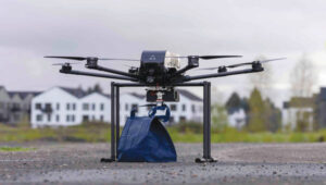
Delivery winch
Improves safety and operational capabilities
A2Z Drone Delivery has released new safety features and hardware upgrades for its RDS2 commercial UAV delivery winch, including a weatherproof cover and an auto-releasing bag hook. This aims to improve safety and operational capabilities as well as aid in regulatory compliance for beyond-visual-line-of-sight (BVLOS) operations.
The system features entanglement auto-detection, which autonomously detects tether entanglements and allows the system to safely abandon the tether to prevent damage to the UAV. This feature can be customized to recognize different types of obstructions, whether at altitude or during the landing phase, enhancing safety across a variety of operational scenarios.
Additionally, the overweight payload rejection feature ensures that the payload weight does not exceed the 5 kg limit. This is useful when picking up payloads from third parties, as it automatically confirms that the weights are within safe flying limits before proceeding with the mission. The RDS2 now includes Tether Lifecycle Alerts, which notify operators when the winch’s tether, rated for up to 800 deliveries, requires replacement.
A2Z Drone Delivery, a2zdronedelivery.com

Integration platform
For fully autonomous operations
Flinks is designed for one-click integrations with third-party applications and devices. The platform aims to streamline the coordination of various systems involved in UAV operations, creating end-to-end automated workflows for fully autonomous systems.
It allows users to connect the FlytBase platform with critical business systems such as alarm systems, video management, data processing and more. By eliminating the need for complex, time-consuming manual interventions, Flinks is designed for users to seamlessly incorporate autonomous drones into their existing operations.
By joining the Flinks Partner Program, organizations can access FlytBase’s global network of UAV service providers, system integrators and enterprise customers.
FlytBase, flytbase.com
MACHINE CONTROL
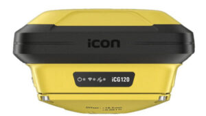
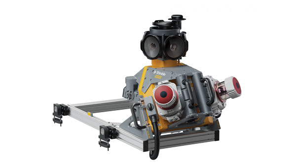
Antenna
Integrates with heavy construction equipment
The iCON 120 machine smart antenna offers scalable and flexible machine control solutions for construction professionals.
The iCON 120 is a GNSS antenna intended for integration within the existing Leica MC1 platform. Using the iCON 120, operators can benefit from a tailor-made, Leica MC1-based machine control, allowing for more streamlined operations and consistent workflows with a variety of heavy construction equipment and application requirements.
Leica iCON 120 users can start with a single GNSS solution using a satellite-based augmentation system (SBAS), such as WAAS or EGNOS, or a HxGN SmartNet service. The HxGN SmartNet family offers network real-time kinematics (RTK) with RTK bridging and precise point positioning (PPP) services that work exclusively with Leica Geosystems GS sensors. The new smart antenna can be easily switched, with quick mounting and dismounting, between Leica MC1-prepared machines.
Users can optionally upgrade their basic-level machine-control solution with the Leica CR50 communication unit to receive RTK correction data via radio or modem. The CR50 features a web interface, automotive ethernet communication, worldwide cellular modem and integrated dual-frequency UHF radio.
Leica Geosystems, leica-geosystems.com
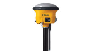
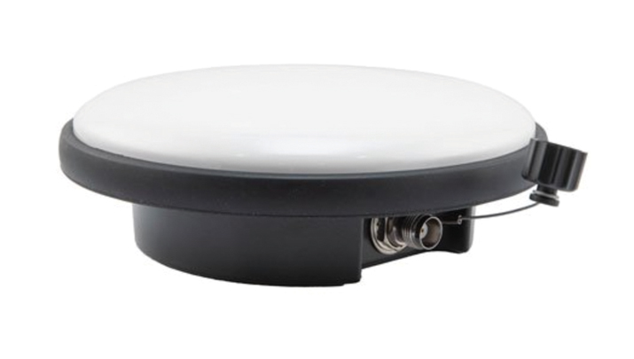
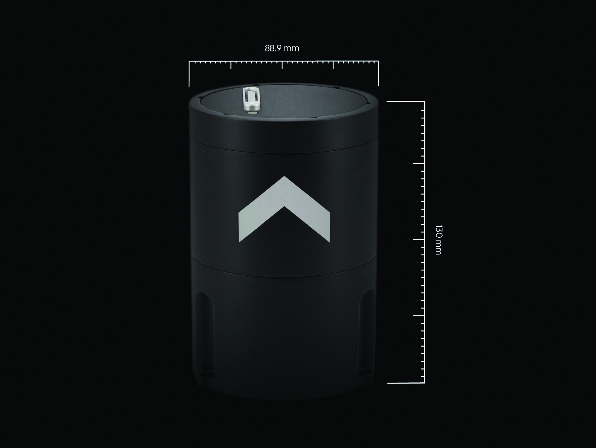
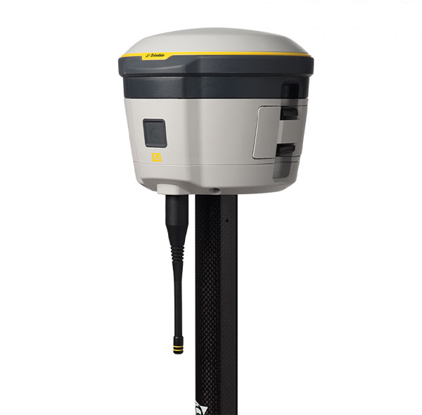
GNSS smart antenna
For construction Site Positioning
The R780 GNSS Smart Antenna is designed for construction site positioning. It features a dual-band radio (450/900 MHz) that connects to diverse base stations and job sites without additional external radios. The dual Trimble Maxwell 7 GNSS ASIC chip allows the system to perform in challenging GNSS environments such as a blocked sky, multi-path or degraded signal.
An activated and ready-to-use Trimble CenterPoint RTX subscription is included for the first 12 months. CenterPoint RTX is point positioning technology that provides real-time, centimeter-level corrections via satellite or cellular/IP.
Using the R780 with Trimble FieldLink software supports underground and long-distance layout projects as well as QA/QC and field positioning tasks. The R780 can serve as a GNSS rover or as a base station for other GNSS operations including machine control.
Trimble Civil Construction, heavyindustry.trimble.com